Tri Peaks
in the Santa Monica Mountains
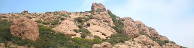
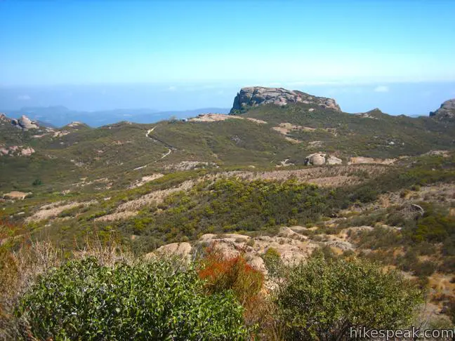
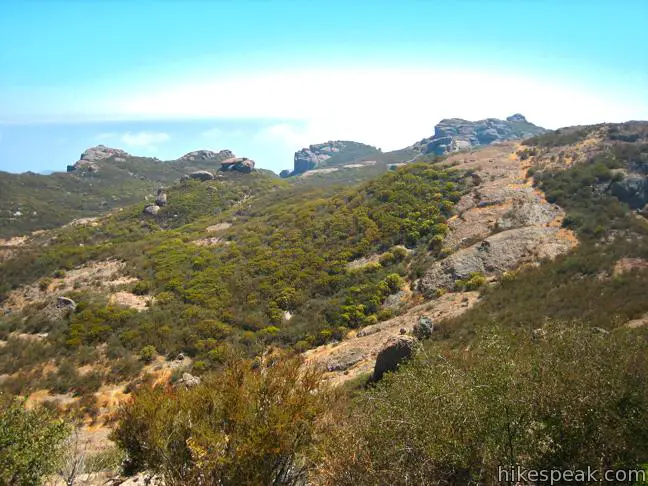
Want to add another peak to the Sandstone Peak-Mishe Mokwa loop? The side trail to Tri Peaks offers an additional 1.2 miles of rugged (but not too steep) hiking. The offshoot is far less maintained than the main loop and appears to get frequent visits from water runoff. Getting to Tri Peaks involves hiking up a trail that has devolved into a gully. If that doesn’t bother you, hike the extra track to Tri Peaks. The westward views are worth the extra effort.
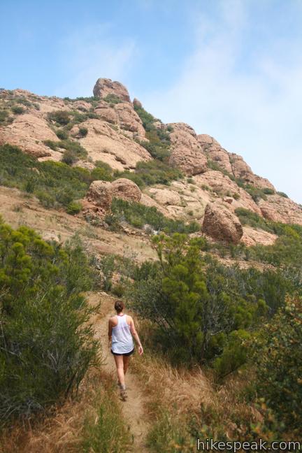
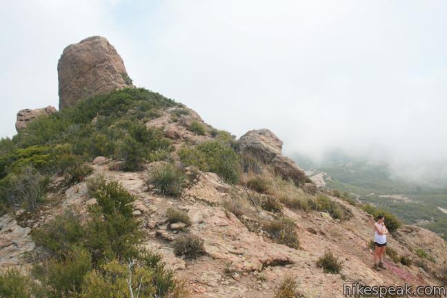
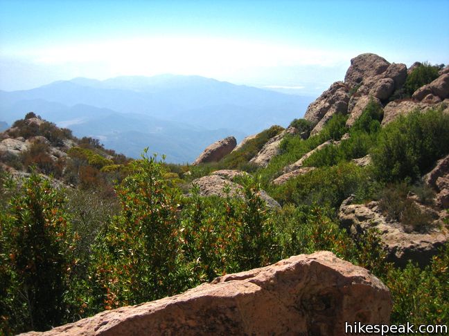
First hike the initial 3 1/3 miles of the loop on Mishe Mokwa Trail toward Sandstone Peak. At the Backbone Trail junction turn right, following the sign for Tri Peaks. Make two more right turns at similarly well marked junctions to arrive at the base of this fun sandstone outcropping. As the trail dissolves, make your way up upon the rocks and take in the view to the west over Point Mugu State Park.
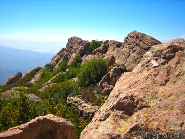
Climb around on the rocks and enjoy all there is to see. Tri Peaks is only one hundred feet shorter than Sandstone and offers great views to the north and west. With Tri Peaks added to the Sandstone Peak loop, the hike comes to a respectable 7.45 miles.
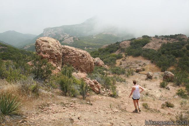
Woolsey Fire Update: Trails around Circle X Ranch have reopened following the November 2018 Woolsey Fire. Check the NPS Circle X Ranch webpage for more information.
Directions to the Trailhead
- Take PCH to the far west end of Malibu.
- Make a right on Yerba Buena Road (just past Neptune's Net Restaurant) and drive up Yerba Buena for 5.5 miles to the Circle X Ranch Ranger Station.
- Continue past the ranger station up Yerba Buena Road another mile and turn left into the Sandstone Peak trailhead parking lot.
- Bathroom are located at the trailhead and the Circle X Ranch Ranger Station.
Trailhead Location
Trailhead address: 12896 Yerba Buena Road, Malibu, CA 90265
Trailhead coordinates: 34.1116, -118.9268 (34° 06′ 41.8″N 118° 55′ 36.5″W)
View Santa Monica Mountains in a larger map
Or view a regional map of surrounding Los Angeles trails and campgrounds.

 | Sandstone Peak This 6.25-mile loop summits the tallest peak in the Santa Monica Mountains. |
 | The Grotto This 3-mile out and back hike visits a remote grotto in the Santa Monica Mountains National Recreation Area. |
 | Nicholas Flat via Malibu Springs Trail This scenic 7-mile round trip hike ascends 1,425 feet to meadows and a pond on Nicholas Flat in Leo Carrillo State Park. |
 | More trails in the Santa Monica Mountains Explore beyond Circle X Ranch to other destinations in the range. |
Common Questions about Tri Peaks in the Santa Monica Mountains
- Is the trail open?
- Yes. You should expect to find that Sandstone Peak Loop & Tri Peaks is open. There are no recent reports of trail closures. If you discover that the trail is closed, please help your fellow hikers by reporting a closure.
- Is this trail free to access?
- Yes, Sandstone Peak Loop & Tri Peaks is free to access. No entrance fee, pass, or permit is required. If you discover that access rules have changed, please provide feedback on your experience.
- How much time does this hike take?
- It takes approximately 1 hour 15 minutes to hike Sandstone Peak Loop & Tri Peaks. Individual hiking times vary. Add extra time for breaks and taking in the views.
- How long is this hike?
- The hike to Sandstone Peak Loop & Tri Peaks is a 1.2 mile extension with 1075 feet of elevation change.
- Are dogs allowed on this trail?
- No, dogs are likely not allowed on Sandstone Peak Loop & Tri Peaks. The trail is primarily open to hikers.
- What mountain range is this trail in?
- Sandstone Peak Loop & Tri Peaks is located in the Santa Monica Mountains.
- Where is the trailhead located?
- The trailhead for Sandstone Peak Loop & Tri Peaks is located in Malibu, CA.
Trailhead Address:
12554 Yerba Buena Road
Malibu, CA 90265
Trailhead Coordinates:
34.1116, -118.9268 - What are the driving directions to the start of the hike?
To get to the trailhead: Take PCH to the far west end of Malibu. Make a right on Yerba Buena Road (just past Neptune's Net Restaurant) and drive up Yerba Buena for 5.5 miles to the Circle X Ranch Ranger Station. Continue past the ranger station up Yerba Buena Road another mile and turn left into the Sandstone Peak trailhead parking lot. Bathroom are located at the trailhead and the Circle X Ranch Ranger Station.
View custom Google Maps directions from your current location.
- Are there other trails near Sandstone Peak Loop & Tri Peaks?
- Yes, you can find other nearby hikes using the Hikespeak Hike Finder Map.

This is a great trail write-up and this is one of our favorite hiking locations. Keep up the good work.