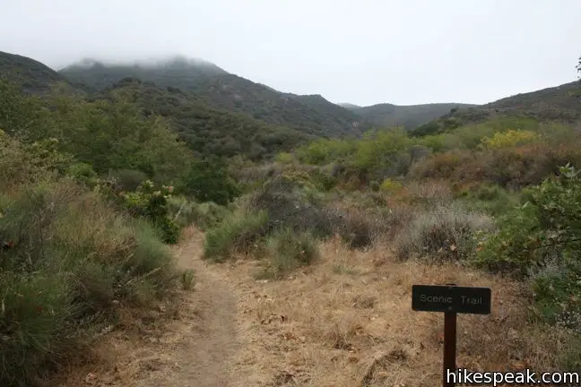
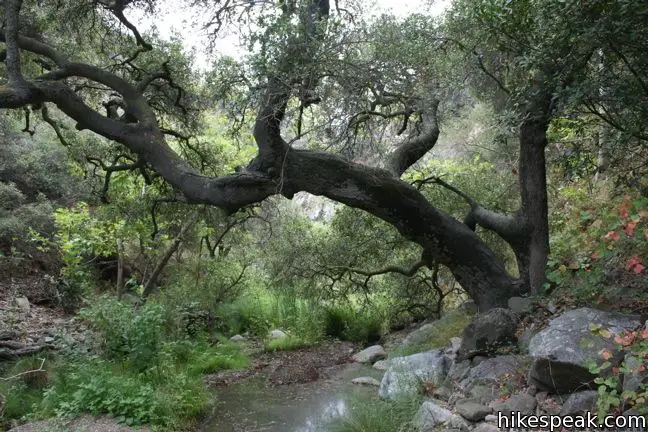
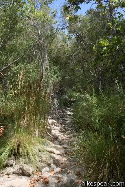
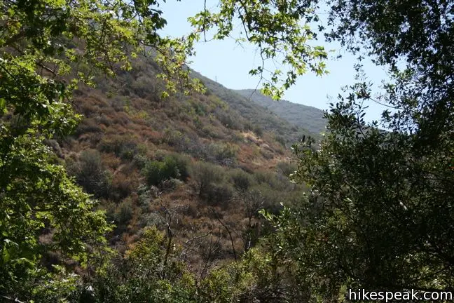
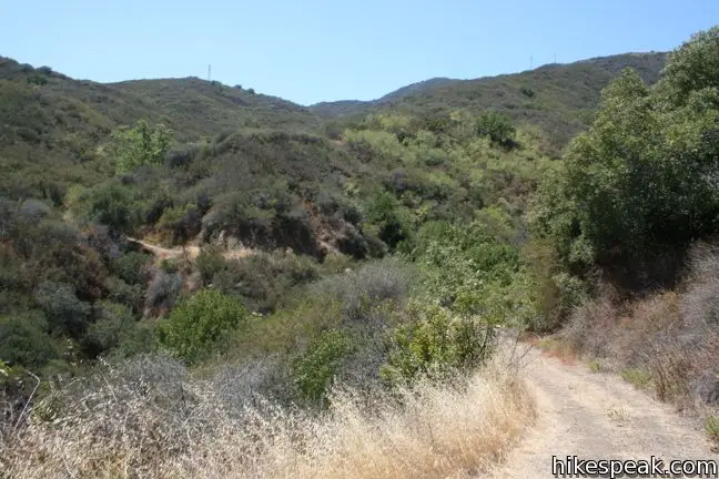
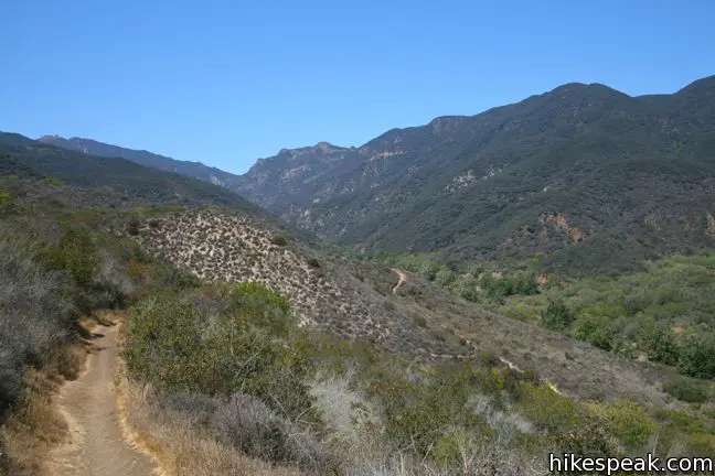
This demanding 8-mile loop includes two miles off-trail, trekking through a lush untamed canyon. Begin the loop on Zuma Canyon Trail. The sandy single track traverses a brushy open space, crossing and following a stony creek bed. After 1.4 miles, Zuma Canyon narrows and the trail dissolves. The true challenge begins!
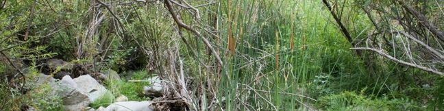
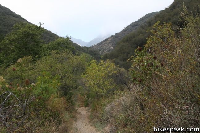
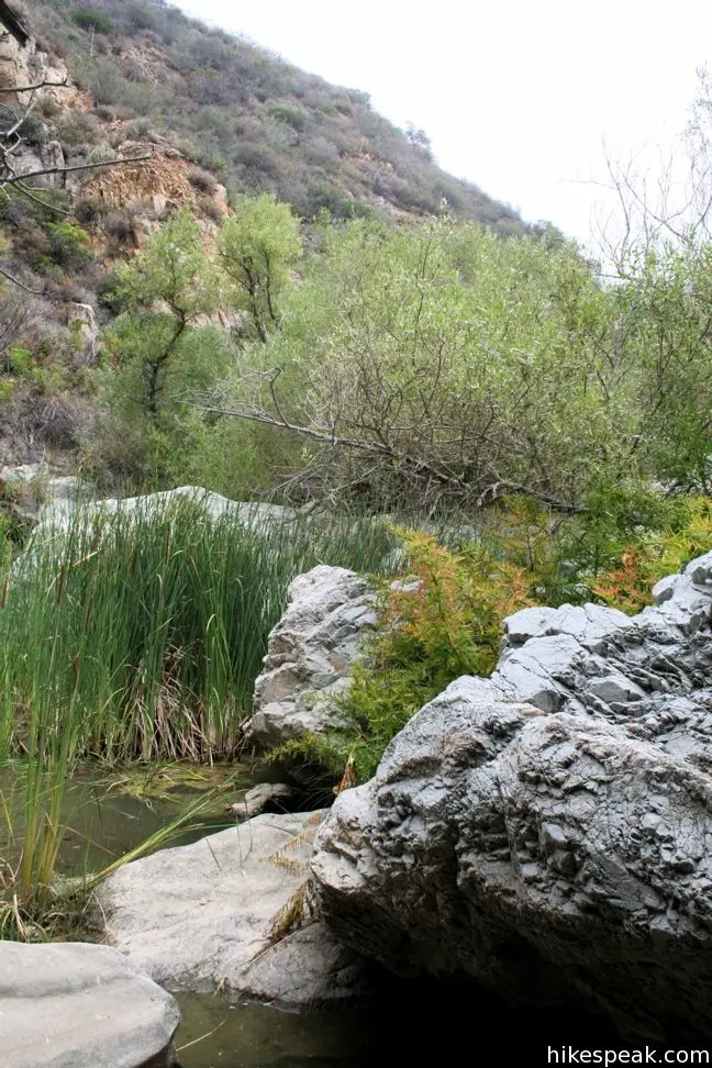
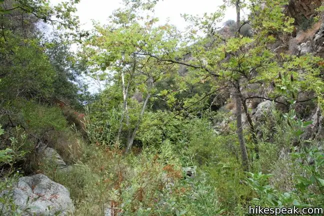
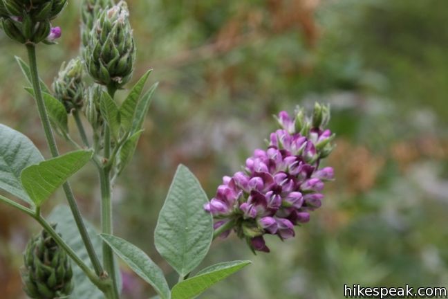
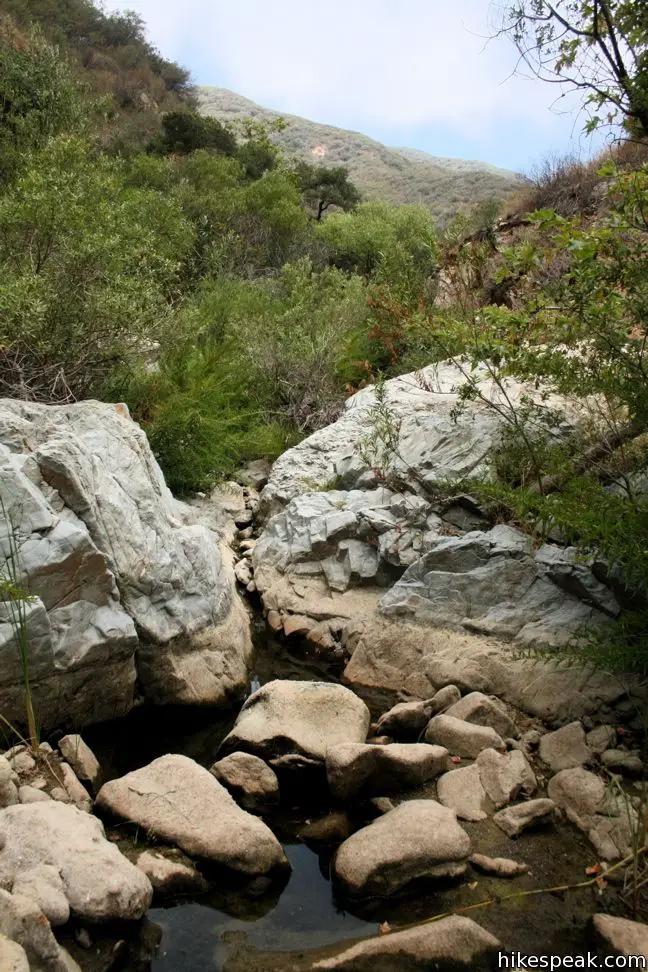
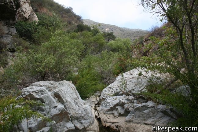
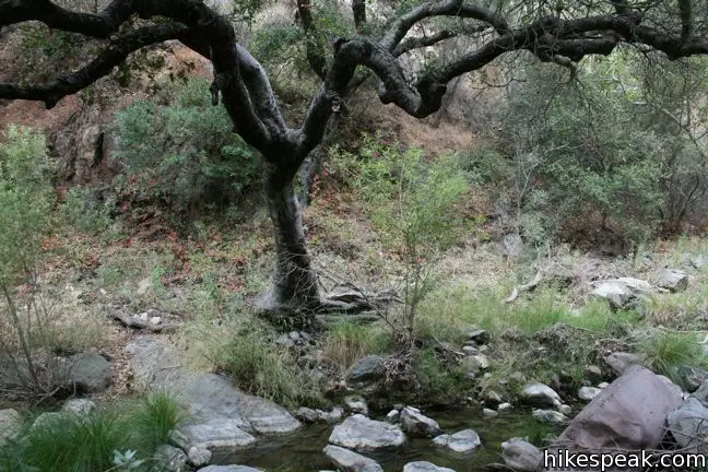
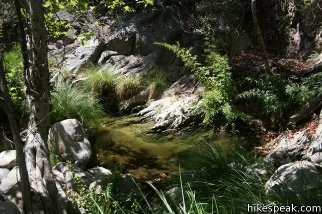
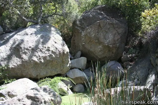
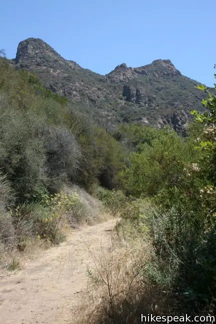
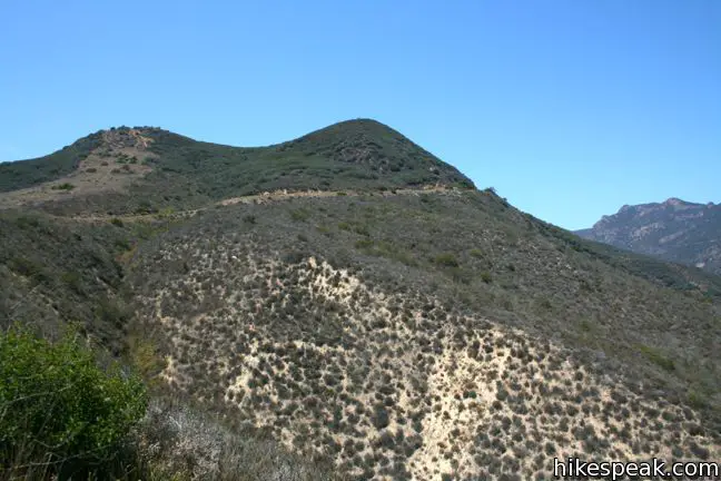
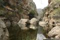
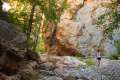
From the end of Zuma Canyon Trail, it is two miles to the next maintained path, an Edison Fire Road. In between lies an arduous, two to three hour crossing. There is thick brush to push through, boulders to climb over, and pools of water to navigate around (or wade through in the wet season). The canyon floor is a mere hundred feet across for much of the duration, leaving few options when plotting a course. Occasionally there is a thin deer trail to follow, but for the most part, hiker-explorers must make their own way. Tall cattails, ferns, and other shrubs add to the challenge, while well-watered willows, oaks, bays, and sycamores stretch skyward, further entrapping hikers and limiting views.
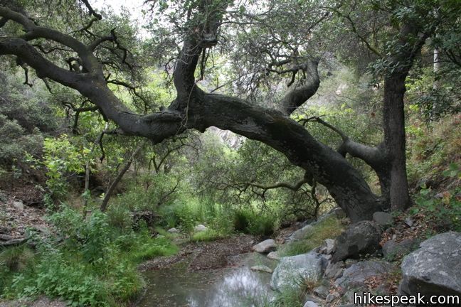
Plot ahead up the overgrown canyon as it twists and turns, remaining on the look out for deep mud and poison oak. Standing in the dense vegetation, breathing in the canyon-trapped humidity, can make a hiker wish they had a machete (not that you should). Progress is slow going and judging distances traveled is difficult.
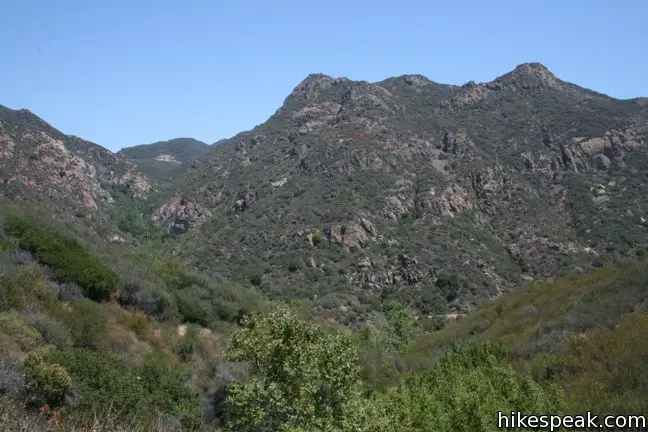
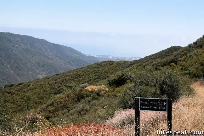
The sandstone boulders increase in mass and the canyon levels out and approaches the Edison Fire Road. The intersection is impossible to miss, and will come as a relief after such a long struggle.

Those eager to spend more time in the thick of things can venture up Zuma Canyon as far as the 25-foot tall Newton Canyon Falls beneath Kanan Dune Road.
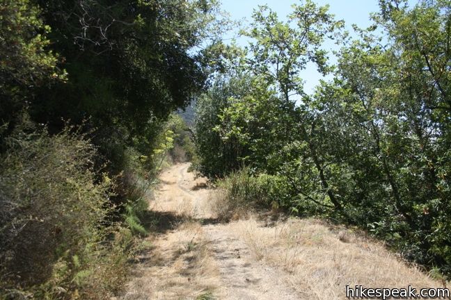
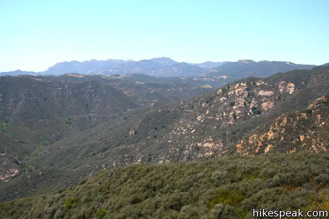
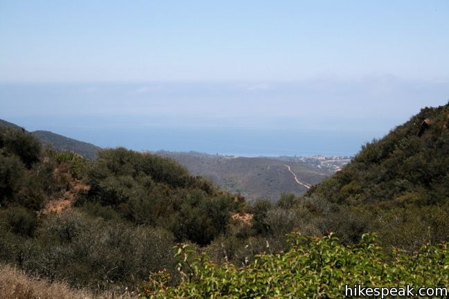
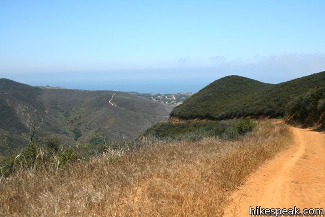
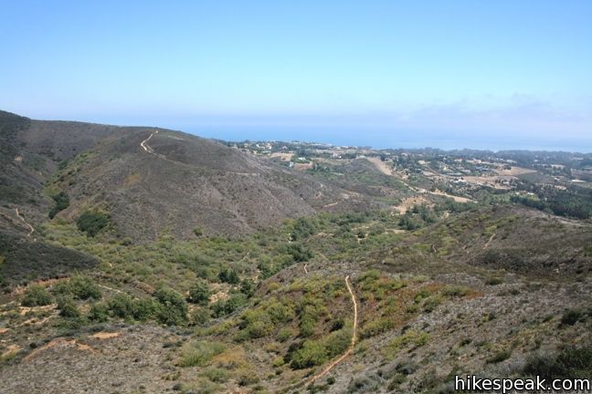
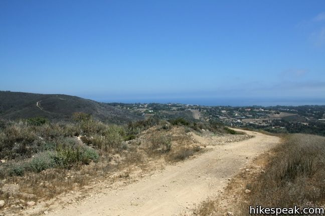
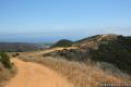
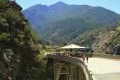
To return, turn left on the road toward Zuma Ridge. Free from the jungle in the Canyon, the 1,085-foot climb up the wide dirt road may not seem so bad. The sun-exposed Edison Road snakes its way up the ridge offering expending views over Zuma Canyon.
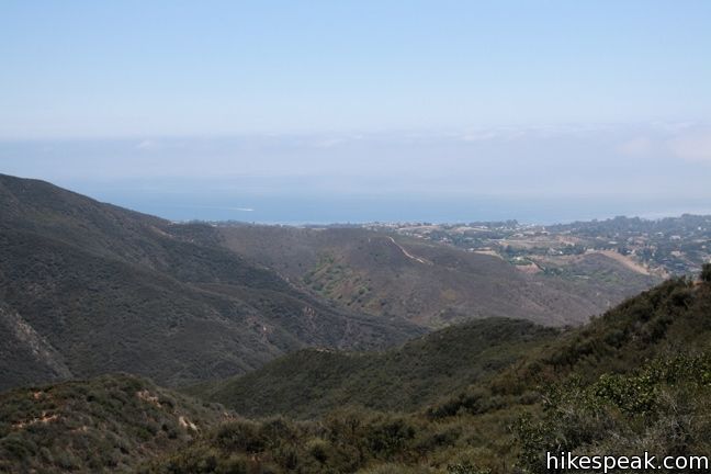
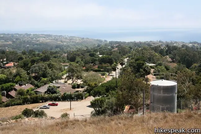
At the top, turn left on Zuma Ridge Road. It is all down hill from here, so enjoy the ocean views over this 2.7-mile descent. At the bottom, take the marked Ridge-Canyon Access Trail for 0.6 miles to return to Bonsall Trailhead.
Directions to the Trailhead
- Take PCH to Malibu and make a right on Bonsall Drive, one mile west of Kanan Dune Road (If you pass Zuma Beach, you have gone too far).
- Drive north on Bonsall Drive for one more mile to the dirt parking lot at the end of the road.
- The trail leaves from the northwest corner of the lot.
Trailhead Location
Trailhead address: 5875 Bonsall Drive, Malibu, CA 90265
Trailhead coordinates: 34.0317, -118.8122 (34° 01′ 54.2″N 118° 48′ 43.9″W)
View Santa Monica Mountains in a larger map
Or view a regional map of surrounding Los Angeles trails and campgrounds.
Zuma Canyon Trail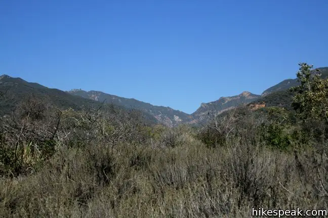
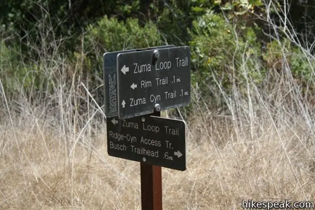

Zuma Canyon Narrows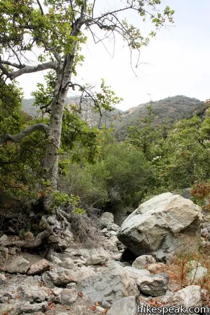
Edison Fire Road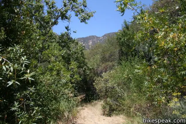


Zuma Ridge Trail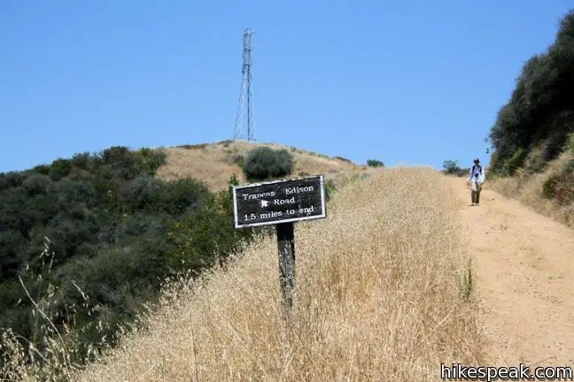


 | Zuma Canyon Trail This 2.8-mile hike leaves a coastal Malibu neighborhood to explore rustic Zuma Canyon. |
 | Zuma Ridge Trail This wide dirt service road which weaves northwest up the back of the ridge west of Zuma Canyon offering access to several trails in the area. |
 | Ocean View Trail - Canyon View Trail Loop This 3.1-mile loop demands more effort than Zuma Canyon Trail and provides great ocean and canyon views. |
 | More trails in the Santa Monica Mountains Explore other destinations in the range. |
 | Malibu Creek Traverse This adventure hike explores the C-shaped gorge between Rock Pool and Century Lake in Malibu Creek State Park. |
 | Rustic Canyon's Murphy Ranch from Will Rogers State Historic Park This 4 to 5-mile adventure visits the ruins of a strange commune in a canyon east of the park. |
 | Fish Canyon Narrows This hike of ten miles or more explores an enchanting narrow canyon on the east side of the Angeles National Forest in the Sierra Pelona Mountains north of Santa Clarita. |
 | Bridge to Nowhere This adventurous 10-mile hike in the San Gabriel Mountains reaches an abandoned and out-of-place bridge with a unique history. |
- Zuma Canyon National Park Service brochure (opens in a new tab)
- Zuma Canyon in 101 Hikes in Southern California by Jerry Schad (opens in a new tab)
- Afoot and Afield: Los Angeles County by Jerry Schad (opens in a new tab)
- Top Trails: Los Angeles by Jerry Schad (opens in a new tab)
- Area Trails on venturacountrytrails.org (opens in a new tab)
Common Questions about Zuma Canyon Narrows – Zuma Ridge Loop in the Santa Monica Mountains
- Is the trail open?
- Yes. You should expect to find that Zuma Canyon Narrows – Zuma Ridge Loop is open. There are no recent reports of trail closures. If you discover that the trail is closed, please help your fellow hikers by reporting a closure.
- Is this trail free to access?
- Yes, Zuma Canyon Narrows – Zuma Ridge Loop is free to access. No entrance fee, pass, or permit is required. If you discover that access rules have changed, please provide feedback on your experience.
- How much time does this hike take?
- It takes approximately 4 hours 15 minutes to hike Zuma Canyon Narrows – Zuma Ridge Loop. Individual hiking times vary. Add extra time for breaks and taking in the views.
- How long is this hike?
- The hike to Zuma Canyon Narrows – Zuma Ridge Loop is a 8 mile loop with 1715 feet of elevation change.
- Are dogs allowed on this trail?
- No, dogs are likely not allowed on Zuma Canyon Narrows – Zuma Ridge Loop. The trail is primarily open to hikers.
- Are there ocean views on this hike?
- Yes, Zuma Canyon Narrows – Zuma Ridge Loop offers views of the ocean.
- What mountain range is this trail in?
- Zuma Canyon Narrows – Zuma Ridge Loop is located in the Santa Monica Mountains.
- Where is the trailhead located?
- The trailhead for Zuma Canyon Narrows – Zuma Ridge Loop is located in Malibu, CA.
Trailhead Address:
5875 Bonsall Drive
Malibu, CA 90265
Trailhead Coordinates:
34.0317, -118.8122 - What are the driving directions to the start of the hike?
To get to the trailhead: Take PCH to Malibu and make a right on Bonsall Drive, one mile west of Kanan Dune Road (If you pass Zuma Beach, you have gone too far). Drive north on Bonsall Drive for one more mile to the dirt parking lot at the end of the road. The trail leaves from the northwest corner of the lot.
View custom Google Maps directions from your current location.
- Are there other trails near Zuma Canyon Narrows – Zuma Ridge Loop?
- Yes, you can find other nearby hikes using the Hikespeak Hike Finder Map.

12 Comments on Zuma Canyon Narrows – Zuma Ridge Loop in the Santa Monica Mountains
What hikers are saying:
✨ Generated summary of user commentsHikers find this trail to be a grueling yet rewarding adventure through dense underbrush and rugged creek beds. The narrows section requires navigating slippery moss and large boulders, making sturdy footwear and hiking poles essential tools for stability. Frank warns that long sleeves and pants are mandatory to avoid the pervasive poison oak. Despite the physical toll, the stunning ocean views at the end of the climb provide a sense of accomplishment.
“The narrows were beautiful, but the creek was dry.” Jump to comment ↓
Could this be an okay hike for a German Shepherd, or are the boulders too big?
Generally, I would not recommend this hike for dogs. Then again, your German shepherd might have an easier time than you. The canyon is very overgrown and challenging to pass through.
Hmm, okay. 2 more questions: (1) Are dogs allowed (legally)? I know some parks do not allow them. (2) Are there any boulders to climb over (6 feet or higher) — my dog can get through a cluttered path but cannot climb huge rocks. Thanks!
There are certainly boulders larger than that size. Dogs are allowed on trails in the park, but are not permitted to go off trail, which includes hiking through the narrows. Here is a full list of trails that do allow dogs that you may enjoy: https://www.hikespeak.com/los-angeles/dog-friendly-trails/
This was one of the hardest hikes Ive done! The narrows were beautiful, but the creek was dry. Careful! We ran across a rattle snake! I was so relieved to be at the end of the boulders, dry creek bed and POISON OAK….. UNTIL that nasty 1,000ft climb. I have never despised something so much…it never ends! But when it does, running down the hill with the gorgeous ocean views…well worth it. Overall I’d do it again, but hopefully when there is water present.
OH! and we did bring a machete! Came in handy with the overgrown cattails and dry branches.
This was the most difficult, challenging and interesting hike I’ve ever done, including the 10 wk Sierra Club course I took. BEWARE – WEAR PANTS AND A LONG SLEEVE SHIRT OR YOU WILL LIKELY GET POISON OAK like I did. I was in shorts and a t-shirt since it was a warm day. Clean hiking poles, boots and clothing carefully so you do not get poison oak by touching those items. Do not bring a dog here unless you want your dog to be covered in poison oak too. A machete really would have been helpful. Follow the creek all along the way and do not stray far from it. You will have to cross it multiple times.
We were the few who made the decision to hike from Edison Fire Road to Zuma Canyon Trail “off trail” via the creek. These were the longest 2 miles we experienced all day. The hike to the trail took almost three hours. Even though the creek was dry, It was overgrown and any signs of previous hikers were few. It was slippery from the remaining moss. We decided to go off trail after we reached the creek from Edison Road and have been hiking for 2 hours, having started from the trailhead on Bonsall Drive. Thus, we were in shorts and t-shirts and ill prepared for the intense underbrush and the amount of poison oak we encountered. We advise against attempting this without pants, proper hiking shoes, and a machete. Great experience overall. A little scary searching for Zuma Canyon trail as dusk was upon us.
Please don’t “bring a machete”–good grief. This is public park land in Santa Monica Mountains National Recreation Area, a public trust. The canyon bed is filled with native flowers and shrubs, some of them rare. They aren’t yours to cut down. “Leave no trace” is the hiker’s ethics. I’ve done this hike, going slowly up much of the narrows and eventually going back the way I came when it became impossible so as not to have to destroy things. Done that way it’s still a very beautiful and interesting hike.
I did this trail a couple days ago and the 2 miles of narrows is kind of ridiculous. I can normally do a 7.5 mile hike in a little over 3 hours, but by the time I reached edison road via the narrows, I was already 3 hours in and dusk was starting to fall (only about 3 miles in total). I think there was poison oak everywhere, but luckily I’m resistant to the stuff and I wore jeans to protect me from the overgrowth everywhere; definitely need to be wearing long sturdy pants if you dont want to get quite scratched up. There were only a few small pools of stagnant liquid leftover that attracted lots of bugs, the rest was covered with a thick layer of dry moss and spiderweb leftovers. There really is no obvious path for a lot of it, and it gets more arduous the deeper in you get. I temporarily commandeered a large piece of wood as a walking staff to help me get across/up some of the bigger,trickier boulders (I abandoned it right before the end of the narrows) and keep spider webs out of of my face; if you have hiking poles that would probably help. Overall the entire trek from parking lot and back took me just under 5 hours and 20min, and was a total of 8.7 miles (according to gps and mapmyhike app). I also ended up drinking a lot more water than I did on other hikes even though the weather was fine, so bring more than you think you might need. overall it was the most difficult hike I’ve been on, dont underestimate the narrows
Very tough, even when almost completely dry. 4.5 hours. Should have gone right and skipped the climb, since the off-trail takes a lot out of your legs.
[…] 1.4 miles the trails ends at the canyon narrows. If you are more adventurous then keep going. The Zuma Canyon Narrows do not have a hiking path and you have to make your own way. The hike ends at the crossing of the […]