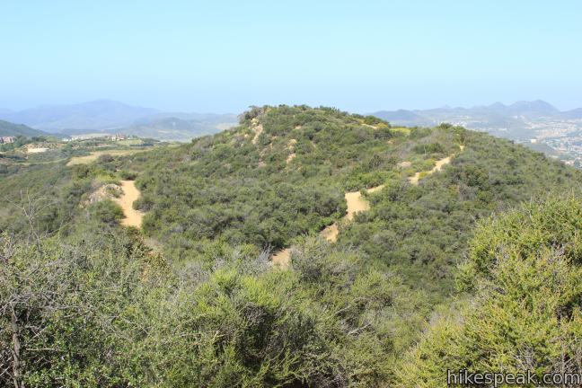
Los Robles Trail in Thousand Oaks crosses a chaparral-covered mountainside leading to Angel Vista, one of the premier overlooks on the north side of the Santa Monica Mountains. There are a few routes to the viewpoint, including this 7.6-mile round trip hike up the east end of West Los Robles Trail. The hike charts a steady course along a mountain slope, gaining 800 feet to reach the vista above the Conejo Valley. For a shorter climb, check out the 4-mile round trip hike to Angel Vista via Rosewood Trail.
The ascent is quite gradual and the start of the hike is easy, beginning with a fairly level half mile. There are a few junctions to be concerned with during the opening act, but once West Los Robles Trail begins to climb, the route is very straightforward.
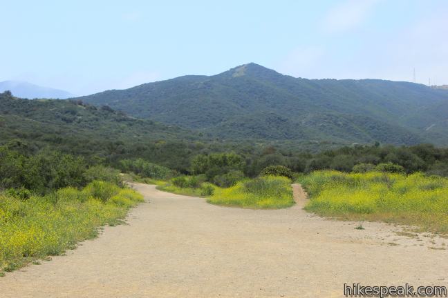
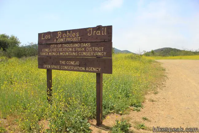
West Los Robles Trail enters Los Robles Open Space from the end of Moorpark Avenue, just half a mile from the 101 Freeway. Pass through the Moorpark Gate and get warmed up hiking over level terrain, entering Hope Nature Preserve, a 359-acre park donated by Bob Hope. After a tenth of a mile, stay to the right past a trail that heads up into the mountains. At the following junction, stay to the left past a marked junction with a connector to Oak Creek Canyon Loop Trail, a 0.8-mile nature trail loop.
Next the trail will split, with East Los Robles Trail heading off to the left. Stay to the right on West Los Robles Trail. Finally turn left at a junction with Spring Canyon Trail, about half a mile from the start, to remain on West Los Robles Trail as it leaves the flatland and begins to climb.
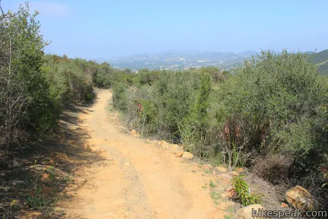
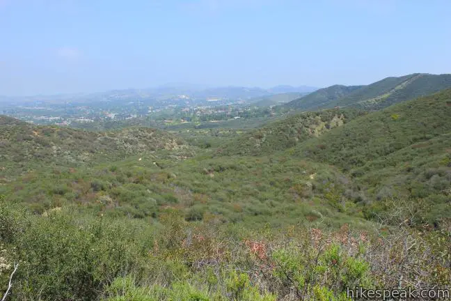
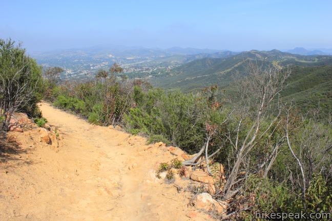
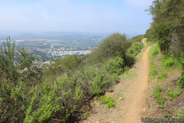
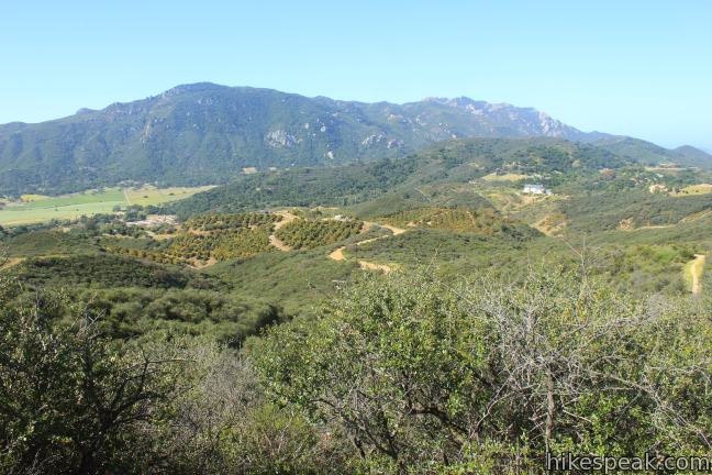
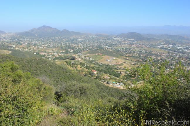
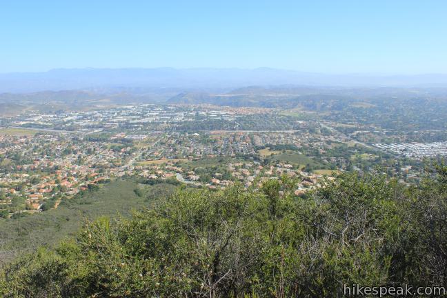
The popular mountain biking trail eases higher and higher, delivering mounting views back over the start of the trail. At around 1.7 miles from the start, the switchbacks lead to broad view over the Conejo Valley. The 101 Freeway runs below complimented by a panorama of hills around Thousand Oaks.
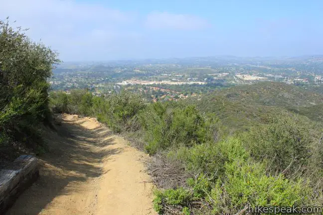
Juan Bautiste de Anza, after whom Anza-Borrego Desert State Park is named, led a group of settlers from Mexico to San Francisco, passing through the Conejo Valley in 1776. Amazingly, much of the 101 Freeway still follows his original route, including the lanes of traffic seen below.
Los Robles Trail parallels and overlooks Anza’s route, and was designated as the official recreational route of the historic trail by the National Park Service.
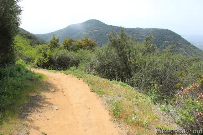
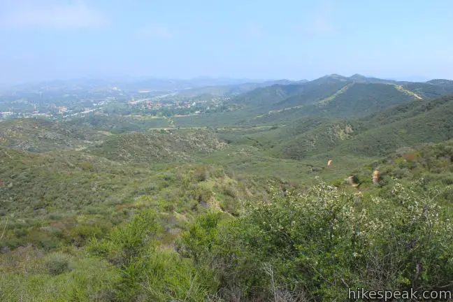
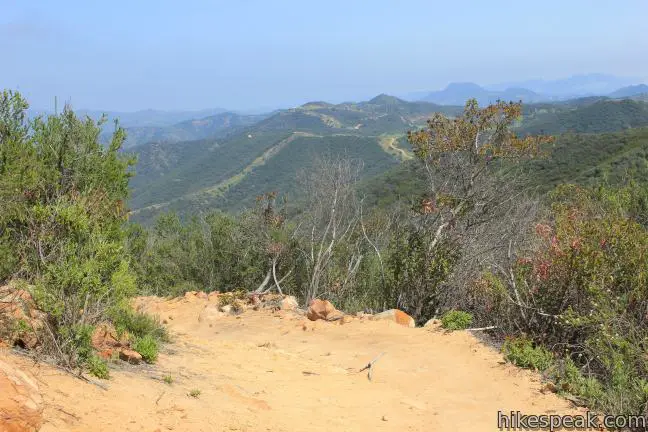
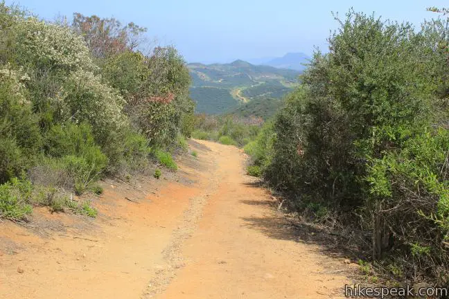
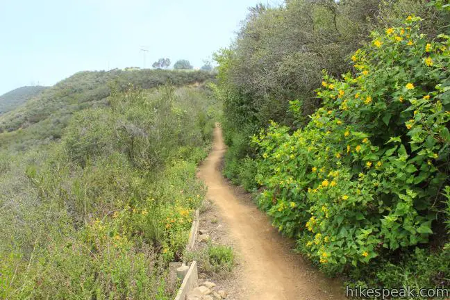
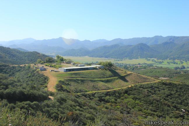
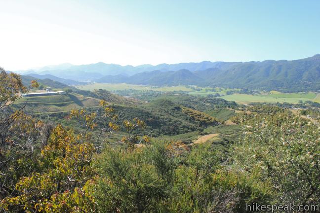
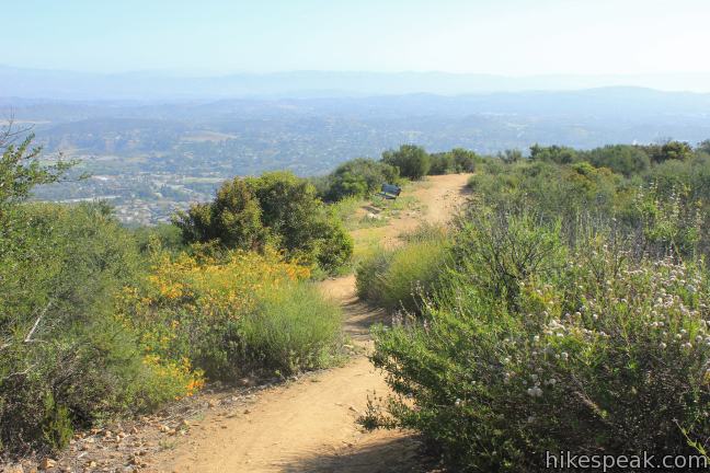
After 2.15 miles of hiking, Los Robles Trail passes a landing on the mountainside and actually turns temporarily downhill. A short spur to the right delivers a panoramic eastward view. Ahead, you will pass a private property sign, which explains that hikers are permitted to continue as long as they stay on the trail. Los Robles Trail levels out, offering easy to enjoy views over the Conejo Valley. The trail gradually ascends to 1,475 feet before dropping 125 feet over a series of switchbacks down to a dirt road, 3.15 miles from the start. Cross the road, which leads up the mountain to a nearby ranch, and continue toward Angel Vista. The viewpoint is just 2/3 of a mile away!
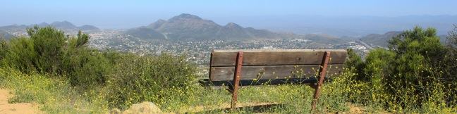
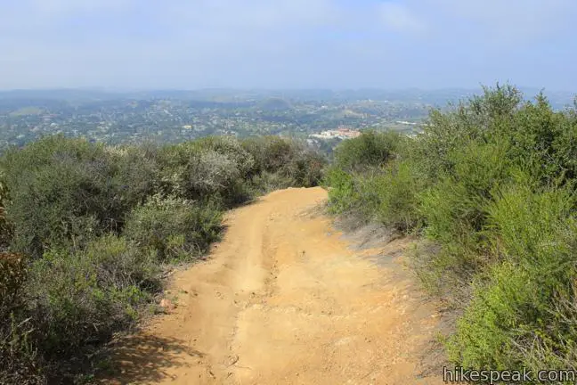
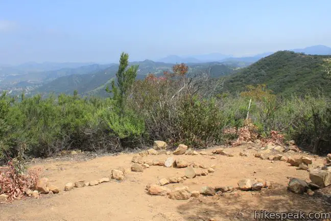
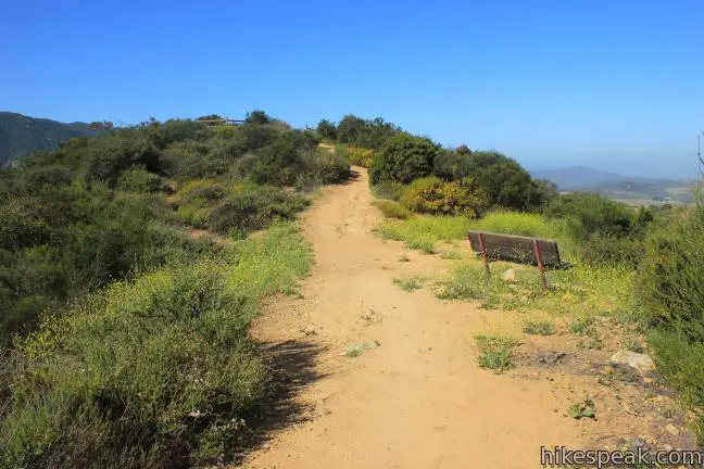
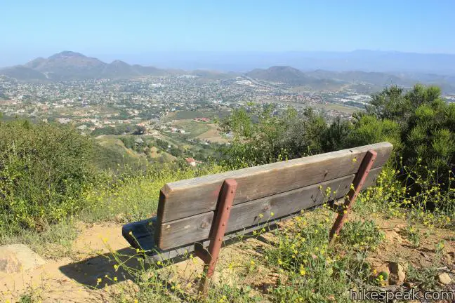
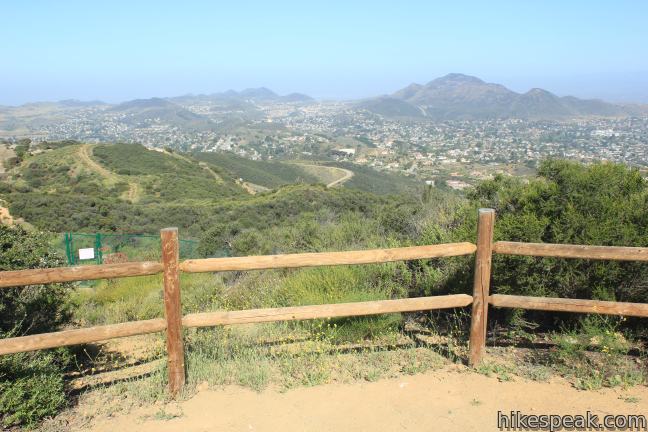
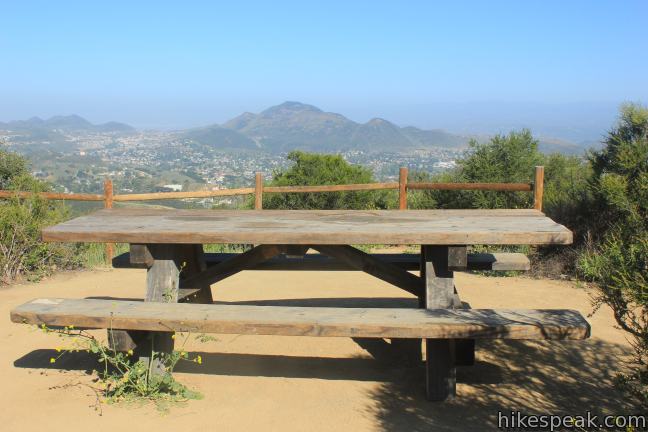
Angel Vista comes into view after another third of a mile, when you also gain sight of the ranch. Reach a junction with Rosewood Trail and turn right. Hike a short distance to a split and take the path to the left for Angel Vista, reaching it after less than a tenth of a mile. There is a bench and a picnic table at Angel Vista, so relax and enjoy the view.
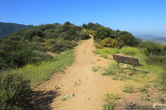
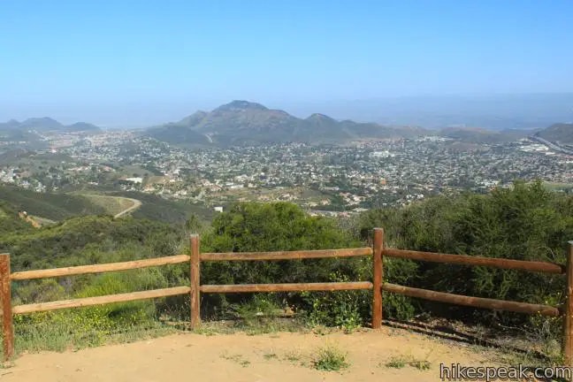
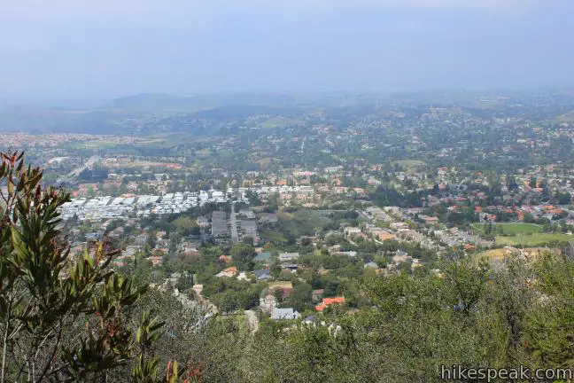
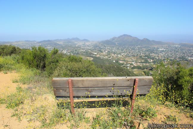
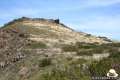
Angel Vista lies at 1,600 feet and delivers the most sweeping view of the hike, looking west over Thousand Oaks into Ventura County. Conejo Mountain is the most prominent summit in sight, directly to the west. The north side of the Boney Mountains rise to the south, containing Sandstone Peak, the highest point in the Santa Monica Mountain Range.
Return the way you came. This trail is dog and mountain bike-friendly. No fee or permit is required to hike West Los Robles Trail to Angel Vista, so get out and enjoy!
Directions to the Trailhead
- Take the 101 Freeway to Thousand Oaks to exit 44 for Moorpark Road.
- Drive south for half a mile.
- Pass Greenmeadow Avenue and pull into the dirt lot on the right.
- The trail begins from the kiosk at the northwest corner of the turnout.
Trailhead Location
Trailhead address: Moorpark Road, Thousand Oaks, CA 91361
Trailhead coordinates: 34.1719, -118.881 (34° 10′ 18.84″N 118° 52′ 51.60″W)
View Santa Monica Mountains in a larger map
Or view a regional map of surrounding Los Angeles trails and campgrounds.


Angel Vista by hikespeak.
 | Rosewood Trail to Angel Vista This 4-mile round trip hike is the most direct route to Angel Vista, a panoramic viewpoint in the Santa Monica Mountains overlooking the Conejo Valley. |
 | Oak Creek Canyon Trail This 0.8-mile loop starts with an all-access nature trail with signs in English and Braille before transitioning to a less developed dirt single track, looping through chaparral and oak woodlands in Los Robles Open Space. |
 | Tarantula Hill This 1-mile round trip hike follows a paved trail to the top of a small, round hill in Thousand Oaks with views across the Conejo Valley into the surrounding mountains. |
 | Paradise Falls This 40-foot waterfall is located within Wildwood Park in Thousand Oaks and is reachable via several trails. |
 | Lizard Rock To add extra mileage and views to a visit to Paradise Falls in Thousand Oaks, consider placing Lizard Rock on your itinerary. |
 | More trails in Los Angeles Explore other hiking destinations around Los Angeles. |
Common Questions about Angel Vista via West Los Robles Trail in the Santa Monica Mountains
- Is the trail open?
- Yes. You should expect to find that West Los Robles Trail to Angel Vista is open. There are no recent reports of trail closures. If you discover that the trail is closed, please help your fellow hikers by reporting a closure.
- Is this trail free to access?
- Yes, West Los Robles Trail to Angel Vista is free to access. No entrance fee, pass, or permit is required. If you discover that access rules have changed, please provide feedback on your experience.
- How much time does this hike take?
- It takes approximately 3 hours 45 minutes to hike West Los Robles Trail to Angel Vista. Individual hiking times vary. Add extra time for breaks and taking in the views.
- How long is this hike?
- The hike to West Los Robles Trail to Angel Vista is a 7.6 mile out and back with 800 feet of elevation change.
- Are dogs allowed on this trail?
- Yes, dogs are allowed on West Los Robles Trail to Angel Vista. The trail is open to hikers, dogs, bikes.
- What mountain range is this trail in?
- West Los Robles Trail to Angel Vista is located in the Santa Monica Mountains.
- Where is the trailhead located?
- The trailhead for West Los Robles Trail to Angel Vista is located in Thousand Oaks, CA.
Trailhead Address:
Moorpark Road
Thousand Oaks, CA 91361
Trailhead Coordinates:
34.1719, -118.881 - What are the driving directions to the start of the hike?
To get to the trailhead: Take the 101 Freeway to Thousand Oaks to exit 44 for Moorpark Road. Drive south for half a mile. Pass Greenmeadow Avenue and pull into the dirt lot on the right. The trail begins from the kiosk at the northwest corner of the turnout.
View custom Google Maps directions from your current location.
- Are there other trails near West Los Robles Trail to Angel Vista?
- Yes, you can find other nearby hikes using the Hikespeak Hike Finder Map.

Is this an off or on leash hike?
We inadvertently walked through a pack of coyotes on this trail yesterday evening! Be aware and carry a stick or something.