Tarantula Hill
in Thousand Oaks
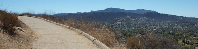
The foreboding sounding Tarantula Hill, which also goes by the more welcoming name of Dawn’s Peak, is a small, isolated mound in Thousand Oaks that hikers can summit for views over the Conejo Valley and into the nearby Santa Monica Mountains. If your spider senses are detecting pavement, that’s because the entire half-mile-long trail up Tarantula Hill is paved. While Tarantula Hill Trail might be hard on your legs, the 360-degree views are easy on the eyes. The hike up Tarantula Hill is one mile round trip with 275 feet of elevation gain.
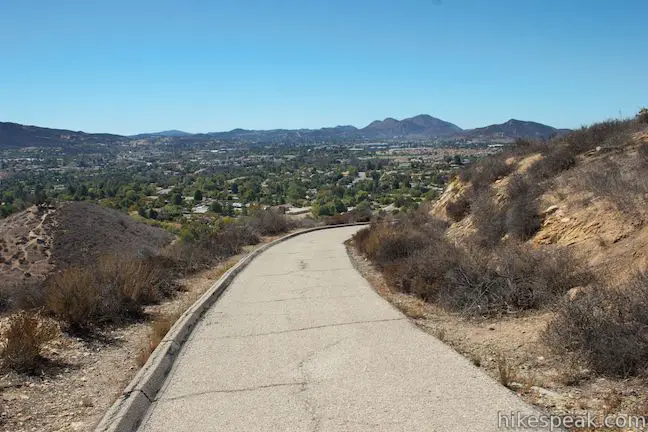
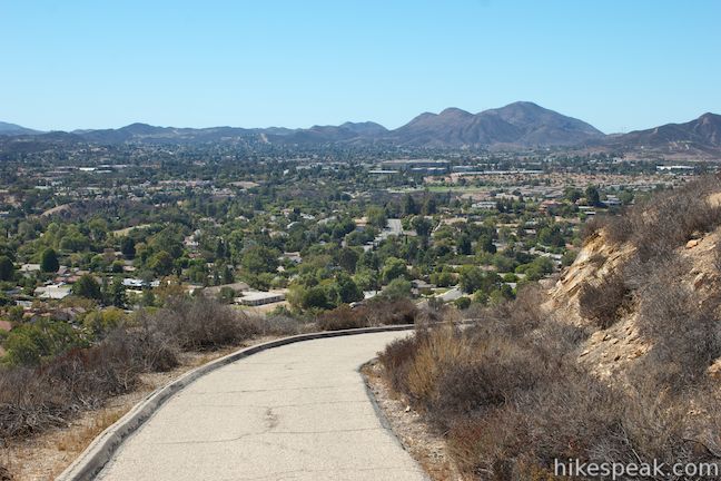
From a trailhead along Gainsborough Road, where roadside parking is available, Tarantula Hill Trail heads southwest, roughly parallel to the road through cacti and low grasses (that tarantulas are known to inhabit). After a horseshoe bend to the right, the paved road begins to climb, spiraling counterclockwise up Tarantula Hill.
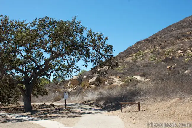
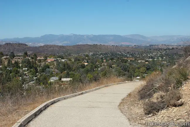
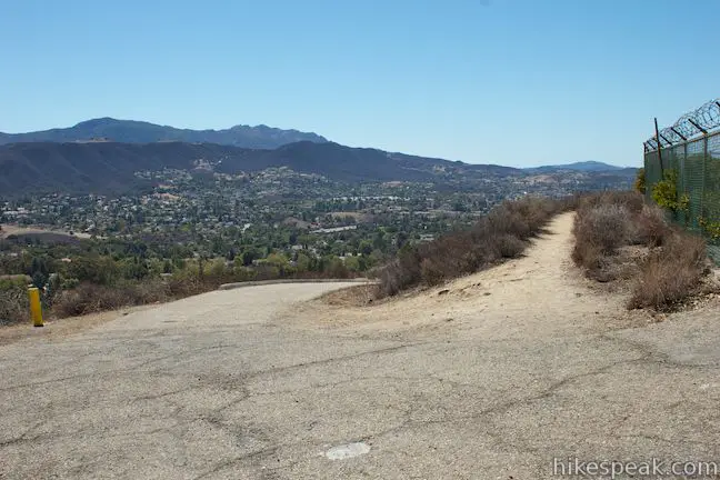
The views are constantly rotating as you wind your way up Tarantula Hill, starting with views to the south and east toward the Santa Monica Mountains. A quarter mile from the start, the road passes a dirt path on the right, just before slipping between a pair of oaks. This path can be used as an alternate route to the summit for those who prefer less pavement, trimming the ascent from 0.5 miles to 0.4 miles.

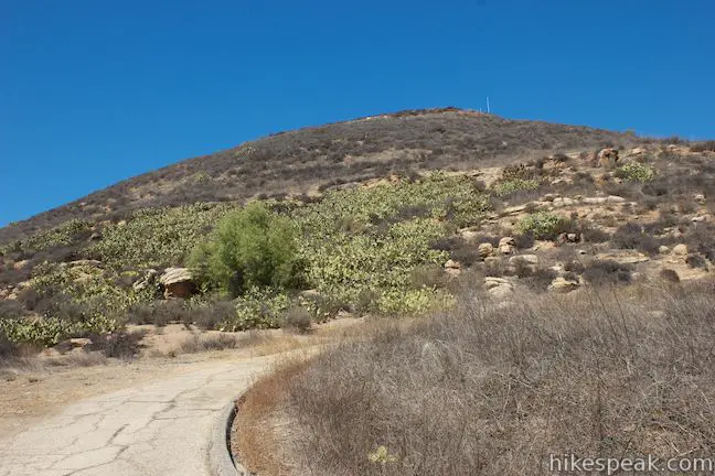
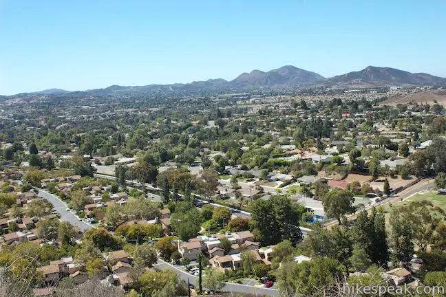
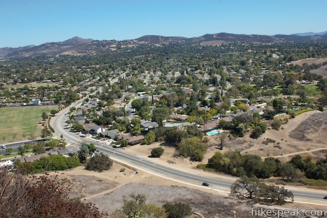
Past the oaks, the trail rounds up the north side of Tarantula Hill for new views across Thousand Oaks toward the Topatopa Mountains in Los Padres National Forest.
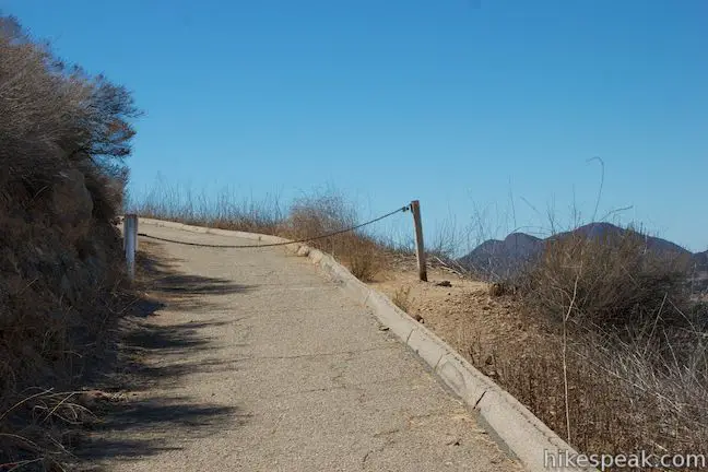
Step over or around a chain that crosses the road at 0.35 miles from the start, and continue up the wide paved trail. You’ll curl up to the west side of the summit for views across the Conejo Valley. Continue to spiral up and to the left, crossing the south face of the hill to reach views to the east as the trail comes to an end at the summit of Tarantula Hill.
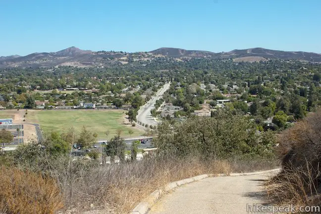
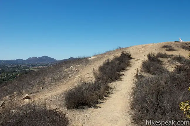
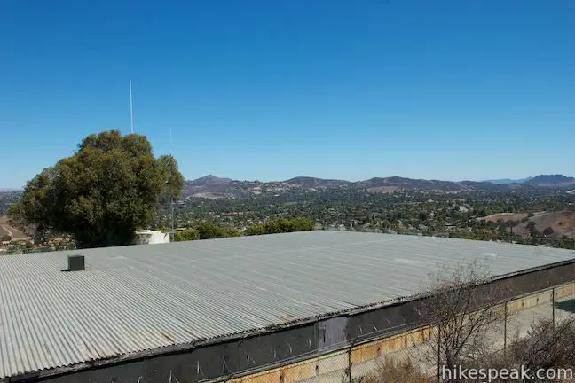
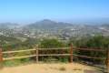
The pavement ends alongside a water reservoir, which is fenced off. Leave the trail and follow a path west around the facility to a bench at the 1,057-foot top of Tarantula Hill. The bench offers a restful view west toward Newbury Park and south into the Santa Monica Mountains, where the trails to Angel Vista can be seen. The 45-acre open space that preserves Tarantula Hill is bordered by houses on three sides and the Conejo Valley Botanical Garden on the south side, which extends this undeveloped pocket in Thousand Oaks.

Return the way you came for a quick 1-mile round trip hike with 275 feet of elevation gain. If you prefer to take the dirt path at the start of the hike instead of the paved trail, walk a few hundred feet east from the trailhead along Gainsborough Road road and turn left up a path that climbs the slope below Tarantula Hill. In a tenth of a mile, turn left at a junction and follow the path up to Tarantula Hill Trail by the cluster of oaks.
Dogs, bikes, and horses are welcome on Tarantula Hill. Those looking to walk farther can check out the Conejo Valley Botanical Gardens, which are across the street from the trailhead for Tarantula Hill. No fee or permit is required to hike Tarantula Hill Trail, so get out and enjoy!
Directions to the Trailhead
- Take the 101 Freeway to exit 45 for Lynn Road.
- Turn north from the offramp and take Lynn Road for 3/4 of a mile to Gainsborough Road (across from Camino Dos Rios).
- Turn right at the light and drive another 3/4 of a mile to the trailhead, which will be on the left (just past the road on the right into Conejo Community Park and Conejo Valley Botanical Gardens).
- You may want to make a U-turn before parking along the road.
- A wide wooden sign on the right side of the trailhead reads, authorized vehicles only.
- A white sign on the left of the trail, posted by the Conejo Open Space Conservation Agency, lists the guidelines for the Conejo Open Space.
Trailhead Location
Trailhead address: Gainsborough Road, Thousand Oaks, CA 91360
Trailhead coordinates: 34.195528, -118.885343 (34° 11′ 43.90″N 118° 53′ 07.23″W)
You may also view a regional map of surrounding Los Angeles trails and campgrounds.


 | Paradise Falls This 40-foot waterfall spills into a large pool along the Arroyo Conejo. Paradise Falls is located within Wildwood Park in Thousand Oaks and is reachable via several trails. |
 | Oak Creek Canyon Trail This 0.8-mile loop starts with an all-access nature trail with signs in English and Braille before transitioning to a less developed dirt single track, looping through chaparral and oak woodlands in Los Robles Open Space. |
 | Angel Vista via Rosewood Trail This 4-mile round trip hike is the most direct route to a panoramic viewpoint overlooking the Conejo Valley. |
 | Angel Vista via West Los Robles Trail This 7.6-mile round trip hike is a more gradual route to the overlook on the north side of the Santa Monica mountains. |
 | Rocky Peak This 4.75-mile hike rises to a 2,715-foot summit in Rocky Peak Park within a rugged mountain range between Chatsworth and Simi Valley. |
 | More trails in Los Angeles Explore other hiking destinations around Los Angeles. |
Common Questions about Tarantula Hill in Thousand Oaks
- Is the trail open?
- Yes. You should expect to find that Tarantula Hill Trail is open. There are no recent reports of trail closures. If you discover that the trail is closed, please help your fellow hikers by reporting a closure.
- Is this trail free to access?
- Yes, Tarantula Hill Trail is free to access. No entrance fee, pass, or permit is required. If you discover that access rules have changed, please provide feedback on your experience.
- How much time does this hike take?
- It takes approximately 30 minutes to hike Tarantula Hill Trail. Individual hiking times vary. Add extra time for breaks and taking in the views.
- How long is this hike?
- The hike to Tarantula Hill Trail is a 1 mile out and back with 275 feet of elevation change.
- Are dogs allowed on this trail?
- Yes, dogs are allowed on Tarantula Hill Trail. The trail is open to hikers, dogs, bikes.
- Is Tarantula Hill Trail good for kids?
- Yes, this hike is likely suitable for children. It is relatively short (1 miles) with manageable elevation gain.
- Does this trail go to a summit?
- Yes, Tarantula Hill Trail reaches a summit with panoramic views.
- Where is the trailhead located?
- The trailhead for Tarantula Hill Trail is located in Thousand Oaks, CA.
Trailhead Address:
Gainsborough Road
Thousand Oaks, CA 91360
Trailhead Coordinates:
34.195528, -118.885343 - What are the driving directions to the start of the hike?
To get to the trailhead: Take the 101 Freeway to exit 45 for Lynn Road. Turn north from the offramp and take Lynn Road for 3/4 of a mile to Gainsborough Road (across from Camino Dos Rios). Turn right at the light and drive another 3/4 of a mile to the trailhead, which will be on the left (just past the road on the right into Conejo Community Park and Conejo Valley Botanical Gardens). You may want to make a U-turn before parking along the road. A wide wooden sign on the right side of the trailhead reads, authorized vehicles only. A white sign on the left of the trail, posted by the Conejo Open Space Conservation Agency, lists the guidelines for the Conejo Open Space.
View custom Google Maps directions from your current location.
- Are there other trails near Tarantula Hill Trail?
- Yes, you can find other nearby hikes using the Hikespeak Hike Finder Map.

4 Comments on Tarantula Hill in Thousand Oaks
What hikers are saying:
✨ Generated summary of user commentsThis trail provides a sense of gratitude among visitors who value the transition from restricted land to a public recreation space. Hikers enjoy the opportunity to climb the hill that was once guarded by no trespassing signs due to the water tank at the summit. Jeff expresses appreciation for the city finally opening the area, marking a welcome shift for those who have waited to explore Tarantula Hill.
I am glad the city finally opened the area up to the public. For many years there were no trespassing signs there to keep people off the hill, I guess due to the fact that there was a water tank at the top of the hill.
Are there tarantulas?
Yes.
Thank you for asking this, Elaine. Like, this is the first thing I wanted to know …. now I totally wanna go.