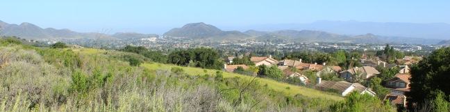
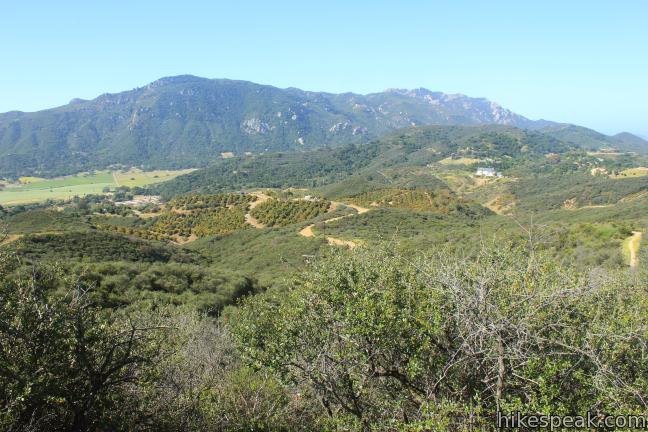
The boldly named Angel Vista is one of the top viewpoints in the Santa Monica Mountains, a coastal range running between Los Angeles and Ventura. Angel Vista soars over Thousand Oaks, presenting panoramic views of the west end of the range, which includes the Boney Mountains, the rocky crown of Santa Monicas. A few trails lead to the vista point, including the 7.6-mile round trip trek up the eastern half of West Los Robles Trail to Angel Vista. Rosewood Trail offers a more direct option, climbing 850 feet in 2 miles to make it the shortest route to the top.
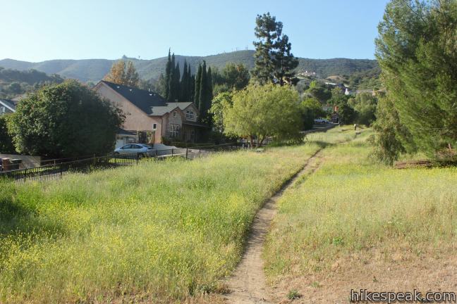
While the 4-mile round trip hike up Rosewood Trail begins in a narrow green alley shouldered by rows of houses, do not be dissuaded. The trail quickly transitions to development-free slopes preserved by the Conejo Open Space Foundation. The trail starts along Lynn Road in Newbury Park, but the trailhead lacks roadside parking. Instead, warm up by walking a tenth of a mile up the road from a nearby parking area. The free lot runs alongside a grassy park associated with the Stagecoach Inn Museum (where you can find an easy trail through the pioneer park). Carefully cross the lanes of traffic on Lynn Road and turn right, walking west to the start of Rosewood Trail.
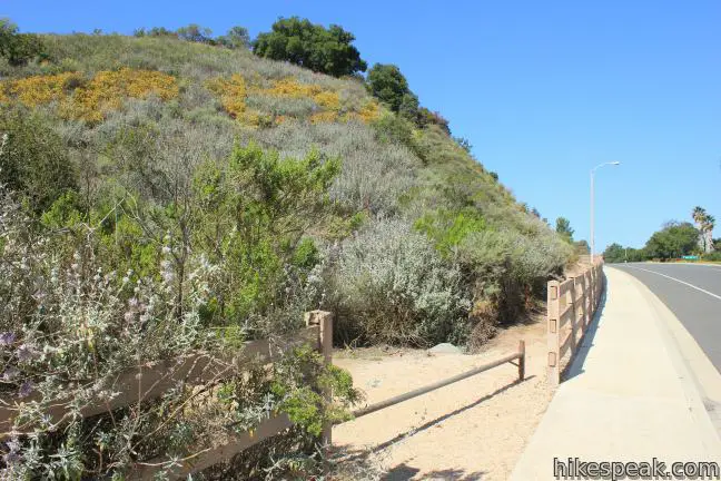
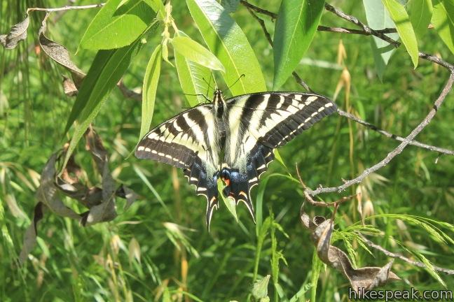
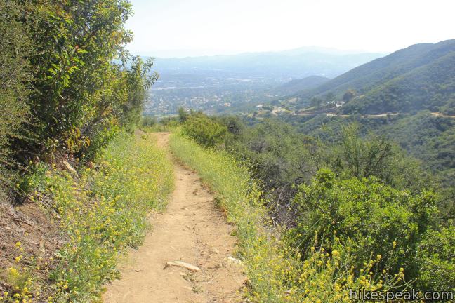
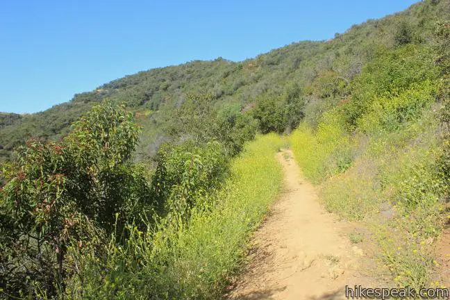
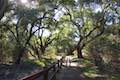
You will find the dirt trail heading up a shaded ravine at the base of the mountains. Ascend a corridor between residential streets to reach a trail kiosk about 0.4 miles from Lynn Road. Leave the houses behind and enter a mountainside draped in chaparral. Spring brings vibrant colors to the side of the trail including sage and orange monkeyflower. You may even spot a hummingbird along the trail to Angel Vista.
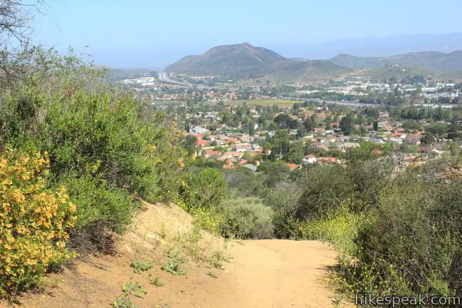
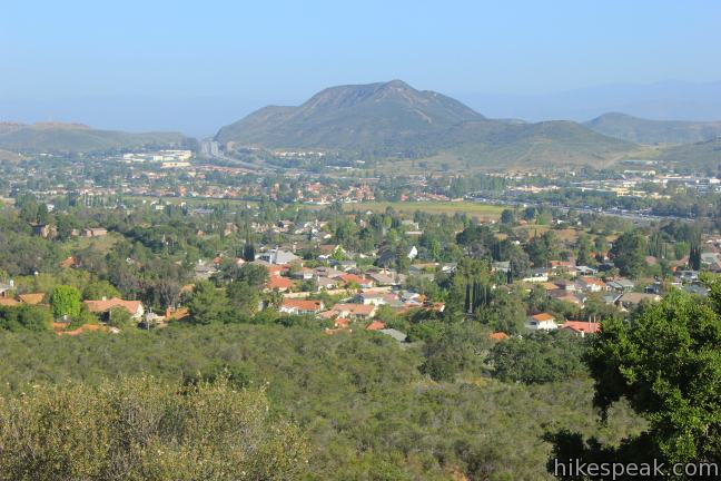
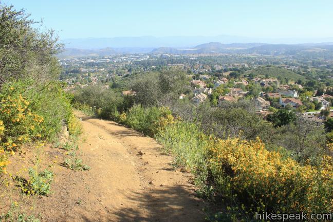
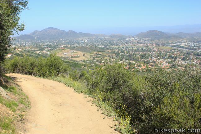
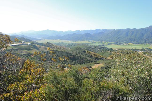
After angling west for a quarter mile, the trail presents a clear view over the 101 Freeway carving up the Conejo Valley. This is a preview of the panorama to come at Angel Vista, and the view grows larger as you hike higher up the mountain. Follow a mile of switchbacks in and out of a draw as you climb to new heights, attaining a southeastward view toward West Los Robles Trail and a ranch in the mountains above the trail.
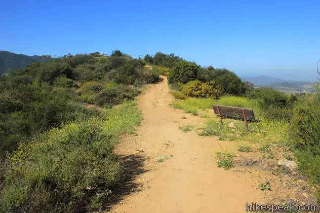
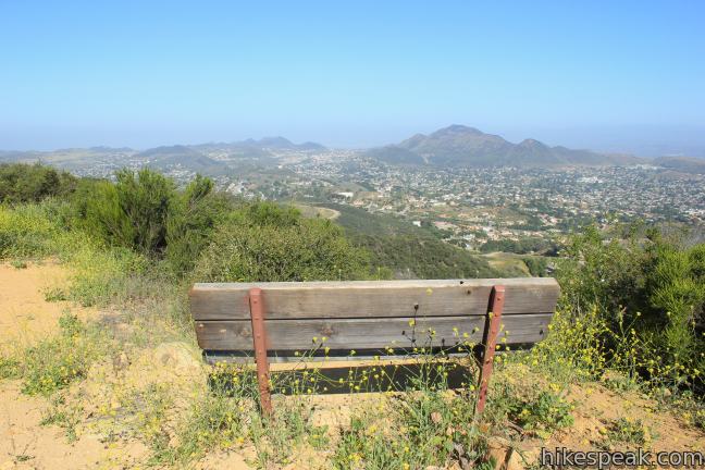
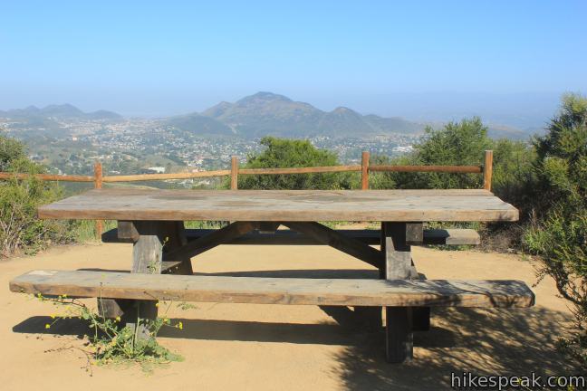
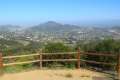
The first junction of the hike comes 1.75 miles from Lynn Road and a few steps from a T-junction with West Los Robles Trail. Turn right before you reach the end of Rosewood Trail, following the sign for Angel Vista. The viewpoint will be in sight, roughly a tenth of a mile away. A bench and a picnic table at Angel Vista allow you to relax and enjoy the view.
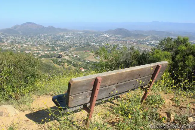
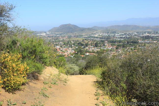
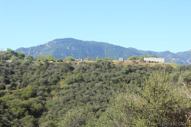
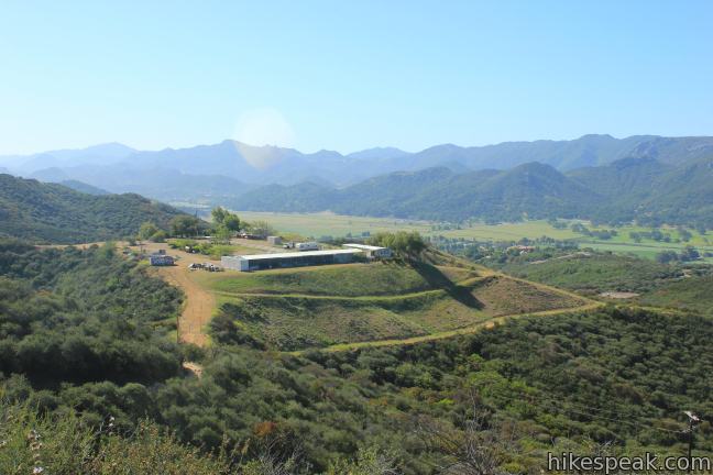
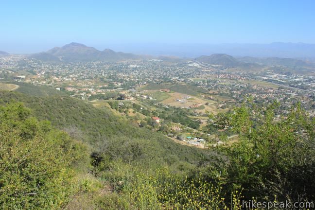
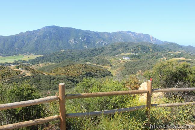
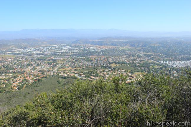
Angel Vista lies at 1,600 feet above sea level, delivering the biggest views of the hike. Not only can you look west over Thousand Oaks and Newbery Park in Ventura County, but you can also look south toward the orange pinnacles of the Boney Mountains containing Sandstone Peak, the highest point in the Santa Monica Mountain Range. Another prominent summit rising above the valley due west of Angel Vista is called Conejo Mountain.
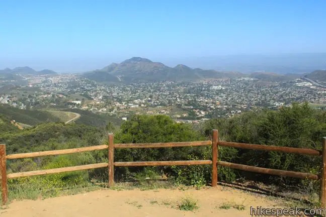
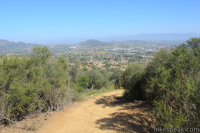
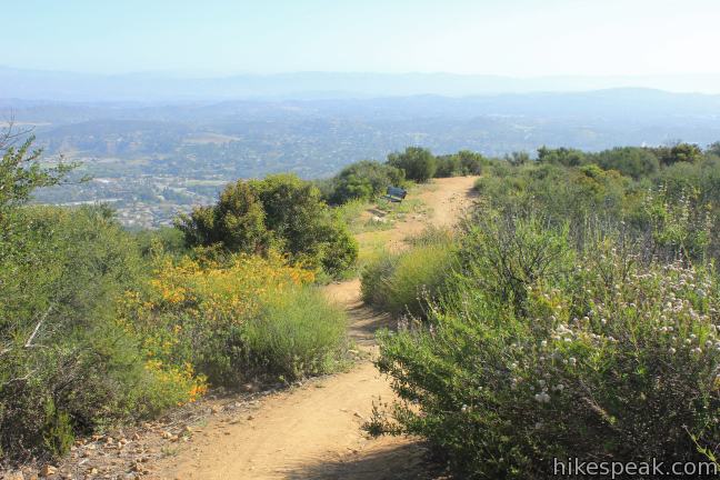
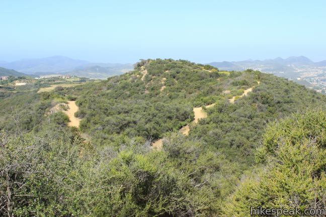
Want to hike a little more? A bump on the ridge about 10 feet higher than Angel Vista has broad northward views. To reach it, hike back down the spur trail to Angel Vista, cross Rosewood Trail, and walk up a path heading east a tenth of a mile up the rise. A bench at the top provides a seated view overlooking Thousand Oaks and the rolling foothills dotting the Conejo Valley. The green mountains protected by Los Padres National Forest loom large in the background. This higher vantage offers views to the northeast not visible from Angel Vista, making it a worthy addition.
Return by hiking down Rosewood Trail the way you came. No fee or permit is required to hike Rosewood Trail, which is dog and mountain bike-friendly, so get out and enjoy!
Directions to the Trailhead
- Take the 101 Freeway to exit 46 for Ventu Park Road.
- Drive south for half a mile to Lynn Road and turn right.
- Make the next right on Susan Drive to enter the parking area alongside the Stagecoach Inn Museum park.
Trailhead Location
Trailhead address: 1617 Lynn Road, Thousand Oaks, CA 91320
Trailhead coordinates: 34.1768, -118.9128 (34° 10′ 36.48″N 118° 54′ 46.08″W)
You may also view a regional map of surrounding Los Angeles trails and campgrounds.


Angel Vista by hikespeak.
 | Angel Vista via West Los Robles Trail This 7.6-mile round trip hike climbs 800 feet to an overlook on the north side of the Santa Monica Mountains above Thousand Oaks. |
 | Oak Creek Canyon Trail This 0.8-mile loop starts with an all-access nature trail with signs in English and Braille before transitioning to a less developed dirt single track, looping through chaparral and oak woodlands in Los Robles Open Space. |
 | Tarantula Hill This 1-mile round trip hike follows a paved trail to the top of a small, round hill in Thousand Oaks with views across the Conejo Valley into the surrounding mountains. |
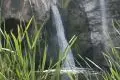 | Paradise Falls This 40-foot waterfall is located within Wildwood Park in Thousand Oaks and is reachable via several trails. |
 | Lizard Rock To add extra mileage and views to a visit to Paradise Falls in Thousand Oaks, consider placing Lizard Rock on your itinerary. |
 | More trails in Los Angeles Explore other hiking destinations around Los Angeles. |
Common Questions about Angel Vista via Rosewood Trail in the Santa Monica Mountains
- Is the trail open?
- Yes. You should expect to find that Rosewood Trail To Angel Vista is open. There are no recent reports of trail closures. If you discover that the trail is closed, please help your fellow hikers by reporting a closure.
- Is this trail free to access?
- Yes, Rosewood Trail To Angel Vista is free to access. No entrance fee, pass, or permit is required. If you discover that access rules have changed, please provide feedback on your experience.
- How much time does this hike take?
- It takes approximately 2 hours 15 minutes to hike Rosewood Trail To Angel Vista. Individual hiking times vary. Add extra time for breaks and taking in the views.
- How long is this hike?
- The hike to Rosewood Trail To Angel Vista is a 4 mile out and back with 850 feet of elevation change.
- Are dogs allowed on this trail?
- Yes, dogs are allowed on Rosewood Trail To Angel Vista. The trail is open to hikers, dogs, bikes.
- What mountain range is this trail in?
- Rosewood Trail To Angel Vista is located in the Santa Monica Mountains.
- Where is the trailhead located?
- The trailhead for Rosewood Trail To Angel Vista is located in Thousand Oaks, CA.
Trailhead Address:
1617 Lynn Road
Thousand Oaks, CA 91320
Trailhead Coordinates:
34.1768, -118.9128 - What are the driving directions to the start of the hike?
To get to the trailhead: Take the 101 Freeway to exit 46 for Ventu Park Road. Drive south for half a mile to Lynn Road and turn right. Make the next right on Susan Drive to enter the parking area alongside the Stagecoach Inn Museum park.
View custom Google Maps directions from your current location.
- Are there other trails near Rosewood Trail To Angel Vista?
- Yes, you can find other nearby hikes using the Hikespeak Hike Finder Map.

Aggressive Falcon on the Rosewood trail
We live on the Rosewood trail and we hike it daily, or at least several ties a week. It’s a busy trail.
Recently, we have encountered a new adventure while hiking the trail, an aggressive raptor is apparently defending a nest. it dives our heads close enough to ruffle our hair.
Our house guest, who is from Saudi Arabia, and who hunts with raptors in his country first encountered it, and my husband, who has hiked the trail at least weekly for over 16 years didn’t believe him. My husband has now had his hair ruffled, and has taken some videos.
The bird appears to be too large to be an American Kestrel, darker in color than the available photos of Cooper’s Hawks, and less bulky with a finer head (and no color in the tail ) than our well known Redtailed Hawk. Maybe a Peregrin, or a Red Shouldered Hawk?
The trail is a very busy trail. There have to be others who have seen it, and been “ruffled” by it.
Wondering if the recent upsurge in homeowners (we’re in Ventu Park) keeping chickens in their yards is attracting them….
Jacquie, Mike & Fahad
[…] Angel Vista via West Los Robles Trail: If you are looking for something a little longer, this trail is about 7.6 miles and climbs 800ft on the north side of the Santa Monica Mountains above Thousand Oaks. […]