Bantam Trail and Castair Trail
in Trebek Open Space


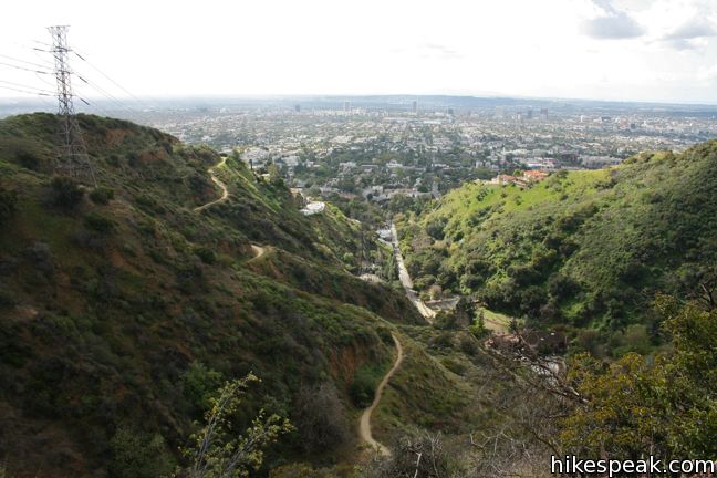
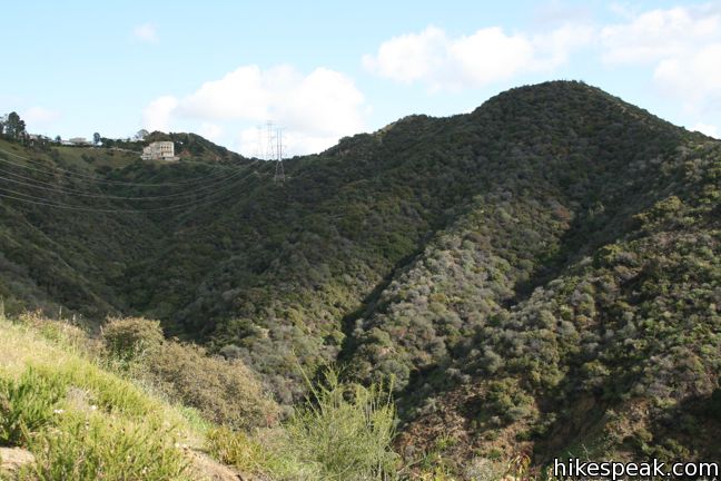
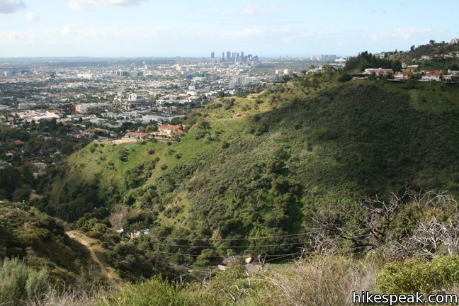
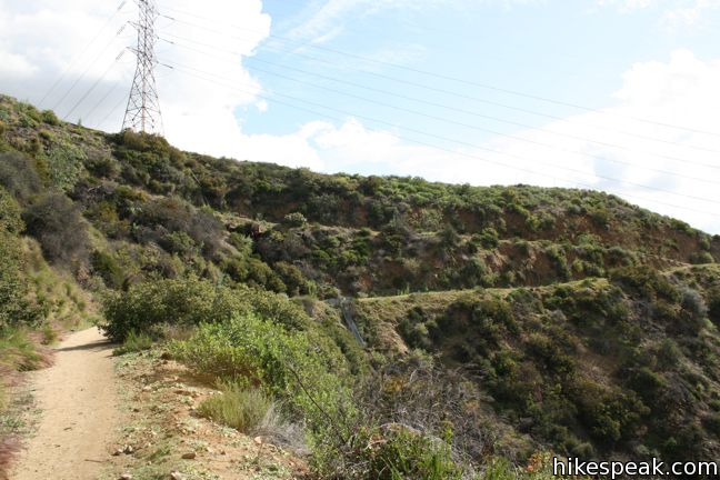
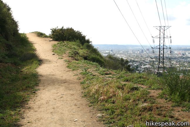
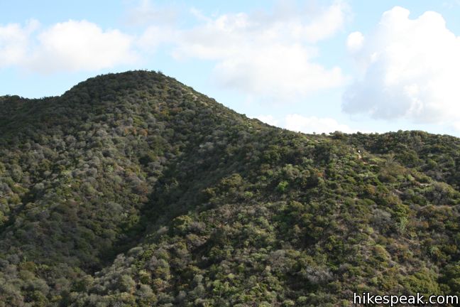
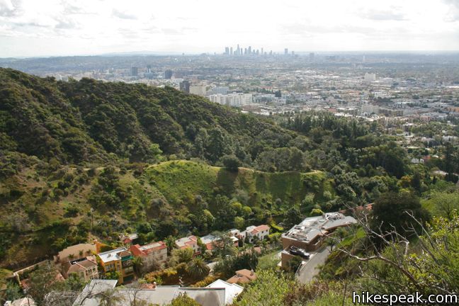
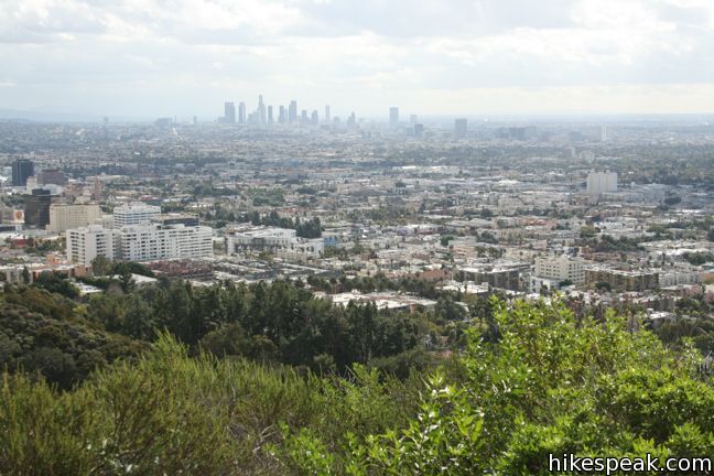
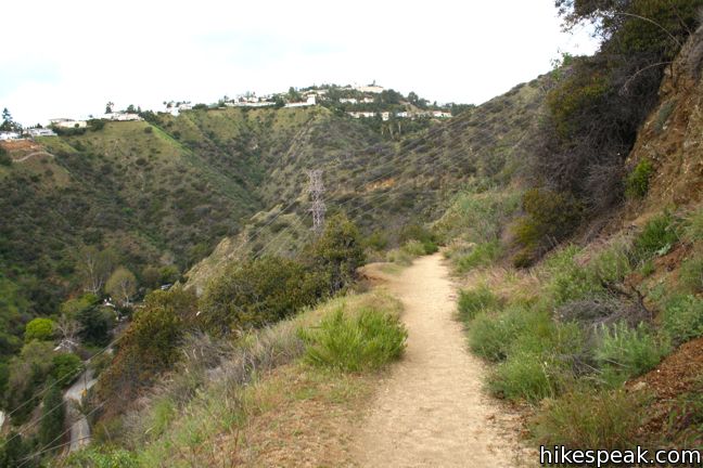
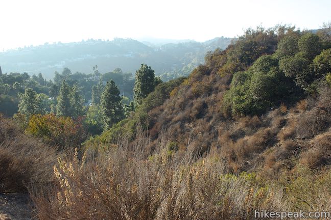
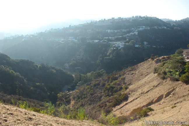
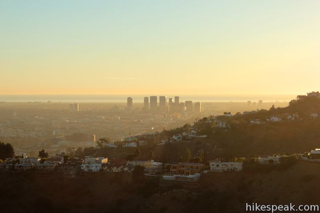
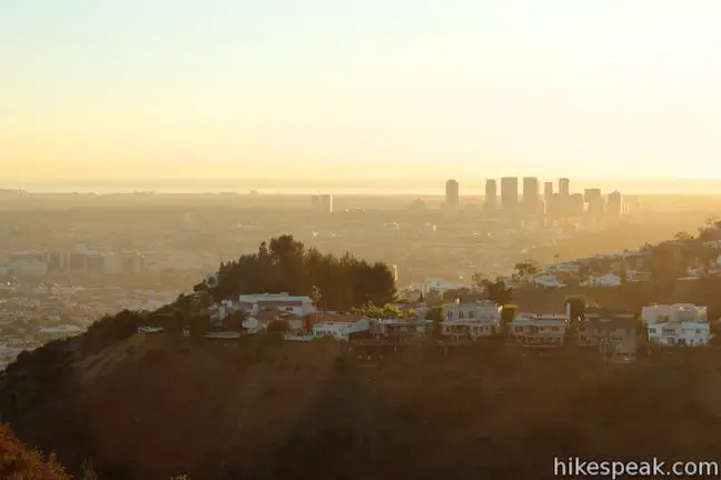
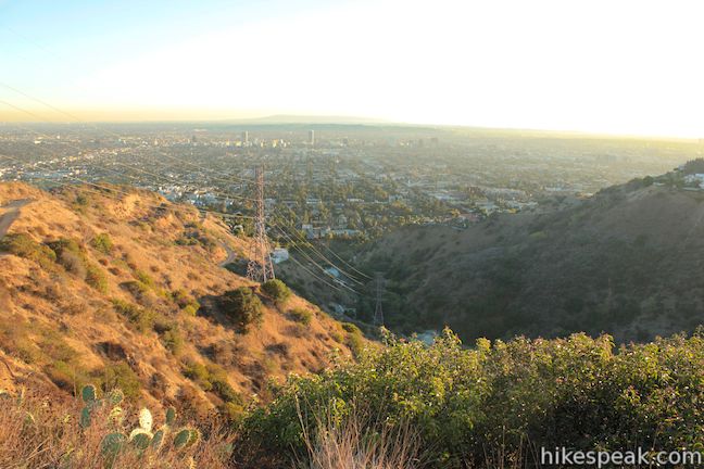
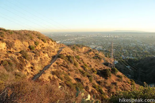
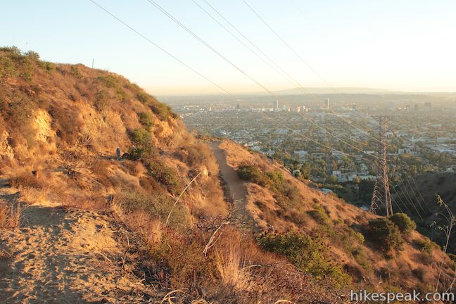
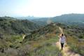
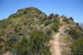
Two half-mile long fire roads cross the 62-acre Trebek Open Space, providing short hikes on the south face of the Hollywood Hills. Bantam Trail begins from Nichols Canyon Road and climbs to a ridge running down the east side of the park. Castair Trail begins from a trailhead lower down the ridge and drops into Nichols Canyon, coming to a dead-end above the road. A rugged single track descends the ridge between the two trails, offering a panoramic view over Hollywood spanning from downtown Los Angeles to Century City.
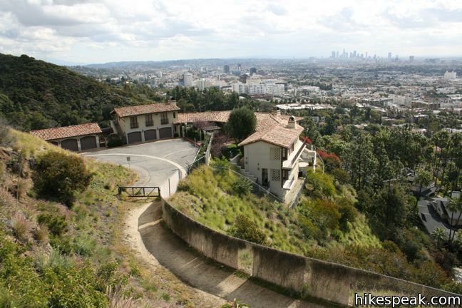
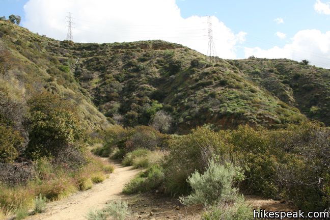
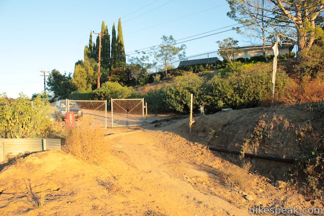
Beginning from Nichols Canyon Road, 1.3 miles north of Hollywood Boulevard, step through the black gate and start up Bantam Trail. The dirt fire road heads southeast gradually ascending out of the canyon. Views over Hollywood expand as the trail crosses the east side of Nichols Canyon, passing through low brush and grasses. After ascending 150 feet in the first 0.45 miles, you will come to a junction with Astral Drive Trail.
If you would like to hike between Trebek Open Space and Runyon Canyon, you should turn up Astral Drive Trail. Astral Drive Trail ascends 125 feet over 0.3 miles to a trailhead on Astral Drive at the top of Trebek Open Space. Turn left and hike 0.15 miles up Astral to Solar Drive. There are two options from here. Turn right on Solar Drive to walk a quarter mile to Runyon Canyon Park at a junction with Western High Way Trail. Alternatively, you may continue another 0.05 miles up Astral Drive and make the next right up a service road that connects to the trailhead at the top of Runyon Canyon Park along Mulholland Drive. After 0.1 miles on this residential road, the pavement ends and you will have a wide dirt road to hike up for the following 0.3 miles. From the Bantam Trail – Astral Drive Trail Junction, it is 0.9 miles to the trailhead at the top of Runyon Canyon Park or 0.7 miles to Western High Way Trail in Runyon Canyon Park via Solar Drive. These routes are shown on the map below.
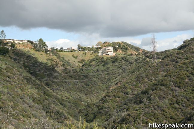
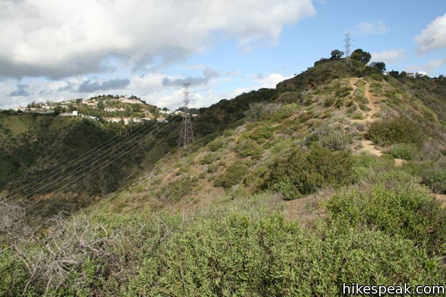
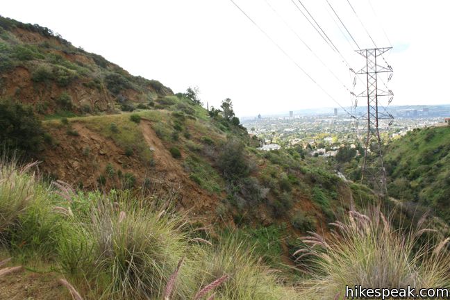
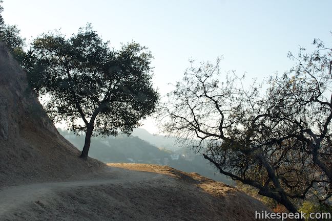
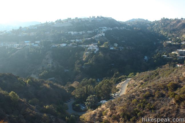
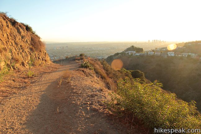
To continue along Bantam Trail, stay to the right at the junction with Astral Drive Trail. In another 0.05 miles (half a mile from the start with 175 feet of elevation gain), Bantam Trail will reach a ridgeline and comes to an end at an overlook with views to the east across a small canyon toward the ridge on the west side of Runyon Canyon Park. Hikers may be visible making their way along Western High Way Trail on the backbone of the ridge.
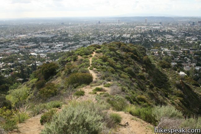
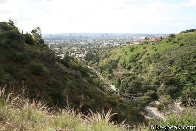
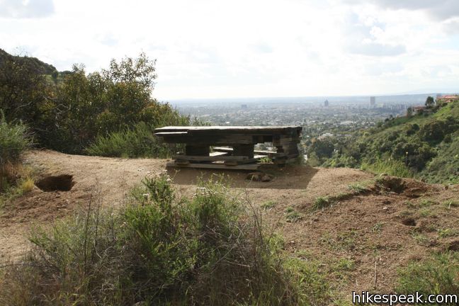
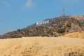
A quarter mile (and 175 feet) below is the trailhead for Castair Trail. Before heading back down Bantam Trail, venture a short distance down the ridge to a lower landing. On a clear day, Santa Monica Bay is visible to the west, and Griffith Observatory peaks out behind the ridges to the east. Turn around here for a 1.15-mile hike, or drop down the ridge to Castair Trail.
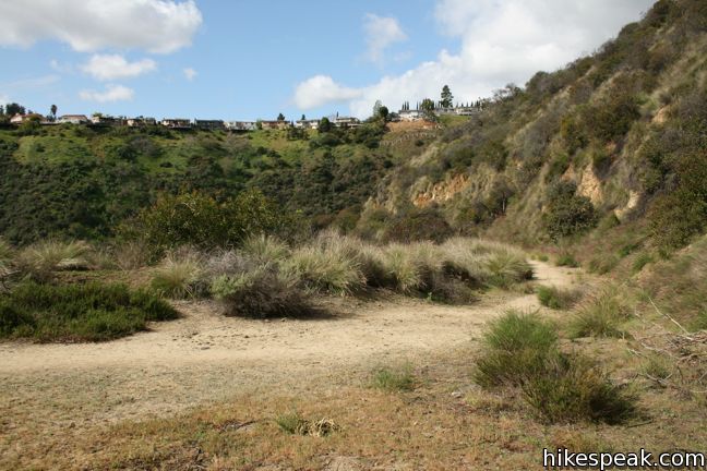
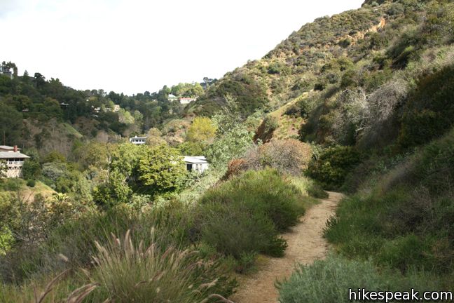
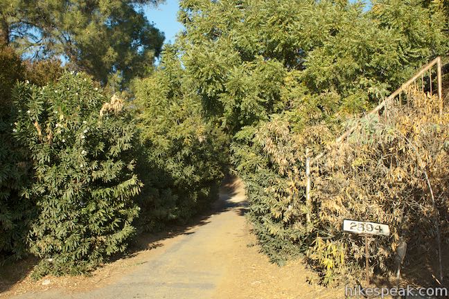
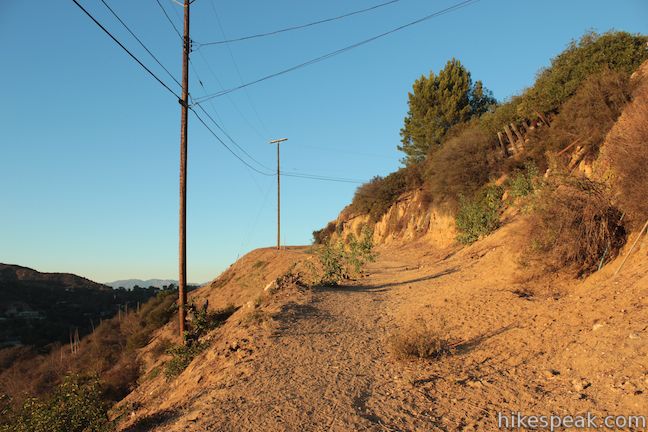
The rugged single track descends precipitously to the top of Wattles Drive and the start of Castair Trail. The fire road heads northwest into Nichols Canyon, losing elevation as it charts a parallel course below Bantam Trail.
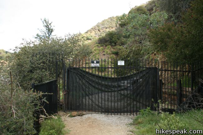
There are nice views up and down the canyon, similar to the trail above. Half a mile in, Castair Trail comes to a sudden stop at an imposing black gate marked “No Trespassing” and does not connect to Nichols Canyon Road. Turn around, and hike 125 feet back up to the trailhead, and then make the steep climb up the ridge to return to Bantam Trail. Both trails combined (a.k.a. the Daily Double) make a 2.5-mile out-and-back trebek, I mean trek. There is 325 feet of elevation between the high and low points of the hike. The unmaintained single track up the ridge is quite steep, but the fire roads are gradual otherwise.
Dogs are welcome in Trebek Open Space, and this is a popular dog-walking destination. Overall, there is far less foot and paw traffic than nearby Runyon Canyon Park, with similar scenery. No fee or permit is required to visit Trebek Open Space, so get out and enjoy.
Directions to the Trailhead
Bantam Trailhead:
- From Hollywood Boulevard, three block east of Fairfax Ave, head north on Nichols Canyon Road.
- The road ascends the canyon, makes a sweeping turn to the left and arriving at the trailhead after 1.3 miles.
- The trail starts on the outside of a grand turn to the left behind a black gate.
- Ample roadside parking is available.
Castair Trailhead:
- From Hollywood Boulevard, six blocks west of Fairfax, head north on Curson Ave for 0.6 miles.
- At road's end take the sharp left, and continue up Wattles Drive for 0.3 miles to the trailhead.
- Limited roadside parking is available.
Trailhead Location
Trailhead address: Bantam Trailhead, 2500 Nichols Canyon Road, Los Angeles, CA 90046
Trailhead coordinates: 34.11354, -118.3594 (34° 06′ 48.7″N 118° 21′ 33.8″W)
Trailhead address: Castair Trailhead, 1900 Wattles Drive, Los Angeles, CA 90046
Trailhead coordinates: 34.105764, -118.356813 (34° 06′ 20.75″N 118° 21′ 24.52″W)
View Santa Monica Mountains in a larger map
Or view a regional map of surrounding Los Angeles trails and campgrounds.


Runyon Canyon Park to Astral Drive Trail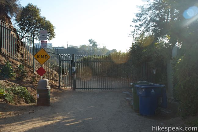


 | Runyon Canyon Tour Hollywood's most popular dog park on loops of various lengths, offering good exercise and views over Los Angeles. |
 | Fryman Canyon Loop This 3-mile loop follows Betty B. Dearing Trail through Wilacre Park and Coldwater Canyon Park around Fryman Canyon in the Studio City side of the Hollywood Hills. |
 | Hastain Trail This pair of short loops explore Franklin Canyon Park and ridges in the Santa Monica Mountains above Beverly Hills. |
 | Franklin Canyon Lake Loop & Chaparral Trail This 2.5-mile hike loops around Franklin Canyon Lake and ascends Chaparral Trail (optionally) for an overview of Franklin Canyon. |
 | Mount Lee and the Hollywood Sign via Hollyridge Trail This 3.5-mile hike ascends 750 feet to reach the summit of Mount Lee behind the Hollywood Sign. |
 | Mount Lee and the Hollywood Sign via Brush Canyon Trail This 6.4-mile hike crosses Griffith Park from Canyon Drive to the top of Mount Lee directly behind the landmark Hollywood Sign. |
 | Bronson Cave This short easy hike visits a man-made cave recognizable as the Batcave from the 1960s Batman TV series and hundreds of other locations on TV and film. |
 | Cahuenga Peak This 3-mile hike on Burbank Peak Trail and Aileen Getty Ridge Trail ascends to Cahuenga Peak and the adjacent Mount Lee, home of the Hollywood Sign. |
 | Lake Hollywood Reservoir Walking Trail This 3.5-mile loop circles a peaceful fence-enclosed reservoir in the hills below the Hollywood Sign. |
 | More trails in the Santa Monica Mountains Explore other destinations in the range. |
Common Questions about Bantam Trail and Castair Trail in Trebek Open Space
- Is the trail open?
- Yes. You should expect to find that Trebek Open Space is open. There are no recent reports of trail closures. If you discover that the trail is closed, please help your fellow hikers by reporting a closure.
- Is this trail free to access?
- Yes, Trebek Open Space is free to access. No entrance fee, pass, or permit is required. If you discover that access rules have changed, please provide feedback on your experience.
- How much time does this hike take?
- It takes approximately 1 hour 15 minutes to hike Trebek Open Space. Individual hiking times vary. Add extra time for breaks and taking in the views.
- How long is this hike?
- The hike to Trebek Open Space is a 2.5 mile out and back with 375 feet of elevation change.
- Are dogs allowed on this trail?
- Yes, dogs are allowed on Trebek Open Space. The trail is open to hikers, dogs, bikes.
- What mountain range is this trail in?
- Trebek Open Space is located in the Santa Monica Mountains.
- Where is the trailhead located?
- The trailhead for Trebek Open Space is located in Los Angeles, CA.
Trailhead Address:
2500 Nichols Canyon Road
Los Angeles, CA 90046
Trailhead Coordinates:
34.113539, -118.359405 - What are the driving directions to the start of the hike?
To get to the trailhead: Bantam Trailhead: From Hollywood Boulevard, three block east of Fairfax Ave, head north on Nichols Canyon Road. The road ascends the canyon, makes a sweeping turn to the left and arriving at the trailhead after 1.3 miles. The trail starts on the outside of a grand turn to the left behind a black gate. Ample roadside parking is available.
Castair Trailhead: From Hollywood Boulevard, six blocks west of Fairfax, head north on Curson Ave for 0.6 miles. At road's end take the sharp left, and continue up Wattles Drive for 0.3 miles to the trailhead. Limited roadside parking is available.
View custom Google Maps directions from your current location.
- Are there other trails near Trebek Open Space?
- Yes, you can find other nearby hikes using the Hikespeak Hike Finder Map.

4 Comments on Bantam Trail and Castair Trail in Trebek Open Space
What hikers are saying:
✨ Generated summary of user commentsHikers find this mountain amazing but warn against the dangers of straying from the main path. Mary advises staying on the beaten tracks to avoid becoming stranded on the steep terrain. Staying on established routes ensures a safe and enjoyable experience while taking in the views.
“What an amazing mountain.” Jump to comment ↓
It seems like the Castair Trailhead is closed. When you round the sharp left on Curson, there is a big black gate blocking the way. I have no idea why this gate is there, there are no “No Trespassing” signes or anything. I was able to walk down from the Castair Trailhead through the pedestrian gate on Curson, but I’m not sure you can get in that way.
There is one alternate trailhead, at Astral Dr. It can be reached by continuing up Nichols canyon and turning right onto Astral. The trailhead is behind a chain link gate.
Hi Toivo – I’m not sure if you will get this, but I am curious: is there any way to get around the black gate at the very top of Curson (leading onto Wattles Drive, and eventually the Castair Trailhead)? I looked at it on Google Maps and couldn’t tell if there was a pedestrian entrance, and maybe just cars can’t go through. Otherwise, where exactly was the other pedestrian gate on Curson that you mentioned above? Thanks for any info! Wanted to check out this trail this weekend by entering on Curson Ave! Tiffany
To answer my own question (in case anyone else has the same one), the gate all the way at the top of Curson, which leads into Castair Trail, is just a pedestrian gate and seems to be open during all daylight hours. After you go through, you walk a bit past some houses on Wattles Drive and then the trail starts. Very pretty!
When climbing on Runyon Canyon it might be best to stick to the beaten tracks. I was attracted to a trail less travelled and got stuck three quarters of the way to the top supporting my self by hanging on to a bush and leaning my back foot on another bush. I needed to be rescued.What an amazing mountain.