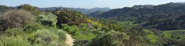
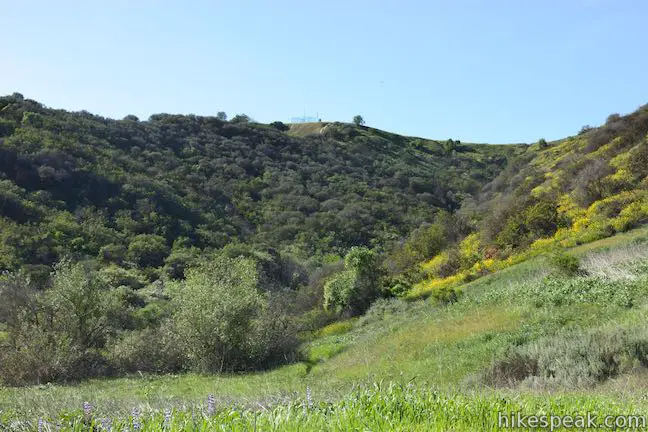
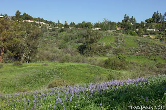
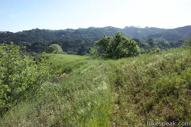
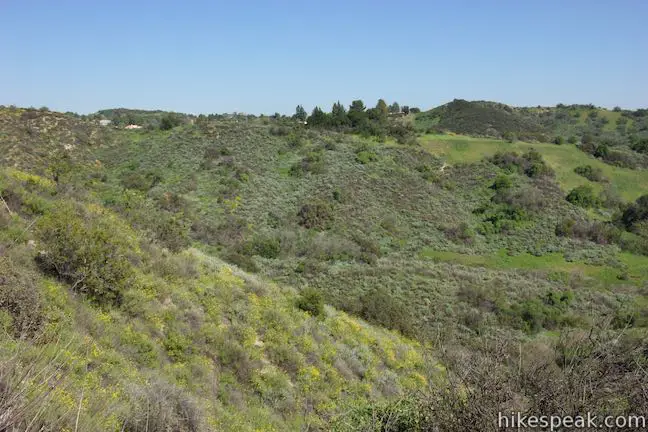
Summit Valley Edmund D. Edelman Park preserves 652 acres at the top of Topanga Canyon that were saved from development. Hikers can explore a couple loops through the main area of the park. For a short 1.65-mile hike with 190 feet of elevation change, try Edelman North Loop, which goes along the valley floor before circling back along a wildflower-covered ridge.
For a longer 2-mile hike with 410 feet of elevation change, get higher views on a second loop from Summit Valley up to Summit to Summit Motorway, a dirt road that goes along the ridge at the top of Summit Valley. Both loops provide scenic perspectives down Summit Valley toward Topanga and have excellent wildflower viewing in season. Along with these two hikes, nearby Viewridge Trail crosses the less visited east side of Summit Valley Edmund D. Edelman Park toward a Canyon Overlook.
The official map for Summit Valley Edmund D. Edelman Park gives an incomplete view of the park’s trails, showing only one loop. The loop at the center of the park, referred to as Edelman North Loop, relies on sections of trail that are not well established. Along with thin trails, there are no markers at junctions, so attention is needed when hiking in Summit Valley.
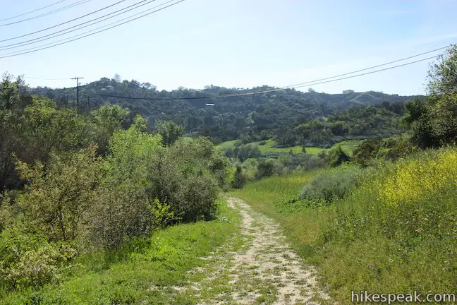
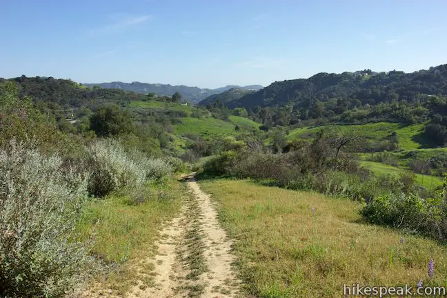
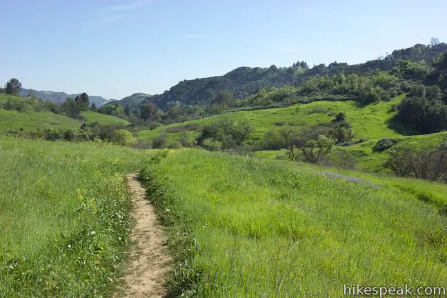
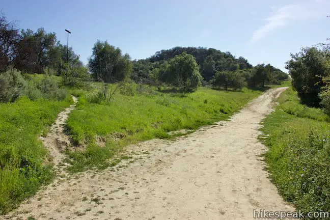
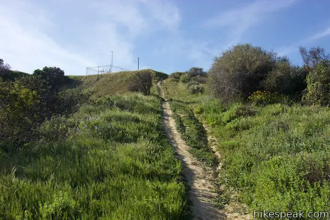
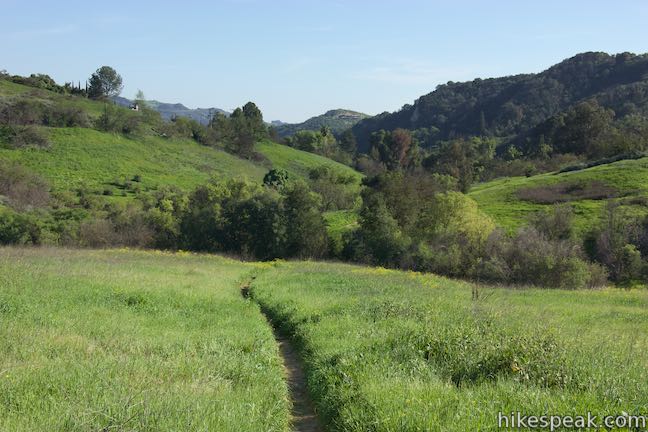
Start from a trailhead along Topanga Canyon Boulevard. Descend into the valley on a wide jeep trail. Cross a dry creek bed at the bottom of the valley and begin up the other side (ignoring a path that parts to the left and heads south down the valley). As you turn uphill, come to the first of two neighboring junctions, 0.22 miles from the start. For the shorter loop (Edelman North Loop), bear right at the first junction to head up the valley. You will come to the second junction, which is 50 yards straight ahead, at the end of the loop. For the longer hike up to Summit to Summit Motorway, you should continue straight (stay to the left) through both junctions.
Edelman North Loop
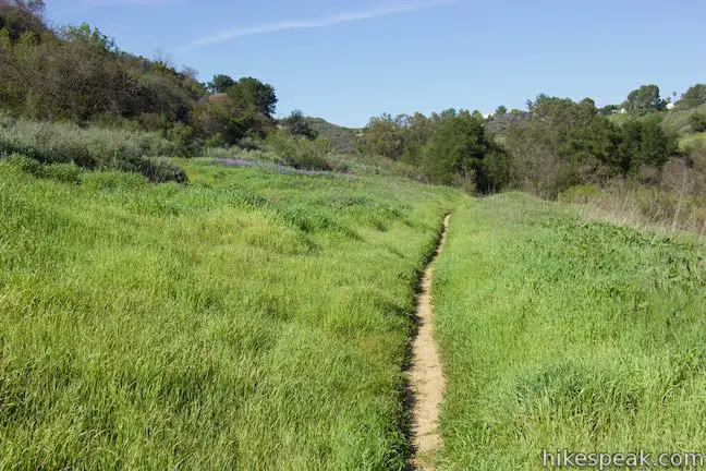
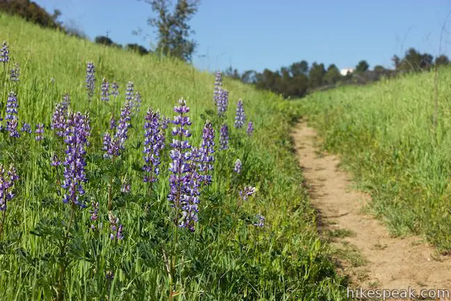
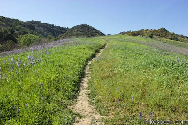
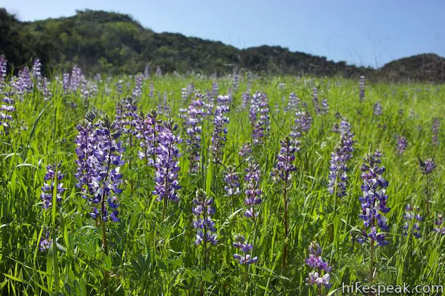
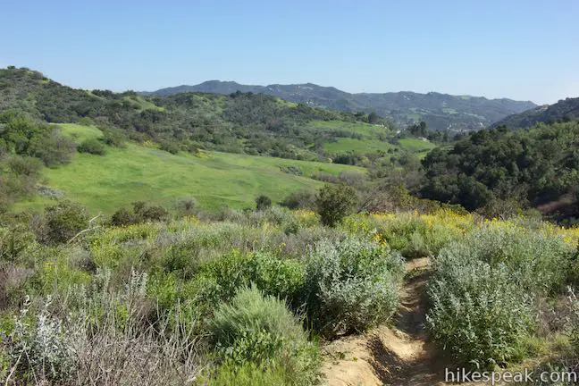
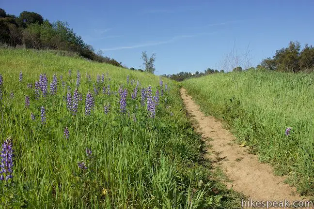
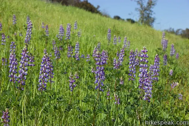
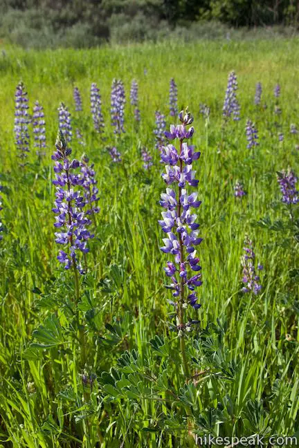
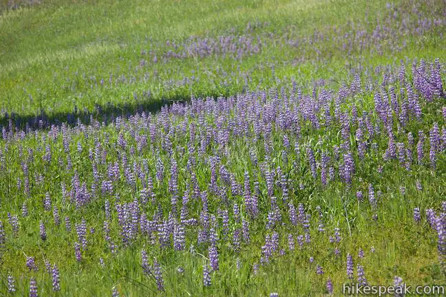
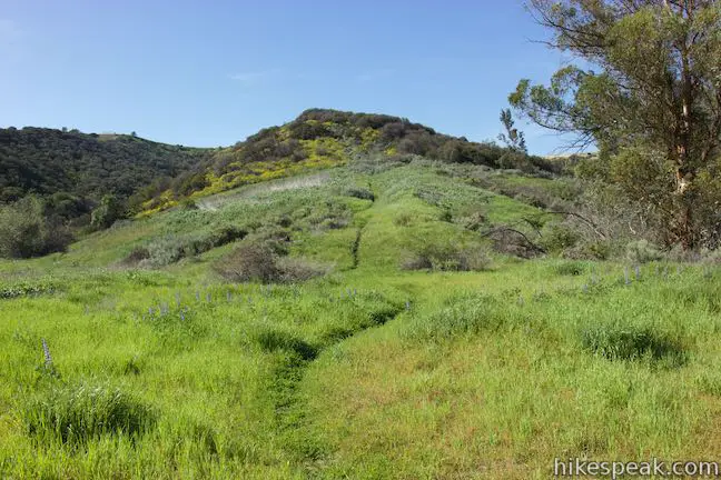
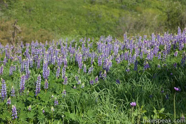
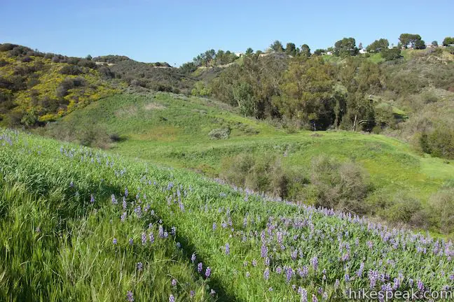
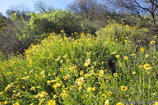
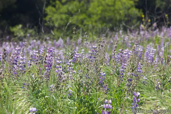
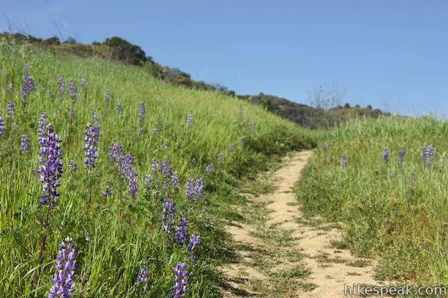
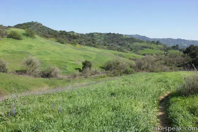
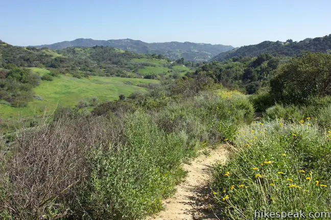
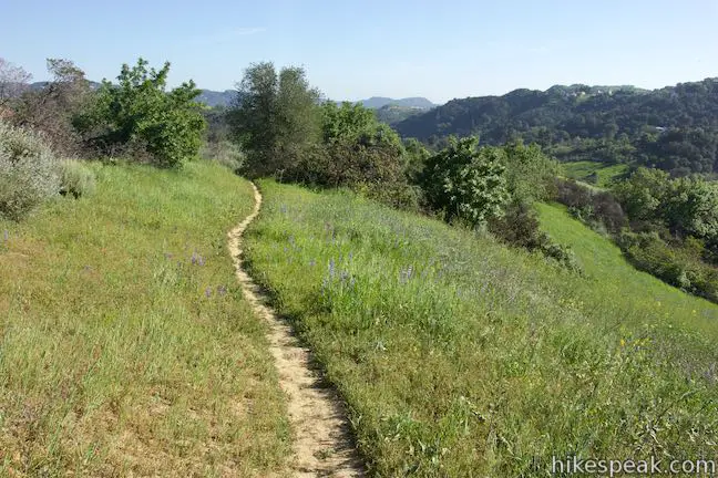
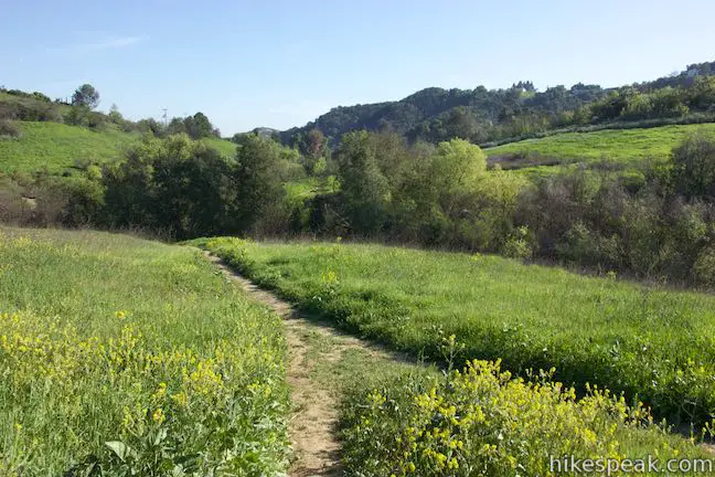
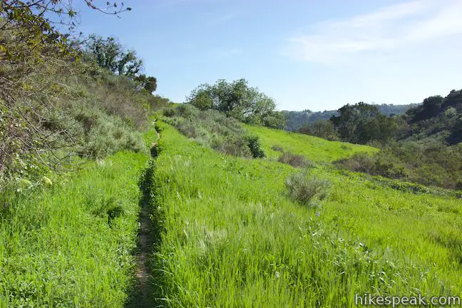
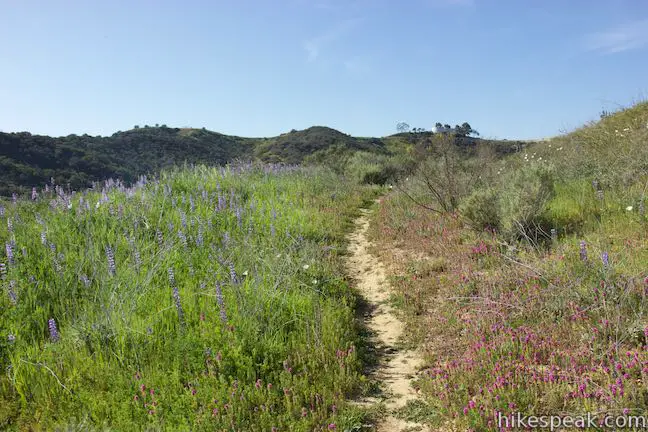
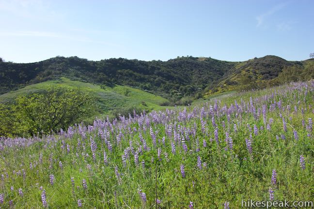
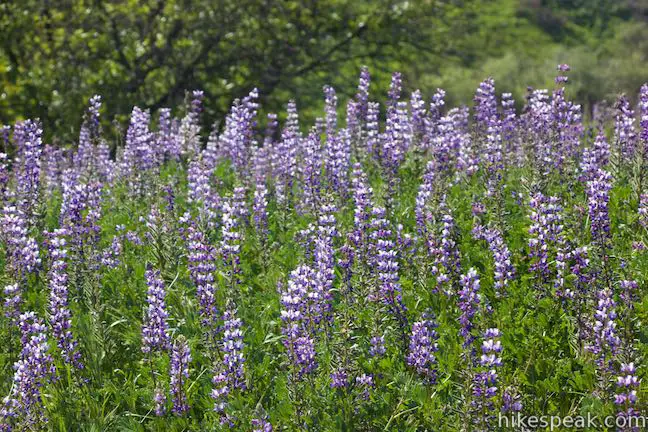
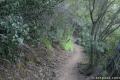
Heading north from the first junction, the single track trail stays close to the bottom of the valley, passing grassy slopes, oaks, and walnut trees. When Summit Valley is green at the end of the winter wet season, this is a lovely place to hike. Lupines are abundant along the trail, adding purple patches to the green grasses.
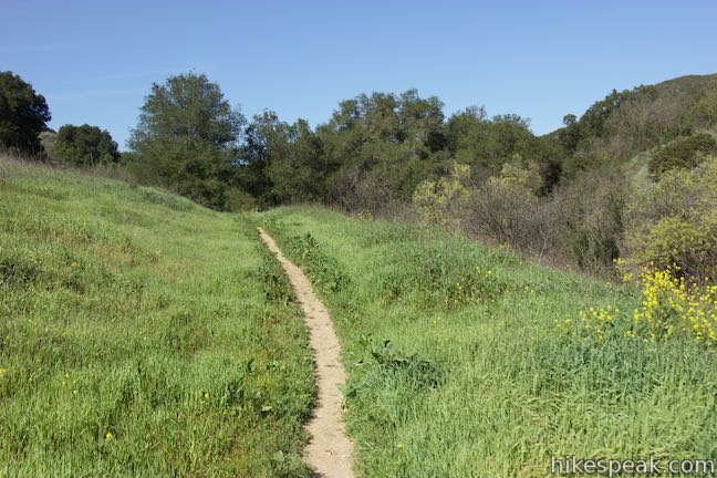
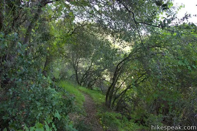
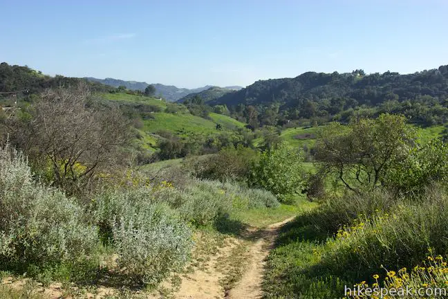
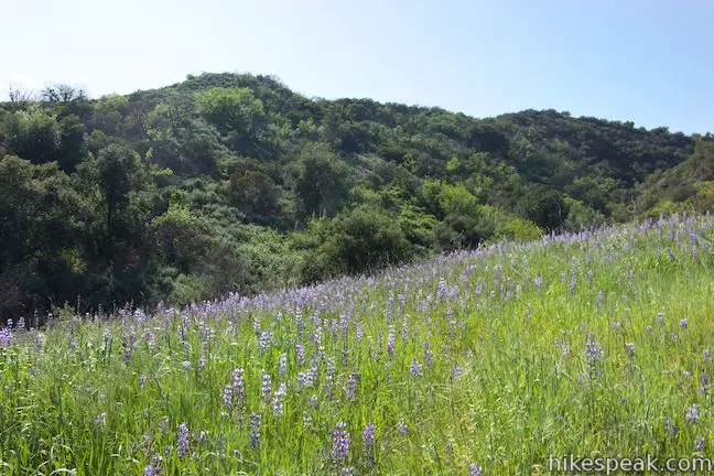
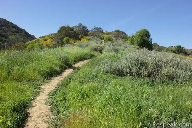
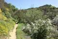
The trail ascends gradually and, at 0.7 miles from the trailhead, you will come to an unmarked split. Bear left to continue with the loop. Another trail, which appears to be more established, drops into a eucalyptus grove to the right and winds its way up to Topanga Canyon Boulevard near an intersection with Viewridge Road. This connector trail is a third of a mile long and provides views down Summit Valley from a lupine-covered hillside. From the intersection at the top of the trail, it is a half mile walk up Viewridge Road to the top of Viewridge Trail on the east side of Summit Valley Edmund D. Edelman Park.
Bypass the connector trail and stay to the left past the eucalyptus grove. Almost immediately, there is another trail split. A path to the right heads up the end of a ridge. Bear left to stay on Edelman North Loop Trail. After these two splits, the trail is quite faint.
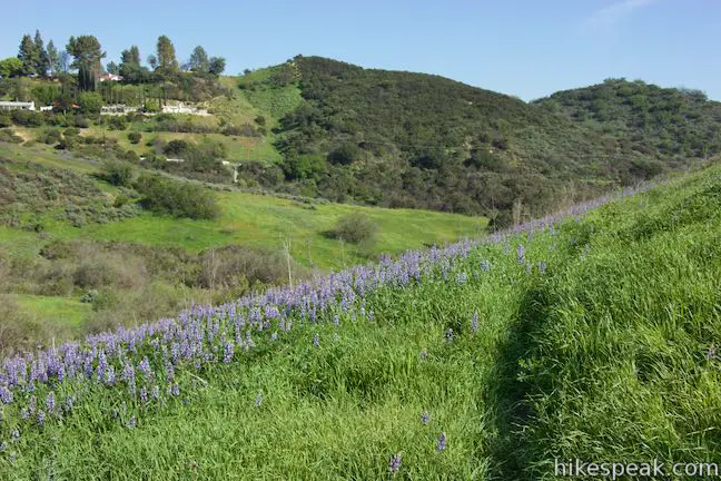
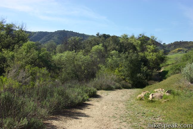
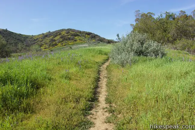
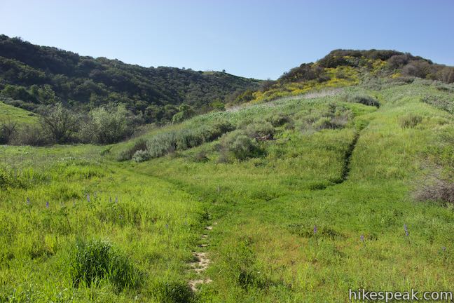
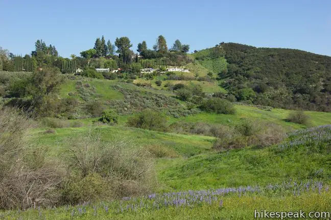
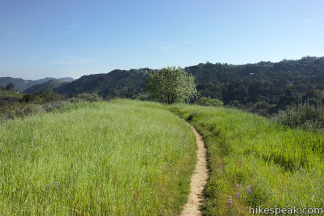
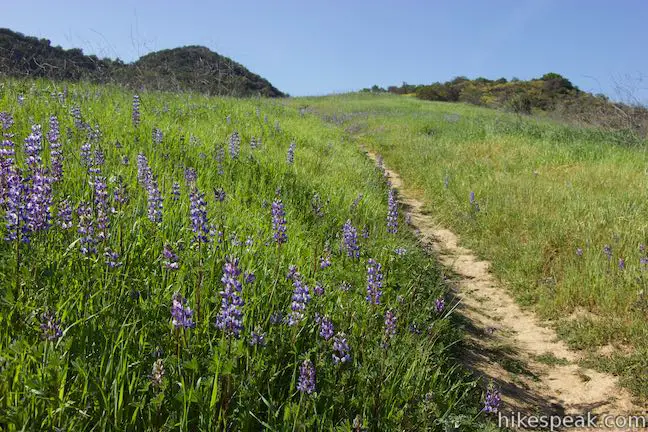
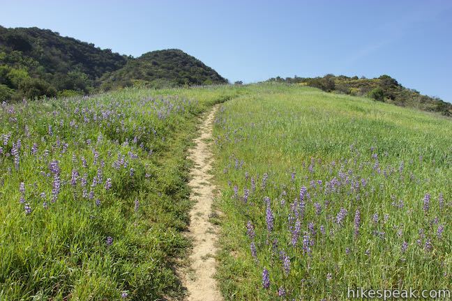
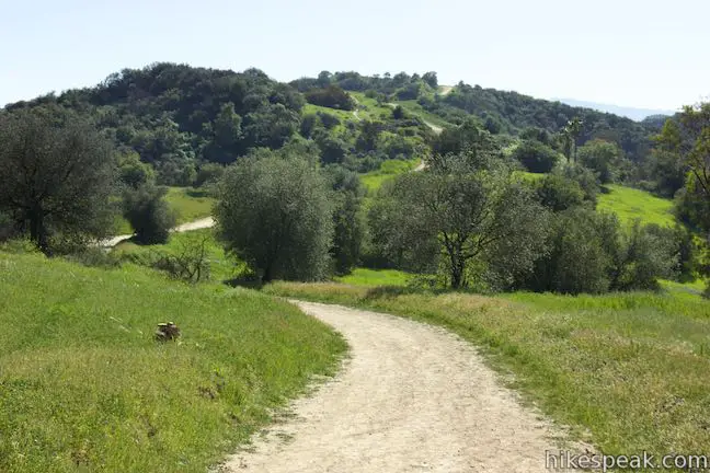
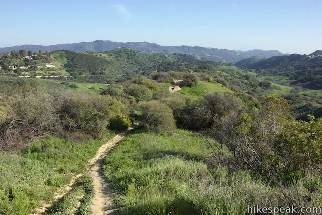
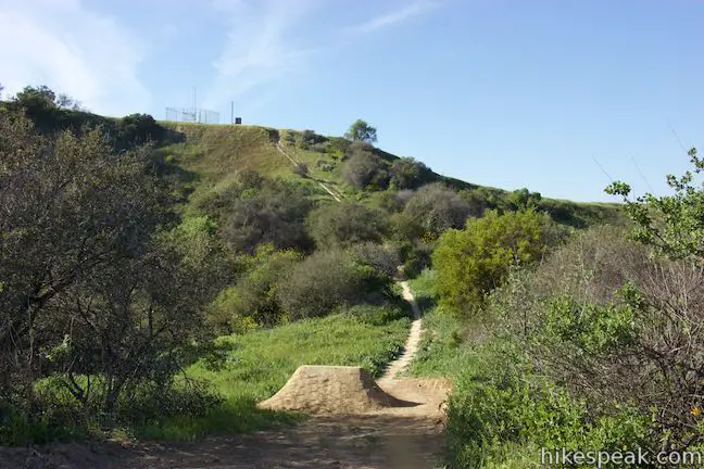
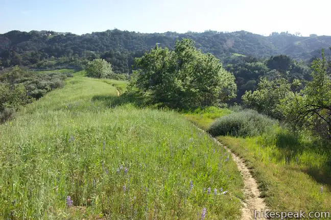
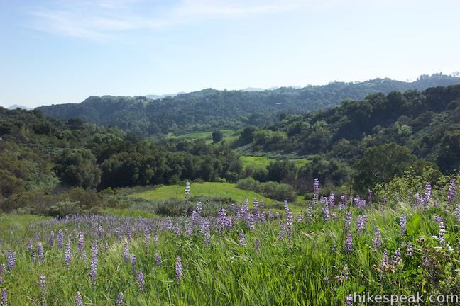
Edelman North Loop Trail heads through brush to the back of a ridge-framed canyon. Another path heads up the canyon to the right. Bear left to stick with the loop, which turns south and rises gradually along the side of the ridge. The narrow trail cuts across a grassy slope right through patches of lupines that bloom in the early spring. Look down on the first half of the loop trail in the valley below or look across the valley toward Topanga Canyon Boulevard.
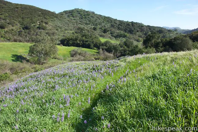
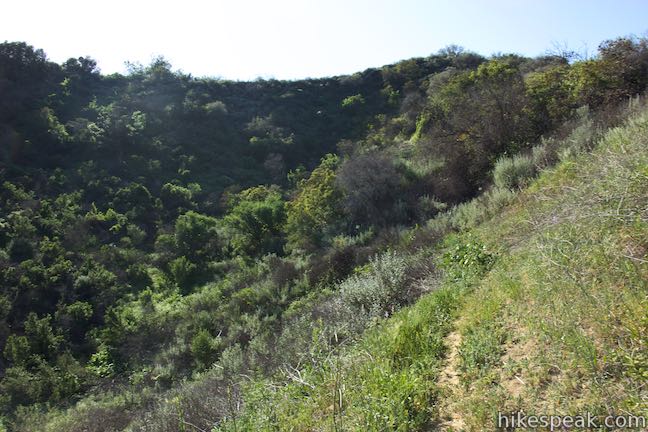
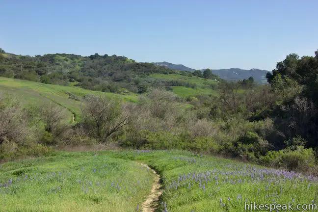
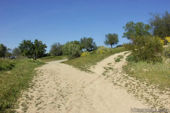
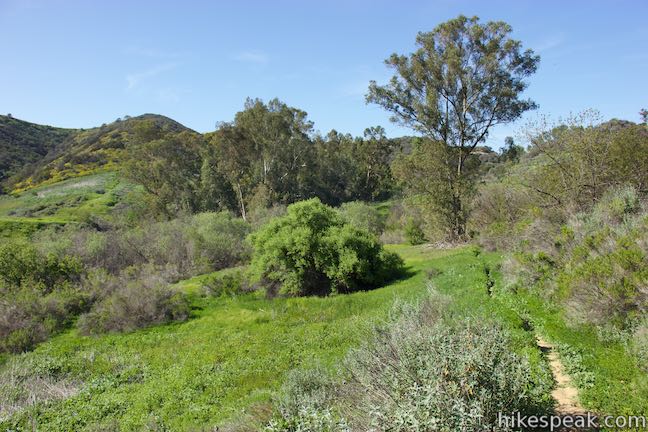
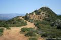
The trail rounds a crease on the ridge, crosses a draw, and then ascends through brush. At 1.22 miles from the start, the faint loop trail comes to a T-junction with a well-worn trail running down the ridge that cuts down the center of Summit Valley. Looking back, the trail you came up may be hard to spot among the tall grasses (a good reason to hike the loop in this direction). If you turned right up the ridge, you could extend the hike by venturing up to Summit to Summit Motorway, which runs along the back of the park. Otherwise, continue with the shorter loop and turn left down the ridge.
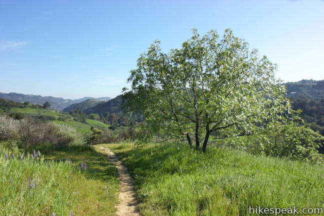
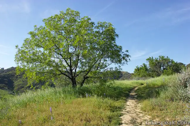
A short way farther, the trail passes an alluring California walnut tree just off the trail. This is a scenic spot to pause and enjoy a panoramic view down Summit Valley. The trail descends for another 0.15 miles, offering more views looking down the valley toward Topanga.
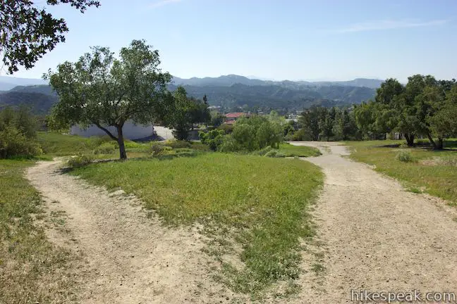
When you reach a junction at the bottom of the ridge trail, turn left and walk 50 yards to the junction where the loop began. Continue straight to walk back up to the trailhead to complete this 1.65-mile hike in Summit Valley Edmund D. Edelman Park.
The basic directions for Edelman North Loop are:
- Descend from the trailhead and cross the creek bed at the bottom of the valley (0.2 miles)
- Make the first right turn to start the loop (0.22 miles)
- Bear left at a split to avoid dropping into a eucalyptus grove. (0.7 miles)
- Stay to the left at another split with a path going up a ridge (0.72 miles)
- Turn left down the ridge at the center of Summit Valley (1.22 miles)
- Descend past a walnut tree at a scenic spot on the ridge (1.25 miles)
- Turn left at a junction at the bottom of the ridge trail (1.4 miles)
- Close the loop and continue straight through the junction where you originally turned right (1.43 miles)
- Return to the trailhead (1.65 miles)
Loop to Summit to Summit Motorway
For the slightly longer loop in Summit Valley Edmund D. Edelman Park, make the same descent from the trailhead on Topanga Canyon Boulevard. Stay to the left past the first junctions at the bottom of the valley (the start of North Edelman Loop Trail). Walk 50 yards farther to the second junction, 0.25 miles from the trailhead, where the longer loop begins.
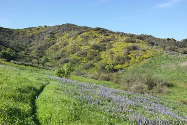
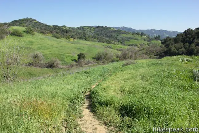
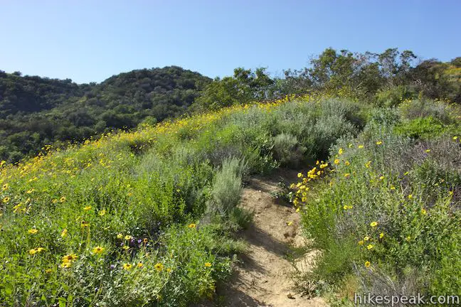
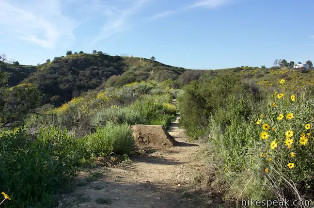
You can hike the loop in either direction, but it may be easiest to travel in a clockwise direction. Therefore, proceed straight (staying to the left) to start the loop. The trail heads northwest along a grassy hillside. Drop across a gully through a strip of brush and hike up the grassy slope on the other side. If you are lucky enough to by hiking this trail from February to April, the bloom of lupines in the surrounding grasses could be abundant.
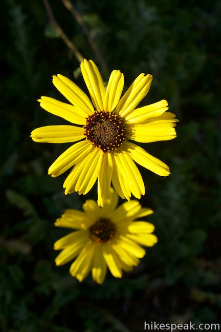
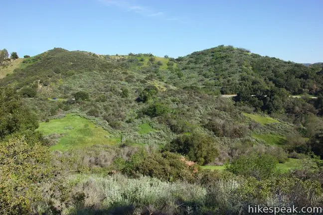
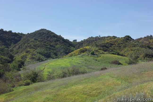
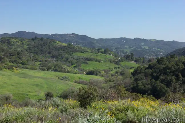
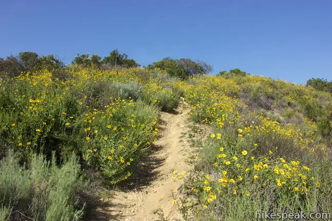
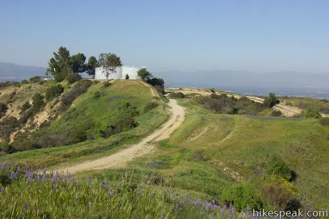
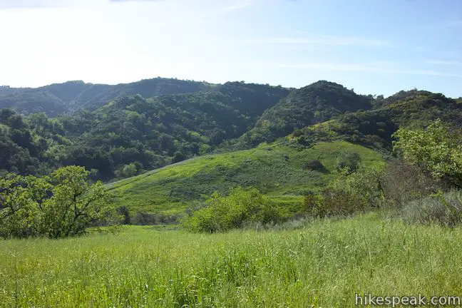
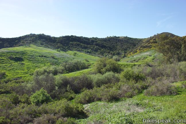
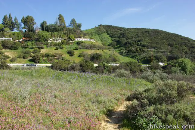
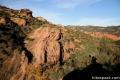
Pushing up the side of the valley, the grasses give way to thicker chaparral. The flowers remain present though; bush sunflowers bloom bright. The trail climbs 275 feet to the rim of Summit Valley, 0.75 miles from the trailhead. Definitely look over your should for a broad perspective southeast the toward Topanga and the mountains beyond in Topanga State Park.
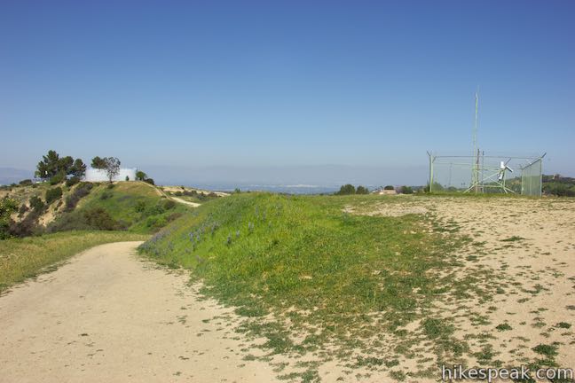
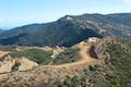
Once it levels out, the trail comes to a junction with Summit to Summit Motorway. Turn right to hike 0.3 miles on this road before returning to Summit Valley Edmund D. Edelman Park. Summit to Summit Motorway is a 3.2-mile long mostly unpaved road that crosses the top of a ridge between the high points of Old Topanga Canyon Boulevard and Topanga Canyon Boulevard (hence the name Summit to Summit).
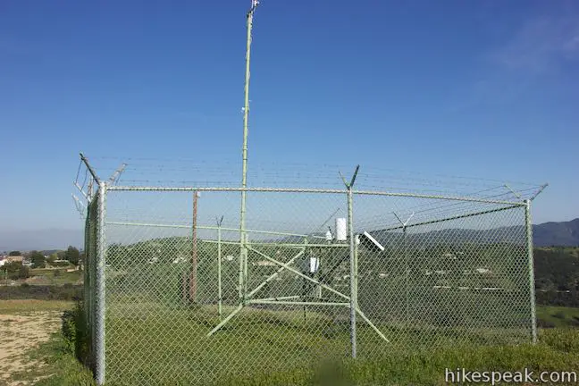
After a quarter mile on Summit to Summit Motorway, pass a holding tank on the left and reach a split in the trail. Straight ahead, the motorway comes to a T-junction. Bear right at the split (or at the T) to continue up the trail. Around the next bend, a short tower appears, framed by a square chain-link fence. Leave the road and walk along a line of trees out to the tower. On the far side of the tower, you’ll find a trail heading down the spine of the ridge that runs up the center of Summit Valley. This is the return route, so turn down the trail and leave Summit to Summit Motorway.
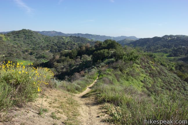
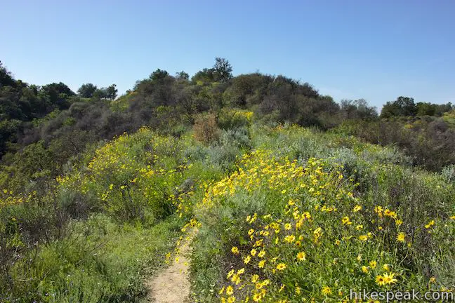
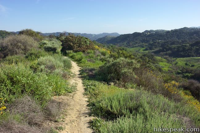
There are a few bumps in the ridgeline with little flat steps that deliver broad views toward Topanga and this picturesque part of the Santa Monica Mountains. Bush sunflowers line this ridge as well. Mountain bikers have built a couple jumps on the trail.
Almost half a mile from the top of the ridge, a faint path joins the ridge trail on the left. This is Edelman North Loop Trail, which could be used to hike a bit farther in Summit Valley. Continue down the ridge to a lovely California walnut tree on the right side of the trail that is accompanied by nice views over Summit Valley.
Continue another 0.15 miles down to the end of the trail at the bottom of the ridge, returning to the junction where the loop started. You have now hiked 1.75 miles. Turn left and hike a quarter mile up out of the valley to the trailhead on Topanga Canyon Boulevard to complete this 2-mile hike in Summit Valley Edmund D. Edelman Park.
The basic directions for the loop to Summit to Summit Motorway are:
- Descend from the trailhead and cross the creek bed at the bottom of the valley (0.2 miles)
- Stay to the left through the first junction (0.22 miles)
- Stay to the left through a second junction at the start of this loop (0.25 miles)
- Ascend to the rim of the valley (0.75 miles)
- Turn right on Summit to Summit Motorway (0.8 miles)
- Turn right before a T-junction in Summit to Summit Motorway (1.05 miles)
- Leave the road and walk to the tower at the top of the ridge trail back down to Summit Valley (1.1 miles)
- Pass a faint junction with Edelman North Loop Trail (1.57 miles)
- Pass a walnut tree at a scenic spot on the ridge (1.6 miles)
- Turn left at the junction at the bottom of the ridge trail (1.75 miles)
- Continue straight past Edelman North Loop Trail (1.78 miles)
- Return to the trailhead (2 miles)
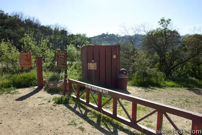
All junctions in Summit Valley Edmund D. Edelman Park are unmarked, so do your best to stay on track. New growth can crowd the trails during the early months of the year. A $5 fee is charged to park a vehicle at the trailhead (as of 2015). There is a bathroom at the trailhead and a picnic table a short distance down the trail. Dogs (on leashes) and bikes are allowed, so get out and enjoy!
Directions to the Trailhead
- The parking area for the trailhead is located on the inside of a bend on the west side of Topanga Canyon Boulevard (Route 27), 4.1 miles south of the 101 Freeway (0.7 miles south of the intersection with Viewridge Road) and 8.3 miles north of Pacific Coast Highway (4 miles north of the intersection with Old Topanga Canyon Road).
- There is a gate and an iron ranger at the top of the trail.
- Roadside parking is not permitted along Topanga Canyon Boulevard.
Trailhead Location
Trailhead address: North Topanga Canyon Boulevard, Topanga Canyon, CA 90290
Trailhead coordinates: 34.12738, -118.59877 (34° 07′ 38.56″N 118° 35′ 55.57″W)
You may also view a regional map of surrounding Los Angeles trails and campgrounds.
Edelman North Loop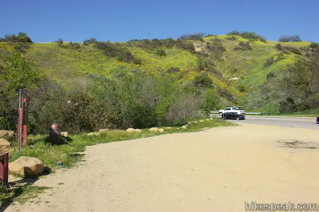


Loop to Summit to Summit Motorway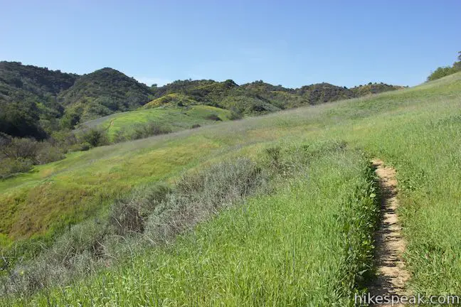


Connector Trail to Viewridge Road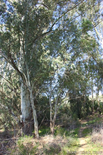

 | Viewridge Trail This 3-mile hike in Summit Valley Edmund D. Edelman Park travels down a canyon on Viewridge Trail (also known Santa Maria Canyon Trail) to Summer Hill Ranch Road where there are sweeping views over Topanga and the Santa Monica Mountains from Canyon Overlook. |
 | Summit to Summit Motorway This mostly unpaved road along the ridge between the tops of Old Topanga Canyon Road and Topanga Canyon Boulevard provides a 6 to 6.6-mile hike with panoramic views over the Santa Monica Mountains and the San Fernando Valley (with the potential for shorter and longer hikes). |
 | Vanalden Cave This 0.6-mile round trip hike visits a unique sandstone cave that you can stand inside and above. The hike can be extended to 1.55 miles round trip to visit a nearby vista point with a panoramic perspective of the Santa Monica Mountains. |
 | Eagle Rock from Trippet Ranch This 4.5-mile loop takes Musch Trail and Eagle Springs Fire Road to visit an exceptional sandstone summit in Topanga State Park. |
 | Parker Mesa Overlook from Trippet Ranch This 6.7-mile round trip hike heads up to an incredibly scenic overlook from Topanga State Park's main trailhead. |
 | Hondo Canyon This section of the Backbone Trail crosses fields of grains and forests of bays, climbing 1,550 feet over 3.8 miles to a small ocean view. Extend the hike to Topanga Lookout for an incredible perspective over the Santa Monica Mountains. |
 | Red Rock Canyon The trails in the beautifully sculpted Red Rock Canyon are 2.5 and 5.2 miles in length. |
 | Calabasas Peak from Old Topanga Canyon Road This 4.2-mile hike on Calabasas Peak Motorway approaches Calabasas Peak from the northeast, providing big views over Topanga and other parts of the Santa Monica Mountains. |
 | Calabasas Peak via Calabasas - Cold Creek Trail This 4.5-mile round trip hike starts up a scenic single track formerly know as the Secret Trail and ascends 750 feet to the summit of Calabasas Peak. |
 | More trails in the Santa Monica Mountains Explore other destinations in the range. |
- Summit Valley in Afoot and Afield: Los Angeles County by Jerry Schad (opens in a new tab)
- A Los Angeles Times article about Summit Valley Edmund D. Edelman Park (opens in a new tab)
- Edelman North Loop Trail on trails.lacounty.gov (opens in a new tab)
- A video of Summit Valley by the Mountains Recreation and Conservation Authority on youtube.com (opens in a new tab)
- The official directions and trail map for Summit Valley Edmund D. Edelman Park (opens in a new tab)
- The official MRCA webpage for Summit Valley Edmund D. Edelman Park (opens in a new tab)
Common Questions about Summit Valley Edmund D. Edelman Park in the Santa Monica Mountains
- Is the trail open?
- Yes. You should expect to find that Summit Valley: Edelman North Loop is open. There are no recent reports of trail closures. If you discover that the trail is closed, please help your fellow hikers by reporting a closure.
- Do I need a permit for this hike?
- Yes. Parking fee.
- How much time does this hike take?
- It takes approximately 45 minutes to hike Summit Valley: Edelman North Loop. Individual hiking times vary. Add extra time for breaks and taking in the views.
- How long is this hike?
- The hike to Summit Valley: Edelman North Loop is 1.65 - 2 miles (lollipop loops) with 190 feet of elevation change.
- Are dogs allowed on this trail?
- Yes, dogs are allowed on Summit Valley: Edelman North Loop. The trail is open to hikers, dogs, bikes.
- Is Summit Valley: Edelman North Loop good for kids?
- Yes, this hike is likely suitable for children. It is relatively short (1.65 miles) with manageable elevation gain.
- What mountain range is this trail in?
- Summit Valley: Edelman North Loop is located in the Santa Monica Mountains.
- Where is the trailhead located?
- The trailhead for Summit Valley: Edelman North Loop is located in Topanga, CA.
Trailhead Address:
North Topanga Canyon Boulevard
Topanga, CA 90290
Trailhead Coordinates:
34.12738, -118.59877 - What are the driving directions to the start of the hike?
To get to the trailhead: The parking area for the trailhead is located on the inside of a bend on the west side of Topanga Canyon Boulevard (Route 27), 4.1 miles south of the 101 Freeway (0.7 miles south of the intersection with Viewridge Road) and 8.3 miles north of Pacific Coast Highway (4 miles north of the intersection with Old Topanga Canyon Road). There is a gate and an iron ranger at the top of the trail. Roadside parking is not permitted along Topanga Canyon Boulevard.
View custom Google Maps directions from your current location.
- Are there other trails near Summit Valley: Edelman North Loop?
- Yes, you can find other nearby hikes using the Hikespeak Hike Finder Map.

Go the extra miles...
Submit a rating of this hike to go with your comment. Contribute to the average trail rating.