Caballero Canyon Trail
in the Santa Monica Mountains
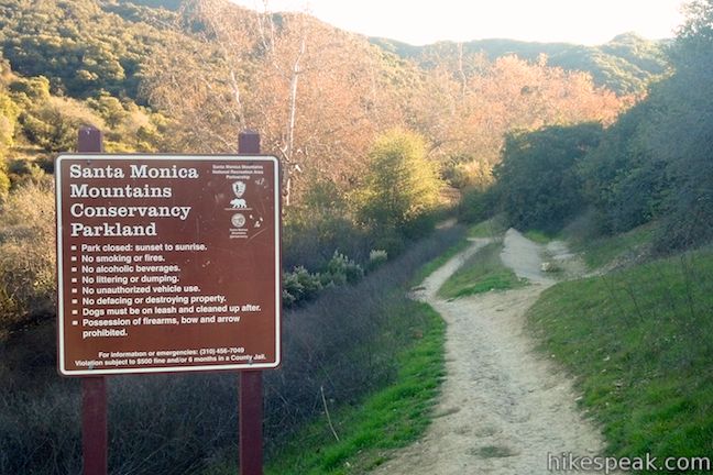
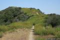
Located on the north side of the Santa Monica Mountains in Tarzana, Caballero Canyon Trail is a straightforward dirt single track that ascends 625 feet over 1.7 miles to an unpaved section of Mulholland Drive. Caballero Canyon Trail makes a satisfying 3.4-mile round trip hike (or ride if you take your mountain bike), and extensions are available to places like San Vicente Mountain. If you need a break from the commotion of the San Fernando Valley, escape up Caballero Canyon Trail in Marvin Braude Mulholland Gateway Park!
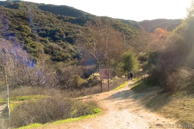
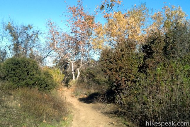
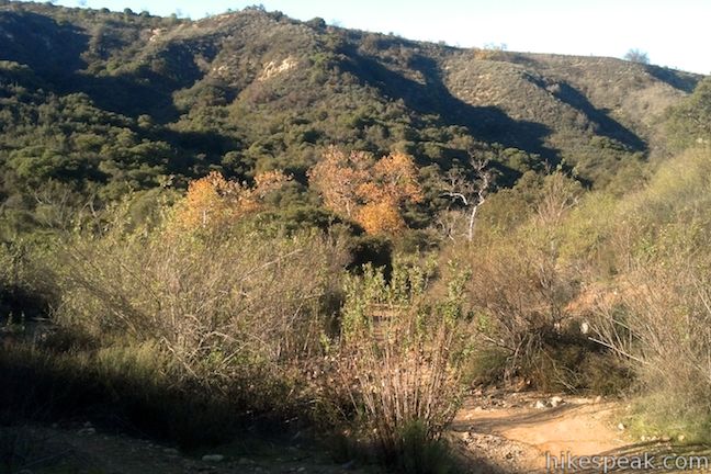
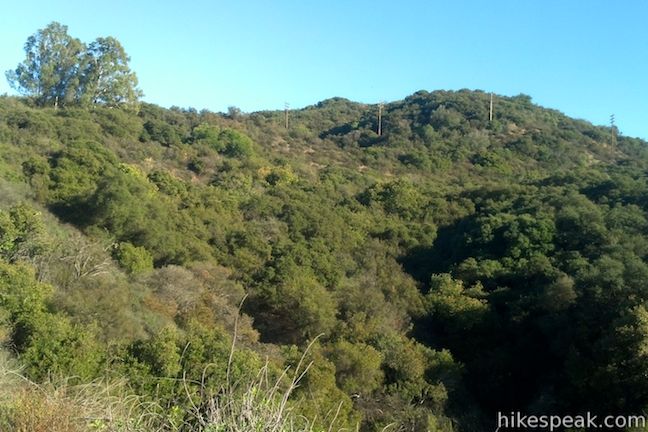
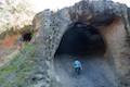
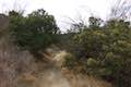
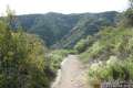
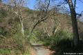
Start hiking from the Caballero Canyon Trailhead on Reseda Boulevard, about 4 miles west of the place where the 101 and 405 freeways meet. Begin hiking up Caballero Canyon, staying to the right through an early junction. Follow Caballero Canyon Trail past a string of sycamores that line the bottom of the canyon. You’ll quickly leave the chaos of Los Angeles behind.
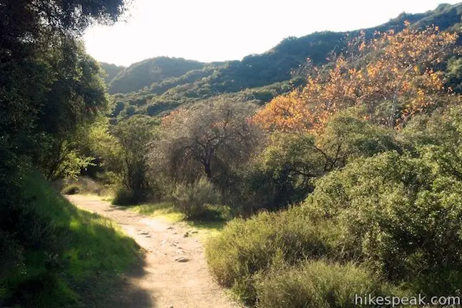
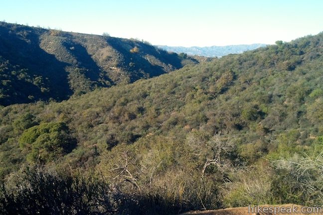
After just under half a mile, cross a creek bed to the left side of the canyon and continue heading north. A mile from the start, the trail bends to the left, heading up a fork of the canyon that will give way to the ridges above. The trail splits briefly. The official trail, and the more gradual route goes to the right to a horseshoe bend that cuts back to a reunion with the steeper route. Pick a path (0.05 miles vs 0.12 miles) and continue up the side of the canyon.
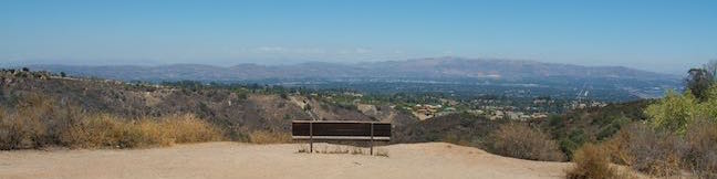
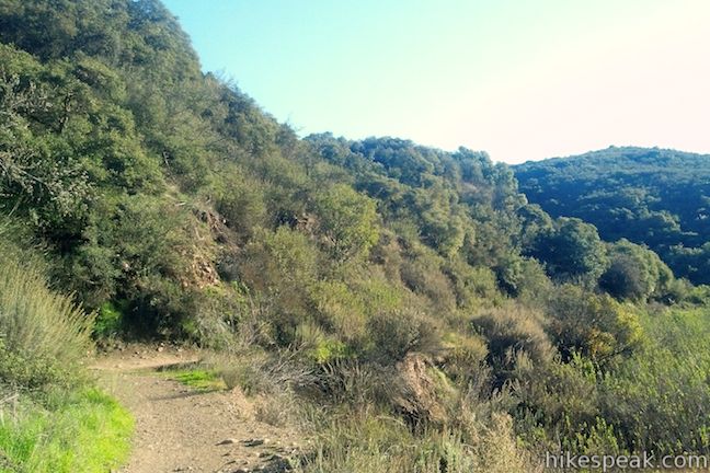
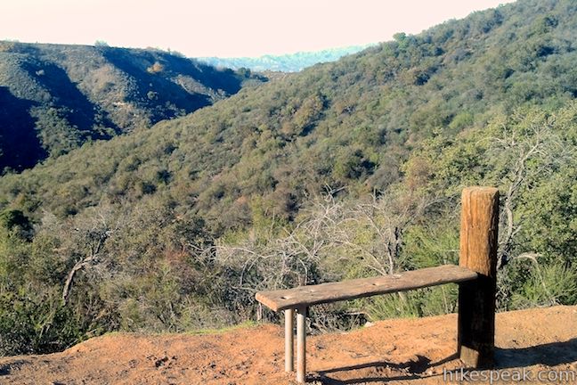
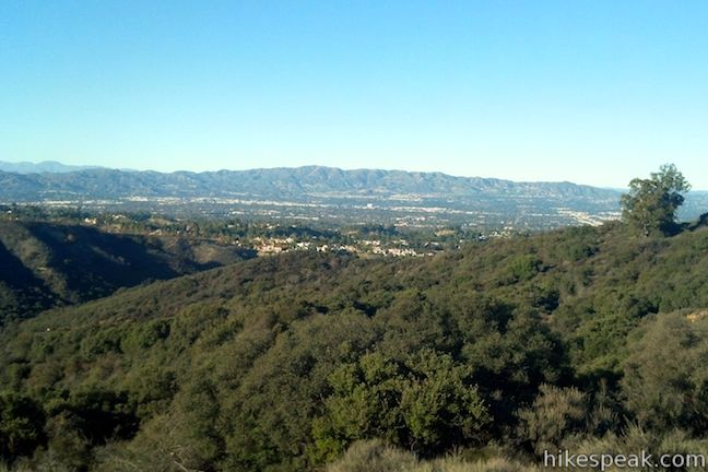
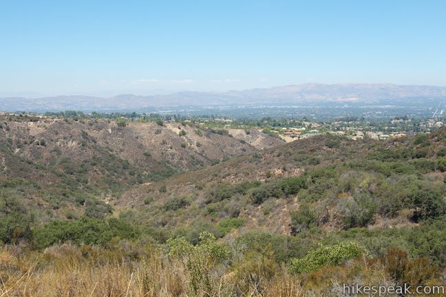
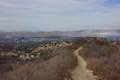
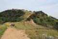
Pass a short bench, 1.25 miles from the start, shortly before reaching a sign marking the Caballero Canyon Entrance to Topanga State Park. Pause to enjoy the views down Caballero Canyon toward the San Fernando Valley before pushing on toward the top.
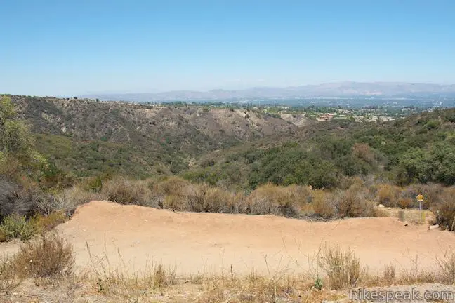
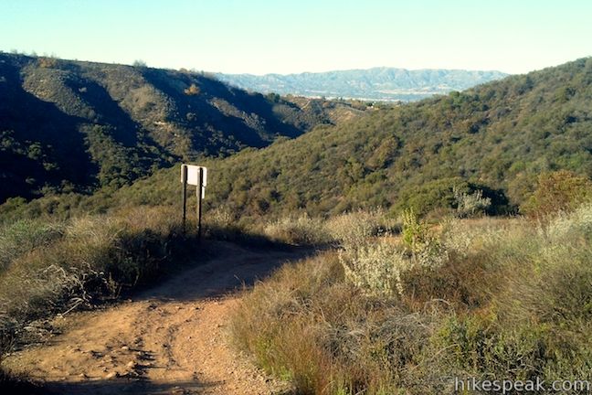
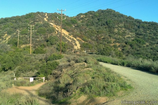
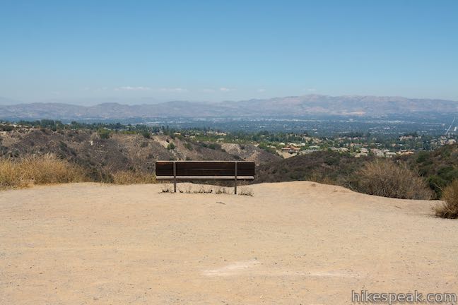
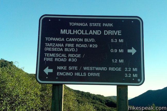
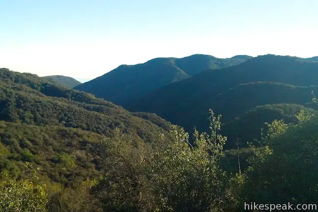
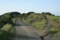
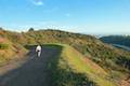
Pass through a gate and come to a junction with Mulholland Drive, 1.7 miles from the start. Sit on a bench to admire the view over the canyon you just climbed. A trail sign at the junction explains your options for exploring farther in this area of the Santa Monica Mountains called the “Big Wild.” To the left, The Nike Missile Site on San Vicente Mountains is 2.5 miles to the east at the top of Westridge Trail. You will also pass Sullivan Ridge Trail en route to San Vicente Mountain. To the west, Mulholland Drive makes its way to a junction with Temescal Ridge Trail after 1.15 miles and continues for 4.4 miles to the west end of Dirt Mulholland Drive.
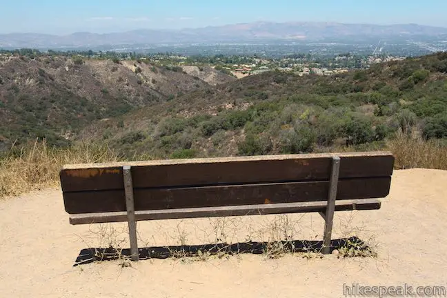
After enjoying the view from the bench on Mulholland Drive, and taking advantage of any extensions, return the way you came down Caballero Canyon Trail. No fee or permit is required to hike Caballero Canyon Trail in Marvin Braude Mulholland Gateway Park. Dogs and mountain bikes are welcome, so get out and enjoy! For another nearby hike, continue to the top of Reseda Boulevard and hike to Hub Junction and beyond.
Directions to the Trailhead
- From the meeting between the 101 Freeway and the 405 Freeway, drive west on the 101 Freeway for 4 miles to exit 23 for Reseda Boulevard.
- At the bottom of the offramp, turn left and head south for 2.2 miles.
- The trailhead will be on the left and roadside parking is ample.
Trailhead Location
Trailhead address: Reseda Boulevard, Tarzana, CA 91356
Trailhead coordinates: 34.14273, -118.54088 (34° 08′ 33.82″N 118° 32′ 27.16″W)
You may also view a regional map of surrounding Los Angeles trails and campgrounds.


 | Hub Junction from Reseda Boulevard This 5.3 to 5.45-mile hike from the edge of the San Fernando Valley goes through Topanga State Park to a scenic junction at the crossroads of the Eastern Santa Monica Mountains. Extend the trek to 6.85 miles round trip by summiting Temescal Peak or to 7.95 miles round trip by taking a loop to Eagle Rock. |
 | Vanalden Cave This 0.6-mile round trip hike visits a unique sandstone cave that you can stand inside and above. The hike can be extended to 1.55 miles round trip to visit a nearby vista point with a panoramic perspective of the Santa Monica Mountains. |
 | Corbin Canyon This 2.05-mile hike offers an easy stroll along the bottom of a canyon on the north side of the Santa Monica Mountains near Tarzana and Woodland Hills. |
 | Winnetka Ridge Trail This 1.5-mile hike ventures up a ridge into the Santa Monica Mountains from the end of Winnetka Avenue in Woodland Hills. |
 | San Vicente Mountain from Mulholland Drive This 2-mile hike approaches the peak from the east and offers views to the north and south en route to the old Nike Missile site. |
 | Westridge Trail to San Vicente Mountain This 7.4-mile hike travels a scenic ridge between a Brentwood neighborhood and a summit that was once used as a Nike Missile site. |
 | Mandeville Canyon to San Vicente Mountain Loop This 5-mile hike incorporating a few trails, taking a DWP road up to Westridge to visit San Vicente Mountain, before crossing Mulholland Drive and Canyonback Ridge to return to Mandeville Canyon via Hollyhock Fire Road. |
 | Upper Canyonback Trail This 3 mile hike descends Canyonback Ridge from Mulholland Drive to the Mountain Gate Country Club Estates. |
 | Sullivan Canyon This 8.5-mile round trip hike follows a wide trail up the center of a sycamore-filled canyon. |
 | Sullivan Ridge A prominent lone-standing Live Oak along Sullivan Ridge makes a natural turnaround point and a 7.5 to 8.3 mile round trip hike. |
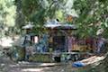 | Murphy Ranch This 3.85-mile loop descending from Sullivan Ridge Fire Road into Rustic Canyon, where hikers can visit abandoned buildings that had unusual occupants. |
 | Getty View Park This 3-mile out and back hike crosses East Sepulveda Fire Road (Casiano Fire Road) on a ridge east of the 405 Freeway that offers light traffic and plentiful views of the Getty Museum and Santa Monica Bay. |
 | More trails in the Santa Monica Mountains Explore other destinations in the range. |
- Caballero Canyon Trail in Afoot & Afield Los Angeles County by Jerry Schad (opens in a new tab)
- Caballero Canyon Trail on sandiegoreader.com (also by Jerry Schad) (opens in a new tab)
- Caballero Canyon Trail in 60 Hikes Within 60 Miles: Los Angeles by Laura Randall (opens in a new tab)
- Caballero Canyon Trail in Best Easy Day Hikes: San Fernando Valley by Deke Williams (opens in a new tab)
- The official website for Topanga State Park (opens in a new tab)
Common Questions about Caballero Canyon Trail in the Santa Monica Mountains
- Is the trail open?
- Yes. You should expect to find that Caballero Canyon Trail is open. There are no recent reports of trail closures. If you discover that the trail is closed, please help your fellow hikers by reporting a closure.
- Is this trail free to access?
- Yes, Caballero Canyon Trail is free to access. No entrance fee, pass, or permit is required. If you discover that access rules have changed, please provide feedback on your experience.
- How much time does this hike take?
- It takes approximately 1 hour 45 minutes to hike Caballero Canyon Trail. Individual hiking times vary. Add extra time for breaks and taking in the views.
- How long is this hike?
- The hike to Caballero Canyon Trail is a 3.4 mile out and back with 625 feet of elevation change.
- Are dogs allowed on this trail?
- Yes, dogs are allowed on Caballero Canyon Trail. The trail is open to hikers, dogs, bikes.
- What mountain range is this trail in?
- Caballero Canyon Trail is located in the Santa Monica Mountains.
- Where is the trailhead located?
- The trailhead for Caballero Canyon Trail is located in Tarzana, CA.
Trailhead Address:
Reseda Boulevard
Tarzana, CA 91356
Trailhead Coordinates:
34.14273, -118.54088 - What are the driving directions to the start of the hike?
To get to the trailhead: From the meeting between the 101 Freeway and the 405 Freeway, drive west on the 101 Freeway for 4 miles to exit 23 for Reseda Boulevard. At the bottom of the offramp, turn left and head south for 2.2 miles. The trailhead will be on the left and roadside parking is ample.
View custom Google Maps directions from your current location.
- Are there other trails near Caballero Canyon Trail?
- Yes, you can find other nearby hikes using the Hikespeak Hike Finder Map.

9 Comments on Caballero Canyon Trail in the Santa Monica Mountains
What hikers are saying:
✨ Generated summary of user commentsThis trail is a favorite for locals in the San Fernando Valley because it offers easy parking and access to various paths within the Santa Monica Mountains. While the area is popular for mountain biking and scenic exploration, hikers must remain vigilant regarding wildlife. Betsy warns that small dogs are at risk due to frequent coyote sightings, including rare encounters in broad daylight near the public parking areas.
I always hike from the Top of Reseda Blvd. I was told there is a trail that will lead you direct to the PCH in Malibu at Gladstone’s. 1. is this true 2. What is the exact route to take from the top of reseda?
Is there any danger of mountain lions or other wildlife in this area? I thought there were a few incidences in the recent past. Please let me know as I would love to take this hike. Thank you.
BKVitale
I was just attacked today in broad daylight. My dog (medium poodle) started tugging at his leash and I looked back to see a coyote staring him dead in the face, fangs drawn and ready to go. We ran for our lives (literally) screaming help until we reached the bottom of the trail. We were only 150 yards from the bottom- this didn’t happen that far away from the public parking area. Still shaken up about it I still can’t believe we survived without a scratch. My high school track days kicked in and I am so impressed my poodle kept up with my speed (there was no time to pick him up the coyote would have pounced). Ppl at the bottom came to help retrieve my phone as it fell out of my pocket halfway up the hill. The coyote was still circling as they were walking up the hill. I would definitely not clear this trail for safety.
My experience tells me that if you’re in the Santa Monica Mountains, you will come across critters like Coyotes. Also near the L.A. River. Even at Balboa Park. It’s part of the deal. Perhaps a small dog on the trail isn’t right for you.
That’s so scary Nicolette! Glad you guys are safe. I met someone on a hike whose dog was attacked by coyotes and for that reason I never bring my little dog.
[…] Detailed information from someone that puts their heart and soul into Blogging about hiking in more descriptive detail: https://www.hikespeak.com/trails/caballero-canyon-hike-tarzana/ […]
-Caballero Canyon is off Reseda, at the base of the mountain before Country Club PL.
– Dogs are allowed, however, some people have reported that their small dog was attacked by coyotes. To be safe, I would not recommend bringing your small dog. I’ve done this trail about 70 times and have seen coyotes but only very early in the morning, never mid day but don’t risk bringing your fur baby.
-Mountain Bikes are allowed, this is a popular place for mountain biking.
-Free street parking off of Reseda.
There’s also a parking lot at the top of Reseda—there’s a designated are that’s free while another area is $5
This is one of my favorite hiking trails in the SFV. It’s part of the Santa Monica Mountains so there are tons of different trails you can explore. Parking is easy, you can park off reseda if you are doing the caballero trail which is at the base of Reseda on the left hand side before Country Club PL. You can keep driving up Reseda Blvd and you’ll find a parking lot and plenty of other trails.
Is it kid friendly
Are the coyotes any more or less of a danger currently?… and what coyote detergents are available; is there is pepper spray or something else that’s effective on coyotes?