Bike Trails in Los Angeles
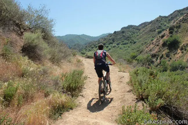
While hikespeak.com has hike in its name, mountain bikers can enjoy a lot of the trails on this website too. Many trails around Los Angeles are open for biking, so if you like to bike, check out the selection of trails below, which all permit mountain bikes.
To make it easier to navigate read, the trails listed below are divided into groups by LA’s main mountain ranges:
Jump right to the area that interests you or keep scrolling down.
In addition to browsing this list, you can search for bike-friendly trails in a more specific area by using the Hike Finder Map. Uncheck the box next to “Doesn’t Allow Bikes” to only view trails that are open to bikes. Enjoy the ride!
Mountain Biking Trails around Los Angeles
These bike-friendly trails are separated by region and listed alphabetically to make it easy for cyclists to find places to have fun on two wheels.
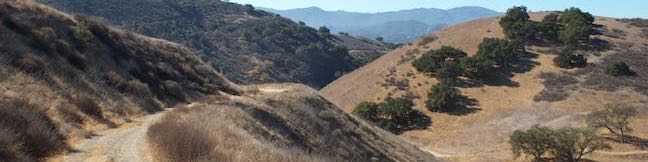
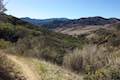
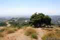
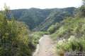
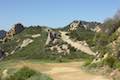
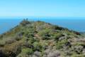
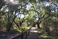
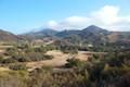
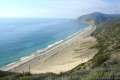
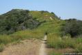
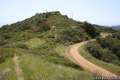
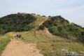
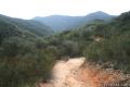
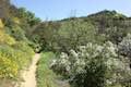
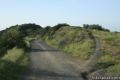
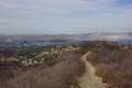
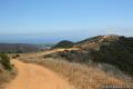
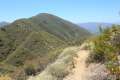
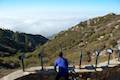
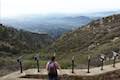
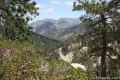
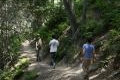
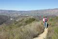
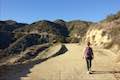
Bike-Friendly Trails in the Santa Monica Mountains
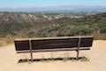
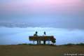
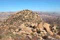
 | Angel Vista via Rosewood Trail This 4-mile round trip ride is the most direct route to Angel Vista, a panoramic viewpoint in the Santa Monica Mountains overlooking the Conejo Valley. |
 | Angel Vista via West Los Robles Trail This 7.6-mile round trip ride climbs 800 feet to an overlook on the north side of the Santa Monica Mountains above Thousand Oaks. |
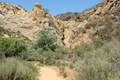
 | Arroyo Sequit This 2.05-mile loop winds around the upper reaches of a canyon carved by the East Fork of Arroyo Sequit and has grand views of the Santa Monica Mountains. |
 | Caballero Canyon Trail This 3.4-mile round trip ride ascends a canyon on the north side of the Santa Monica Mountains with views over the San Fernando Valley. |
 | Calabasas Peak from Old Topanga Canyon Road This 4.2-mile ride on Calabasas Peak Motorway approaches Calabasas Peak from the northeast, providing big views over Topanga and other parts of the Santa Monica Mountains. |
 | Calabasas Peak from Stunt Road This 3.6-mile ride on Calabasas Peak Motorway approaches Calabasas Peak from the south, ascending through sandstone formations to panoramic views of the Santa Monica Mountains and San Fernando Valley. |
 | Calabasas Peak via Calabasas – Cold Creek Trail This 4.5-mile round trip ride starts up a scenic single track formerly know as the Secret Trail and ascends 750 feet to the summit of Calabasas Peak. |
 | Castro Crest from Latigo Canyon Road This 3.8-mile ride crosses a green canyon and climbs to a scenic saddle below Castro Peak. |
 | Corbin Canyon Park This 2.05-mile ride offers an easy stroll along the bottom of a canyon on the north side of the Santa Monica Mountains near Tarzana and Woodland Hills. |
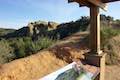
 | Eagle Rock from Trippet Ranch This 4-mile ride up Eagle Springs Fire Road visits an exceptional sandstone summit in Topanga State Park. |
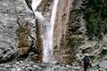
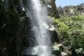
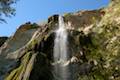 | Escondido Falls This 4-mile out and back ride visits a 200-foot waterfall that is split into two tiers. The upper tier is 150 feet tall and stunning after a rainstorm. |
 | Getty View Park This 3-mile out and back ride crosses East Sepulveda Fire Road (Casiano Fire Road) on a ridge east of the 405 Freeway that offers light traffic and plentiful views of the Getty Museum and Santa Monica Bay. |
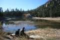
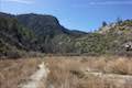
 | Grassland Trail to Crags Road and Rock Pool This easy 3-mile ride enters Malibu Creek State Park on South Grassland Trail, then forms a loop around Crags Road to visit Rock Pool, a popular park retreat. |
 | Hastain Trail This pair of short loops explore Franklin Canyon Park and ridges in the Santa Monica Mountains above Beverly Hills. |
 | Hub Junction from Reseda Boulevard This 5.3 to 5.45 mile ride from the edge of the San Fernando Valley goes through Topanga State Park to a scenic junction at the crossroads of the Eastern Santa Monica Mountains. Extend the trek to 6.85 miles round trip by summiting Temescal Peak or to 7.95 miles round trip by taking a loop to Eagle Rock. |
 | Las Virgenes View Trail This 4.95-mile ride patiently weaves its way across hills along Las Virgenes Road and rises up a canyon to ridgetop views over Malibu Creek State Park and mountains in Calabasas. |
 | Lower Canyonback Trail This 4.2 mile ride ascends Canyonback Ridge from Kenter Ave. in Brentwood to the Mountain Gate Country Club Estates. |
 | Malibu Lagoon State Beach This short bike-friendly trail around a bird-filled lagoon below the Santa Monica Mountains leads to Surfrider Beach. |
 | M*A*S*H Set This bike ride visits the site where the exteriors of the television show MASH were filmed, a 4.75-mile trek from the park entrance. |
 | Mandeville Canyon to San Vicente Mountain Loop This 5-mile bike incorporating a few trails, taking a DWP road up to Westridge to visit San Vicente Mountain, before crossing Mulholland Drive and Canyonback Ridge to return to Mandeville Canyon via Hollyhock Fire Road. |
 | McAuley Peak This 6.15-mile round trip ride goes even higher up the Backbone Trail to a panoramic summit with a cool rock formation. |
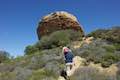
 | Mesa Peak from Corral Canyon Road This 6.5-mile ride travels along a ridge adorned with sandstone outcroppings to approach a peak with ocean views over Malibu. Shorten the outing to 5.35 miles round trip by stopping at a crest above Mesa Peak with a prominent boulder. |
 | Mesa Peak from Malibu Canyon Road (Piuma Trailhead) This 6.5-mile ride ascends 1,375 feet up the Backbone Trail from Malibu Creek State Park to a subtle summit with substantial ocean views. |
 | Oak Creek Canyon Trail This 0.8-mile loop starts with an all-access nature trail with signs in English and Braille before transitioning to a less developed dirt single track, looping through chaparral and oak woodlands in Los Robles Open Space. |
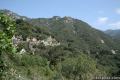
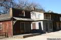 | Paramount Ranch This segment of the Santa Monica Mountains National Recreation Area includes Western Town, an outdoor set cast as frontier towns in TV and film since the 1950s. There are also several miles of hiking trails to explore. |
 | Parker Mesa Overlook from Paseo Miramar This steep 5.7-mile out-and-back ride begins down the ridge south of the overlook and delivers knockout ocean views. |
 | Parker Mesa Overlook from Trippet Ranch This 6.7-mile round trip ride heads up to the overlook from the opposite direction, starting at Trippet Ranch, Topanga State Park’s main trailhead. |
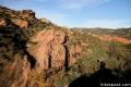 | Red Rock Canyon The trails in the beautifully sculpted Red Rock Canyon are 2.5 and 5.2 miles in length. |
 | Rocky Oaks Park This short and easy ride visits a pond and a scenic overlook in a small parcel of Santa Monica Mountains National Recreation Area. |
 | San Vicente Mountain from Mulholland Drive This 2-mile bike ride approaches the peak from the east and offers views to the north and south en route to the old Nike Missile site. |
 | Scenic and Overlook Trails Loop This 2.7 to 3.5-mile ride takes in tremendous ocean views above Big Sycamore Canyon in Point Mugu State Park (Only half of this loop is open to bikes). |
 | Sullivan Canyon This 8.5-mile round trip ride follows a wide trail up the center of a sycamore-filled canyon. |
 | Sullivan Ridge A prominent lone-standing Live Oak along Sullivan Ridge makes a natural turnaround point and a 7.5 to 8.3 mile round trip ride. |
 | Summit to Summit Motorway This mostly unpaved road along the ridge between the tops of Old Topanga Canyon Road and Topanga Canyon Boulevard provides a 6 to 6.6-mile ride with panoramic views over the Santa Monica Mountains and the San Fernando Valley (with the potential for shorter and longer hikes). |
 | Summit Valley Edmund D. Edelman Park This park offers a relatively easy 1.65-mile loop and a slightly tougher 2-mile loop that ascends to Summit to Summit Motorway and provides loftier views over Summit Valley in Upper Topanga Canyon. |
 | Talepop Loop This 4.75-mile ride climbs 500 feet over a scenic mountain between Liberty Canyon and Las Virgenes Canyon. |
 | Temescal Peak This 5.8 to 7.6-mile bike ride ascends Temescal Ridge to a summit with sweeping views over Topanga State Park and the Santa Monica Mountains. |
 | Trebek Open Space Bantam Trail and Castair Trail a short dirt roads that can be biked in this park adjacent to Runyon Canyon. |
 | Tuna Canyon Park This 1.6 to 5.1-mile ride offers spectacular ocean views from a less-visited park between Topanga and Malibu. |
 | Upper Canyonback Trail This 3 mile ride descends Canyonback Ridge from Mulholland Drive to the Mountain Gate Country Club Estates. |
 | Upper Solstice Canyon This 5.5 to 6.5-mile ride travels the Backbone Trail across Upper Solstice Canyon from Corral Canyon Road to Castro Crest, with the option to bike an extra half mile up Newton Road toward Castro Peak. |
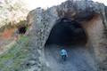 | Vanalden Cave This 0.6-mile round trip ride visits a unique sandstone cave that you can stand inside and above. The ride can be extended to 1.55 miles round trip to visit a nearby vista point with a panoramic perspective of the Santa Monica Mountains. |
 | Viewridge Trail This 3-mile ride in Summit Valley Edmund D. Edelman Park travels down a canyon on Viewridge Trail (also known Santa Maria Canyon Trail) to Summer Hill Ranch Road where there are sweeping views over Topanga and the Santa Monica Mountains from Canyon Overlook. |
 | Westridge Trail to San Vicente Mountain This 7.4-mile ride travels a scenic ridge between a Brentwood neighborhood and a summit that was once used as a Nike Missile site. |
 | Winnetka Ridge Trail This 1.5-mile ride ventures up a ridge into the Santa Monica Mountains from the end of Winnetka Avenue in Woodland Hills. |
 | Zuma Ridge Trail This wide dirt service road which weaves northwest up the back of the ridge west of Zuma Canyon offering access to several trails in the area. |
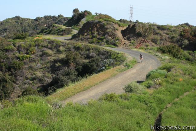
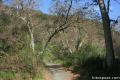
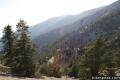
Bike-Friendly Trails in the San Gabriel Mountains
 | Baldy Notch Bike up a dirt service road to a ski lodge at the top of the Mount Baldy Ski Lift. |
 | Crystal Lake This 1 1/3-mile round trip ride visits the only naturally occurring lake in the San Gabriel Mountains. Bike up a paved a road to a parking area above the lake and then walk down a flight up stairs to the waterfront. |
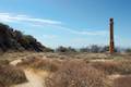
 | Echo Mountain via Sam Merrill Trail This 5.8-mile ride visits a historic railway and ruins from a century old resort overlooking Pasadena. |
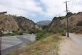 | Gould Mesa Trail Camp via Gabrielino Trail This 5.1-mile round trip ride follows Gabrielino Trail up a canyon along the Arroyo Seco to a trail camp just inside Angeles National Forest. |
 | Gould Mesa Trail Camp via Gould Mesa Road This road descends 1.15 miles to a junction with Gabrielino Trail near Gould Mesa Trail Camp in Angeles National Forest, presenting a steep 2.4-mile round trip route to the campground with 525 feet of elevation change. |
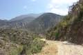
 | Heaton Flats Trail This ride of 3.6 to 6 miles (or more) starts from the same trailhead as the trail to the Bridge to Nowhere and climbs toward Iron Mountain and panoramic views of the San Gabriel Mountains. |
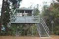 | Henninger Flats via Mount Wilson Toll Road This 6-mile round trip ride ascends 1,325 feet to a trail camp, tree nursery, lookout tower, and visitor center on a landing in the San Gabriel Mountains operated by the Los Angeles County Fire Department. The ride can be extended to 8.7 miles by exploring a loop above Henninger Flats. |
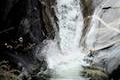 | Hermit Falls This 2.5-mile ride heads down canyon away from Sturtevant Falls toward a 30-foot waterfall. The lush canyon and the babbling creek are quite calming. |
 | Hoegees Camp via Lower Winter Creek Trail This 4.25-mile ride follows Lower Winter Creek Trail through a beautiful wooded canyon to a backcountry campground with fourteen first-come first-serve sites. |
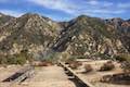
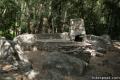
 | Inspiration Point & Mount Lowe Trail Camp This 7.25-mile round trip ride descends Mount Lowe Road into the San Gabriel Mountains to a historic scenic overlook and a trail camp built on interesting ruins. |
 | Lower Zion Trail The trail from Hoegees Camp up Mt. Zion is 1.5 miles long. |
 | Mount Hillyer This 6,215-foot summit can be reach from two trailheads for a 1.33 to 6.25-mile ride gaining between 575 and 1,000 feet. |
 | Castle Canyon Trail to Inspiration Point (and beyond) This 2-mile long trail ascends from the ruins on Echo Mountain to a historic viewpoint that still offers hike-worthy panoramas. Form a loop back to Echo Mountain to visit Mount Lowe Trail Camp, Cape of Good Hope, and other landmarks on Mount Lowe Railway. |
 | Mount Waterman The 5.5 to 6 miler can be completed as an out and back ride or a loop, traveling through a pine forest to a round summit. |
 | San Antonio Falls This 1.2-mile ride visits a multi-tier waterfall along the trail to Mt. Baldy. |
 | Santa Anita Canyon Loop This 9.5-mile loop visits two peaceful creeks in sylvan canyons, passing a 60-foot waterfall and plenty of beautiful wilderness. |
 | Spruce Grove Camp This 8-mile in-and-out or 9.5-mile loop takes bikers beyond Sturtevant Falls to a backcountry campground with seven first-come first-serve sites. |
 | Strawberry Meadow This 15-mile ride goes around Strawberry Peak to a remote and scenic flat below a massive cliff on the north side of the mountain, offering views of Big Tujunga Canyon and surrounding peaks along the way. |
 | Sturtevant Falls This 3.25-mile ride visits a 60-foot waterfall and a lush cottage-lined canyon. |
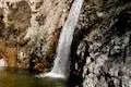 | Switzer Falls This 4.5-mile ride starts out above and finishes below a 50-foot tall waterfall. |
 | Upper Winter Creek Trail This 2.75-mile long trail can be used to extend Santa Anita Canyon Loop or create a 4.85-mile loop with Lower Winter Creek Trail. |
 | Upper Zion Trail The trail from Spruce Grove Camp up Mt. Zion is 1.5 miles long. |
 | Vetter Mountain This 3.8 or 4.4-mile ride ascends from Charlton Flats Picnic Area to Vetter Mountain where there are exceptional 360-degree view from the site of an old fire lookout tower. |
Bike-Friendly Trails in the Vedugo Mountains
 | Beaudry Motorway Loop to Tongva Peak This 6.15-mile loop climbs 1,475 feet to the summit of Tongva Peak on the east end of the Verdugo Mountains. |
 | Hostetter Fire Road to Verdugo Mountain This 7.5-mile round trip ride up La Tuna Canyon reaches the highest summit in the Verdugo Mountains, a small mountain range north of Burbank. |
 | La Tuna Canyon Trail This 4.5-mile round trip ridee ascends a ridge and a pair of canyons in La Tuna Canyon Park on the northwest side of the Verdugo Mountains. |
 | Las Flores Motorway to Mount Thom This 5.3-mile ride follows a wide dirt road to the summit of Mount Thom, offering panoramic views from the southeast end of the Verdugo Mountains. |
 | Old Youth Camp Loop in Stough Canyon This 2.6-mile loop passes the ruins of an abandoned camp in the Verdugo Mountains with views across the San Fernando Valley. |
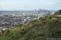
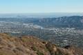 | Skyline Motorway This 6.1 to 6.6-mile ride (or more) ascends an abandoned fire road in the Verdugo Mountains with expansive views that include the skyline of downtown Los Angeles. |
Bike-Friendly Trails Elsewhere in Los Angeles
 | China Flat & Simi Peak This 5.45 to 6.2-mile ride ventures up rugged ridges to a peaceful oak savanna and a trail to the highest point in the Simi Hills, sporting 360-degree views of surrounding mountain ranges. |
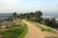 | Community Trail This 2.5-mile ride delivers views over Los Angeles from Kenneth Hahn State Recreation Area in the Baldwin Hills. |
 | Fish Canyon Narrows This ride of ten miles or more explores an enchanting narrow canyon on the east side of the Angeles National Forest in the Sierra Pelona Mountains north of Santa Clarita. |
 | Lizard Rock To add extra mileage and views to a visit to Paradise Falls in Thousand Oaks, consider placing Lizard Rock on your itinerary. |
 | LMU Trail This easy ride of up to 4.7 miles round trip follows the Westchester Bluffs west below the campus of Loyola Marymount University. |
 | Lunada Canyon Trail This short trail explores an overgrown canyon between two residential ridges inland of Lunada Bay. |
 | Paradise Falls This 40-foot waterfall is located within Wildwood Park in Thousand Oaks and is reachable via several trails, including a 2.55-mile loop. |
 | Portuguese Bend Reserve This 5.15-mile double loop explores the scenic coastal hillsides and canyons in Portuguese Bend Reserve on the Palos Verdes Peninsula and can easily be shortened to 3 miles round trip by omitting the lower loop. |
 | Rocky Peak This 4.75-mile round trip ride climbs 900 feet to a 2,715-foot summit in Rocky Peak Park in the Santa Susana Mountains between Chatsworth and Simi Valley. |
 | Tarantula Hill This 1-mile round trip ride follows a paved trail to the top of a small, round hill in Thousand Oaks with views across the Conejo Valley into the surrounding mountains. |
 | Towsley View Loop Trail This 5.4-mile loop explores two canyons and scenic ridges in the Santa Susana Mountains, passing the narrows of Towsley Gorge in Towsley Canyon. |