Upper Winter Creek Trail
in the San Gabriel Mountains
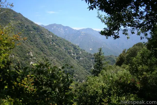
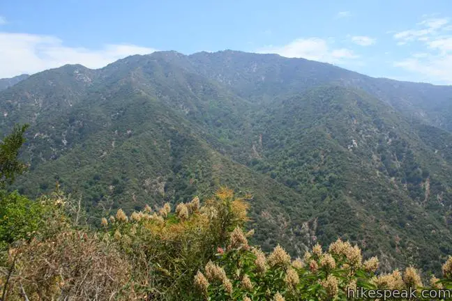
If you have hiked Santa Anita Canyon Loop, you probably wondered, were can I find more great trails like this? The answer is Upper Winter Creek Trail, a 2.75-mile track on the east wall of Santa Anita Canyon with 600 feet of elevation change.
Upper Winter Creek Trail can be used to replace Lower Winter Creek Trail on Santa Anita Canyon Loop to create a slightly larger ten-mile loop that trades in creek crossings for canyon views. You can also combine Upper and Lower Winter Creek Trails for a shorter hike from Chantry Flats, a 4.85-mile loop with 1,000 feet of elevation change. Both loops are excellent ways to employ Upper Winter Creek Trail.
Winter Creek Trails Loop
Set out from Chantry Flats and make your way down the paved road to Roberts Camp, dropping 350 feet over 0.6 miles. Cross over the bridge at the low-point of the hike, at approximately 1,800 feet, and turn left up Lower Winter Creek Trail.
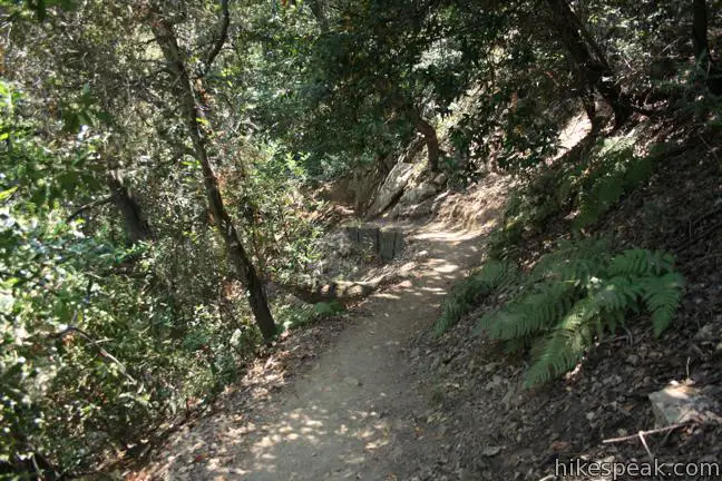
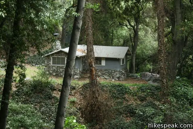
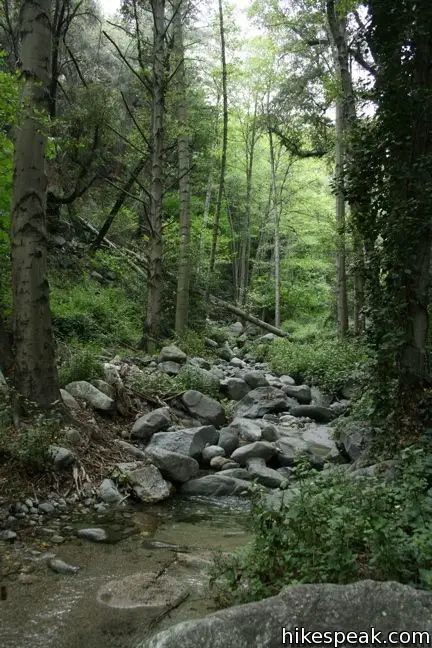
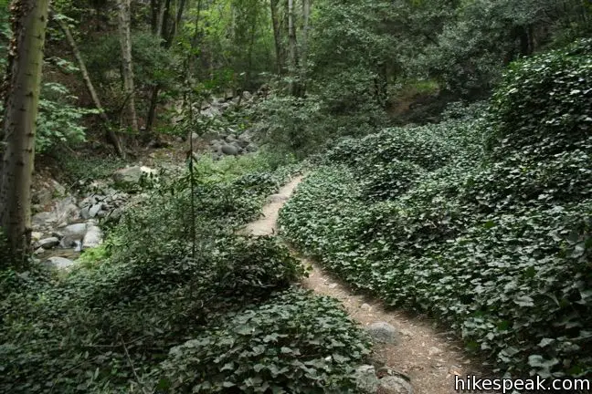
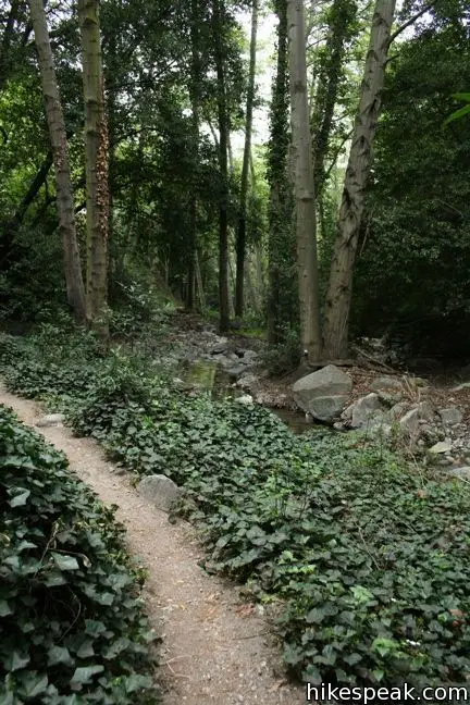
Lower Winter Creek Trail is a creek-side track that weaves up a sylvan canyon, which receives less foot traffic than Gabrielino Trail to Sturtevant Falls on the other side of Santa Anita Canyon.
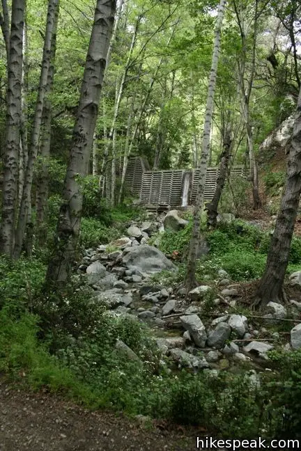
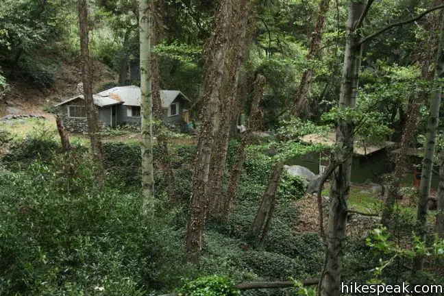
Above Hoegees Trail Camp and the junction with Lower Zion Trail (2.1 miles from the start), Upper Winter Creek Trail climbs out of the canyon and back to Chantry Flats.
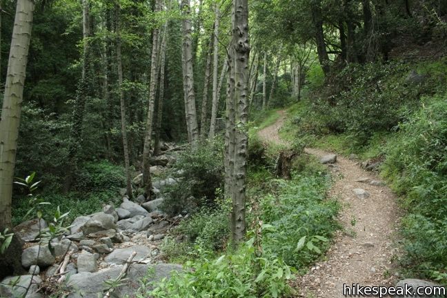
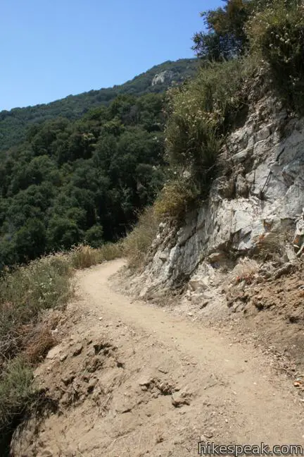
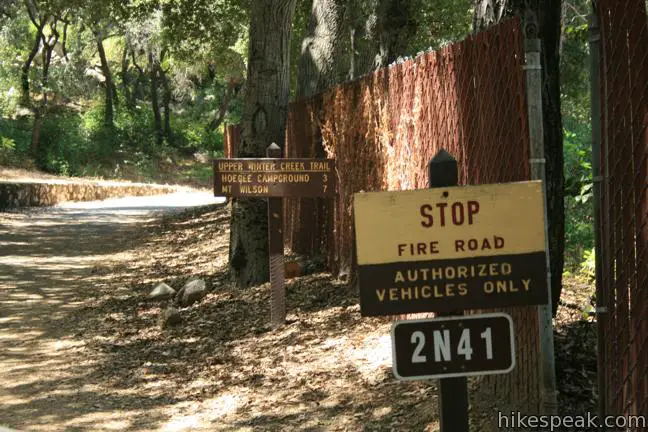
Upper Winter Creek Trail follows the creek to one more crossing and begins up the side of the canyon. After 0.15 miles on Upper Winter Creek Trail, reach another junction, this one with a trail climbing 4.5 miles to Mount Wilson, the San Gabriel Mountain’s famous observatory-covered summit. Turn left at the junction to return to Chantry Flats and climb higher up the side of the canyon.
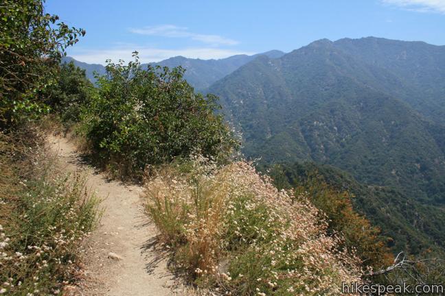
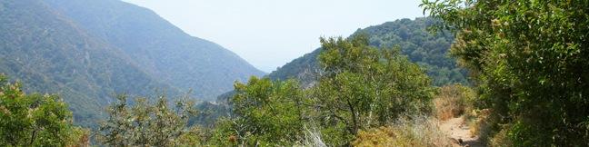
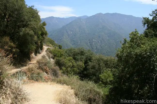
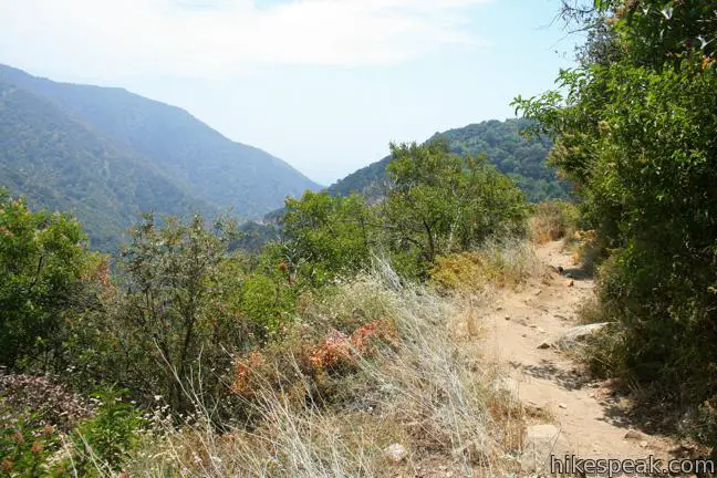
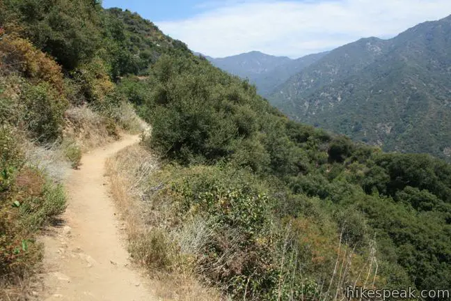
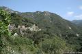
The forest trail is fairly well shaded, but occasional gaps in the trees offer expansive views over the canyon as you climb to an elevation of 2,800 feet.
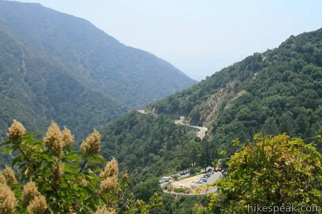
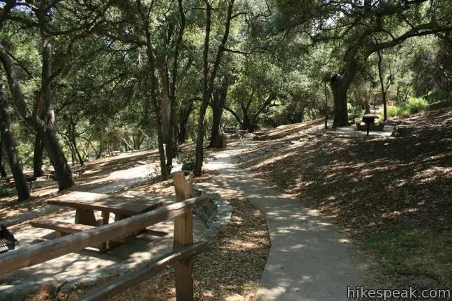
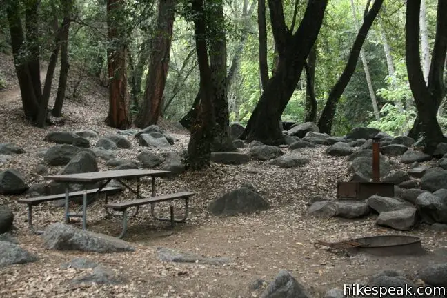
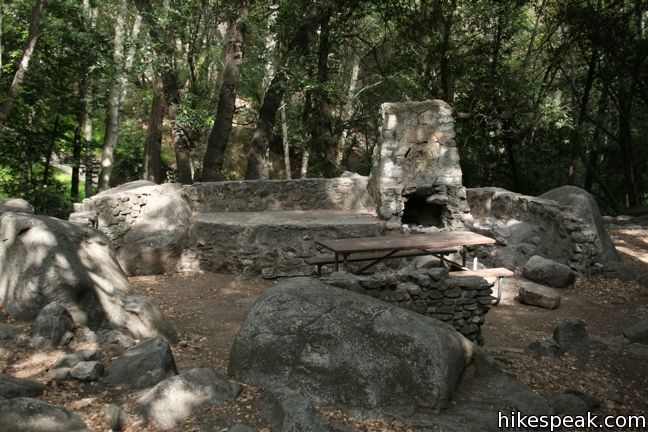
When you spot the terraced parking lot of Chantry Flats, one mile of hiking remains. Upper Winter Creek Trail turns downhill and wraps around the wall of the canyon, passing a seasonal spring. Upon hitting the pavement of Forest Route 2N41, turn left and drop the final 1/3 of a mile to Chantry Flats, passing a picnic area en route to the trailhead at 2,150 feet.
Dogs are welcome on leashes. A National Forest Adventure Pass is required for vehicles park at the Chantry Flats Trailhead. No permit is needed to hike Upper Winter Creek Trail, so get out and enjoy!
Directions to the Trailhead
- Take the 210 Freeway to Arcadia, east of Pasadena.
- Use exit 32 for Santa Anita Avenue and head north at the end of the offramp.
- Drive 5 miles up Santa Anita Avenue, going into the mountains.
- The road ends at Chantry Flats.
Trailhead Location
Trailhead address: Chantry Flats Road, Angeles National Forest, Arcadia, CA 91006
Trailhead coordinates: 34.196194, -118.02265 (34° 11′ 46.29″N 118° 01′ 21.53″W)
View Santa Anita Canyon in a larger map
Or view a regional map of surrounding Los Angeles trails and campgrounds.
Upper Winter Creek Trail to Hoegees Camp


Lower Winter Creek Trail to Hoegees Camp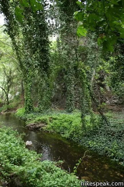


 | Hoegees Camp This 4.25-mile hike follows Lower Winter Creek Trail through a beautiful wooded canyon to a backcountry campground with fourteen first-come first-serve sites. |
 | Sturtevant Falls This 3.3-mile hike visits a 60-foot waterfall and a lush cottage-lined canyon. |
 | Hermit Falls This 2.5-mile heads down canyon away from Sturtevant Falls toward a 30-foot waterfall. The lush canyon and the babbling creek are quite calming. |
 | Santa Anita Canyon Loop This 9.5-mile loop visits two peaceful creeks in sylvan canyons, passing a 60-foot waterfall and plenty of beautiful wilderness. |
 | More trails in the San Gabriel Mountains Explore other destinations in the range. |
Common Questions about Upper Winter Creek Trail in the San Gabriel Mountains
- Is the trail open?
- Yes. You should expect to find that Upper & Lower Winter Creek Trails Loop is open. There are no recent reports of trail closures. If you discover that the trail is closed, please help your fellow hikers by reporting a closure.
- Do I need a permit for this hike?
- Yes. National Forest Adventure Pass.
- How much time does this hike take?
- It takes approximately 2 hours 30 minutes to hike Upper & Lower Winter Creek Trails Loop. Individual hiking times vary. Add extra time for breaks and taking in the views.
- How long is this hike?
- The hike to Upper & Lower Winter Creek Trails Loop is a 4.85 mile loop with 1000 feet of elevation change.
- Are dogs allowed on this trail?
- Yes, dogs are allowed on Upper & Lower Winter Creek Trails Loop. The trail is open to hikers, dogs, bikes.
- What mountain range is this trail in?
- Upper & Lower Winter Creek Trails Loop is located in the San Gabriel Mountains.
- Where is the trailhead located?
- The trailhead for Upper & Lower Winter Creek Trails Loop is located in Arcadia, CA.
Trailhead Address:
Chantry Flats Road
Arcadia, CA 91006
Trailhead Coordinates:
34.196194, -118.02265 - What are the driving directions to the start of the hike?
To get to the trailhead: Take the 210 Freeway to Arcadia, east of Pasadena. Use exit 32 for Santa Anita Avenue and head north at the end of the offramp. Drive 5 miles up Santa Anita Avenue, going into the mountains. The road ends at Chantry Flats.
View custom Google Maps directions from your current location.
- Are there other trails near Upper & Lower Winter Creek Trails Loop?
- Yes, you can find other nearby hikes using the Hikespeak Hike Finder Map.

This was a beautiful hike, with hardly anyone else on the trail on a Sunday morning. Thanks for the tip!