China Flat and Simi Peak
in the Simi Hills
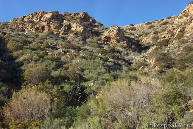
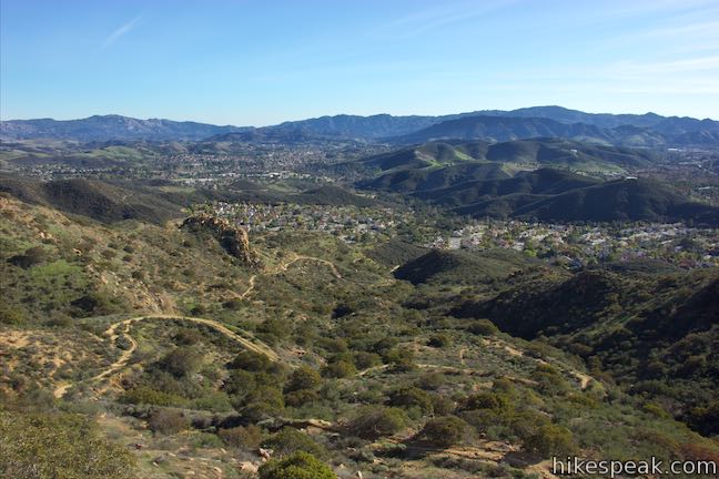
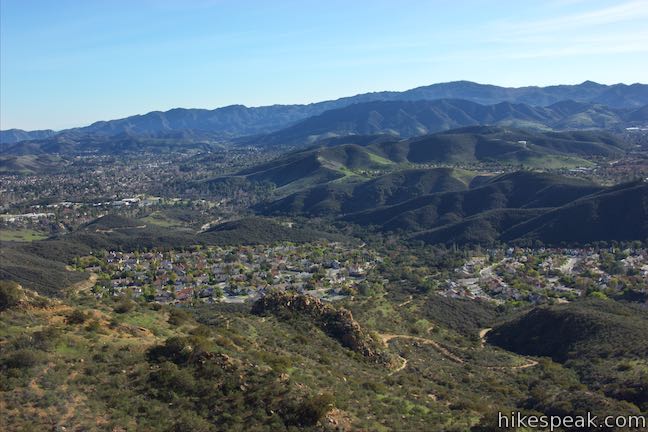
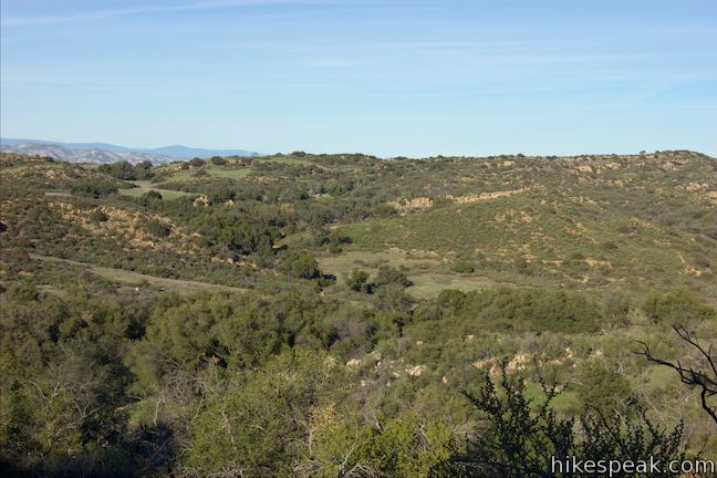
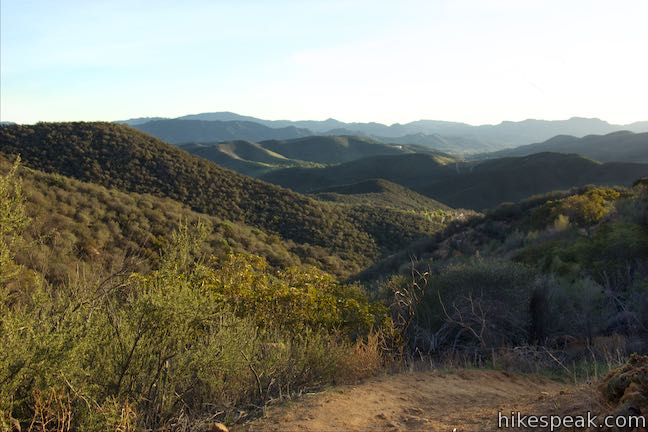
Looking up at the orange sandstone outcroppings on the rugged slopes of the Simi Hills, you would hardly expect the terrain above to host a peaceful oak savanna. Walk through this grassy area shade by tall oaks to ascend to Simi Peak, the highest point in a mountain range that spans the boundary between Ventura County and Los Angeles County just north of the 101 Freeway. Simi Peak is 2,403 feet tall and boast 360-degree views over the Simi Hills toward several surrounding mountain ranges and valleys. This hike up China Flat Trail and Simi Peak Trail is 5.45 miles out and back with 1,090 feet of elevation change. A loop can be added around the mountainside below China Flat to extend the hike to 6.2 miles round trip.
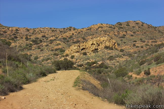
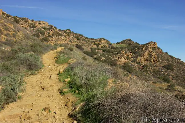
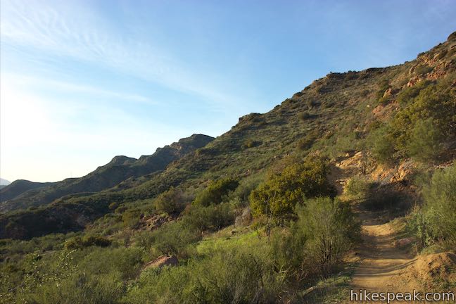
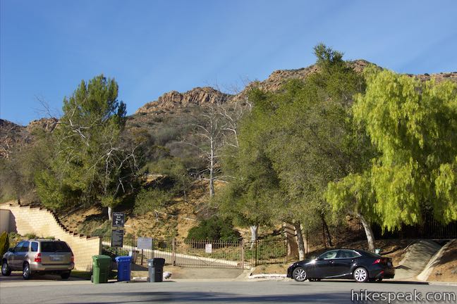
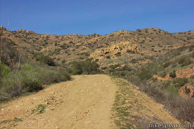
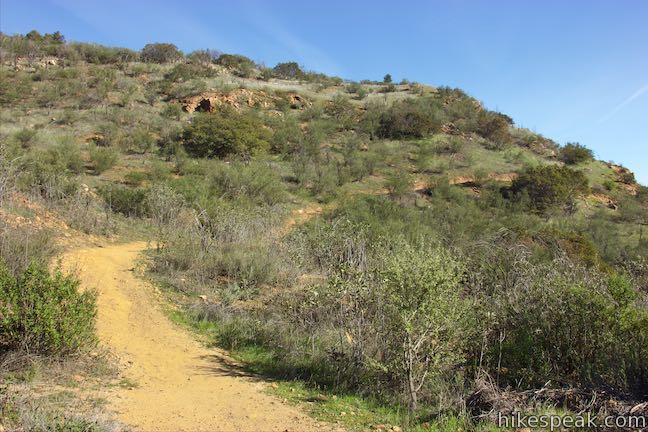
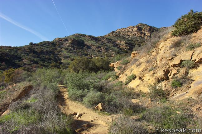
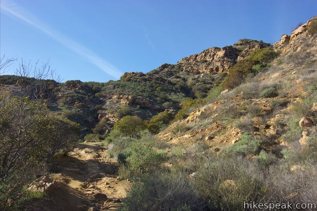
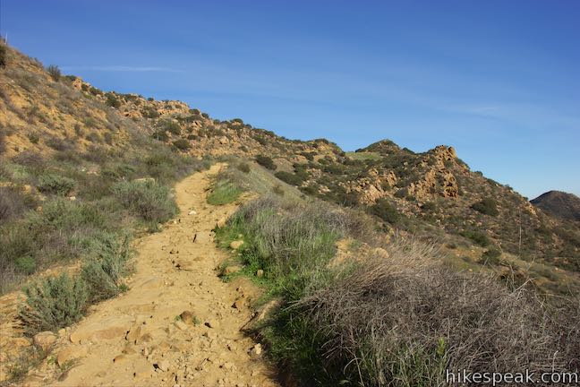
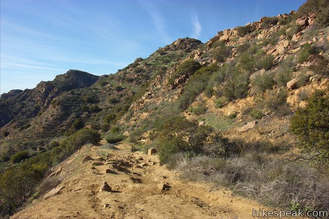
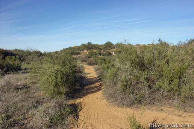
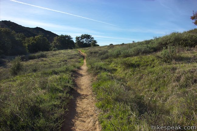
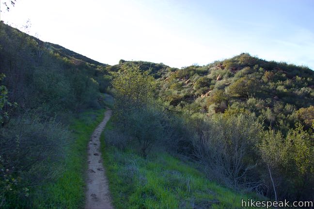
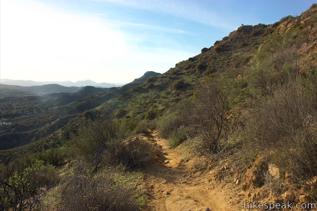
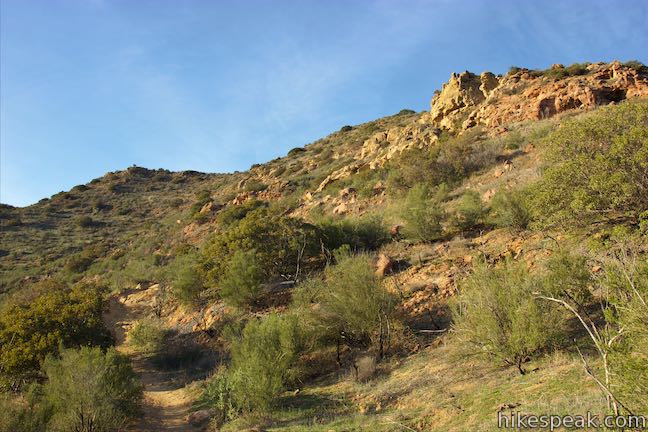
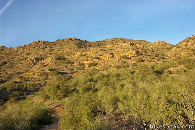
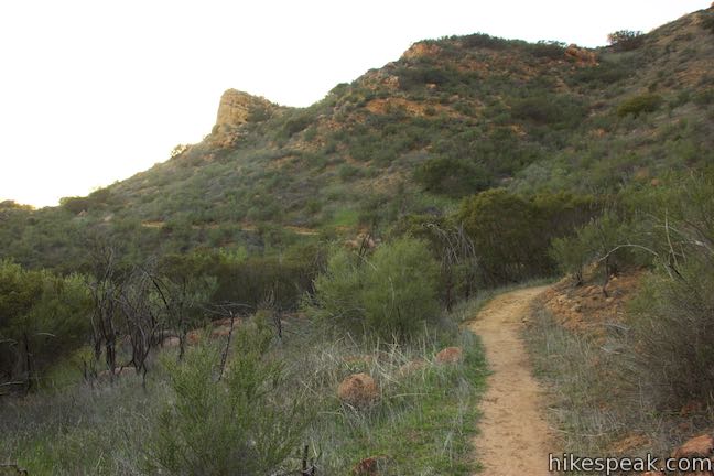
This hike begins from the top of King James Court, a cul-de-sac off Lindero Canyon Road in Oak Park, California, which is just east of Thousand Oaks near the communities of Westlake Village and Agoura Hills. Begin up the trail at the top of the road, passing through a gate by a sign that reads “China Flat Trail Head.” Walk up about 250 feet of pavement and turn right on a wide dirt trail. This stretch of China Flat Trail on the mountainside below the flat is also called Dead Cow Road. If you don’t find that name appealing, wait until you reach Suicide Trail (neither trail is as bad as it sounds). Hike north up the trail toward a prominent round outcropping of pocketed sandstone on the lower slopes ahead.
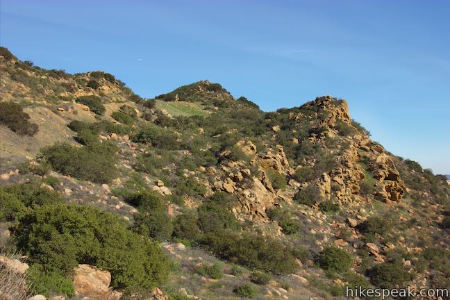
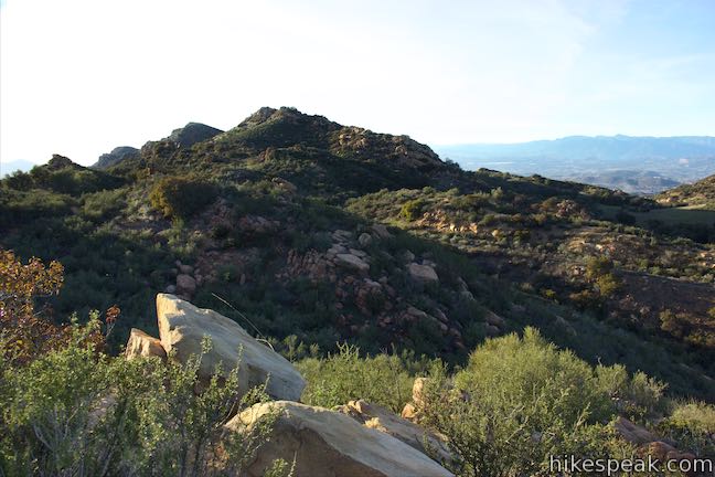
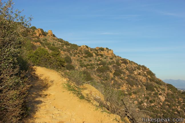
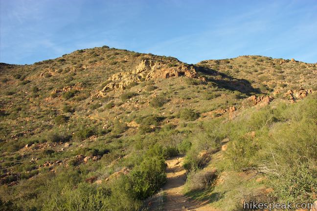
Across a draw on the right, another branch of China Flat Trail is visible on a neighboring ridge. This trail begins from an alternate trailhead on Lindero Canyon Road. Reach the back of the draw and come to a junction with this other trail. Stay to the left and the hike will line you up for views toward the summit of Simi Peak, which rises to the northeast above steep ridges covered in sandstone outcroppings and chaparral.
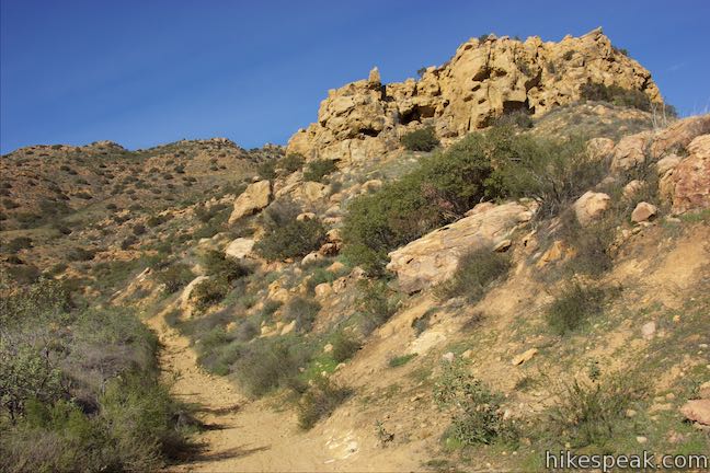
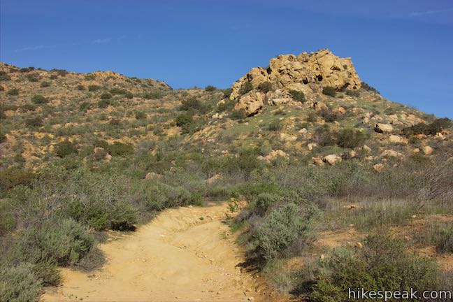
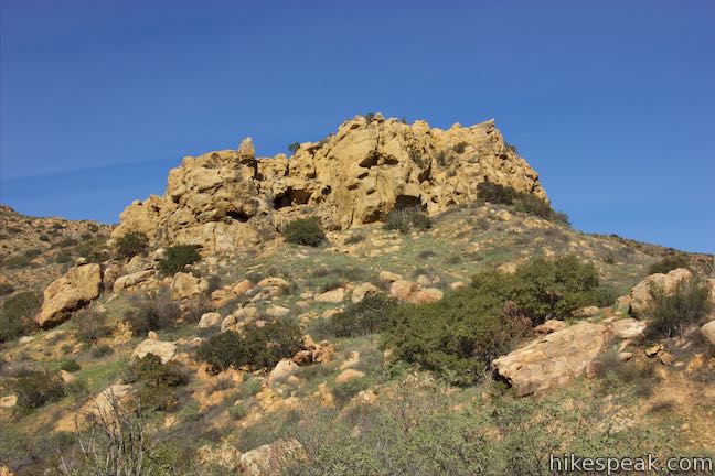
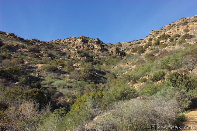
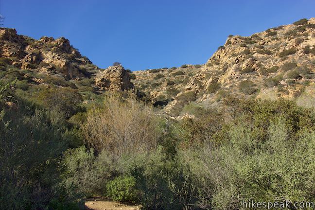
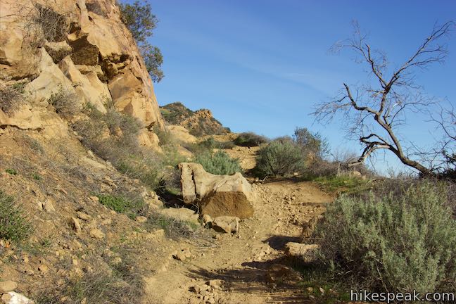
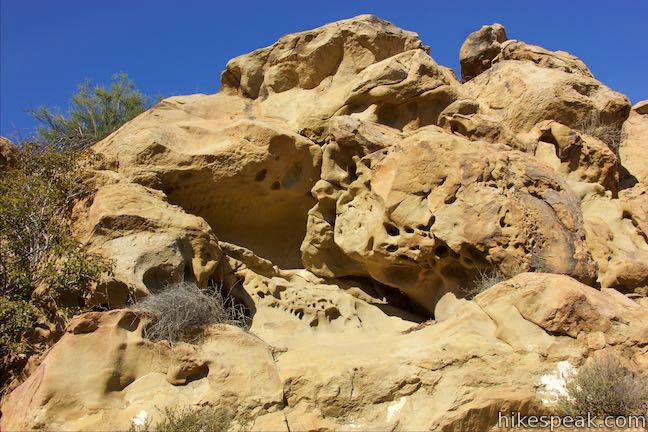
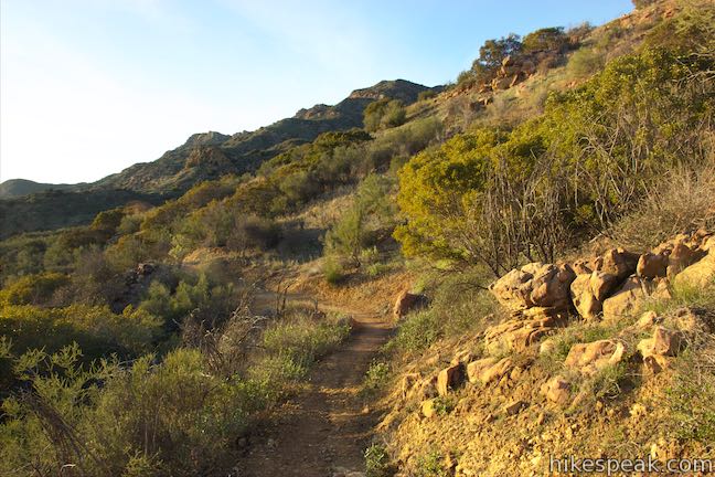
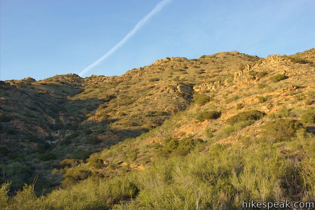
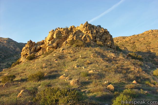
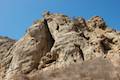
The trail curves to the right and comes to another junction just below a large sandstone knob that stands out from the ridge. Oddly shaped alcoves dissect this alluring rock formation. The trail to China Flat continues to the left. On your right, a connector trail ventures east across the mountainside to connect to Suicide Trail. Use this trail on the hike down if you opt for the loop route.
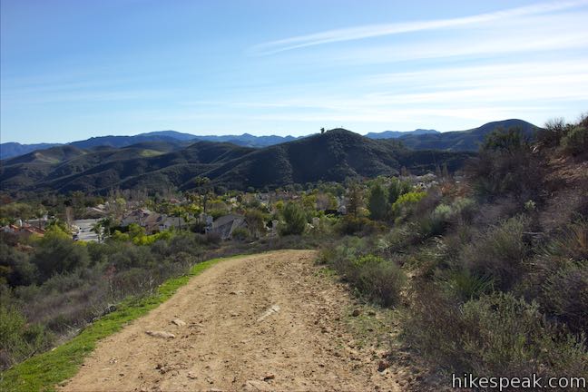
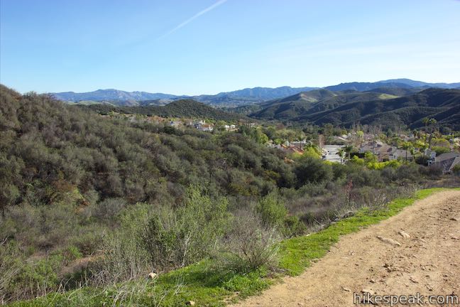
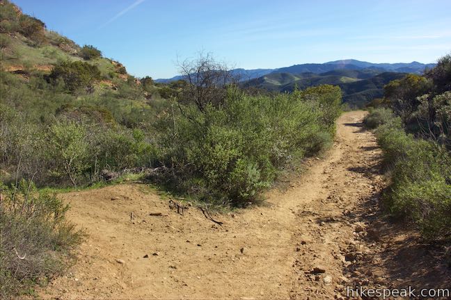
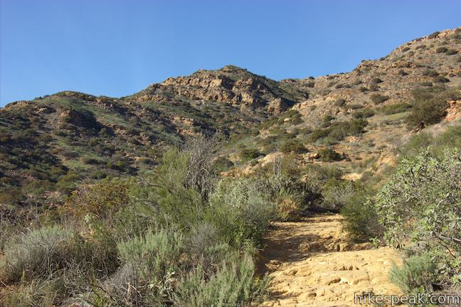
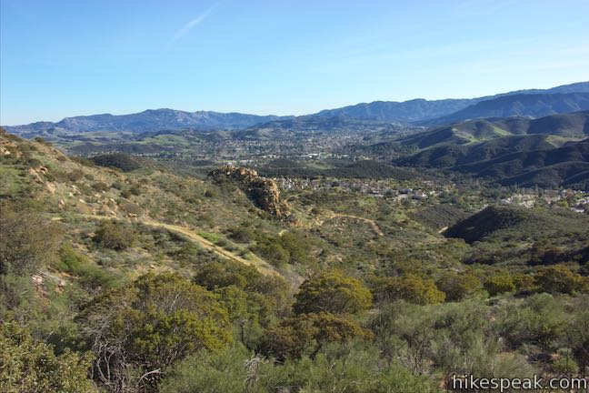
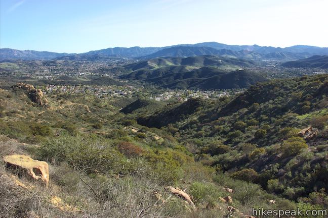
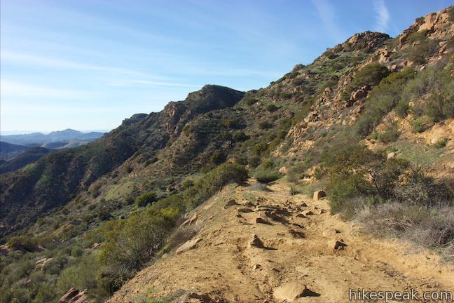
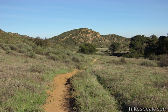
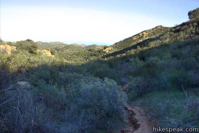
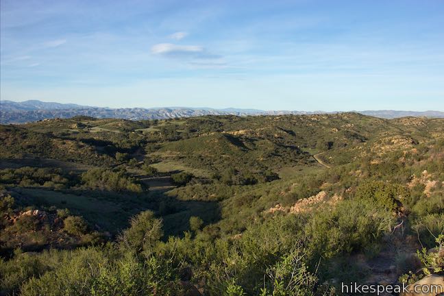
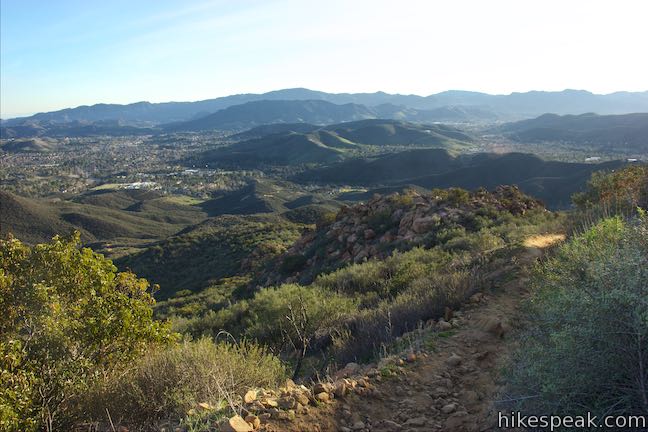
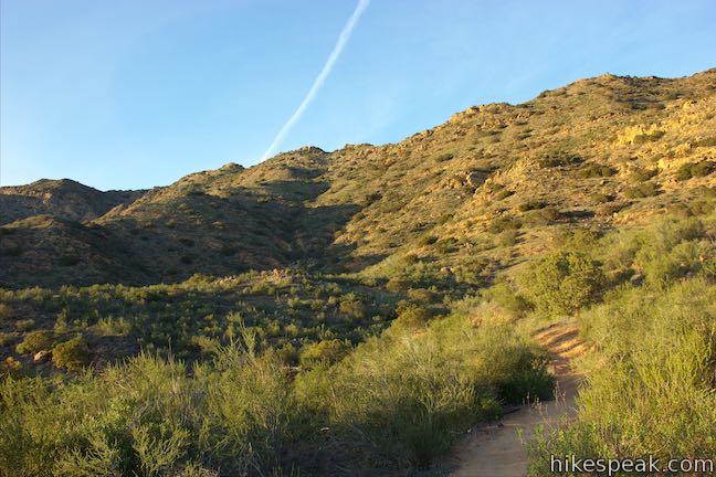
Proceed up the trail to China Flat, which aims toward a canyon below Simi Peak. At 0.3 miles above the junction by the knob, the trail curves to the right and heads away from the canyon. As the trail rises higher, look south over Oak Park and Agoura Hills toward the Santa Monica Mountains.
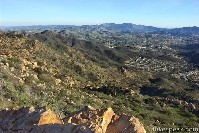
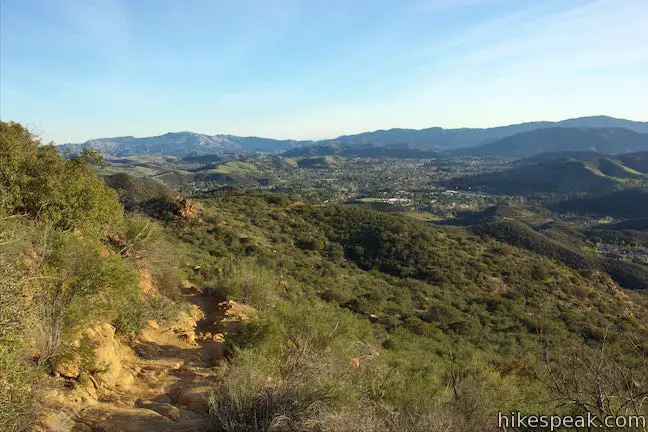
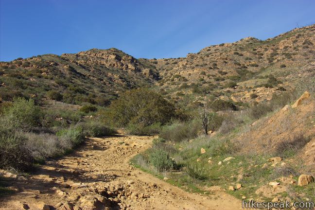
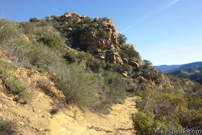
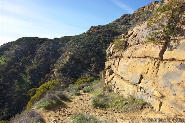
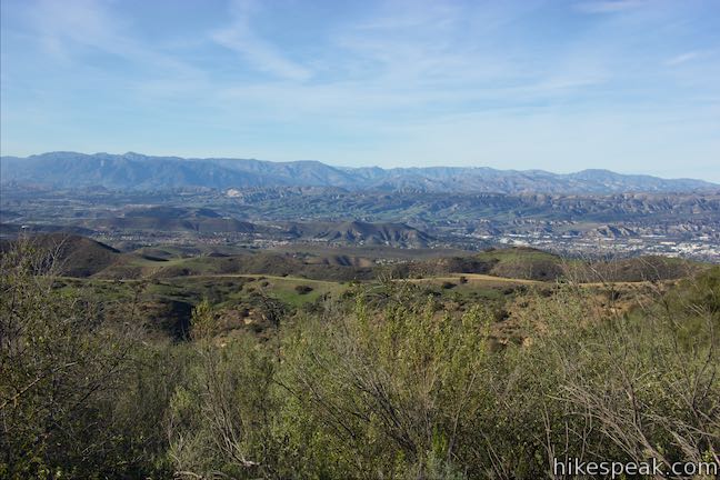
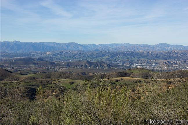
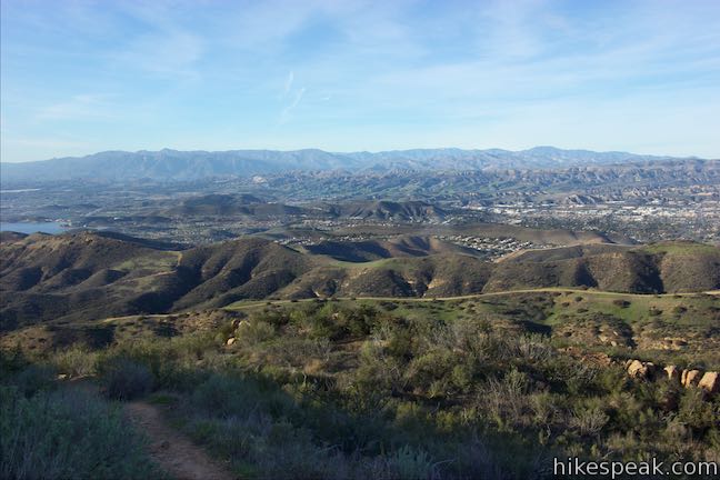
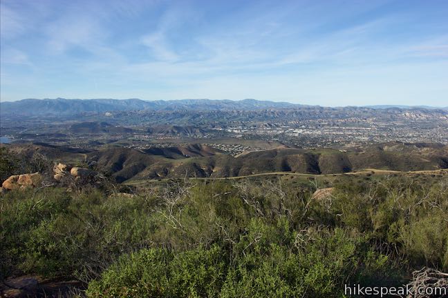
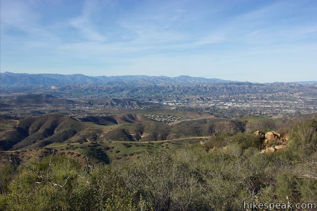
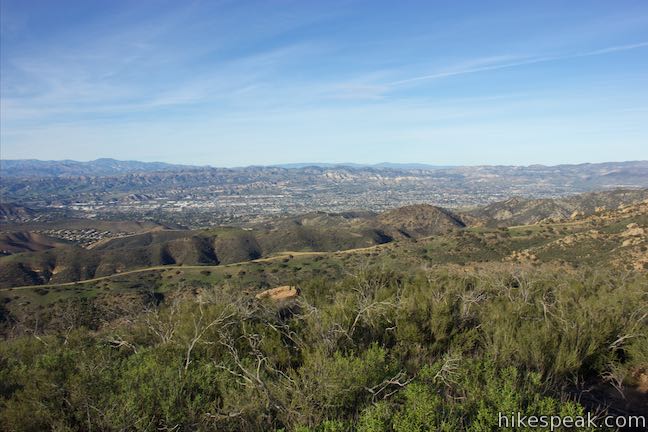
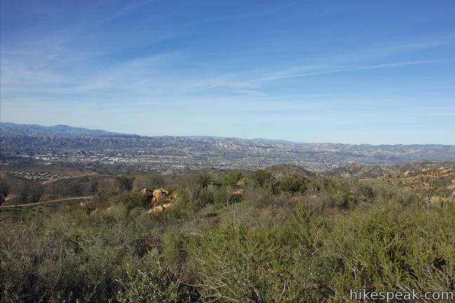
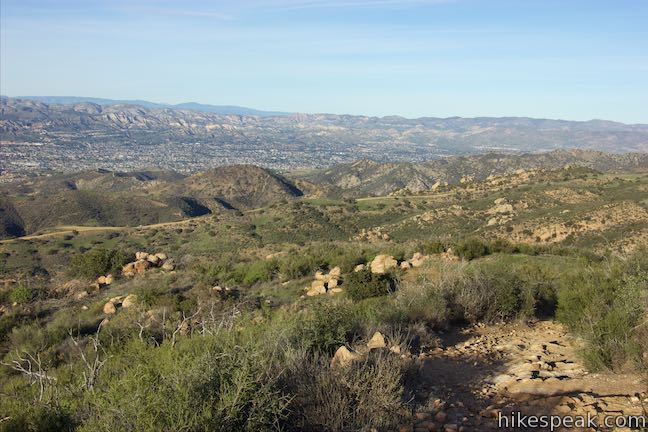
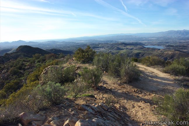
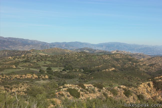
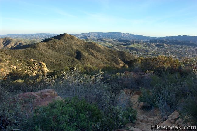
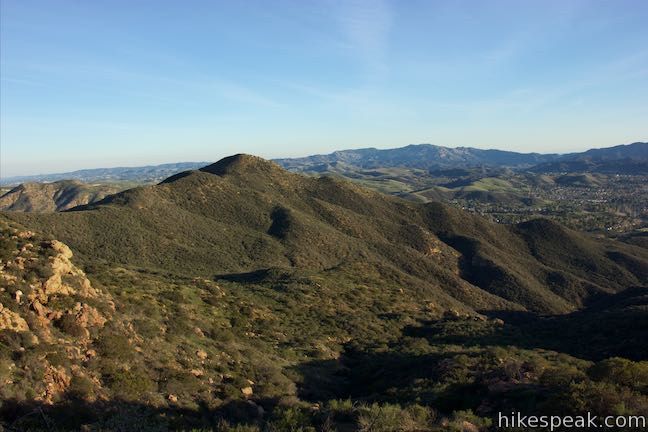
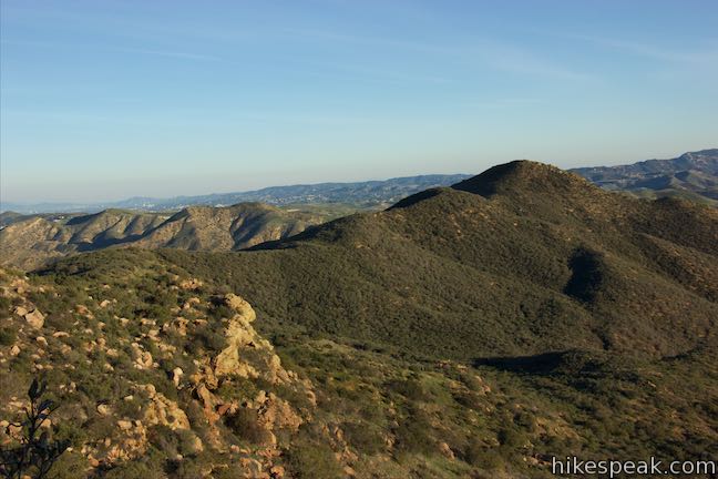
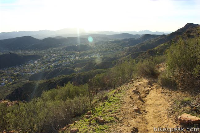
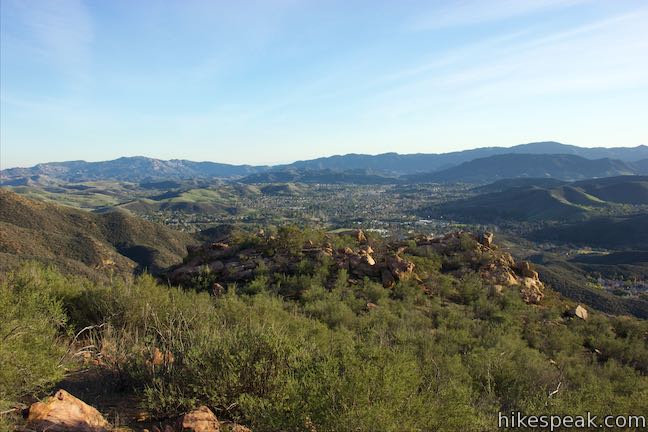
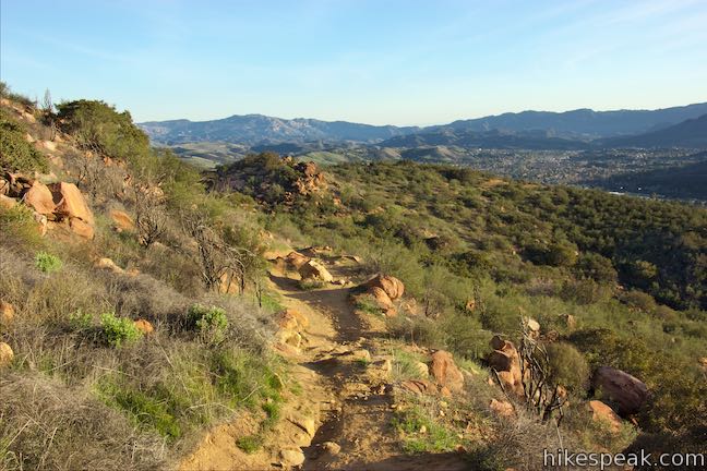
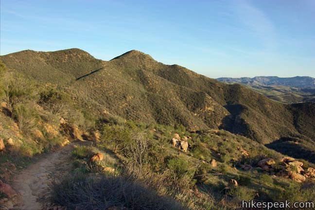
Views over this lovely landscape expand as the trail turns back toward the canyon and continues to climb. Approach the canyon again, farther up this time, and walk through an area of tall brush and towering boulders. A horseshoe bend to the right takes you out of the canyon. Push up the mountainside past steep cliffs and go east toward a small gap in the ridgeline. This is the last stretch of the ascent to China Flat, with fine views back over the trail and across the Conejo Valley toward row after row of long verdant peaks and ridges in the Santa Monica Mountains.
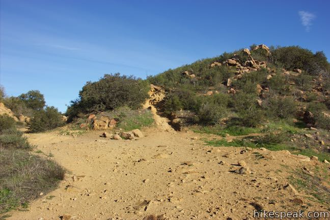
At 1.35 miles from the start, you’ll approach a gap in the ridge. A path breaks off to the right that goes across and around a rise to meet Suicide Trail. Unless you don’t want to see China Flat, continue to the left.
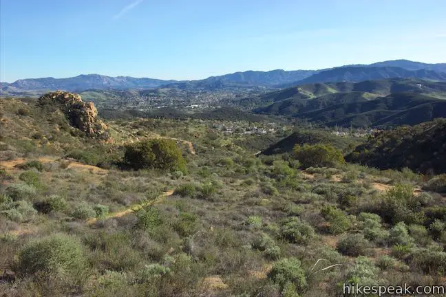
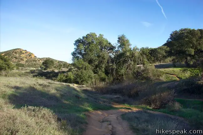
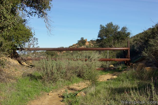
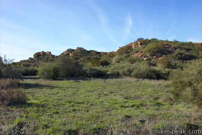
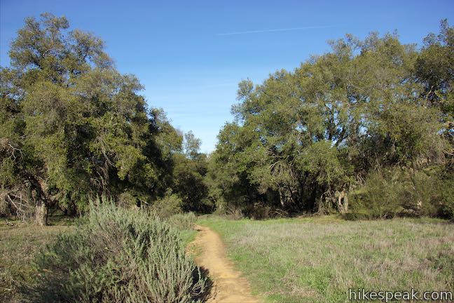
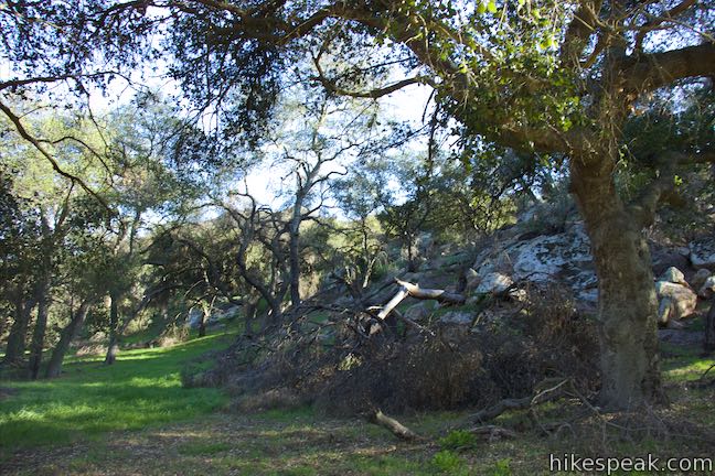
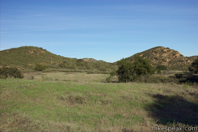
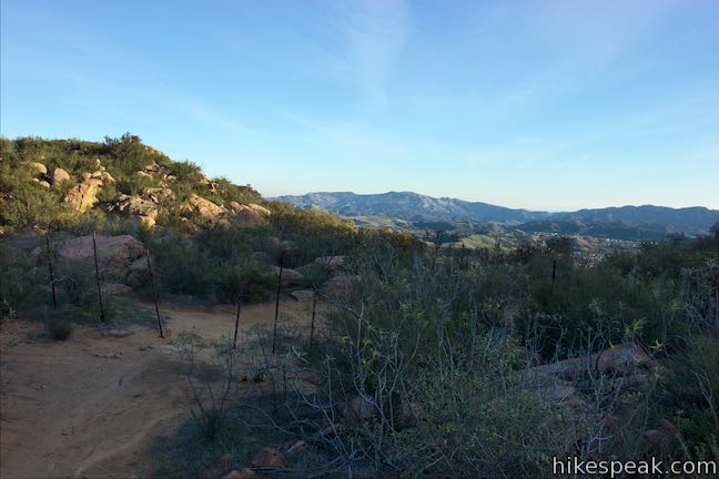
The trail levels as you pass an old rusted gate on the ground, followed by a standing rusted gate. Reach a grassy field on the edge of China Flat. Several important junctions lie just ahead, which you need to navigate through to reach Simi Peak.
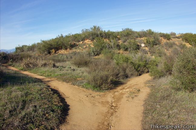
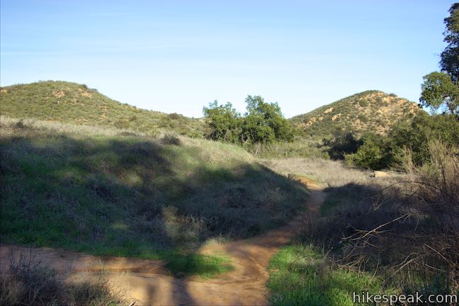
Just past the clearing and 1.45 miles from the start, hit an unmarked junction where Suicide Trail parts to the right at a ninety-degree angle. This is the optional return route. Stay to the left and you will immediately come to a split. You can actually take either branch at this point because the trails reunite beneath the crest in front of you. The trail to the left is shorter and steeper with less views. Taking the trail to the right gives you a more gradual descent and more views over China Flat to the north, where oaks are spread around grasslands and rolling ridges.
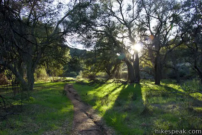
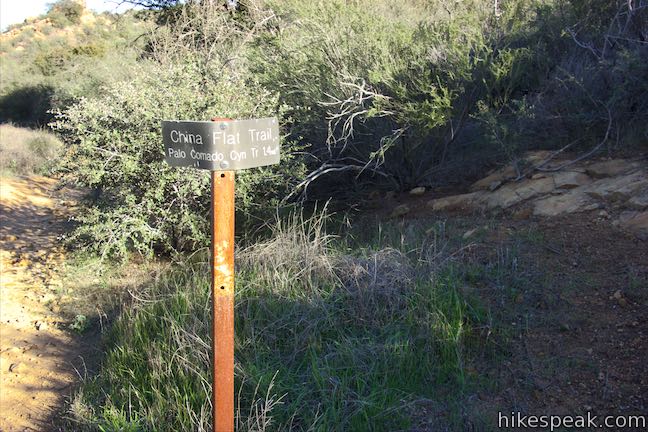
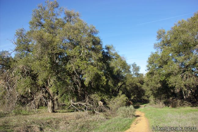
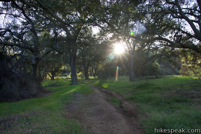
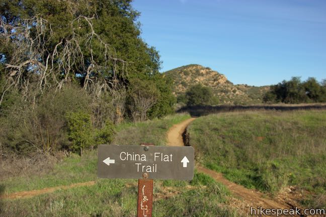
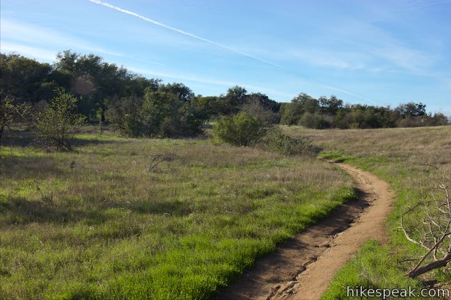
Descend into the oaks where the trails come back together. Walk along the dirt track through a peaceful grassy area shaded by grand oak trees. Come to a marked junction after 1.8 miles of hiking. A sign here points in two directions for China Flat Trail. The trail to the right connects to Palo Comado Canyon Trail and can be used as part of a larger loop on China Flat (known as China Flat Loop Trail). Turn left and go around an S-shaped bend to quickly arrive at another junction that is unmarked. Turn left here onto Simi Peak Trail to hike 0.9 miles to the summit.
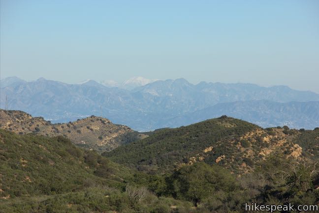
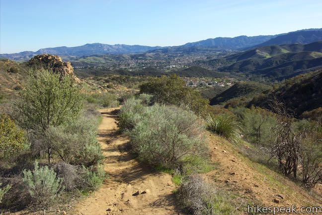
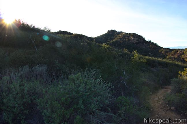
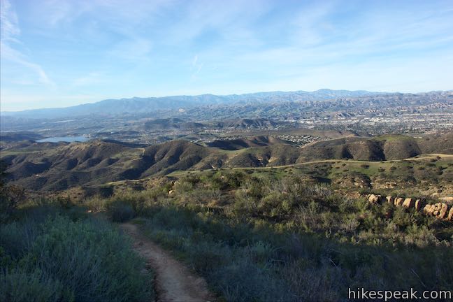
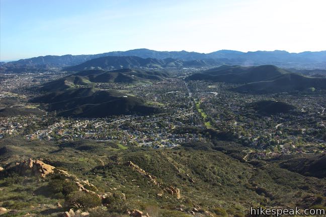
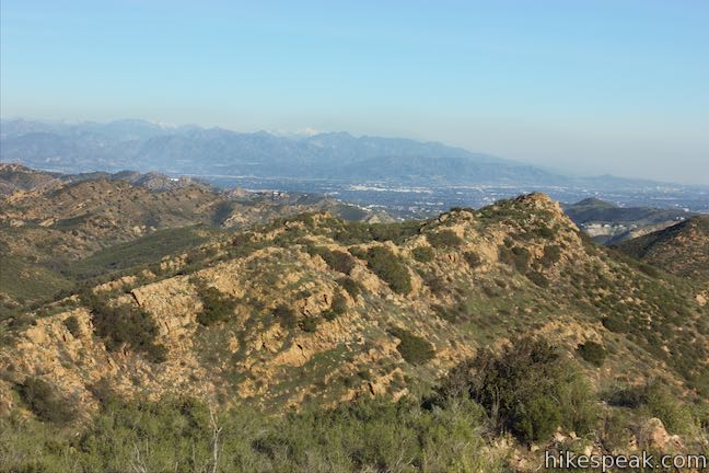
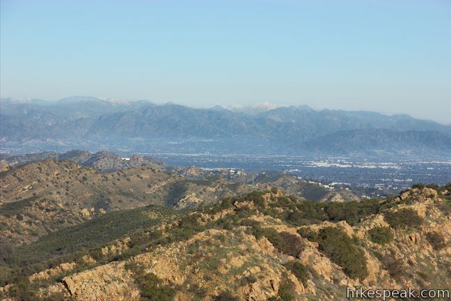
Simi Peak Trail heads west, gradually ascending through more oak savanna on China Flat. Less than halfway up Simi Peak Trail, you’ll pass a junction on the right. This trail can be used for the longer circuit around China Flat (China Flat Loop Trail). Stay to the left to keep hiking up the mountain, briefly dropping across a depression. As you ascend the other side, look over your shoulder and you should be able to spot the San Gabriel Mountains to the east. On clear winter days, the snowy top of Mount Baldy will be hard to miss.
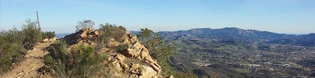
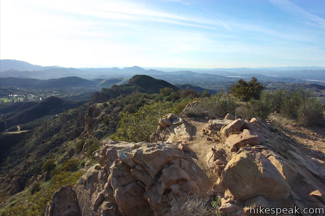
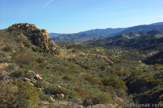
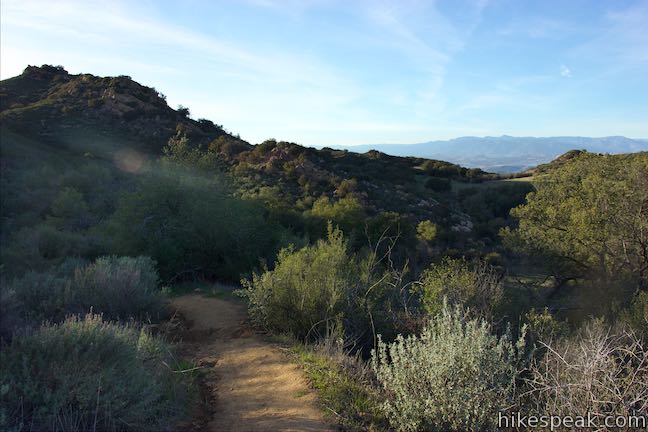
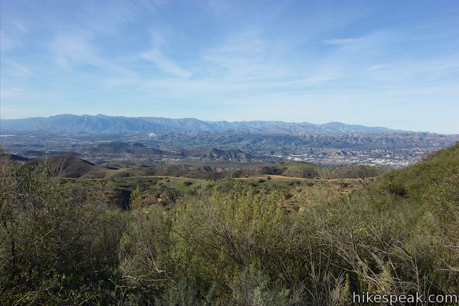
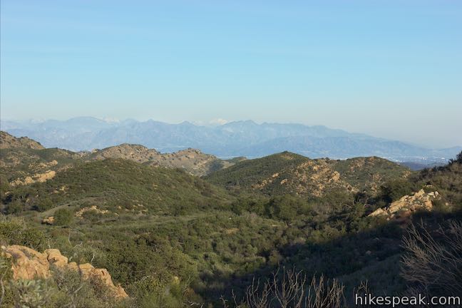
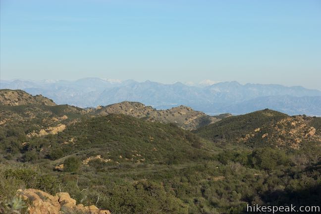
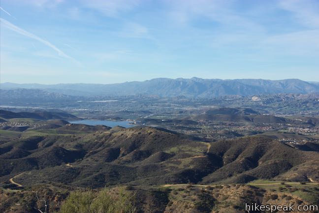
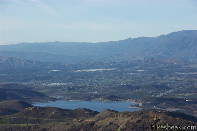
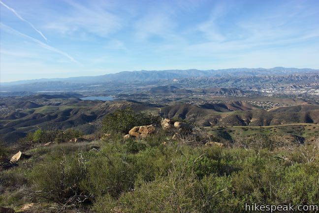
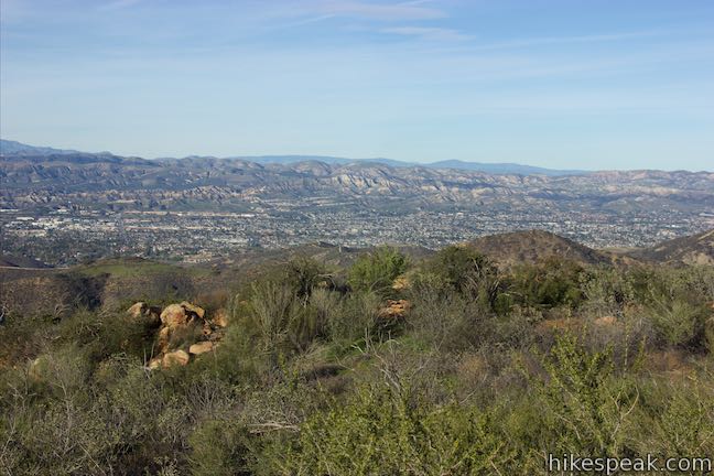
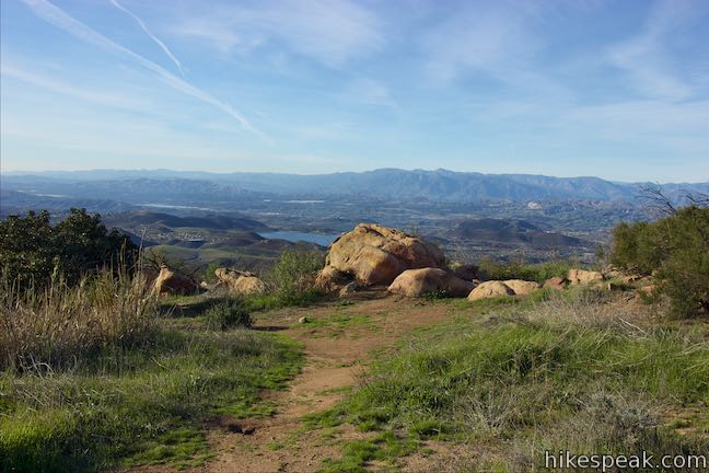
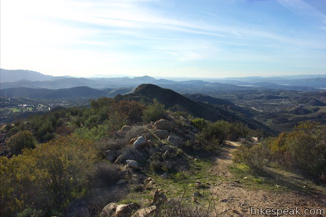
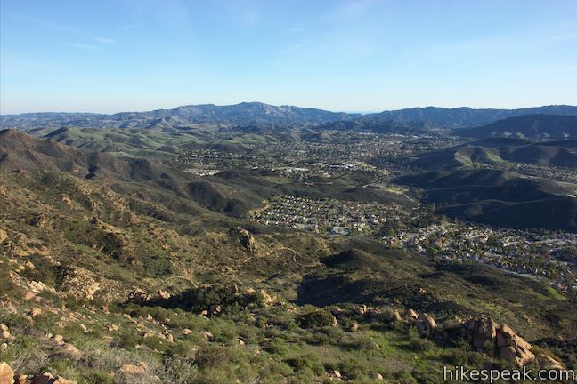
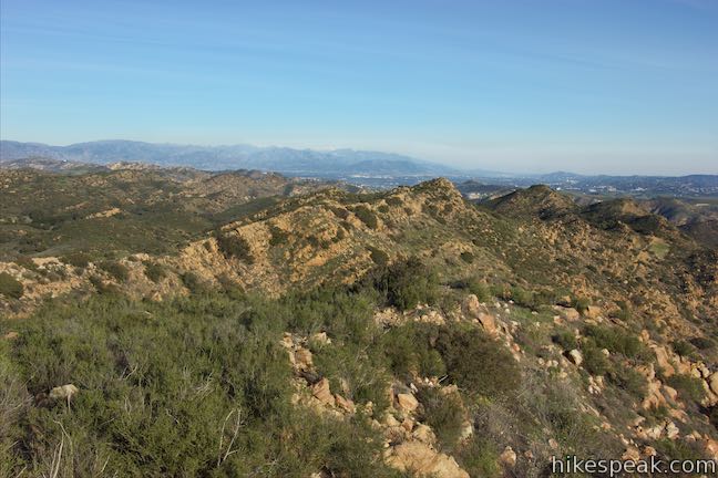
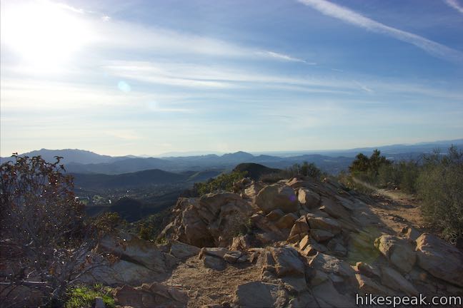
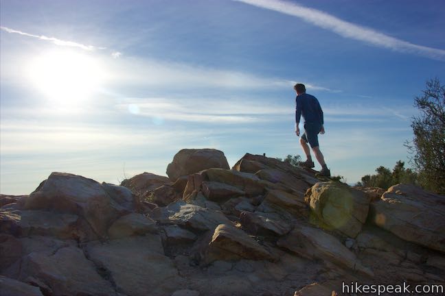
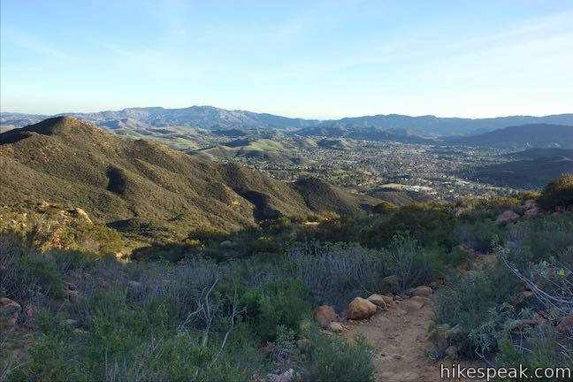
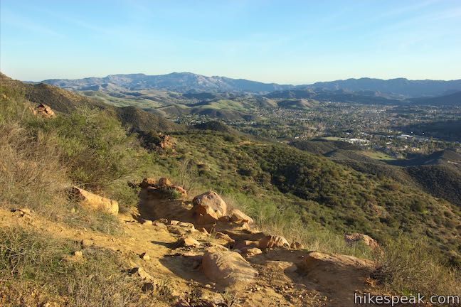
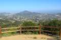
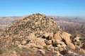
Proceed up the trail and find swell views north down the rippling ridges of the Simi Hills. The best spot to take in this view is from a rock outcropping off the right side of the trail just below the summit (a path next to these boulders drops to the west and is known as the “Secret Trail to Simi Peak”). Standing on the boulders gives you a great vantage. The blue water of Bard Lake glistens to the northwest. Simi Valley is cradled to the north, backed by the Santa Susana Mountains. The Topatopa Mountains lie beyond that, rising even higher. It is a grad perspective over a sparsely developed part of Southern California.

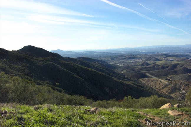
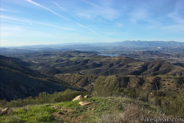
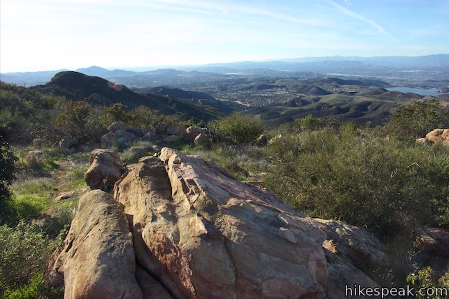
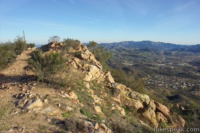
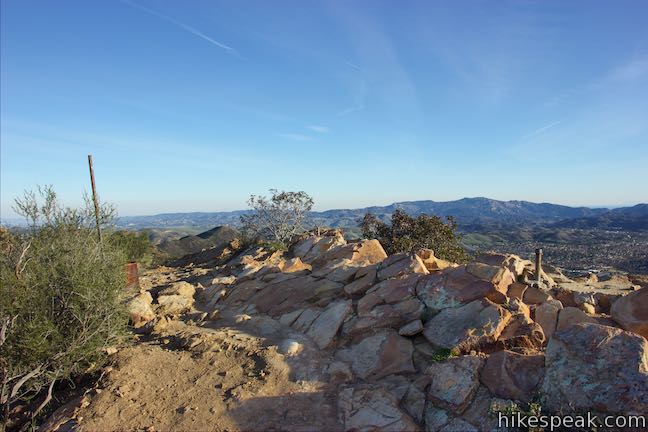
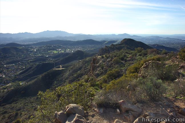
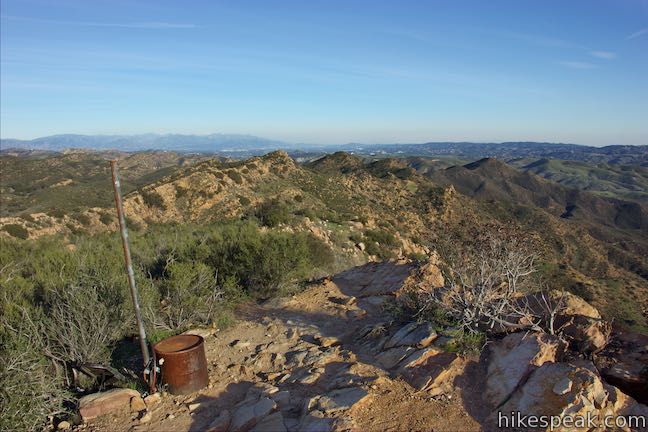
Push 0.05 miles farther up a steep stretch of Simi Peak Trail to arrive at the summit ridge. Bear left to reach the mountaintop, which is marked by a sandstone ledge, metal poles, and USGS survey markers. The summit of Simi Peak has views in every direction. The mountainside drops away steeply to the south allowing you to look down over the trail you took up. The Santa Monica Mountains stand tall on the far side of the valley, stretching to the east and west about as far as can be seen.
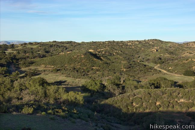
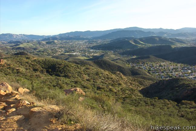
From the east side of the summit, gaze across China Flat and lower points in the Simi Hills. That tranquil world of loosely packed oaks and grass fields stands out from the rest of the range. Farther to the east, the San Fernando Valley is followed by the San Gabriel Mountains. There is a lot to see from Simi Peak!
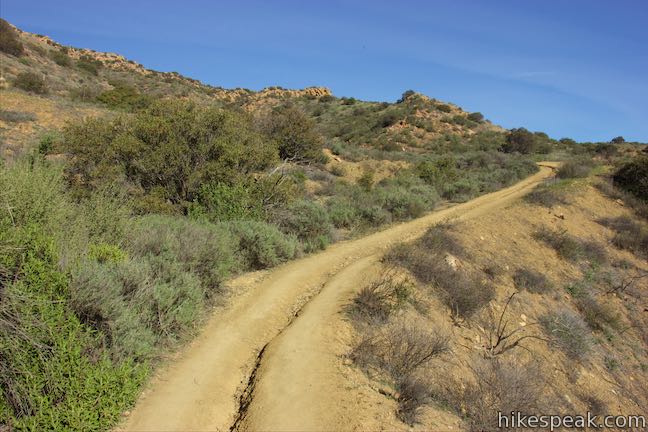
When you are ready to go, hike back down Simi Peak Trail. If you return the way you came, this hike is around 5.45 miles round trip. Add 3/4 of a mile to that distance by leaving China Flat on Suicide Trail – it’s not as ominous an idea as it sounds – taking a rugged course down ridges to the east before wrapping around the mountainside to the trail you took up. To add the loop to your return route, hike down Simi Peak Trail and make a pair of right turns by that S-shaped bend to retrace your steps south on China Flat Trail. Hike 0.35 miles up the trail through the area where it splits and merges. Just past the spot where the trail comes together, turn left at the junction onto Suicide Trail. You will now have hiked 4 miles.
Head east on Suicide Trail, crossing over a rise with a good perspective north over China Flat. Pass through a fence after 0.15 miles and turn down a steep rocky trail. Suicide Trail is probably most dangerous for mountain bikers and should be far-from-fatal for hikers. Stay to the left as another path joins Suicide Trail having left the trail up to China Flat near the gap in the ridge by the metal gates.
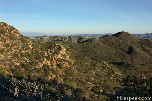
Wrap around the ridge as you descend to take in bigger and bigger views. Look east over nearby ridges in the Simi Hills and southeast toward the Santa Monica Mountains. This trail is rougher and rockier than the one you took up.
Pass through sagebrush and orange sandstone boulders. After curving to the right around the ridge, the trail hits a sharp bend to the left and begins heading south down the ridge. Go over a bump on the ridge half a mile from the top of the trail and continue to descend. Take a steep curve to the left and continue to plunge to an even tighter curve to the left. Each bend offers nice views over the canyon to the east and up the mountains above the trail. Suicide Trail drops all the way down the ridge to the south, but you’ll need to make your way west to get back to your starting point.
After one mile on Suicide Trail, turn right on Suicide Connector Trail. The junction is unmarked, so keep an eye out for it. The junction comes as Suicide Trail crosses a shallow saddle on the ridge. The trail ahead turns uphill over a bump before resuming its descent. Don’t go that way and instead turn left, leaving the ridge.
Suicide Connector Trail wraps around creases and ridges on the mountainside between Suicide Trail and the trail you took up to China Flat. The connector trail is a lot more easy-going than Suicide Trail, but does have its ups and downs.
At the end of the trail, you will wrap around the prominent sandstone knob that will look familiar from the hike up. After 0.8 miles on the Connector Trail, come to a split and turn right. The path straight ahead descends to the branch of China Flat Trail going to Lindero Canyon Road. Hike a short distance farther down the trail to the right to the end of the connector trail. You’ll have hiked 5.85 miles to this point with about 1/3 of a mile to go. Turn left down China Flat Trail (aka Dead Cow Road) to return to the trailhead to complete the hike.
These trails to China Flat and Simi Peak are open to dogs and bikes. No permit is needed for this hike and no fee is required to park at the trailhead, so get out and enjoy!
The basic directions for the partial loop hike are:
- Begin up China Flat Trail from the top of King James Court (0 miles)
- Stay to the left past a branch of the trail down to Lindero Canyon Trail (0.2 miles)
- Turn left to stay on China Flat Trail through a junction with a connector to Suicide Trail (0.35 miles)
- Stay to the left past a path crossing a ridge to Suicide Trail (1.35 miles)
- Stay to the left on China Flat Trail past the top of Suicide Trail (1.45 miles)
- Bear right (or left) at a trail split (1.47 miles)
- Walk through a trail merger (1.64 miles)
- Turn left toward Simi Peak Trail leaving a trail that connects to Palo Comado Canyon Trail and can be used for a large loop around China Flat (1.8 miles)
- Turn left on Simi Peak Trail (1.83 miles)
- Stay to the left past the top of China Flat Loop Trail (2.25 miles)
- Pass an outcropping on the right with sweeping views (2.65 miles)
- Reach the summit ridge and bear left toward the mountaintop (2.7 miles)
- Explore the summit and hike back down Simi Peak Trail
- Make two right turns to head back south on China Flat Trail (3.65 miles)
- After the trail split and merges, turn left onto Suicide Trail (4 miles)
- Turn right on Suicide Connector Trail (5 miles)
- Turn right, below a porous outcropping, to bypass a path down to the trailhead on Lindero Canyon Road (5.8 miles)
- Turn left on China Flat Trail to close the loop (5.85 miles)
- Return to the trailhead (6.2 miles)
Directions to the Trailhead
- Take the 101 Freeway to exit 39 in Westlake Village and head north on Lindero Canyon Road.
- Drive 3.7 miles and turn left up King James Court (which is 0.9 miles past Kanan Road).
- Go a tenth of a mile up to the trailhead at the end of the road and park.
- If parking on King James Court is not available, you can also park near the other trailhead on Lindero Canyon Road.
Trailhead Location
Trailhead address: 1400 King James Court, Oak Park, CA 91377
Trailhead coordinates: 34.19536, -118.77684 (34° 11′ 43.29″N 118° 46′ 36.62″W)
View Simi Hills in a larger map
Or view a regional map of surrounding Los Angeles trails and campgrounds.


Suicide Trail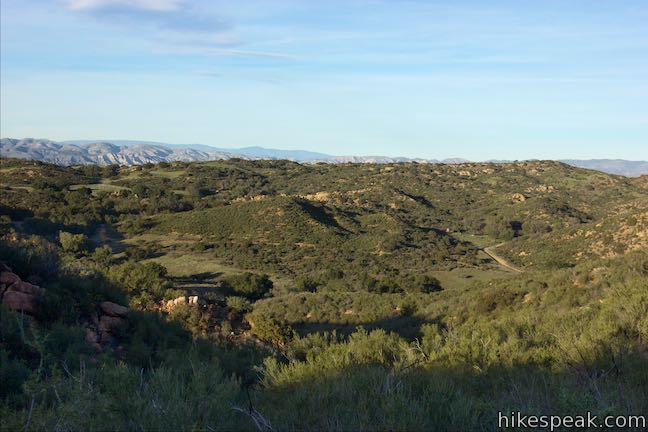

 | Cave of Munits and Castle Peak This action-packed 2.1-mile loop has two great attractions, crossing an impressive cave to climb to a rocky peak with views over the San Fernando Valley. |
 | Angel Vista via Rosewood Trail This 4-mile round trip hike is the most direct route to a panoramic viewpoint overlooking the Conejo Valley. |
 | Angel Vista via West Los Robles Trail This 7.6-mile round trip hike is a more gradual route to the overlook on the north side of the Santa Monica Mountains. |
 | Tarantula Hill This 1-mile round trip hike follows a paved trail to the top of a small, round hill in Thousand Oaks with views across the Conejo Valley into the surrounding mountains. |
 | Rocky Oaks Park This short and easy hike visits a pond and a scenic overlook in a small parcel of Santa Monica Mountains National Recreation Area. |
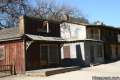 | Paramount Ranch This segment of the Santa Monica Mountains National Recreation Area includes Western Town, an outdoor set cast as frontier towns in TV and film since the 1950s. There are also several miles of hiking trails to explore. |
 | Rocky Peak This 4.75-mile hike rises to a 2,715-foot summit in Rocky Peak Park within a rugged mountain range between Chatsworth and Simi Valley. |
 | More trails in Los Angeles Explore other hiking destinations around Los Angeles. |
- China Flat Trail – Suicide Trail Loop on alltrails.com (opens in a new tab)
- China Flat Loop Trail on mtbproject.com (opens in a new tab)
- Dead Cow Trail on mtbproject.com (opens in a new tab)
- Simi Peak on peakery.com (opens in a new tab)
- China Flat with connecting trails on venturacountytrails.org (opens in a new tab)
- China Flat on wikipedia.org (opens in a new tab)
- Hiking Simi Peak and China Flat Trail on hikeamazing.com (opens in a new tab)
Common Questions about China Flat and Simi Peak in the Simi Hills
- Is the trail open?
- Yes. You should expect to find that China Flat & Simi Peak is open. There are no recent reports of trail closures. If you discover that the trail is closed, please help your fellow hikers by reporting a closure.
- Is this trail free to access?
- Yes, China Flat & Simi Peak is free to access. No entrance fee, pass, or permit is required. If you discover that access rules have changed, please provide feedback on your experience.
- How much time does this hike take?
- It takes approximately 3 hours 15 minutes to hike China Flat & Simi Peak. Individual hiking times vary. Add extra time for breaks and taking in the views.
- How long is this hike?
- The hike to China Flat & Simi Peak is a 6.2 mile partial loop with 1090 feet of elevation change.
- Are dogs allowed on this trail?
- Yes, dogs are allowed on China Flat & Simi Peak. The trail is open to hikers, dogs, bikes.
- Does this trail go to a summit?
- Yes, China Flat & Simi Peak reaches a summit with panoramic views.
- Where is the trailhead located?
- The trailhead for China Flat & Simi Peak is located in Oak Park, CA.
Trailhead Address:
1400 King James Court
Oak Park, CA 91377
Trailhead Coordinates:
34.19536, -118.77684 - What are the driving directions to the start of the hike?
To get to the trailhead: Take the 101 Freeway to exit 39 in Westlake Village and head north on Lindero Canyon Road. Drive 3.7 miles and turn left up King James Court (which is 0.9 miles past Kanan Road). Go a tenth of a mile up to the trailhead at the end of the road and park. If parking on King James Court is not available, you can also park near the other trailhead on Lindero Canyon Road.
View custom Google Maps directions from your current location.
- Are there other trails near China Flat & Simi Peak?
- Yes, you can find other nearby hikes using the Hikespeak Hike Finder Map.

This is a very enjoyable hike, especially after getting through the first 1.4 miles, which is a fairly tough uphill grind almost the entire way. Footing is iffy in a few spots, but nothing serious. The views from Simi Peak are terrific (if only there had been a bit less haze). The detailed directions above were a bit confusing. The distances didn’t match my GPS reading at point 7, and instead of a left turn onto Simi Peak Trail, it really is straight through, with the loop trail turning right. You’ll know when you get there. It’s a rise to a flat area, with the narrower trail straight ahead starting a short descent, while the trail to the right stays broader and has no elevation change.
If you want to go the most direct route to Simi Peak, just remember to bear left at every split or junction. If you want to take other routes, you’ll need to plan a little more.
Also, there is very little shade, even in the oak grove (unless you stop to sit and lean against one of the trees), so hat, sunscreen and cooler days are all pluses. As for the oaks, for some reason I couldn’t get the Doobie Brothers “China Grove” out of my head for nearly the entire trip.