Valencia Peak
in Montaña de Oro State Park
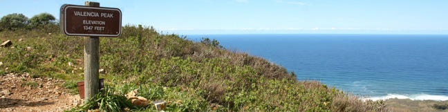
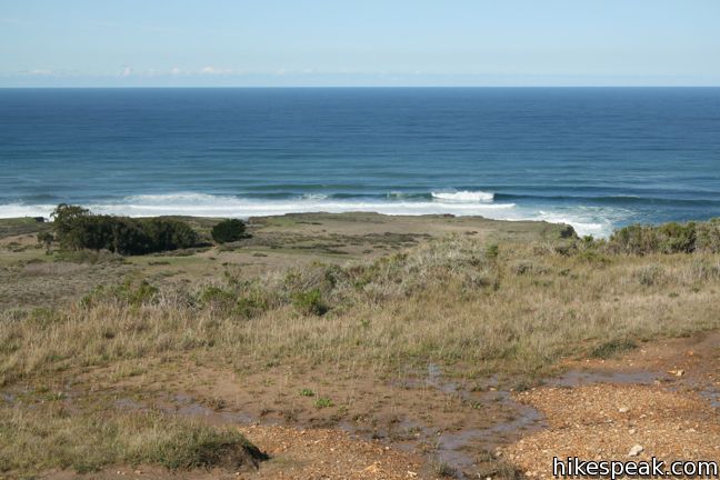
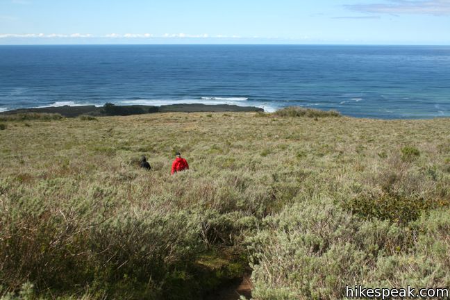
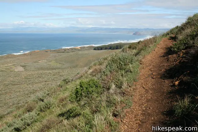
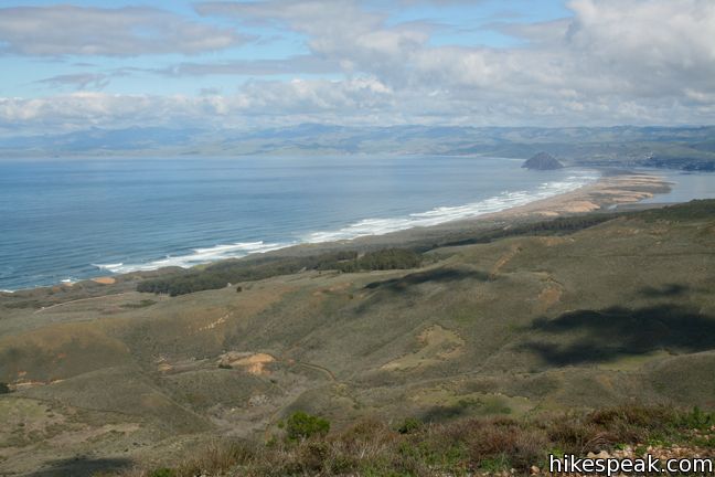
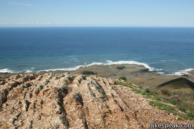
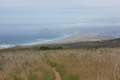
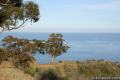
At 1,347 feet, Valencia Peak is one of the highest summit in Montaña de Oro State Park and may provide the best panorama of the park’s stunning shoreline and inviting inland peaks. The views are epic and the hike is 4.5-miles round trip with 1,275 feet of elevation. An older version of Valencia Peak Trail was 0.4 miles shorter each way, and the new route uses more switchbacks to ease the ascent. Valencia Peak Trail crosses a couple level steps in the terrain that offer inspiring ocean views on the scenic climb to a summit with 360-degree views.
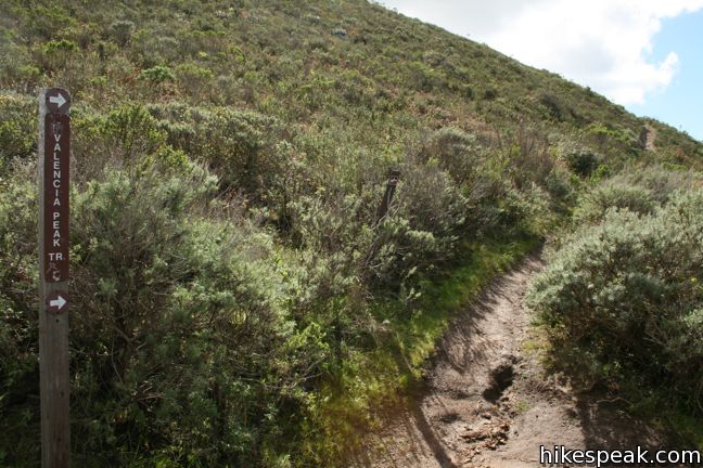
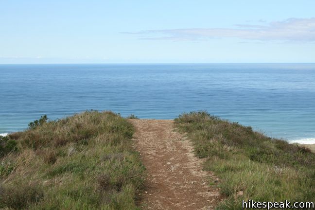
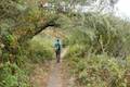
Begin from the parking area just south of Spooner’s Cove and the park visitor center. Hike inland on Valencia Peak Trail toward the pyramid-shaped Valencia Peak. The level Bluff Trail also begins from this parking lot, heading south down the coast from the opposite side of the road. The single-track Valencia Peak Trail cuts through coastal sage, passing a junction with Rattlesnake Flats Trail after just one-tenth of a mile.
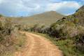
After the junction, Valencia Peak Trail curves to the left (passing an older route of Valencia Peak Trail). You’ll head in the wrong direction for a stretch as the trail angles north to views over Spooner’s Cove. Stay to the right past a spur to some holding tanks, 0.2 miles from the start. The trail then makes a broad curve to the right, allowing you to look down over Islay Creek Campground in the canyon below.
Around 1/3 of a mile from the start, stay to the right past a trail that descends to the right to connect to Oats Peak Trail. This connector make it possible to form some different loops and reach Valencia Peak Trail from the campground.
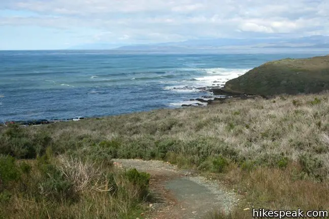
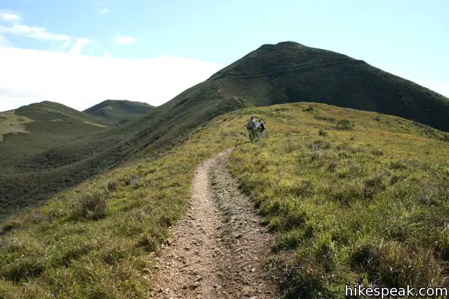
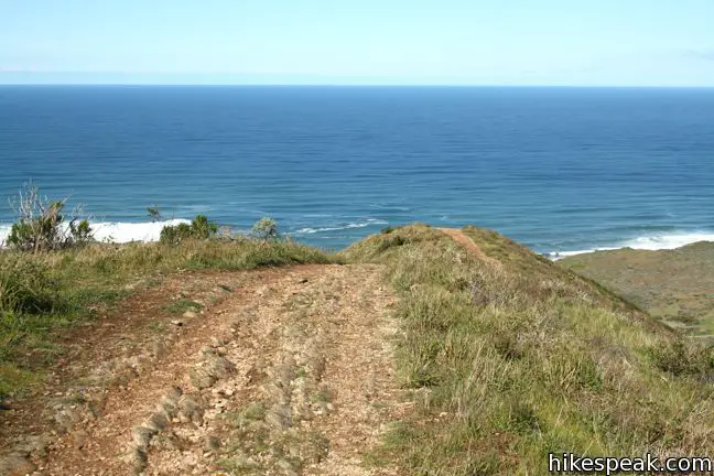
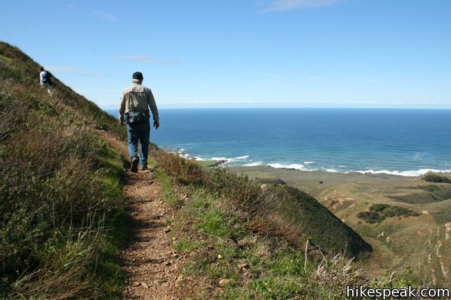
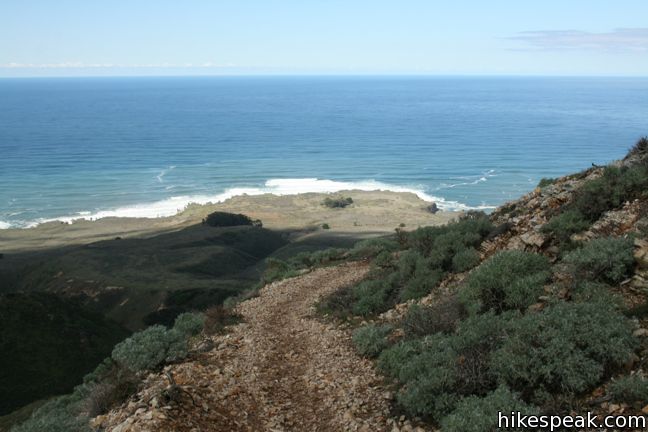
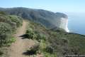
Proceed up Valencia Peak Trail to the base of a series of switchbacks, 0.45 miles from the start. Hike through a handful of turns as the trail takes an easy route up steep terrain, expanding views over the coast. After a quarter mile of switchbacks, cross a draw in the terrain and rise to a landing that provides great views over the ocean to the west and the canyon to the northeast.
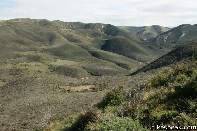
Get an eyeful looking up Islay Creek Canyon as the trail continues. You can also look down on Oats Peak Trail on its way up to a summit inland of Valencia Peak. Bear right past a near trail junction and then come to an actual junction with a trail kiosk. Bebee Trail descends to the left, connecting to Oats Peak Trail. Bear right to proceed on Valencia Peak Trail.
A short distance ahead, and 1.15 miles from the start, come to a junction with Badger Trail, which parts to the right. On the left, find a picnic table that offers a good spot to rest before the second section of the ascent. Continue straight up Valencia Peak Trail to hike another 1.1 miles to the summit, gaining 820 feet. Another picnic table can be found at the summit.
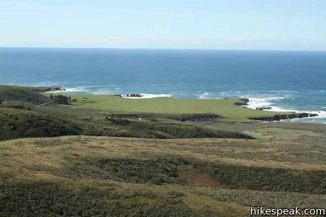
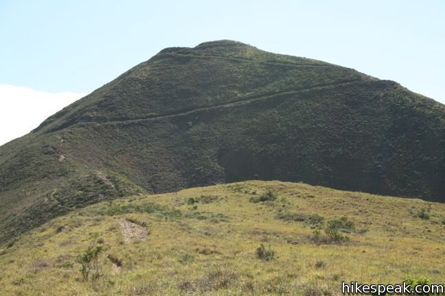
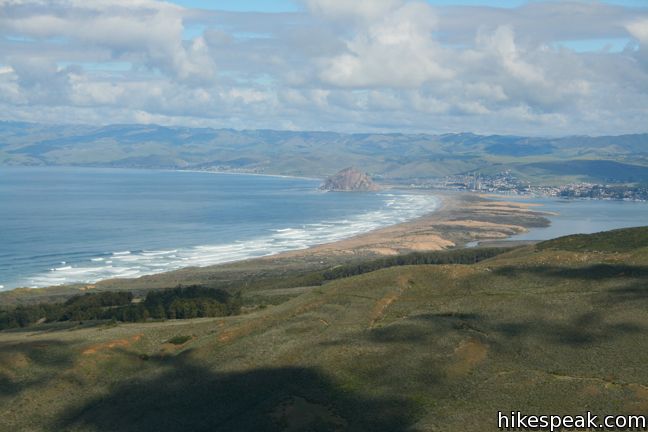
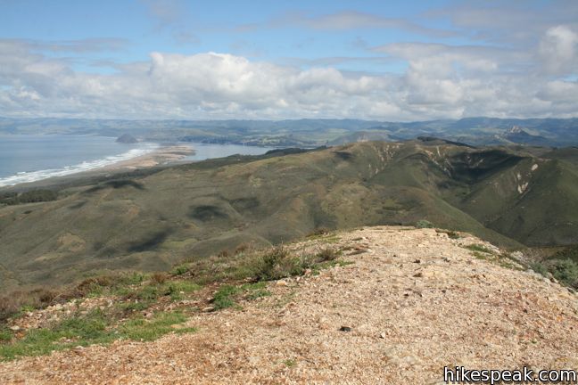
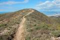
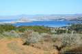
A quarter mile of switchbacks take you up to the ridge that leads to the peak. The emblematic Morro Rock becomes visible to the north along with Cerro Cabrillo, while another Central Coast landmark Point Buchon can be seen to the south.
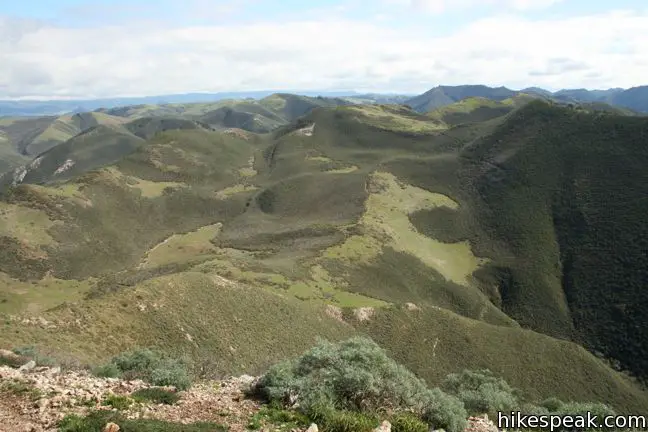
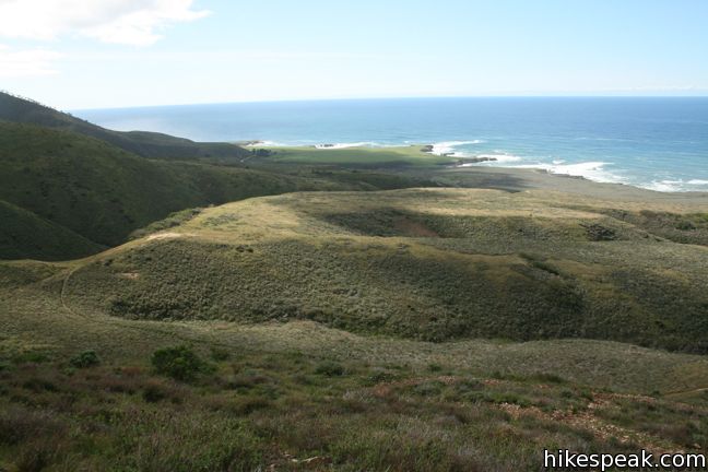
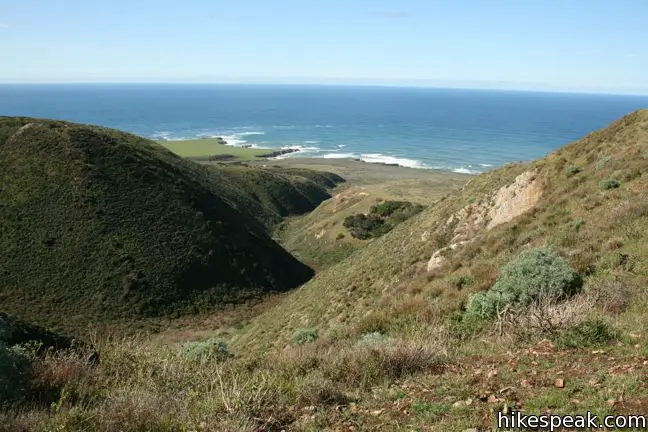
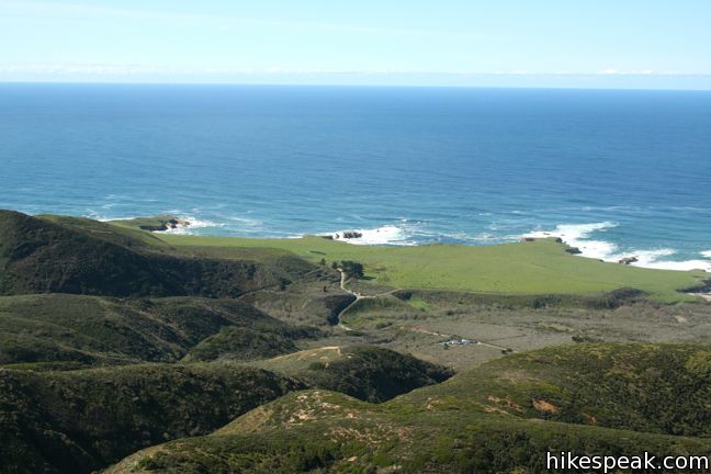
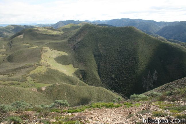
Enjoy an easing of the ascent as the trail goes up a ridgeline straddling two sylvan canyons. Islay Creek Trail is visible in the canyon to the north, followed by the 1,076-foot summit of Hazard Peak. A saddle at the end of the ridge offers a beautiful view down the canyon to the southwest toward the blue waters below.
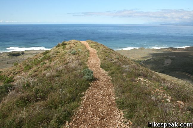
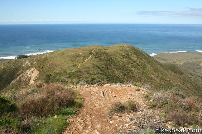
Stay to the right through a final junction, a third of a mile from the top. This connection trail also heads down to Oats Peak Trail for those continuing deeper into Montaña de Oro. Push up the mountainside switchbacks to a sign reading, “Valencia Peak – Elevation 1,347 Feet.” You’ve made it! Take either of two routes that ascend a short distance above the sign to the round open summit of Valencia Peak.
The ocean views you’ve enjoyed on the way up are augmented by new views over the interior of Montaña de Oro. To the east is Oats Peak, the second highest point in the park, and a full 26 feet taller than Valencia Peak (but with less ocean views).
Valencia Peak sits at the center of a beautiful stretch of the California Coast, and the 360-degree summit views make it one of the essential hikes in the San Luis Obispo area. Return down Valencia Peak Trail, which is perhaps more picturesque on the descent, and return to the trailhead for a 4.5-mile round trip trek.
If you are looking for a cool down, the Bluff Trail beginning on the other side of the parking lot is an easy level trail with great ocean views. Dogs are not allowed on any trails in Montaña de Oro State Park. Don’t forget sunscreen. The hike has little shade. No fee or permit is required to hike Valencia Peak Trail, so get out and enjoy.
Directions to the Trailhead
- From San Luis Obispo, exit Highway 101 at Los Osos Valley Road and drive a total of fifteen miles northwest toward Montaña de Oro State Park.
- After 11.2 miles, Los Osos Valley Road becomes Pecho Valley Road and turns sharply to the south.
- Continue the final 3.8 miles, entering Montaña de Oro State Park and passing through a eucalyptus grove before reaching the parking area for Valencia Peak on the left side of the road just past the visitor center.
Trailhead Location
Trailhead address: Pecho Valley Road, Montaña de Oro State Park, Los Osos, CA 93402
Trailhead coordinates: 35.272858, -120.888755 (35° 16′ 22.28″N 120° 53′ 19.51″W)
(Valencia Peak Trail is in purple)
View Montaña de Oro State Park in a larger map
Or view a regional map of surrounding Central Coast trails and campgrounds.


 | Bluff Trail This hike of around three miles tours tide pools, beaches, and impressive cliffs along the picturesque coast of Montaña de Oro State Park. |
 | Rattlesnake Flats Trail – Badger Trail – Bluff Trail Loop This 1 2/3-mile hike offers a twist on the Bluff Trail, going along and just above the coast of Montaña de Oro State Park. |
 | Oats Peak Trail This scenic 10.8-mile hike ventures into Montaña de Oro State Park to a panoramic summit. |
 | Reservoir Flats Trail This 2-mile loop delivers fine ocean and canyon views as it explores the bottom of Islay Creek Canyon in Montaña de Oro State Park. |
 | Islay Creek Trail This easy 6-mile round trip hike follows a wide trail up a coastal canyon flanked by thousand-foot peaks, passing a small waterfall to reach an abandoned barn. |
 | Hazard Peak Trail This 6-mile round trip hike ascends coastal ridges to a 1,076-foot summit with panoramic views that include a dynamic perspective of Morro Bay. |
 | Hazard Peak - Islay Creek Loop This 9.2 mile loop continues beyond Hazard Peak deeper into Montana de Oro before circling back on Islay Creek Trail. |
 | South Dune Trail – Bloody Nose Trail – Hiedra Trail – Hazard Peak Trail Loop This 2 2/3-mile loop combines four trails through dunes and eucalyptus trees to lovely coastal views. |
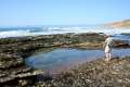 | Dune Trail to Hazard Canyon Reef This one-mile hike in Montaña de Oro State Park descends an oceanfront ravine to a rocky shoreline graced with engaging tide pools. |
 | Coon Creek Trail This 5-mile out and back hike ventures up a coastal canyon at the south end of Montaña de Oro State Park. |
 | Point Buchon Trail This 1 1/3 to 6.8-mile hike explores the beautiful coastline south of Montaña de Oro State Park. |
 | Morro Dunes Ecological Reserve This 2.6-mile loop serves up panoramic views over Morro Bay as it ascends 800 feet from Los Osos to Montaña de Oro State Park. |
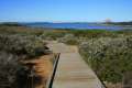 | Elfin Forest Natural Reserve This easy 1-mile loop on a boardwalk explores a pygmy forest on the edge of Morro Bay. |
 | More hikes in San Luis Obispo Explore other trails around San Luis Obispo including Morro Bay State Park and the Morros. |
 | Gaviota Peak This 6.5-mile loop mounts a 2,458-foot summit two miles from the Pacific and then descends Trespass Trail to explore the wilds of the Santa Ynez Mountains west of Santa Barbara. |
 | Hermit Gulch Trail Trans-Catalina Trail Loop This 11.75-mile hike circles the ridges surrounding Avalon and offers offers amazing views of the interiors of Catalina Island and the ocean beyond. |
 | Mugu Peak This 6.5-mile hike ascends from the bottom of La Jolla Canyon to the top of a 1,266-foot peak, providing exceptional ocean and canyon views. |
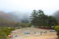 | Islay Creek Campground This 50-site campground is located at the heart of Montaña de Oro State Park in Islay Creek Canyon, and is a great base camp for treks in the park. |
- Bluff Trail on californiacoastaltrail.com (opens in a new tab)
- Valencia Peak and Oats Peak on Bob Burd's Trip Reports (opens in a new tab)
- Valencia Peak on 100peaks.com (opens in a new tab)
- Montaña de Oro State Park on summitpost.org (opens in a new tab)
- Montaña de Oro State Park on wikipedia.org (opens in a new tab)
- The official website for Montaña de Oro State Park (opens in a new tab)
Common Questions about Valencia Peak in Montaña de Oro State Park
- Is the trail open?
- Yes. You should expect to find that Valencia Peak Trail is open. There are no recent reports of trail closures. If you discover that the trail is closed, please help your fellow hikers by reporting a closure.
- Is this trail free to access?
- Yes, Valencia Peak Trail is free to access. No entrance fee, pass, or permit is required. If you discover that access rules have changed, please provide feedback on your experience.
- How much time does this hike take?
- It takes approximately 2 hours 45 minutes to hike Valencia Peak Trail. Individual hiking times vary. Add extra time for breaks and taking in the views.
- How long is this hike?
- The hike to Valencia Peak Trail is a 4.5 mile out and back with 1275 feet of elevation change.
- Are dogs allowed on this trail?
- No, dogs are likely not allowed on Valencia Peak Trail. The trail is primarily open to hikers.
- Are there ocean views on this hike?
- Yes, Valencia Peak Trail offers views of the ocean.
- Does this trail go to a summit?
- Yes, Valencia Peak Trail reaches a summit with panoramic views.
- Where is the trailhead located?
- The trailhead for Valencia Peak Trail is located in Los Osos, CA.
Trailhead Address:
Pecho Valley Road
Los Osos, CA 93402
Trailhead Coordinates:
35.272858, -120.888755 - What are the driving directions to the start of the hike?
To get to the trailhead: From San Luis Obispo, exit Highway 101 at Los Osos Valley Road and drive a total of fifteen miles northwest toward Montaña de Oro State Park. After 11.2 miles, Los Osos Valley Road becomes Pecho Valley Road and turns sharply to the south. Continue the final 3.8 miles, entering Montaña de Oro State Park and passing through a eucalyptus grove before reaching the parking area for Valencia Peak on the left side of the road just past the visitor center.
View custom Google Maps directions from your current location.
- Are there other trails near Valencia Peak Trail?
- Yes, you can find other nearby hikes using the Hikespeak Hike Finder Map.

11 Comments on Valencia Peak in Montaña de Oro State Park
What hikers are saying:
✨ Generated summary of user commentsThis trail offers a rewarding experience through diverse plant life and stunning aerial views that remain beautiful even in heavy fog. The path becomes rocky and strenuous near the summit, where loose shale and gravel create a treacherous descent for those without sturdy footwear. Jane recommends watching for mountain bikers on the lower switchbacks, and visitors should prepare for full sun exposure by carrying water and dressing in layers.
“the hike is still gorgeous, especially the variety of plant life and the terrain.” Jump to comment ↓
Just finished this hike today. The views are truly beautiful, and seem to be some of the best in the park (if you want the aerial experience). Going up is fairly strenuous for the non-athletic hiker, and lots of broken shale and gravel can make it difficult to get a strong foothold at times. I saw some people running back down, but I almost lost it in a couple places.
There are no trees for shade, so bring glasses and dress in layers: broke a sweat climbing up, got windy and chilly climbing down. Don’t forget water and a snack if you plan on hanging out on the trail for awhile. A pretty straightforward there and back – I’d give it a 4/5.
I hiked this on May 27, and the route between Rattlesnake Flats Trail junction and Badger Trail junction has changed significantly. The route shown is no longer usable (blocked off with fences & debris), and goes more towards the north (and also has lots more curves/switchbacks).
I have run this trail many times. It is certainly challenging, especially the trip up to the summit. Downhill is treacherous, you really have to be careful. Definitely not for the beginning runner, but definitely doable by the average hiker, just take your time and carry water, sunscreen, hat etc. Owen is right, the trail alignment has been changed over the past year.
hi i plan on doing a long run (22-24miles) at MDO what trails do you recommend
[…] (gorgeous winery, great wine — thanks for the suggestions, Karl!), we decided to hike Valencia Peak at Montaña de Oro State […]
Ran the Valencia Peak trail this morning. Ended up being 4.58 miles because the trail, as marked, went to the left and added quite a bit of distances (you can see the north/left loop in the aerial picture above). Otherwise, great run or hike. Beautiful views. While not that challenging, I would dissuade anyone who is out of shape or with inappropriate footwear from attempting this. For trail runners, this is a very nice short run with great elevation and good footing overall although sections of the downhill just below the summit are definitely sketchy.
Just hiked this yesterday. The views were absolutely fantastic. Especially, if you continue to the very tip top. I’d give it a 5/5!
Check out my personal blog about my experience hiking Valencia Peak at https://adulthoodinslo.wordpress.com/2016/09/08/valencia-peak-in-montana-de-oro-state-park/ !
Hiked up to the peak this morning. It was foggy until our descent, but the hike is still gorgeous, especially the variety of plant life and the terrain. The distance on this page is a little confusing based on where you begin your hike. From the campground to the top of the peak and back was around 7.1 miles in total. The switchbacks at the bottom are easy–watch out for the mountain bikers–but the actual peak gets extremely rocky though the trail is well-maintained. Excellent hike!
Yes, I’ve hiked up and down the entire trail in the fog. It is so much nicer when the views appear. Based on two clues, I believe you may have left the campground on Oats Peak Trail/Reservoir Flats Trail (it allows bikes whereas Valencia Peak Trail does not). Its possible to connect Oats Peak Trail and Valencia Peak Trail partway up the mountains, which is how you might get the longer distance than you did. Glad you enjoyed the hike!
[…] coast but is arguably one of the best viewpoints along the central coast. According to Hikes Peak, Valencia Peak is one of the highest summit in Montaña de Oro State Park at over 1,300 feet. This summit ranks as one of the more difficult hikes in the area in terms of distance and vertical […]