Morro Dunes Ecological Reserve
in San Luis Obispo
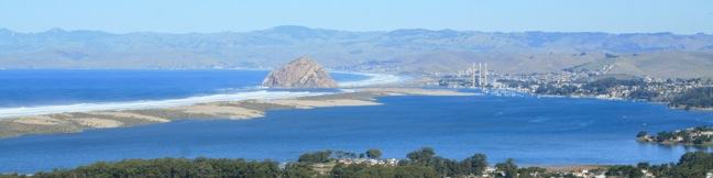
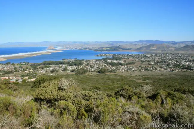
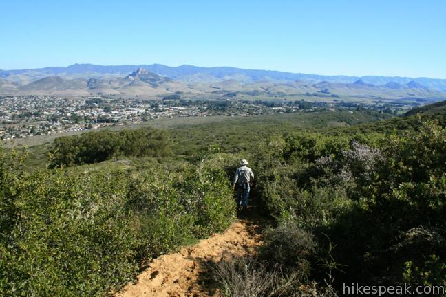
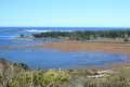
The community of Los Osos on the San Luis Obispo County coast is buffered on the south side by an ecological reserve. A 2.6-mile hike through Morro Dunes Ecological Reserve (also called Bayview Ecological Reserve) ascends 800 feet, briefly entering Montaña de Oro State Park at the trail’s highest point. The loop travels over ancient sand dunes that became grown over by grasses and brush. Nearly every step of the hike provides beautiful northward views across Los Osos toward Morro Bay.
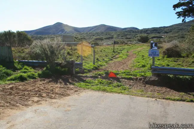
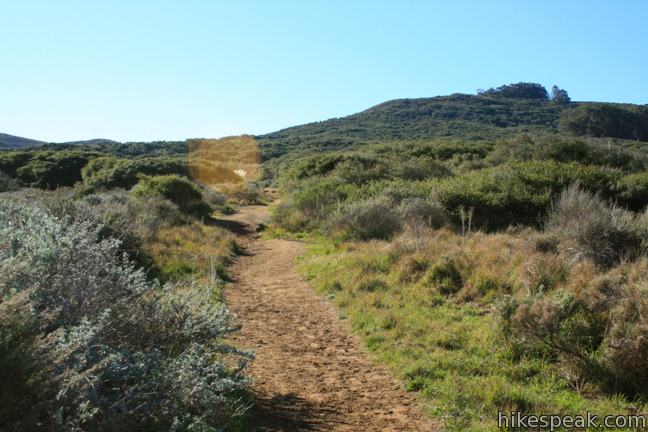
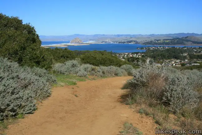
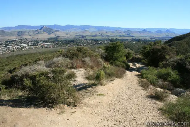
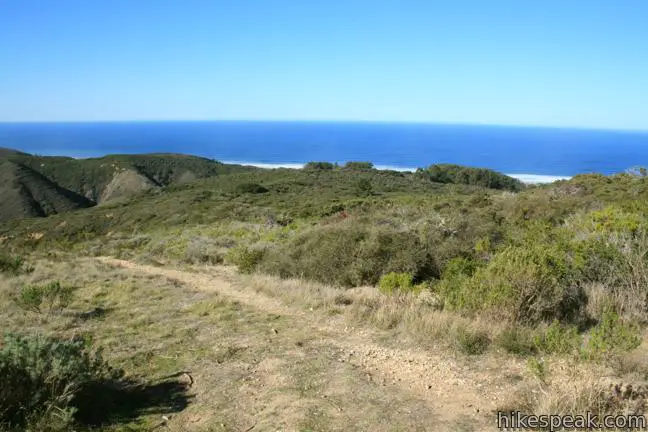
Begin hiking south from a trailhead at the end of Broderson Avenue in Los Osos. The trail (sometimes called Broderson Peak Lookout Trail) heads gradually uphill through grasses toward steeper sage-covered slopes.
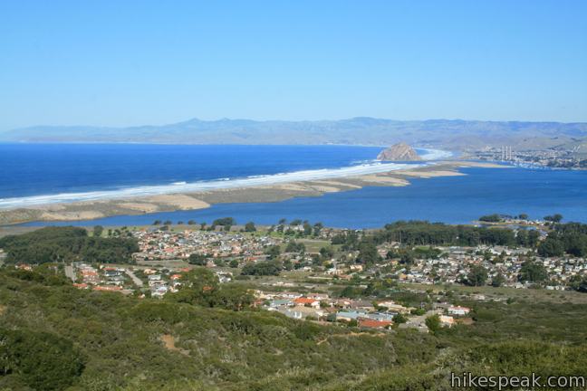
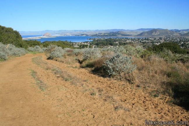
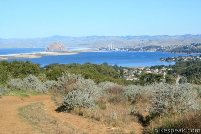
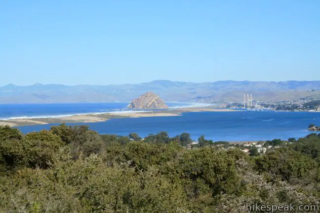
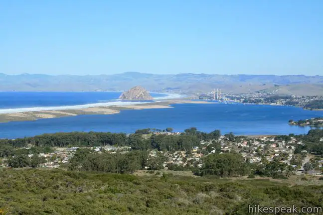
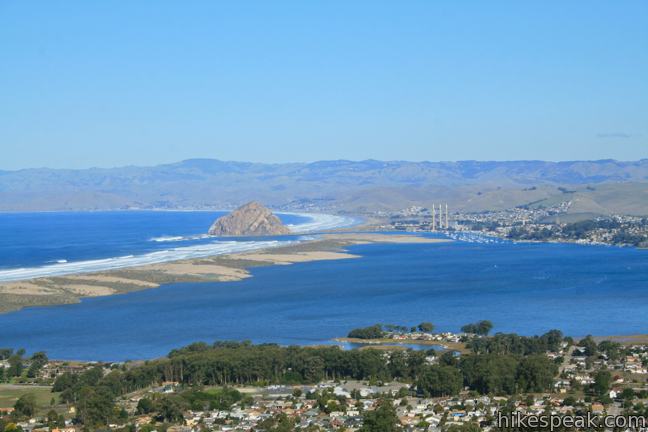
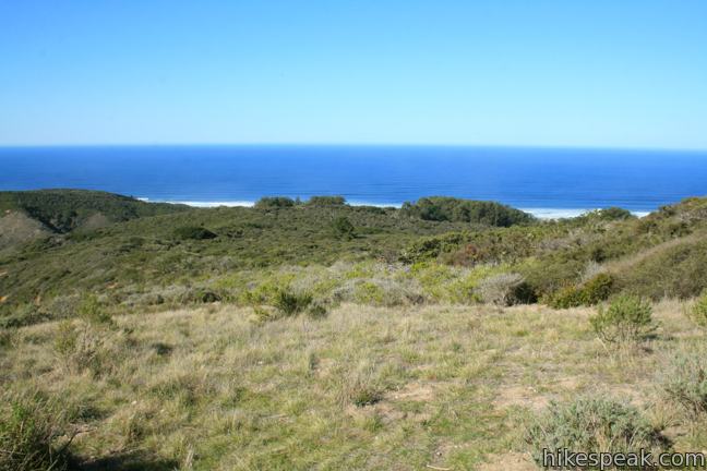
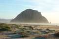
Right from the very start, you get impressive over-the-shoulder views toward Morro Bay State Park. The far side of the blue-water bay is backed by the pyramid-shaped Morro Rock, an iconic feature on the Central Coast. The bay is separated from the pacific by a long wall of golden sand.

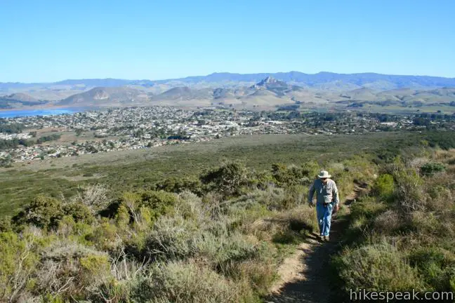
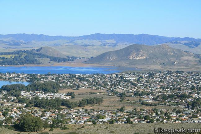
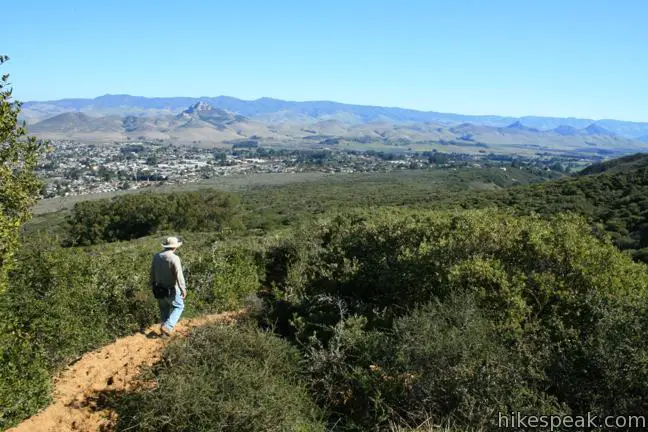
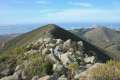
After less than half a mile, the trail bends to the left providing a view to the north and east toward Cerro Cabrillo and Hollister Peak, members of the Morros, a string of volcanic plugs spanning across San Luis Obispo County.
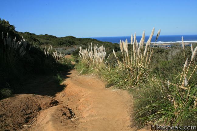
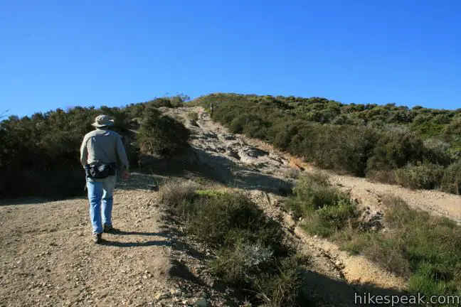
Shortly after bending left, the trail curves back to the right to continue a southward climb. The trail enters a sandy trench, a unique hiking alley that provides some of the loop’s only shade. Stay left at a split in the eroded ravine, following the most worn path. This is the start of the loop portion of the lollipop-shaped hike. When the trail comes to what looks like a three-way junction, the easiest option is to turn left and curl up a trail to the ridge straight ahead. For a tougher effort, continue up the ravine, tackling a short but very steep slope up the same ridge.
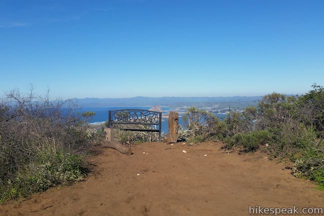
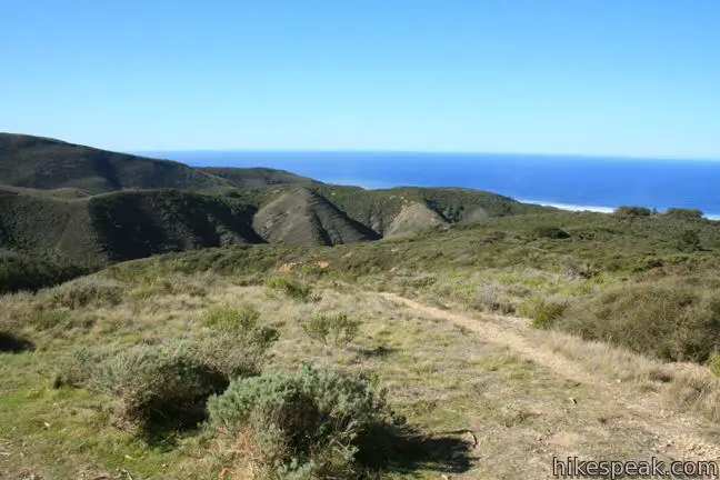
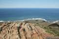
Reach the ridge by either route and peer over a verdant canyon to the southeast. The trail climbs southwest, entering Montaña de Oro State Park. A eucalyptus grove appears at the top of the ridge. It is an arduous ascent to the high point of the loop, but the views justify the effort. Just past the grove, the trail comes to a junction at the top of the loop.
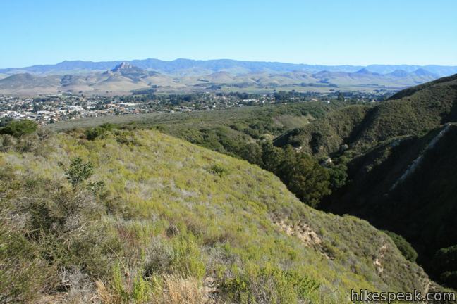
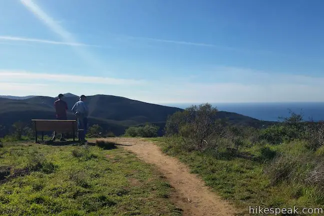
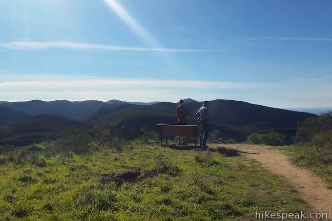
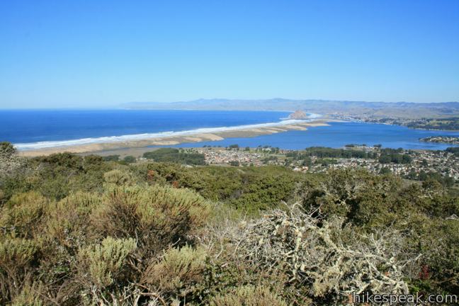
On the right, there is a metal bench just off the trail where you can catch your breath and appreciate a northward vantage over Los Osos and Morro Bay. The loop continues to the right, but before you head down that trail, turn left and walk a few hundred feet to a panoramic viewpoint.
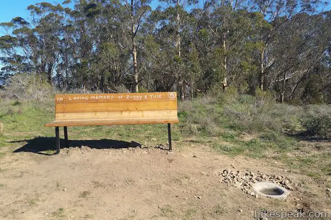
Look south across Hazard Canyon toward the higher mountains of Montaña de Oro State Park, including Hazard Peak and Valencia Peak. To the west, the blue waters of the Pacific are spread out below. There is a wooden bench here, helping you to enjoy the scenic perch before backtracking to the junction to continue around the loop.
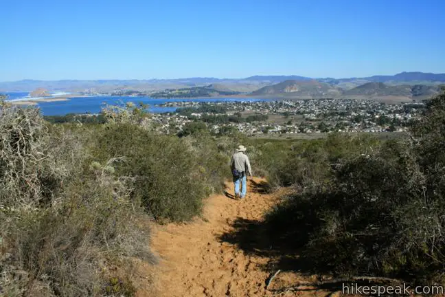
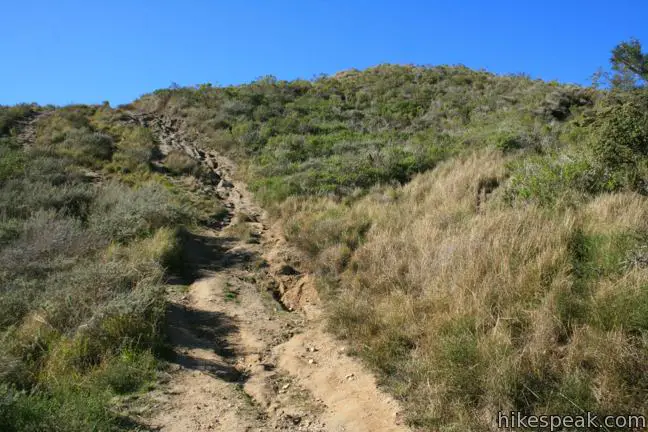
Make a right turn after a few hundred feet to avoid taking Rim Trail down to Pecho Valley Road. Over the next 0.4 miles, the trail descends a steep sandy slope. The loose sand makes hiking this stretch feel like downhill skiing. The reserve’s past role as a sand dune does not seem so distant. The loop would definitely be more arduous in the opposite direction. At the next trail split, stay to the right, following the most traveled trail. Head straight through another junction after a tenth of a mile and hike a final tenth of a mile to meet the trail you hiked in on. Turn left and hike 0.7 miles back to the trailhead. Dogs are welcome. No fee or permit is required to hike the loop in Morro Dunes Ecological Reserve, so get out and enjoy.
Directions to the Trailhead
- From Highway 101 south of San Luis Obispo, take exit 200 onto Los Osos Valley Road and drive 10.7 miles west to Broderson Avenue (one mile past South Bay Boulevard).
- Turn left on Broderson Ave. and drive 1/3 of a mile to the trailhead parking at the end of the road.
Trailhead Location
Trailhead address: Broderson Avenue, Los Osos, CA 93402
Trailhead coordinates: 35.308454, -120.843157 (35° 18′ 30.43″N 120° 50′ 35.36″W)
View Morro Dunes Ecological Reserve & Montaña de Oro State Park in a larger map
Or view a regional map of surrounding Central Coast trails and campgrounds.


 | Elfin Forest Natural Reserve This easy 1-mile loop on a boardwalk explores a pygmy forest on the edge of Morro Bay. |
 | Los Osos Oaks State Natural Reserve This short hikes explores a pygmy forest of coast live oaks, providing a shady level stroll of up to 1.5 miles. |
 | Dune Trail to Hazard Canyon Reef This one-mile hike in Montaña de Oro State Park descends an oceanfront ravine to a rocky shoreline graced with engaging tide pools. |
 | South Dune Trail – Bloody Nose Trail – Hiedra Trail – Hazard Peak Trail Loop This 2 2/3-mile loop combines four trails through dunes and eucalyptus trees to lovely coastal views. |
 | Hazard Peak This 6-mile out and back hike ascends coastal ridges to a 1,076-foot summit with panoramic views that include a dynamic perspective of Morro Bay. |
 | Valencia Peak This 4.5-mile hike summits a 1,347-foot peak with stunning views over Montaña de Oro. |
 | Bluff Trail This hike of around three miles tours tide pools, beaches, and impressive cliffs along the picturesque coast of Montaña de Oro State Park. |
 | Coon Creek Trail This 5-mile out and back hike ventures up a coastal canyon at the south end of Montaña de Oro State Park. |
 | Point Buchon Trail This 1 1/3 to 6.8-mile hike explores the beautiful coastline south of Montaña de Oro State Park. |
 | Cerro Cabrillo This tough 2.5-mile hike summits the highest mountain in Morro Bay State Park, a 911-foot member of the Nine Sisters. |
 | Turtle Rock This easy 2.1-mile hike reaches a short rise between Black Hill and Cerro Cabrillo in Morro Bay State Park. |
 | Portola Point This 2-mile loop explores a short hill just east of Morro Estuary in Morro Bay State Park. |
 | Black Hill This short 0.6-mile out and back hike ascends 175 feet to the summit of Black Hill, which presents 360-degree views over Morro Bay. |
 | Morro Rock via Morro Strand Trail This level one to 3.5-mile round trip hike starts from Cloisters Park and crosses Morro Strand State Beach to reach Morro Rock. |
 | More hikes in San Luis Obispo Explore other trails around San Luis Obispo including Montaña de Oro State Park and the Morros. |
 | Islay Creek Campground This 50-site campground is located at the heart of Montaña de Oro State Park in Islay Creek Canyon, and is a great base camp for treks in the park. |
Common Questions about Morro Dunes Ecological Reserve in San Luis Obispo
- Is the trail open?
- Yes. You should expect to find that Morro Dunes Ecological Reserve is open. There are no recent reports of trail closures. If you discover that the trail is closed, please help your fellow hikers by reporting a closure.
- Is this trail free to access?
- Yes, Morro Dunes Ecological Reserve is free to access. No entrance fee, pass, or permit is required. If you discover that access rules have changed, please provide feedback on your experience.
- How much time does this hike take?
- It takes approximately 1 hour 30 minutes to hike Morro Dunes Ecological Reserve. Individual hiking times vary. Add extra time for breaks and taking in the views.
- How long is this hike?
- The hike to Morro Dunes Ecological Reserve is a 2.6 mile loop with 800 feet of elevation change.
- Are dogs allowed on this trail?
- Yes, dogs are allowed on Morro Dunes Ecological Reserve. The trail is open to hikers, dogs.
- Are there ocean views on this hike?
- Yes, Morro Dunes Ecological Reserve offers views of the ocean.
- Where is the trailhead located?
- The trailhead for Morro Dunes Ecological Reserve is located in Los Osos, CA.
Trailhead Address:
Broderson Avenue
Los Osos, CA 93402
Trailhead Coordinates:
35.308454, -120.843157 - What are the driving directions to the start of the hike?
To get to the trailhead: From Highway 101 south of San Luis Obispo, take exit 200 onto Los Osos Valley Road and drive 10.7 miles west to Broderson Avenue (one mile past South Bay Boulevard). Turn left on Broderson Ave. and drive 1/3 of a mile to the trailhead parking at the end of the road.
View custom Google Maps directions from your current location.
- Are there other trails near Morro Dunes Ecological Reserve?
- Yes, you can find other nearby hikes using the Hikespeak Hike Finder Map.

6 Comments on Morro Dunes Ecological Reserve in San Luis Obispo
What hikers are saying:
✨ Generated summary of user commentsHikers find the ascent marvelous and the views rewarding, though the path down can be confusing. This unofficial trail crosses private property and suffers from significant erosion on the sand dunes. Becky advises visitors to park legally in front of homes and keep noise levels low to respect the local residents. To protect the bay, hikers should pack out all dog waste and use the provided trash cans.
“Going up was marvelous.” Jump to comment ↓
Going up was marvelous. Down I lost my way. But what a view.
Hi, I am so lucky to have lived at this trailhead for 13 years. Please be respectful of people who live here. The only parking is in front of people’s homes, please park legally. When you stomp the sand off your hiking shoes you are just outside my neighbor’s bedroom window and she likes to sleep past 5:30 in the morning. Please don’t yell across the street to your friends, please don’t stand in front of people’s homes and talk loudly for 20 minutes, or talk loudly into your cell-phones facing our homes. Please don’t smash into our cars and not leave a note or run over the neighbors sprinklers or park on their ice plant or turn on their hose and leave it on. Please don’t let your dogs loose from your cars and then yell at them to come back – they won’t. Please pick up your dog doo – it flows down the trail and into the bay. Pick it up and pack it out. We have fund-raised for a trashcan and Mutt-Mitts for you to use. If we offer you a Mutt-Mitt – don’t get cranky at us, we don’t take our dogs to poop in your yard or pee on your bushes. We are happy to help you if you are in trouble, we help rescue lost people, lost dogs, stuck horses and more.
[…] NO trail signs (I got lost at least 3 times) so make sure you download the map on THIS PAGE and keep some kind of GPS handy (a smartphone will do). […]
What kind of flowers grow at Montana De Oro?
This trail is for a good part on private property and the erosion is horrendous. It is a sand dune and cannot take the amount of traffic that is starting to use it – especially bikes. Are you OK with promoting this?!
After many attempts to get San Luis Obispo County to take care of their property, they will not. Sorry to inform everyone, but this is not an official, legal, trail, so it should not be posted on this site. It starts on a San Luis Obispo County maintenance access road in their Mitigation Effort of the leach field site. The trail is not maintained by any of the three agencies (SLOCO, California Fish and Wildlife, State Parks) or private property owners. None of them have the desire or funding to maintain this trail. If you have questions you can contact SLO County Public Works Dept.