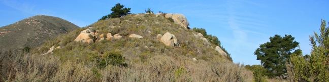
Turtle Rock
in Morro Bay State Park
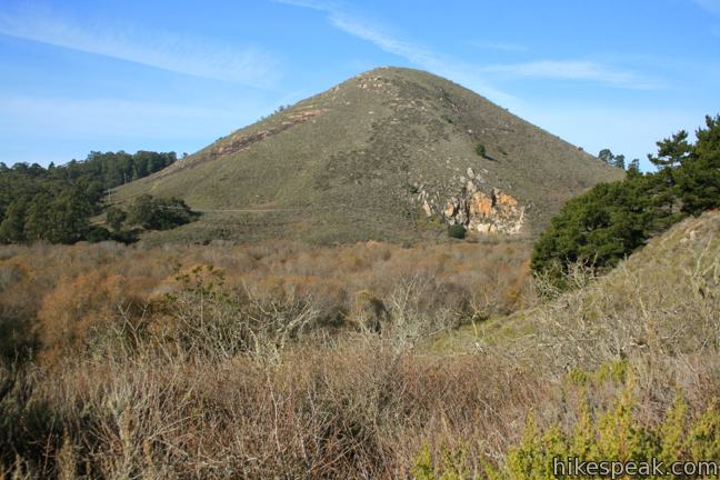
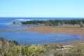
If you are looking for an easy 45-minute hike to the top of a pimple of a hill between two of San Luis Obispo’s Nine Sisters, take Chorro Trail to Turtle Rock in Morro Bay State Park. This 2.1-mile round trip hike begins with views of the estuary feeding Morro Bay and ends atop a small rise between Black Hill and Cerro Cabrillo. There is only 200 feet of elevation gain along the way, making this a quick hike that can be easily connected to other trails in the park. Turtle Rock makes a great warm-up for the tougher ascent on Cerro Cabrillo, and can also be used to extend the hike over Portola Hill.
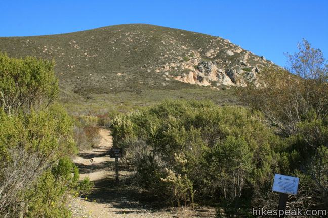
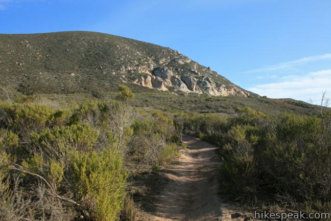
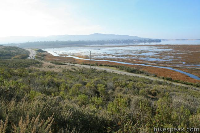
Begin from a trailhead on the east side of South Bay Boulevard across from the estuary between the cities of Los Osos and Morro Bay. Take Quarry Trail, heading northeast toward Cerro Cabrillo. At the first junction, 0.17 miles from the start, turn left on Chorro Trail. This level track wraps around the skirt of Cerro Cabrillo, heading west and then north toward Turtle Rock (also known as Chorro Hill).
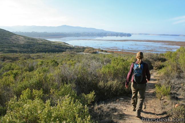
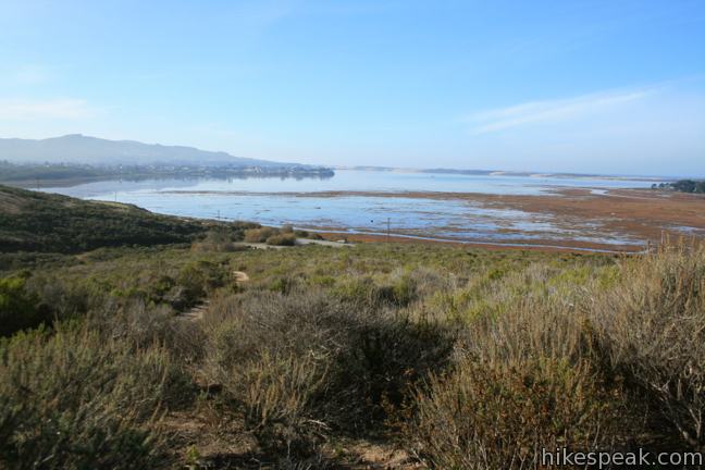
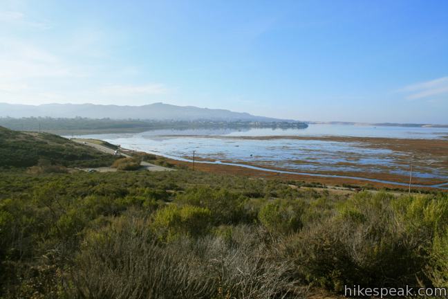
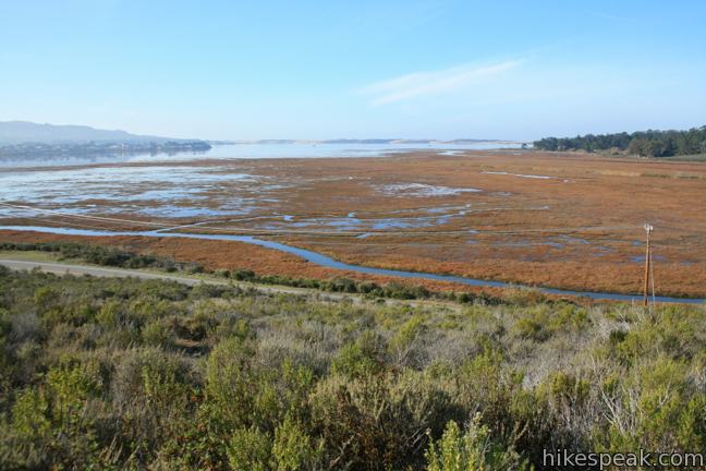
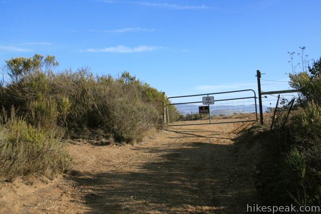
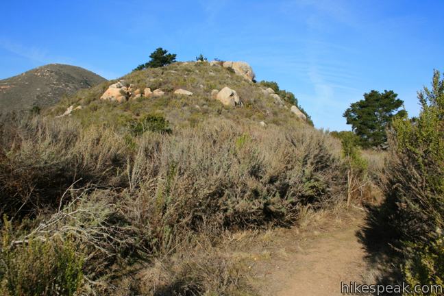
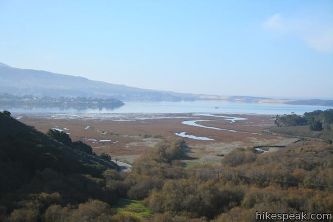
Take in fine perspective over the blue waters of Morro Bay before the trail curves to the right, paralleling South Bay Boulevard. Enjoy a view of Black Hill across the boulevard, and drop through a strip of live oaks to reach a dirt service road, half a mile from the start. Turn right here and walk 0.3 miles up to a gate. Turn left on the path just in front of the gate, which quickly takes you to the top of Turtle Rock.
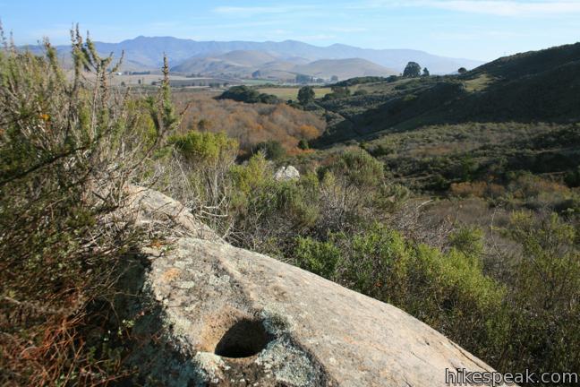
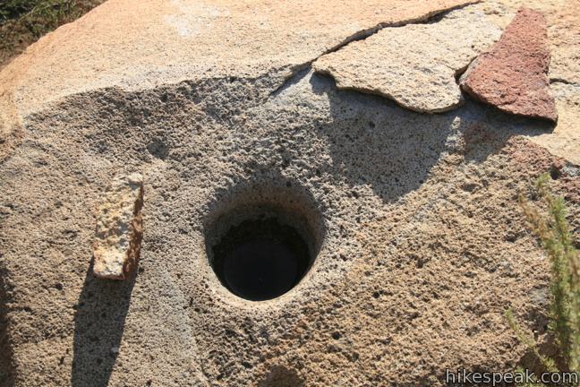
Climb up the rocky hill, passing grinding holes carved into the boulders. These “morteros” were used by Chumash Indians to grind acorns from nearby oaks into meal.
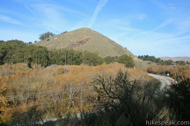
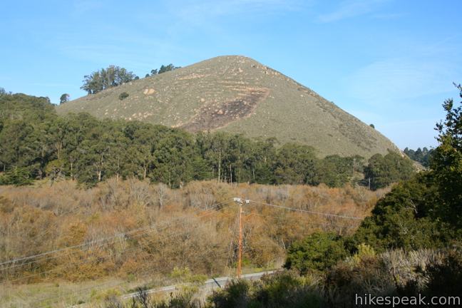
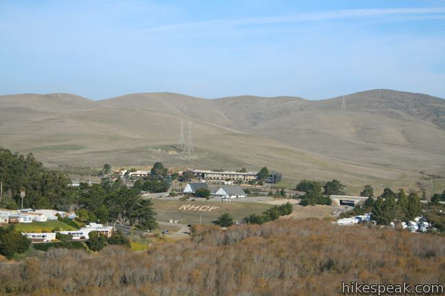
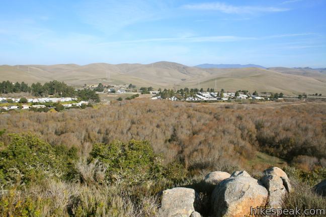
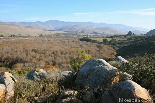
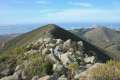
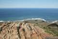
From the summit of Turtle Rock (if you can call it that), you gain a nice view to the east and north across Chorro Valley toward the Santa Lucia Mountain. Cerro Cabrillo looms to the southeast, a full 700 feet taller at 911 feet. Pines cover the western face of Turtle Rock, framing a view of Black Hill (661 feet). Looking back over the trail, you can see Morro Bay shouldered by the green slopes of the two Morros.
After planting your flag in the 209-foot mount, return the way you came. When you reach the junction, 0.17 miles from the start, if you turn left instead of right, you can continue hiking toward Portola Hill, Cerro Cabrillo, and other destinations in Morro Bay State Park. Dogs are not permitted on the trail to Turtle Rock. No fee or permit is required, so get out and enjoy!
Directions to the Trailhead
- From Highway 1 in Morro Bay, take exit 277, following signs for Los Osos and Baywood Park.
- Turn south on South Bay Boulevard and drive 1.4 miles to the trailhead parking area, set a few meters back from the road on the left.
- From Highway 101 south of San Luis Obispo, take exit 200A onto Los Osos Valley Road.
- Drive 9.8 miles west to South Bay Boulevard.
- Turn right and drive 2.6 miles north to the trailhead on the right, 0.4 miles past Turri Road.
Trailhead Location
Trailhead address: South Bay Boulevard, Morro Bay, CA 93442
Trailhead coordinates: 35.34652, -120.8252 (35° 20′ 47.5″N 120° 49′ 30.7″W)
You may also view a regional map of surrounding Central Coast trails and campgrounds.
 | Black Hill This short 0.6-mile out and back hike ascends 175 feet to the summit of Black Hill, which presents 360-degree views over Morro Bay. |
 | Cerro Cabrillo This tough 2.5-mile hike summits the highest mountain in Morro Bay State Park, a 911-foot member of the Nine Sisters. |
 | Portola Point This 2-mile loop explores a short hill just east of Morro Estuary in Morro Bay State Park. |
 | Chumash & Crespi Trails Loop This 2.9-mile circuit in Morro Bay State Park visits an oak grove and bay views by combining Chumash Trail, Crespi Trail, and Hutash Trail. |
 | Elfin Forest Natural Reserve This easy 1-mile loop on a boardwalk explores a pygmy forest on the edge of Morro Bay. |
 | Morro Dunes Ecological Reserve This 2.6-mile loop serves up panoramic views over Morro Bay as it ascends 800 feet from Los Osos to Montaña de Oro State Park. |
 | Valencia Peak This 4.5-mile hike summits a 1,347-foot peak with stunning views over Montaña de Oro. |
 | Bluff Trail This hike of around three miles tours tide pools, beaches, and impressive cliffs along the picturesque coast of Montaña de Oro State Park. |
 | Point Buchon Trail This 1 1/3 to 6.8-mile hike explores the beautiful coastline south of Montaña de Oro State Park. |
 | More hikes in San Luis Obispo Explore other trails around San Luis Obispo including Montaña de Oro State Park and the Morros. |
Common Questions about Turtle Rock in Morro Bay State Park
- Is the trail open?
- Yes. You should expect to find that Chorro Trail to Turtle Rock is open. There are no recent reports of trail closures. If you discover that the trail is closed, please help your fellow hikers by reporting a closure.
- Is this trail free to access?
- Yes, Chorro Trail to Turtle Rock is free to access. No entrance fee, pass, or permit is required. If you discover that access rules have changed, please provide feedback on your experience.
- How much time does this hike take?
- It takes approximately 1 hour to hike Chorro Trail to Turtle Rock. Individual hiking times vary. Add extra time for breaks and taking in the views.
- How long is this hike?
- The hike to Chorro Trail to Turtle Rock is a 2.1 mile out and back with 200 feet of elevation change.
- Are dogs allowed on this trail?
- No, dogs are likely not allowed on Chorro Trail to Turtle Rock. The trail is primarily open to hikers.
- Are there ocean views on this hike?
- Yes, Chorro Trail to Turtle Rock offers views of the ocean.
- Where is the trailhead located?
- The trailhead for Chorro Trail to Turtle Rock is located in Morro Bay, CA.
Trailhead Address:
South Bay Boulevard
Morro Bay, CA 93442
Trailhead Coordinates:
35.34652, -120.8252 - What are the driving directions to the start of the hike?
To get to the trailhead: From Highway 1 in Morro Bay, take exit 277, following signs for Los Osos and Baywood Park. Turn south on South Bay Boulevard and drive 1.4 miles to the trailhead parking area, set a few meters back from the road on the left.
From Highway 101 south of San Luis Obispo, take exit 200A onto Los Osos Valley Road. Drive 9.8 miles west to South Bay Boulevard. Turn right and drive 2.6 miles north to the trailhead on the right, 0.4 miles past Turri Road.
View custom Google Maps directions from your current location.
- Are there other trails near Chorro Trail to Turtle Rock?
- Yes, you can find other nearby hikes using the Hikespeak Hike Finder Map.

Go the extra miles...
Submit a rating of this hike to go with your comment. Contribute to the average trail rating.