Portola Point
in Morro Bay State Park
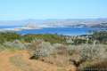
It can feel like stealing when you snag great views from an easy hike. This is the situation on the 2-mile loop to Portola Point in Morro Bay State Park, which ascends 315 feet to panoramic views over Morro Bay. The view-to-effort ratio on this hike is quite favorable, almost criminal.
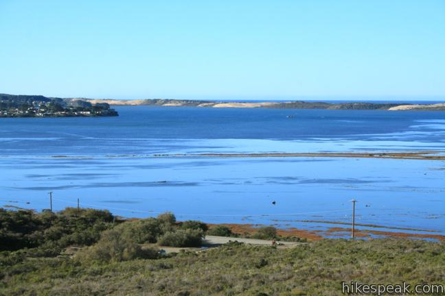
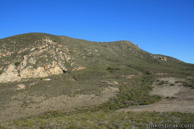
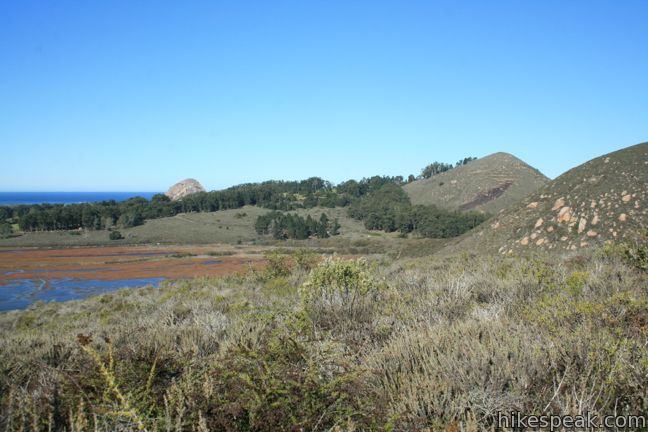
Portola Hill is a dome-shaped volcanic rise on the eastern edge of Morro Estuary. The 329-foot hill is not big enough to be ranked among the notable Morros of San Luis Obispo, but it is tall enough to offer great ocean views.
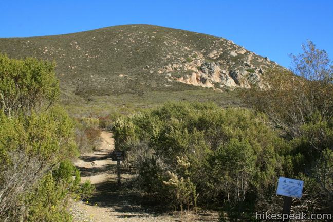
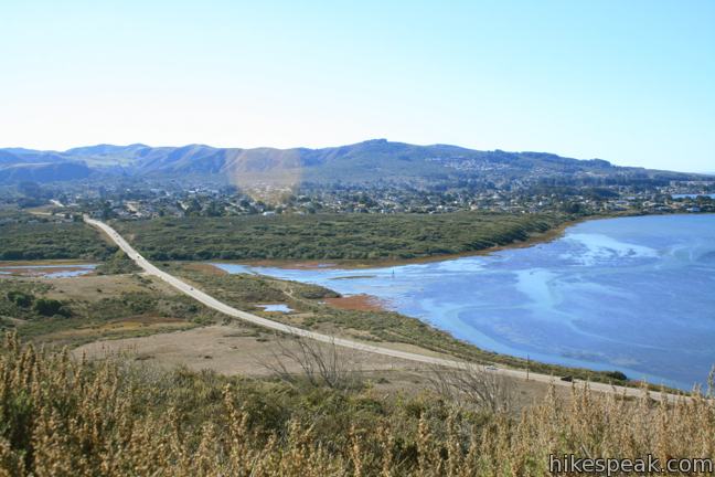
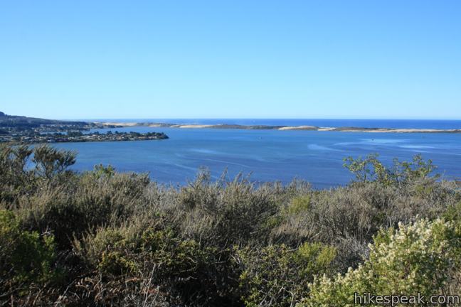
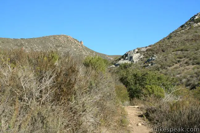
Start from a free parking area on South Bay Boulevard and begin up Quarry Trail, departing from the northeast corner of the lot. Hike 0.17 miles to a junction with Chorro Trail and angle right to remain on Quarry Trail (Chorro Trail heads north for 0.9 miles to Turtle Rock). Hike another third of a mile east beneath the rocky southern face of Cerro Cabrillo. You may spend less time looking forward than you do looking over your shoulder, appreciating the expanding view of Morro Bay and the sand dunes separating this sanctuary from the ocean beyond.
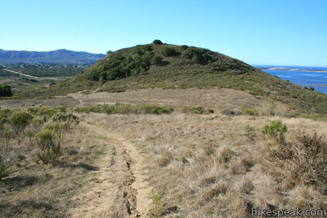
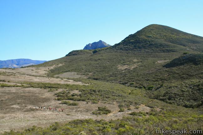
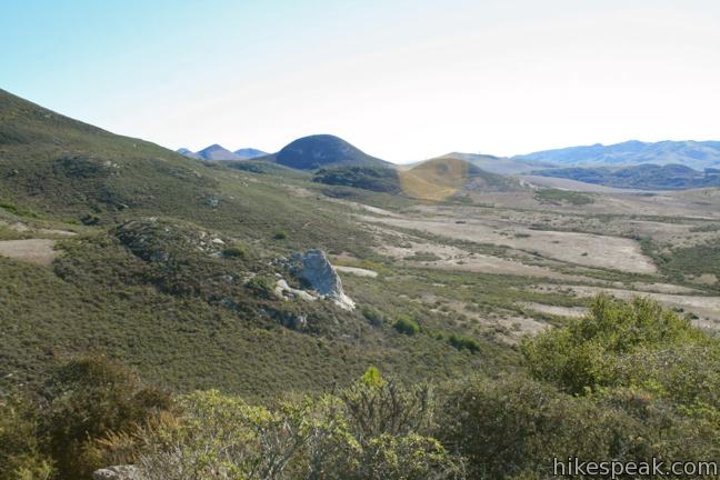
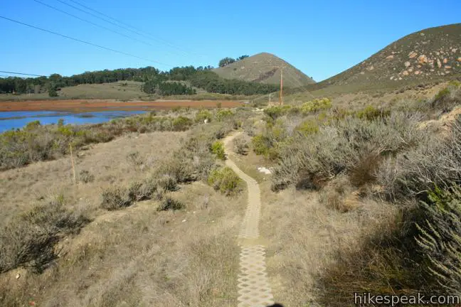
Half a mile from the start, turn right at the marked junction with Live Oak Trail. If you continued straight, you could strike for the summit of Cerro Cabrillo. After gaining about 225 feet on Quarry Trail, Live Oak Trail eases downhill across a grassy meadow hanging between Cerro Cabrillo and Portola Hill. After another 0.17 miles, when the trail splits, make two quick right turns to find Portola Trail and begin ascending the north side of Portola Hill. A quarter-mile climb brings you to a small loop around the sage and oak-covered summit, allowing you to take in the views in every direction.
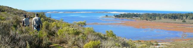
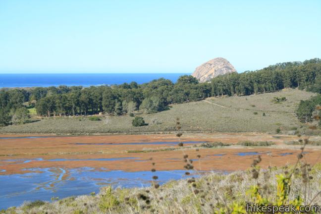
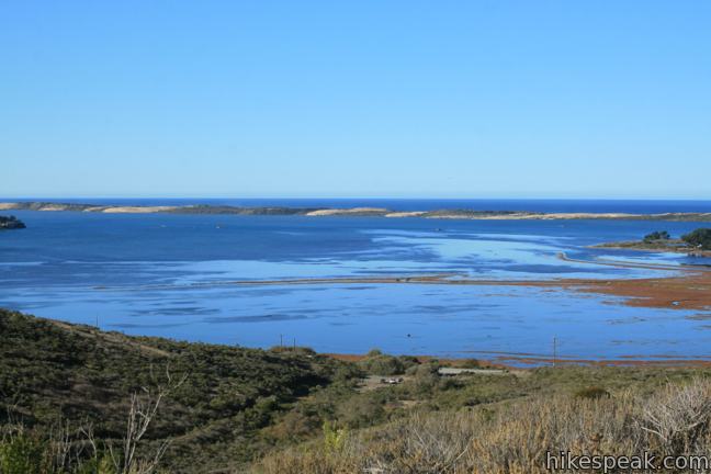
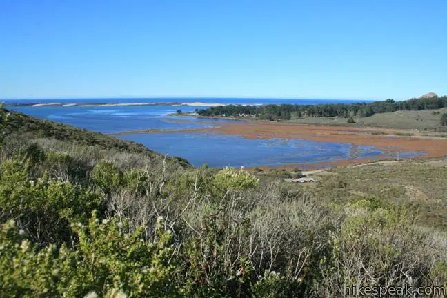
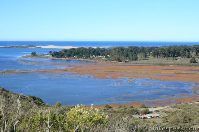
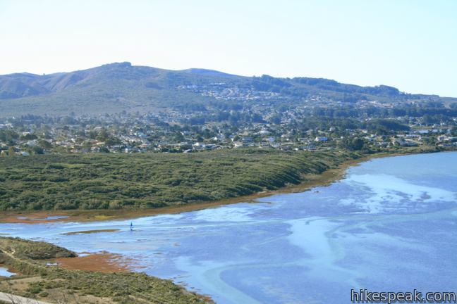
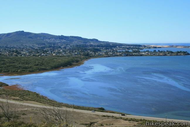
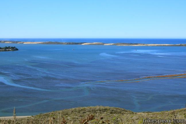
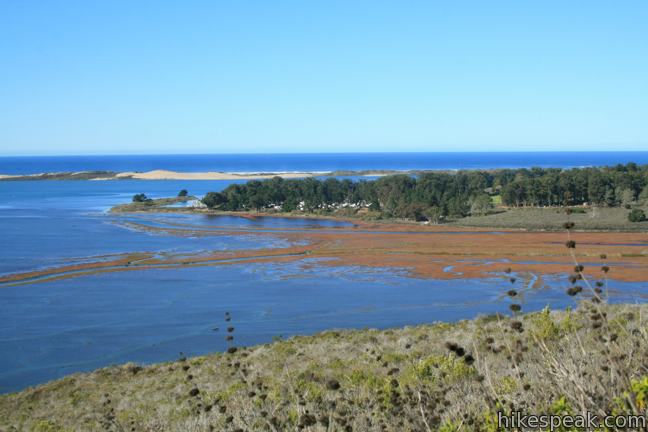
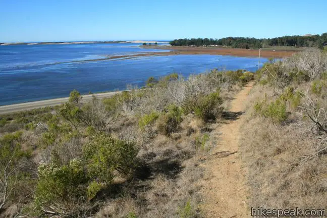
Have a seat at the bench at the south end of Portola Point and enjoy the finest perspective yet over Morro Bay. What birds can you spot? Great blue heron, snowy egret, double-crested cormorant, and many other fliers reside in the thriving estuary on the east side of Morro Bay. At low tide, Portola Point reveals canals running through the estuary, but if you reach the top a high tide, these veins will be submerged as the estuary expands to a giant basin of vivid blue water. Black Hill and Morro Rock are visible to the northwest, while Los Osos and the mountains of Montaña de Oro rise up the south. It is a panoramic view worthy of a much more challenging hike!
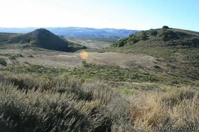
Head back down the hill facing Cerro Cabrillo. Notice the pointed outcropping on its southeastern slope named Tiki Rock. At the bottom of Portola Trail, make a pair of quick rights to resume looping around Portola Hill on Live Oak Trail. Pass through a small oak grove wedged in a gap between Portola Hill and a 500-foot taller hill to the east. After less than a quarter mile, reach an unmarked junction and turn right up a short rise to remain on Live Oak Trail. The single track levels out for the next quarter mile aiming west around the base of Portola Hill toward Morro Bay. Make a final right turn (always turn right on this hike!) to return to the south end of the trailhead after a short concrete walkway.
There are no bathrooms at the trailhead and dogs are not welcome on this hike. No fee or permit is required to hike to Portola Point in Morro Bay State Park, so get out and enjoy!
Directions to the Trailhead
- From Highway 1 in Morro Bay, take exit 277, following signs for Los Osos and Baywood Park.
- Turn south on South Bay Boulevard.
- Drive 1.4 miles to the trailhead parking area, set a few feet back from the road on the left.
- From Highway 101 south of San Luis Obispo, take exit 200A onto Los Osos Valley Road.
- Drive 9.8 miles west to South Bay Boulevard.
- Turn right and drive 2.6 miles north to the trailhead on the right, 0.4 miles past Turri Road.
Trailhead Location
Trailhead address: South Bay Boulevard, Morro Bay, CA 93442
Trailhead coordinates: 35.34652, -120.8252 (35° 20′ 47.5″N 120° 49′ 30.7″W)
You may also view a regional map of surrounding Central Coast trails and campgrounds.


 | Cerro Cabrillo This tough 2.5-mile hike summits the highest mountain in Morro Bay State Park, a 911-foot member of the Nine Sisters. |
 | Turtle Rock This easy 2.1-mile hike reaches a short rise between Black Hill and Cerro Cabrillo in Morro Bay State Park. |
 | Chumash & Crespi Trails Loop This 2.9-mile circuit in Morro Bay State Park visits an oak grove and bay views by combining Chumash Trail, Crespi Trail, and Hutash Trail. |
 | Black Hill This short 0.6-mile out and back hike ascends 175 feet to the summit of Black Hill, which presents 360-degree views over Morro Bay. |
 | Morro Rock via Morro Strand Trail This level one to 3.5-mile round trip hike starts from Cloisters Park and crosses Morro Strand State Beach to reach Morro Rock. |
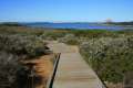 | Elfin Forest Natural Reserve This easy 1-mile loop on a boardwalk explores a pygmy forest on the edge of Morro Bay. |
 | Morro Dunes Ecological Reserve This 2.6-mile loop serves up panoramic views over Morro Bay as it ascends 800 feet from Los Osos to Montaña de Oro State Park. |
 | Valencia Peak This 4.5-mile hike summits a 1,347-foot peak with stunning views over Montaña de Oro. |
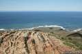
 | Bluff Trail This hike of around three miles tours tide pools, beaches, and impressive cliffs along the picturesque coast of Montaña de Oro State Park. |
 | Point Buchon Trail This 1 1/3 to 6.8-mile hike explores the beautiful coastline south of Montaña de Oro State Park. |
 | More hikes in San Luis Obispo Explore other trails around San Luis Obispo including Montaña de Oro State Park and the Morros. |
Common Questions about Portola Point in Morro Bay State Park
- Is the trail open?
- Yes. You should expect to find that Portola Point is open. There are no recent reports of trail closures. If you discover that the trail is closed, please help your fellow hikers by reporting a closure.
- Is this trail free to access?
- Yes, Portola Point is free to access. No entrance fee, pass, or permit is required. If you discover that access rules have changed, please provide feedback on your experience.
- How much time does this hike take?
- It takes approximately 1 hour to hike Portola Point. Individual hiking times vary. Add extra time for breaks and taking in the views.
- How long is this hike?
- The hike to Portola Point is a 2 mile loop with 315 feet of elevation change.
- Are dogs allowed on this trail?
- No, dogs are likely not allowed on Portola Point. The trail is primarily open to hikers.
- Is Portola Point good for kids?
- Yes, this hike is likely suitable for children. It is relatively short (2 miles) with manageable elevation gain.
- Are there ocean views on this hike?
- Yes, Portola Point offers views of the ocean.
- Does this trail go to a summit?
- Yes, Portola Point reaches a summit with panoramic views.
- Where is the trailhead located?
- The trailhead for Portola Point is located in Morro Bay, CA.
Trailhead Address:
South Bay Boulevard
Morro Bay, CA 93442
Trailhead Coordinates:
35.34652, -120.8252 - What are the driving directions to the start of the hike?
To get to the trailhead: From Highway 1 in Morro Bay, take exit 277, following signs for Los Osos and Baywood Park. Turn south on South Bay Boulevard. Drive 1.4 miles to the trailhead parking area, set a few feet back from the road on the left.
From Highway 101 south of San Luis Obispo, take exit 200A onto Los Osos Valley Road. Drive 9.8 miles west to South Bay Boulevard. Turn right and drive 2.6 miles north to the trailhead on the right, 0.4 miles past Turri Road.
View custom Google Maps directions from your current location.
- Are there other trails near Portola Point?
- Yes, you can find other nearby hikes using the Hikespeak Hike Finder Map.

4 Comments on Portola Point in Morro Bay State Park
What hikers are saying:
✨ Generated summary of user commentsHikers find this route rewarding for its natural features and the beautiful view at the end. Spring visitors can expect to see native wildflowers blooming along the path. Cindy suggests using a plant list to identify the various species found throughout the area.
Beautiful view!
The views are indeed impressive from this little hill that could be easily overlooked
[…] Portola Point – This hike begins at the Quarry Trail and winds up and into the hills, giving you a panoramic view of the estuary, the watershed, and beyond […]
We hiked this trail in early May in 2022, a very dry spring, and were pleased to see some native wildflowers blooming. The San Luis Obispo Chapter of the California Native Plant Society is developing an illustrated plant list for the plants you may see as you hike the trail route described above: https://www.calflora.org/app/ipl?list_id=px2737 We hope you enjoy the natural features of this hike.