Morro Strand Trail to Morro Strand State Beach and Morro Rock from Cloisters Park
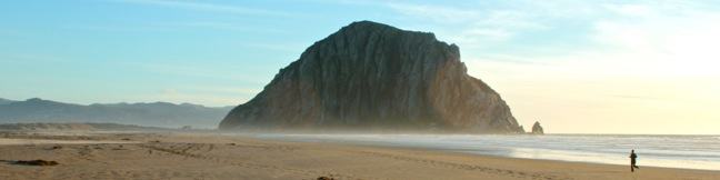
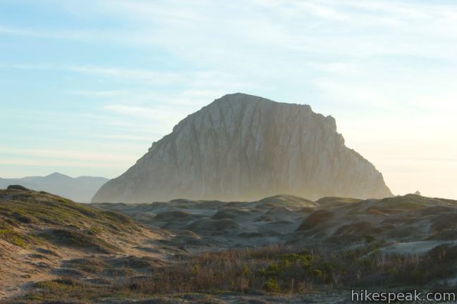
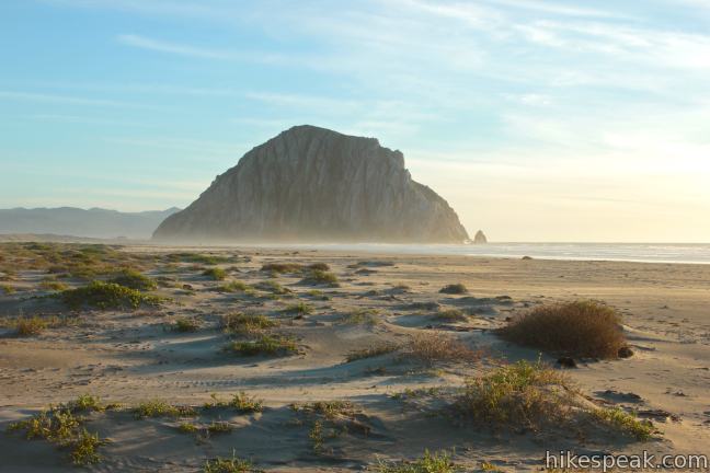
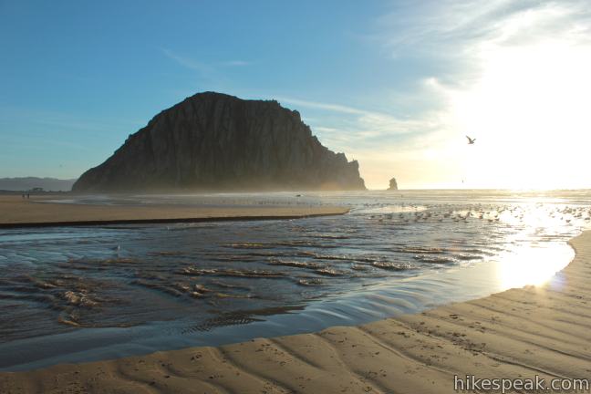
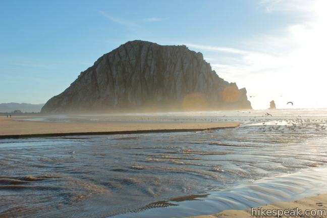
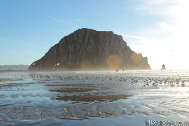
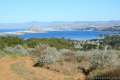
Morro Rock is an iconic landmark on California’s Central Coast. Located north of San Luis Obispo, the 578-foot tall mass of volcanic rock rises above of the Pacific Ocean, separating the inviting sands of Morro Strand State Beach from the blue waters of Morro Bay Harbor. Starting from a protected coastal wetland along Highway One in Morro Bay, this easy beach hike crosses sand dunes into Morro Strand State Beach, where you can walk along the ocean to the wave-battered mini-mountain guarding the entrance of Morro Bay. It is half a mile from Cloisters Park to the beach, and another mile down Morro Strand State Beach to Morro Rock. Spin around to the south side of Morro Rock to stretch things out to a 3.5-mile round trip hike.
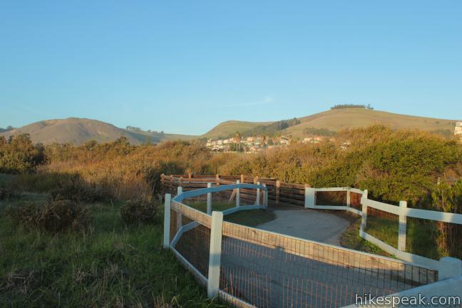
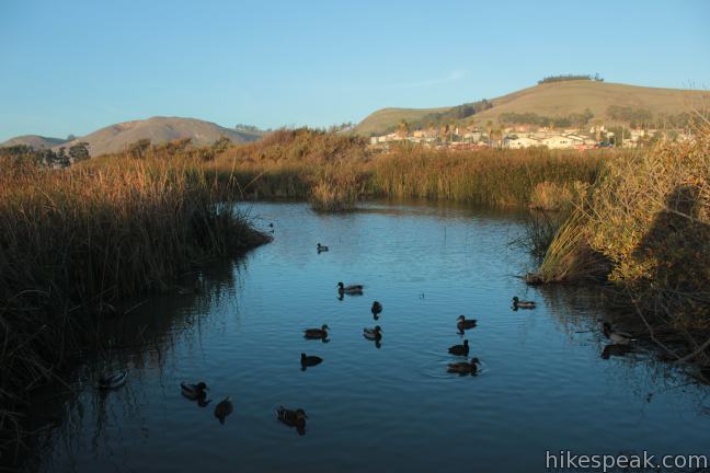
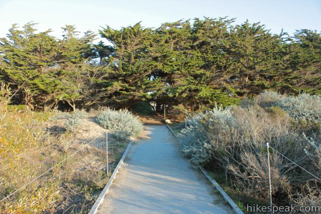
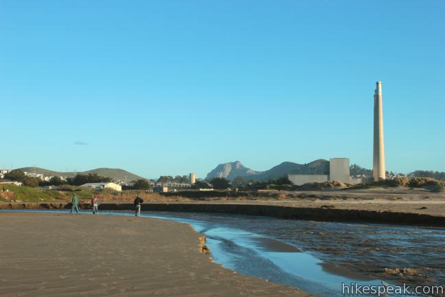
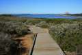
From the parking area, take one of several paths westward into Clusters Park, walking under a tenth of a mile to Morro Strand Trail, the coastal route to Morro Rock. There will be a field to your left where dogs can run around and a lagoon to your right where ducks can float around. Take a quick detour down a wooden boardwalk to the right to visit a viewing platform of the small lagoon.
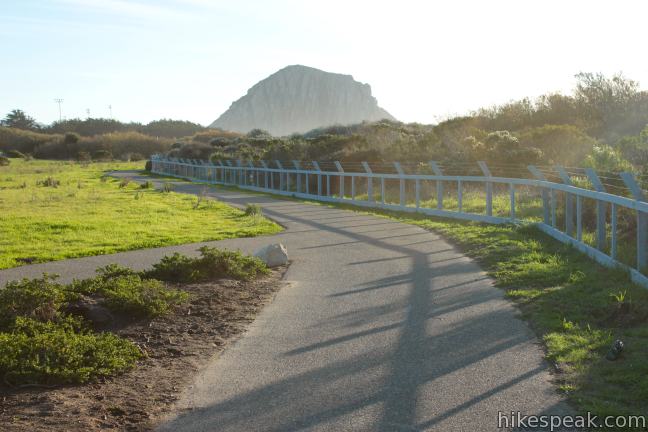
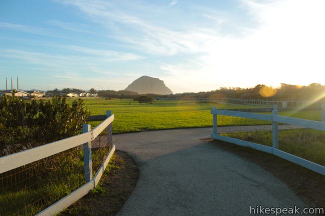
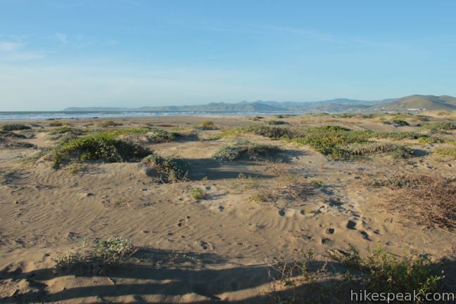
When you reach Morro Strand Trail, turn left and head south toward Morro Strand State Beach (or take a side trip to the right to explore more of the Cloisters Wetland). As you walk down the level Morro Strand Trail, there will be low sand dunes to your right, protected by a white fence. Straight ahead, the treeless pyramid-shaped form of Morro Rock can be seen towering above the dunes.
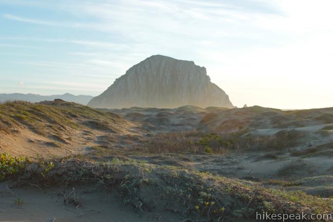
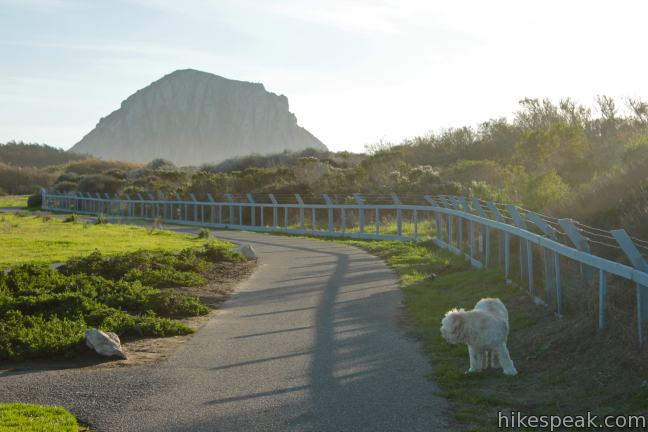
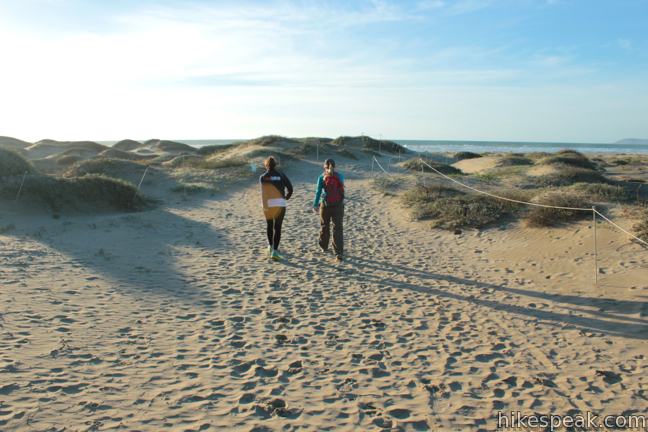
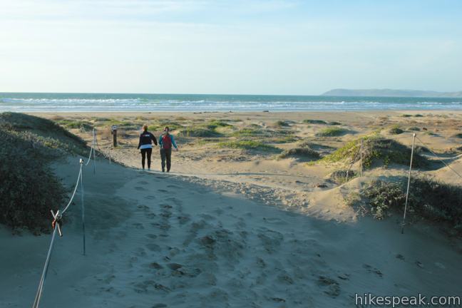
Stay straight through the next junction, passing a path that links the trail to a nearby neighborhood. The paved trail transitions into an artificial boardwalk, bending through arroyo willows. Cross a short bridge over the 54th Street Channel to a T-junction and turn right, following a line of pines as they sweep south toward Morro Rock. The trail makes a hard right turn for the beach, and then you will begin walking on the sand. Enjoy a lovely view to the left toward Morro Rock above the dunes, as you follow a sandy path straight toward the ocean. It is roughly half a mile from the trailhead in Cloisters Park to the sand in Morro Strand State Beach.
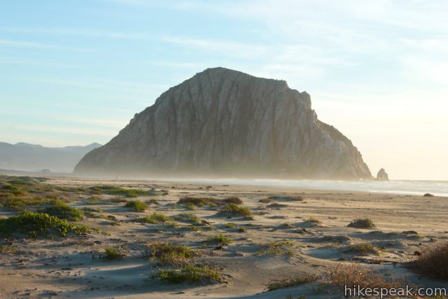
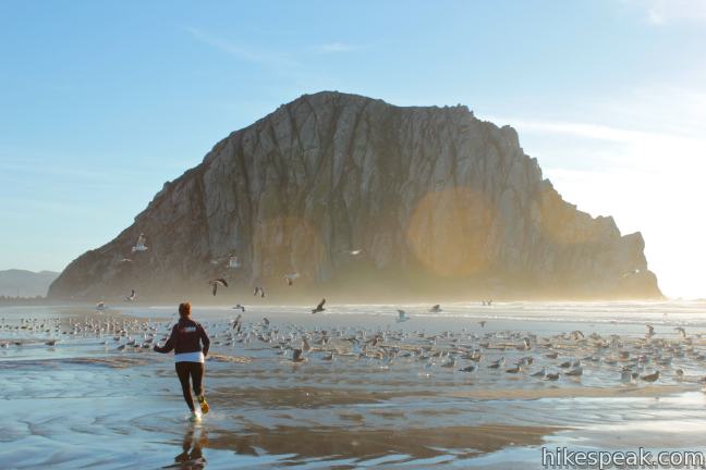
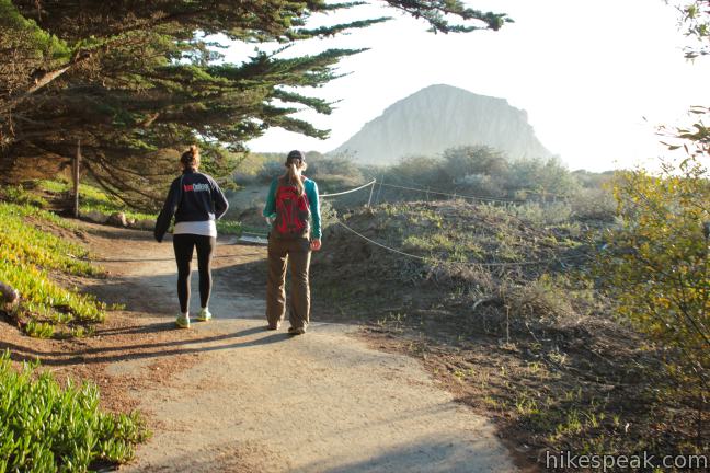
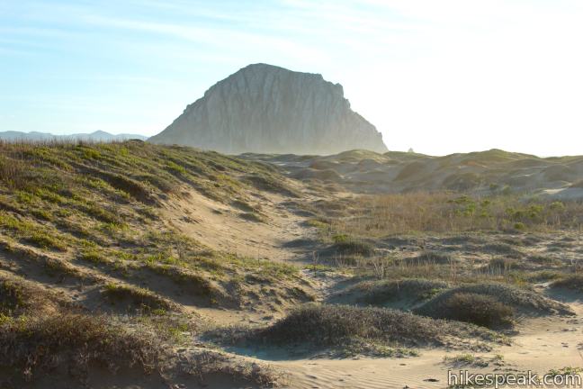
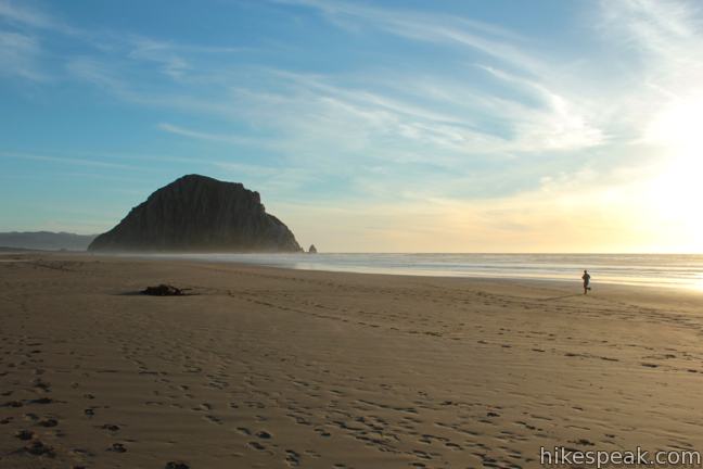
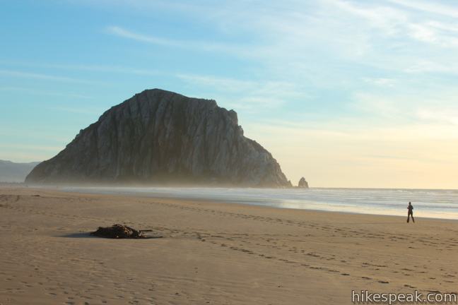
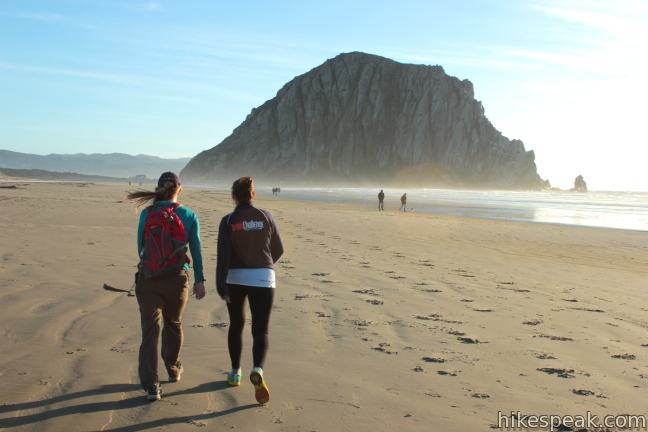
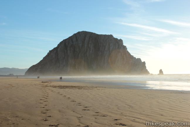
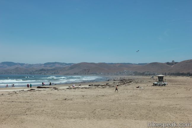
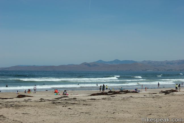
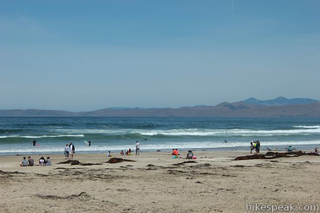
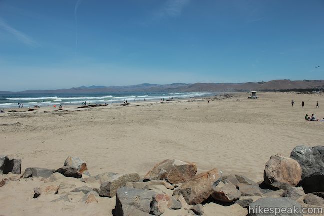
When you reach the firm sand near the water’s edge, turn left, heading down the beach toward Morro Rock. Morro Strand State Beach is graced by sea breezes and rolling waves, presenting a long straight stretch of sand that ends at Morro Rock. As you enjoy the picturesque views of the massive rock straight ahead, be sure not to miss the broad over-the-shoulder views up the coast toward Cayucos and Cambria.
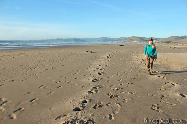
After 2/3 of a mile walking down the sand, you will reach the mouth of Little Morro Creek. After a good rain, you will have to wade through ankle or calf deep water to cross this seasonal creek (sandals and towels recommended), but there may be no water at all to cross during dry months.
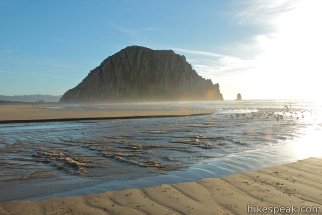
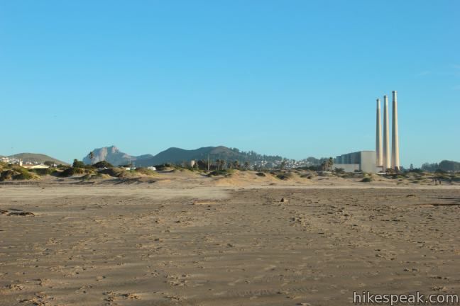
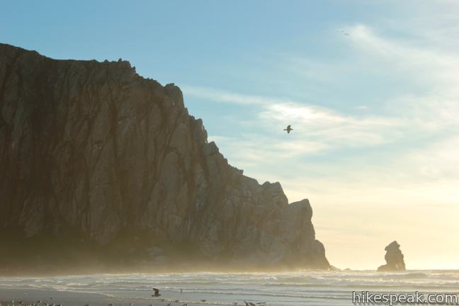
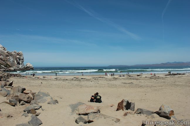
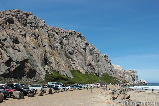
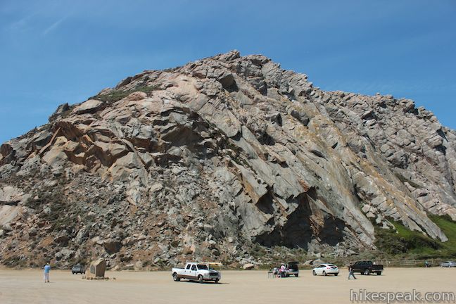
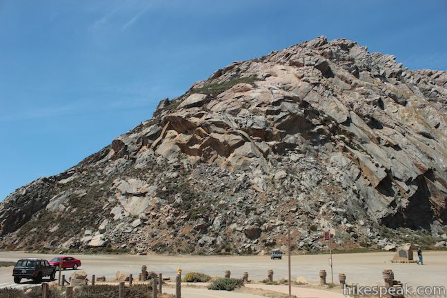
Beyond Little Morro Creek, you may continue another third of a mile to the end of the beach, where the sand hits the basalt at Morro Rock. Cross a parking lot to reach Coleman Drive, which you may follow around the east side of Morro Rock to a breakwater at the mouth of Morro Bay.
The breakwater was constructed with boulders quarried from Morro Rock. There is no longer any quarrying on Morro Rock today as the California Historical Landmark is protected by Morro Rock State Preserve. Morro Rock is the westernmost peak in the Morros, a string of volcanic plugs running across San Luis Obispo County nicknamed the Seven Sisters or the Nine Sisters (depending on how well you count). Climbing up Morro Rock is prohibited, but if you would like to hike to the top of one of the other Morros, there are trails on five of the volcanic peaks: Black Hill, Cerro Cabrillo, Bishop Peak, Cerro San Luis, and Islay Hill.
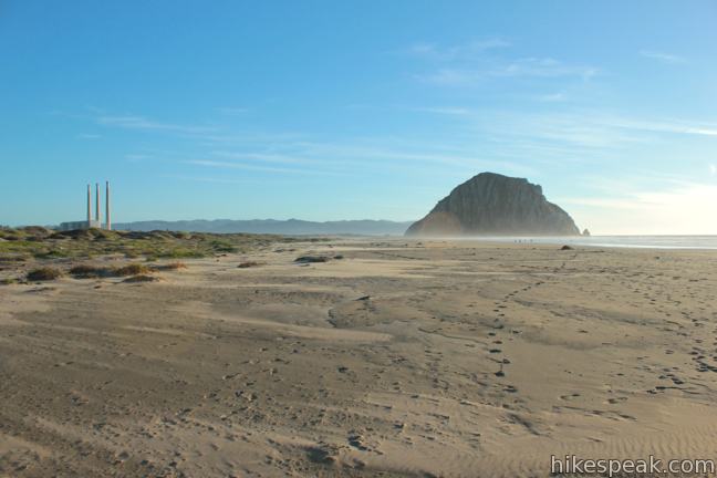
It is 3.5 miles round trip to the south side of Morro Rock. Those with smaller ambitions can still enjoy a satisfying scenic day at the ocean by taking a shorter trip to any part on Morro Strand State Beach. The Beach continues north for two miles past the path connecting to Cloisters Park, allowing for longer walks on the beach.
Dog are allowed in Cloisters Park. They are not allowed on the beach in Morro Strand State Beach, but are allowed at the state park’s developed campground, which has 81 tightly-packed RV-friendly sites along the beach north of Cloisters Park. No fee or permit is required to hike Morro Strand Trail from Cloisters Park across Morro Strand State Beach to Morro Rock, so get out and enjoy!
Directions to the Trailhead
- From Highway One in Morro Bay (14.5 miles north of Highway 101 in San Luis Obispo), exit on San Jacinto Street and drive west for one block to Coral Ave.
- Turn left and drive a third of a mile to the parking area for Cloisters Park, on the left.
Trailhead Location
Trailhead address: Cloisters Park, Coral Ave, Morro Bay, CA 93442
Trailhead coordinates: 35.38898, -120.860108 (35° 23′ 20.32″N 120° 51′ 36.38″W)
You may also view a regional map of surrounding Central Coast trails and campgrounds.


 | Black Hill This short 0.6-mile out and back hike ascends 175 feet to the summit of Black Hill, which presents 360-degree views over Morro Bay. |
 | Cerro Cabrillo This tough 2.5-mile hike summits the highest mountain in Morro Bay State Park, a 911-foot member of the Nine Sisters. |
 | Portola Point This 2-mile loop explores a short hill just east of Morro Estuary in Morro Bay State Park. |
 | Turtle Rock This easy 2.1-mile hike reaches a short rise between Black Hill and Cerro Cabrillo in Morro Bay State Park. |
 | Elfin Forest Natural Reserve This easy 1-mile loop on a boardwalk explores a pygmy forest on the edge of Morro Bay. |
 | Morro Dunes Ecological Reserve This 2.6-mile loop serves up panoramic views over Morro Bay as it ascends 800 feet from Los Osos to Montaña de Oro State Park. |
 | Cerro Alto This semi-loop bags the 2,624-foot summit of Cerro Alto, plus a scenic ridge south of the peak, for a 5.35-mile hike with 1,600 feet of elevation gain. |
 | Eagle Rock Nature Trail This 2.4-mile hike in El Chorro Regional Park climbs 450 feet to Eagle Rock Viewpoint for an overview of the valley between San Luis Obispo and Morro Bay. |
 | Moonstone Beach Boardwalk This 2.85-mile out and back hike crosses a boardwalk along a charming Cambria beach in Hearst San Simeon State Park. |
 | More hikes in San Luis Obispo Explore other trails around San Luis Obispo including Morro Bay State Park, Montaña de Oro State Park, and the Morros. |
Common Questions about Morro Strand Trail to Morro Strand State Beach and Morro Rock from Cloisters Park
- Is the trail open?
- Yes. You should expect to find that Morro Strand Trail is open. There are no recent reports of trail closures. If you discover that the trail is closed, please help your fellow hikers by reporting a closure.
- Is this trail free to access?
- Yes, Morro Strand Trail is free to access. No entrance fee, pass, or permit is required. If you discover that access rules have changed, please provide feedback on your experience.
- How much time does this hike take?
- It takes approximately 1 hour 30 minutes to hike Morro Strand Trail. Individual hiking times vary. Add extra time for breaks and taking in the views.
- How long is this hike?
- The hike to Morro Strand Trail is a 3.5 mile out and back with 25 feet of elevation change.
- Are dogs allowed on this trail?
- No, dogs are likely not allowed on Morro Strand Trail. The trail is primarily open to hikers.
- Are there ocean views on this hike?
- Yes, Morro Strand Trail offers views of the ocean.
- Where is the trailhead located?
- The trailhead for Morro Strand Trail is located in Morro Bay, CA.
Trailhead Address:
Coral Ave
Morro Bay, CA 93442
Trailhead Coordinates:
35.38898, -120.860108 - What are the driving directions to the start of the hike?
To get to the trailhead: From Highway One in Morro Bay (14.5 miles north of Highway 101 in San Luis Obispo), exit on San Jacinto Street and drive west for one block to Coral Ave. Turn left and drive a third of a mile to the parking area for Cloisters Park, on the left.
View custom Google Maps directions from your current location.
- Are there other trails near Morro Strand Trail?
- Yes, you can find other nearby hikes using the Hikespeak Hike Finder Map.

6 Comments on Morro Strand Trail to Morro Strand State Beach and Morro Rock from Cloisters Park
What hikers are saying:
✨ Generated summary of user commentsThis trail offers a serene escape into a natural preserve where hikers appreciate the presence of sea otters, snowy plovers, and seals. Dogs are strictly prohibited on the beach to protect these vulnerable species, though pet owners can find designated dog-friendly areas at Morro Rock or north of the campground. Maintaining this separation ensures that the local wildlife remains undisturbed while providing a peaceful coastal experience for everyone.
Check out my blog post about this amazing hike with more information and personal insider tips at https://adulthoodinslo.wordpress.com/2016/09/23/morro-strand-trail-to-morro-rock/ !
I think the park’s name is ‘Cloisters’. You have it as ‘Coisters’ and as ‘Clusters’. Great pictures, by the way!
Great catch. Thank you!
I live in Cloisters and walk Morro Strand State Beach daily. Think you need to emphasize at the beginning that the State Beach is a Natural Preserve and dogs are not allowed at all! Too many times I’ve watched dog owners walk to the beach with their dog on a leash, then unleash it on the beach. Dogs are playful and hungry. If they see any kind of wildlife on the beach they want to chase it, sniff it, lick it, bite it or eat it. Grounded sea otters, snowy plovers, seals, etc. don’t enjoy hassling. A dog beach is at Morro Rock and 1/2 mile north of the MSSB Campground. Wildlife are loosing more safe areas. We are loosing wildlife…
[…] and makes for a memorable beach hike. While it will require around a 3-hour drive from L.A. first, Morro Strand Trail is unlike anything you’ll ever see. You can trek across the undulating dunes of Morro State […]
is there accomadations for lite walk/stroll for elderly/disabled. ?