Laguna Lake Park to Cerro San Luis
in San Luis Obispo
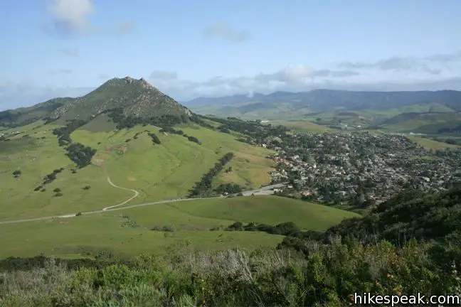
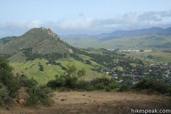
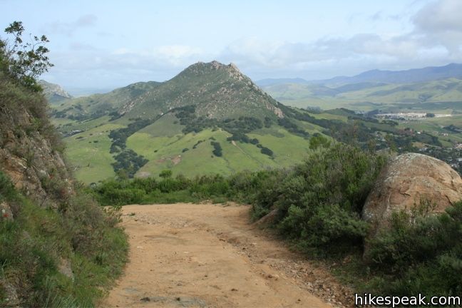
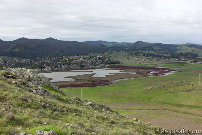
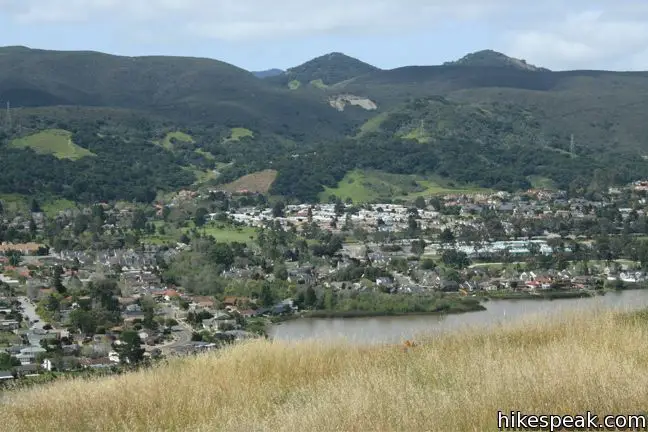
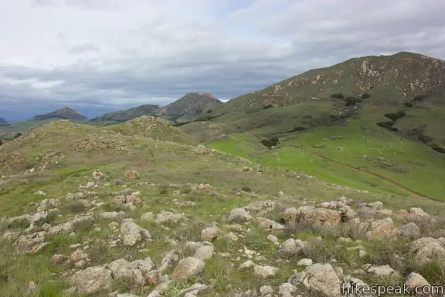
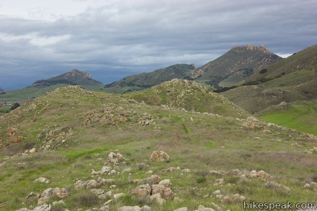
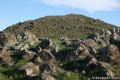
Located just west of downtown San Luis Obispo, the 1,292-foot Cerro San Luis (or San Luis Mountain) offers sweeping views of the Santa Lucia Mountains and other peaks in the Morros, the chain of mountains that Cerro San Luis is a part of. The Morros, or Nine Sisters, are a line of prominent volcanic peaks between Morro Bay and San Luis Obispo. These beautiful peaks set the postcard-like backdrop to SLO and make excellent hiking destinations. Cerro San Luis offers an excellent view of the adjacent Bishop Peak, perhaps the most well know member of the Morros.
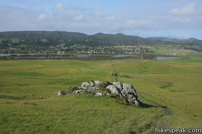
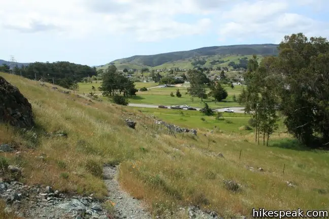
Laguna Lake Park lies south of Cerro San Luis. This 375-acre park includes a 25-acre lake and several hiking trails. The trek from Laguna Lake Park up San Luis Mountain is 5.7 mile round trip with 1,150 feet of elevation gain (for those who prefer something shorter, there is also a more direct four-mile route from a trailhead at the end of Fernandez Road).
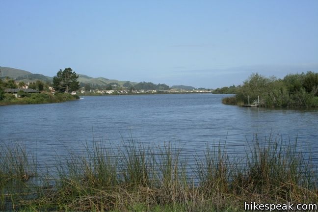
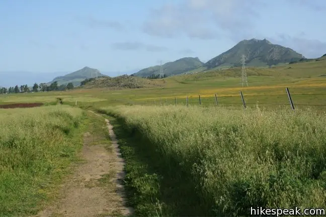
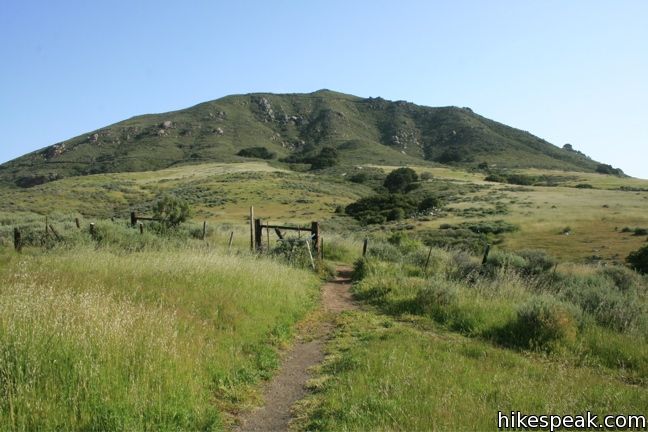
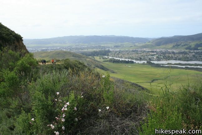
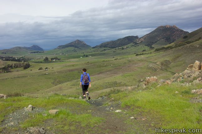
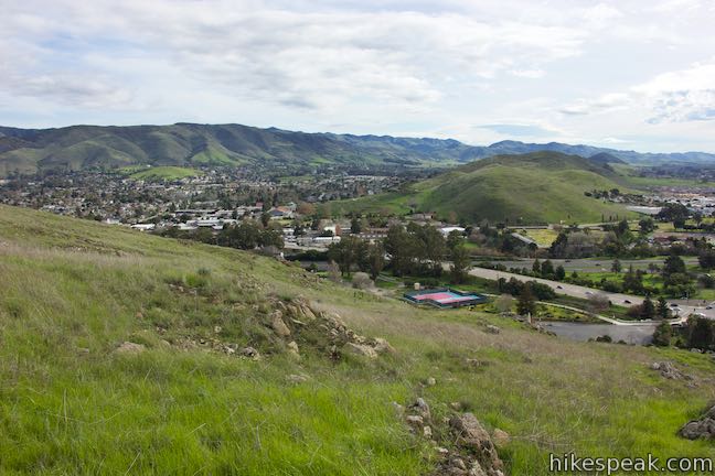
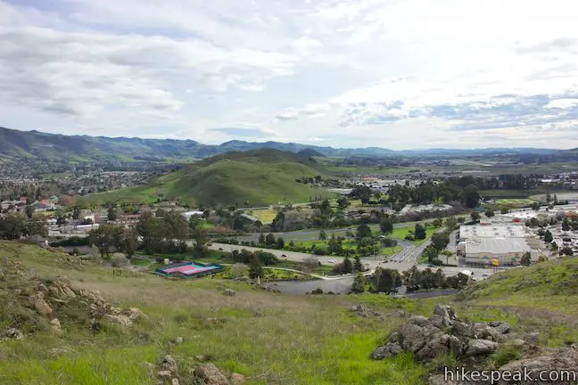
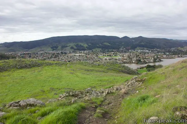
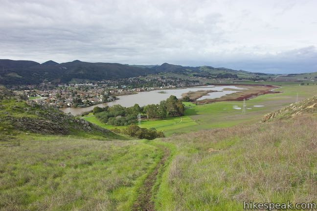
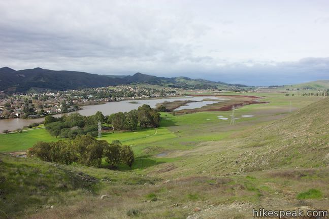
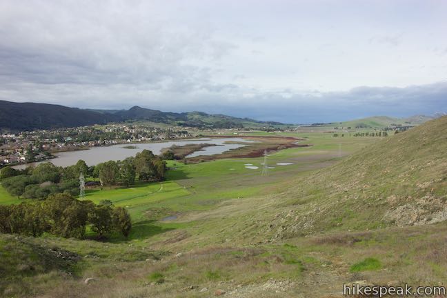
The start of this trek gives hikers a few options, as there are a number of routes to the base of San Luis Mountain. One trail heads straight up the center of Laguna Lake Park beneath a row of power lines. To the left, a trail travels closer to the lake shore, and to the right, a third trail travels closer to the base of a long ridge that runs alongside the park, Laguna Ridge. Take any of these parallel trails heading northeast through a grass field toward the park boundary. When the trail of your choosing comes even with Cerro San Luis, turn right and follow the trail uphill to the left of a prominent outcropping.
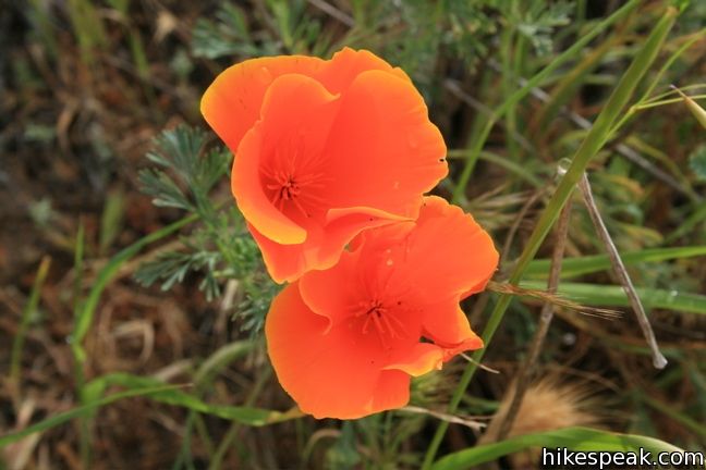
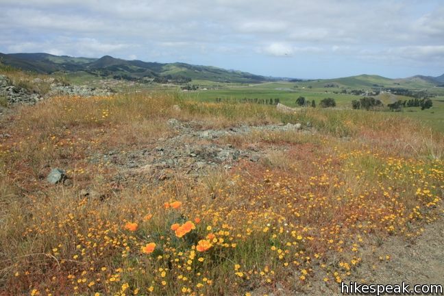
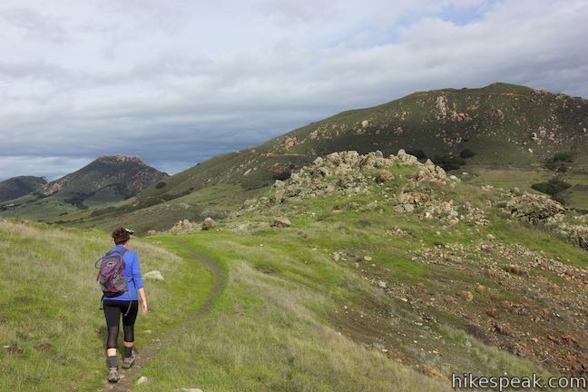
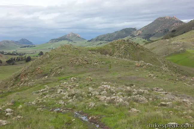
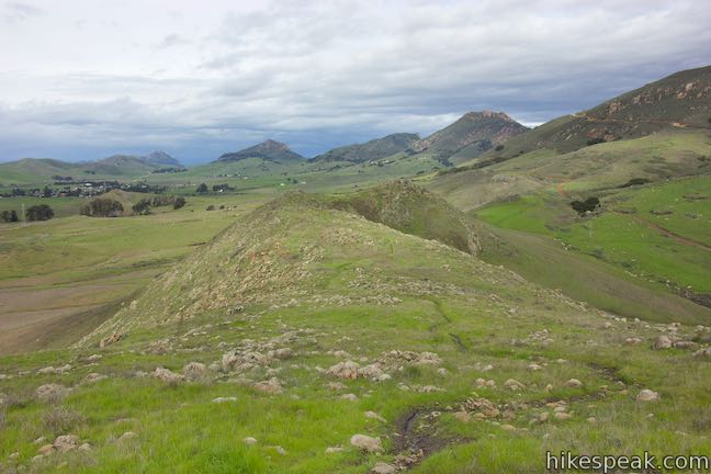
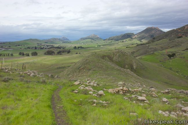
Another trail can be seen crossing Laguna Ridge to the right. This single track is a fourth option from Laguna Lake Park. It provides tremendous views and should be taken in at least one direction on this hike. To start this way, take the path across from the bathrooms and hike up the notch in the ridge. The trail is steep at the start (may be preferable to return by this route) and passes through an open space adjacent to the park that is owned by the Madonna Family. Much of Cerro San Luis itself is owned by the Madonnas, and for this reason, some locals actually call Cerro San Luis by the name Madonna Mountain. After climbing up the notch, the trail turns left and follows the ridgeline through fields of grains where poppies and larkspur bloom in spring.

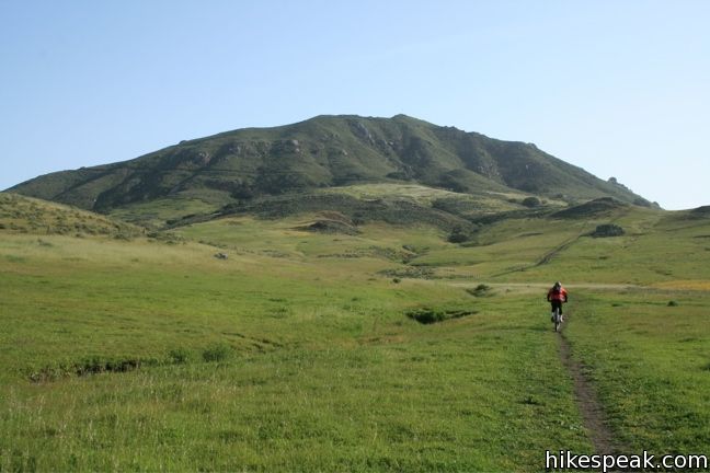
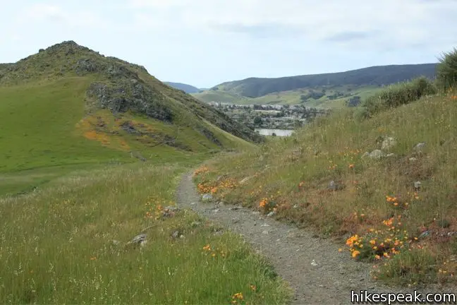
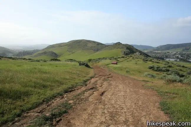
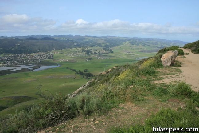
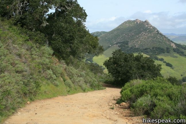
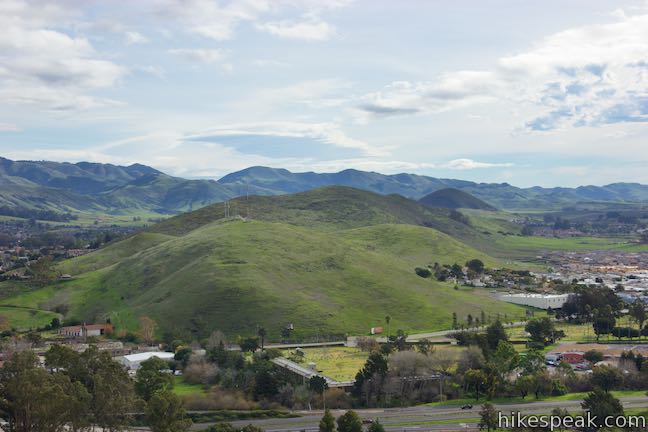
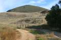
From the junction of the trails, continue north toward the summit. The trail joins a wider dirt road ascending from behind Madonna Inn. At the T-junction 0.4 miles later, turn left heading up hill. The wide trail bends around the northern slope to offer fantastic views of Bishop Peak. Three other Morros, Chumash Peak, Cerro Romualdo, and Hollister Peak can also be seen from this vantage point.
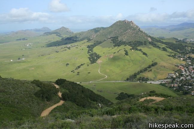
The trail continues to climb, swinging around to the north side of the mountain. Coast live oaks provide occasional shade, while Indian paintbrush, morning glories, lupines, monkeyflower, and other wildflowers add splashes of color to the trail-side in the spring.
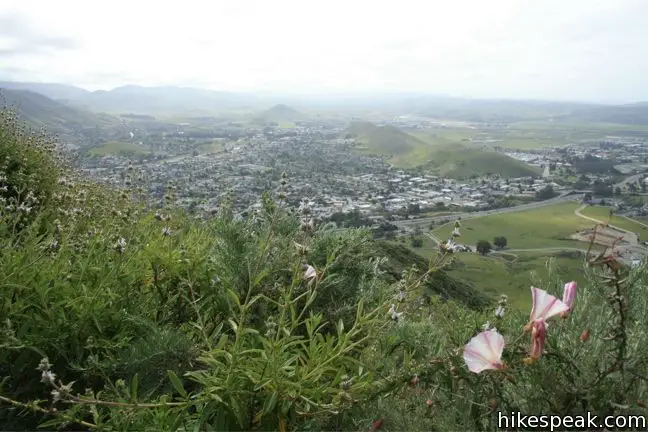
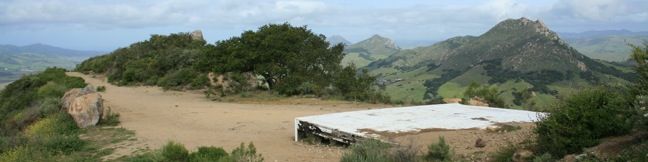
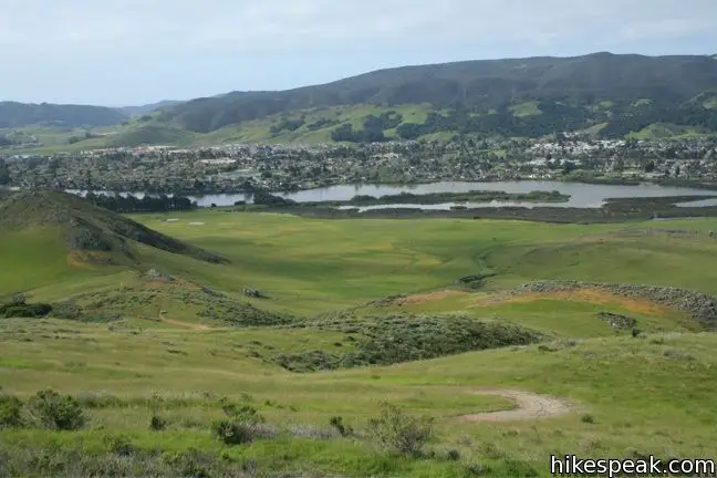
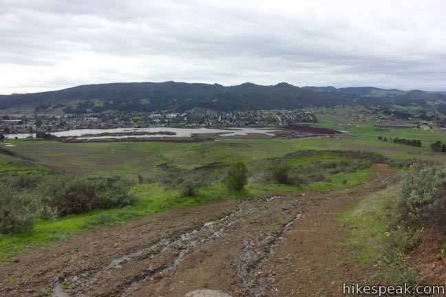
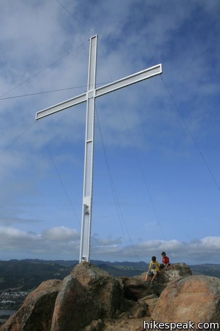
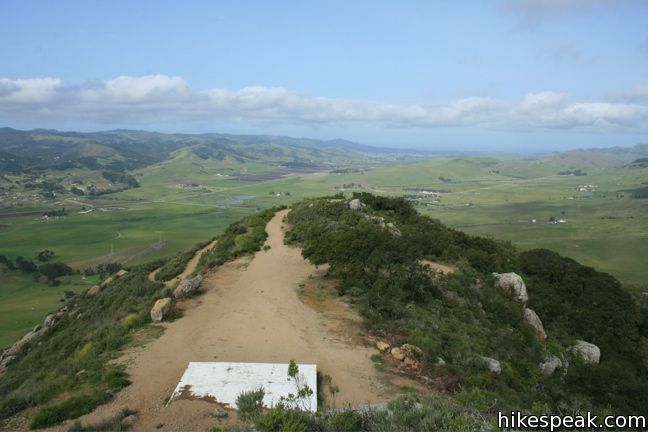
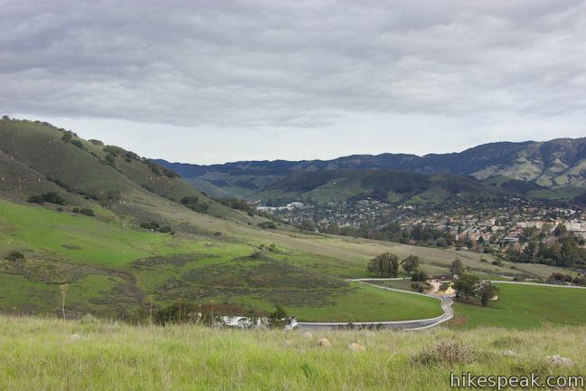
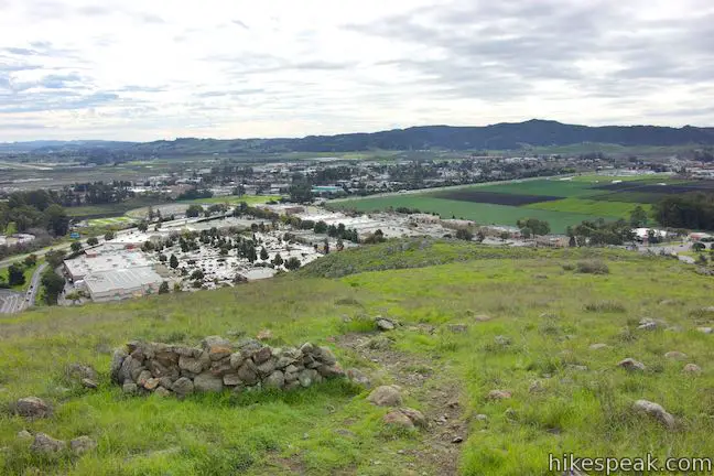
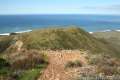
Cal Poly, northern San Luis Obispo, and the Santa Lucia Mountains fill the view as the trail winds up to a loop beneath the summit. Turn right or left here (or take the foot path straight up to the western summit) to loop around to the upper eastern summit. From a white platform at the top of the road where special church services are held, climb up the pile of boulders at the top of the peak.
Around Easter, a tall white cross stands atop the summit. At Christmas, lights are put up that look like a tree. Neither interferes with the sweeping views of San Luis Obispo.
To return to Laguna Lake Park, complete the loop around the summit and head back down the trail. If you ascended via one of the park trails, take the path across Laguna Ridge on the descent. The views will not disappoint. Dogs and mountain bikers are allowed. No fee or permit is requires, so get out and enjoy.

Directions to the Trailhead
- From Highway 101 in San Luis Obispo, exit on Madonna Road and head west for half a mile.
- Turn right on Dalidio Drive to enter Laguna Lake Park.
- Park at the end of the drive or turn left at the only intersection to find parking closer to the lakefront trail.
Trailhead Location
Trailhead address: 504 Madonna Road, San Luis Obispo, CA 93405
Trailhead coordinates: 35.26521, -120.68274 (35° 15′ 54.75″N 120° 40′ 57.86″W)
View San Luis Obispo in a larger map
Or view a regional map of surrounding Central Coast trails and campgrounds.


 | Cerro San Luis This traditional route to the summit is four miles out and back, or five if you return via an alternate trail. |
 | "M" Trail This extensions off the trail up Cerro San Luis makes its own 1.9-mile round trip hike to the large white "M" installed halfway up the east side of the mountain. |
 | Lemon Grove Trail This 2.2-mile loop visits a historical lemon grove on the eastern slopes of Cerro San Luis. |
 | Lemon Grove & "M" Trails Loop This 2.4-mile hike uses all of the "M" Trail and part of Lemon Grove Loop Trail for a scenic circuit on the east side of Cerro San Luis. |
 | Bishop Peak This 3.5-mile hike ascends 950 feet to highest summit in the Nine Sisters, offering excellent views of San Luis Obispo and the surrounding Morros. |
 | Morro View This 3.15-mile hike in the Irish Hills Natural Reserve delivers panoramic views over Los Osos Valley and the full chain of Morros. |
 | Froom Creek Trail This 3-mile loop explores a canyon on the east side of the Irish Hills, ascending 500 feet to a nice view over Laguna Lake, Cerro San Luis, and Bishop Peak. |
 | Felsman Loop Trail This 2.7-mile loop crosses oak, sagebrush, and grass-covered slopes around the base of Bishop Peak, providing excellent views of that notable rocky summit and its San Luis Obispo surroundings. |
 | South Hills Ridge Trail This 1.5-mile round trip hike ascends 450 feet to the highest point in a cluster of hills near downtown San Luis Obispo, offering fine views over the city and surroundings. |
 | Islay Hill This 1.8-mile round trip hike climbs 550 feet to the top of San Luis Obispo's easternmost Morro. |
 | Poly Canyon Design Village This 2.5-mile hike visits an experimental architectural village designed by Cal Poly students at the base of the Santa Lucia Mountains. |
 | Reservoir Canyon This 5.35-mile hike ascends 1,350 feet past a waterfall and a collection of junk sculptures to a treeless summit overlooking San Luis Obispo. |
 | More hikes in San Luis Obispo Explore other trails around San Luis Obispo including Morro Bay State Park and Montaña de Oro State Park. |
Common Questions about Laguna Lake Park to Cerro San Luis in San Luis Obispo
- Is the trail open?
- Yes. You should expect to find that Laguna Lake Park to Cerro San Luis is open. There are no recent reports of trail closures. If you discover that the trail is closed, please help your fellow hikers by reporting a closure.
- Is this trail free to access?
- Yes, Laguna Lake Park to Cerro San Luis is free to access. No entrance fee, pass, or permit is required. If you discover that access rules have changed, please provide feedback on your experience.
- How much time does this hike take?
- It takes approximately 3 hours to hike Laguna Lake Park to Cerro San Luis. Individual hiking times vary. Add extra time for breaks and taking in the views.
- How long is this hike?
- The hike to Laguna Lake Park to Cerro San Luis is a 5.7 mile out and back with 1150 feet of elevation change.
- Are dogs allowed on this trail?
- Yes, dogs are allowed on Laguna Lake Park to Cerro San Luis. The trail is open to hikers, dogs, bikes.
- Does this trail go to a summit?
- Yes, Laguna Lake Park to Cerro San Luis reaches a summit with panoramic views.
- Is this a good hike for wildflowers?
- Yes, Laguna Lake Park to Cerro San Luis is known for its seasonal wildflower displays.
- Is there a lake on this hike?
- Yes, Laguna Lake Park to Cerro San Luis visits a lake.
- Where is the trailhead located?
- The trailhead for Laguna Lake Park to Cerro San Luis is located in San Luis Obispo, CA.
Trailhead Address:
504 Madonna Road
San Luis Obispo, CA 93405
Trailhead Coordinates:
35.26521, -120.68274 - What are the driving directions to the start of the hike?
To get to the trailhead: From Highway 101 in San Luis Obispo, exit on Madonna Road and head west for half a mile. Turn right on Dalidio Drive to enter Laguna Lake Park. Park at the end of the drive or turn left at the only intersection to find parking closer to the lakefront trail.
View custom Google Maps directions from your current location.
- Are there other trails near Laguna Lake Park to Cerro San Luis?
- Yes, you can find other nearby hikes using the Hikespeak Hike Finder Map.

5 Comments on Laguna Lake Park to Cerro San Luis in San Luis Obispo
What hikers are saying:
✨ Generated summary of user commentsHikers appreciate the expansive views of the ocean and Morro Bay visible on clear days. The initial climb is the steepest part of the journey, but the terrain becomes more gradual once you reach the ridge. Caitlin recommends this route during rainy seasons because it leads to dry land quickly.
“on a clear day you can even see the ocean and Morro Bay” Jump to comment ↓
Seth: Beautiful shots. There is a big shindig Saturday at the Carrizo Plain National Monument–tour of painted rock, BBQ, docent talk on the area. If you’re interested, call them at (805)475-2131.
Alex Gough
Adobe Realty
Thanks Alex! If I weren’t heading out to Joshua Tree this weekend, I would definitely make a trip to Carrizo Plain
Great hike, on a clear day you can even see the ocean and Morro Bay. I hiked the extra ridge both ways… with all the rain we’ve been having recently, this trail gets you up to high elevation/dry land very quickly. The first part is the steepest section of the whole hike but once you reach the top of the ridge you have great views and gradual terrain most of the way.
[…] and I climbed up the hill and saw the passageway over the ridge to the top of Cerro San Luis. Due to time restraints we did not continue onto that path, but made our own little loop along the […]
What time is the Easter Sunday Service on the top of Madonna Mountain in San Luis Obispo, ca.?
thank you