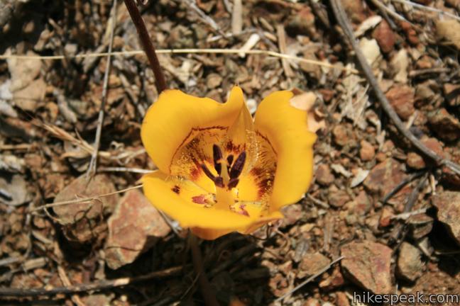
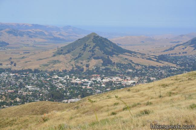
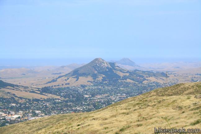
From a less heralded summit in the Santa Lucia Foothills northeast of San Luis Obispo, you will find triumphant views of the peaks and valleys surrounding this gem on the Central Coast. The hike from Reservoir Canyon to this 1,715-foot crown is not for the meek. The 5.35-mile round trip hike ascends 1,350 feet, and over 800 of those feet come in the final grueling mile. The effort is rewarded with an exceptional 360-degree panorama from the top, and there are other points of interest along the way to spur you on, like a waterfall and a puzzling collection of scrap metal sculptures.
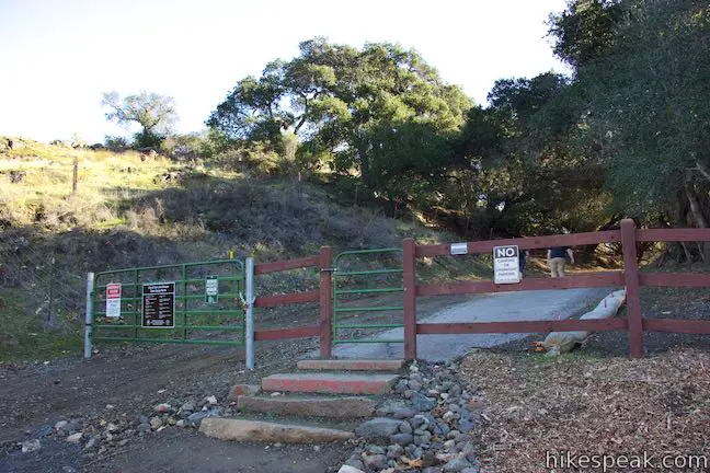
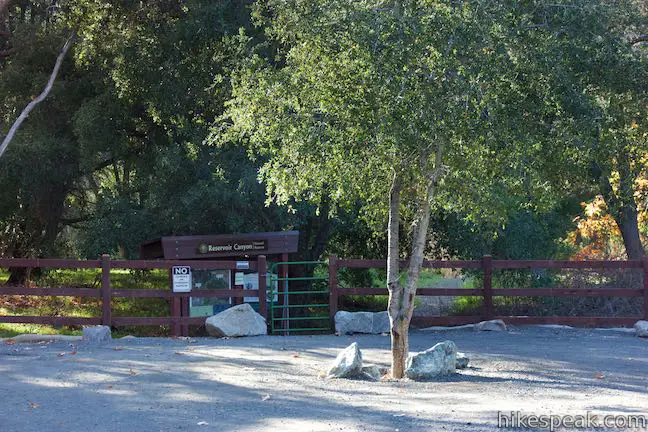
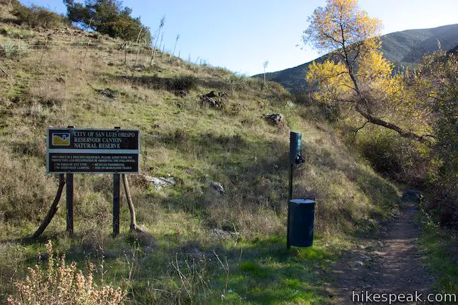
The hike begins from a trailhead in the 783-acre Reservoir Canyon Natural Reserve, located just off Highway 101 at the base of Cuesta Grade. The main trail continues straight in line with the road to the parking area, while another veers to the right.
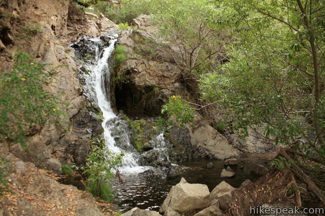
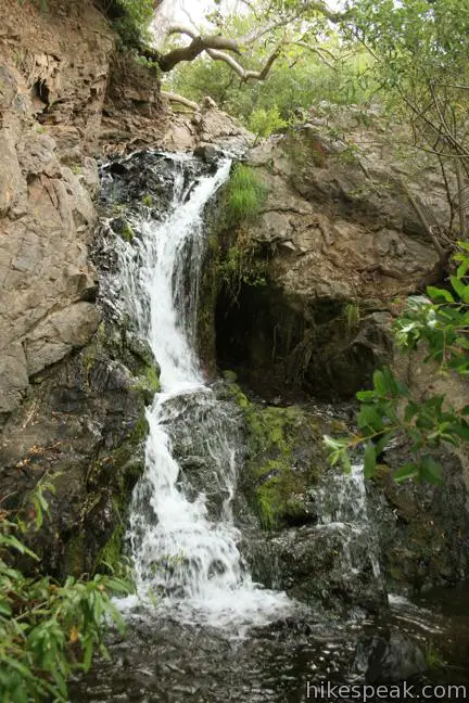
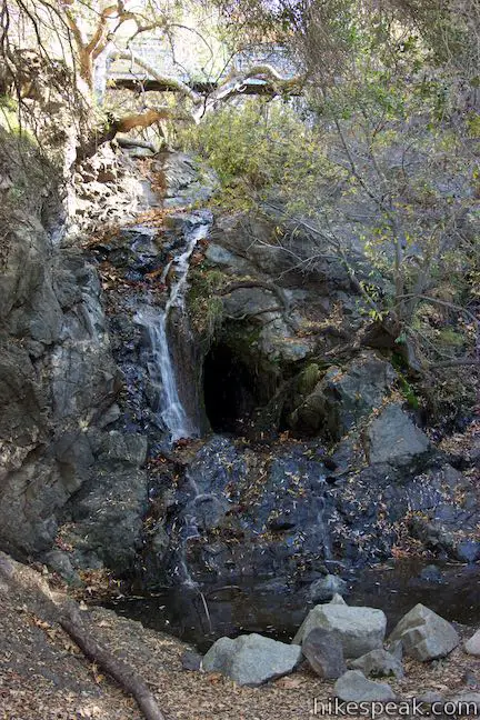
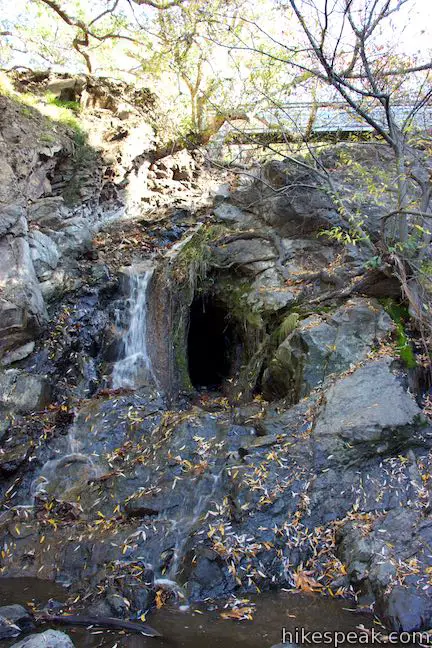
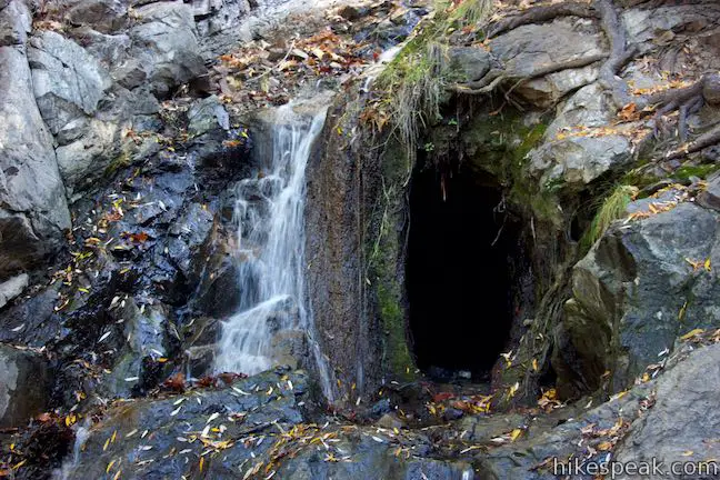
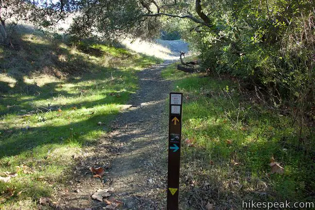
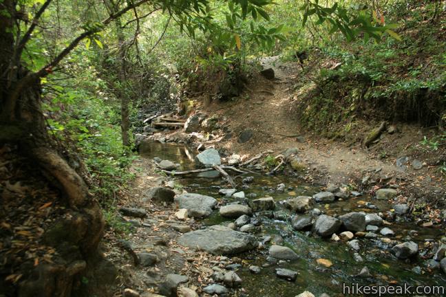
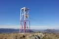
Take the trail to the right for a two-minute detour to a charming 15 to 20-foot waterfall. Reservoir Creek Falls cascades down a slope of black rock into a shallow oak-shaded pool. A single track climbs up the left side of the falls, cutting through the forest to rejoin the main trail leaving the parking lot. Between the waterfall and the main trail, Summit Trail breaks off across Reservoir Creek and rises to an old tower housing a bell that is positioned at the end of the ridge extending northwest from the top of Reservoir Canyon Trail. A loop can be created by combining Reservoir Canyon Trail and Summit Trail.
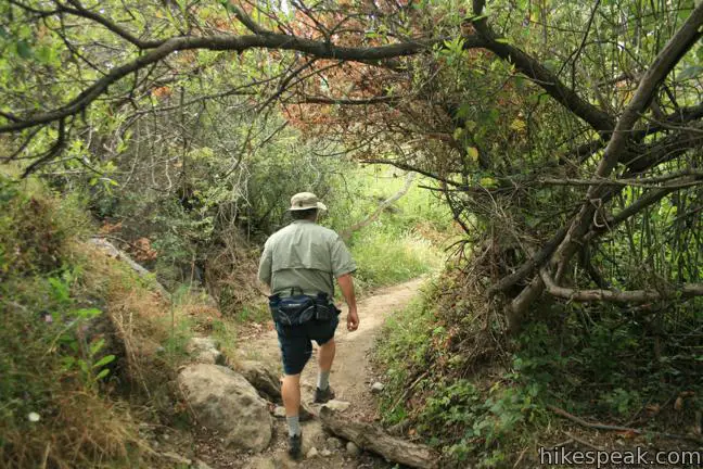
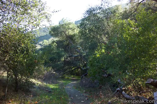
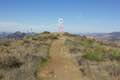
The first 1.25 miles of this hike are quite level, gaining approximately 225 feet. The effort is made easier by abundant shade from overhanging oaks, sycamores, and smaller trees that thrive along this year-round water source. The canyon was used to preserve water for San Luis Obispo residents about a century ago, but evidence of the canyon’s former occupation has disappeared under new growth. The former municipal road, now a hiking trail, has been downsized to a conduit that is perfect for foot traffic.
After 0.4 miles, Reservoir Canyon Trail passes through a junction with Creek Bypass Trail, which parts to the right. When the bottom section of Reservoir Canyon Trial becomes wet and muddy after went storms, Creek Bypass Trail provides an alternate route up Reservoir Canyon. The trail can also be used to for a short loop.
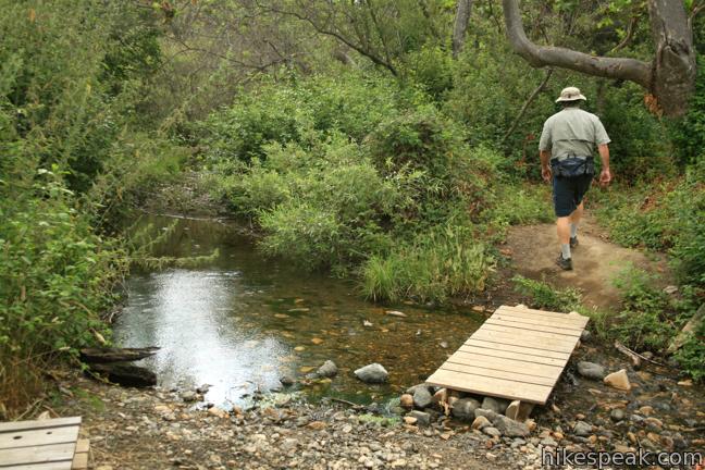
After crossing several small wooden footbridges, you come to a larger bridge crossing the creek to the right. Follow the trail up a fork in the canyon where it breeches the trees for an open view of Cuesta Grade and the Santa Lucia Mountains.
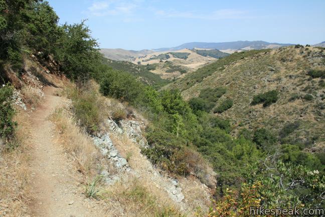
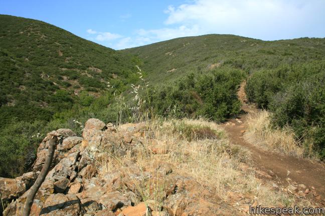
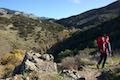
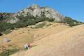
Half a mile from the bridge and approximately 1.25 miles from the start, the trail drops down to the bank of the creek. Rock hop to the other side and rise to a sharp turn to the right. Those inclined for a leisurely hike could turn around here for a pleasant 2.5-mile. Going forward, prepare to climb 1,125 feet over the next 1.4 miles on a sun-exposed single track.
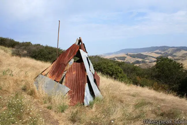
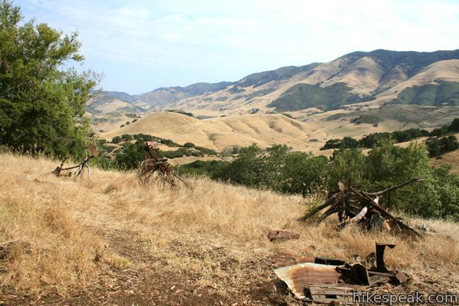
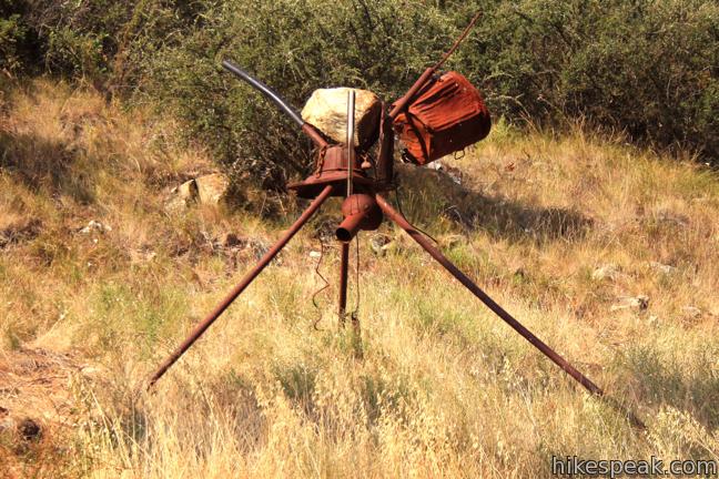
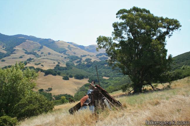
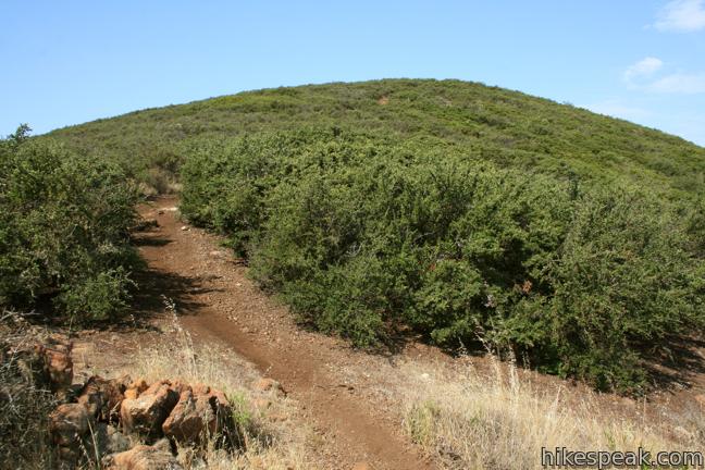
This tale of two hikes recommences with a steady climb up the side of the canyon. Be very careful as you hike up narrow segments on the trail. Trees give way to sloping grassland, which in turn give way to chest-high chaparral. Just under half a mile from the creek (though it may feel longer than that), you will arrive at a peculiar collection of scrap metal sculptures. These mysterious features would look more at home in the Poly Canyon Design Village than they do on the slope of this mountain. The site is also inhabited by a grand eucalyptus tree complete with a swing. Cross through the camp of robotic-looking tripods toward a metal teepee at the continuation of the trail.
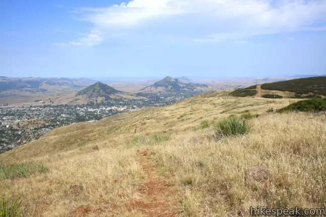
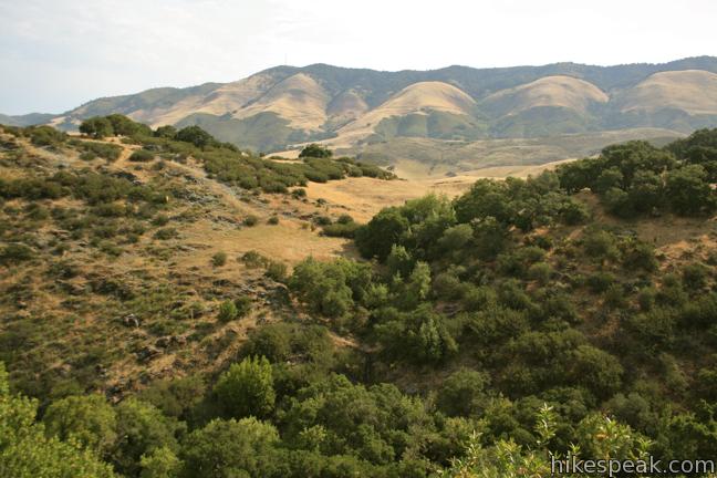
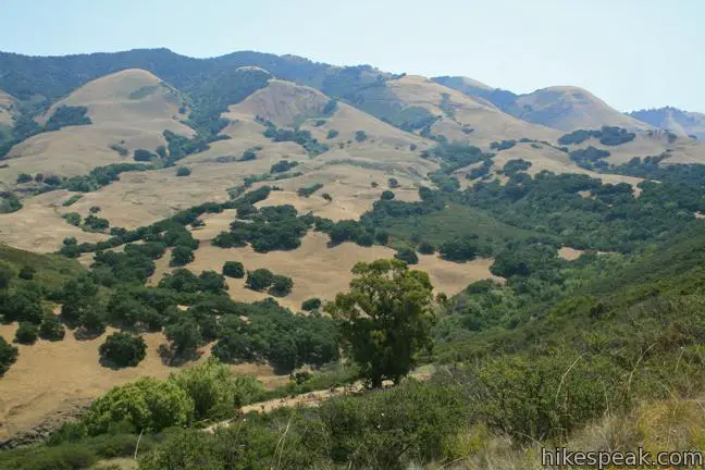
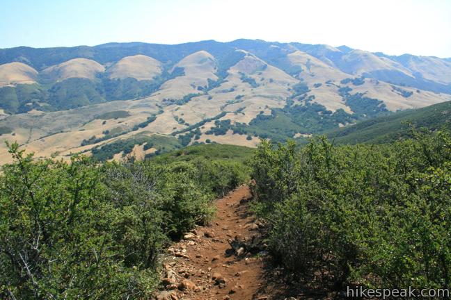
Press on as the trail becomes progressively steeper. Excellent views are waiting at the top. Any time you need to pause and catch your breath on the climb, there are over the shoulder views of Cuesta Grade and the Santa Lucia Mountains. The ascent appears relentless, and this is one of those trails where every time you think you are approaching the summit, the mountain extends itself just a bit farther.
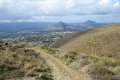
After climbing for 0.9 miles, the trail tapers out, reaching a small saddle north of the summit of Murray Hill (Unnamed Hill). Reservoir Canyon Trail ends at a T-junction with Ridge Trail, an old jeep road along the ridge. A short distance to the right is the top of Sydney Street, which comes up from the city side of the ridge. Farther down Ridge Trail is a viewpoint at an old tower housing a bell beside the top of Summit Trail.
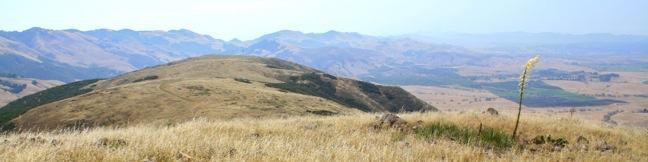
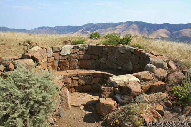
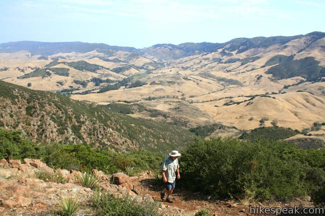
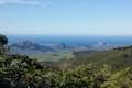
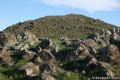
Take a sharp left (at a 45-degree angle) up another single track striding the final 0.05 miles to the summit of Murray Hill, where a SLO local has built a stone memorial that includes a U-shaped bench ideal for resting your legs and taking in the view over Edna Valley. Farther to the south, one can see the Pismo Dunes and Point Sal. There are three windows of ocean views in all, Pismo Beach to the south, Whalers Island in San Luis Bay (by Avila Beach) to the southwest, and Moro Bay to the west. The panorama does not stop there as Murray Hill looks east toward the Santa Lucia Mountains and west toward the Irish Hills and several jagged Morros, including the prominently displayed Cerro San Luis and Bishop Peak. Below the summit is the city of San Luis Obispo. It is quite a sight.
While many locals aren’t sure what to call this summit (unlike the other prominences around), it can be called Murray Hill, taking its name from Judge Walter Murray who resided in San Luis Obispo in the 1800s. Murray took part in the California gold rush after fighting in the Mexican-American War and wrote for the San Luis Obispo Tribune.
When your legs have recovered from the ascent and your eyes have recovered from the beauty, head back the way you came (or hike down Ridge Trail to attempt Reservoir Canyon Trail – Summit Trail Loop). The descent is brisk and easy. Dogs are welcome on leashes, but mountain bikes are prohibited. No fee or permit is required to hike in Reservoir Canyon Natural Reserve, so get out and enjoy!
Directions to the Trailhead
- From downtown San Luis Obispo, take Highway 101 north for approximately two miles to Reservoir Canyon Road (an easy-to-miss road connecting to the freeway).
- Turn right and drive half a mile to the trailhead parking area at road’s end.
- After the hike, exercise caution when getting back on the highway.
- It may be safer to drive north and turn around at another exit rather than cutting across northbound traffic to reach the southbound lanes to San Luis Obispo.
Trailhead Location
Trailhead address: Reservoir Canyon Road, San Luis Obispo, CA 93401
Trailhead coordinates: 35.29075, -120.62775 (35° 17′ 26.7″N 120° 37′ 39.9″W)
View Reservoir Canyon Trail in a larger map
Or view a regional map of surrounding Central Coast trails and campgrounds.


 | Reservoir Canyon Summit Trail This 4.1-mile hike ascends to a point on the northwest end of the ridge above Reservoir Canyon, presenting panoramic views over San Luis Obispo from the base of an old tower with a bell that can be rung with a thrown pebble. |
 | Reservoir Canyon Trail - Summit Trail Loop This 5.6-mile loop ventures up Reservoir Canyon Trail to the summit viewpoint, crosses Ridge Trail to the bell tower, and descends Summit Trail back into Reservoir Canyon. |
 | Creek Bypass Trail Loop This 1-mile hike takes the beginnings of Summit Trail and Reservoir Canyon Trail and connect them with a short trail boasting big canyon views. |
 | Murray Hill via Sydney Street Trail This 2.8-mile round trip hike rapidly ascends 1,275 feet up a rugged trail to a stone seating area at a summit with panoramic views. |
 | Cuesta Ridge Botanical Area This 6-mile round trip hike crosses a ridge in the Santa Lucia Mountains with panoramic views over San Luis Obispo, ascending to a grove of Sargent cypress in a botanical area in Los Padres National Forest. |
 | East Cuesta Ridge This wide dirt road offers an 8.4-mile hike to the top of Mount Lowe or a longer trek to the top of Lopez Canyon Trail, offering ocean views over San Luis Obispo and inland views over an evergreen wilderness. |
 | Cerro San Luis This 4-mile hike summits one of the Nine Sisters just west of downtown San Luis Obispo. |
 | Cerro San Luis from Laguna Lake Park This 5.7-mile hike reaches the summit from a nearby park. |
 | Bishop Peak This 3.5-mile hike ascends 950 feet to highest summit in the Nine Sisters, offering excellent views of San Luis Obispo and the surrounding Morros. |
 | Felsman Loop Trail This 2.7-mile loop crosses oak, sagebrush, and grass-covered slopes around the base of Bishop Peak, providing excellent views of that notable rocky summit and its San Luis Obispo surroundings. |
 | South Hills Ridge Trail This 1.5-mile round trip hike ascends 425 feet to the highest point in a cluster of hills near downtown San Luis Obispo, offering fine views over the city and surroundings. |
 | Poly Canyon Design Village This 2.5-mile hike visits an experimental architectural village designed by Cal Poly students at the base of the Santa Lucia Mountains. |
 | More hikes in San Luis Obispo Explore other trails around San Luis Obispo including Morro Bay State Park, Montaña de Oro, and the Morros. |
Common Questions about Reservoir Canyon Trail in Reservoir Canyon Natural Reserve
- Is the trail open?
- Yes. You should expect to find that Reservoir Canyon Trail is open. There are no recent reports of trail closures. If you discover that the trail is closed, please help your fellow hikers by reporting a closure.
- Is this trail free to access?
- Yes, Reservoir Canyon Trail is free to access. No entrance fee, pass, or permit is required. If you discover that access rules have changed, please provide feedback on your experience.
- How much time does this hike take?
- It takes approximately 3 hours to hike Reservoir Canyon Trail. Individual hiking times vary. Add extra time for breaks and taking in the views.
- How long is this hike?
- The hike to Reservoir Canyon Trail is a 5.35 mile out and back with 1350 feet of elevation change.
- Are dogs allowed on this trail?
- Yes, dogs are allowed on Reservoir Canyon Trail. The trail is open to hikers, dogs.
- Will I see a waterfall on this hike?
- Yes, Reservoir Canyon Trail features a waterfall.
- Does this trail go to a summit?
- Yes, Reservoir Canyon Trail reaches a summit with panoramic views.
- Where is the trailhead located?
- The trailhead for Reservoir Canyon Trail is located in San Luis Obispo, CA.
Trailhead Address:
Reservoir Canyon Road
San Luis Obispo, CA 93401
Trailhead Coordinates:
35.29075, -120.62775 - What are the driving directions to the start of the hike?
To get to the trailhead: From downtown San Luis Obispo, take Highway 101 north for approximately two miles to Reservoir Canyon Road (an easy-to-miss road connecting to the freeway). Turn right and drive half a mile to the trailhead parking area at road’s end.
After the hike, exercise caution when getting back on the highway. It may be safer to drive north and turn around at another exit rather than cutting across northbound traffic to reach the southbound lanes to San Luis Obispo.
View custom Google Maps directions from your current location.
- Are there other trails near Reservoir Canyon Trail?
- Yes, you can find other nearby hikes using the Hikespeak Hike Finder Map.

25 Comments on Reservoir Canyon Trail in Reservoir Canyon Natural Reserve
What hikers are saying:
✨ Generated summary of user commentsThis trail provides a strenuous workout featuring a shaded creek at the start and a challenging final climb to the ridge. Matthew finds the vistas here superior to more famous local peaks like Bishop Peak.
“Better views of SLO and environs than either SL Mountain or Bishop's Peak.” Jump to comment ↓
I heard a few old timers call the ridge Murray Hill. Good name for it! Nice to see in print.
is there any water in the falls this year? thanks…
Maggie,
Yes, there is a good flow of water. I was just there today (March 15, 2014). Here is a picture I took of the waterfall last week. https://bit.ly/NihLbh
Luke
[…] Last week’s climb trumps Bishop’s Peak! By the luck of the draw, Arleena and I choose Reservoir Canyon Trail located just off the 101 Freeway at the base of Cuesta Grade. On the website, it speaks of a […]
[…] have found 3 entrances (to date) to reach the 1,715-foot summit of Murray Hill: Reservoir Canyon Trail, Sydney Street, and Lizzie Street (yet another hike to come). As we did not see the sign that […]
“Lizzie Street” = High School Hill trailhead…
Is this hike safe enough to do solo or should you go with at least one other person??? I usually take my dog and we roll, speaking of which are dogs allowed on the trail?? Thanks so much!!
Dogs are welcome on leashes, but mountain bikes are prohibited.
What’s so special about hikers. Everybody should sure all trails. It’s a small county in the trails here suck. Why not open a bike park somewhere or so much open space wasted a nice little bike park would be nice then the hikers can have all the trails they want.
This criticism seems way out of place. San Luis Obispo (not a small county) has numerous trails open to mountain bikers as well as a bike park. If you search for hikes around San Luis Obispo and filter for Bikes Allowed,” you’ll see that many of the trails are bike-friendly. Many of the volunteer-built trails are really well constructed with bikes in mind. The area has tremendous offerings for mountain bikers.
Great hike, albeit one of the more difficult in SLO County. The final climb is pretty tough. Beginning of the trail is quite lovely and well shaded. The creek setting makes for a cool beginning and end to the hike. I’d recommend keeping dogs and kids out of the water, however. My dog got Giardia from drinking out of the creek – not an experience I would choose to relive.
Definitely one of the more difficult (vertical) hikes in SLO. As far as views of the area go, I greatly prefer Bishop Peak, but this is a nice hike if you’re looking for a solid workout and some views of the back country. Definitely bring water, take all the breaks you need, and give yourself a few hours for this one – it’ll kick your butt if you haven’t been up on the hills for awhile!
any idea on what the tunnel under the waterfall was used for?
part of the old reservoir/water sewage plant?
Last month my brother, sister, and I hiked up the Reservoir Canyon to revisit childhood memories of the canyon. Some of the memories were when my parents used to collect rocks from the creek to build a rock wall in our back yard. While they picked up the rocks, us kids used to play around the area, which had old beat up picnic tables, concrete barbeques, and a road that was drivable for miles. I think the canyon used to be a resort picnic area in the 1920’s? In about 1960, my father took us on a hike up a steep trail to where the metal sculptures are now. That area used to have a wooden shack with a corrugated metal roof. As we stood in the chaparral near the clearing many years ago, we watched an old man with long white hair and a white beard walk around his yard. There were chickens and piles of old rusty tin cans in his yard. It was such a remarkable sight that I have never forgotten it. I know there was a fire that swept through that area years ago that burned down the wooden structures that were there, but the metal pieces that he’d used for his roof seem to be what is now part of the sculptured artwork. There are still remnants of the piles of rusty tin cans there also and in one of the sculptures, there appears to be an old iron stove that must have been his. My dad used to work for Cal Trans in the 50’s and 60’s when they were building the new 101 freeway. He said he used to see an old lady walking to town from Reservoir Canyon to get her groceries, about once a week. We thought that maybe she was the old man’s wife. If anyone knows anything about the old man that used to live on the side of Reservoir Canyon, near the old Eucalyptus tree and metal sculptures, I’d be very interested in learning about what is known. Also, it would be interesting to know about the development of Reservoir Canyon when the road went way back (before floods) and there were picnic tables and barbeque pits. Thanks!
Thank you for sharing your interesting memories of Reservoir Canyon! Did anyone with more history get back to you? Hope so!
I went fishing many times for trout and caught many in the reservoir at Reservoir Canyon in 1954-57. I also incidentally hooked a number of fresh water turtles in the reservoir. We used to drive to the reservoir from 101. The DFG used to stock it in the 1950’s. This was before Lopez Lake was formed. In fact I went for picnics and fossil hunting in Lopez Canyon numerous times before the Lake covered the area.
Well that’s interesting that you saw the man who lived in that little building. I saw that building many times before it burned down. I believe the man you saw was Ed Hastings. He owned a 40 acre parcel there. I have heard that he was called the goat man by some folks. That area is definitely the Hastings property. Have been going to the meadow since the mid 70s.
Ed Hastings was my Great Grandfather. I believe He moved in with his daughter in Oakland around 1930’s That is most likely when the original Homestead still existed He was the Goatman. His son Frank remained on the property until his death in 1968. (Except during world war 1 there are enlistment documents found in ancestry searches. He was the old man people reportedly saw while hiking. He lived in that shack.
Hi. My Great Grandfather was Ed Hastings. His son Francis(Frank)lived there until he died in the late 60’s. I remember going there with my Dad to put a new lock on the gate. We drove inside the gate as far as We could access by car. Yes my GG Ed was called the Goatman He moved to Oakland in his 30’s/40’s with his wife Josephine. She helped raise my Dad so his parents could work. Josephine died in 1942 and Ed in 53. I was about 10 when I made that trip with my Dad. I suspect it was after they found my great uncles body. Not sure when his wife died but definitely before him. I have old portraits of John Hastings and his wife (Her name was not on the back of the portrait) dated 1851. I know my Grandmother grew up there and rode horses to town and the beach. Her older brother was Frank and younger sister Violet was 5 years younger born in 1905. Violet developed an MS type disease in late teens. Perhaps that is why they moved to Oakland. She attended UC Berkeley and died before age 30. If you Google Goatman San Luis Obispo an interesting article comes up. I would love to know more. The original House could not have been that shack With a family of 5 -7 living there. Frank had 2 sons John and Frank Jr I knew Frank well and He and my father were close and both became Oakland Fireman. I would be interested in knowing about their Education in SLO. I suspect they were home schooled by Josephine.The elders immigrated from England and Ireland to Canada and then into the US and lived in Michigan before I migrating to California. Michigan is where Frank was born My grandmother had beautiful penmanship and was very educated although I don’t think formally. The family owned property in Oregon Feather River Oakland and of course SLO. The SLO property was reported to be on the highest peak and We sold it to the California Conservation Corporation CCC around 1990. There was talk of them extending/connecting the California aqueduct through the property to the coast. Any more info from you and your siblings would be greatly appreciated. I seem to be the only family member really interested in Family History. My Email is deborahwrightklug@yahoo.com
Better views of SLO and environs than either SL Mountain or Bishop’s Peak.
How’s the poison oak around Jan-March?
Who built the in ground bench/memorial? When? And, what is it a memorial to?
[…] Reservoir Canyon is located at the base of the Cuesta Grade off the 101. We’ve never been to the area so decided to head check it out. It was a quick exit off the 101 north from our hotel. The hike starts out with a view of a pretty little waterfall and then continues switchbacking up the canyon. There are nice views and lots of oak and sycamore trees[…]
Are drones allowed ?