Cuesta Ridge Botanical Area via West Cuesta Ridge Road in Los Padres National Forest
Discover a tucked-away oasis of Sargent cypress straddling a ridge in the Santa Lucia Mountains north of San Luis Obispo. The evergreens are accompanied by coastal views that could have you imagining you’re somewhere farther north in California. The hike to Cuesta Ridge Botanical Special Interest Area is 6 miles round trip up a partially paved road with 950 feet of elevation change.
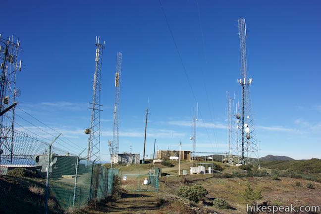
A big perk for this hike is that it starts from the top of Cuesta Grade, already high in the mountains, which means that panoramic views come early and often. In fact, you’ll see eight of San Luis Obispo’s Nine Sisters (Morros) before you get halfway up the trail. There is a radio-towered summit near the botanical area, which you can bag to bring the hike up to 6.4 miles (or more).
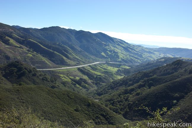
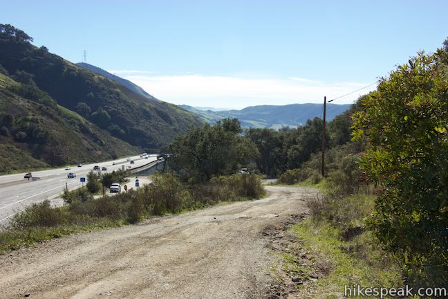
Set out from a trailhead on the west side of Highway 101 at Cuesta Pass, which is at the top of the long grade between San Luis Obispo and Santa Margarita at 1,500 feet of elevation.
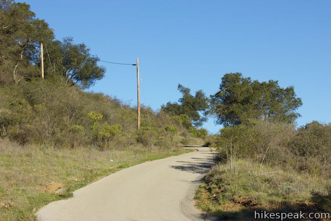
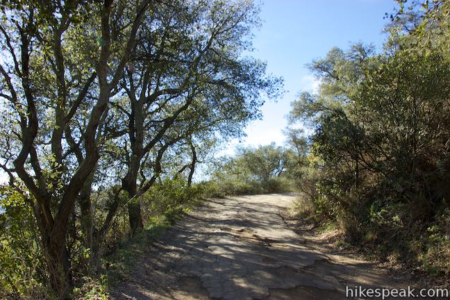
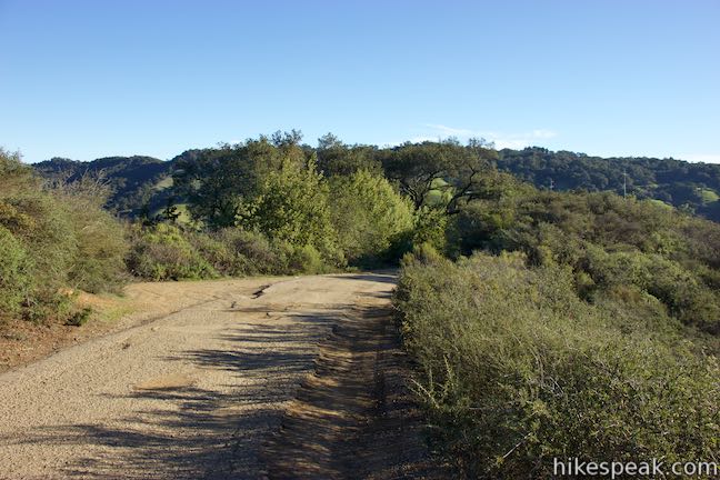
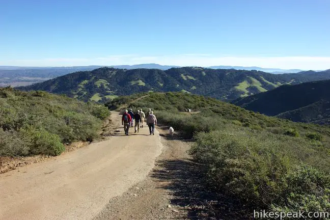
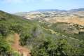
Despite the proximity to the freeway, the sound of the traffic slips away quickly as you begin up Forest Route 29S11, also know as West Cuesta Ridge Road or TV Tower Road. The rough paved road is open to high clearance vehicles, but is mostly used by hikers and bikers. A pair of switchbacks at the start ascend an oak-covered slope, but most of the route is treeless with big open views.
As the trail concludes the switchbacks and comes up onto the end of the ridge, half a mile from the start, make the obvious left turn and continue past a driveway on the right that goes out to a building. After hiking for 3/4 of a mile, you’ll get your first big views of the trek, liking south down Cuesta Grade, which is backed by East Cuesta Ridge, where communication towers rise above Mount Lowe and other points along the long ridge.
For more big views to the south, continue up West Cuesta Ridge Road. Bear right at a split, 1.05 miles from the start, taking the high road to continue toward Cuesta Ridge Botanical Area. The dirt road to the left descends to Roller Coaster Trail and Shooters Trail, which can be used to reach The Eucs (a popular route for mountain bikers).
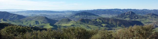
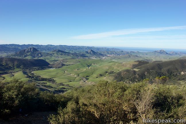
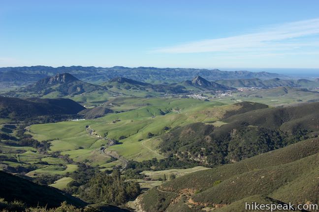
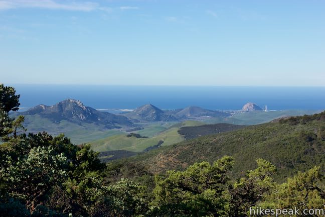
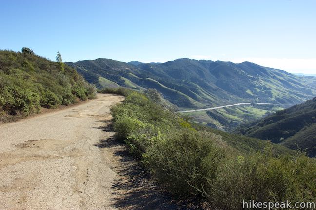
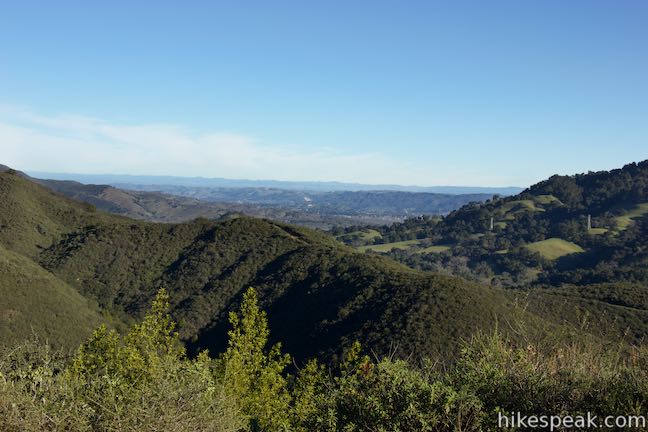
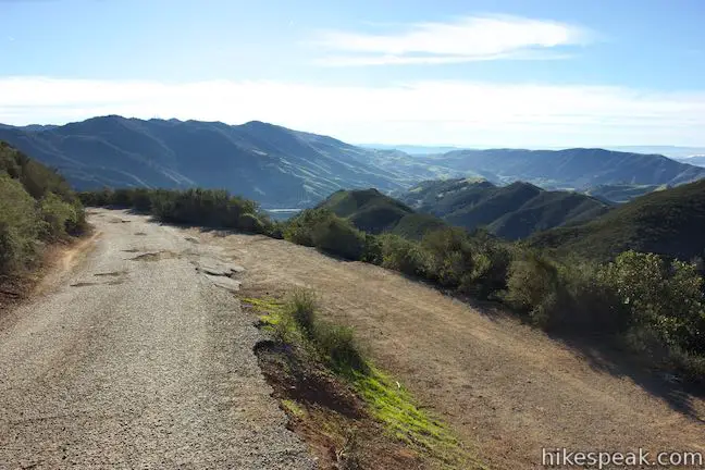
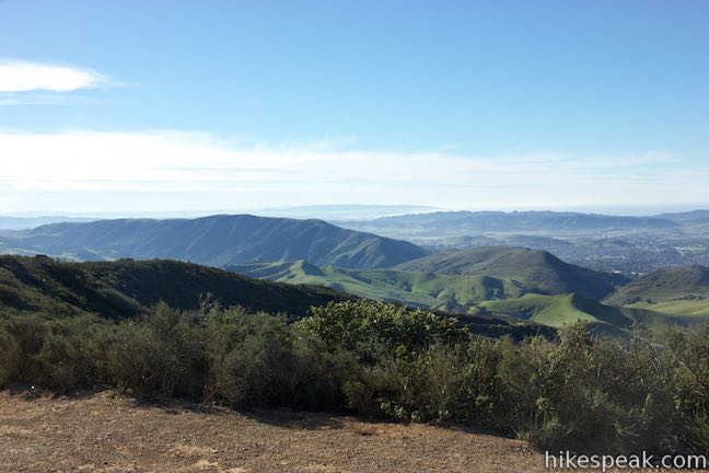
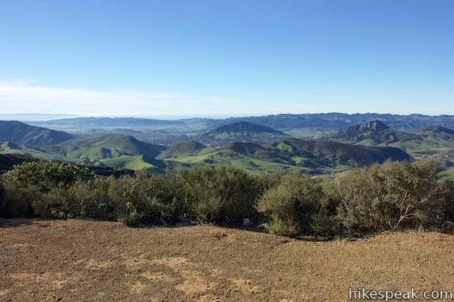
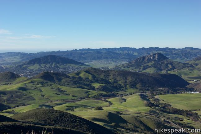
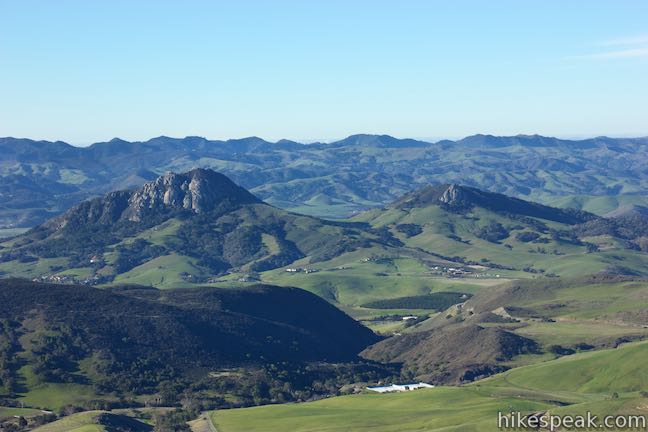
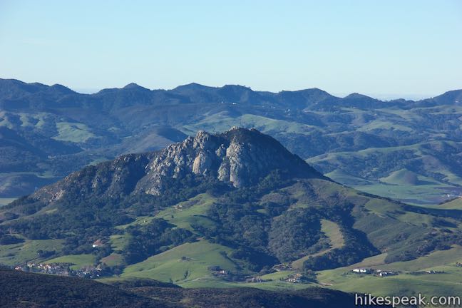
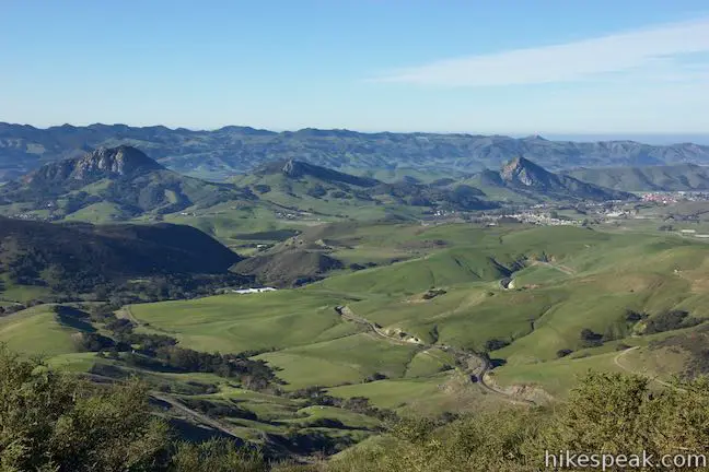
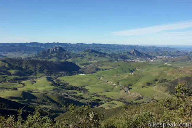
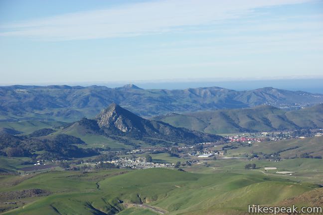
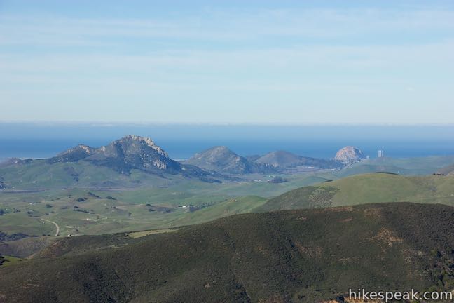
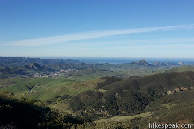
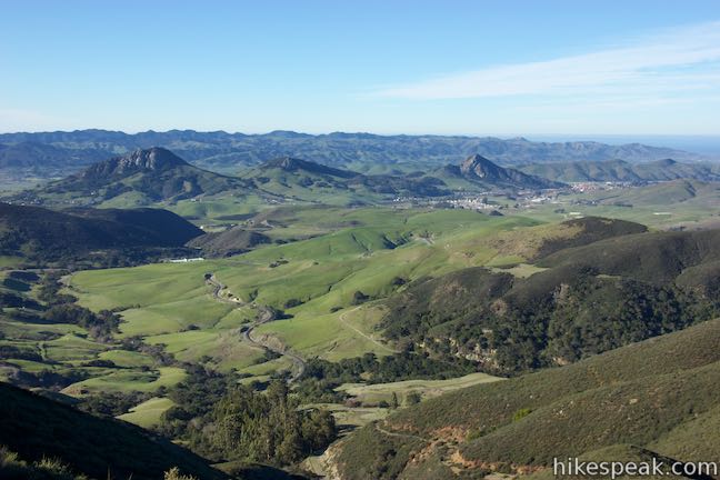
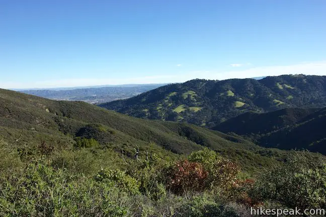
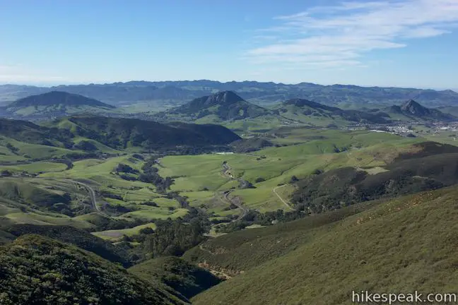
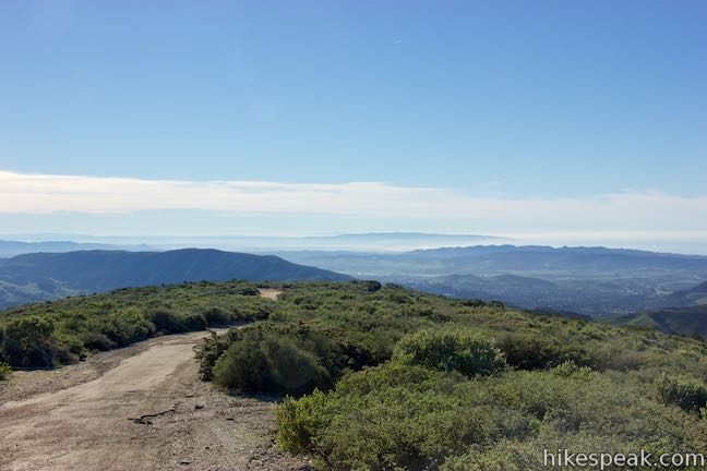
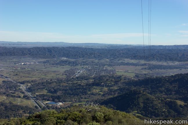
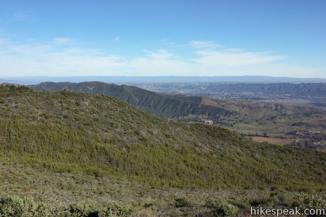
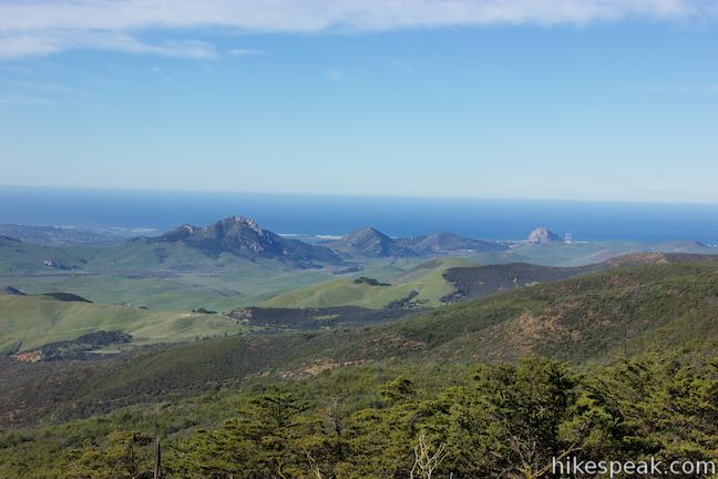
At 1.3 miles from the start, West Cuesta Ridge Road passes a big open landing on the left. The views from here are immense, and far more than you’ve earned from the limited effort to this point. Don’t let that stop you from enjoying the 180-degree views though! Walk a short distance out on the dirt road on this landing and look out across the valley below. The city of San Luis Obispo lies to the south, cradled by Murray Hill and Cerro San Luis. Farther to the south, beyond the Irish Hills, there’s a shimmering sliver of the Pacific Ocean by the Oceano Dunes. The bucolic ripples of Polly Canyon are below the viewpoint, and beyond that you’ll see the signature form of Bishop Peak rising alongside Cerro San Luis.
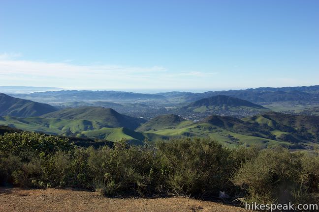
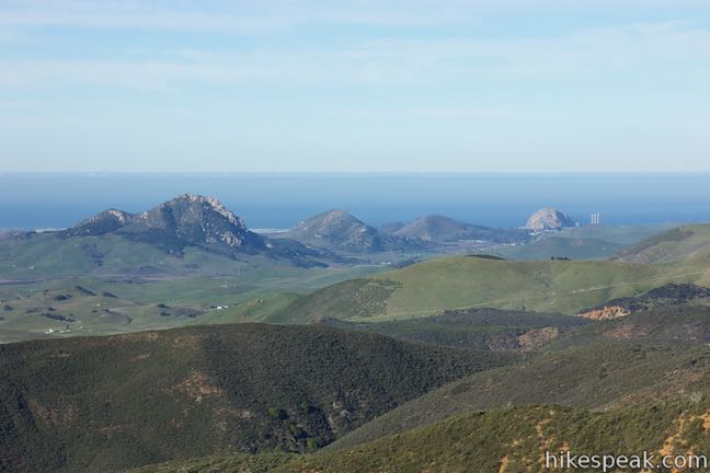
You can actually see eight of the Nine Sisters, the name given to the volcanic plugs (Morros) that run across San Luis Obispo County. From left to right (east to west) there’s Cerro San Luis, Bishop Peak, Chumash Peak, Cerro Romauldo, Hollister Peak, Cerro Cabrillo, Black Hill, and Morro Rock. Backing this picturesque chain are the Irish Hills to the south and the Pacific Ocean to the west. The only sister that’s missing is Islay Hill, which is blocked by Murray Hill, the long ridge on the backside of Reservoir Canyon to the southeast. The Valley Overlook gives such an impressive perspective over San Luis Obispo County that you’ll probably be reluctant to leave. Rest assured, there are more great views to enjoy as you push west up the wind-swept ridge toward Cuesta Ridge Botanical Area.
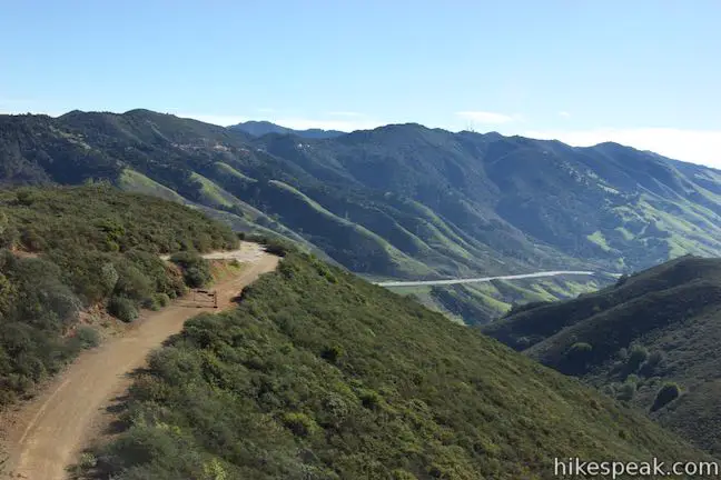
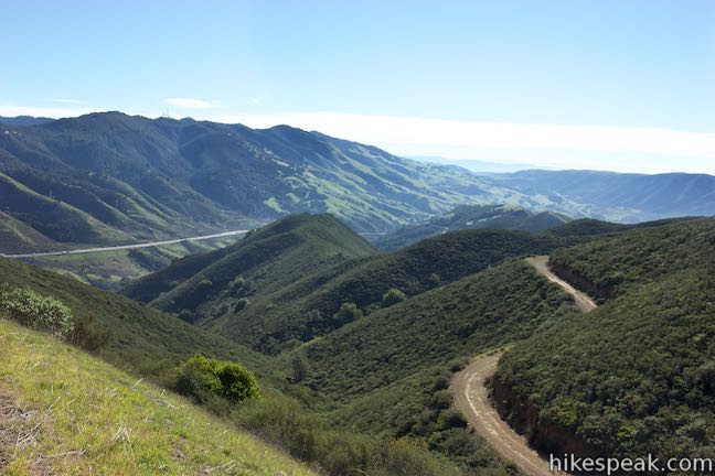
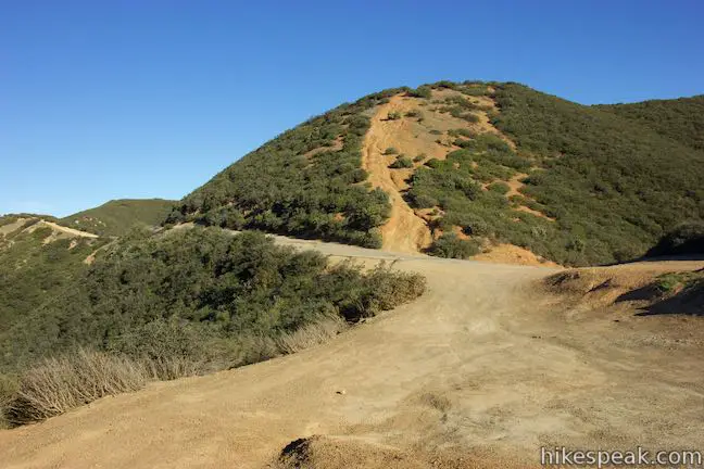
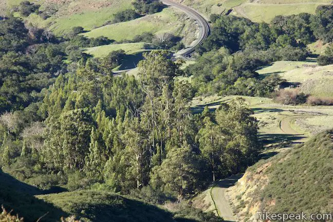
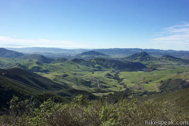
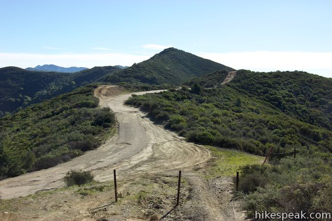
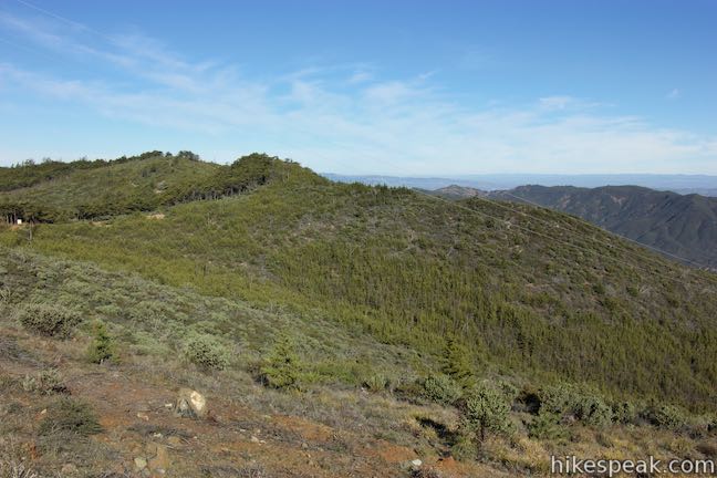
Along the tapered ascent, the road turns downhill for a stretch and dips across a saddle in the ridgeline, 1.6 miles from the start. Pause, look west, and take in a broad view toward Morro Bay. Cuesta Ridge rises high above the pastoral valley below. Near the bottom of the canyon beneath the saddle, you’ll spot a grove of tall eucalyptus trees at the site of The Eucs freestyle bike trails.
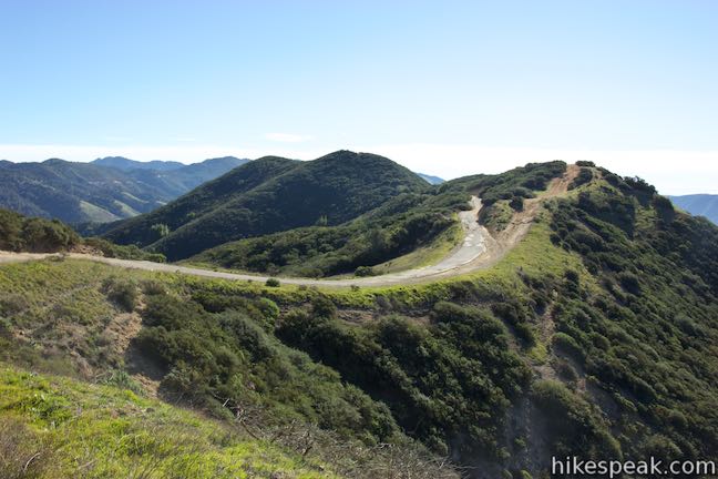
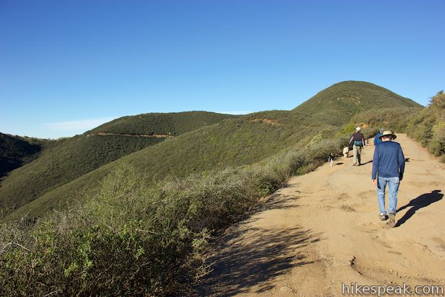
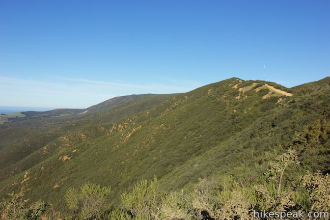
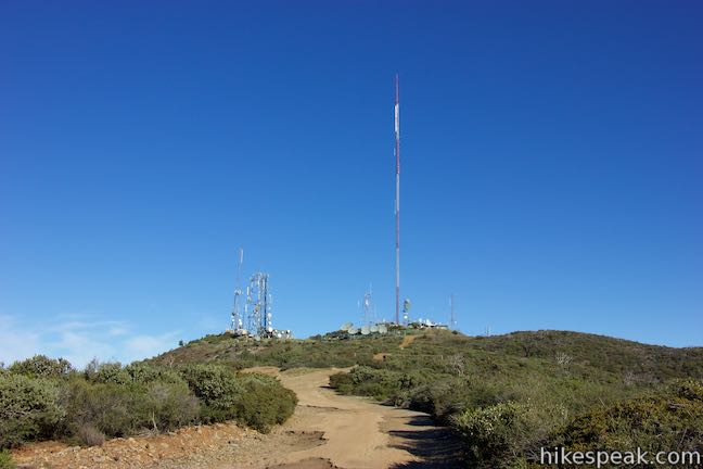
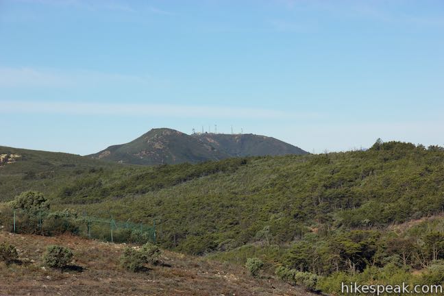
West Cuesta Ridge Road continues to climb from here with glimpses of the radio tower-covered summit near the botanical area. A dirt trail runs parallel to the road, which can be used to add extra ridge crests and cut a couple corner. Pushing onward, you’ll find views to the northeast looking over the valley that contains Atascadero and Santa Margarita.
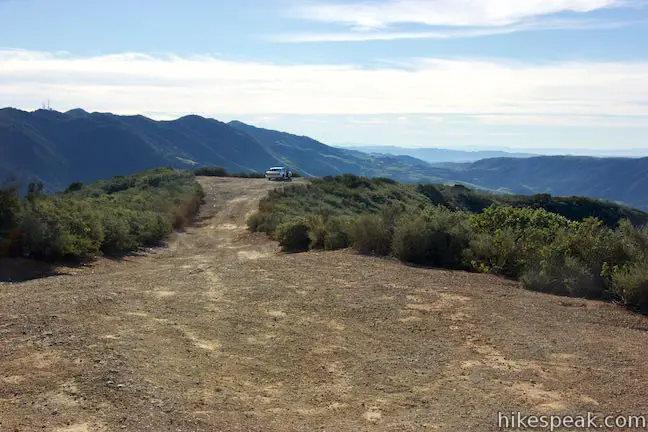
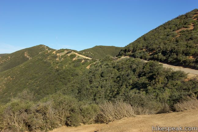
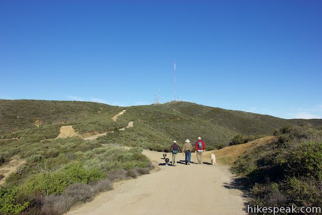
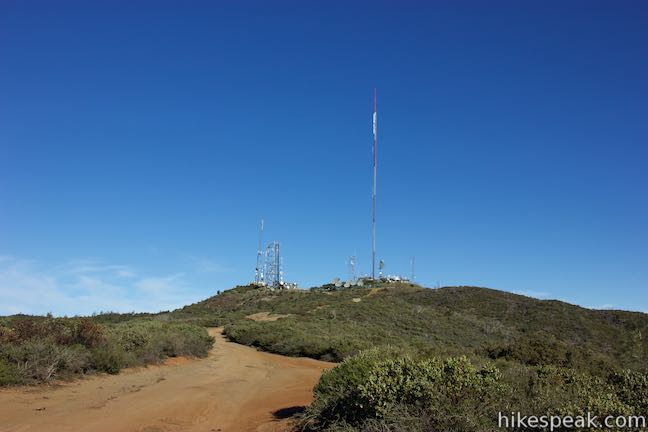
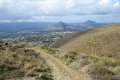
There is a split in the road, 2 2/3 miles from the start of the hike, as you near the summit covered in TV and radio towers. If you bear right here, you can hike 0.2 miles up to the 2,460-foot summit and take in big view to the northeast. You can look west from the mountaintop farther down the ridge toward Tassajara Peak, which is also covered in radio towers. The very top of Cerro Alto might be visible as well, playing peekaboo behind the ridge.
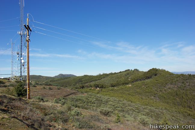
To reach Cuesta Ridge Botanical Area, take the left fork at the split below the summit. The road maintains a gradual course around the west side of the mountaintop and proceed another quarter mile to the edge of the Cuesta Ridge Botanical Area. As you approach the grove of Sargent cypress trees that are preserved there, a wide dirt trail will join the road on the left. This is Botanical Trail and it descends to Morning Glory Trail, which connects to Shooters Trail near the Eucs.
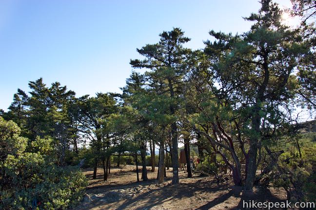
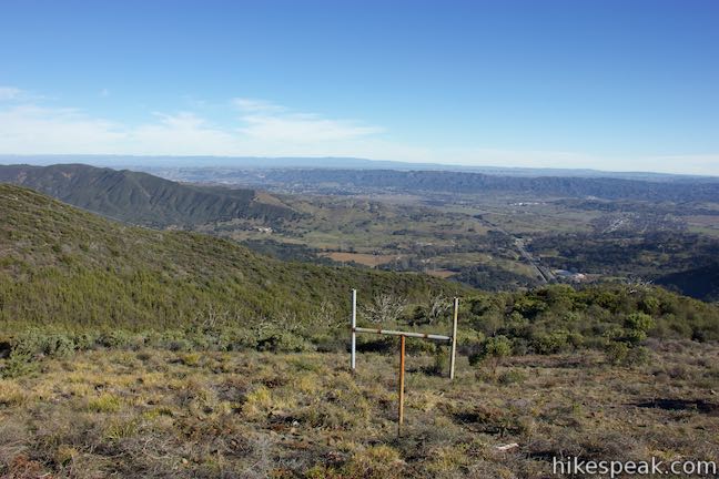
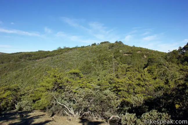
Pass through young Sargent cypress trees that have regrown since a wildfire scorched this area in 1994. After 2.95 miles of hiking, reach a sign with the title “A place set aside” that describes some of the plants that grow in this 1,333-acre protected parcel of Los Padres National Forest.
Cuesta Ridge Botanic Area is home to many plants, including some that are rare and local. The sign identifies Leather oak, Bishop manzanita, San Luis Sedge (a grass-like plant that only grows in San Luis Obispo County), San Luis Mariposa Lily, Brewer’s Spineflower (which also only grows San Luis Obispo County), and Cuesta Pass Checkerbloom (which is only found in this vicinity). As the panel explains, this is a special place for special plants:
You are standing in a grove of Sargent cypress trees. Although these trees grow in several locations in central and northern California, this is the largest grove that can be reached easily by car. To provide protection for this grove and other associated rare plants, the USDA Forest Service has designated these 1,333 acres as Cuesta Ridge Botanical Area.
While the grove might not be as easy to reach in a car is it was in decades past (better to hike here anyway), it is a great place to see Sargent cypress trees, which are only found in coastal mountain ranges between Santa Barbara and San Francisco. These evergreens prefer to grow in pure stands on serpentine soil. Sargent cypress can rise to fifty feet tall, but come from humble beginnings, growing out of small round cones that are about an inch long.
West Cuesta Ridge Road continues through the grove, so you can explore quite a ways farther. If you turn left at the sign and walk a couple hundred feet, you will come to a west-facing ledge with views across the mountain ridges toward the Pacific. With the combination of evergreen-covered slopes and vast ocean views, you could easily believe you were standing on a remote ridge on the Big Sur coast.
Walk among the large Sargent cypress, grab some shade and have a picnic, or just snap a few photos and turn back. There are abundant views over San Luis Obispo as you descend West Cuesta Ridge Road.
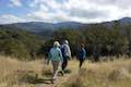
The 6-mile round trip hike to Cuesta Ridge Botanical Area (6.4 miles if you add the summit) is satisfying and panorama packed. The wide trail makes this a good group hike. No fee or permit is required to day hike on this trail in Los Padres National Forest. A permit is only required if you plan to build a fire or camp overnight. Dogs and bikes are welcome, so get out and enjoy!
Directions to the Trailhead
- West Cuesta Ridge Road begins just off Highway 101, 6 miles north of San Luis Obispo.
- Pass Old Stage Coach Road at the bottom of Cuesta Grade (an alternate route to the trailhead) and drive 2.2 miles up the freeway.
- Use the exit lane on the left just before the top of the grade.
- There will not be a sign for this exit.
- Safely cross the southbound lanes and drive onto the road on the other side, which curves past a southbound offramp and comes to a T-intersection.
- Use the parking area on the left alongside the top of Old Stage Coach Road.
- Across from this, heading north and upward is West Cuesta Ridge Road, the route to the botanical area.
Trailhead Location
Trailhead address: Forest Route 29S11 (a.k.a. West Cuesta Ridge Road or TV Tower Road), Los Padres National Forest, Santa Margarita, CA 93453
Trailhead coordinates: 35.347125, -120.63045 (35° 20′ 49.64″N 120° 37′ 49.61″W)
View Santa Lucia Mountains in a larger map
Or view a regional map of surrounding Central Coast trails and campgrounds.


 | East Cuesta Ridge This wide dirt road offers an 8.4-mile hike to the top of Mount Lowe or a longer trek to the top of Lopez Canyon Trail, offering ocean views over San Luis Obispo and inland views over an evergreen wilderness. |
 | Rinconada Trail This 3 to 3.25-mile hike near Santa Margarita ascends past an old mercury mine and bucolic views to a grassy saddle with a sweeping perspective over the Santa Lucia Mountains. Extend the outing to the nearby summit of Bell Mountain for even grander vistas. |
 | Cerro Alto This semi-loop bags the 2,624-foot summit of Cerro Alto, plus a scenic ridge south of the peak, for a 5.35-mile hike with 1,600 feet of elevation gain. |
 | Reservoir CanyonThis 5.35-mile hike ascends 1,350 feet past a waterfall and a collection of junk sculptures to a treeless summit overlooking San Luis Obispo. |
 | Murray Hill via Sydney Street Trail This 2.8-mile round trip hike rapidly ascends 1,275 feet up a rugged trail to a stone seating area at a summit with panoramic views. |
 | Cerro San Luis This 4-mile hike summits one of the Nine Sisters just west of downtown San Luis Obispo. |
 | Cerro San Luis from Laguna Lake Park This 5.7-mile hike reaches the summit from a nearby park. |
 | Bishop Peak This 3.5-mile hike ascends 950 feet to highest summit in the Nine Sisters, offering excellent views of San Luis Obispo and the surrounding Morros. |
 | Felsman Loop Trail This 2.7-mile loop crosses oak, sagebrush, and grass-covered slopes around the base of Bishop Peak, providing excellent views of that notable rocky summit and its San Luis Obispo surroundings. |
 | Poly Canyon Design Village This 2.5-mile hike visits an experimental architectural village designed by Cal Poly students at the base of the Santa Lucia Mountains. |
 | Stenner Creek Trail to The Eucs This 3.7-mile hike goes up Stenner Creek Canyon past a small waterfall and views of Bishop Peak to a collection of freeride bike trails called The Eucs. |
 | Stenner Creek Trail – Red Dog Trail – Poly Canyon Road Loop This 4.25-mile loop goes beyond the Eucs to explore grass-covered slopes at the base of the Santa Lucia Mountains. |
 | More hikes in San Luis Obispo Explore other trails around San Luis Obispo including Morro Bay State Park, Montaña de Oro, and the Morros. |
- West Cuesta Ridge in Top Trail: California Central Coast by Brian Milne (opens in a new tab)
- West Cuesta Ridge on hikemasters.com (opens in a new tab)
- A Los Padres National Forest information page for Cuesta Ridge (opens in a new tab)
- The official Los Padres National Forest webpage for Cuesta Ridge Botanical Area (opens in a new tab)
Common Questions about Cuesta Ridge Botanical Area via West Cuesta Ridge Road in Los Padres National Forest
- Is the trail open?
- Yes. You should expect to find that West Cuesta Ridge Road to Cuesta Ridge Botanical Area is open. There are no recent reports of trail closures. If you discover that the trail is closed, please help your fellow hikers by reporting a closure.
- Is this trail free to access?
- Yes, West Cuesta Ridge Road to Cuesta Ridge Botanical Area is free to access. No entrance fee, pass, or permit is required. If you discover that access rules have changed, please provide feedback on your experience.
- How much time does this hike take?
- It takes approximately 3 hours to hike West Cuesta Ridge Road to Cuesta Ridge Botanical Area. Individual hiking times vary. Add extra time for breaks and taking in the views.
- How long is this hike?
- The hike to West Cuesta Ridge Road to Cuesta Ridge Botanical Area is a 6 mile out and back with 950 feet of elevation change.
- Are dogs allowed on this trail?
- Yes, dogs are allowed on West Cuesta Ridge Road to Cuesta Ridge Botanical Area. The trail is open to hikers, dogs, bikes.
- Are there ocean views on this hike?
- Yes, West Cuesta Ridge Road to Cuesta Ridge Botanical Area offers views of the ocean.
- Does this trail go to a summit?
- Yes, West Cuesta Ridge Road to Cuesta Ridge Botanical Area reaches a summit with panoramic views.
- What mountain range is this trail in?
- West Cuesta Ridge Road to Cuesta Ridge Botanical Area is located in the Santa Lucia Mountains.
- Where is the trailhead located?
- The trailhead for West Cuesta Ridge Road to Cuesta Ridge Botanical Area is located in Santa Margarita, CA.
Trailhead Address:
Forest Route 29S11
Santa Margarita, CA 93453
Trailhead Coordinates:
35.347125, -120.63045 - What are the driving directions to the start of the hike?
To get to the trailhead: West Cuesta Ridge Road begins just off Highway 101, 6 miles north of San Luis Obispo. Pass Old Stage Coach Road at the bottom of Cuesta Grade (an alternate route to the trailhead) and drive 2.2 miles up the freeway. Use the exit lane on the left just before the top of the grade. There will not be a sign for this exit. Safely cross the southbound lanes and drive onto the road on the other side, which curves past a southbound offramp and comes to a T-intersection. Use the parking area on the left alongside the top of Old Stage Coach Road. Across from this, heading north and upward is West Cuesta Ridge Road, the route to the botanical area.
View custom Google Maps directions from your current location.
- Are there other trails near West Cuesta Ridge Road to Cuesta Ridge Botanical Area?
- Yes, you can find other nearby hikes using the Hikespeak Hike Finder Map.

9 Comments on Cuesta Ridge Botanical Area via West Cuesta Ridge Road in Los Padres National Forest
What hikers are saying:
✨ Generated summary of user commentsHikers find the sweeping panoramas of Morro Rock and the Pismo dunes to be a highlight of this scenic route. The dense, ancient Cypress stands at the summit offer a unique botanical experience that feels rewarding.
“The panoramas were beautiful in every direction.” Jump to comment ↓
How many miles to do a loop hike if you park on TV tower road off top of Cuesta Grade, hike up Shooters, Morning Glory, and Botanical trails then walk down TV tower road back to car?
[…] began last year when Greg Golf and his buddies decided to start throwing little kickbacks on the Cuesta Ridge and Boy oh Boy it has been growing and […]
Just drove the road up to the Botanical area. Be careful. The original asphalt road is full of pot-holes that will eat a car up in one munch. The Cypress is amazing at the top, and to see such a vast, dense stand in the state is amazing. If you plan on driving up there, be safe and plan on extra time for the 3 mile trip.
GREAT site for the area.
[…] way to Paso Robles. There are two hikes that are off the freeway at the top of the grade – West Cuesta Grade to the Cuesta Ridge Botanical Area and the East Cuesta Ridge. We decided to do the west hike. It was a very pretty day which provided […]
Is parking overnight alright?
Yes. Parking overnight, camping is free for 2 weeks. No fires without permits. We saw less than 10 vehicles that appeared to be camping. 1 tent. One camper. and one truck camper. The wildflowers were beautiful, the weather in the 50s. The panoramas were beautiful in every direction. The late sun on the ocean reflected in the clouds over Morro Rock and the towers. To the south, the Pismo dunes were sunlit and clearly visible. We just drove up the road. Truck or 4 wheel drive recommended!
Hi! How do you drive up the road? It seems to be blocked by a gate
where do park for camping? do we have to hike to the campground?
[…] three of us, the two Vermonters and me. We decided to go on hike. We headed to the always enjoyable West Cuesta trailhead. It is located off the 101 between Santa Margarita and San Luis Obispo. You have to be […]