Stenner Creek Trail to The Eucs
in San Luis Obispo
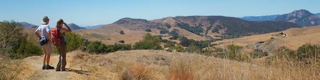
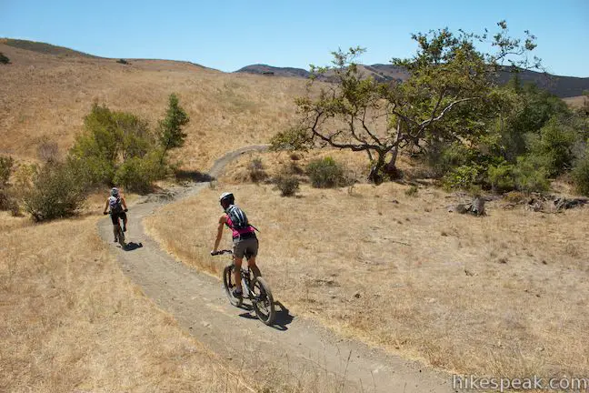
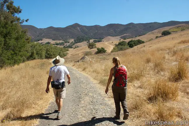
Crafty mountain bikers have built a playground for themselves in a eucalyptus grove in the foothills of the Santa Lucia Mountains near Cal Poly. It is 1.85 miles from a trailhead on Stenner Creek Road to The Eucs, where bikers can zip down freeride trails with impressive banked turns and jumps. Hikers can enjoy the trail up Stenner Creek Canyon too, taking in views of nearby Bishop Peak and surrounding San Luis Obispo County landscapes. The trail goes through grasslands and oak groves, and even passes a small waterfall. It is 3.7 miles round trip up Stenner Creek Trail to the Eucs in Stenner Springs Natural Reserve with 650 feet of elevation gain.
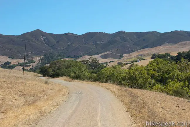
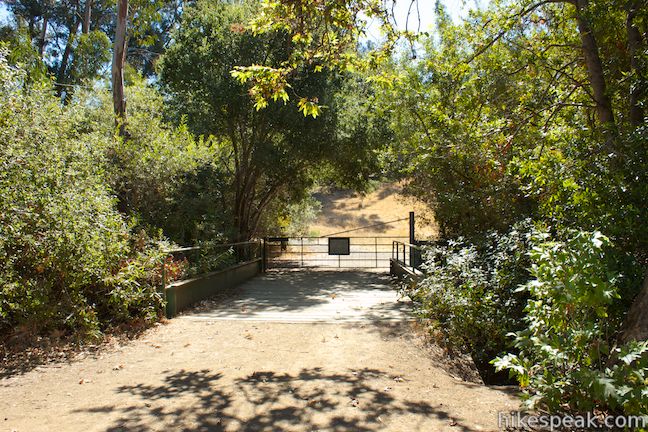
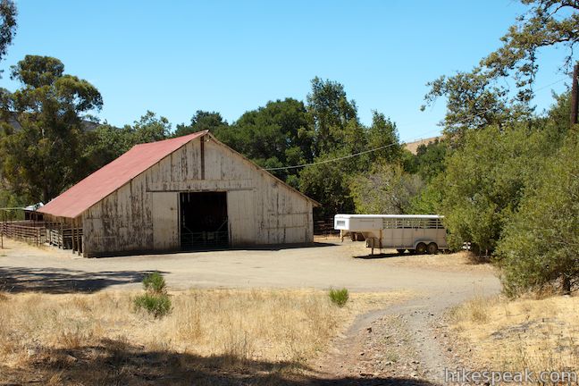
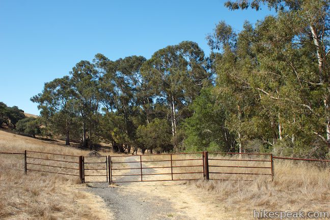
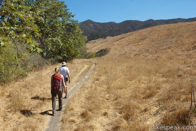
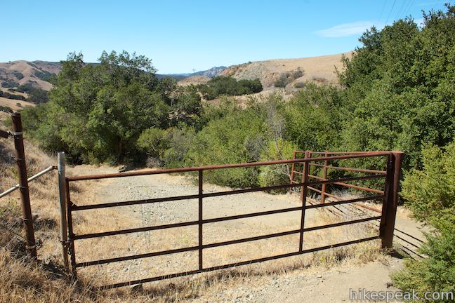
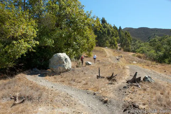
Hikers can begin the trek to the Eucs from a parking lot, two and a quarter miles up Stenner Creek Road from Highway One. Slip through a gate and walk up the dirt road, which continues northeast. Straight ahead, rise the Santa Lucia Mountains where radio towers are visible on a summit along West Cuesta Ridge Road. After a third of a mile, as the road approaches a ranch house, turn right and cross a bridge over Stenner Creek. On the far side of the bridge, go through a gate (that you should open, step through, and close) and come to a split. Poly Canyon Road ascends to the right next to a horse barn and pasture and can be used as part of a loop hike beyond the Eucs. Bear left to continue up Stenner Creek Trail.
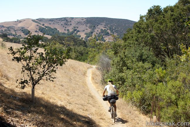
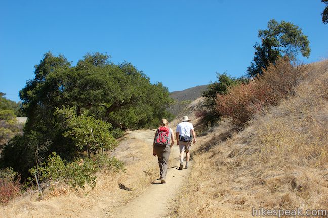
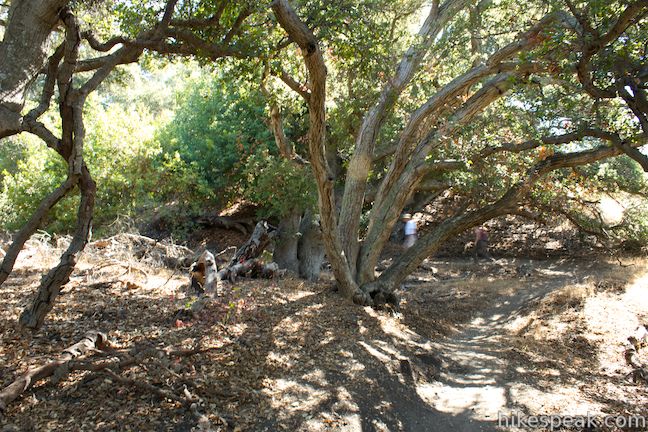
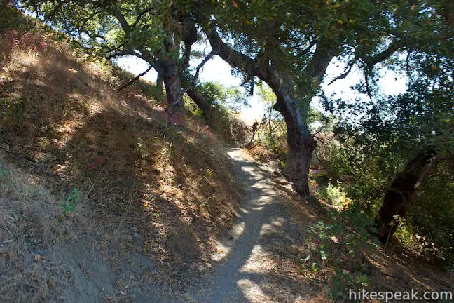
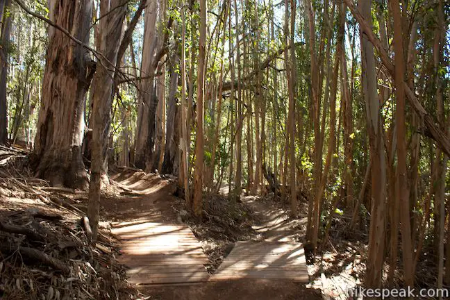
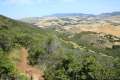
Past the gate, turn left and continue northeast along the creek. You will go through a small eucalyptus grove (an appetizer for things to come) and reach a cattle gate after another tenth of a mile. After that, there is a split in the trail. Stay to the left on the single track alongside Stenner Creek. Grassy ranchland rises to your right and a small riparian woodland hugs the creek to your left. The trail drops alongside Stenner Creek, passing beneath a few oaks as it gradually ascends toward the wall of mountains rising to the north and east. Look over your shoulder and you’ll spot the rocky mass of Bishop Peak looming above the trail.
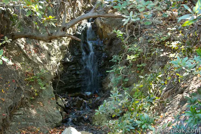
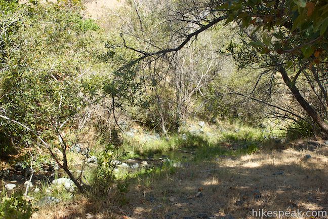
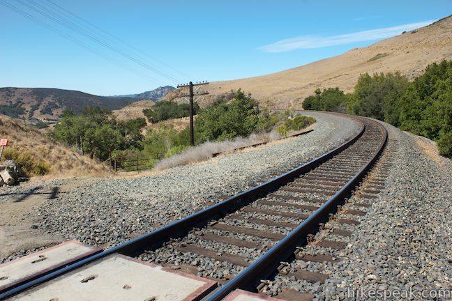
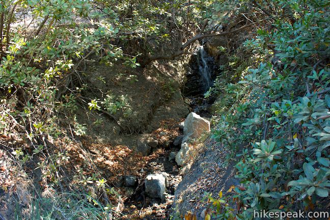
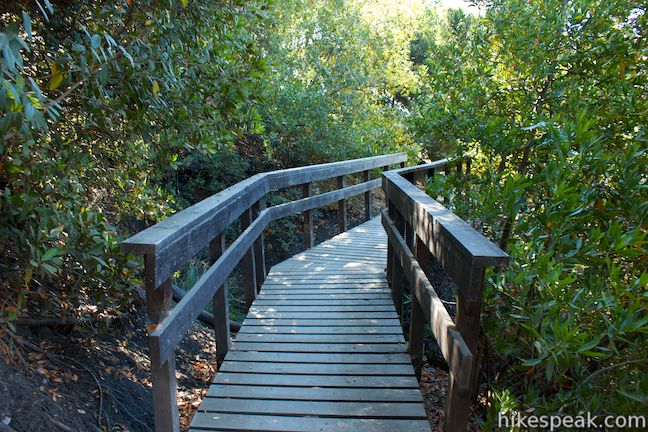
After crossing a footbridge, the trail turns uphill and gets a bit steep as it rises above the creek. Go through a cattle gate at the top to reach a line of train tracks belonging to the Union Pacific Railroad. Look both ways and scurry across the tracks, one mile from the start. After another gate on the opposite side of the tracks, follow a dirt trail uphill into a grove of oaks. Pass another trail called Elevator Trail that breaks off to the right, taking a shorter and steeper route to the Eucs. This trail is marked with a “No Entry – Wrong Way” sign and is intended for downhill bike traffic. Bear left to stick with Stenner Creek Trail and in less than a tenth of a mile, you’ll come to a wooden bridge just below a small waterfall. From the middle of the bridge, look up into the forest and watch the creek drop about seven feet down a dark rock wall.
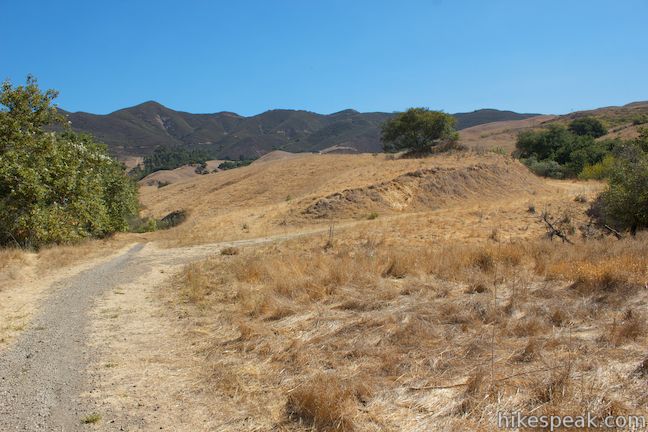
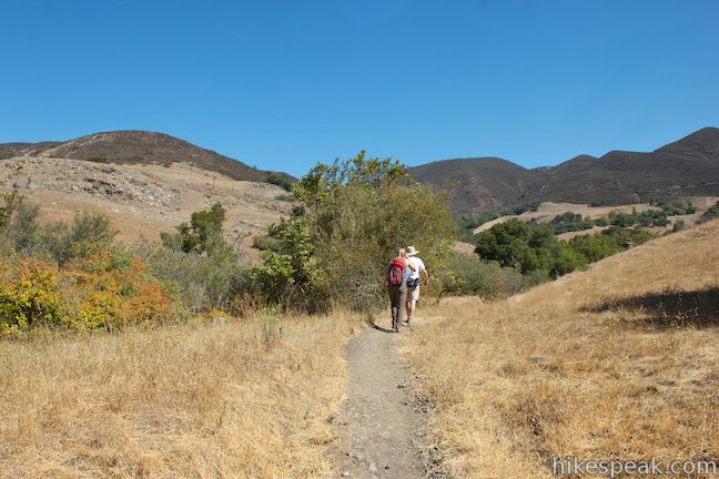
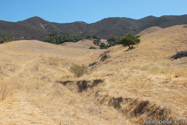
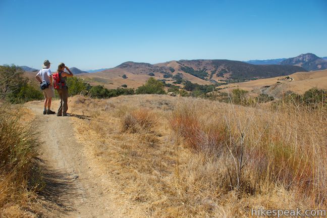
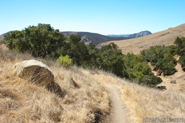
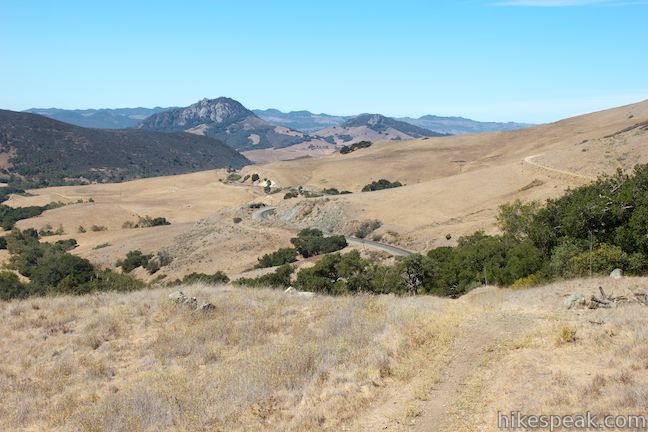
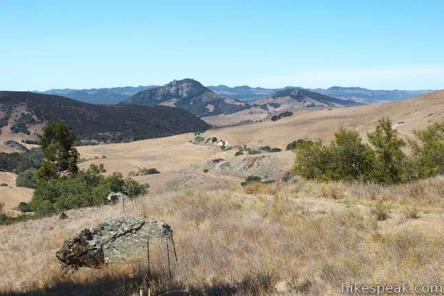
Pressing on, the trail weaves between oaks over a few bridges and switchbacks, eventually ascending out of the trees to a fine vista, 1.25 miles from the start. Pause to enjoy views back down Stenner Creek Canyon toward Bishop Peak.

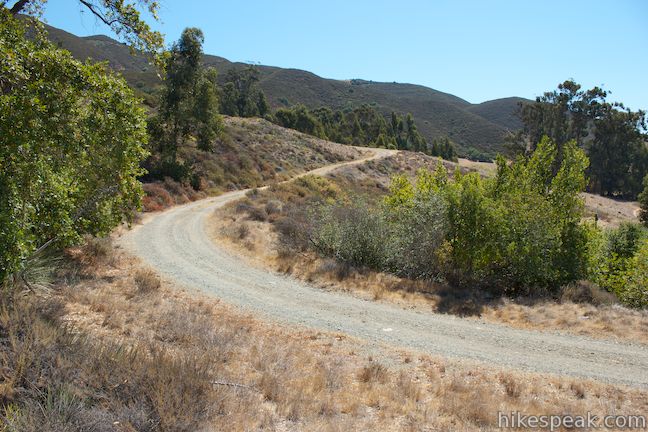
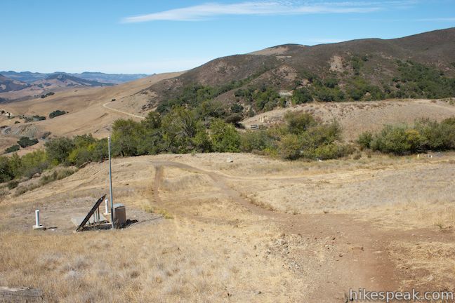
The dirt trail continues up the mountainside through another crossing of the creek. At 1.5 miles from the start, you will reach a junction just below the Eucs. On the right, there is a survey station with a solar panel. Straight ahead, the trail ascends to the bottom of the Eucs, but bikers and hikers should start at the top, which means turning left at the junction, following a single track that becomes a wide road and climbs to the top of the Eucs over the next 0.35 miles.
In 0.05 miles, you will cross Stenner Creek one last time. Go a few hundred feet farther to a junction with a dirt road. Turn right to continue up the mountainside toward the Eucs. After another 0.05 miles, you will reach a big bend in the road. If you want to see the source of Stenner Creek, take a path on the left, ascending a hundred feet into a thicket where Stenner Springs appears.
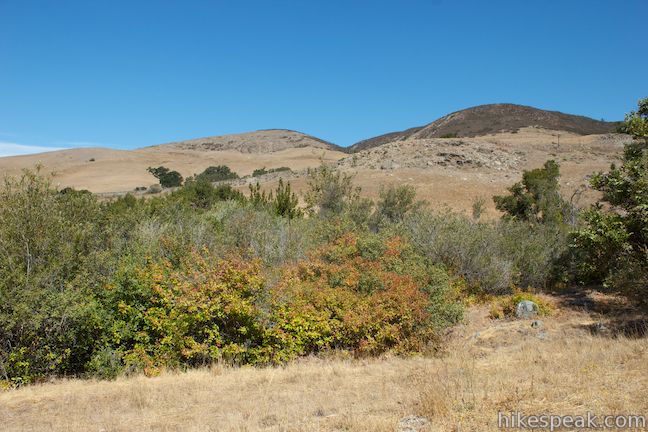
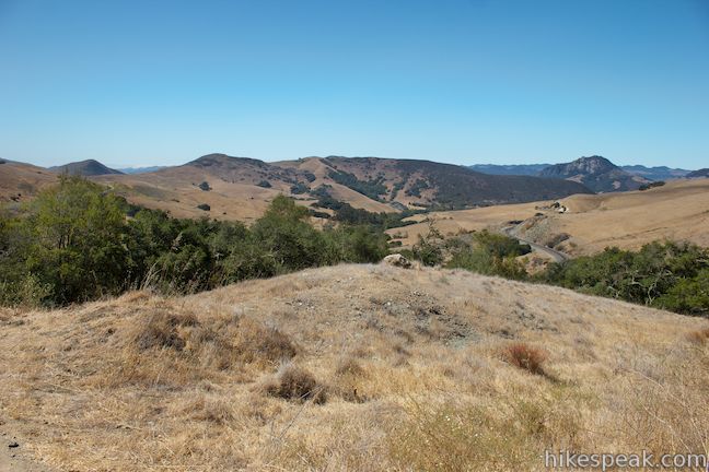
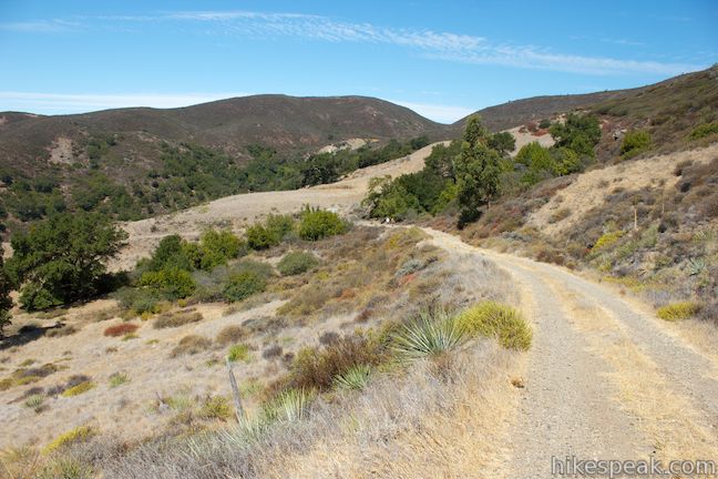
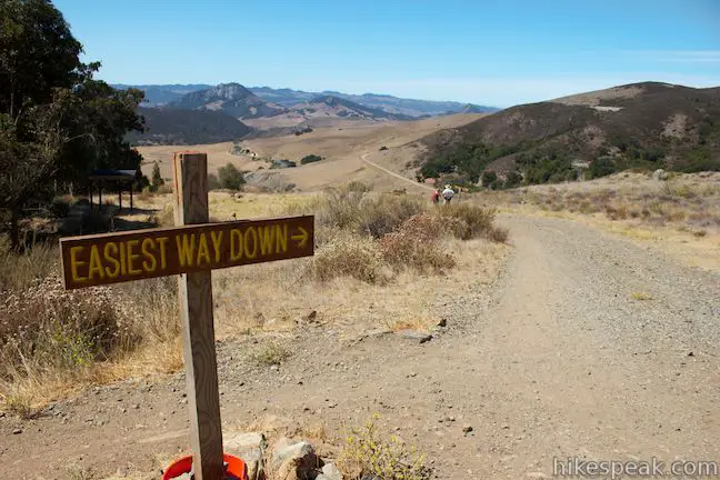
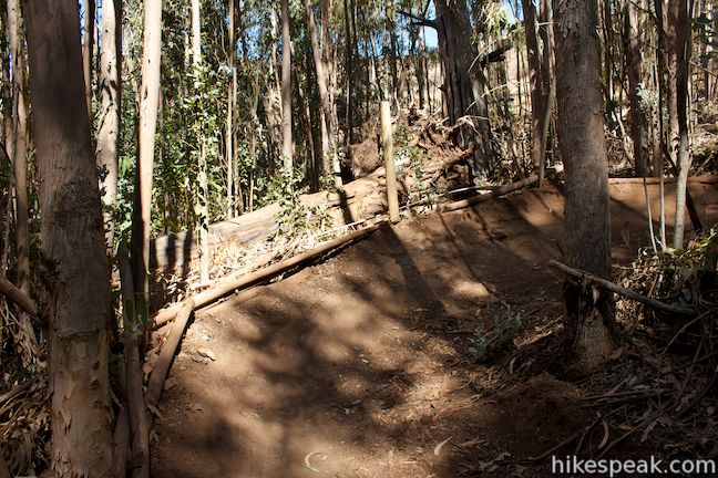
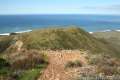
Proceed up the trail and take in the biggest views yet down Stenner Creek Canyon toward Bishop Peak. Pass the top of Elevator Trail, which is marked with a sign on the right, and continue up to the next junction. Turn right to enter the Eucs. There will be a sign here labeling the trail you came up as the “Easiest Way Down.” Ahead, the road ventures higher into the Santa Lucia Mountains, meeting Morning Glory Trail and Shooters Trail.
Note: Mountain bikers looking for a larger and more adventurous ride can start from Cuesta Grade along Highway 101, bike down Shooters Trail through Los Padres National Forest to the Eucs, and loop down Stenner Creek Canyon to San Luis Obispo.
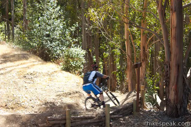
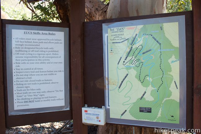
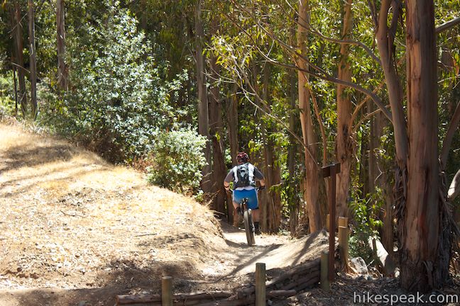
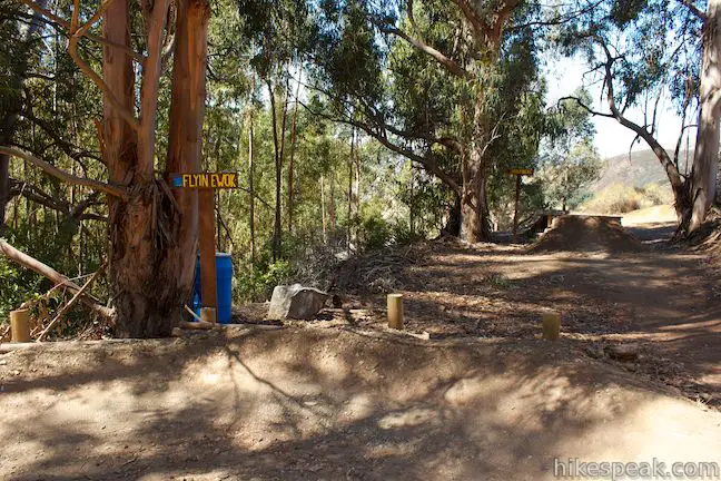
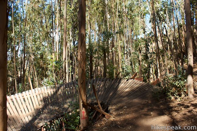
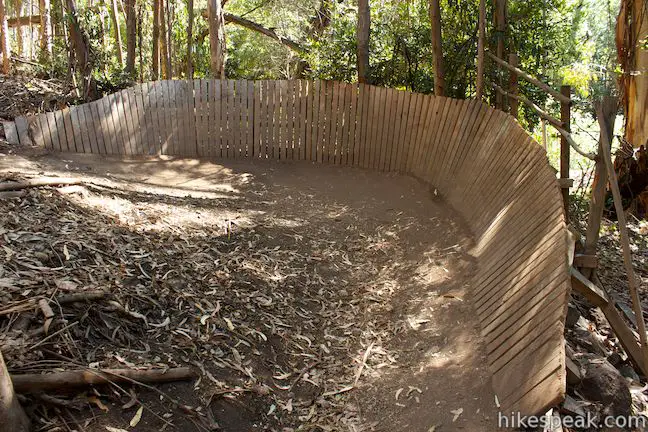
Pass the tops of Jailbreak and Flying Ewok, two bike routes through the Eucs, and come to a kiosk with a map of the Eucs and a list of the area’s rules. If you’re on a mountain bike, things are about to get fun. Within the eucalyptus grove below, bikers have built a series of runs with banked dirt and wooden turns, jumps, berms, and other fun creations. If you’re hiking, you should stay off the bike trails, but if other bikers are there, definitely watch a bit of the action.
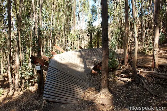
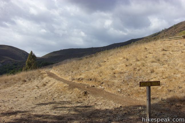
Hikers can head back the way they came, or circle around the eucalyptus grove to examiner the freeride area from all sides, adding a lollipop loop to the top of this hike. At the bottom of the Eucs, you’ll spot a shed between the trees on the left. Opposite that, there is a sign marking the Return Trail (Elevator Trail), which brings bikers back up to the top of the Eucs for another run. Straight ahead the trail descends to the junction by the survey station where you initial turned left to reach the top of the Eucs. From there it is 1.5 miles back to the start, on a downhill course filled with lots of views of Bishop Peak. It’s definitely a pleasant finish for this fun hike or bike.

To extend this hike, leave the Eucs on Red Dog Trail on the way to Poly Canyon Road for the Stenner Creek Trail – Red Dog Trail – Poly Canyon Road Loop. For another interesting hike, check out the Poly Canyon Design Village, located one canyon east of Stenner Creek Canyon behind the Cal Poly campus. In addition to bikes, dogs are allowed on Stenner Creek Trail. It is free to park at the trailhead and no permit is required to visit the Eucs, so get out and enjoy!
Directions to the Trailhead
- From Highway 101 in San Luis Obispo, take Highway One northwest for 1.75 miles and turn left onto Stenner Creek Road.
- Drive 2.25 miles to the trailhead parking area, which will be on the left, just in front of a gate blocking the road.
- Stenner Creek Road is only paved for the first 0.8 miles, and passes beneath a railroad bridge shortly after becoming unpaved.
Trailhead Location
Trailhead address: Stenner Creek Road, San Luis Obispo, CA 93405
Trailhead coordinates: 35.33016, -120.6631 (35° 19′ 48.6″N 120° 39′ 47″W)
You may also view a regional map of surrounding Central Coast trails and campgrounds.


 | Stenner Creek Trail – Red Dog Trail – Poly Canyon Road Loop This 4.25-mile loop goes beyond the Eucs to explore grass-covered slopes at the base of the Santa Lucia Mountains. |
 | Poly Canyon Design VillageThis 2.5-mile hike visits an experimental architectural village designed by Cal Poly students at the base of the Santa Lucia Mountains. |
 | Cuesta Ridge Botanical Area This 6-mile round trip hike crosses a ridge in the Santa Lucia Mountains with panoramic views over San Luis Obispo, ascending to a grove of Sargent cypress in a botanical area in Los Padres National Forest. |
 | East Cuesta Ridge This wide dirt road offers an 8.4-mile hike to the top of Mount Lowe or a longer trek to the top of Lopez Canyon Trail, offering ocean views over San Luis Obispo and inland views over an evergreen wilderness. |
 | Eagle Rock Nature Trail This 2.4-mile hike in El Chorro Regional Park climbs 450 feet to Eagle Rock Viewpoint for an overview of the valley between San Luis Obispo and Morro Bay. |
 | Bishop Peak This 3.5-mile hike ascends 950 feet to highest summit in the Nine Sisters, offering excellent views of San Luis Obispo and the surrounding Morros. |
 | Cerro San LuisThis 4-mile hike summits one of the Nine Sisters just west of downtown San Luis Obispo. |
 | Reservoir CanyonThis 5.35-mile hike ascends 1,350 feet past a waterfall and a collection of junk sculptures to a treeless summit overlooking San Luis Obispo. |
 | More hikes in San Luis ObispoExplore other trails around San Luis Obispo including Morro Bay State Park and Montaña de Oro State Park. |
Common Questions about Stenner Creek Trail to The Eucs in San Luis Obispo
- Is the trail open?
- Yes. You should expect to find that Stenner Creek Trail is open. There are no recent reports of trail closures. If you discover that the trail is closed, please help your fellow hikers by reporting a closure.
- Is this trail free to access?
- Yes, Stenner Creek Trail is free to access. No entrance fee, pass, or permit is required. If you discover that access rules have changed, please provide feedback on your experience.
- How much time does this hike take?
- It takes approximately 2 hours to hike Stenner Creek Trail. Individual hiking times vary. Add extra time for breaks and taking in the views.
- How long is this hike?
- The hike to Stenner Creek Trail is a 3.7 mile out and back with 650 feet of elevation change.
- Are dogs allowed on this trail?
- Yes, dogs are allowed on Stenner Creek Trail. The trail is open to hikers, dogs, bikes.
- Will I see a waterfall on this hike?
- Yes, Stenner Creek Trail features a waterfall.
- What mountain range is this trail in?
- Stenner Creek Trail is located in the Santa Lucia Mountains.
- Where is the trailhead located?
- The trailhead for Stenner Creek Trail is located in San Luis Obispo, CA.
Trailhead Address:
Stenner Creek Road
San Luis Obispo, CA 93405
Trailhead Coordinates:
35.33016, -120.6631 - What are the driving directions to the start of the hike?
To get to the trailhead: From Highway 101 in San Luis Obispo, take Highway One northwest for 1.75 miles and turn left onto Stenner Creek Road. Drive 2.25 miles to the trailhead parking area, which will be on the left, just in front of a gate blocking the road. Stenner Creek Road is only paved for the first 0.8 miles, and passes beneath a railroad bridge shortly after becoming unpaved.
View custom Google Maps directions from your current location.
- Are there other trails near Stenner Creek Trail?
- Yes, you can find other nearby hikes using the Hikespeak Hike Finder Map.

6 Comments on Stenner Creek Trail to The Eucs in San Luis Obispo
What hikers are saying:
✨ Generated summary of user commentsThis trail offers a playful experience for those navigating the unique landscape near Cal Poly. Visitors enjoy the flying EWOK section for its bridges and curves that wind through scenic groves of eucalyptus trees. These features provide a sense of adventure and fun amidst the mountain scenery.
I have hiked stenner creek before, but I like some info where to turn off to get into Poly Canyon trail from stenner creek .Thank
Sharon
Sharon, check out Polyland at- https://www.polyland.calpoly.edu/topics/recreation/studentsites/2005a/index.html
and CCCMB at- https://www.cccmb.org/home-new/maps/west-cuesta-ridge
for info and maps of the trails around Poly Canyon and Stenner Canyon.
Or just look on Google earth; most of the trails show up if you zoom in.
[…] I was pleasantly surprised with this past week’s hike. Arleena chose for us to hike the Stenner Creek Trail; I think mostly due to being one of the closer and shorter trails on our […]
Hi Josh, Do you still have your mountain bike? Look at this trail called the flying EWOK At Cal Poly San Luis Obispo. the trail takes you on bridges and cool curves through the grove of mountains and Eucalyptus (U-caw-lip-tus) trees. Look at these pictures! Fun!! G. Debby
Excellent presentation
[…] February 13th, we set off to San Luis Obispo to hike near Cal Poly. We chose the Stenner Creek trail. It is mainly used by bikers to get to the “Eucs” to practice their jumps. We parked in a […]