Stenner Creek Trail – Red Dog Trail – Poly Canyon Road Loop in San Luis Obispo
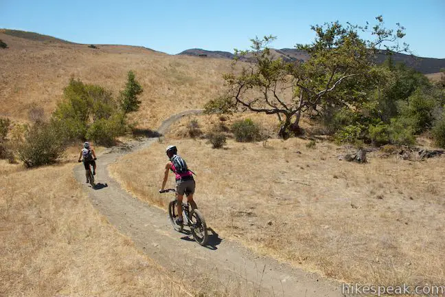
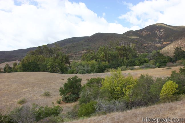
Above Stenner Creek Road near the Cal Poly Campus, a freestyle bike course is hidden within a eucalyptus grove. The easiest route to The Eucs is to head up and back on Stenner Creek Trail. For a longer hike that explores neighboring grassland on slopes below the Santa Lucia Mountains, consider this 4.25-mile loop with 550 feet of elevation change. This hike takes Stenner Creek Trail up to the Eucs and then continues on Red Dog Trail, which sets out across grassy ridges and descends to Poly Canyon Road, a dirt road back to the beginning of Stenner Creek Trail. The loop offers views of Bishop Peak, Cerro Romauldo, and other Morros running across San Luis Obispo County.
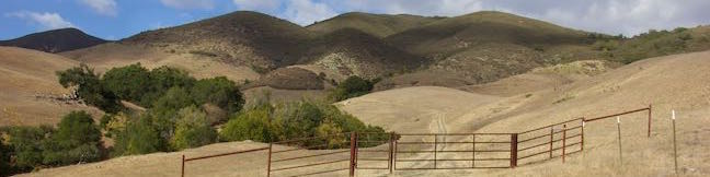
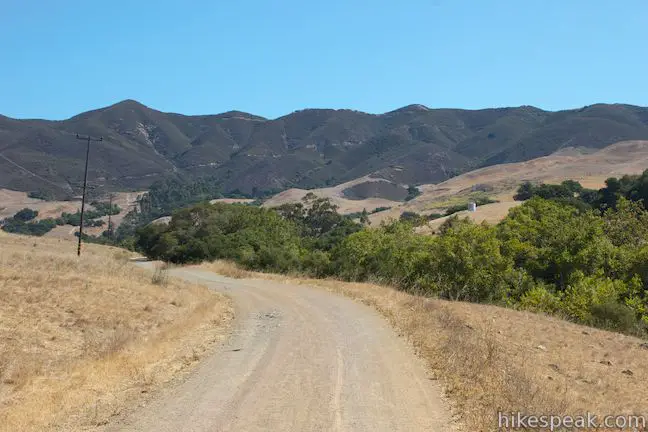
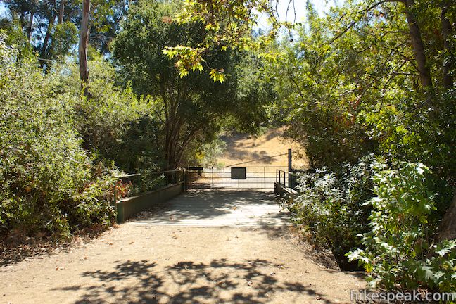
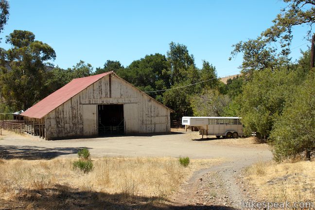
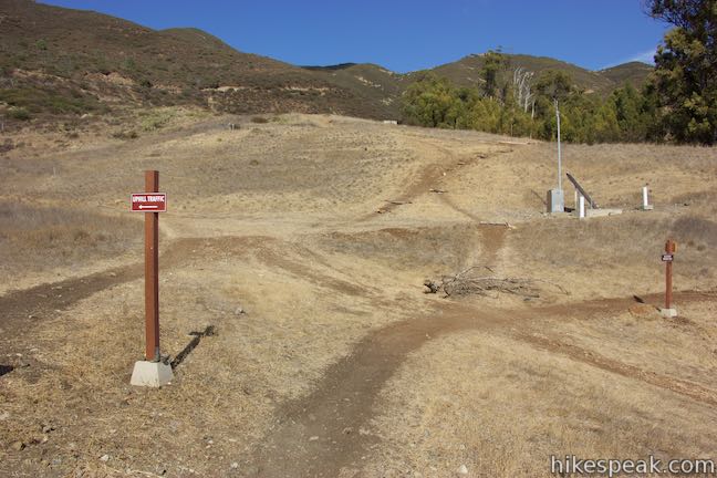
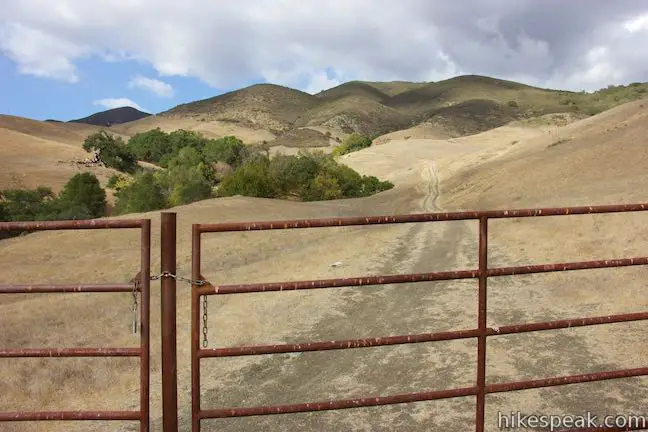
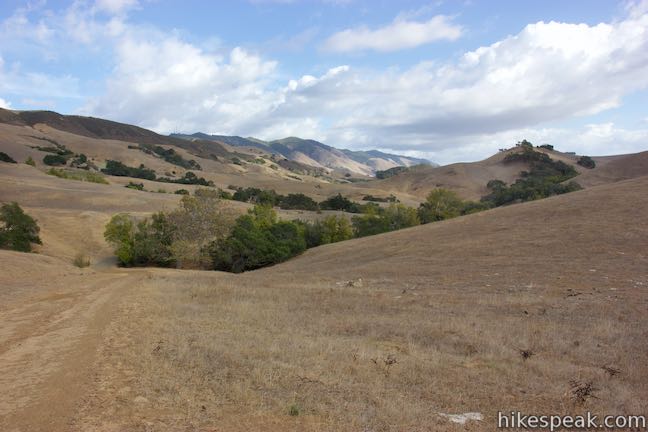
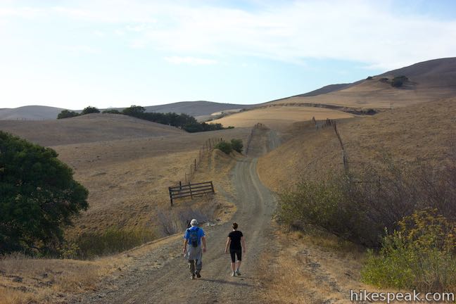
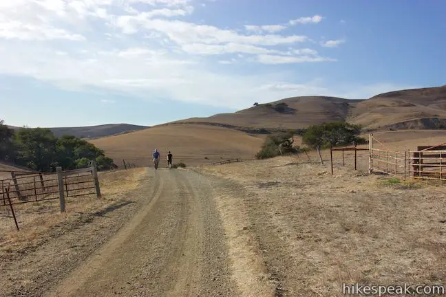
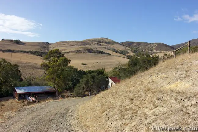
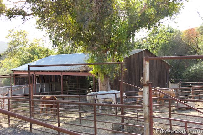
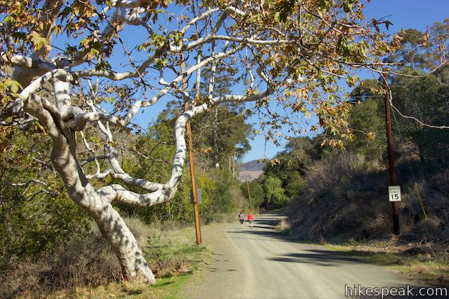
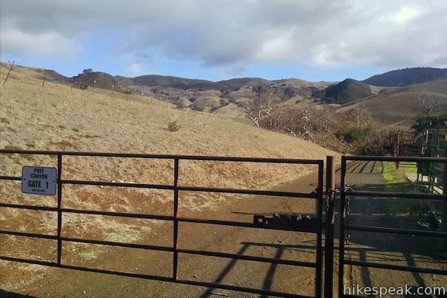
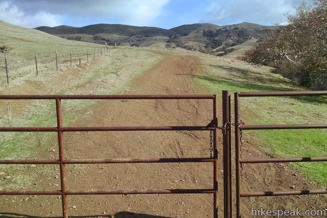
The directions given here start from Stenner Creek Road, but the outing could also begin from California Polytechnic State University by heading up Poly Canyon Road from campus (Starting from Cal Poly, this loop would be 9.7 miles long with 775 feet of elevation change – directions below). Set out from a parking area that is two and a quarter miles up Stenner Creek Road from Highway One. Slip through a gate and walk up the dirt road, which continues northeast. Straight ahead, rise the Santa Lucia Mountains where radio towers are visible on a summit along West Cuesta Ridge Road. After a third of a mile, as the road approaches a ranch house, turn right and cross a bridge over Stenner Creek. On the far side of the bridge, go through a gate (that you should open, step through, and close) and come to a split. Poly Canyon Road ascends to the right next to a horse barn and pasture. This is the return route when taking the loop in a clockwise direction. For now, bear left up Stenner Creek Trail to head toward the Eucs.
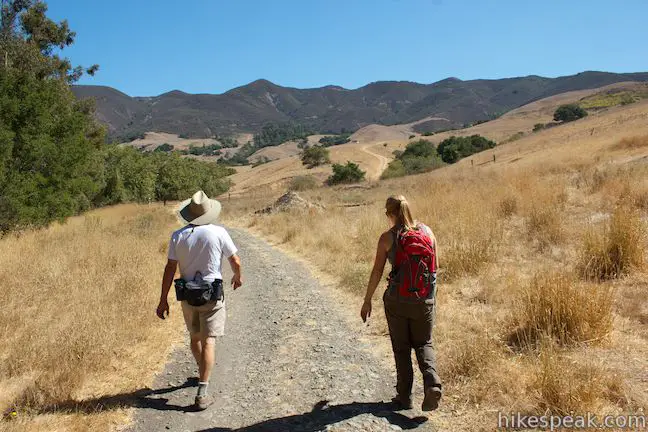
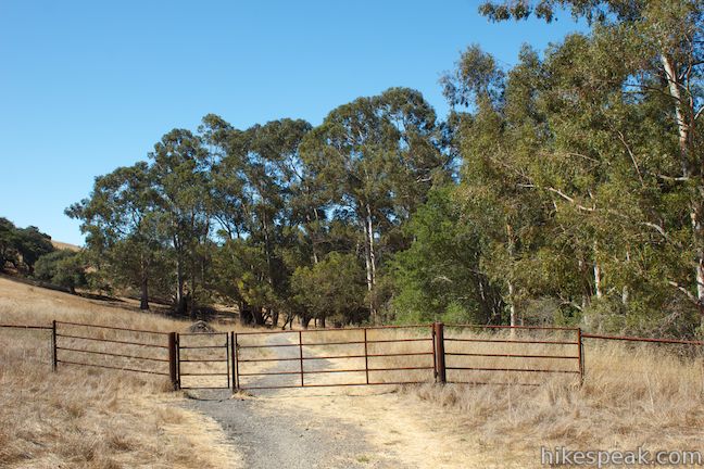
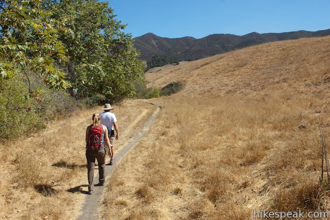
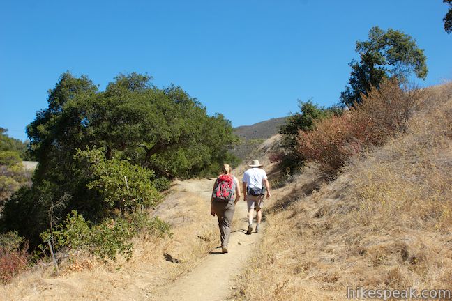
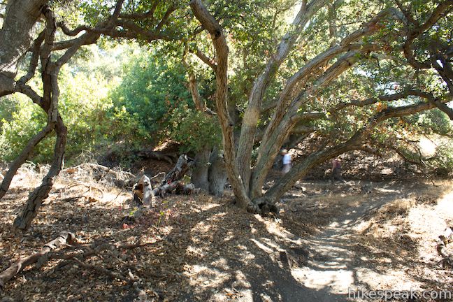
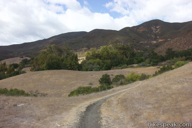
Hike northeast along the creek, passing through a small eucalyptus grove that is an appetizer for things to come. Reach a cattle gate followed by a split in the trail over the next tenth of a mile. Stay to the left on the single track along Stenner Creek. Grassy ranchland rises to your right and riparian woodland hugs the creek to your left, cloaking the water, which you may hear without seeing. The trail drops closer to Stenner Creek and passes beneath a few oaks as it gradually ascends toward the wall of mountains rising to the north and east. Look over your shoulder and you’ll spot the rocky mass of Bishop Peak looming above the trail.
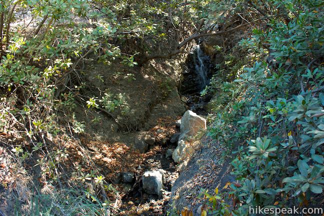
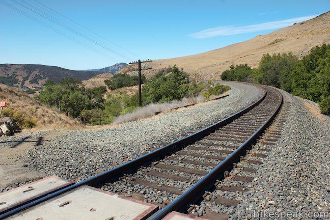
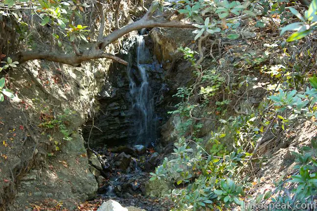
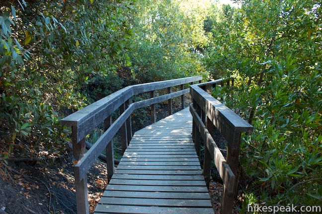
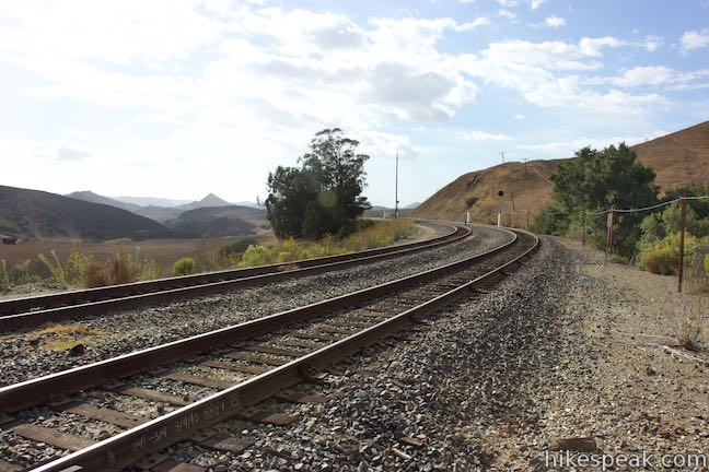
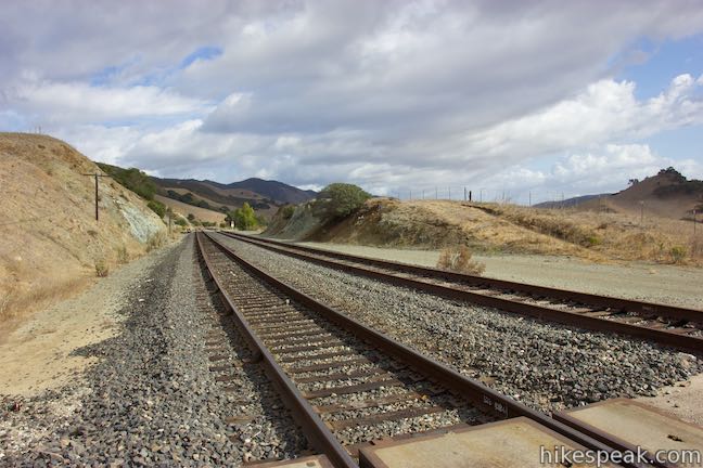
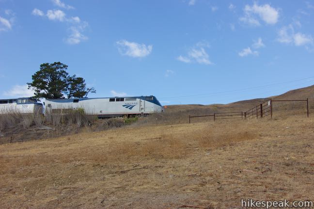
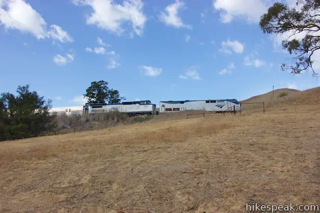
After crossing a footbridge, the trail turns uphill and gets a bit steep as it rises above the creek. Go through a cattle gate at the top to reach a line of train tracks belonging to the Union Pacific Railroad. Look both ways and scurry across the tracks, one mile from the start. After another gate on the opposite side of the tracks, follow a dirt trail uphill into a grove of oaks. Pass another trail called Elevator Trail that breaks off to the right, taking a shorter and steeper route to the Eucs. This trail is marked with a “No Entry – Wrong Way” sign and is intended for downhill bike traffic. Bear left to stick with Stenner Creek Trail and in less than a tenth of a mile, you’ll come to a wooden bridge just below a small waterfall. From the middle of the bridge, look up into the forest and watch the creek drop about seven feet down a dark rock wall.
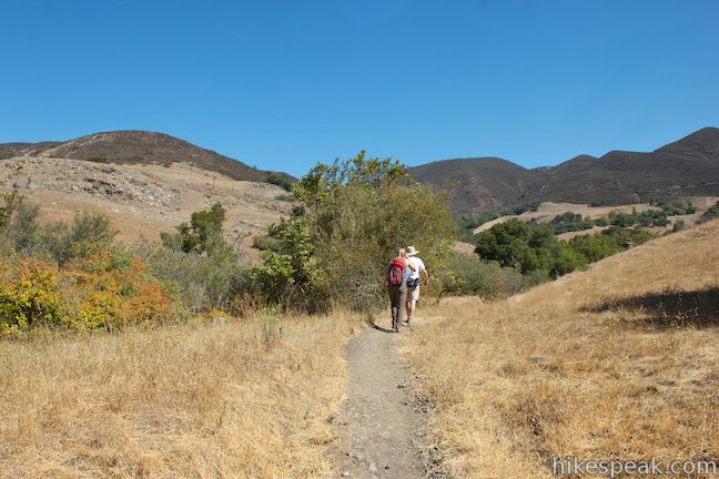
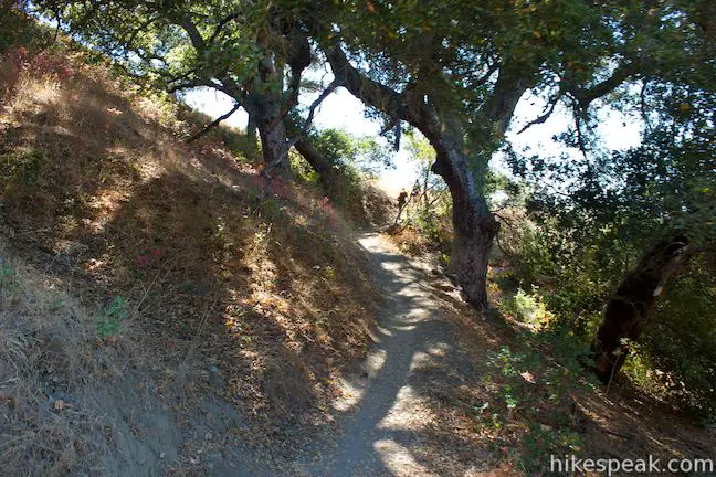
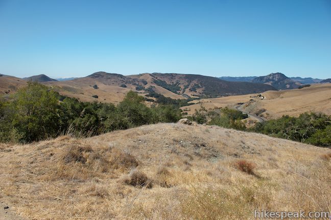
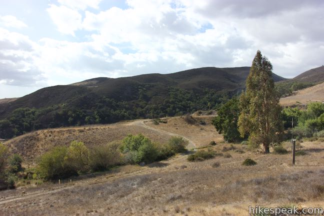
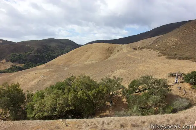
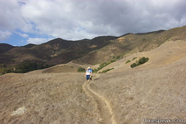
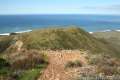
Pressing on, the trail weaves between oaks over a few bridges and switchbacks, eventually ascending out of the trees to a fine vista, 1.25 miles from the start. Pause to enjoy views back down Stenner Creek Canyon toward Bishop Peak. The dirt trail continues up the mountainside through another crossing of the creek. A couple additional trails have been cut across the main trail as this area becomes more developed by bikers. You can follow the switchbacks or take a more direct path.
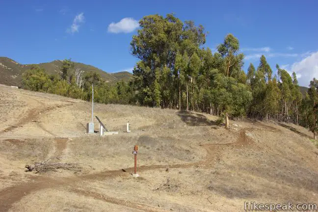
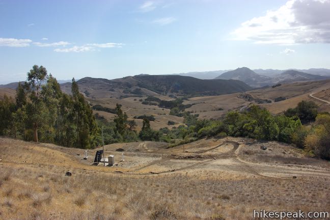
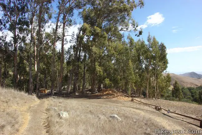
At 1.5 miles from the start, reach a junction just below the Eucs. A survey station with a solar panel sits on the slope up to the right. Straight ahead, a steep trail ascends to the bottom of the Eucs. A sharp left leads to a road that goes to the top of the Eucs (a better arrival spot for bikers wanting to head down the bike course). If you’re just hiking through, make a slight left turn on a single-track trail that uses one switchback to ascend the slope and curve back to the right to the edge of the Eucs.
Hike into the eucalyptus grove, 1.65 miles from the start, making a pair of right turns in the next tenth of a mile to bypass the cool bike trails and get on Red Dog Trail, which is unmarked but heads toward the grasslands to the southeast.
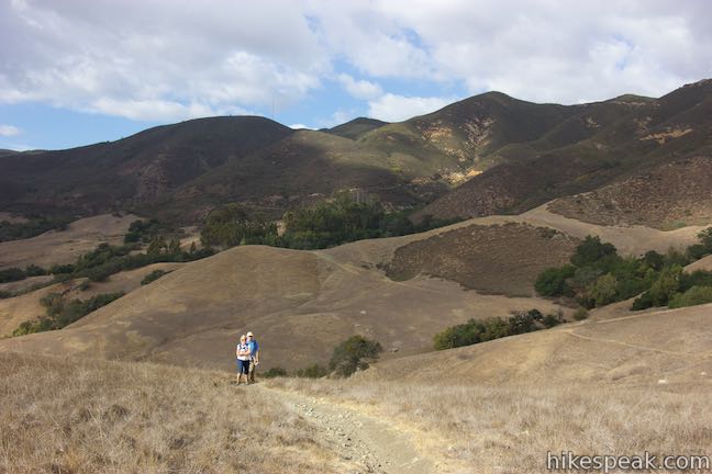
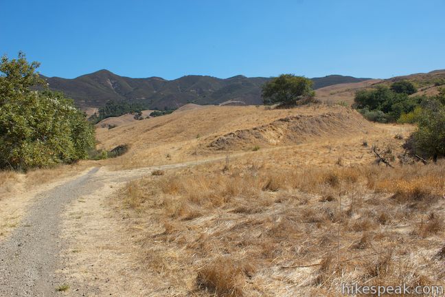
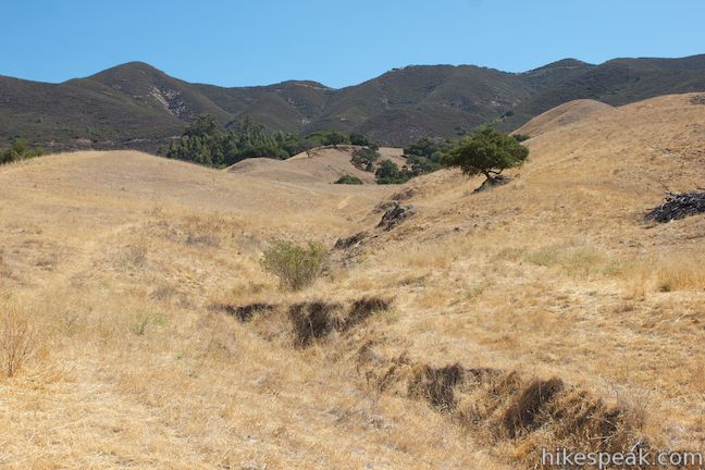
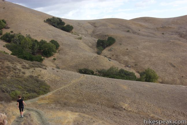
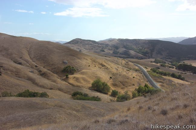
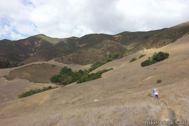
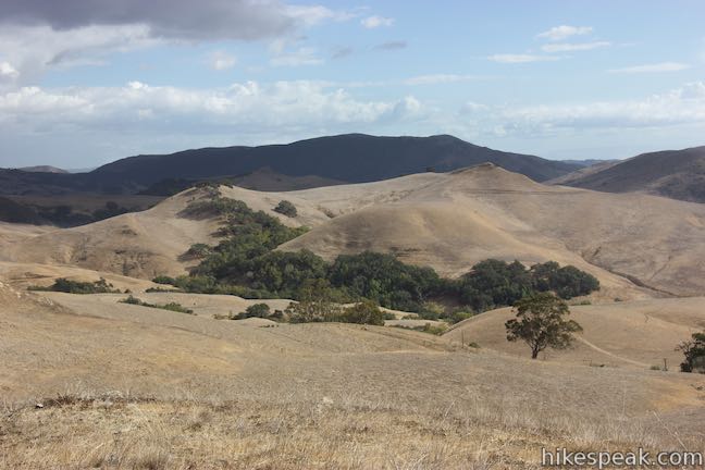
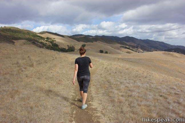
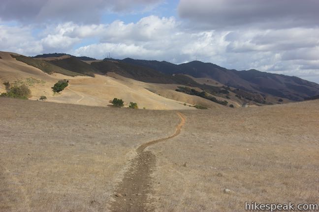
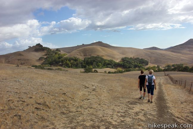
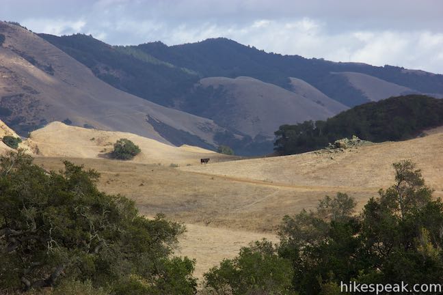
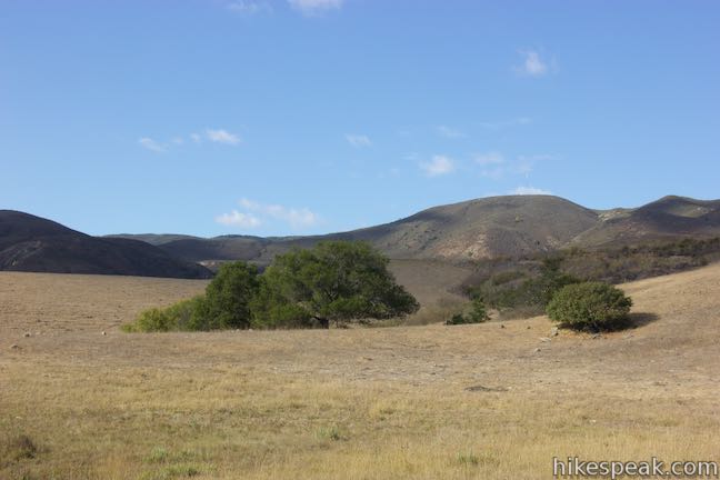
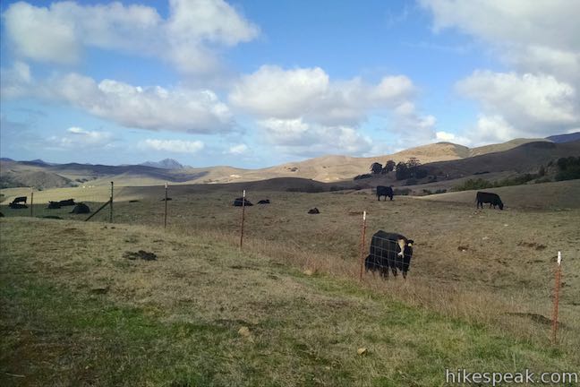
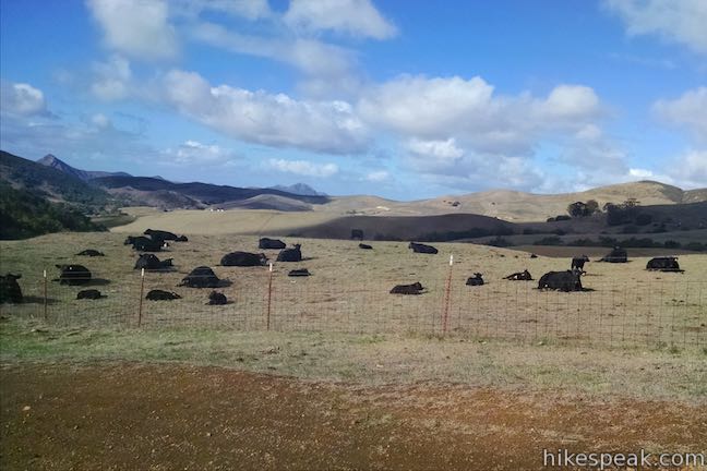
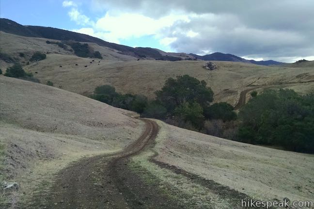
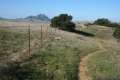
Walk across a short wooden footbridge as Red Dog Trail crosses a small stream and leaves the forest. Once out of the trees, this narrow dirt track goes up onto a saddle near the end of a small ridge. Ahead of you, a world of rolling grassland is revealed. This area has a stark beauty in the autumn, but is probably nicest to hike through in the spring when the surrounding are at their greenest.

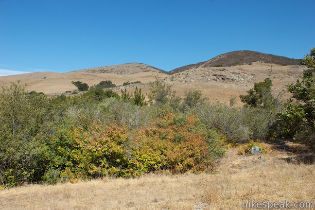
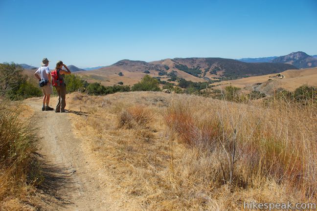
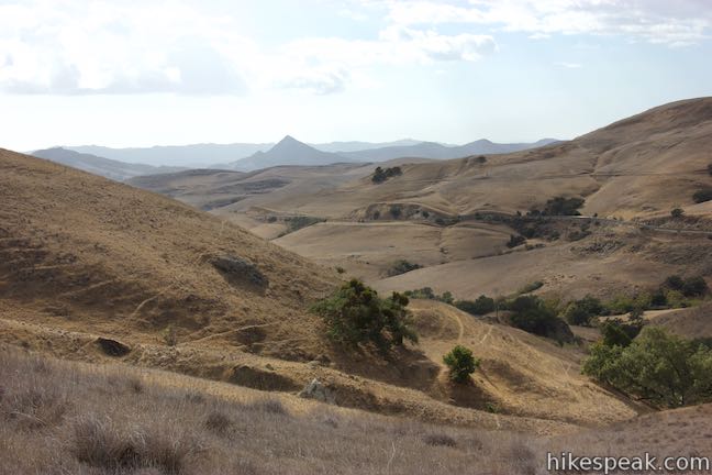
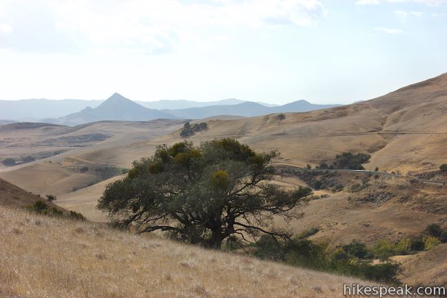
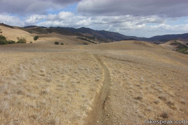
Walk across a dip in the terrain and up to another rise. To your right, you can look down on the railroad tracks to the southwest and the peaks beyond. Cerro Romauldo rises like a pyramid. Look back up the narrow dirt track for a nice perspective of the Santa Lucia Mountains, rising above the Eucs and covered in green chaparral.
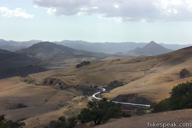
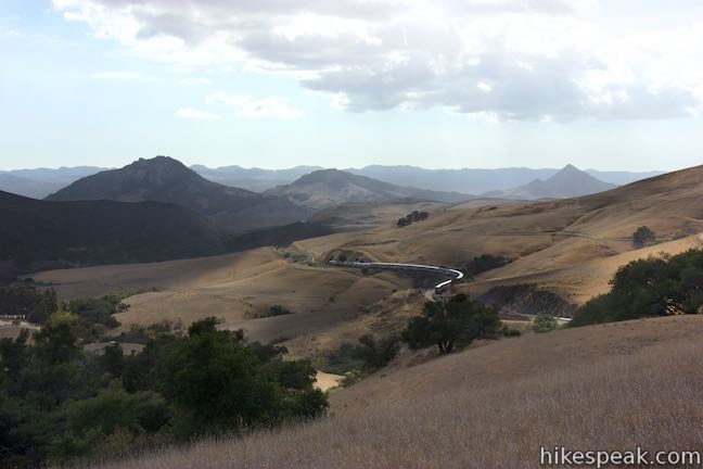
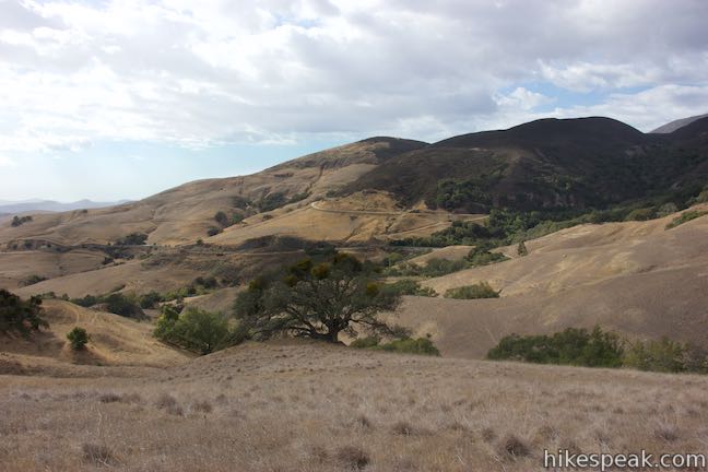
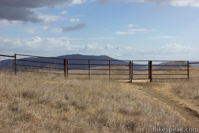
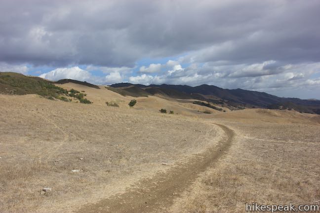
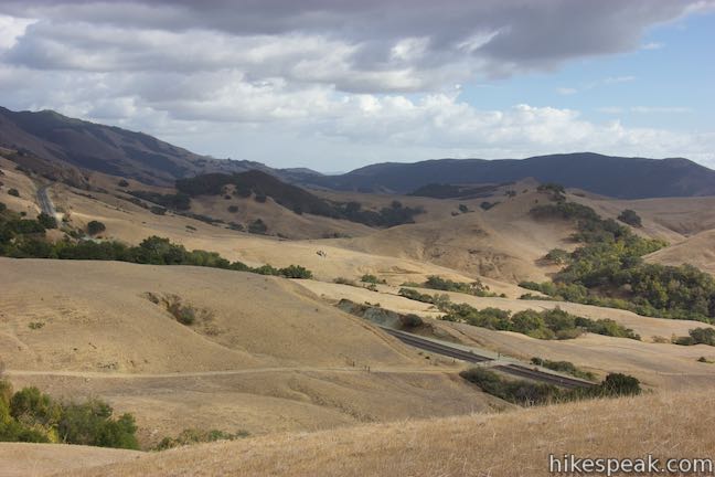
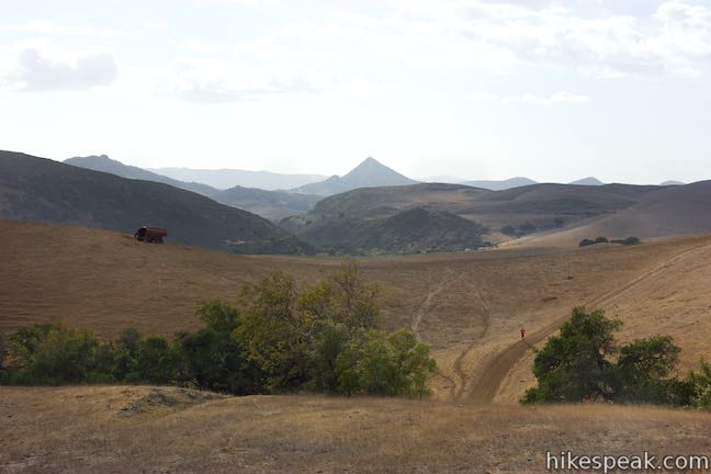
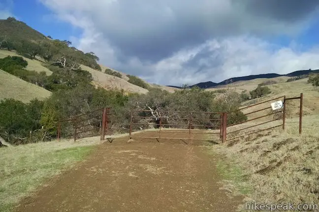
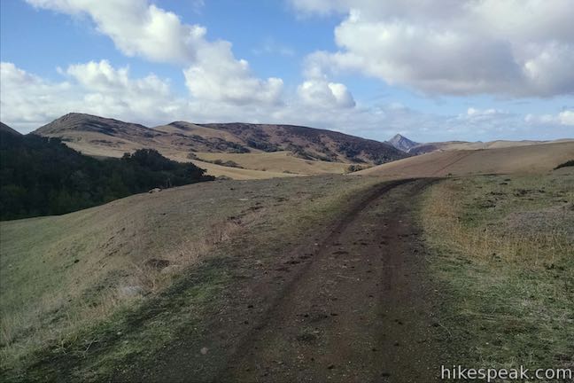
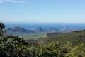
The trail drops across a longer dip and ascends the other side, curving up to a metal gate, 0.7 miles from the start of the trail. Pass through the gate and take a short path on the right out to a viewpoint at the top of the rise. This spot provides sweeping views. Look south over the slopes below and east toward Mount Lowe on East Cuesta Ridge. You may even see a train weaving along the tracks.
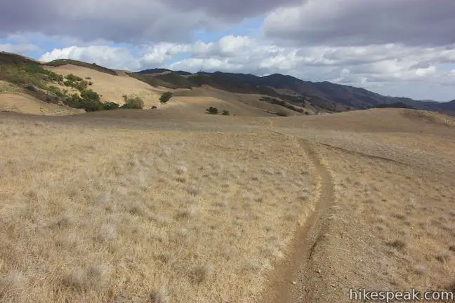
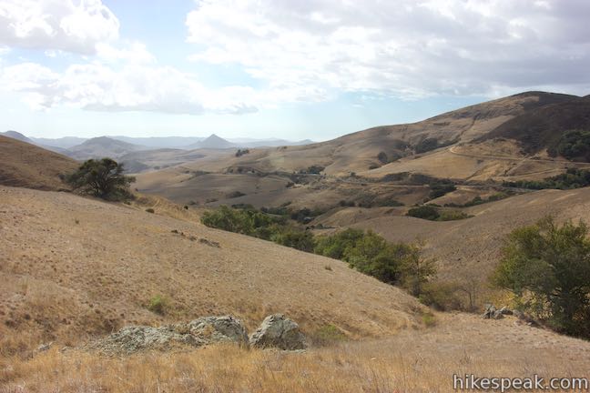
Leaving the gate, Red Dog Trail continues southeast across the prairie-like grassland. The trail tips downhill, separating temporarily, before curving to the left around a draw in the terrain. You will spot a trail descending to the right toward the railroad tracks. At the first junction you come to, after 1.05 miles on Red Dog Trail, turn right to take this jeep trail down to the railroad tracks.
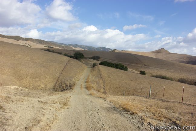
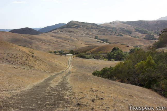
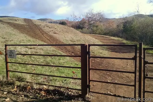
Go through gates on either side of the railroad line to get back to the Cal Poly side of the tracks. Continue downhill to a T-junction where Red Dog Trail meets Cal Poly Road, 1.35 miles from the Eucs. Bear right on this dirt road, passing through gate number six to hike back toward Stenner Creek. If you need to get to Cal Poly instead, you could turn left here and hike 3.05 miles back to campus.
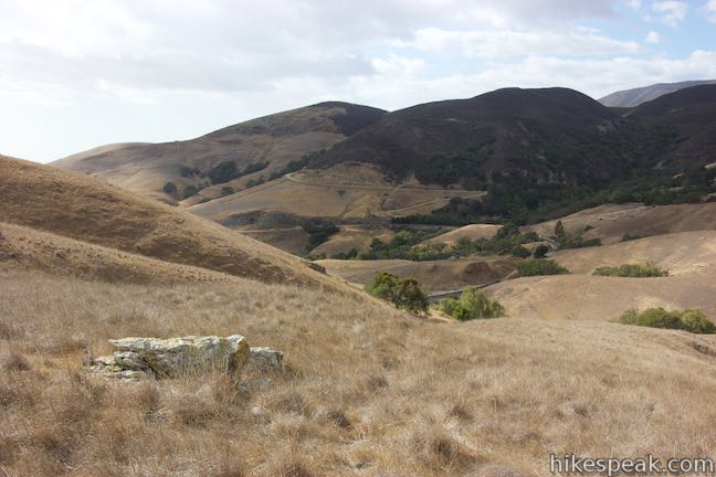
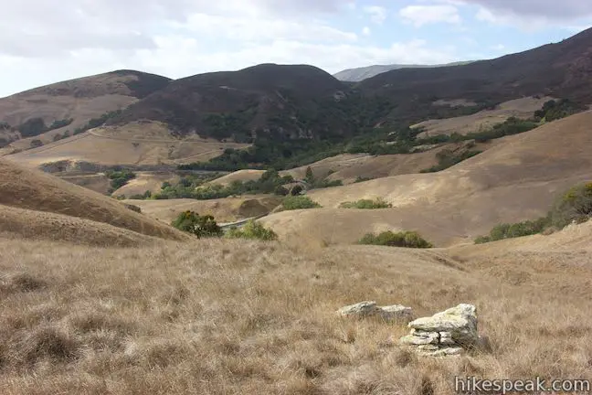
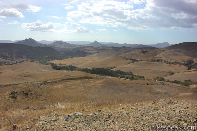
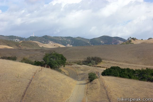
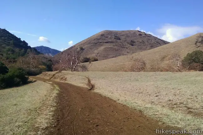
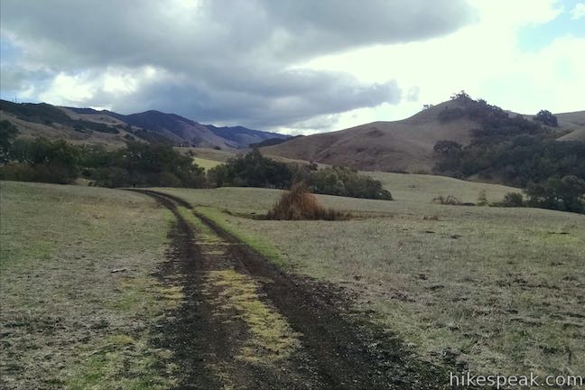
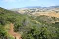
Poly Canyon Road crosses low rolling grassland for the next 0.8 miles to return to Stenner Creek Road. Look over your should for views of East Cuesta Ridge, where a tall red and white tower rises above Mount Lowe. After three hundred yards, make a sharp left turn at a junction with a trail heading up to the railroad tracks.
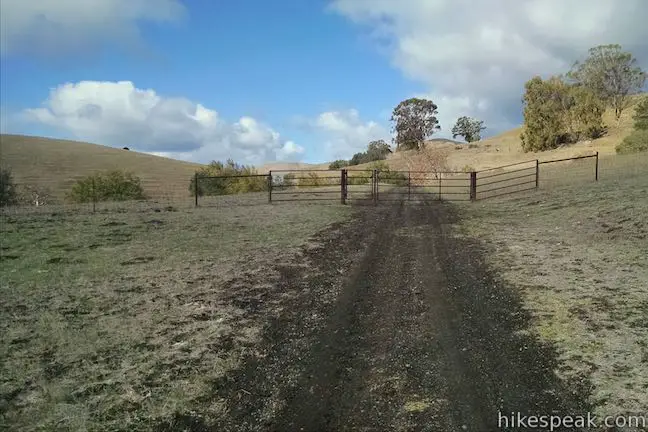
The trail aims southwest for a stretch, before curving back to the right. Go over more undulations in the terrain and eventually head down toward a horse barn and pasture on the left side of the road. Pass through Poly Canyon Gate 8 and walk the last little stretch of the road up to a junction with Stenner Creek Trail, where the loop began.
Go through the gate on the left and take the bridge over Stenner Creek to get to Stenner Creek Road. Turn left and walk a third of a mile back along the road to return to the parking area. Dogs and bikes are both allowed on these trails. It is free to park at the trailhead and no permit is required for this hike so get out and enjoy!
Leaving from Cal Poly: Begin up Poly Canyon Road from Village Drive. Pass the Cal Poly Design Village after 3/4 of a mile and continue up to a farm. Here you’ll pass through the first of several numbered gates along the wide dirt trail. The first two come less than a tenth of a mile apart. Proceed across the grassy ranchland, heading north. At 2.5 miles from the start, as you near the railroad tracks, make a slight left to stay on Poly Canyon Road. Just after this turn, you’ll pass through gate 5. In another half mile, you’ll meet Red Dog Trail (on the right) by gate 6. Proceed another 0.8 miles to the end of Poly Canyon Road where you can hike up Stenner Creek Trail to the Eucs as described above. Descend Red Dog Trail to Poly Canyon Road, turn left, and hike 3.05 miles back to the Cal Poly Campus. This completes the 9.7-mile lollipop loop suitable for bikes or hikers.
Directions to the Trailhead
- From Highway 101 in San Luis Obispo, take Highway One northwest for 1.75 miles and turn left onto Stenner Creek Road.
- Drive 2.25 miles to the trailhead parking area, which will be on the left, just in front of a gate that blocks the road.
- Stenner Creek Road is only paved for the first 0.8 miles, and passes beneath a railroad bridge shortly after becoming unpaved.
Trailhead Location
Trailhead address: Stenner Creek Road, San Luis Obispo, CA 93405
Trailhead coordinates: 35.33016, -120.6631 (35° 19′ 48.6″N 120° 39′ 47″W)
View Stenner Creek Trail in a larger map
Or view a regional map of surrounding Central Coast trails and campgrounds.


Starting from Cal Poly


 | Stenner Creek Trail to The Eucs This 3.7-mile hike goes up Stenner Creek Canyon past a small waterfall and views of Bishop Peak to a collection of freeride bike trails called The Eucs. |
 | Poly Canyon Design VillageThis 2.5-mile hike visits an experimental architectural village designed by Cal Poly students at the base of the Santa Lucia Mountains. |
 | Cuesta Ridge Botanical Area This 6-mile round trip hike crosses a ridge in the Santa Lucia Mountains with panoramic views over San Luis Obispo, ascending to a grove of Sargent cypress in a botanical area in Los Padres National Forest. |
 | East Cuesta Ridge This wide dirt road offers an 8.4-mile hike to the top of Mount Lowe or a longer trek to the top of Lopez Canyon Trail, offering ocean views over San Luis Obispo and inland views over an evergreen wilderness. |
 | Eagle Rock Nature Trail This 2.4-mile hike in El Chorro Regional Park climbs 450 feet to Eagle Rock Viewpoint for an overview of the valley between San Luis Obispo and Morro Bay. |
 | Bishop Peak This 3.5-mile hike ascends 950 feet to highest summit in the Nine Sisters, offering excellent views of San Luis Obispo and the surrounding Morros. |
 | Cerro San Luis This 4-mile hike summits one of the Nine Sisters just west of downtown San Luis Obispo. |
 | Reservoir Canyon This 5.35-mile hike ascends 1,350 feet past a waterfall and a collection of junk sculptures to a treeless summit overlooking San Luis Obispo. |
 | More hikes in San Luis Obispo Explore other trails around San Luis Obispo including Morro Bay State Park and Montaña de Oro State Park. |
Common Questions about Stenner Creek Trail – Red Dog Trail – Poly Canyon Road Loop in San Luis Obispo
- Is the trail open?
- Yes. You should expect to find that Stenner Creek Trail – Red Dog Trail – Poly Canyon Road Loop is open. There are no recent reports of trail closures. If you discover that the trail is closed, please help your fellow hikers by reporting a closure.
- Is this trail free to access?
- Yes, Stenner Creek Trail – Red Dog Trail – Poly Canyon Road Loop is free to access. No entrance fee, pass, or permit is required. If you discover that access rules have changed, please provide feedback on your experience.
- How much time does this hike take?
- It takes approximately 2 hours 15 minutes to hike Stenner Creek Trail – Red Dog Trail – Poly Canyon Road Loop. Individual hiking times vary. Add extra time for breaks and taking in the views.
- How long is this hike?
- The hike to Stenner Creek Trail – Red Dog Trail – Poly Canyon Road Loop is a 4.25 mile loop with 550 feet of elevation change.
- Are dogs allowed on this trail?
- Yes, dogs are allowed on Stenner Creek Trail – Red Dog Trail – Poly Canyon Road Loop. The trail is open to hikers, dogs, bikes.
- What mountain range is this trail in?
- Stenner Creek Trail – Red Dog Trail – Poly Canyon Road Loop is located in the Santa Lucia Mountains.
- Where is the trailhead located?
- The trailhead for Stenner Creek Trail – Red Dog Trail – Poly Canyon Road Loop is located in San Luis Obispo, CA.
Trailhead Address:
Stenner Creek Road
San Luis Obispo, CA 93405
Trailhead Coordinates:
35.33016, -120.6631 - What are the driving directions to the start of the hike?
To get to the trailhead: From Highway 101 in San Luis Obispo, take Highway One northwest for 1.75 miles and turn left onto Stenner Creek Road. Drive 2.25 miles to the trailhead parking area, which will be on the left, just in front of a gate that blocks the road. Stenner Creek Road is only paved for the first 0.8 miles, and passes beneath a railroad bridge shortly after becoming unpaved.
View custom Google Maps directions from your current location.
- Are there other trails near Stenner Creek Trail – Red Dog Trail – Poly Canyon Road Loop?
- Yes, you can find other nearby hikes using the Hikespeak Hike Finder Map.

Go the extra miles...
Submit a rating of this hike to go with your comment. Contribute to the average trail rating.