East Cuesta Ridge
in San Luis Obispo
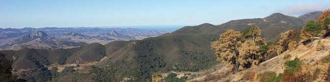
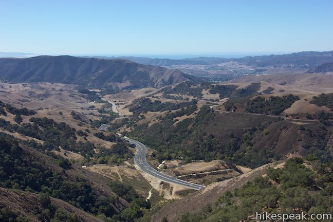
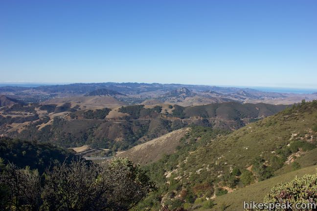
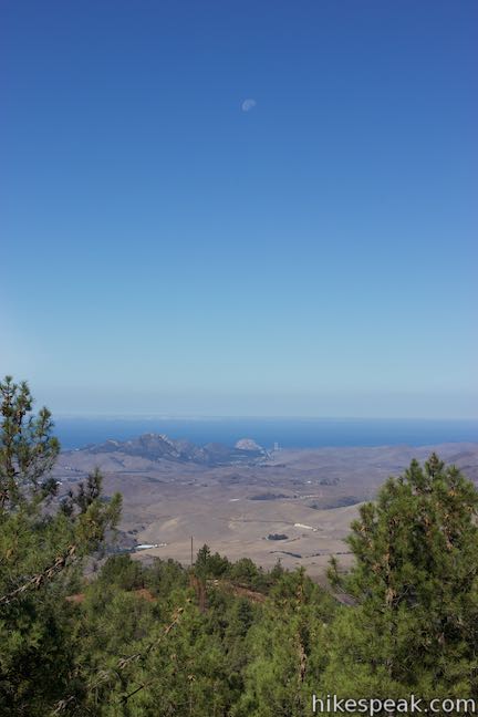
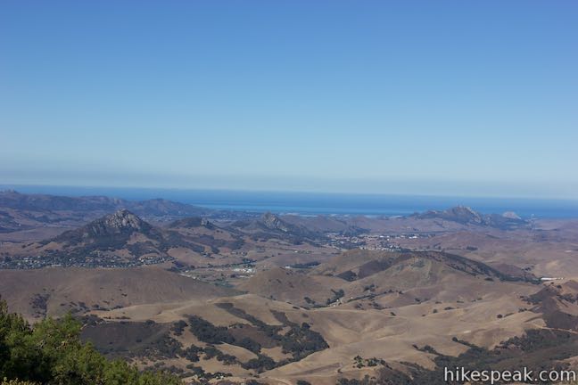
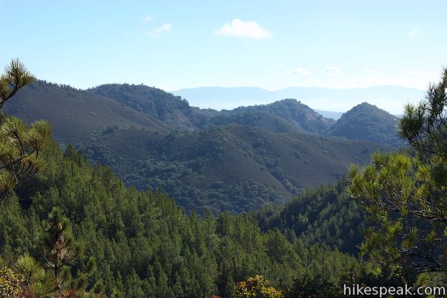
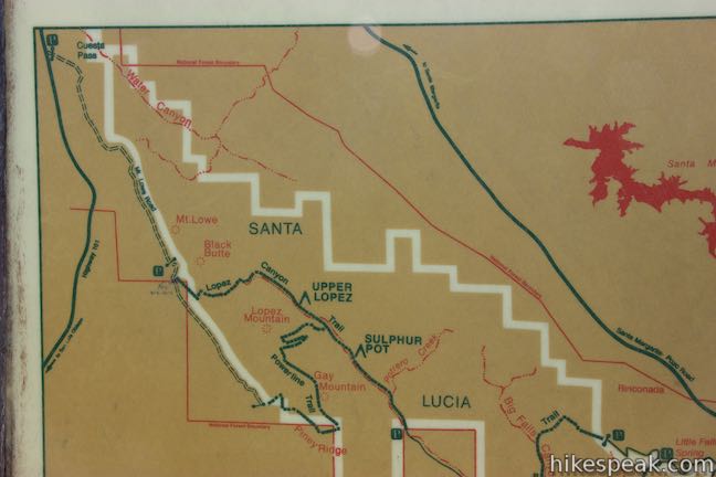
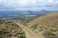
East Cuesta Ridge Road, also known as Mount Lowe Road, is a dirt road that crosses the dominant ridgeline in the Santa Lucia Mountains northeast of San Luis Obispo. Views from the trail extend over San Luis Obispo and its surrounding peaks toward the ocean to the west at Morro Bay and to the south by Oceano Dunes.
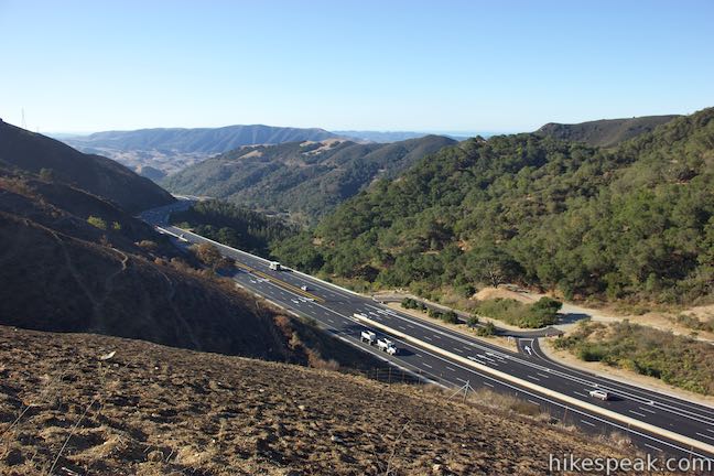
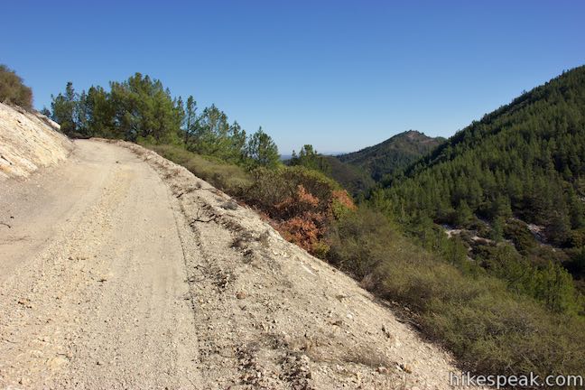
The hike starts just off Highway 101 at the top of Cuesta Grade. Getting underway is easy and the hike rises above the freeway to deliver far more than you might expect. East Cuesta Ridge Road goes a long way into the mountains for extended hikes or bike rides, passing through several different vegetation zones. Mount Lowe sits just off the road and you can bag this summit on an 8.4-mile hike with 1,075 feet of elevation change. Views farther up the road are great too, overlooking an evergreen-covered wilderness that feel like it should be hundreds of miles from San Luis Obisbo (instead of just a few miles away). A junction with Lopez Canyon Trail is another good turnaround point for a 9.6-mile round trip hike with 1,015 feet of elevation change.
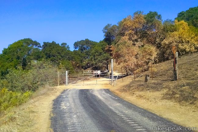
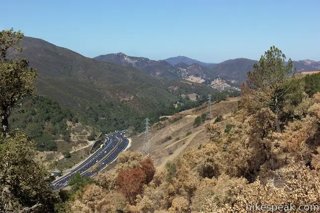
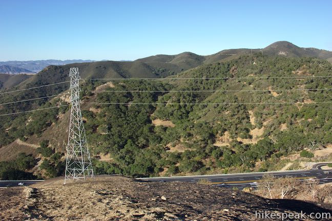
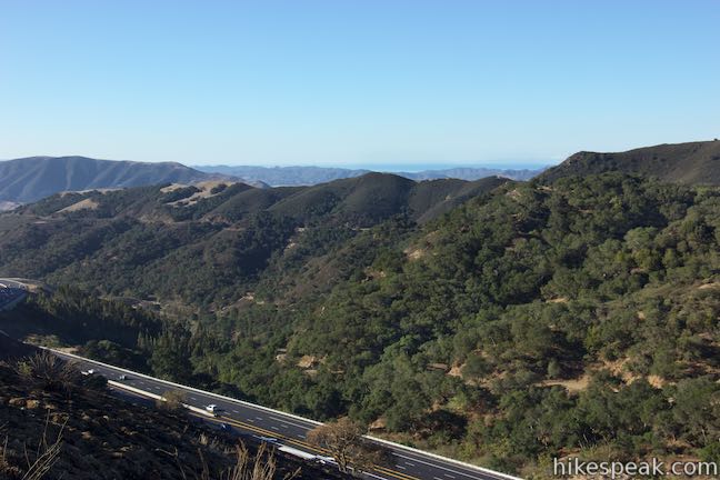
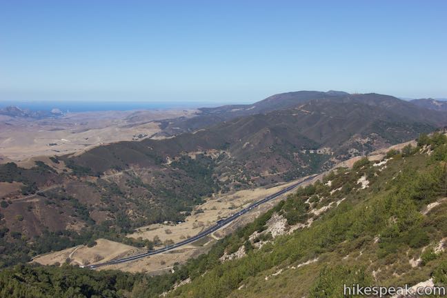
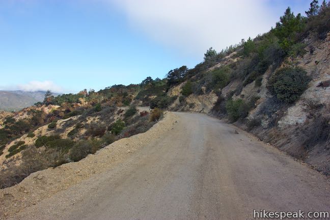
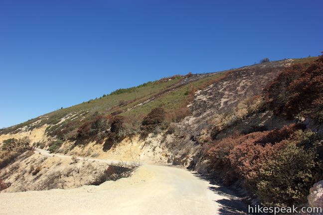
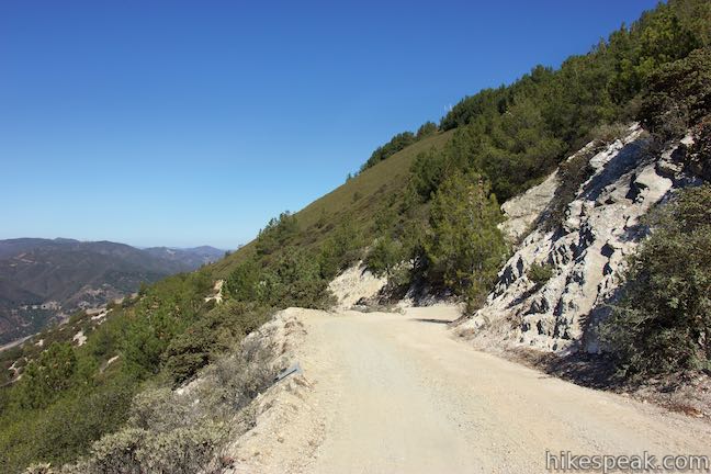
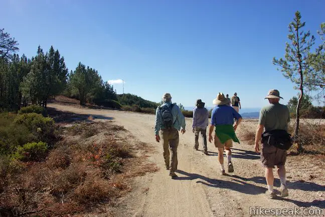
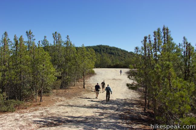
From a turnout on the east (northbound) side of Highway 101, walk up a short paved road to a metal gate. Climb over the gate (intended to keep out motorists) to find a wide dirt road. Hike up this well graded dirt trail, which makes a large curve to the right to point southeast across the slope above the freeway. On the opposite side of this divide in the Santa Lucia Mountains, you’ll see West Cuesta Ridge Road heading up ridges covered in chaparral.
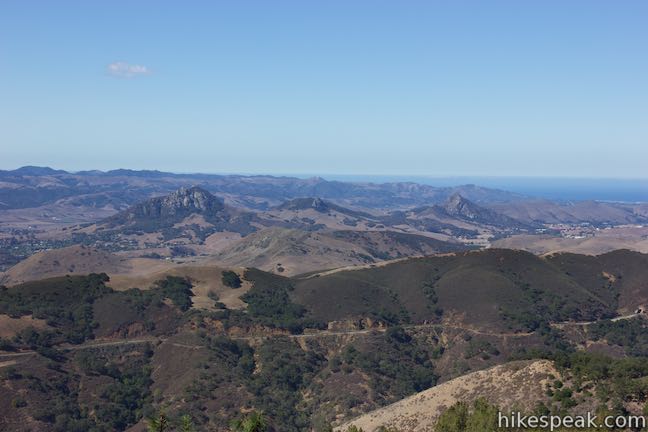
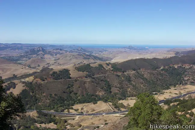
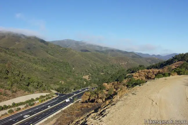
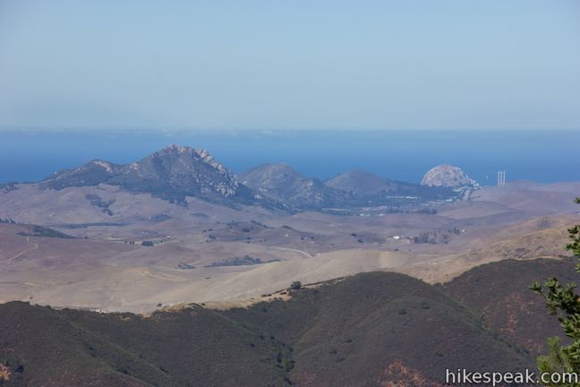
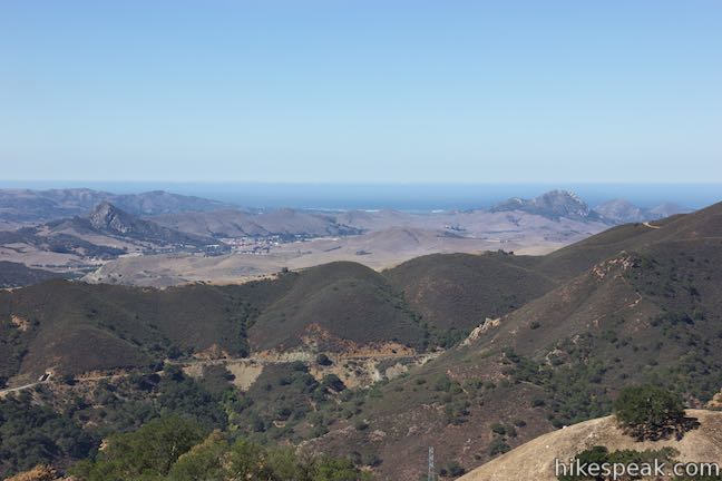
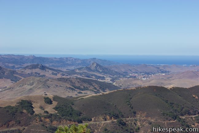
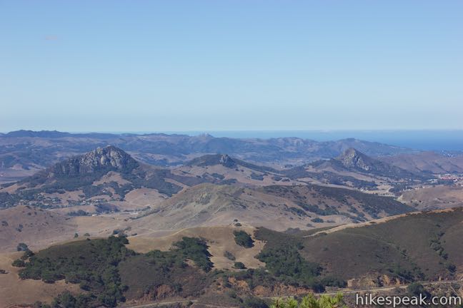
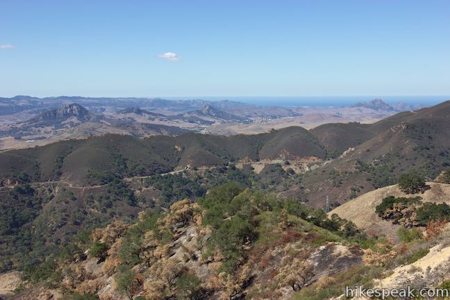
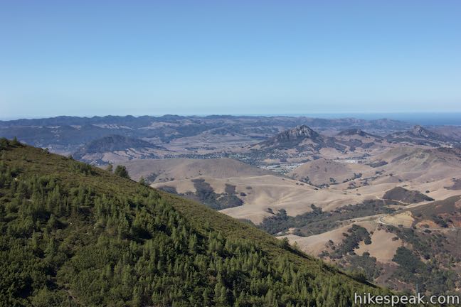
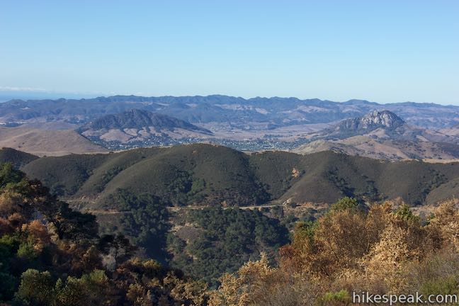
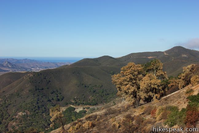
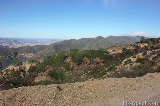
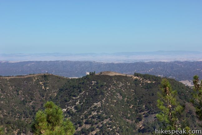
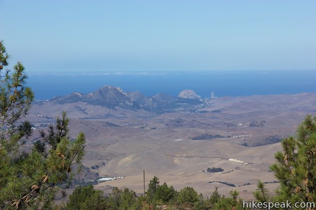
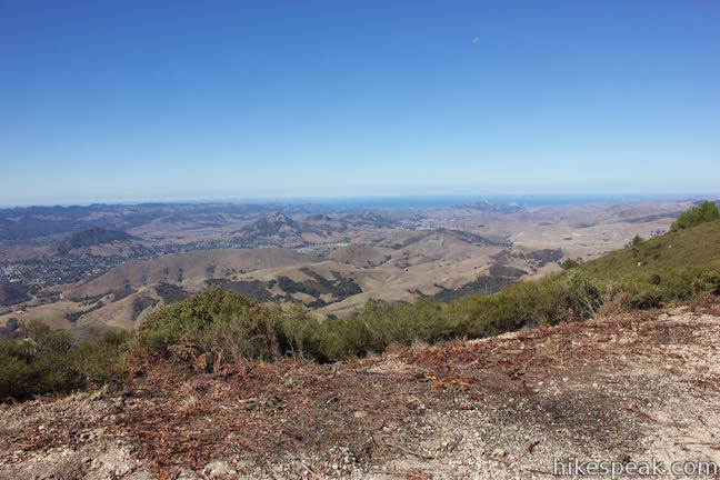
Continue along the dirt road across the southwest side of the ridge, finding views south over the freeway toward San Luis Obisbo, cradled in the valley below. In front of the city, on this side of the freeway, you can look down into Reservoir Canyon. On the west side of San Luis Obisbo rise Cerro San Luis and Bishop Peak, two of the area’s Morros. Farther up the trail, you’ll gain a perspective over the top of the ridges to the west for views toward Morro Bay.
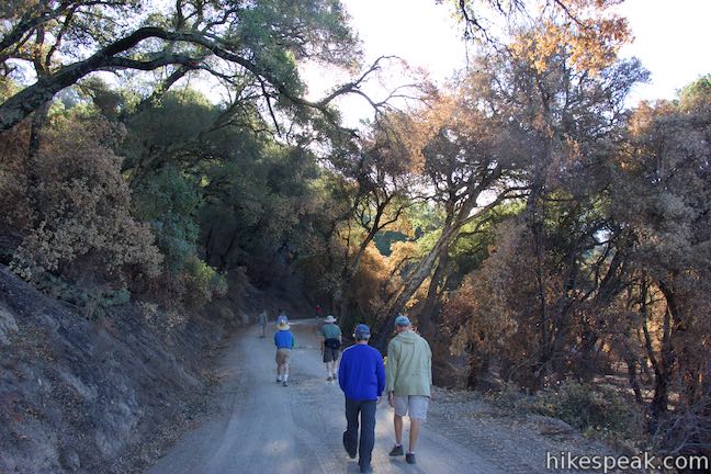
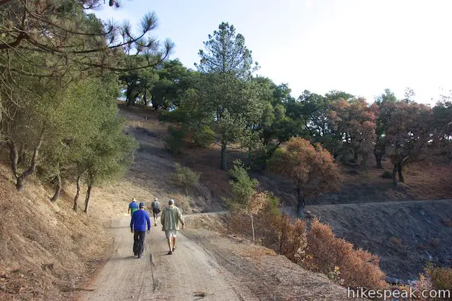
The area along the start of the trail was burned by the Cuesta Fire in August of 2015. The fire left behind scorched earth and stands of charred oaks. The fire damage is interesting to witness up close, and rest assured, the trail eventually passes into uncompromising landscapes.
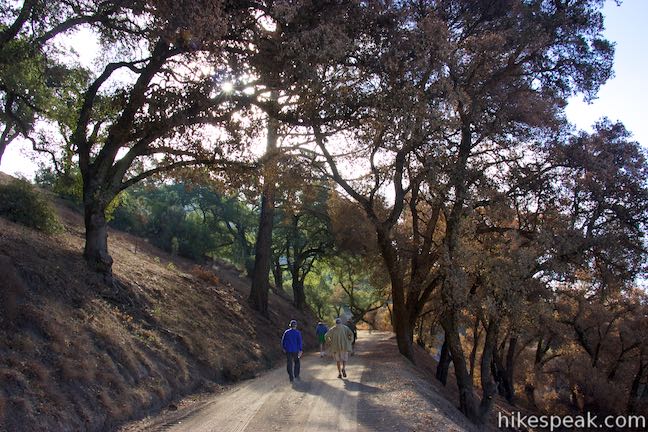
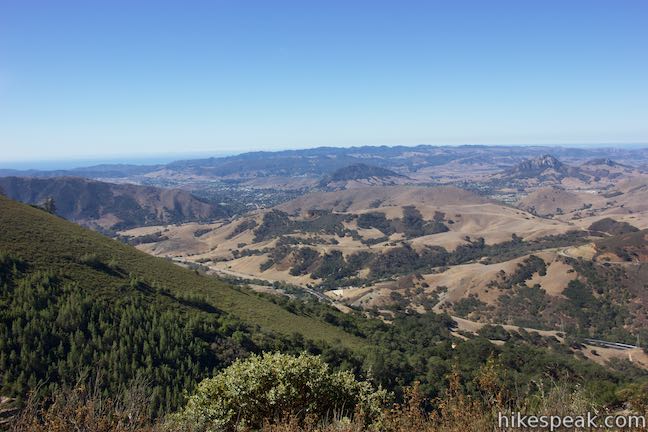
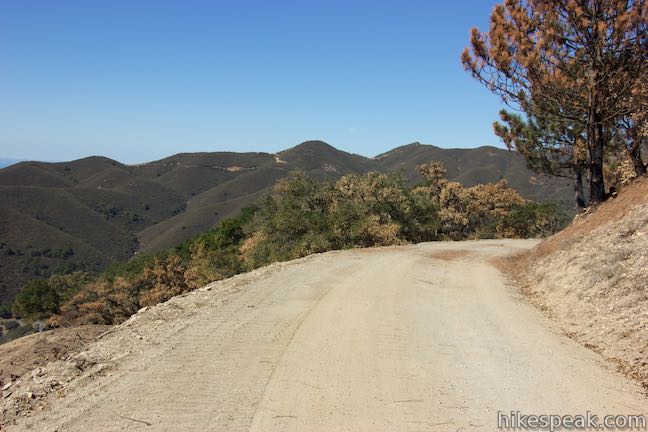
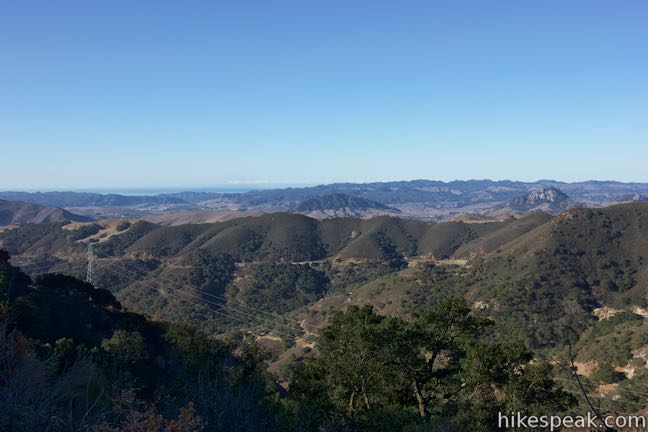
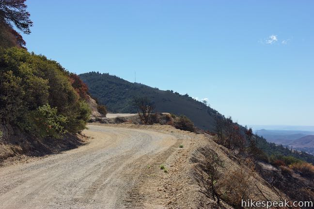
Leave the grassy area at the beginning of the trail and pass through groves of tall oaks clustered along the mountainside. At 1.2 miles from the start, pass through a cattle gate, and continue up the road. In another 0.2 miles, you’ll spot a small cabin built on the ridge above the trail. Continue up through oaks past a gate to a private drive. The trail heads farther and farther south ascending higher and higher into the mountains. The views over San Luis Obispo County are expansive over the next couple miles.
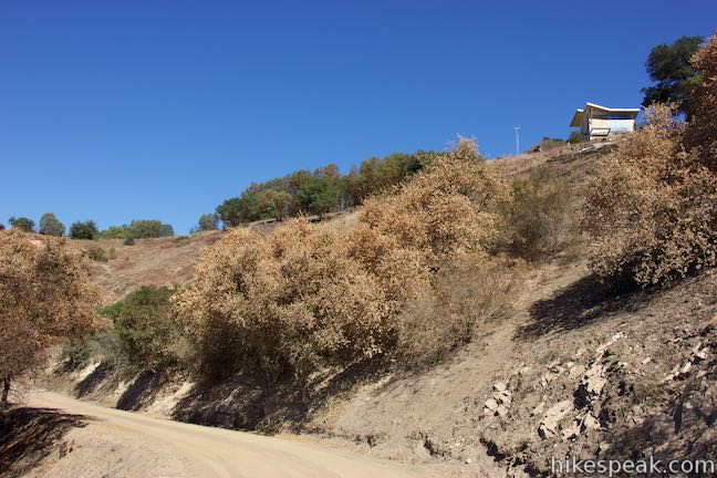
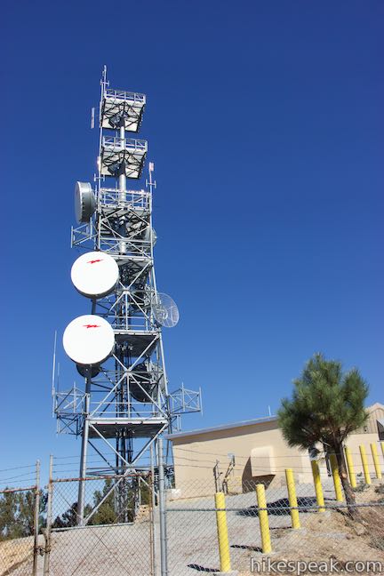
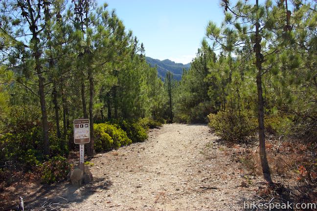
The trail turns in toward a saddle in the ridgeline, temporarily leaving behind the big views. The road then comes to a junction, 3.7 miles from the start, where a side road parts to the left, heading out to a lower summit northwest of Mount Lowe that has cell towers on top. On the right, a firebreak leaves the road and goes up along the spine of the ridge. Hike straight through this junction to stick with East Cuesta Ridge Road.
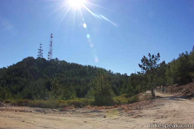
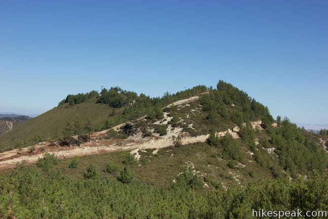
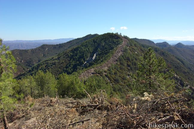
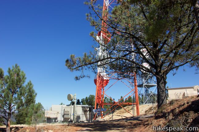
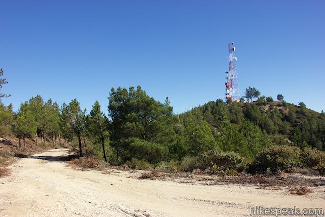
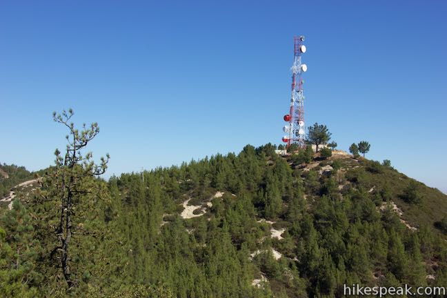
Continue another 300 yards up the wide dirt road to a T-junction. To the left, a short spur goes up to the summit of Mount Lowe, which is easy to identify with its tall red and white tower on top. East Cuesta Ridge Road continues to the right, heading south along the ridge.
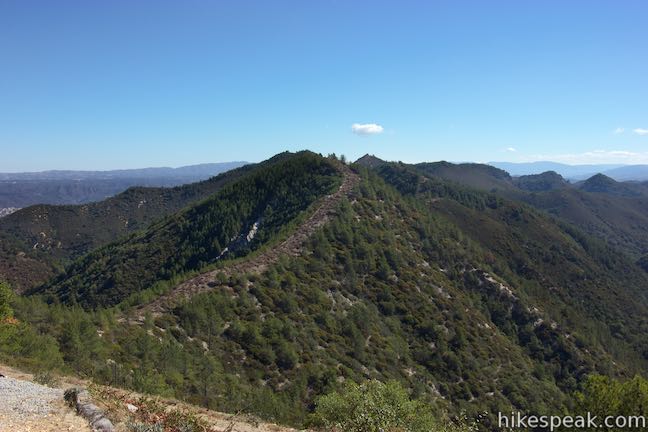
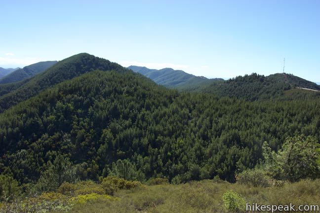
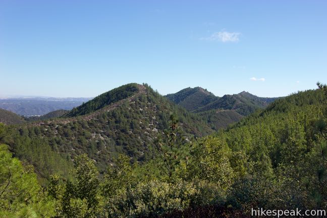
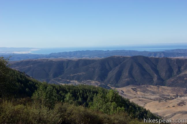
Bear left to hike 0.3 miles to the summit of Mount Lowe. The road begins up the west side of the mountain and wraps around the north side for views down over the mountain range toward Santa Margarita. The road continues to curve to the right and ascends toward the summit, coming to the east side of the mountain where new views appear. An undulating ridge that extends to the northeast looks alluring. South of that, a valley covered in evergreens plunges below the mountain. Additional pine-covered ridges extend to the southeast.
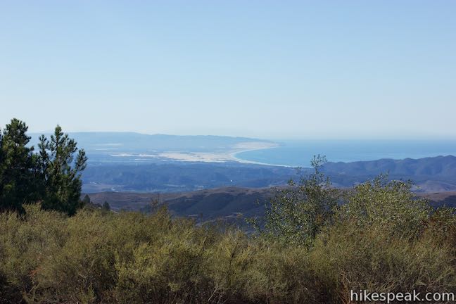
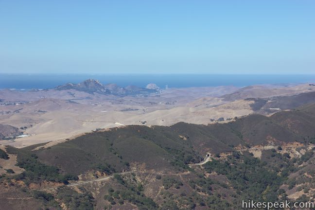
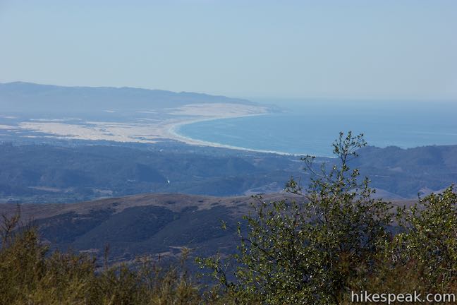
The road ends when it hits the summit, which is fenced off around a pair of towers. From the end of the road, additional views are available to the south, where you can look over the top of a ridge to see the bright sand of the Oceano Dunes wrapped around a crescent-shaped bay in the Pacific Ocean. To the west, catch sight of Morro Rock on that part of the coast. While the summit of Mount Lowe does not offer true 360-degree views, it does make a sensible turnaround point for an 8.4-mile hike.
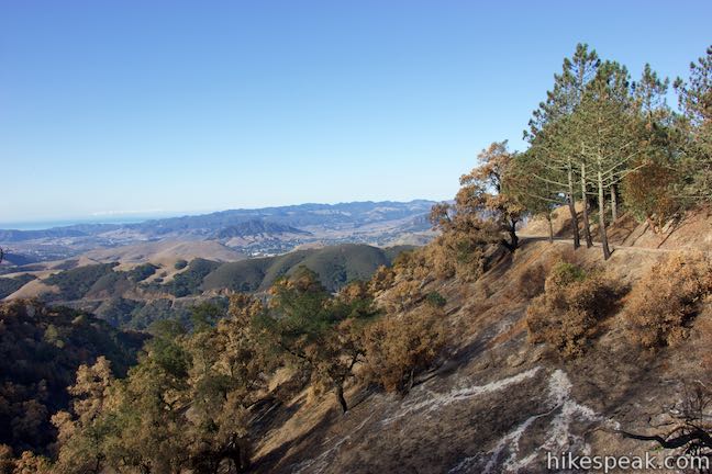
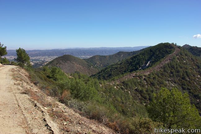
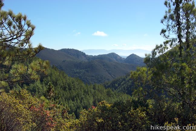
By hiking farther up East Cuesta Ridge Road, you’ll find even better views on both sides of the ridge, looking out over San Luis Obispo toward the coast and in over beautiful evergreen valleys in the Santa Lucia Wilderness, which borders East Cuesta Ridge Road.
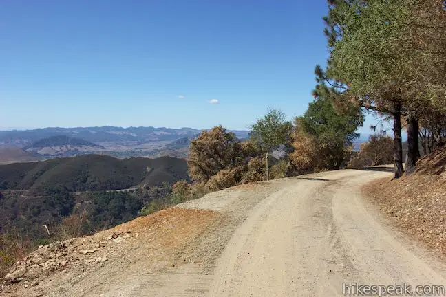
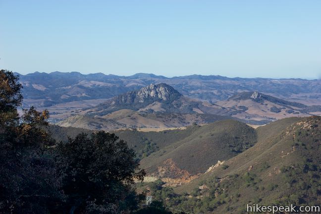
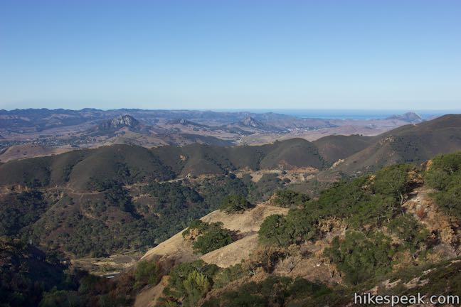
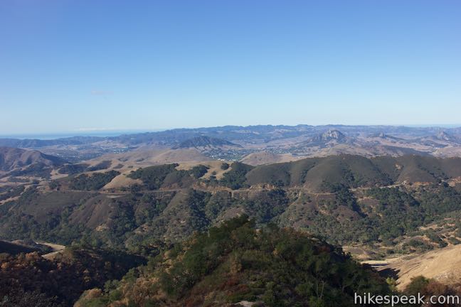
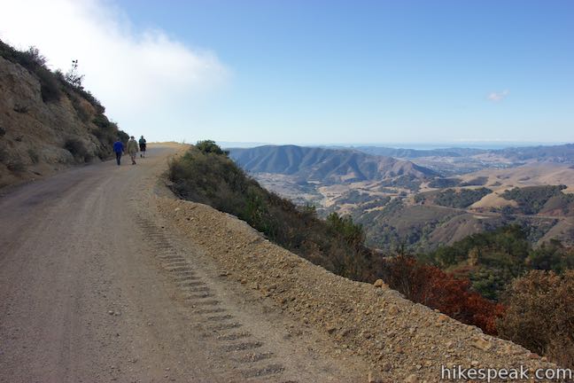
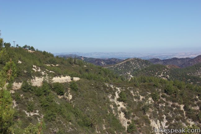
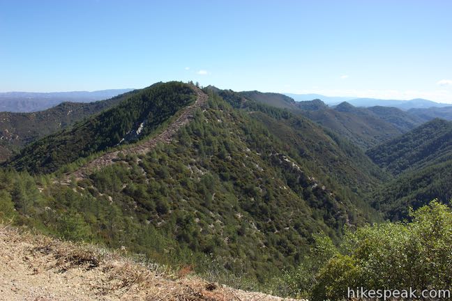
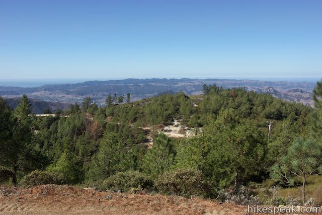
From the T-junction below Mount Lowe, head south (originally a right turn). The trail continues up the ridge, coming to a saddle in less than a tenth of a mile that delivers some of the hike’s biggest views. Gaze out over San Luis Obisbo and the area’s Morros (volcanic plugs). The Pacific Ocean is visible to the west and south on either side of the Irish Hills. Looking south, a large crescent-shaped bay is backed my tall, gleaming ridges of sand, the Oceano Dunes. West of San Luis Obispo, a string of volcanic peaks lead to Morro Rock in Morro Bay on the coast north of the Irish Hills.
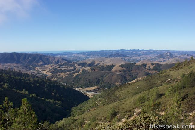
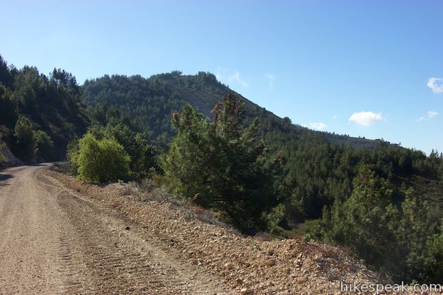
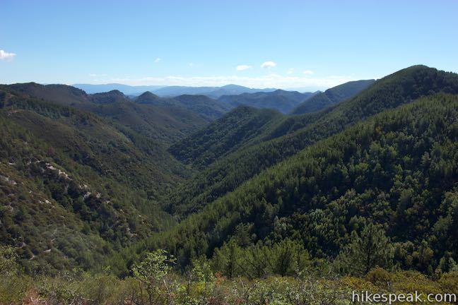
Proceeding along East Cuesta Ridge Road delivers views over the other side of the ridge, looking inland over pine-covered ridges and valleys. At around half a mile past the saddle, you’ll catch sight of a beautiful valley that might just stop you in your tracks. This evergreen landscape is lovely and looks out of place for the Central Coast, letting you imagine that you’ve trekked to somewhere in the Sierra.
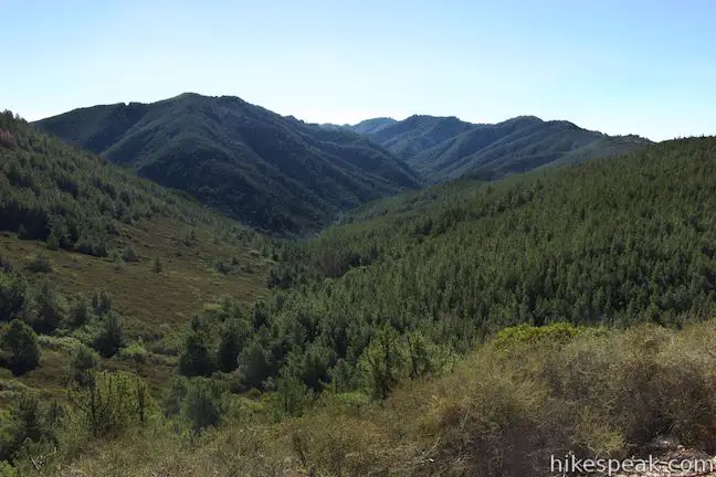
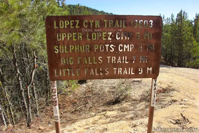
The road curves around this valley and ascends toward another tower-covered peak on the ridge. Before reaching it, the road comes to a junction where a wide dirt road breaks off to the left, crossing a dip to a clearing with a trail kiosk. Bear left here and hike 0.05 miles to the information panels and a register at the top of Lopez Canyon Trail. This vantage delivers views over more peaks and ridges in this area of the Santa Lucia Mountains. Lopez Canyon Trail can be used to hike much farther into the range, but at 4.8 miles from the start (5.4 miles if you take the side trail to Mount Lowe), it might be time to turn around. East Cuesta Ridge Road also continues far beyond this point, for another possible extension.
The hike back down East Cuesta Ridge Road may feel longer than you remember from the hike out, including a few gradual ascents in the return direction over the mileage back to Highway 101. If you hike both to Mount Lowe and the top of Lopez Canyon Trail, the outing is about 10.2 miles round trip. Dogs and bikes are welcome on this trek up East Cuesta Ridge Road. Bikes aren’t allowed on Lopez Canyon Trail, but can continue farther along the dirt road. No fee or permit is required for this hike, so get out and enjoy!
Directions to the Trailhead
- East Cuesta Ridge Road begins from Highway 101, 6 miles north of San Luis Obispo.
- Pass Old Stage Coach Road at the bottom of Cuesta Grade and drive 2.4 miles up the freeway.
- Just over the crest at Cuesta Pass, pull off into a turnout on the right side of the freeway where you can park just below the trail.
Trailhead Location
Trailhead address: Mount Lowe Road & Highway 101, San Luis Obispo, CA 93405
Trailhead coordinates: 35.34995, -120.63175 (35° 20′ 59.81″N 120° 37′ 54.29″W)
View Santa Lucia Mountains in a larger map
Or view a regional map of surrounding Central Coast trails and campgrounds.


To Mount Lowe


To Lopez Canyon Trail


 | Cuesta Ridge Botanical Area This 6-mile round trip hike crosses a ridge in the Santa Lucia Mountains with panoramic views over San Luis Obispo, ascending to a grove of Sargent cypress in a botanical area in Los Padres National Forest. |
 | Rinconada Trail This 3 to 3.25-mile hike near Santa Margarita ascends past an old mercury mine and bucolic views to a grassy saddle with a sweeping perspective over the Santa Lucia Mountains. Extend the outing to the nearby summit of Bell Mountain for even grander vistas. |
 | Reservoir CanyonThis 5.35-mile hike ascends 1,350 feet past a waterfall and a collection of junk sculptures to a treeless summit overlooking San Luis Obispo. |
 | Murray Hill via Sydney Street Trail This 2.8-mile round trip hike rapidly ascends 1,275 feet up a rugged trail to a stone seating area at a summit with panoramic views. |
 | Cerro San Luis This 4-mile hike summits one of the Nine Sisters just west of downtown San Luis Obispo. |
 | Bishop Peak This 3.5-mile hike ascends 950 feet to highest summit in the Nine Sisters, offering excellent views of San Luis Obispo and the surrounding Morros. |
 | Felsman Loop Trail This 2.7-mile loop crosses oak, sagebrush, and grass-covered slopes around the base of Bishop Peak, providing excellent views of that notable rocky summit and its San Luis Obispo surroundings. |
 | Poly Canyon Design Village This 2.5-mile hike visits an experimental architectural village designed by Cal Poly students at the base of the Santa Lucia Mountains. |
 | Stenner Creek Trail to The Eucs This 3.7-mile hike goes up Stenner Creek Canyon past a small waterfall and views of Bishop Peak to a collection of freeride bike trails called The Eucs. |
 | Stenner Creek Trail – Red Dog Trail – Poly Canyon Road Loop This 4.25-mile loop goes beyond the Eucs to explore grass-covered slopes at the base of the Santa Lucia Mountains. |
 | More hikes in San Luis Obispo Explore other trails around San Luis Obispo including Morro Bay State Park, Montaña de Oro, and the Morros. |
Common Questions about East Cuesta Ridge in San Luis Obispo
- Is the trail open?
- Yes. You should expect to find that East Cuesta Ridge Road is open. There are no recent reports of trail closures. If you discover that the trail is closed, please help your fellow hikers by reporting a closure.
- Is this trail free to access?
- Yes, East Cuesta Ridge Road is free to access. No entrance fee, pass, or permit is required. If you discover that access rules have changed, please provide feedback on your experience.
- How much time does this hike take?
- It takes approximately 4 hours 15 minutes to hike East Cuesta Ridge Road. Individual hiking times vary. Add extra time for breaks and taking in the views.
- How long is this hike?
- The hike to East Cuesta Ridge Road is 8.4 - 10.2 miles (out and back) with 1075 feet of elevation change.
- Are dogs allowed on this trail?
- Yes, dogs are allowed on East Cuesta Ridge Road. The trail is open to hikers, dogs, bikes.
- Is East Cuesta Ridge Road a difficult hike?
- This hike should be considered strenuous. Hikers should be prepared for a workout covering 8.4 miles and 1075 feet of climbing.
- Are there ocean views on this hike?
- Yes, East Cuesta Ridge Road offers views of the ocean.
- Does this trail go to a summit?
- Yes, East Cuesta Ridge Road reaches a summit with panoramic views.
- What mountain range is this trail in?
- East Cuesta Ridge Road is located in the Santa Lucia Mountains.
- Where is the trailhead located?
- The trailhead for East Cuesta Ridge Road is located in San Luis Obispo, CA.
Trailhead Address:
Mount Lowe Road
San Luis Obispo, CA 93405
Trailhead Coordinates:
35.34995, -120.63175 - What are the driving directions to the start of the hike?
To get to the trailhead: East Cuesta Ridge Road begins from Highway 101, 6 miles north of San Luis Obispo. Pass Old Stage Coach Road at the bottom of Cuesta Grade and drive 2.4 miles up the freeway. Just over the crest at Cuesta Pass, pull off into a turnout on the right side of the freeway where you can park just below the trail.
View custom Google Maps directions from your current location.
- Are there other trails near East Cuesta Ridge Road?
- Yes, you can find other nearby hikes using the Hikespeak Hike Finder Map.

4 Comments on East Cuesta Ridge in San Luis Obispo
What hikers are saying:
✨ Generated summary of user commentsThis trail provides a smooth experience for families due to a wide path that accommodates jogging strollers without the obstacle of tree roots. The surface consists of gravel and lacks significant side slopes, ensuring a steady walk for those navigating with equipment. Visitors enjoy the accessible nature of the route, which allows for a relaxed outing without technical challenges.
“This nice, wide trail should be a good option with a "jogging stroller."” Jump to comment ↓
Great hike
But lost my burgundy case Fitbit today
Saturday
January 28th
Around 11AM ish
Is there a most and found?
It says MJ
Also I found some dark glasses and placed them at end of trail on post
Hoping karma rules
And my fit big is retrned
Can you backpack in and camp for the night?
Can you hike with baby stroller?
Hi- This nice, wide trail should be a good option with a “jogging stroller.” The road doesn’t slope to the side (in a way that’s tough for strollers). Some of the trail is gravely, but there aren’t tree roots to climb over or anything like that. Have fun!