Rising through grassy meadows, oak woodlands, and chaparral slopes, Rinconada Trail provides North County access to the Santa Lucia Mountains in Los Padres National Forest. Gaze over bucolic valleys on the hike up to a high point in a grassy mountain pass with views over remote ridges and canyons in the Santa Lucia Wilderness. Turn around at an overlook by the crest of Rinconada Trail for a 3-mile round trip hike with 625 feet of elevation change.
Of the many possible extensions off Rinconada Trail, one good option is to form a loop to the top of Bell Mountain, a 2,618-foot peak next to Rinconada Trail. Firebreak trails and a short scramble lead to a summit with soaring 360-degrees over the Santa Lucia Mountains and North San Luis Obispo County. The Rinconada Trail – Bell Mountain Loop is 3.25 miles round trip with 865 feet of elevation change.
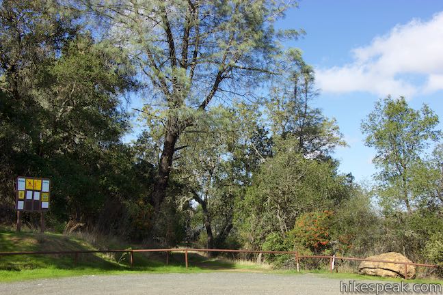
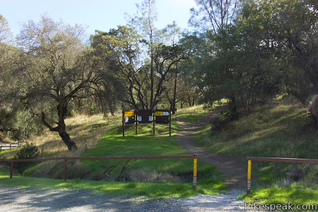
Rinconada Trail begins from a trailhead just off Pozo Road between Santa Margarita and the unincorporated community of Pozo. Two trails actually start from Rinconada Trailhead. An unofficial trail leaves from the northwest side of the trailhead and wraps up to the ruins of Rinconada Mine. It is about a quarter mile up to the rusting graffiti-covered remains of the mine’s processing operation. Machinery lingers from an operation that extracted mercury from cinnabar ore from the 1870s to 1961. The EPA cleaned up the mercury mine in 2004, eliminating the risk of mercury poisoning and other dangers, so you won’t encounter any mad hatters on Rinconada Trail. Do be cautious with your safety if you decide to check out the mine.
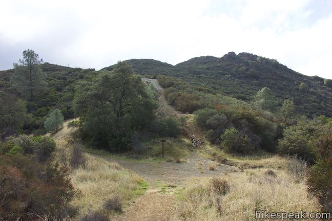
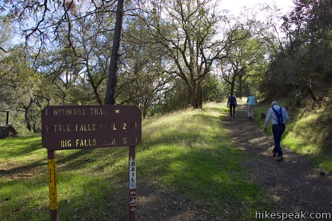
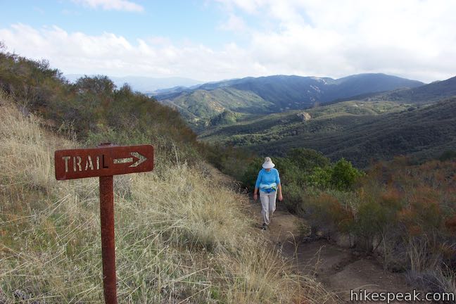
Begin up Rinconada Trail, which leaves from the southeast side of Rinconada Trailhead next to a large mileage sign for Rinconada Trail, displaying the distances to Little Falls Trail and Big Falls Trail at 2 and 5 miles.
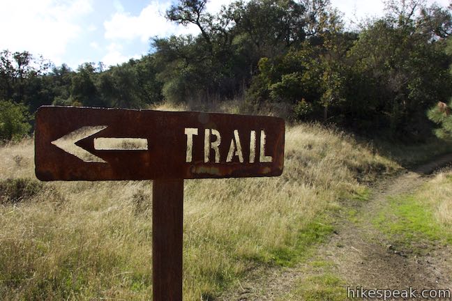
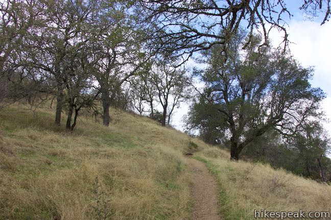
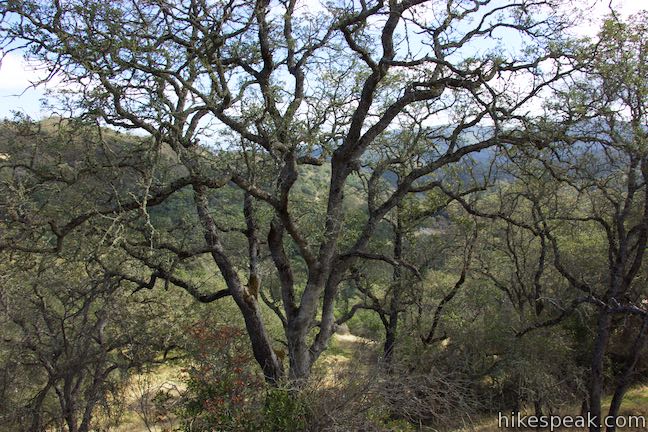
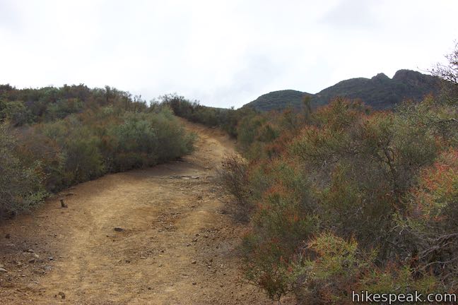
Hike up a wide single track into an oak woodland. Go around a couple bends and come to the first of a few junctions marked with signs that have the word “trail” and arrows cut into metal. Bear left at this first junction, 0.2 miles from the start, bypassing a path into Rinconada Mine.
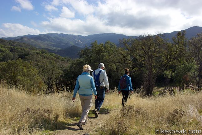
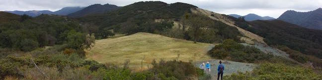
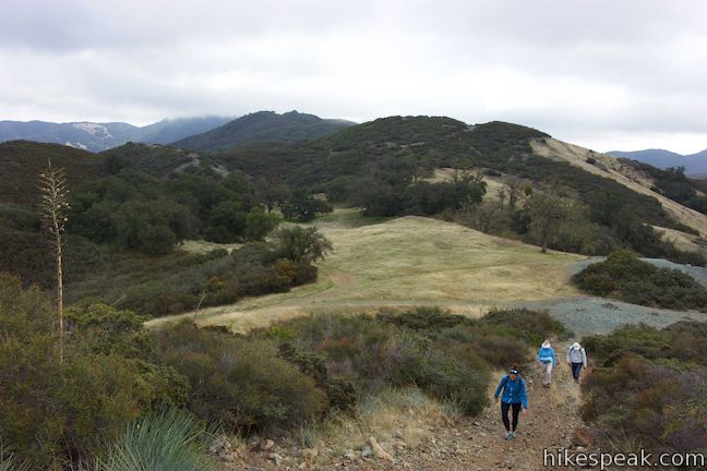
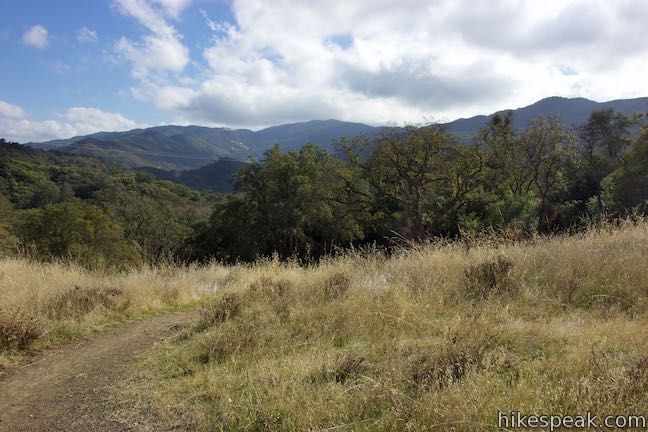
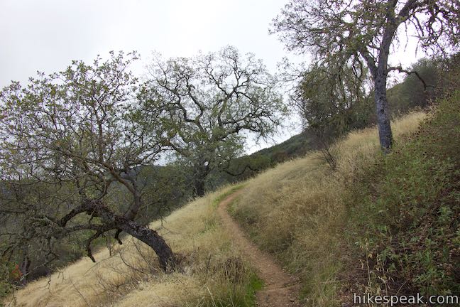
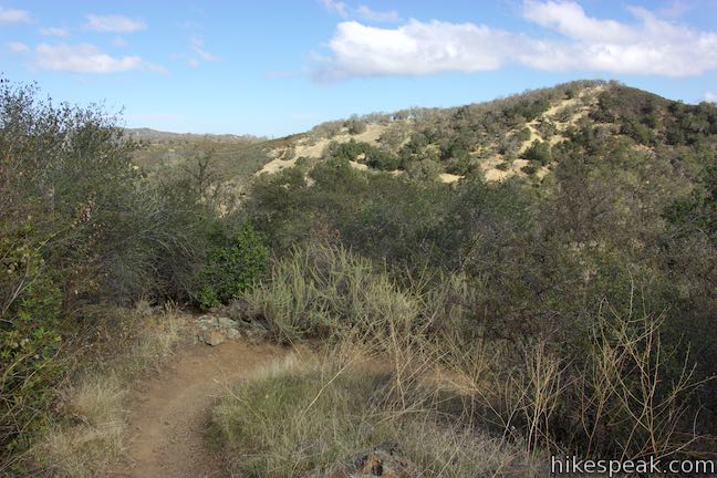
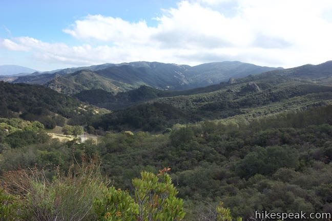
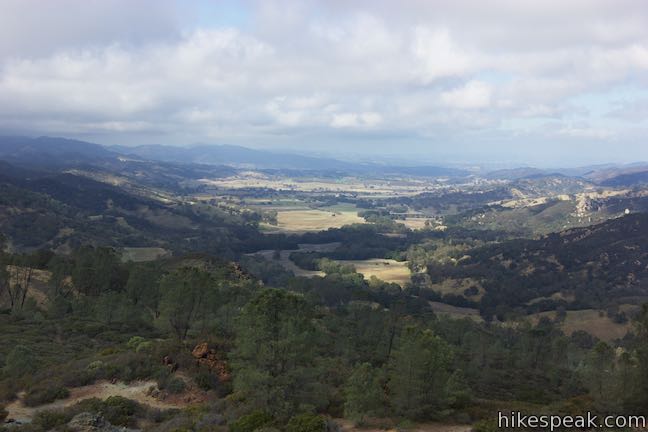
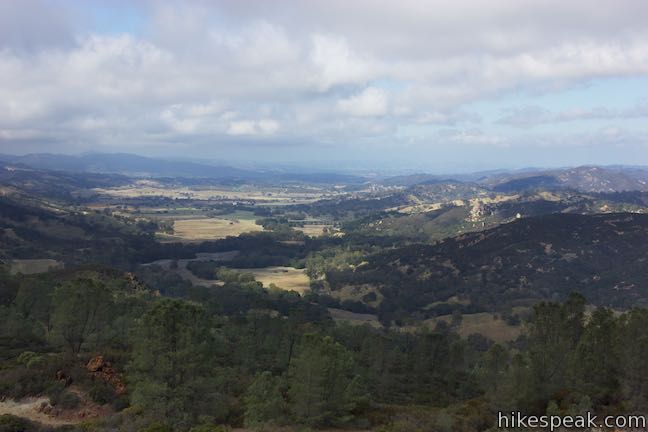
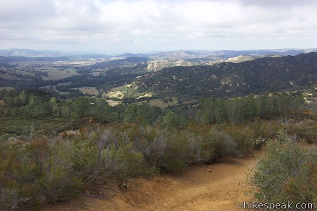
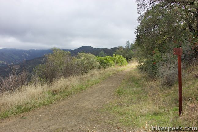
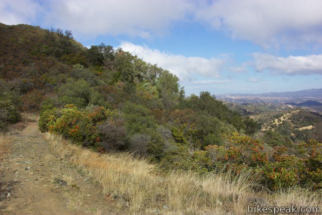
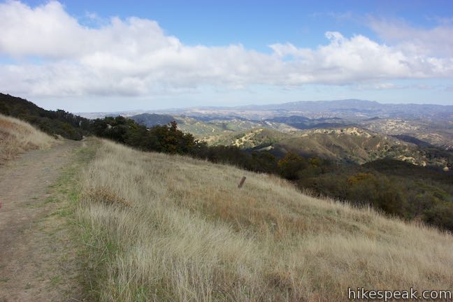
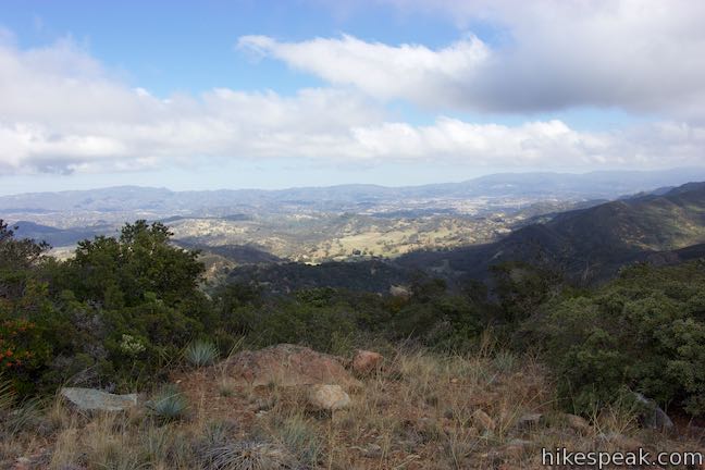
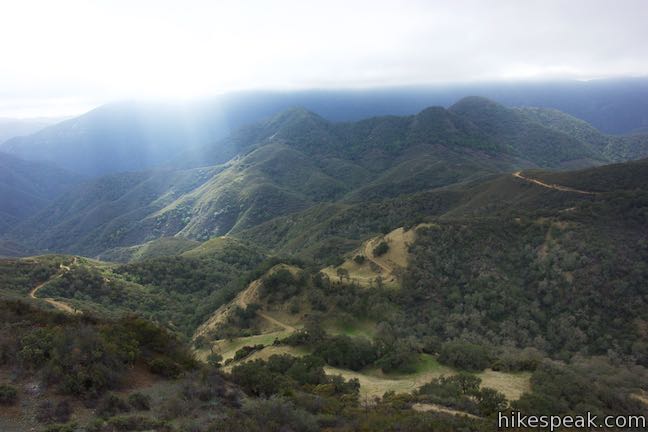
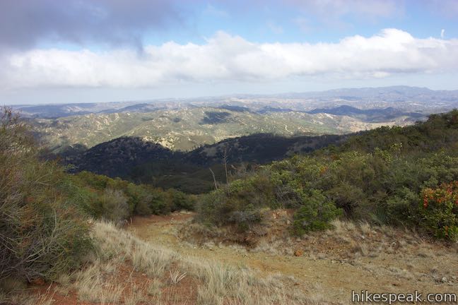
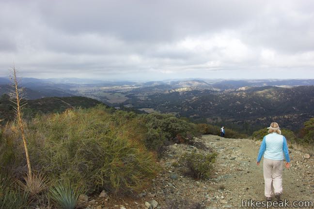
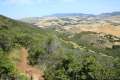
Hike south across a meadow and along a grassy slope spotted with oaks. As you rise up the trail, find pleasant views east over Pozo Road as it weaves up a bucolic valley. A couple switchbacks take you out of the oaks and into a chaparral-covered area that has clearer views.
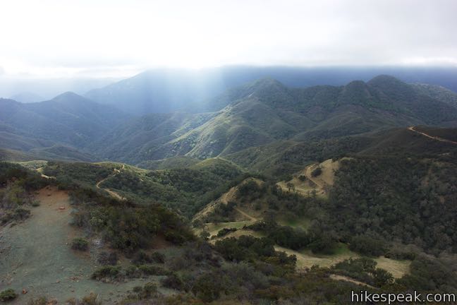
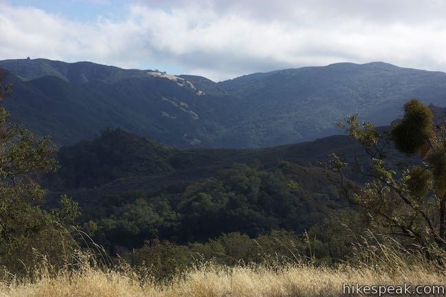
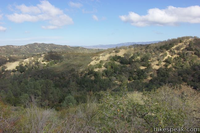
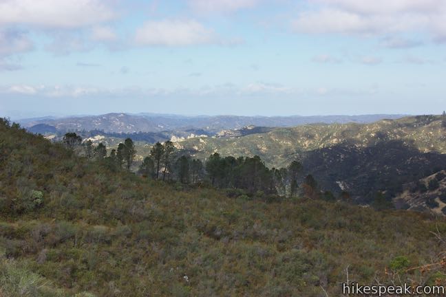
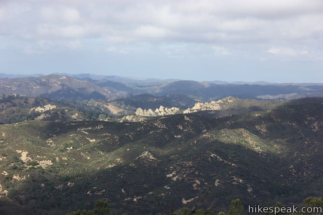
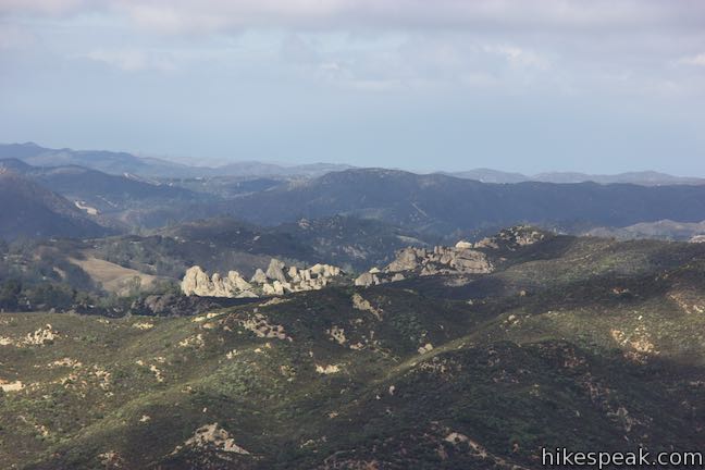
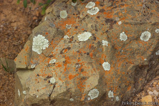
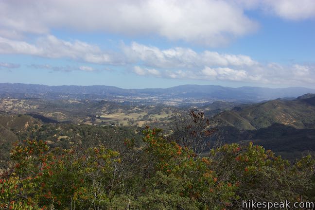
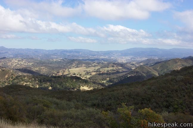
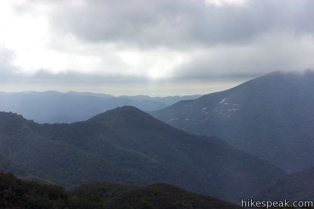
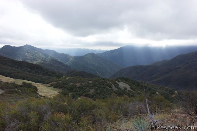
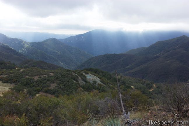
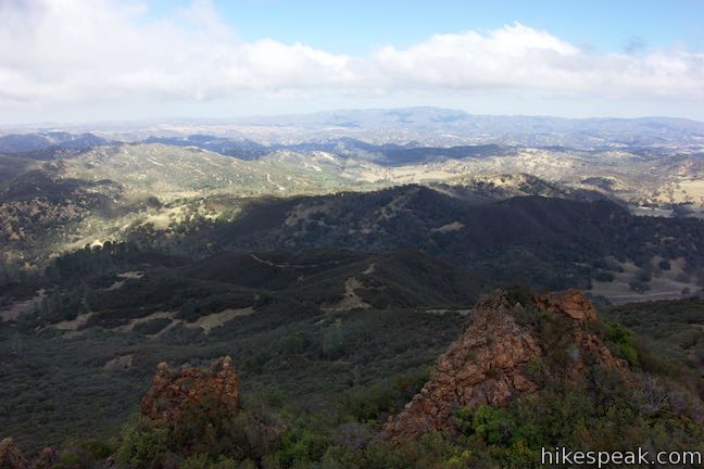
After a couple tight switchbacks, the trail wraps around the back of a larger draw in the landscape for nice views to the north. Turn right up a long switchback leading up onto a ridge, 0.8 miles from the start, where you’ll pass through an unmarked junction. Stay to the left past a path the drops to the right toward Rinconada Mine. It appears that this path could be used to connect with the one that left the first junction along the trail. Look northwest from the ridge over colorful, mineral-rich soils around the old mine. Valleys in the distance cradle Santa Margarita and Paso Robles. Your eyes will be drawn to a chain of jagged rock formations to the north near Santa Margarita Lake (which isn’t in view).
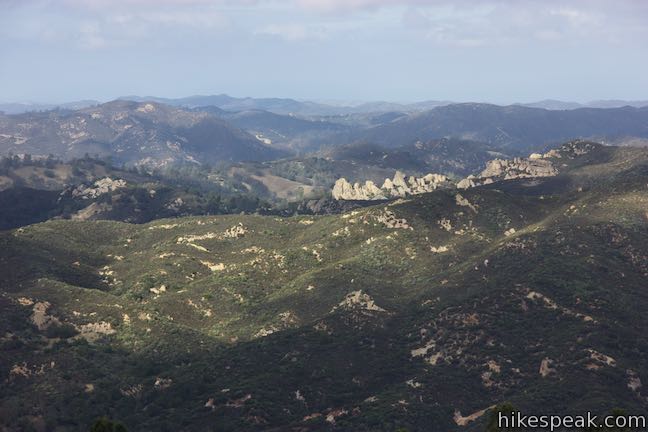
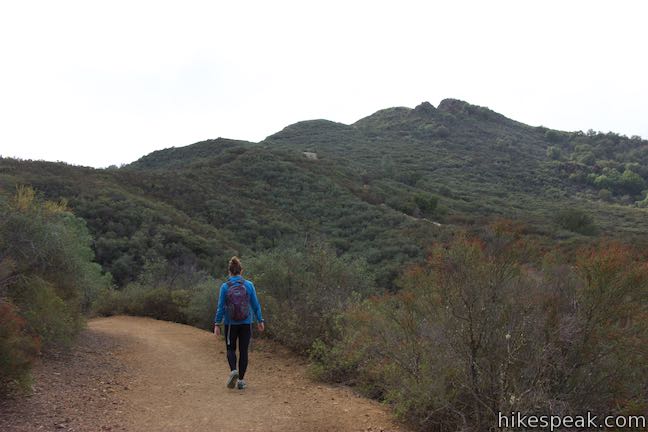
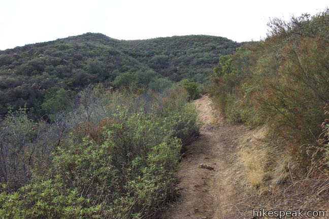
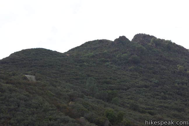
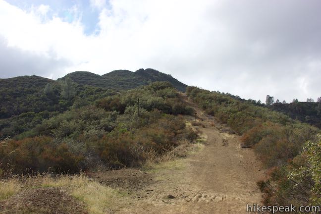
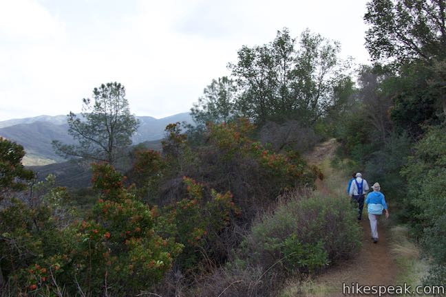
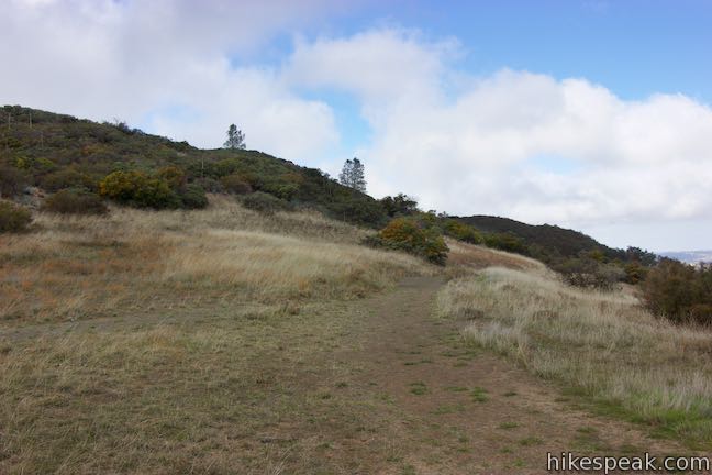
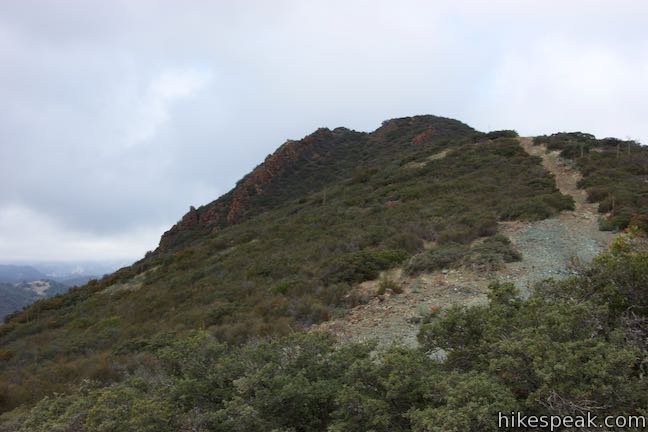
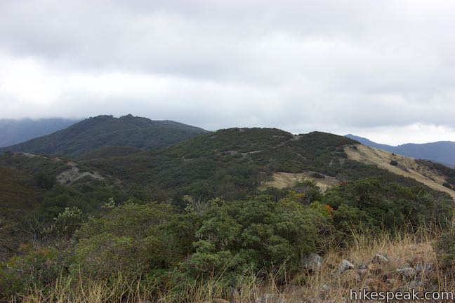
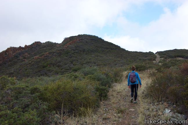
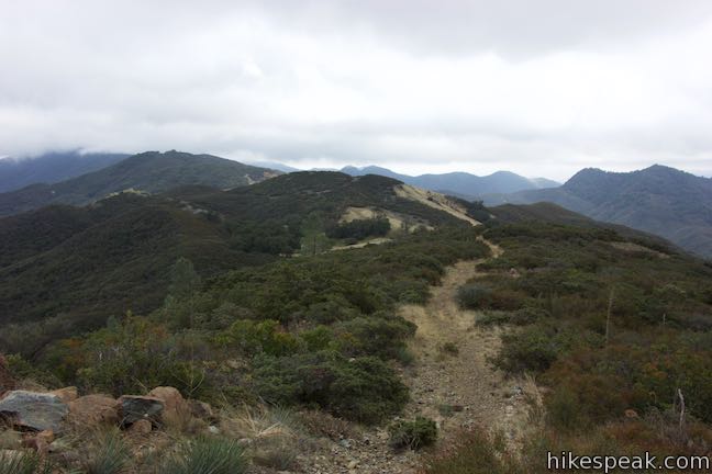
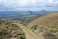
Proceed south up the ridge on Rinconada Trail. Rising in front of you is Bell Mountain (Summit 2618 on forest service maps), which has two humps on its summit that resemble a gun sight from this angle. Rinconada Trail dips just below the spine of the ridge, on the southwest side. When you reach what looks like a T-junction, skip the short spur to the left to take the obvious trail to the right to continue up the ridge (this junction may be more confusing on the hike down).
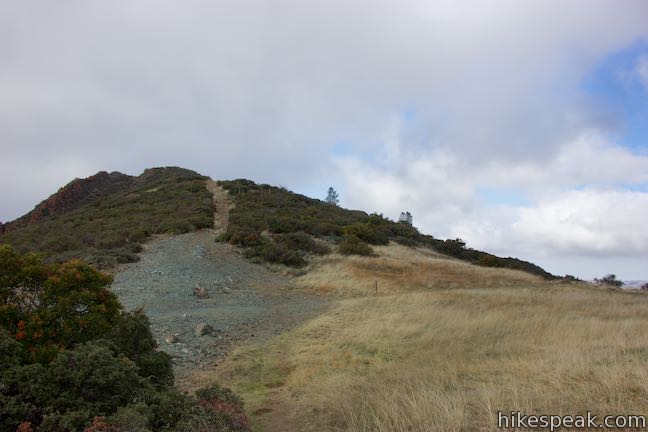
Rinconada Trail is wide as it goes up the ridge toward a bump. Come to a trail sign and follow it by bearing left on a short stretch of single track that wraps around the east side of the ridge, taking an easier grade that bypasses the rise on the ridge. Soon you will rejoin the wider firebreak and bear left again.
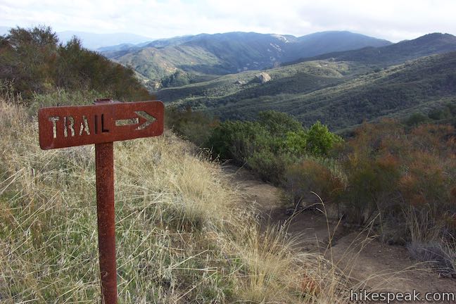
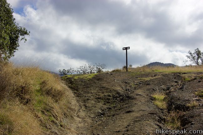
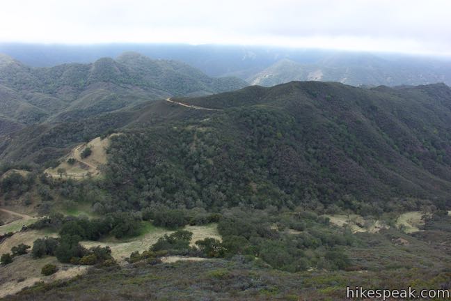
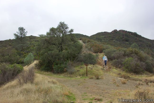
Walk 100 feet to an important six-point junction on Rinconada Trail, 1.1 miles from the start. You can ignore the three paths parting to the right (unless you’re making additional explorations). Straight ahead, a steep firebreak ascends the north side of Bell Mountain. If you plan to hike to that summit, it will be easier to descend by this route after hiking up the mountain from the top of Rinconada Trail. Turn left to stay on Rinconada Trail, following one last metal trail sign.
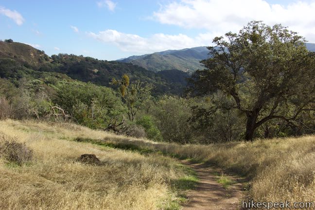
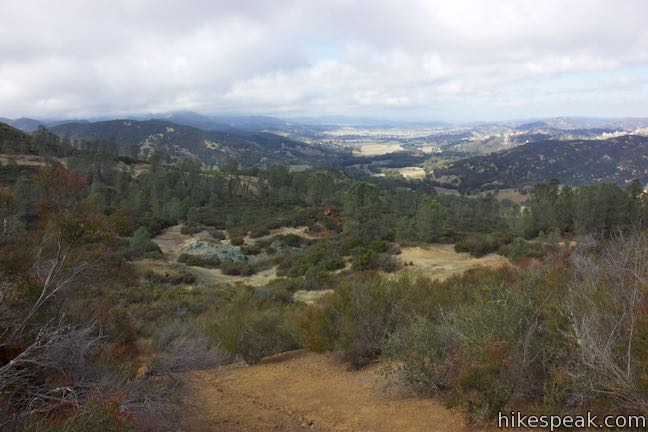
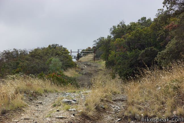
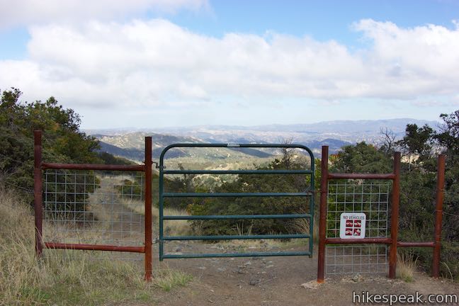
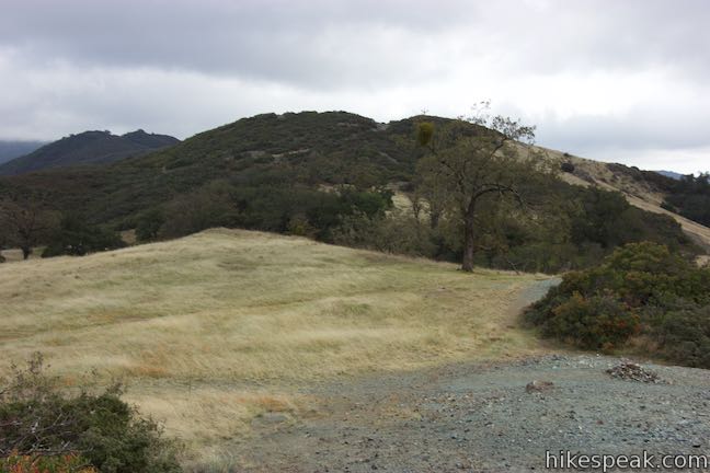
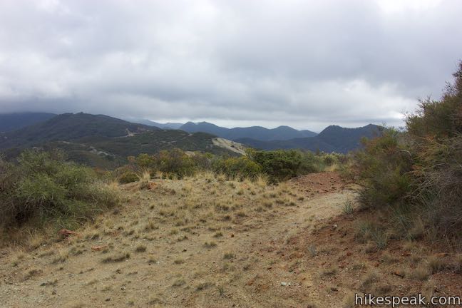
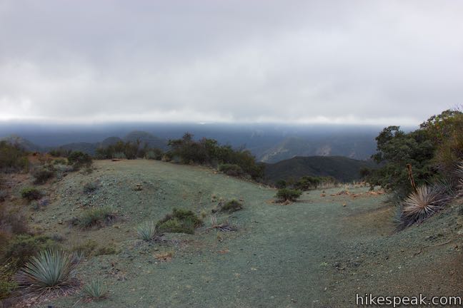
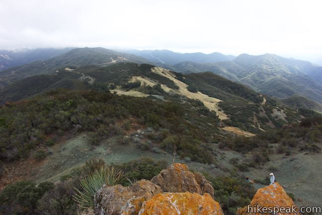
Rinconada Trail eases up a slope of chaparral, only ascending about 75 feet over the last 0.4 miles. Enjoy views up the ridge-framed valley to the northeast. Go through a livestock gate (closing it behind you) and hike less than a tenth of a mile up to a grassy mountain pass in a saddle on the ridge east of Bell Mountain.
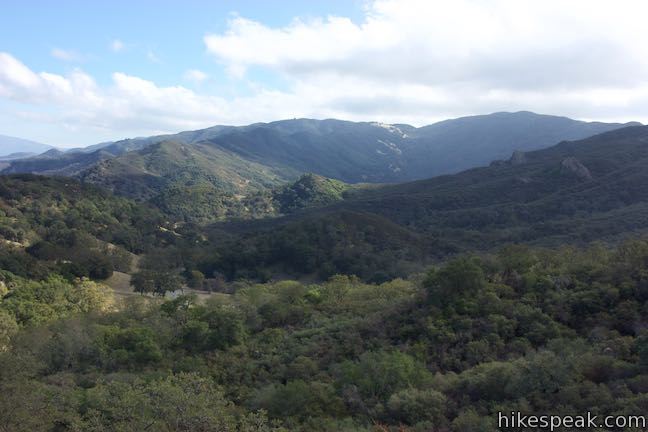
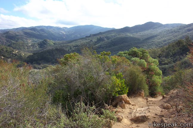
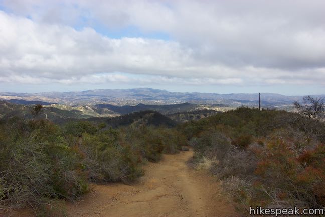
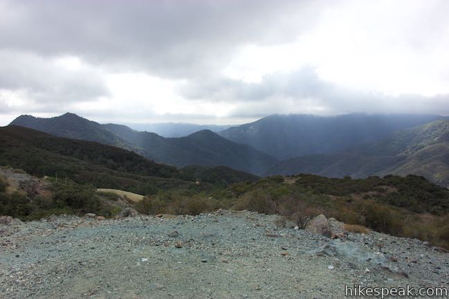
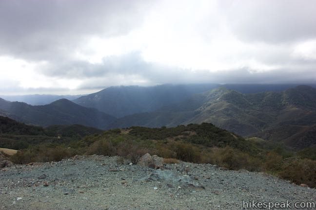
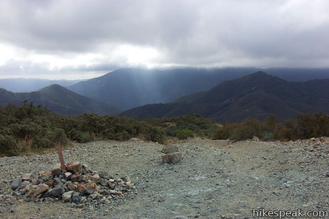
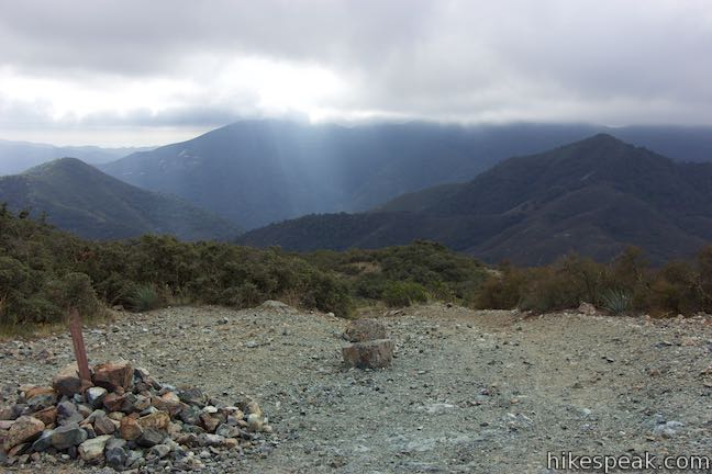
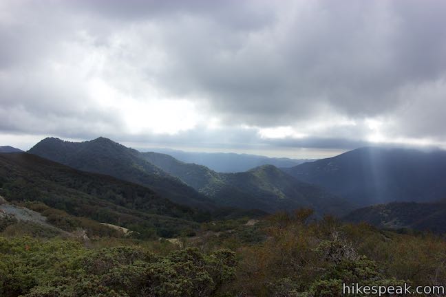
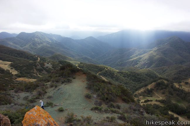
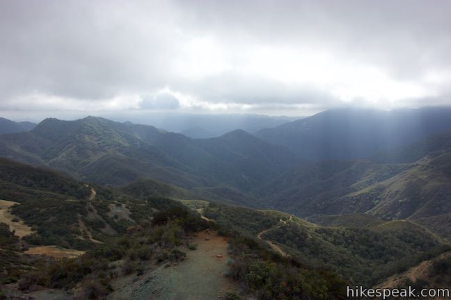
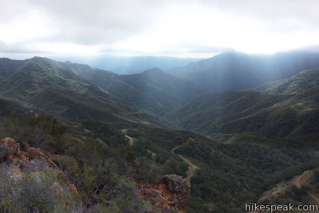
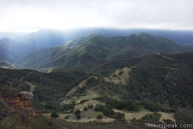
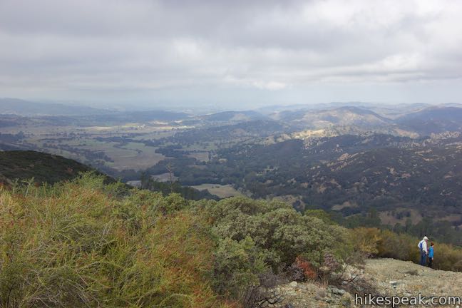
Come to a trail split at this crest on Rinconada Trail, just under 1.5 miles from the trailhead. A dirt road goes east and connects to Hi Mountain Road. Rinconada Trail turns to the right and makes a steep descent to Hi Mountain Road. Some hikers use these two branches to make a loop connected by a short stretch of Hi Mountain Road. The views are so awesome from the saddle that you may not see any reason to hike much farther.
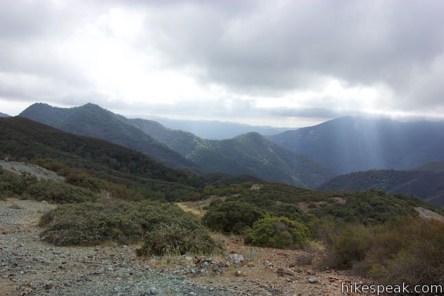
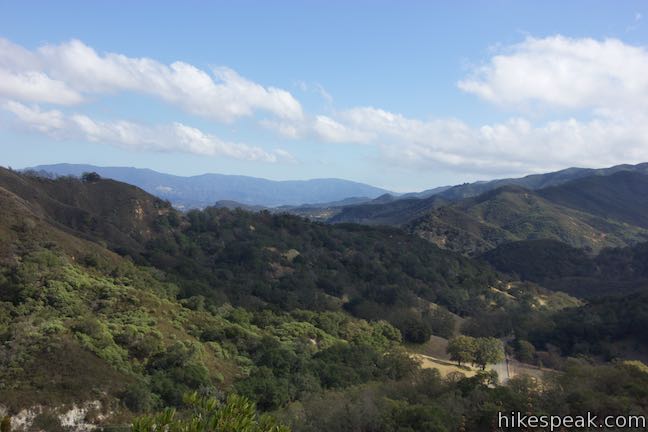
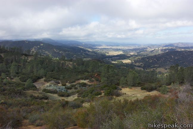
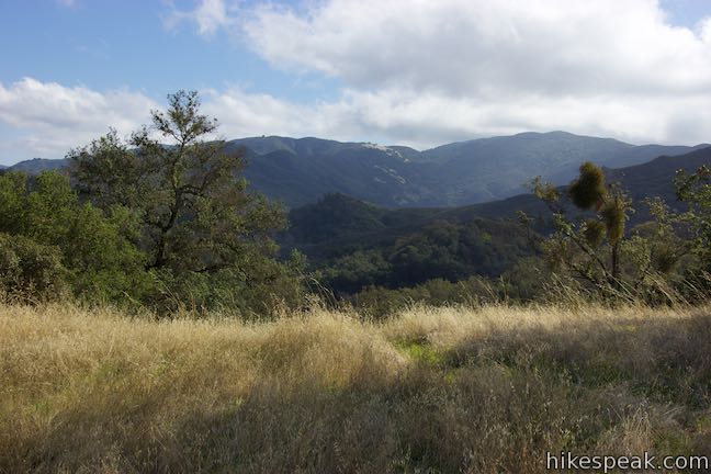
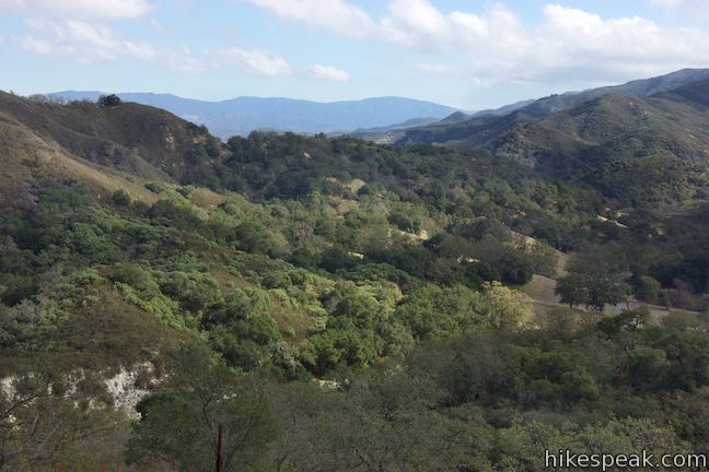
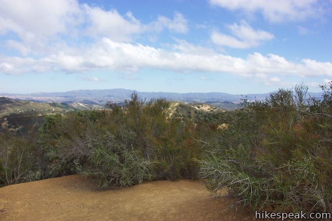
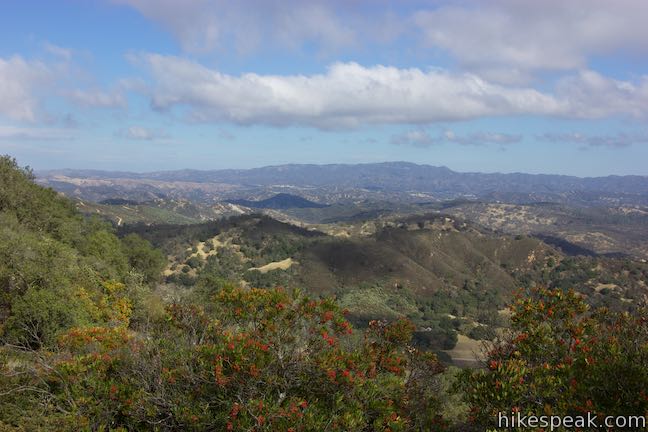
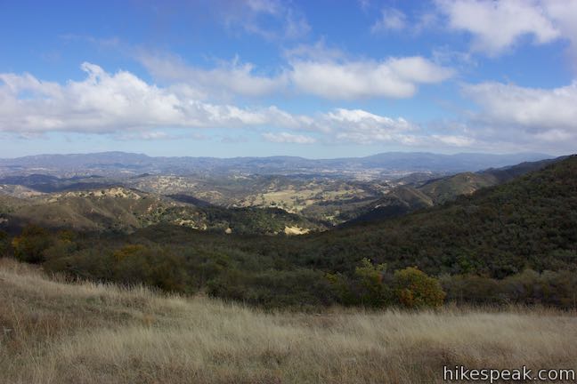
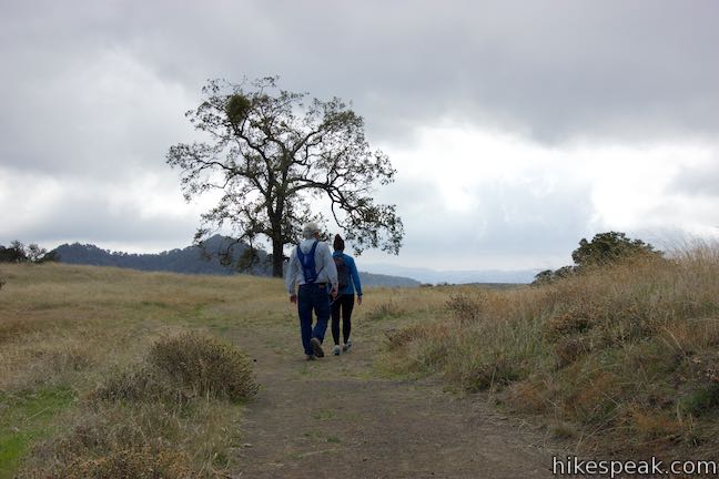
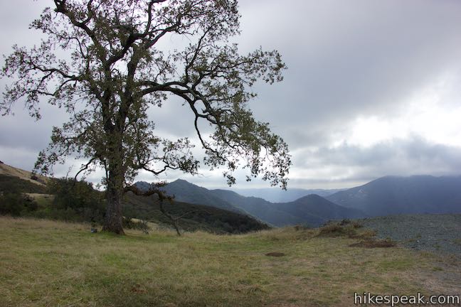
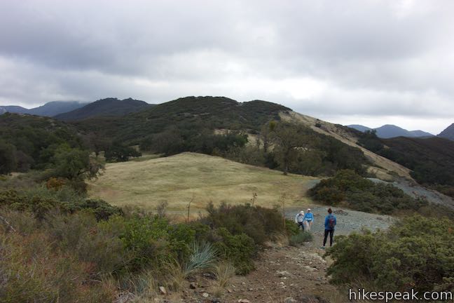
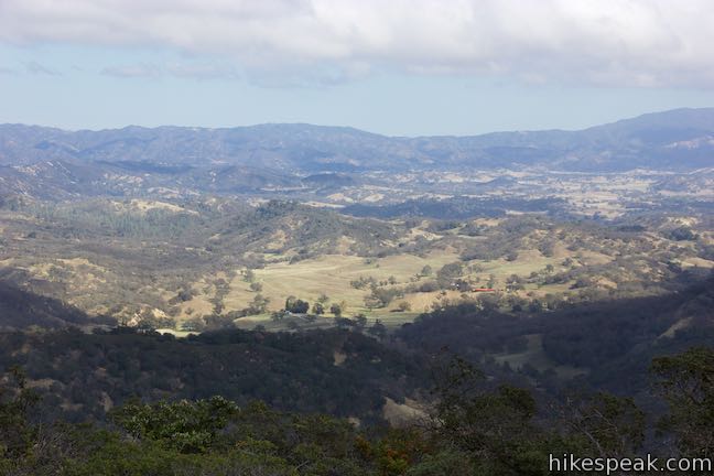
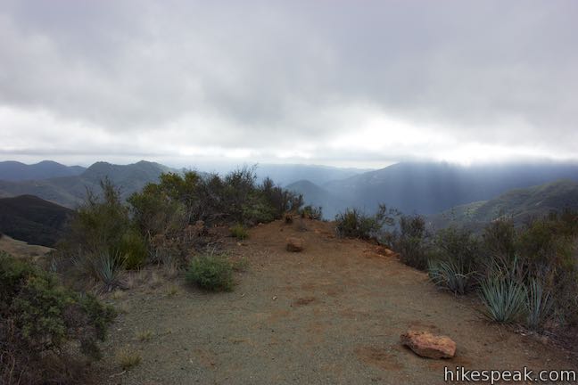
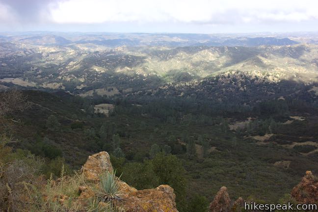
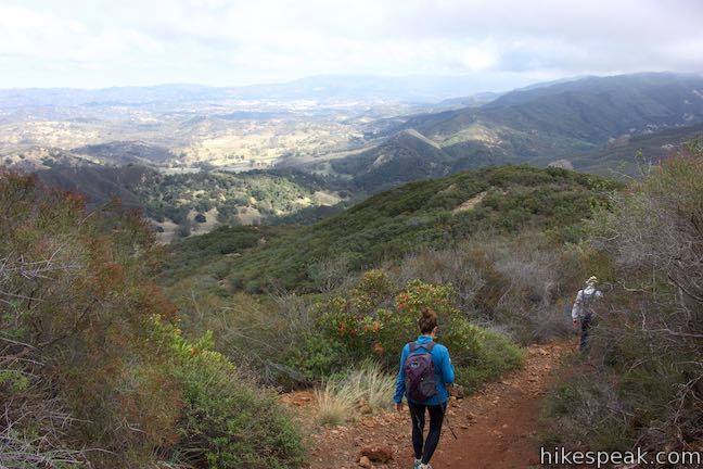
Take a path out between the two trails toward a tall, solitary oak tree. Next to it, you’ll find a viewpoint with a bold perspective south over the Santa Lucia Wilderness. Look down Little Falls Canyon, which join Lopez Canyon to carve out a range of green ridges and peaks. Bald Mountain rises to the south and in clear conditions, you can gaze through the gap from Lopez Canyon all the way to northern Santa Barbara County.
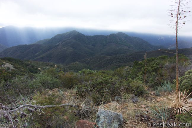
Even through the hike up Rinconada Trail spoils you with views, the perspective from the top of the trail will still knock you out! Turn around at the crest for a 3-mile round trip hike with 625 feet of elevation change. Press on if you’re motivated to find even grander views.
Bell Mountain
On the west side of the pass at the crest of Rinconada Trail, you’ll see a firebreak that cuts up the side of Bell Mountain toward alluring orange-colored rock formations at the top. Hike up the firebreak to form a loop off Rinconada Trail that extends the hike by a quarter mile with another 240 feet of elevation change.
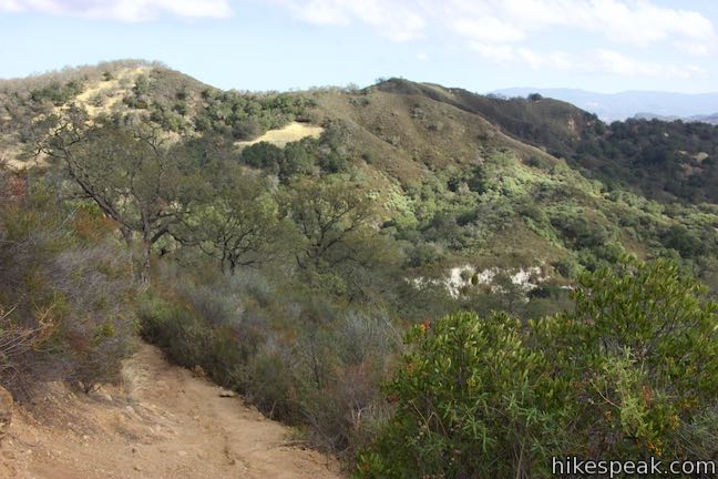
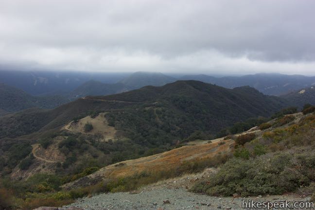
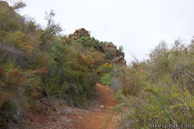
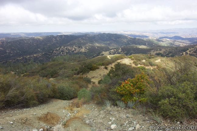
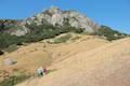
Hike up a path on the firebreak and head northwest toward the top of Bell Mountain. The firebreak rises quickly to a nice perspective back over the saddle and east along the oak and meadow-covered mountain ridge. This view expands as you get higher up the firebreak.
After a quarter-mile ascent from Rinconada Trail, come to an intersection. A short branch of another firebreak goes to the left and immediately dead ends, so ignore that. The firebreak to the right descends the north side of Bell Mountain toward the multi-point junction at the 1.1-mile mark on Rinconada Trail. Save that for the hike down. For now, hike straight on the trail to the top of the mountain.
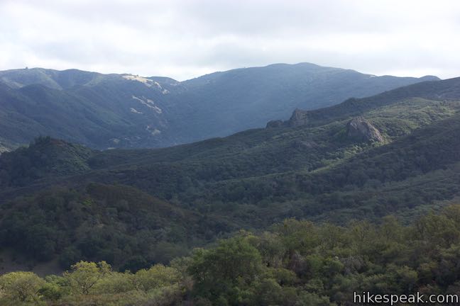
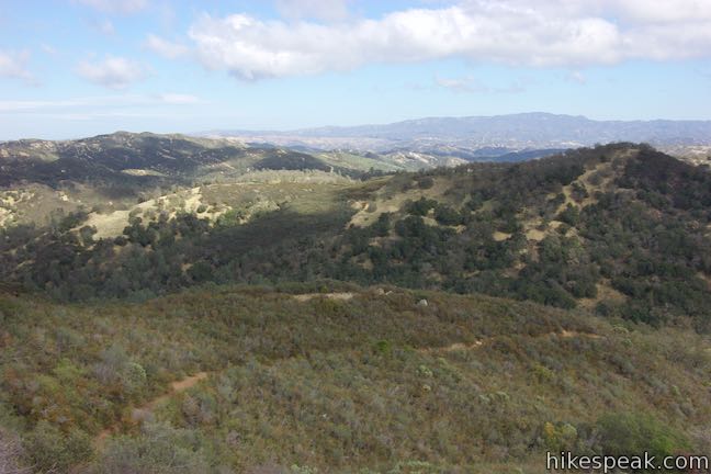
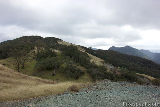
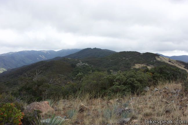
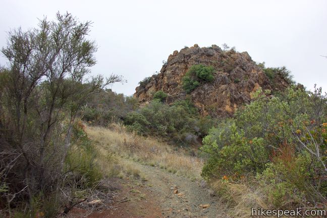
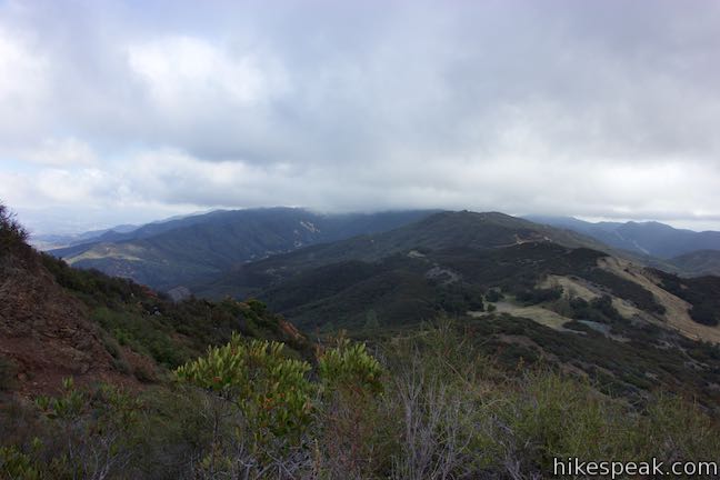
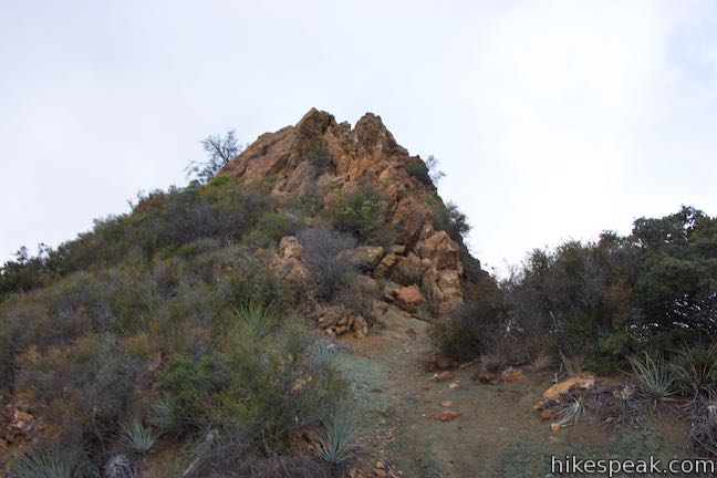
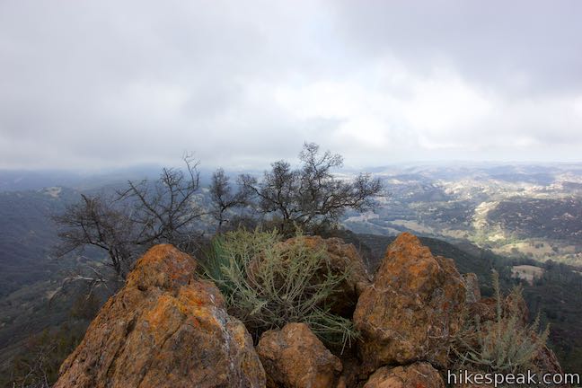
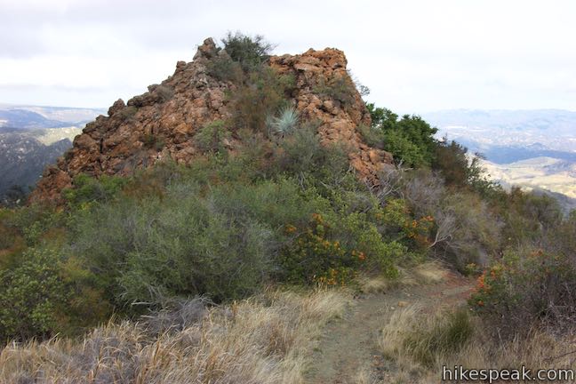
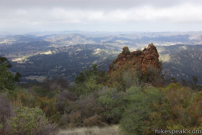
Hike up through a curve to the left past a knobby outcropping of orange rock. Proceed up the firebreak to a landing just south of the actual summit that has an overlook facing into the Santa Lucia Wilderness. From this perch, a third of a mile and 215 vertical feet above Rinconada Trail, you’ll have an even loftier view over Little Falls Canyon, Big Falls Canyon, Lopez Canyon, and the beautiful mountains and ridges that surround them.
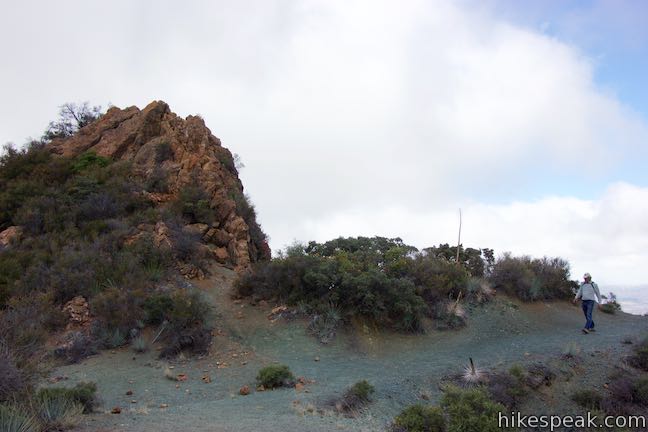
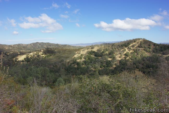
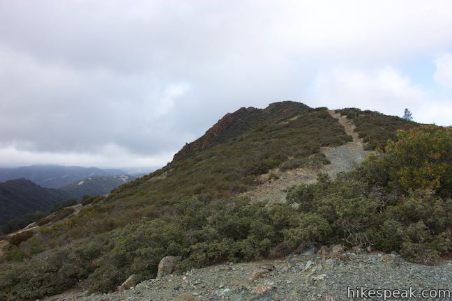
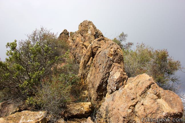
Behind the overlook is the rocky spire at the summit of Bell Mountain. Reach the top with an off trail climb up a rocky path. Although this 2,618-foot mountaintop is not a well know summit in the Santa Lucia Mountains, the views are notable.
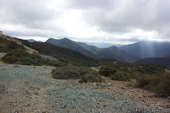
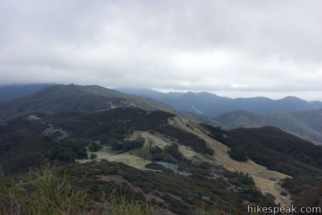
Bell Mountain seems to straddle a ridge between two different landscapes. Mountains and canyons to the south and ranchland and cities in North San Luis Obispo County spread to the north. The rugged crown of Bell Mountain has unobstructed 360-degree views and no matter what direction you look, you’ll love the view!
Leave the summit and hike a tenth of a mile back down to the firebreaks junction. Turn left to hike down the other firebreak toward the six-points junction. This trail is steep, sacrificing 225 feet in 0.2 miles. The firebreak makes a loose, precipitous descent, flattens out, and then plunges again to get down to the junction. Footwear with good traction is a must and trekking poles won’t hurt.
When you return to Rinconada Trail, continue straight, hiking 1.1 miles back down to the trailhead along the original route. The extension up Bell Mountain gets a ringing endorsement!
The basic directions for the Rinconada Trail – Bell Mountain hike are:
- Take the trail heading southeast from Rinconada Trailhead (0 miles)
- Turn left at the first marked junction to stay on Rinconada Trail (0.2 miles)
- Bear left up the ridge, passing a trail on the right down toward the mine (0.8 miles)
- Bear right past a dead end spur out to a bump on the ridge (0.95 miles)
- Make two left turns, following trail signs, to bypass a wider firebreak trail over a rise on the ridge (1.05 miles)
- Follow the sign to turn left at a multi-point junction – the firebreak straight ahead will be used to descend Bell Mountain (1.1 miles)
- Pass through a livestock gate (1.4 miles)
- Come to a trail junction in a grassy saddle at the crest of Rinconada Trail and take a path between the two trails to an overlook (1.5 miles)
- Head west up the firebreak to the nearby summit or return the way you came for an easier hike (1.5 miles)
- Come to an intersection of firebreaks and continue straight up Bell Mountain (1.75 miles)
- Reach an overlook at the top of the firebreak on the south side of the summit (1.83 miles)
- Climb up to the rocky summit of Bell Mountain (1.85 miles)
- Descend to the firebreaks junction and turn left (1.95 miles)
- Come down the north side of Bell Mountain to the multi-point junction (2.15 miles)
- Proceed straight and follow Rinconada Trail back down to the trailhead (3.25 miles)
With or without the extension to Bell Mountain, Rinconada Trail is a worthwhile hike packed with rewarding views. Dogs, bikes, and horses are all allowed on Rinconada Trail. Unless you are trekking into Santa Lucia Wilderness (beyond the hike described here) or staying overnight and building a fire or using a camp stove, you will not need a permit to hike Rinconada Trail. No other pass is needed, and parking at Rinconada Trailhead is free, so get out and enjoy!
Directions to the Trailhead
- From San Luis Obispo, take Highway 101 north for 8.5 miles to exit 211 for Santa Margarita.
- Head east at the end of the offramp onto El Camino Real (Route 58) and drive 1.5 miles to Santa Margarita.
- Just before El Camino Real leaves town and turns north, make a right turn onto Estrada Avenue (Route 58).
- After 3 blocks, follow the road on a sharp bend to the left.
- Take Route 58 for another 1.3 miles and then stay to the right onto Pozo Road.
- Drive 9.4 miles and turn right up a short road marked with the sign for Rinconada Trailhead to find a parking area at the start of Rinconada Trail.
- Coming from the north, exit 211 is 20 miles south of Paso Robles on Highway 101.
Trailhead Location
Trailhead address: 2400 W Pozo Road, Santa Margarita, CA 93453
Trailhead coordinates: 35.28995, -120.47485 (35° 17′ 23.81″N 120° 28′ 29.46″W)
View Santa Lucia Mountains in a larger map
Or view a regional map of surrounding Central Coast trails and campgrounds.


 | East Cuesta Ridge This wide dirt road offers an 8.4-mile hike to the top of Mount Lowe or a longer trek to the top of Lopez Canyon Trail, offering ocean views over San Luis Obispo and inland views over an evergreen wilderness. |
 | Cuesta Ridge Botanical Area This 6-mile round trip hike crosses a ridge in the Santa Lucia Mountains with panoramic views over San Luis Obispo, ascending to a grove of Sargent cypress in a botanical area in Los Padres National Forest. |
 | Reservoir CanyonThis 5.35-mile hike ascends 1,350 feet past a waterfall and a collection of junk sculptures to a treeless summit overlooking San Luis Obispo. |
 | Murray Hill via Sydney Street Trail This 2.8-mile round trip hike rapidly ascends 1,275 feet up a rugged trail to a stone seating area at a summit with panoramic views. |
 | Cerro San Luis This 4-mile hike summits one of the Nine Sisters just west of downtown San Luis Obispo. |
 | Bishop Peak This 3.5-mile hike ascends 950 feet to highest summit in the Nine Sisters, offering excellent views of San Luis Obispo and the surrounding Morros. |
 | Felsman Loop Trail This 2.7-mile loop crosses oak, sagebrush, and grass-covered slopes around the base of Bishop Peak, providing excellent views of that notable rocky summit and its San Luis Obispo surroundings. |
 | Poly Canyon Design Village This 2.5-mile hike visits an experimental architectural village designed by Cal Poly students at the base of the Santa Lucia Mountains. |
 | Stenner Creek Trail to The Eucs This 3.7-mile hike goes up Stenner Creek Canyon past a small waterfall and views of Bishop Peak to a collection of freeride bike trails called The Eucs. |
 | Stenner Creek Trail – Red Dog Trail – Poly Canyon Road Loop This 4.25-mile loop goes beyond the Eucs to explore grass-covered slopes at the base of the Santa Lucia Mountains. |
 | More hikes in San Luis Obispo Explore other trails around San Luis Obispo including Morro Bay State Park, Montaña de Oro, and the Morros. |
- Rinconada Trail with the loop to Hi Mountain Road in Top Trails: California Central Coast by Brian Mine (opens in a new tab)
- Rinconada Trail with the loop to Hi Mountain Road on californiatrekking.com (opens in a new tab)
- Rinconada Trail with the loop to Hi Mountain Road on alltrails.com (opens in a new tab)
- A San Luis Obispo Tribune article about Rinconada Trail (opens in a new tab)
- Rinconada Trail on eclecticarcania.blogspot.com (opens in a new tab)
- Rinconada Mine on atlasobscura.com (opens in a new tab)
- Rinconada Trail on hikingproject.com (opens in a new tab)
- Rinconada Trail on hikelospadres.com (opens in a new tab)
- The official Los Padres National Forest webpage for Rinconada Trailhead (opens in a new tab)
Common Questions about Rinconada Trail and Bell Mountain in the Santa Lucia Mountains
- Is the trail open?
- Yes. You should expect to find that Rinconada Trail - Bell Mountain Loop is open. There are no recent reports of trail closures. If you discover that the trail is closed, please help your fellow hikers by reporting a closure.
- Is this trail free to access?
- Yes, Rinconada Trail - Bell Mountain Loop is free to access. No entrance fee, pass, or permit is required. If you discover that access rules have changed, please provide feedback on your experience.
- How much time does this hike take?
- It takes approximately 1 hour 30 minutes to hike Rinconada Trail - Bell Mountain Loop. Individual hiking times vary. Add extra time for breaks and taking in the views.
- How long is this hike?
- The hike to Rinconada Trail - Bell Mountain Loop is 3 to 3.25 miles (out and back / lollipop loop) with 625 to 865 feet of elevation change.
- Are dogs allowed on this trail?
- Yes, dogs are allowed on Rinconada Trail - Bell Mountain Loop. The trail is open to hikers, dogs, bikes, horses.
- Does this trail go to a summit?
- Yes, Rinconada Trail - Bell Mountain Loop reaches a summit with panoramic views.
- What mountain range is this trail in?
- Rinconada Trail - Bell Mountain Loop is located in the Santa Lucia Mountains.
- Where is the trailhead located?
- The trailhead for Rinconada Trail - Bell Mountain Loop is located in Santa Margarita, CA.
Trailhead Address:
2400 W Pozo Road
Santa Margarita, CA 93453
Trailhead Coordinates:
35.28995, -120.47485 - What are the driving directions to the start of the hike?
To get to the trailhead: From San Luis Obispo, take Highway 101 north for 8.5 miles to exit 211 for Santa Margarita. Head east at the end of the offramp onto El Camino Real (Route 58) and drive 1.5 miles to Santa Margarita. Just before El Camino Real leaves town and turns north, make a right turn onto Estrada Avenue (Route 58). After 3 blocks, follow the road on a sharp bend to the left. Take Route 58 for another 1.3 miles and then stay to the right onto Pozo Road. Drive 9.4 miles and turn right up a short road marked with the sign for Rinconada Trailhead to find a parking area at the start of Rinconada Trail.
Coming from the north, exit 211 is 20 miles south of Paso Robles on Highway 101.
View custom Google Maps directions from your current location.
- Are there other trails near Rinconada Trail - Bell Mountain Loop?
- Yes, you can find other nearby hikes using the Hikespeak Hike Finder Map.

[…] some research and still desiring to hike in new places, we discovered the Rinconada Trail in the Santa Lucia Mountain foothills outside of the small town of Santa […]
[…] our day of rest we drove through the town of Santa Margarita to hike the Rinconada Trail off Pozo Road. This is one of our go-to hikes that was closed last year due to the rain storms that […]