Summit Trail
in Reservoir Canyon Natural Reserve
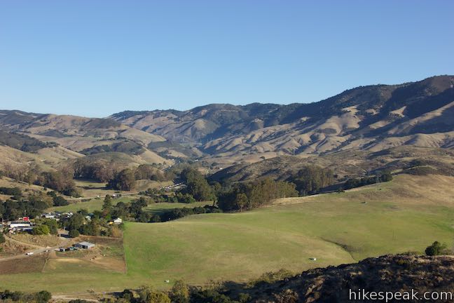
You’ll give a ringing endorsement to this San Luis Obispo hike! Reservoir Canyon’s Summit Trail ascends to sweeping panoramas over San Luis Obispo and an old tower with a bell that you can ring with a pebble. The hike from Reservoir Canyon to the High School Hill Tower is 4.1 miles round trip with 1,175 feet of elevation change. Expand your horizons from there by following Ridge Trail up to the high point of Murray Hill and descend Reservoir Canyon Trail on the 5.6-mile Reservoir Canyon Trail – Summit Trail Loop.
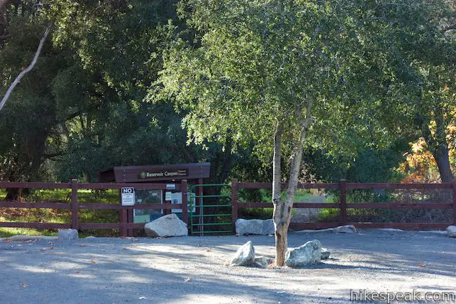
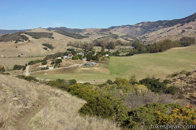
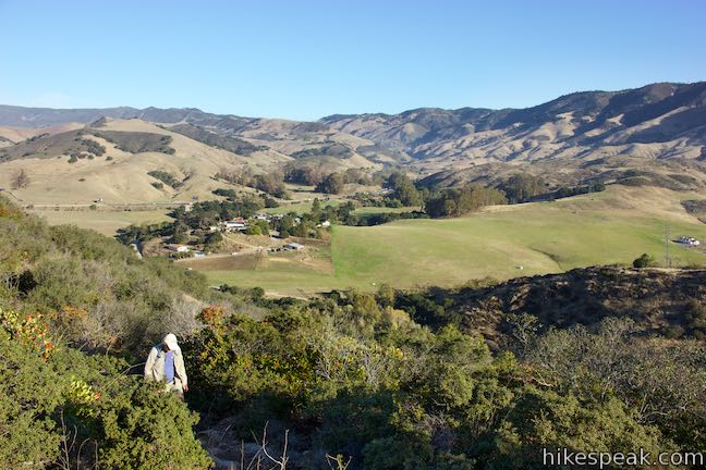
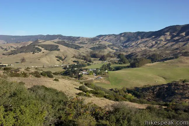
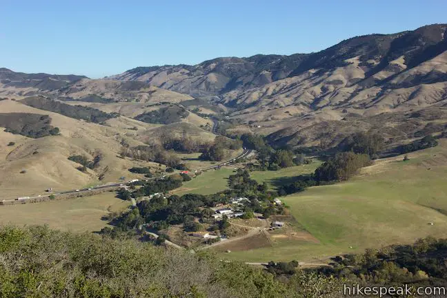
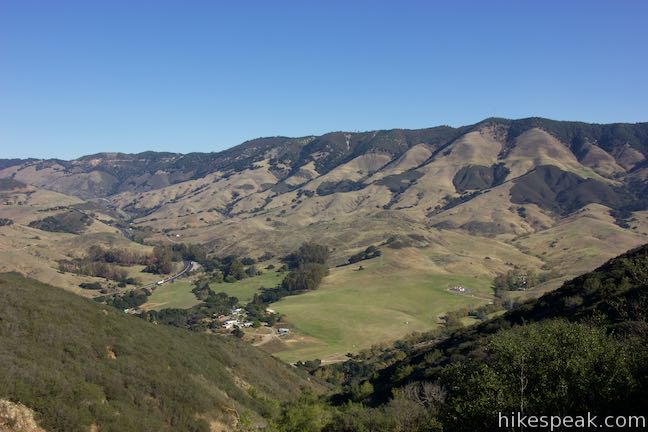
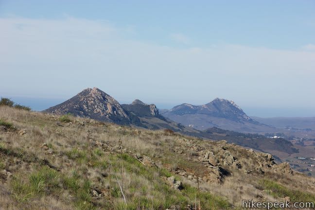
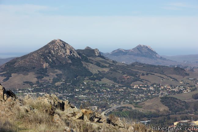
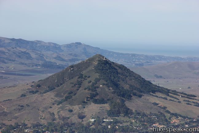
Cerro San Luis and Bishop Peak are two of San Luis Obispo ‘s best known mountains and you’ll get great views of these volcanic plugs from a big hill that’s just as close to downtown. A steep trail up to High School Hill Tower starts near the city’s high school. Begin from Reservoir Canyon Trailhead for a more moderate ascent. The trailhead is on Reservoir Canyon Road about half a mile off Highway 101 near the base of Cuesta Grade.
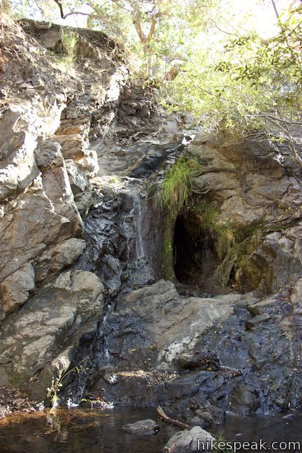
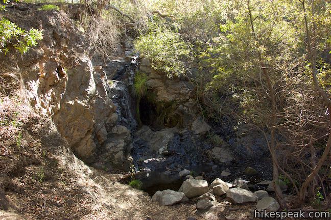
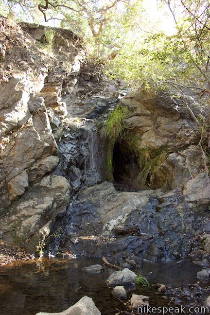
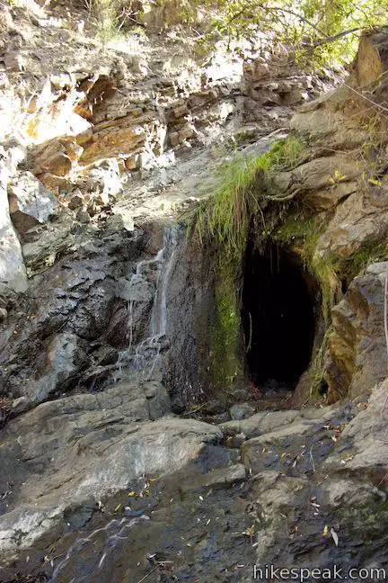
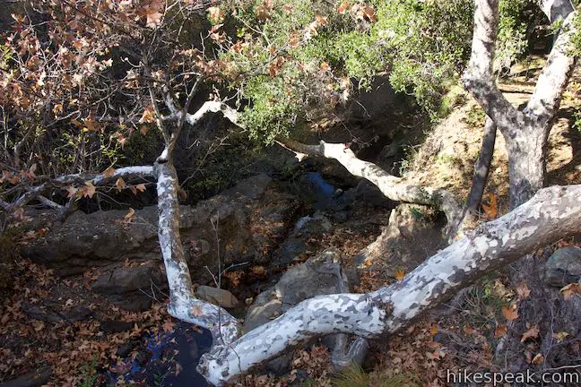
A wide trail sets out straight from the end of the road, becoming Reservoir Canyon Trail. Beside the kiosk at the west end of the parking area, a path extends into the woods to Reservoir Creek Falls, a 15 to 20-foot waterfall that gets lively after it rains. A small cave enters the rock next to the waterfall. This tunnel beside the the waterfall is a remnant of the old reservoir in the canyon that served as an outflow for the dam.
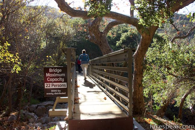
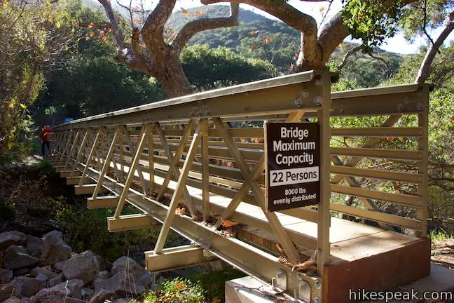
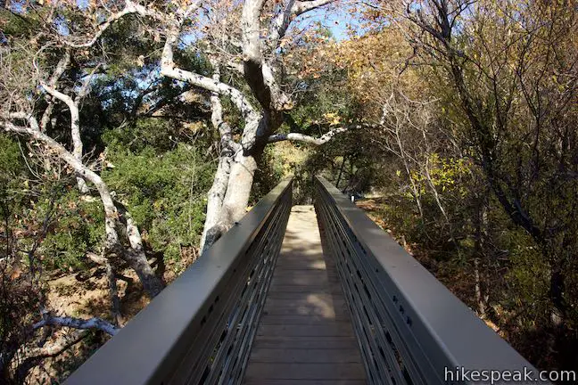
Summit Trail can be reached from the trail to the waterfall or from the wider main trail (Reservoir Canyon Trail). From the waterfall, proceed up the slope to the left of the falls. Come to a junction beside the creek above the waterfall and turn right on a bridge across the creek. Via the trail leaving from the east side of the parking area, go through a gate and quickly come to a trail junction. Reservoir Canyon Trail proceeds straight ahead, while the trail to the right leads to the junction by the bridge above Reservoir Creek Falls. Turn left and cross the creek.
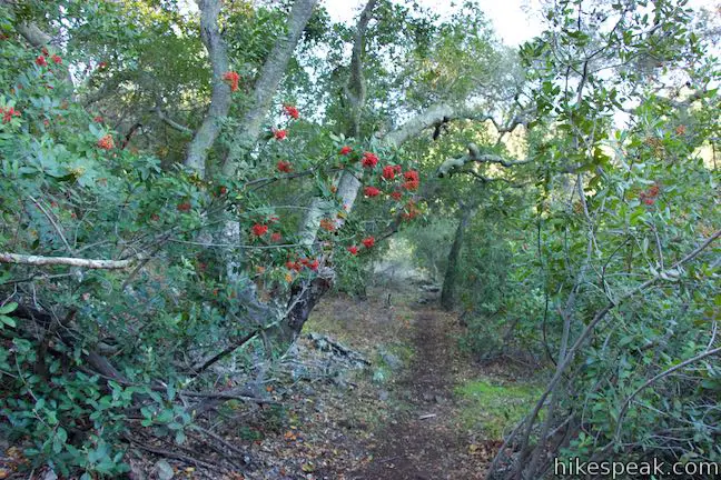
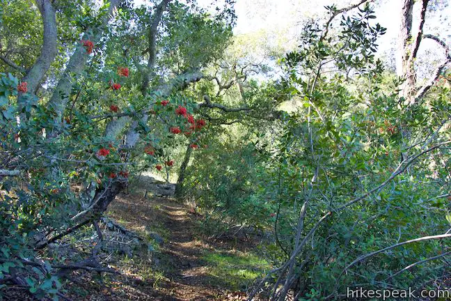
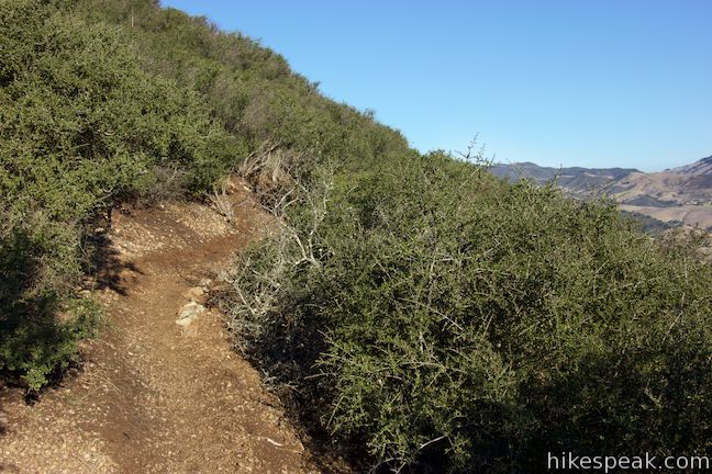
On the other side of Reservoir Creek, the trail angles through a thicket of riparian trees. Bear right up a bank and rise from the creek to a nicely defined single track.
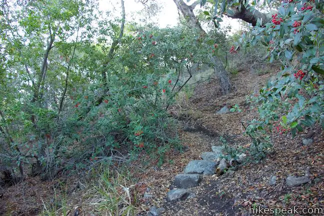
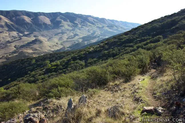
Hike up Summit Trail on a well-established route through a few turns and switchbacks. Oaks and toyon grow along the trail. After a quarter mile of hiking, come to a junction with Creek Bypass Trail. Turn right to proceed up the mountain on Summit Trail. The trail to the left connects with Reservoir Canyon Trail to offer a shorter loop.
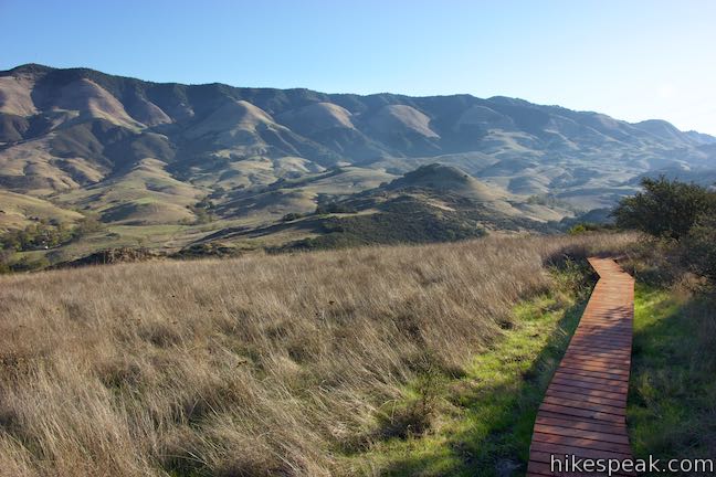
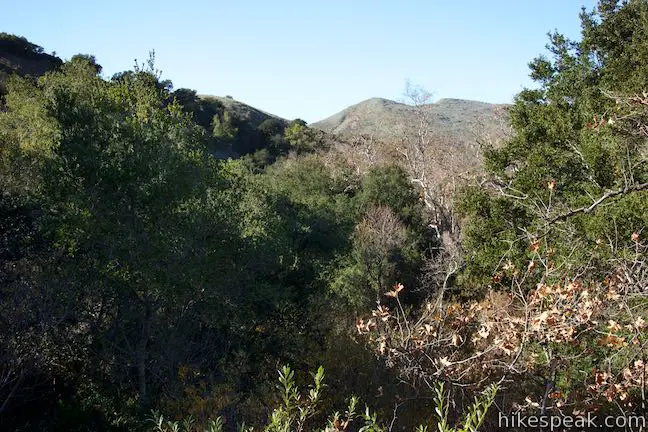
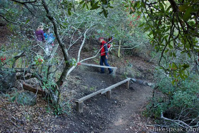
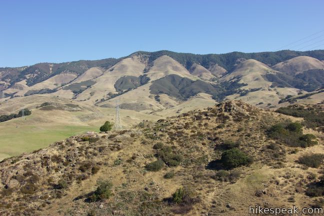
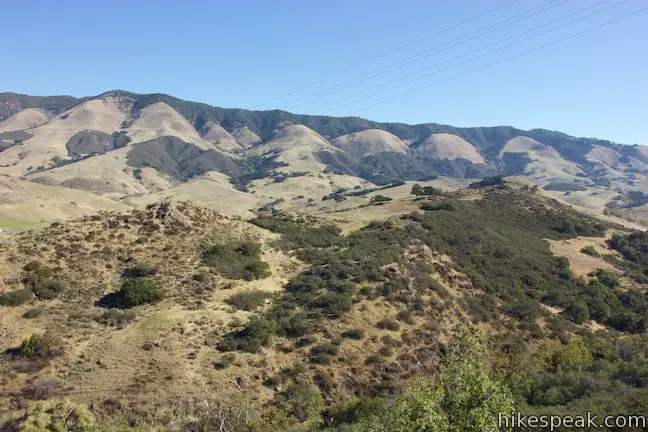
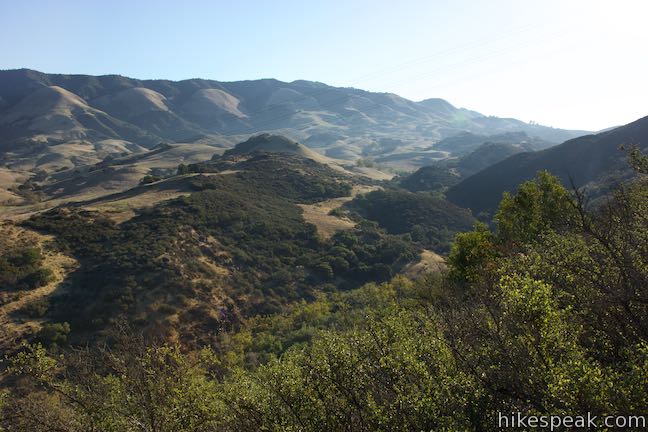
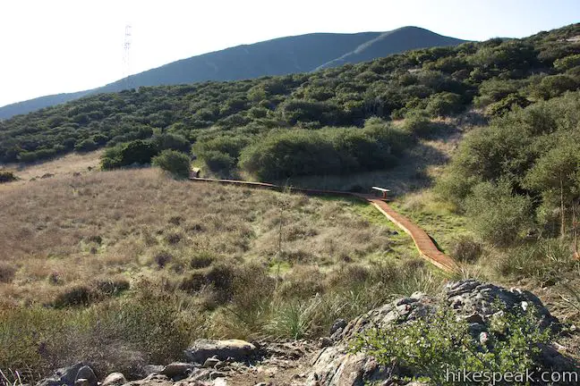
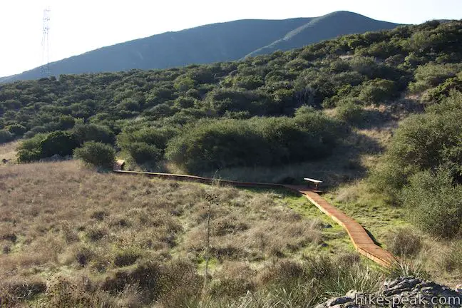
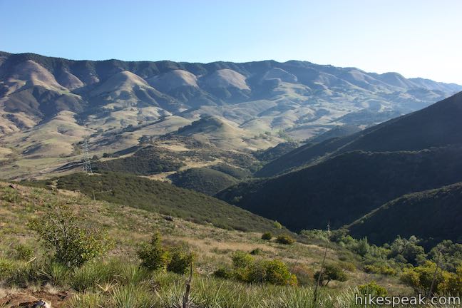
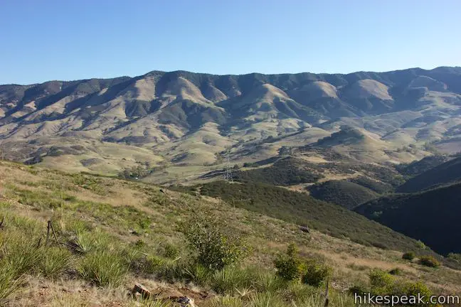
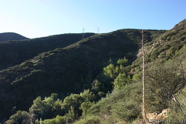
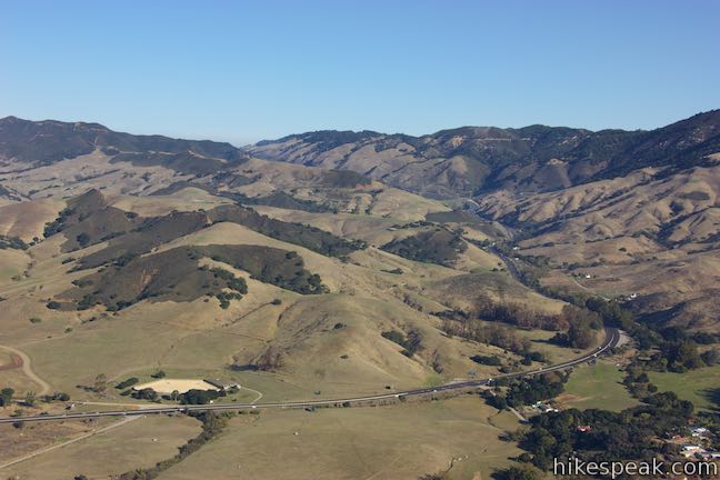
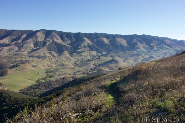
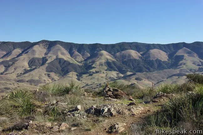
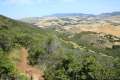
Rise from the junctions through more switchbacks. Pass through grassy areas that allow you to look out from the trail toward Cuesta Grade, which is flanked by hikes on East Cuesta Ridge and West Cuesta Ridge. After a few switchbacks, come to a flatter area on the mountains where a boardwalk has been built to protect the damp grassland. Stroll across the boardwalk and look out toward the Santa Lucia Mountains to the north and east.
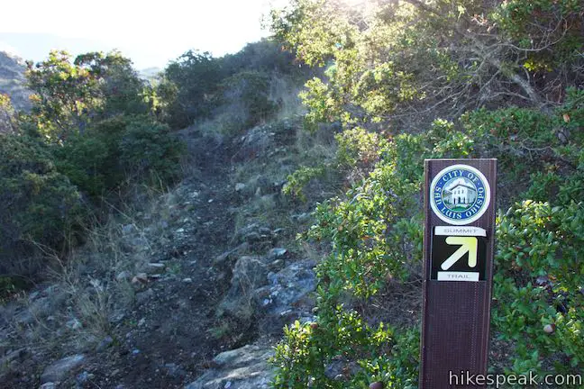
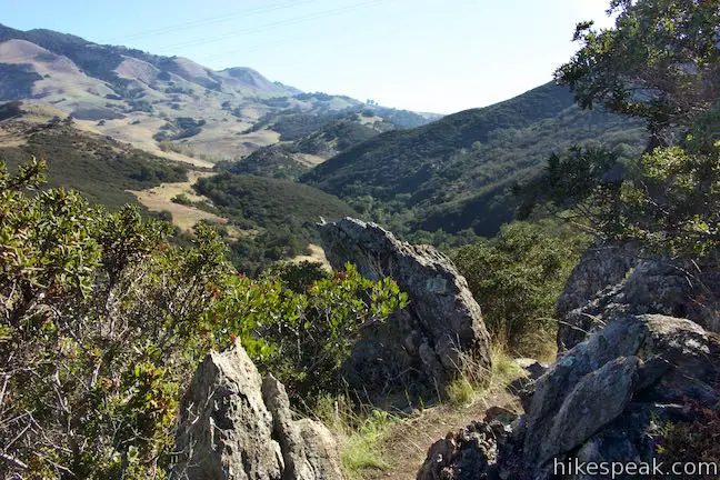
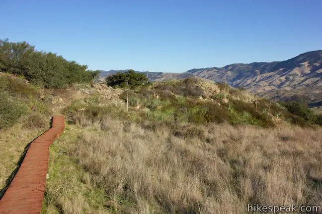
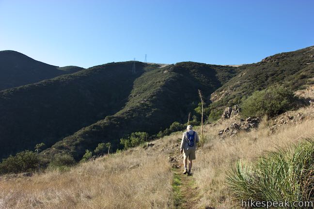
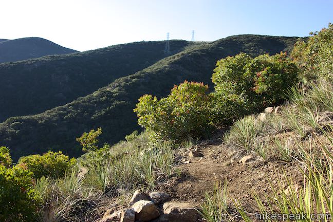
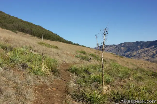
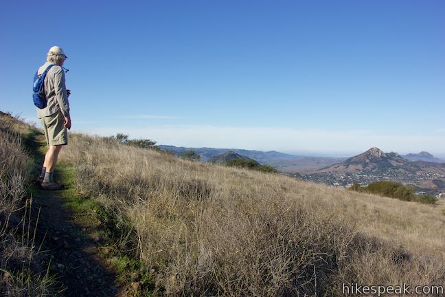
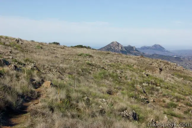
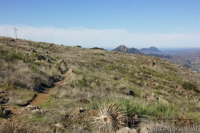
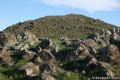
Summit Trail rises again, wrapping around the end of a ridge that extends west up to the old tower. Look south toward the chaparral-covered ridges above Reservoir Canyon. The trail appears to head toward to this high spot until it turns to the right and doubles back across a grassy slope.
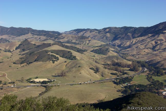
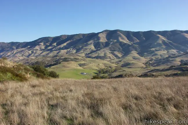
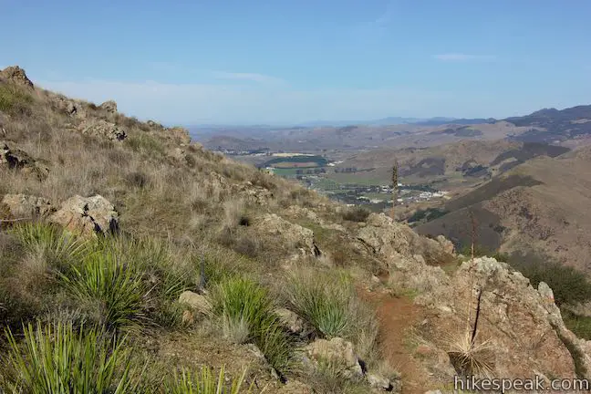
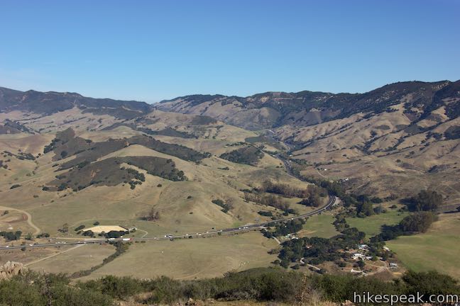
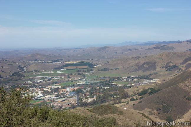
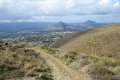
Having gained about 700 feet of elevation, the trail offers towering views over Highway 101 on its path to Cuesta Grade. Look west toward the campus of Cal Poly. The Pacific Ocean may come into view too.
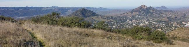
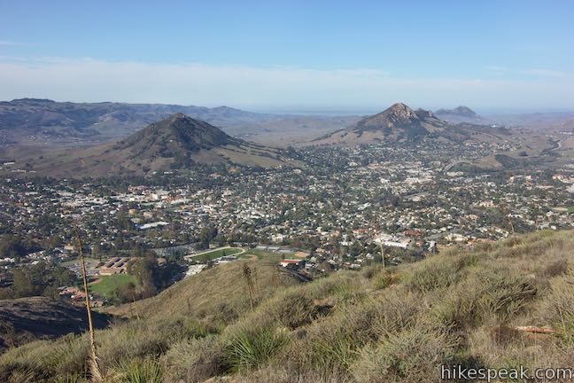
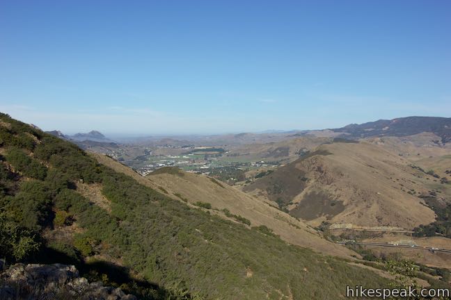
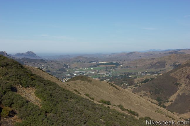
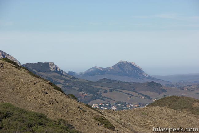
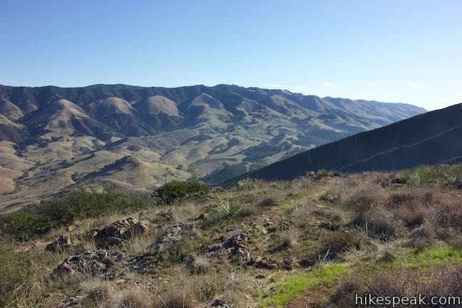
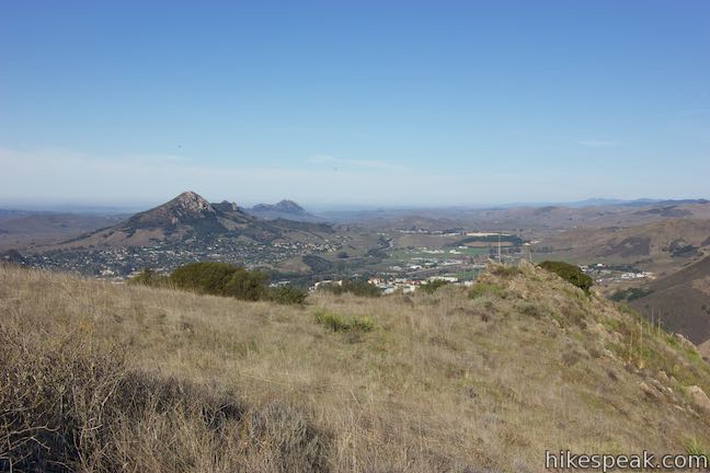
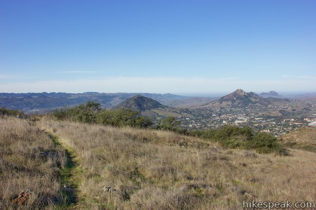
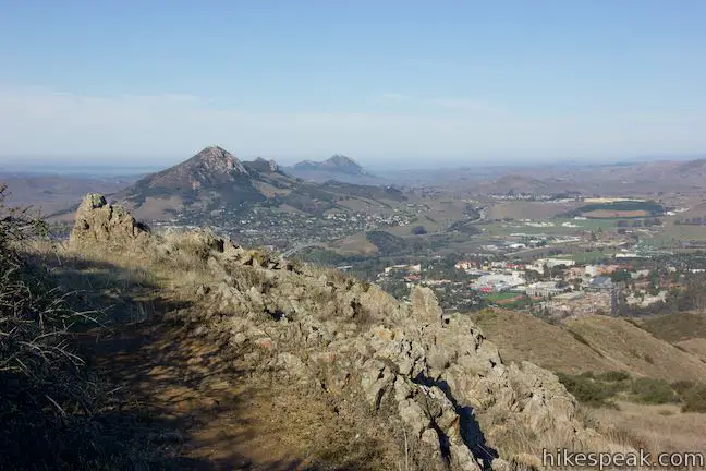
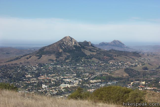
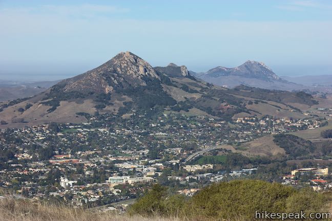
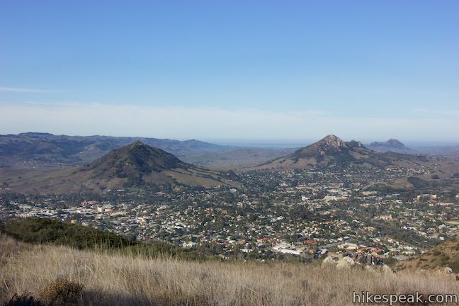
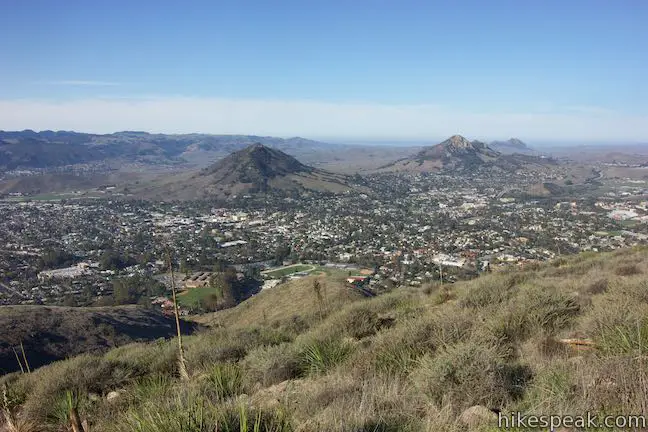
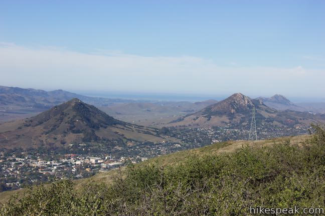
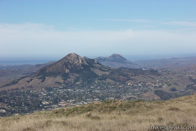
Long switchbacks lead through grasses and short chaparral. The sun-exposed trail has no more trees. Keep hiking up the trail and come around to the west side of the mountain, discovering views over San Luis Obispo and the area’s string of Morros, like Hollister Peak, Bishop Peak, Cerro San Luis. This should be ample motivation to ascend the last quarter mile.
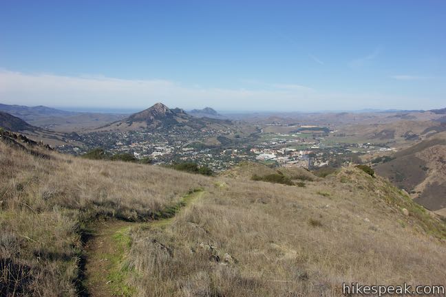
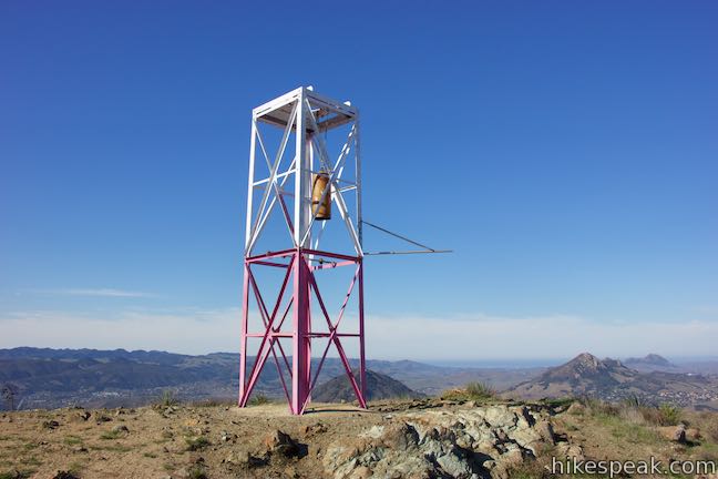
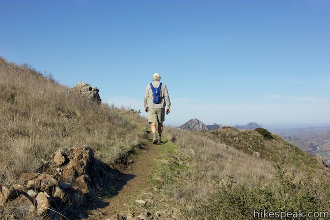
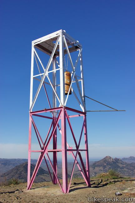
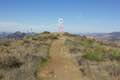
Hike up the trail to more great views over San Luis Obispo. A final switchback brings you to the top of the trail on a 1,550-foot point at the northwest end of the ridge. Summit Trail meets Ridge Trail, a double-track jeep trail, alongside an old air traffic beacon tower that was used during the World War II era. A bell hangs from the tower, well off the ground, and can be rung by striking its side with a pebble. Take aim and ring the bell.
The view over San Luis Obispo from this vantage is sweeping. The Irish Hills rise to the southwest behind Morros that stretch west to the Pacific. Bellissimo!
Having reached the top after a 2.05-mile ascent with 1,175 feet of elevation change, you have a couple options. Return the way you came for an out and back hike or extend things into a long loop. Ridge Trail goes southeast toward a viewpoint at the summit of Murray Hill and the junction at the top of Reservoir Canyon Trail. Return to the trailhead by that route for a 5.6-mile circuit hike.
Dogs are welcome on leashes on this hike, but mountain bikes are prohibited. No fee or permit is required to visit Reservoir Canyon, so get out and enjoy!
Directions to the Trailhead
- From downtown San Luis Obispo, take Highway 101 north for approximately two miles to Reservoir Canyon Road (an easy-to-miss road connecting to the freeway).
- Turn right and drive half a mile to the trailhead parking area at road’s end.
- After the hike, exercise caution when getting back on the highway.
- It may be safer to drive north and turn around at another exit rather than cutting across northbound traffic to reach the southbound lanes to San Luis Obispo.
Trailhead Location
Trailhead address: Reservoir Canyon Road, San Luis Obispo, CA 93401
Trailhead coordinates: 35.29075, -120.62775 (35° 17′ 26.7″N 120° 37′ 39.9″W)
View Reservoir Canyon in a larger map
Or view a regional map of surrounding Central Coast trails and campgrounds.


 | Reservoir Canyon Trail This 5.35-mile hike ascends 1,350 feet past a waterfall and a collection of junk sculptures on the way to a treeless summit overlooking San Luis Obispo. |
 | Reservoir Canyon Trail - Summit Trail Loop This 5.6-mile loop ventures up Reservoir Canyon Trail to the summit viewpoint, crosses Ridge Trail to the bell tower, and descends Summit Trail back into Reservoir Canyon. |
 | Creek Bypass Trail Loop This 1-mile hike takes the beginnings of Summit Trail and Reservoir Canyon Trail and connect them with a short trail boasting big canyon views. |
 | Murray Hill via Sydney Street Trail This 2.8-mile round trip hike rapidly ascends 1,275 feet up a rugged trail to a stone seating area at a summit with panoramic views. |
 | Cuesta Ridge Botanical Area This 6-mile round trip hike crosses a ridge in the Santa Lucia Mountains with panoramic views over San Luis Obispo, ascending to a grove of Sargent cypress in a botanical area in Los Padres National Forest. |
 | East Cuesta Ridge This wide dirt road offers an 8.4-mile hike to the top of Mount Lowe or a longer trek to the top of Lopez Canyon Trail, offering ocean views over San Luis Obispo and inland views over an evergreen wilderness. |
 | Cerro San Luis This 4-mile hike summits one of the Nine Sisters just west of downtown San Luis Obispo. |
 | Cerro San Luis from Laguna Lake Park This 5.7-mile hike reaches the summit from a nearby park. |
 | Bishop Peak This 3.5-mile hike ascends 950 feet to highest summit in the Nine Sisters, offering excellent views of San Luis Obispo and the surrounding Morros. |
 | Felsman Loop Trail This 2.7-mile loop crosses oak, sagebrush, and grass-covered slopes around the base of Bishop Peak, providing excellent views of that notable rocky summit and its San Luis Obispo surroundings. |
 | South Hills Ridge Trail This 1.5-mile round trip hike ascends 425 feet to the highest point in a cluster of hills near downtown San Luis Obispo, offering fine views over the city and surroundings. |
 | Poly Canyon Design Village This 2.5-mile hike visits an experimental architectural village designed by Cal Poly students at the base of the Santa Lucia Mountains. |
 | More hikes in San Luis Obispo Explore other trails around San Luis Obispo including Morro Bay State Park, Montaña de Oro, and the Morros. |
Common Questions about Summit Trail in Reservoir Canyon Natural Reserve
- Is the trail open?
- Yes. You should expect to find that Summit Trail is open. There are no recent reports of trail closures. If you discover that the trail is closed, please help your fellow hikers by reporting a closure.
- Is this trail free to access?
- Yes, Summit Trail is free to access. No entrance fee, pass, or permit is required. If you discover that access rules have changed, please provide feedback on your experience.
- How much time does this hike take?
- It takes approximately 2 hours 30 minutes to hike Summit Trail. Individual hiking times vary. Add extra time for breaks and taking in the views.
- How long is this hike?
- The hike to Summit Trail is a 4.1 mile out and back with 1175 feet of elevation change.
- Are dogs allowed on this trail?
- Yes, dogs are allowed on Summit Trail. The trail is open to hikers, dogs.
- Does this trail go to a summit?
- Yes, Summit Trail reaches a summit with panoramic views.
- Where is the trailhead located?
- The trailhead for Summit Trail is located in San Luis Obispo, CA.
Trailhead Address:
Reservoir Canyon Road
San Luis Obispo, CA 93401
Trailhead Coordinates:
35.29075, -120.62775 - What are the driving directions to the start of the hike?
To get to the trailhead: From downtown San Luis Obispo, take Highway 101 north for approximately two miles to Reservoir Canyon Road (an easy-to-miss road connecting to the freeway). Turn right and drive half a mile to the trailhead parking area at road’s end.
After the hike, exercise caution when getting back on the highway. It may be safer to drive north and turn around at another exit rather than cutting across northbound traffic to reach the southbound lanes to San Luis Obispo.
View custom Google Maps directions from your current location.
- Are there other trails near Summit Trail?
- Yes, you can find other nearby hikes using the Hikespeak Hike Finder Map.

Go the extra miles...
Submit a rating of this hike to go with your comment. Contribute to the average trail rating.