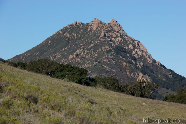
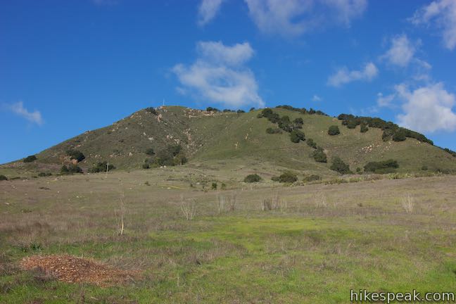
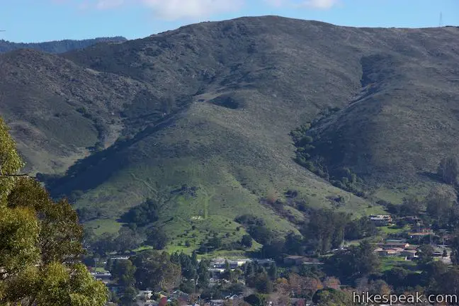
The mountain named Cerro San Luis is one of the top places to hike in San Luis Obispo, and its trailhead is actually in walking distance from downtown SLO. If you’re drawn to the large white “M” on the side of the mountain, you’re in luck! Not only is the “M” reachable as an extension of the hike to the summit, but thanks to trail created in 2017, hikers can touch the “M” at the top of a loop. Combine the “M” Trail with Lemon Grove Loop Trail for a 2.4-mile hike with 560 feet of elevation change (with options to extend this hike to 3 miles or more).
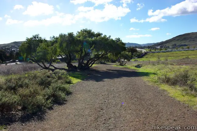
Set out from the Marsh Street Trailhead, just north of Madonna Inn and west of Highway 101 and downtown. Get underway up a grassy slope below Cerro San Luis. After a tenth of a mile, come to a junction where the loop in Lemon Grove Loop Trail begins.
If you plan to summit Cerro San Luis, it’s easiest to bear left toward Cerro San Luis Trail, which passes the “M” Trail, 0.3 below the “M” (adding adding 0.6 miles to the 4-mile round trip hike up the mountain). Venturing left up to the “M” and back is just 1.9 miles round trip. You could also bear left to hike the Lemon Grove & “M” Trails Loop in a clockwise direction. However, the directions offered here travel in the opposite direction for a more gradual approach.
Lemon Grove Loop Trail
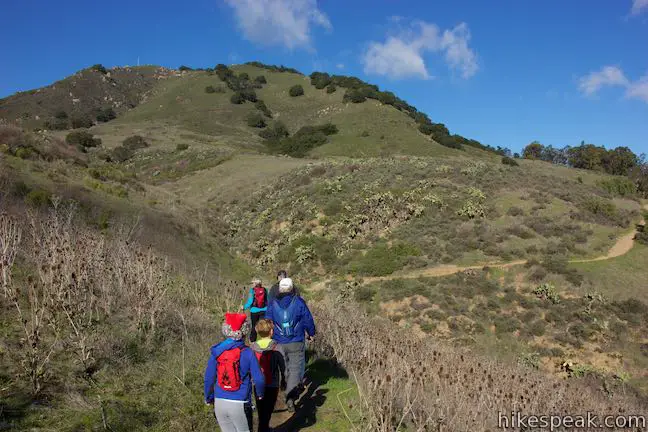
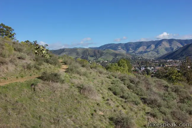
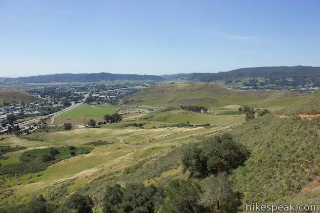
After a right turn at the first junction, Lemon Grove Loop Trail weaves across an undulating grassy slope, dipping into draws and cresting rounded ridges. Prickly pear cacti dot outcroppings along the slope. San Luis Obispo spreads out to the right. Look northeast across downtown toward the Santa Lucia Mountains. Gaze southeast toward ranches and vineyards of Edna Valley.
At the next junction, 0.7 miles from the start, before the trail meets a grove of eucalyptus trees, bear left up a wide dirt trail named Carriage Road. Note: If you skip Carriage Road and continue around the north end of Lemon Grove Loop Trail, this hike can be extended by 0.6 miles.
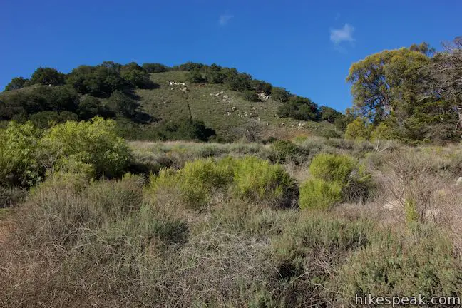
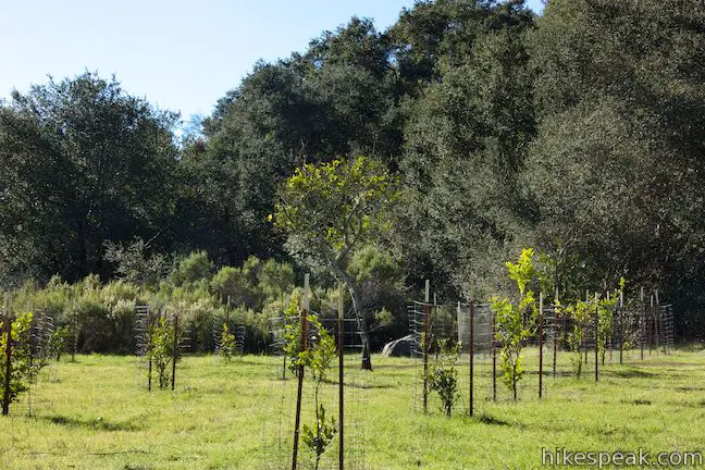
Carriage Road goes through two curves like an “S” with views up toward the “M.” The wide trail quickly meets the upper half of Lemon Grove Loop Trail. Cross the trail and rise into the lemon grove that gives the loop its name. Young lemon trees are growing in this historical grove. Have a seat on a bench and gaze across San Luis Obispo toward Edna Valley.

“M” Trail
The “M” Trail begins from the back of the grove, slipping into an oak woodland. The trail ascends Cerro San Luis, initially flirting along the boundary between the trees and the grasses. Look down on Lemon Grove Loop Trail crossing the slopes below. Gaze north up Highway 101 toward the Santa Lucia Mountains. Cal Poly stands out to the north and the rock mass of Bishop Peak appears as well.
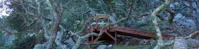
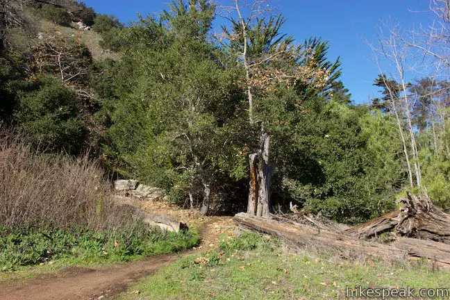
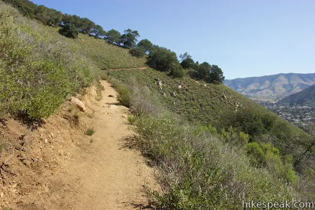
Eventually, the trail commits to the forest and leaves the fields behind. Wind up switchbacks on a rocky slope shaded by live oaks. Several wooded platforms provide gradual turns as the trail cuts up the steep mountainside (making the route suitable for bikes).

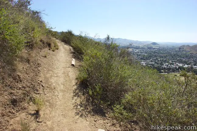
Ascend out of the oaks to an exposed slope with more San Luis Obispo views. Ease through trees one more time, walking over a wooded platform around a rock outcropping that feels like it is floating off the side of the mountain. The impressively built trail then aims right toward the “M.”
Above the “M”
Immediately before you hit the large white letter, the trail passes an unmarked junction. An unmaintained path on the right ascends toward the summit. If you choose to go up the mountain this way, the directions are: bear left at a split (0.1 miles), pass a swing in a tree (0.15 miles), meet a wide trail and turn left (0.25 miles) to reach the summit (0.65 miles).
For the Lemon Grove & “M” Trails Loop, skip past the steep path and enjoy a close look at the “M” with views over San Luis Obispo.

The Cerro San Luis “M”
The “M” on the mountainside is made of concrete and painted white. The “M” does not represent the Madonna Family, owners of property on Cerro San Luis (sometimes called Madonna Mountain). Instead, the “M” represents Mission College Preparatory High School, located in downtown San Luis Obispo beneath the mountain.
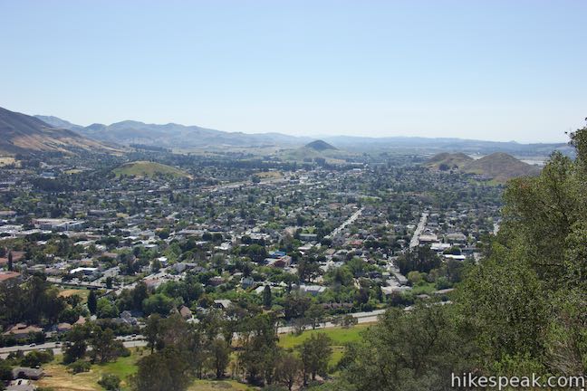
Not to be outdone, a couple other area schools have letters of their own. To the north, the Cal Poly “P” can be read on Yucca Ridge. On the other side of downtown, spot “SP” on the slopes above San Luis High School. Beyond regional school pride, the views from the “M” on Cerro San Luis are broad and revealing, spreading across downtown San Luis Obispo and its surroundings.
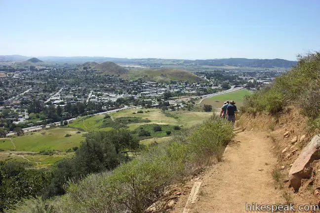
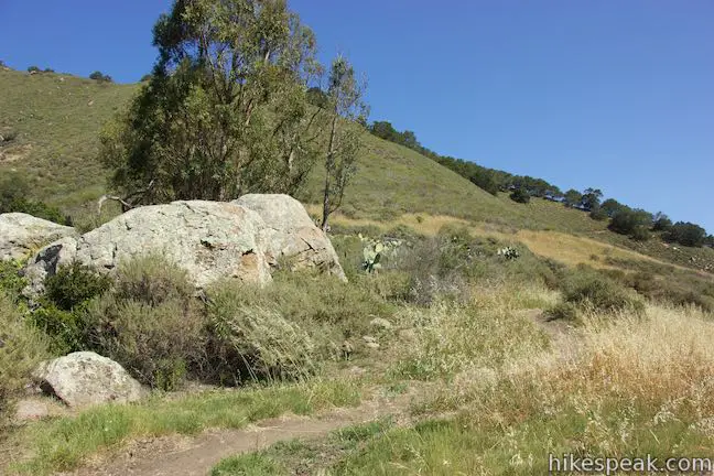
This is the high point of the hike, but just under a mile of hiking remains. Proceed southwest down the other side of “M” Trail across a sage-covered slope with nice views southeast over Edna Valley. Slip through clusters of oaks and descend into a draw where “M” Trail comes to an end at a T-junction with Cerro San Luis Trail. You will have hiked 0.3 miles down from the “M” and 0.95 miles from the start of the “M” Trail at the lemon grove. Unless you’re striving for the summit (1.35 miles up to the right), turn left to return to Marsh Street Trailhead, which is 0.65 miles away.
Follow Cerro San Luis Trail through chaparral and oaks. Pass through a gate at the top of the grassy slopes around the skirt of the mountain. Stay to the right through a couple junctions that connect to Lemon Grove Loop Trail.
Switchbacks have been built into the steep slope to make the route a little more gradual. Hike half a mile down the trail to the trailhead, passing the opening junction with Lemon Grove Loop Trail, a tenth of a mile before returning to the parking area.
The basic directions for this loop are:
- Start toward Cerro San Luis from the Marsh Street Trailhead (0 miles)
- Bear right onto Lemon Grove Loop Trail (0.1 miles)
- Turn left up Carriage Road, a wide dirt trail (0.7 miles)
- Cross Lemon Grove Loop Trail – the upper side – to enter the lemon grove (0.8 miles)
- Proceed out the back of the grove up “M” Trail (0.8 miles)
- Pass the “M” on Cerro San Luis (1.45 miles)
- Continue to the end of “M” Trail and turn left down Cerro San Luis Trail (1.75 miles)
- Stay right past the top of Lemon Grove Loop Trail (1.9 miles)
- Stay right again past the bottom of Lemon Grove Loop Trail (2.3 miles)
- Return to Marsh Creek Trailhead (2.4 miles)
Hiking all of “M” Trail and some of Lemon Grove Loop Trail creates a 2.4-mile loop with 560 feet of elevation change. Skip the Carriage Road shortcut to see more of Lemon Grove Loop Trail for a 3-mile hike. Hikers are welcome to bring dogs. No fee or permit is required to hike around Cerro San Luis, so get out and enjoy!
A note for mountain bikers: The “M” Trail and the top half of Lemon Grove Loop Trail are open to bikes. The city recommends that bikers take this loop in a clockwise direction (opposite of what is described above). Bikers should take Cerro San Luis Trail to the south end of the “M” Trail and ride the trail northward. At the bottom of the “M” Trail by the lemon grove, bikers should turn right on Lemon Grove Loop Trail to get back to the trailhead, rather than using Carriage Road to reach the lower side of the trail.
Directions to the Trailhead
- From downtown San Luis Obispo, take Higuera Street southeast to Marsh Street and turn right.
- Pass beneath Highway 101, and turn right on Fernandez Lane (the only road on the right before Marsh Street turns onto the 101 South).
- Turn right into the dirt parking area.
- The trail begins at the end of the lot.
Trailhead Location
Trailhead address: 1183 Fernandez Road, San Luis Obispo, CA 93405
Trailhead coordinates: 35.2749, -120.67235 (35° 16′ 29.62″N 120° 40′ 20.52″W)
View San Luis Obispo in a larger map
Or view a regional map of surrounding Central Coast trails and campgrounds.


A path from the "M" up Cerro San Luis


 | Cerro San Luis This 4-mile hike summits one of the Nine Sisters just west of downtown San Luis Obispo, delivering panoramic views. |
 | "M" Trail This extensions off the trail up Cerro San Luis makes its own 1.9-mile round trip hike to the large white "M" installed halfway up the east side of the mountain. |
 | Lemon Grove Trail This 2.2-mile loop visits a historical lemon grove on the eastern slopes of Cerro San Luis. |
 | Cerro San Luis from Laguna Lake Park This 5.7-mile hike summits one of the Nine Sisters just west of downtown San Luis Obispo. |
 | Bishop Peak This 3.5-mile hike ascends 950 feet to highest summit in the Nine Sisters, offering excellent views of San Luis Obispo and the surrounding Morros. |
 | Felsman Loop Trail This 2.7-mile loop crosses oak, sagebrush, and grass-covered slopes around the base of Bishop Peak, providing excellent views of that notable rocky summit and its San Luis Obispo surroundings. |
 | South Hills Ridge Trail This 1.5-mile round trip hike ascends 425 feet to the highest point in a cluster of hills near downtown San Luis Obispo, offering fine views over the city and surroundings. |
 | Terrace Hill This 0.55-mile hike tours a flattened mountaintop in the city of San Luis Obispo that hosts panoramic views of the surroundings. |
 | Poly Canyon Design Village This 2.5-mile hike visits an experimental architectural village designed by Cal Poly students at the base of the Santa Lucia Mountains. |
 | More hikes in San Luis Obispo Explore other trails around San Luis Obispo including Morro Bay State Park and Montaña de Oro State Park. |
Common Questions about Lemon Grove & “M” Trails Loop on Cerro San Luis in San Luis Obispo
- Is the trail open?
- Yes. You should expect to find that Lemon Grove & M Trails Loop is open. There are no recent reports of trail closures. If you discover that the trail is closed, please help your fellow hikers by reporting a closure.
- Is this trail free to access?
- Yes, Lemon Grove & M Trails Loop is free to access. No entrance fee, pass, or permit is required. If you discover that access rules have changed, please provide feedback on your experience.
- How much time does this hike take?
- It takes approximately 1 hour 15 minutes to hike Lemon Grove & M Trails Loop. Individual hiking times vary. Add extra time for breaks and taking in the views.
- How long is this hike?
- The hike to Lemon Grove & M Trails Loop is a 2.4 mile loop with 560 feet of elevation change.
- Are dogs allowed on this trail?
- Yes, dogs are allowed on Lemon Grove & M Trails Loop. The trail is open to hikers, dogs, bikes.
- Where is the trailhead located?
- The trailhead for Lemon Grove & M Trails Loop is located in San Luis Obispo, CA.
Trailhead Address:
1183 Fernandez Road
San Luis Obispo, CA 93405
Trailhead Coordinates:
35.2749, -120.67235 - What are the driving directions to the start of the hike?
To get to the trailhead: From downtown San Luis Obispo, take Higuera Street southeast to Marsh Street and turn right. Pass beneath Highway 101, and turn right on Fernandez Lane (the only road on the right before Marsh Street turns onto the 101 South). Turn right into the dirt parking area. The trail begins at the end of the lot.
View custom Google Maps directions from your current location.
- Are there other trails near Lemon Grove & M Trails Loop?
- Yes, you can find other nearby hikes using the Hikespeak Hike Finder Map.

Can you see the big M from the San Luis Obispo mission?