Terrace Hill Open Space
in San Luis Obispo
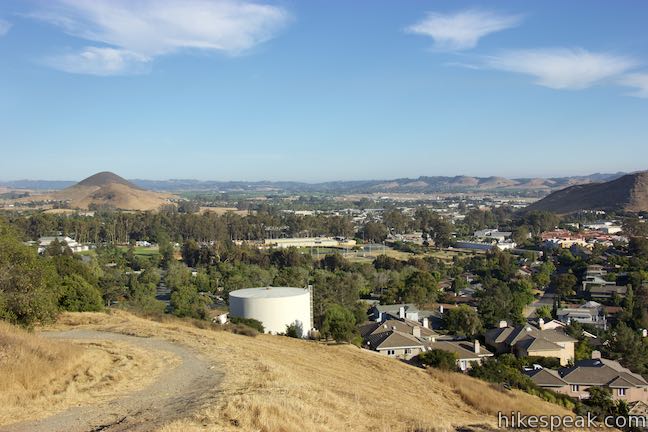
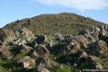
An interesting chain of conical volcanoes, or volcanic plugs called the Morros, graces San Luis Obispo County. Terrace Hill is one of the smaller and harder to identify Morros within the city of San Luis Obispo County. Unlike the other Morros, Terrace Hill has a broad flat summit. The top of the hill was removed for use as construction material in the 1920s, leaving behind a flat mesa-like mountaintop. After being considered for its own development, Terrace Hill was set aside as a 23-acre open space. A loop trail goes around the edges of the flat mountaintop, offering great views over the city and its surrounding peaks, mountain ranges, and valleys. A dirt road accessing Terrace Hill Loop facilitites a hike up around the loop and back that is 0.55 miles long with 110 feet of elevation change.
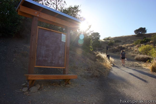
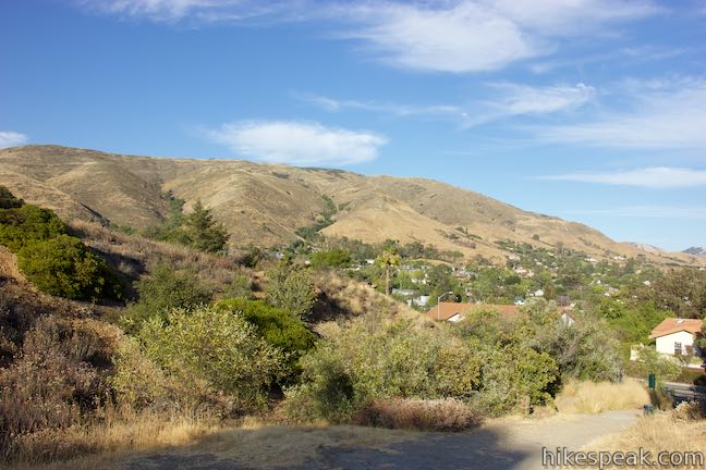
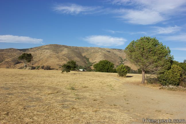
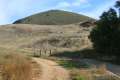
The entrance to Terrace Hill Open Space is located on Bishop Street, southeast of downtown San Luis Obispo. Parking is not available on Bishop Street, but can be found 100 yards away on Augusta Street. Pass through the gate and enter the park at the bottom of a wide dirt road.
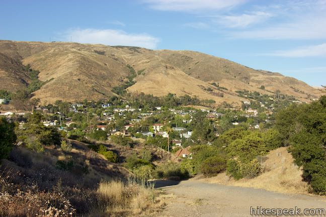
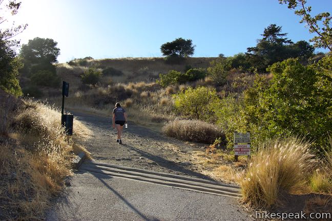
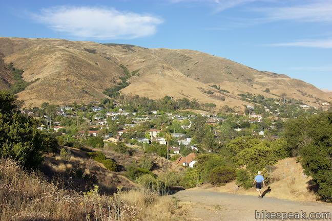
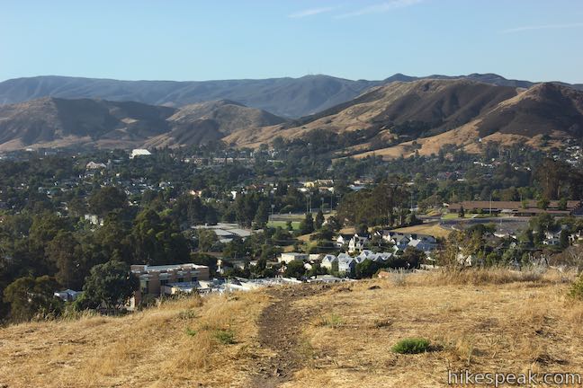
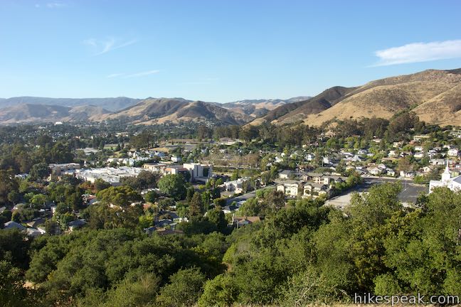
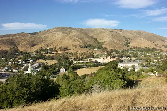
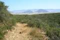
Hike up this access road, which curves to the left before swinging back to the right. Informal paths break off from the main route and can be used for additional exploring. On the hike up, look over your shoulder for views east toward Murray Hill and the Santa Lucia Mountains, the region’s main mountain range. Leaving an area of brush you will rise to new views to the south and east. The appropriately named South Hills lie to the south, with grasses covering uneven serpentine soils. The Railroad District of San Luis Obispo is below the hill to the east, where you’ll see the Amtrak Station and may even hear arriving trains.
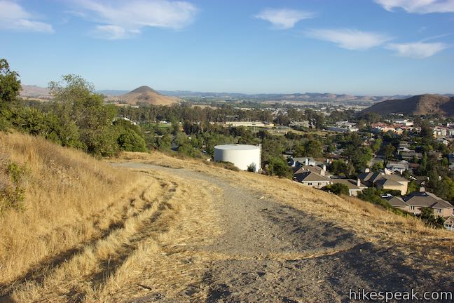
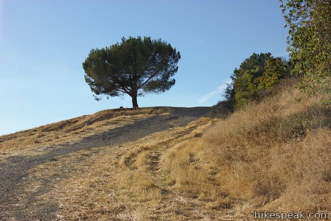
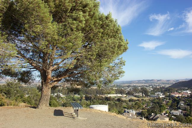
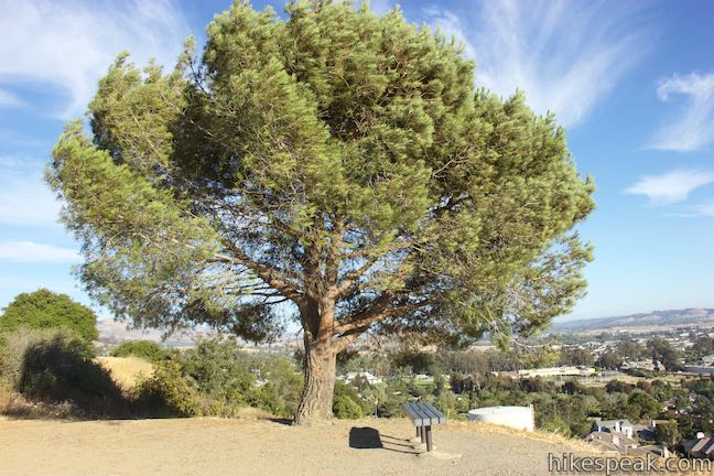
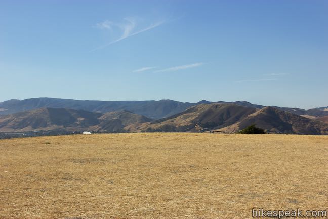
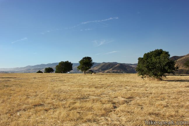
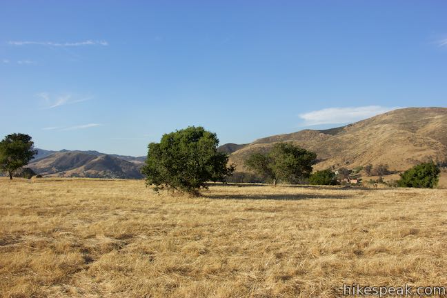
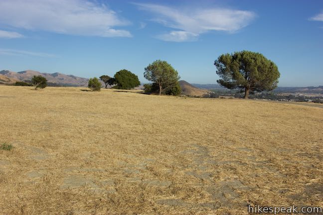
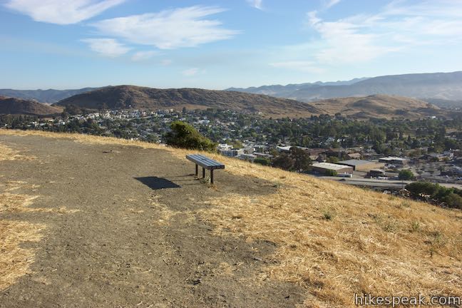
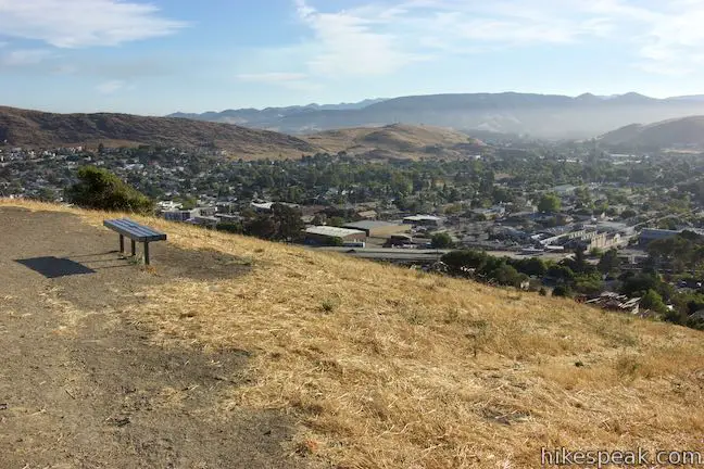
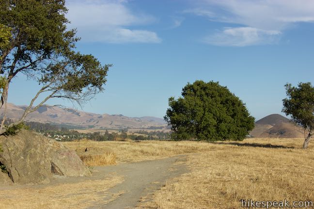
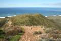
Proceed up the access road to a T-junction with Terrace Hill Loop, a dirt single track that tours the flat summit. On the left side of this junction, which is just 0.14 miles from the start, you’ll find a shade-casting oak and a bench. Benches are placed around the top of Terrace Hill, allowing visitors to relax as they absorb multiple views. The top of Terrace Hill is almost completely flat. It is covered in grasses as well as a few oaks and boulders.
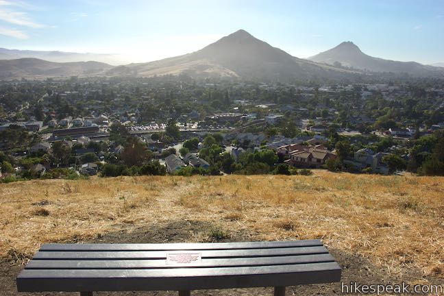
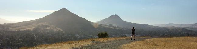
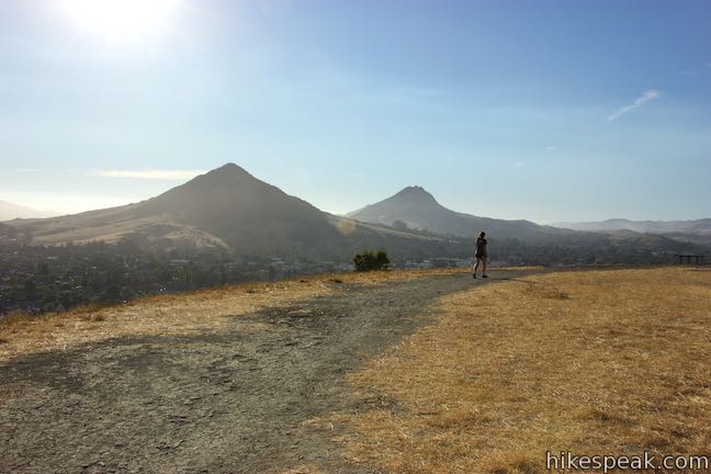
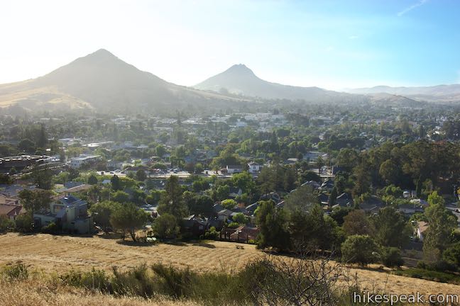
Turn left to begin around the loop in a clockwise direction. You’ll discover views over San Luis Obispo toward Cerro San Luis and Bishop Peak, the county’s grandest Morros.
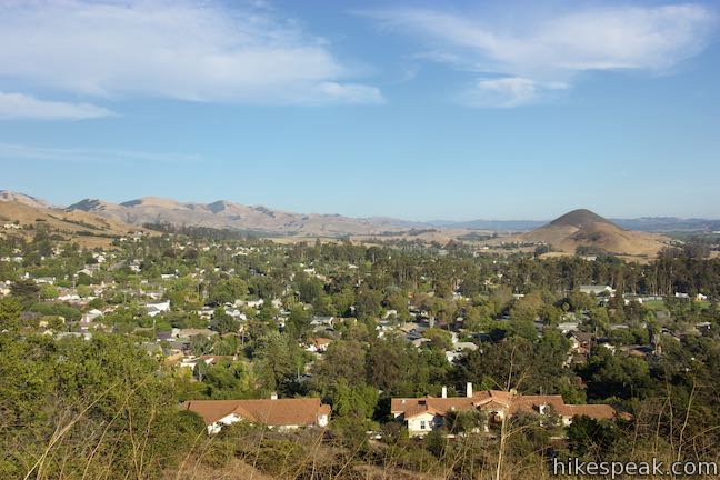
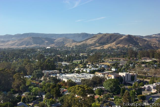
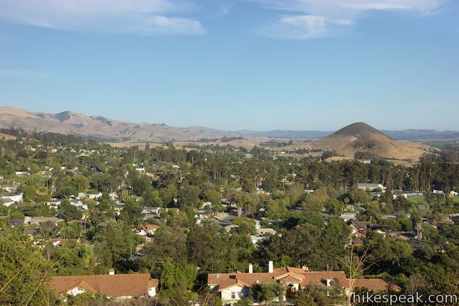
On the north side of Terrace Hill Loop, across from the access road you took up to the mountain top, you’ll find a spur leading a short distance out and slightly downhill to an outcropping on the north side of the hill that offers a nice perspective toward downtown San Luis Obispo and Cal Poly. Skipping this spur will shorten the hike from 0.55 miles to half a mile round trip.
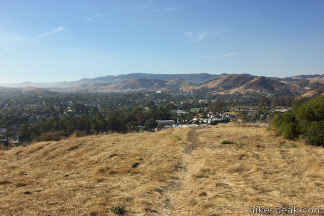
Continue around the loop, looking over the east end of San Luis Obispo. Islay Hill and Edna Valley will come into view to the southeast as the trail weaves between a few oaks to return to the junction with the access road. Turn left to descend the way you came up.
This hike on Terrace Hill is just 0.55 miles long with 110 feet of elevation between the trailhead and the flat mountaintop. Those wanting to draw out this hike could do so by adding extra laps (about 0.21 miles each) around Terrace Hill Loop. Bikes and dogs are allowed on these trails in Terrace Hill Open Space. No fee or permit is required to visit Terrace Hill, so get out and enjoy!
Directions to the Trailhead
- Take Highway 101 to exit 203C for California Avenue (From the 101 South offramp, you'll need to drive a block down Taft Street to reach California Avenue).
- Head south on California Avenue for half a mile.
- Come to an intersection with San Luis Drive and turn right.
- Drive 0.3 miles and turn left onto Johnson Avenue.
- Drive just over half a mile and make the third right onto Bishop Street.
- Go two blocks to an intersection with Augusta Street.
- Turn left and find street parking.
- Walk back to Bishop Street and head to the left (uphill in the direction you were driving).
- Find the trailhead on the right.
Trailhead Location
Trailhead address: 1300 Bishop Street, San Luis Obispo, CA 93401
Trailhead coordinates: 35.2725, -120.64886 (35° 16′ 21.00″N 120° 38′ 55.89″W)
You may also view a regional map of surrounding Central Coast trails and campgrounds.


 | South Hills Ridge Trail This 1.5-mile round trip hike ascends 425 feet to the highest point in a cluster of hills near downtown San Luis Obispo, offering fine views over the city and surroundings. |
 | Islay Hill This 1.8-mile round trip hike climbs 550 feet to the top of San Luis Obispo's easternmost Morro. |
 | Murray Hill via Sydney Street Trail This 2.8-mile round trip hike rapidly ascends 1,275 feet up a rugged trail to a stone seating area at a summit with panoramic views. |
 | Cerro San Luis This 4-mile hike summits one of the Nine Sisters just west of downtown San Luis Obispo, delivering panoramic views. |
 | "M" Trail This extensions off the trail up Cerro San Luis makes its own 1.9-mile round trip hike to the large white "M" installed halfway up the east side of the mountain. |
 | Lemon Grove Trail This 2.2-mile loop visits a historical lemon grove on the eastern slopes of Cerro San Luis. |
 | Lemon Grove & "M" Trails Loop This 2.4-mile hike uses all of the "M" Trail and part of Lemon Grove Loop Trail for a scenic circuit on the east side of Cerro San Luis. |
 | Cerro San Luis from Laguna Lake Park This 5.7-mile hike ascends to the summit from a nearby park. |
 | Bishop Peak This 3.5-mile hike ascends 950 feet to highest summit in the Nine Sisters, offering excellent views of San Luis Obispo and the surrounding Morros. |
 | Felsman Loop Trail This 2.7-mile loop crosses oak, sagebrush, and grass-covered slopes around the base of Bishop Peak, providing excellent views of that notable rocky summit and its San Luis Obispo surroundings. |
 | Morro View This 3.15-mile hike in the Irish Hills Natural Reserve delivers panoramic views over Los Osos Valley and the full chain of Morros. |
 | Froom Creek Trail This 3-mile loop explores a canyon on the east side of the Irish Hills, ascending 500 feet to a nice view over Laguna Lake, Cerro San Luis, and Bishop Peak. |
 | Reservoir Canyon This 5.35-mile hike ascends 1,350 feet past a waterfall and a collection of junk sculptures to a treeless summit overlooking San Luis Obispo. |
 | Poly Canyon Design Village This 2.5-mile hike visits an experimental architectural village designed by Cal Poly students at the base of the Santa Lucia Mountains. |
 | More hikes in San Luis Obispo Explore other trails around San Luis Obispo including Morro Bay State Park and Montaña de Oro State Park. |
- Terrace Hill Open Space on visitslo.com (opens in a new tab)
- Terrace Hill on enjoyslo.com (opens in a new tab)
- Terrace Hill on alltrails.com (opens in a new tab)
- Terrace Hill on localwiki.org (opens in a new tab)
- A gigapan photo from Terrace Hill on gigapan.com (opens in a new tab)
- A trail map for Terrace Hill Open Space on slocity.org (opens in a new tab)
- A conservation plan for Terrace Hill Open Space on slocity.org (opens in a new tab)
Common Questions about Terrace Hill Open Space in San Luis Obispo
- Is the trail open?
- Yes. You should expect to find that Terrace Hill Open Space is open. There are no recent reports of trail closures. If you discover that the trail is closed, please help your fellow hikers by reporting a closure.
- Is this trail free to access?
- Yes, Terrace Hill Open Space is free to access. No entrance fee, pass, or permit is required. If you discover that access rules have changed, please provide feedback on your experience.
- How much time does this hike take?
- It takes approximately 15 minutes to hike Terrace Hill Open Space. Individual hiking times vary. Add extra time for breaks and taking in the views.
- How long is this hike?
- The hike to Terrace Hill Open Space is a 0.55 mile lollipop loop with 110 feet of elevation change.
- Are dogs allowed on this trail?
- Yes, dogs are allowed on Terrace Hill Open Space. The trail is open to hikers, dogs.
- Is Terrace Hill Open Space good for kids?
- Yes, this hike is likely suitable for children. It is relatively short (0.55 miles) with manageable elevation gain.
- Where is the trailhead located?
- The trailhead for Terrace Hill Open Space is located in San Luis Obispo, CA.
Trailhead Address:
1300 Bishop Street
San Luis Obispo, CA 93401
Trailhead Coordinates:
35.2725, -120.64886 - What are the driving directions to the start of the hike?
To get to the trailhead: Take Highway 101 to exit 203C for California Avenue (From the 101 South offramp, you'll need to drive a block down Taft Street to reach California Avenue). Head south on California Avenue for half a mile. Come to an intersection with San Luis Drive and turn right. Drive 0.3 miles and turn left onto Johnson Avenue. Drive just over half a mile and make the third right onto Bishop Street. Go two blocks to an intersection with Augusta Street. Turn left and find street parking. Walk back to Bishop Street and head to the left (uphill in the direction you were driving). Find the trailhead on the right.
View custom Google Maps directions from your current location.
- Are there other trails near Terrace Hill Open Space?
- Yes, you can find other nearby hikes using the Hikespeak Hike Finder Map.

WHO FUNDS TERRACE HILL? WHO OWNS TERRACE HILL?
How can I dedicate a bench to a loved one?