Froom Creek Trail Loop in Irish Hills Natural Reserve
in San Luis Obispo

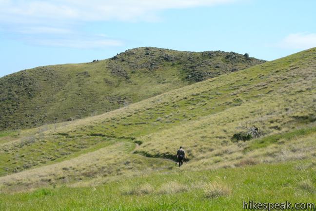
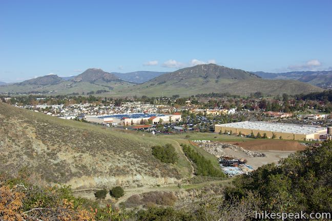
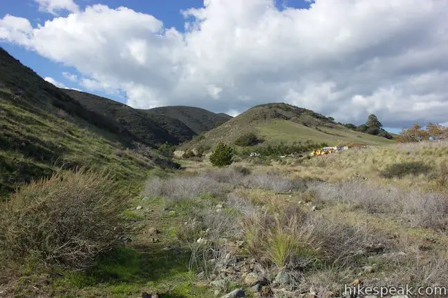
On the east side of the Irish Hills, there is a canyon with a surprisingly southwestern feel. Though surrounded by traditional coastal chaparral, the trail follows an old road up a canyon akin to the old mining roads converted into hiking trails found in the California desert. Above the canyon, there are broad views of San Luis Obispo’s most prominent Morros, Bishop Peak and Cerro San Luis. Thanks to the honeycomb of trails across the Irish Hills, there are several potential hikes exploring Froom Canyon, including this short but varied 3-mile loop with 500 feet of elevation gain. For a little extra hiking, consider adding a 1.1-mile loop around the end of Froom Canyon. For something more, add 2.9 miles with Old Prospector Trail Loop.
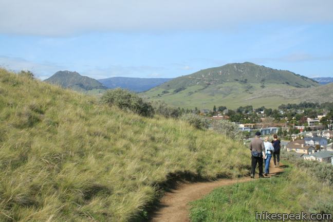
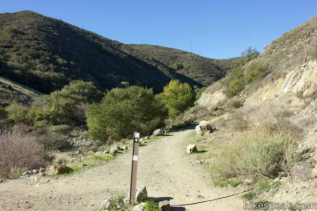
Begin your foray into the Irish Hills from the Madonna Trailhead. Make an immediate left on King Trail. The single track crosses a grass slope to Froom Creek Trail.
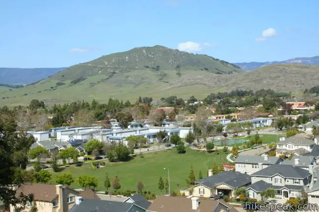
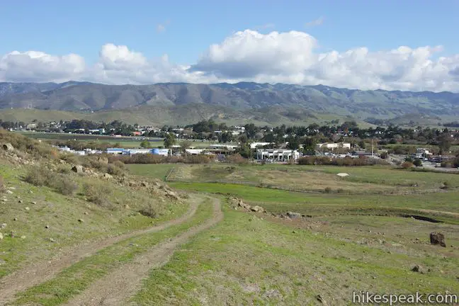
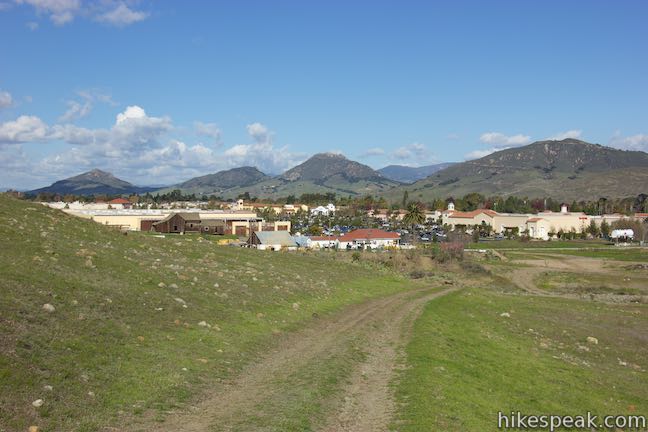
Turn left again, roughly a quarter mile from the start, passing through a pocket of oaks. Enjoy the temporary shade as your cross a few footbridges to reemerge in grasslands on the other side (say goodbye to the shade). From here you can look northeast over the Costco and other developments along Los Osos Valley Road toward downtown San Luis Obispo.
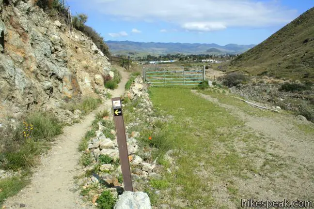
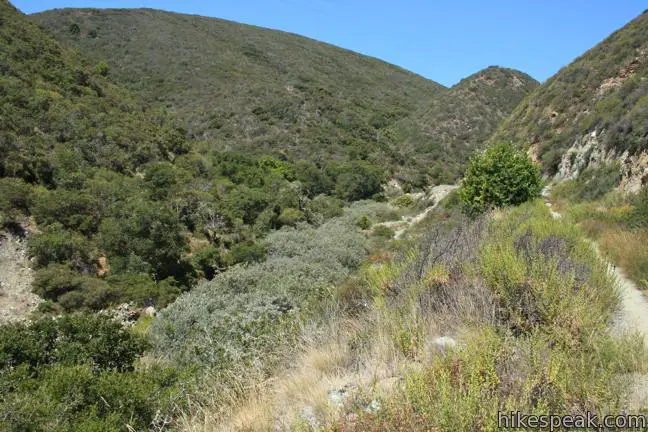
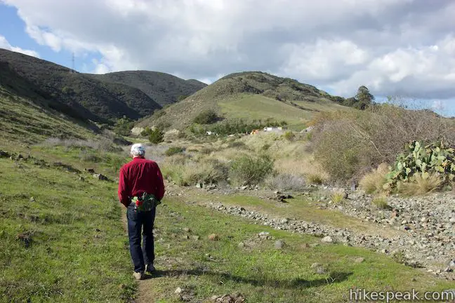
Approximately 3/4 of a mile from the start, the trail hooks to the right and enters Froom Canyon. At this point, a path breaks of to the left crossing the creek bed at the bottom of the canyon. Take this trail to add a 1.1 mile extension to the hike, ascending 175 feet over the end of the ridge bordering the bottom of Froom Canyon. This trail can also be used to reach Old Prospector Trail or continue hiking south on the Johnson Ranch – Irish Hills Connector Trail to Johnson Ranch Open Space.
The directions for the 1.1-mile addition are simple. After crossing the creek bed, the trail turns right, following the left bank for a quarter mile. Make a sharp left, passing the start of Old Prospector Trail, and head uphill for another 0.3 miles. Climb to a saddle at the end of the ridge and meet a jeep trail. Johnson Ranch – Irish Hills Connector Trail continues ascending to the right. Turn left and curve down around the edge of the ridge on what is called Neil Havlik Way. At the bottom, turn left on a single track heading up the canyon to complete the loop. This short loop on the northeast end of the Irish Hills adds pleasant views over San Luis Obispo. If you head straight back to the trailhead from here, it is a 2.65 mile hike. Otherwise, continue up Froom Canyon, bringing the 3-mile hike up to 4.1 miles.
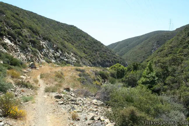
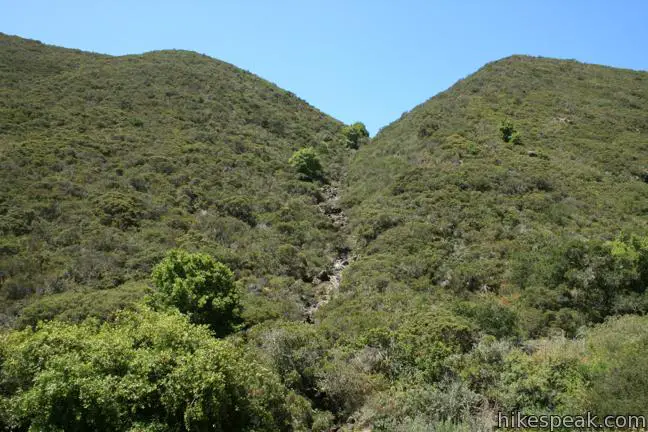
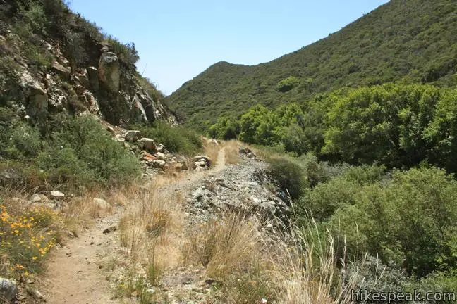
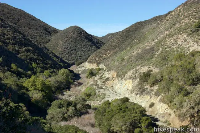
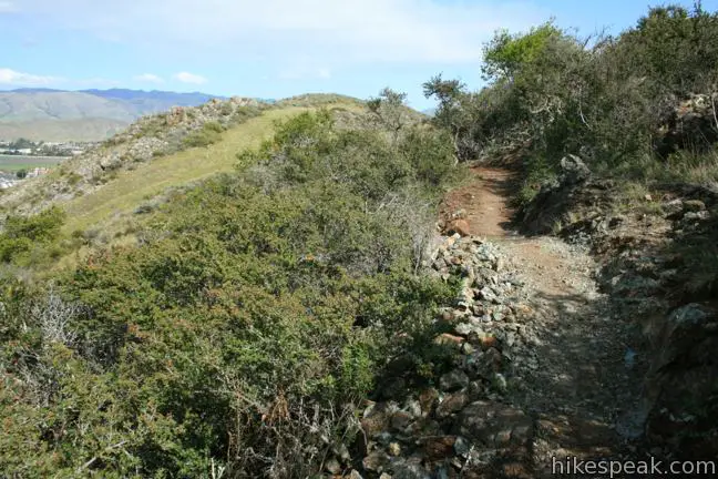
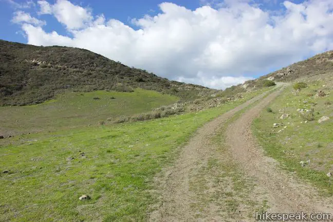
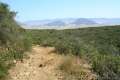
Beyond the junction at the bottom of Froom Canyon (between Froom Creek Trail and the Connector Trail), Froom Creek Trail widens and follows an old road on the north side of the canyon. The road hasn’t seen motor vehicle traffic in some time and offers a good rugged course for hikers. Below the trail, the sometimes visible Froom Creek can be heard gargling down the canyon. Two side canyons join Froom Creek, 0.4 miles and 0.9 miles from the mouth, issuing small seasonal cascades.
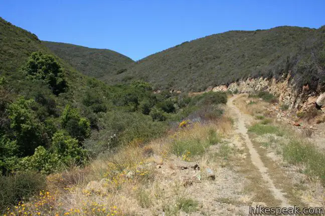
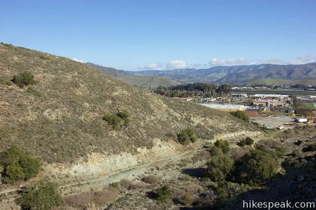
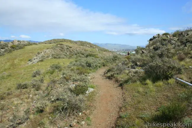
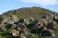
The rocky road gradually ascends the canyon, gaining 300 feet over 1.05 miles to a junction with Canyon View Trail. Ahead, Froom Creek Trail continues another half mile to a junction with Poppy Trail, which can be is used to reach Froom Canyon from the Prefumo Canyon Trailhead. For the most direct route back to the Madonna Trailhead, turn right on Canyon View Trail, backtracking up the north wall of Froom Canyon.
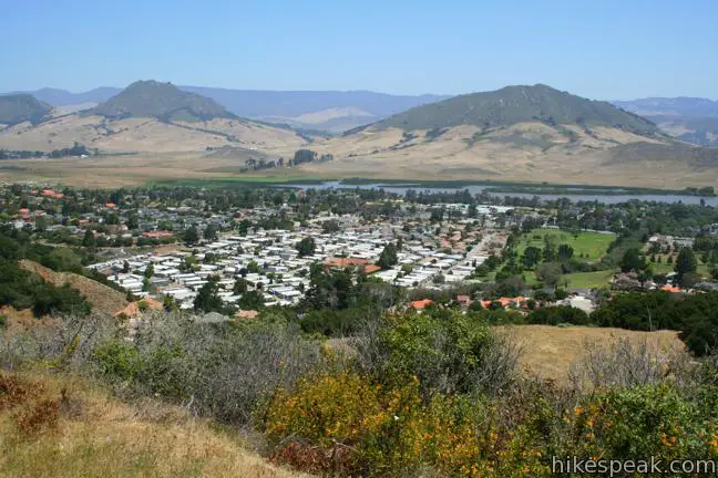
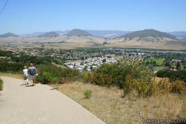
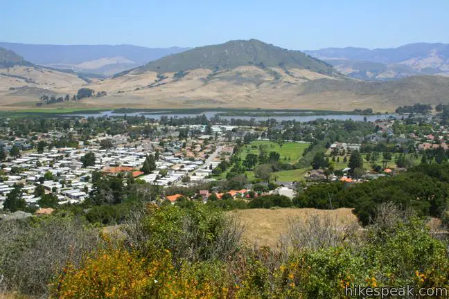
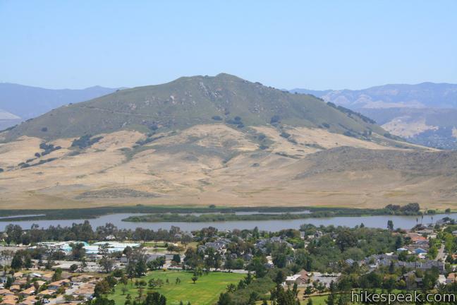
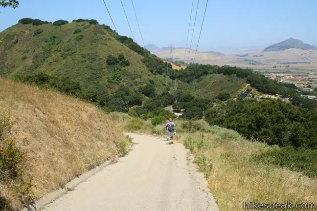
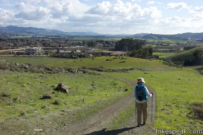
At the top of Canyon View Trail, pass through the gate and turn right on the paved Mariposa Trail. This is the high point of the hike, at approximately 650 feet. Stay to the left through a junction with King Trail and slip down the paved road in line with a string of power lines, enjoying lovely views to the north toward Laguna Lake, Cerro San Luis, and Bishop Peak.
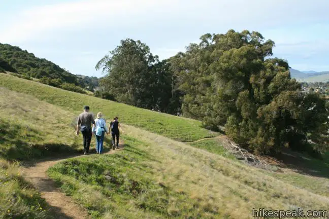
After less that 0.2 miles on the pavement, make a U-turn to the right to remain on the now unpaved Mariposa Trail. Descend just over half a mile through a soothing oak woodland to complete the loop and return to the trailhead. If you worked up an appetite, there are seasonal blackberries at the bottom of the trail, and plums along the path to the trailhead to sample.
To get to the trailhead: Take Highway 101 to exit 200, Los Osos Valley Road, three miles south of downtown San Luis Obispo. Drive northwest on Los Osos Valley Road for one mile and turn left on Madonna Road. Drive 1/3 of a mile to the intersection at the end of the road and park. The trail continues from the end of Madonna Road. There is a short paved walkway between houses up to a map of the park at the junction with King Trail.
Trailhead address: Madonna Road & Devaul Ranch Drive, San Luis Obispo, CA 93405
Trailhead coordinates: 35.25431, -120.69525 (35° 15′ 15.5″N 120° 41′ 42.90″W)
View Irish Hills in a larger map
Or view a regional map of surrounding Central Coast trails and campgrounds.


Additional loop on the Connector Trail and Neil Havlik Way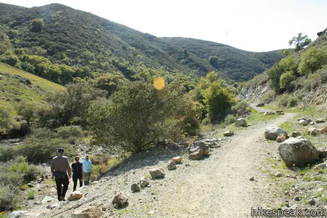


 | Old Prospector Trail Loop This 3.4 to 4.4-mile hike ascends a rugged ravine off Froom Canyon to the ruins of an old mine. |
 | Morro View This 3.15-mile hike in the Irish Hills Natural Reserve delivers panoramic views over Los Osos Valley and the full chain of Morros. |
 | Cerro San Luis This 4-mile hike summits one of the Nine Sisters just west of downtown San Luis Obispo, delivering panoramic views. |
 | Cerro San Luis from Laguna Lake Park This 5.7-mile hike reaches the summit from a nearby park, enjoying even more San Luis Obispo views. |
 | "M" Trail This extensions off the trail up Cerro San Luis makes its own 1.9-mile round trip hike to the large white "M" installed halfway up the east side of the mountain. |
 | Lemon Grove Trail This 2.2-mile loop visits a historical lemon grove on the eastern slopes of Cerro San Luis. |
 | Lemon Grove & "M" Trails Loop This 2.4-mile hike uses all of the "M" Trail and part of Lemon Grove Loop Trail for a scenic circuit on the east side of Cerro San Luis. |
 | Bishop Peak This 3.5-mile hike ascends 950 feet to highest summit in the Nine Sisters, offering excellent views of San Luis Obispo and the surrounding Morros. |
 | South Hills Ridge Trail This 1.5-mile round trip hike ascends 425 feet to the highest point in a cluster of hills near downtown San Luis Obispo, offering fine views over the city and surroundings. |
 | Johnson Ranch Loop This 2.5 to 3.7-mile loop explores a grassy open space just south of San Luis Obispo. |
 | Johnson Ranch - Irish Hills Connector Trail This scenic 5-mile point-to-point hike connects Johnson Ranch Open Space with Irish Hills Natural Reserve. |
 | More hikes in San Luis Obispo Explore other trails around San Luis Obispo including Morro Bay State Park, Montaña de Oro State Park, and the Morros. |
HI I`m John-Michael Mahnke I use to live in San Luis Obispo I`ve been living in Florida for almost 20 years. because of the opportunities in Florida I miss the mountains. I like to look them up on my computer. John-Michael
Tons of poison oak on the start of the trail. Beware!
Prospector trail not marked going from Ocean View Trail from Johnson Ranch to Irish his/Froom Canyon. Signs very confusing. Many places shows wednesday trail either way, but no signs as to where connectors are. Same with Ocean View Trail. Signage needs to improve