If one park is good, than two parks are better, and a trail between those parks brings out the best of both. Opened in the spring of 2013, the Connector Trail between Johnson Ranch Open Space and the Irish Hills Natural Reserve links two of San Luis Obispo County’s great parks. The new trail also connects hikers with grassy slopes and oak-covered ridges with views across San Luis Obispo and Edna Valley. The hike is 5 miles long from trailhead to trailhead (Johnson Ranch Trailhead to the Madonna Trailhead in the Irish Hills) with options to trek even farther.
The Connector Trail makes a good two-car shuttle hike, or a serious out and back hike (or bike ride) of 10 miles round trip. There is 575 feet of elevation between the high and low points of the hike, which you will climb twice if you hike out and back on the Johnson Ranch – Irish Hills Connector Trail.
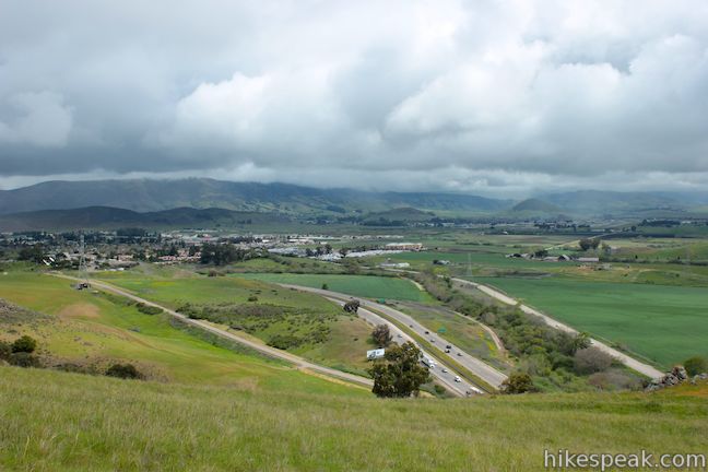
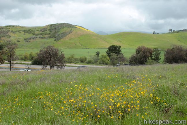
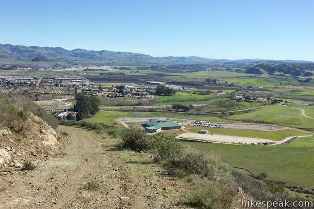
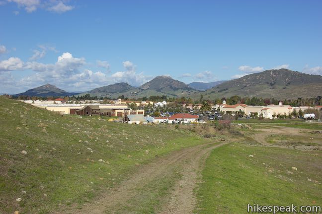
You can start the hike from either end, but if you are only planning to hike one direction, it is recommended that you start from Johnson Ranch Open Space and hike north to the Irish Hills Natural Reserve. The trailhead for the 242-acre Johnson Ranch Open Space is conveniently located just off Highway 101 between San Luis Obispo and Pismo Beach.
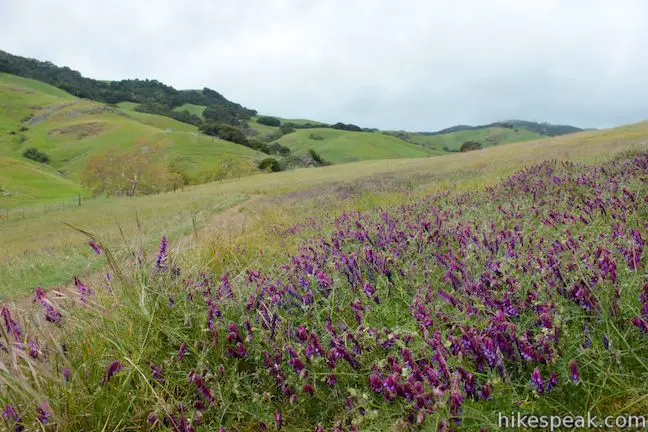
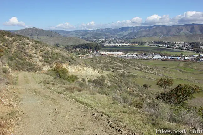
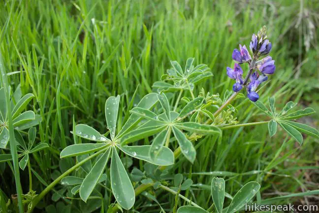
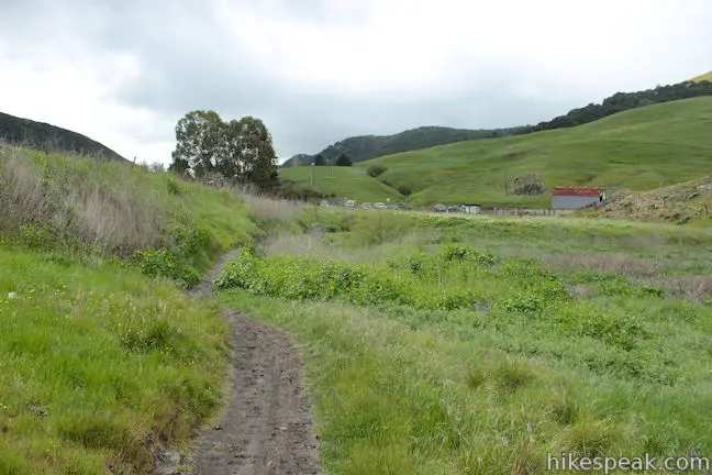
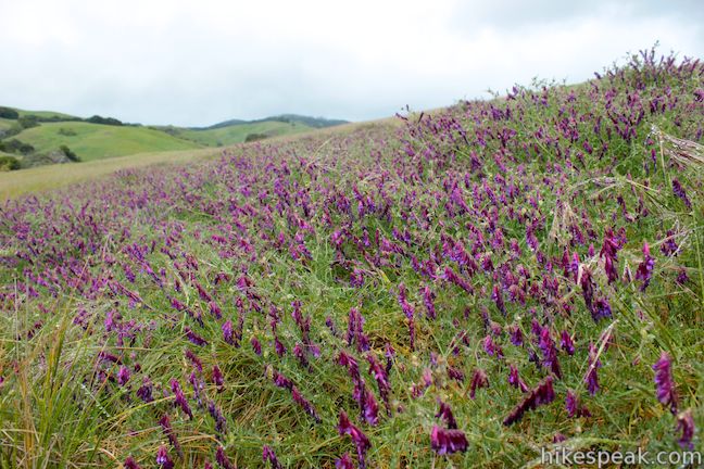
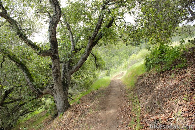
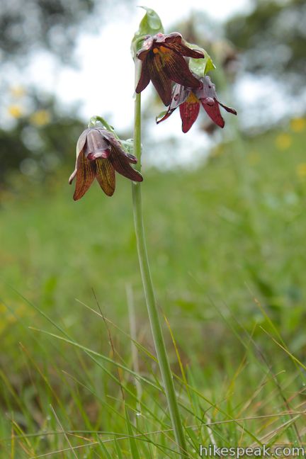
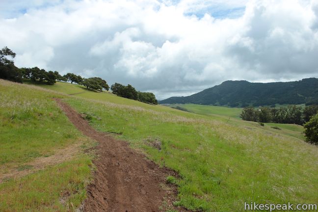
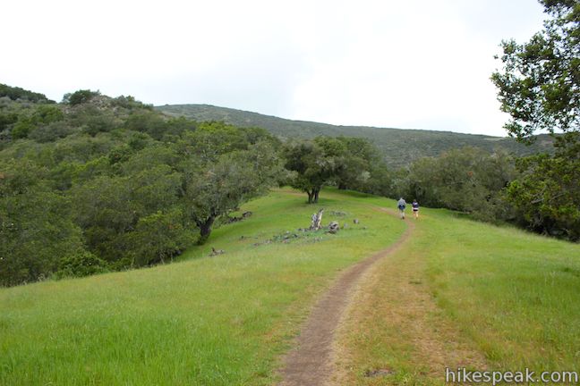
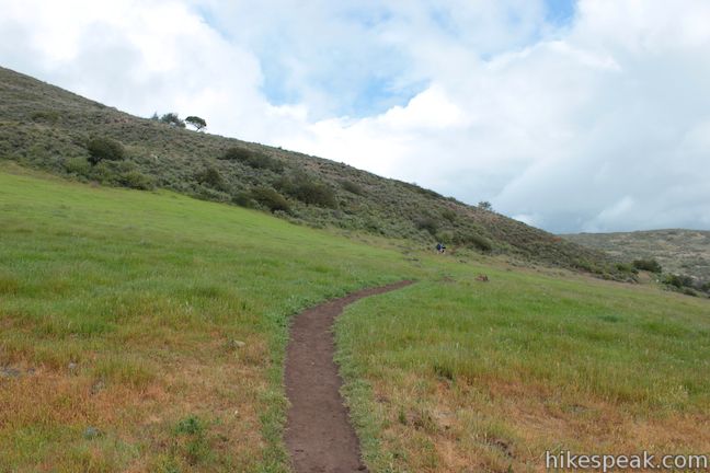
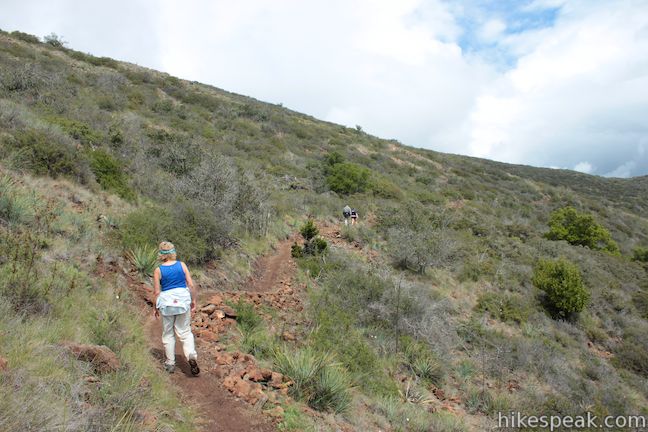
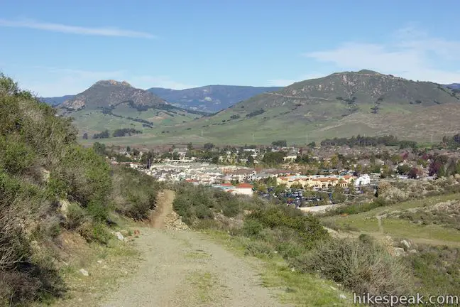
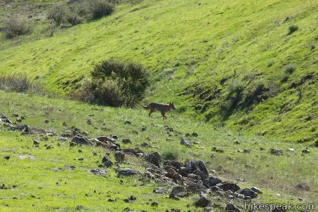
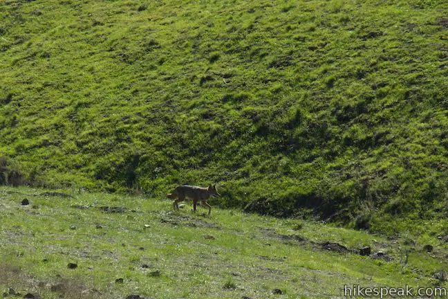
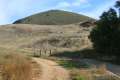
To reach the Connector Trail, you will first hike up the main Johnson Ranch Loop Trail. There is a dirt easement road and a dirt single-track trail leaving from the trailhead. Take the single track, which is to the right of the road and begin hiking up a grassy slope. The hillside browns in the summer and fall, making spring an ideal time to hike in Johnson Ranch when the grass is green and poppies, vetch, and chocolate lilies bloom along the trail.
The trail switches up the right side of a draw in the grassy hillside, passing through a cattle fence after a quarter mile. Round another bend closer to the freeway, and hike up into the former ranch to a trail split, 0.65 miles from the start. To the left is a Shortcut Trail for the larger Johnson Ranch Loop Trail. Turn left here to cut a quarter mile off the distance to the Connector Trail (0.6 miles vs. 0.85 miles). Straight ahead, the Johnson Ranch Loop Trail meanders down a hillside to the north, eventually weaving up to the junction with the Connector Trail in an oak grove. To spare yourself the extra effort, turn left on the Shortcut Trail. After just 0.15 miles, the Shortcut Trail rejoins the larger loop trail. Turn right to head north toward the Johnson Ranch – Irish Hills Connector Trail.
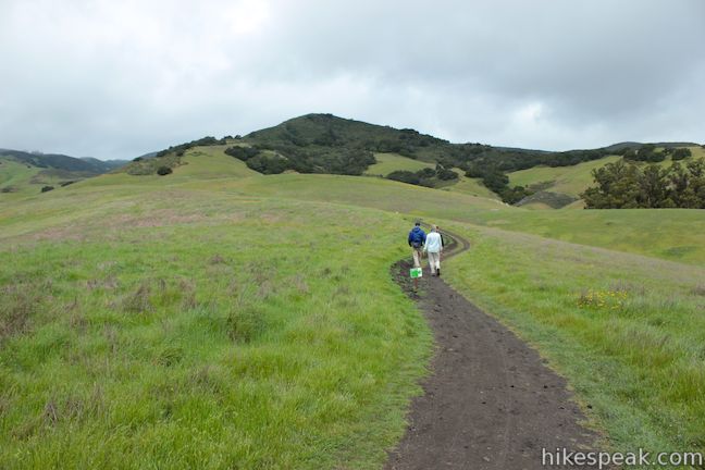
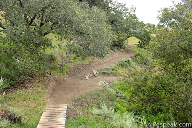
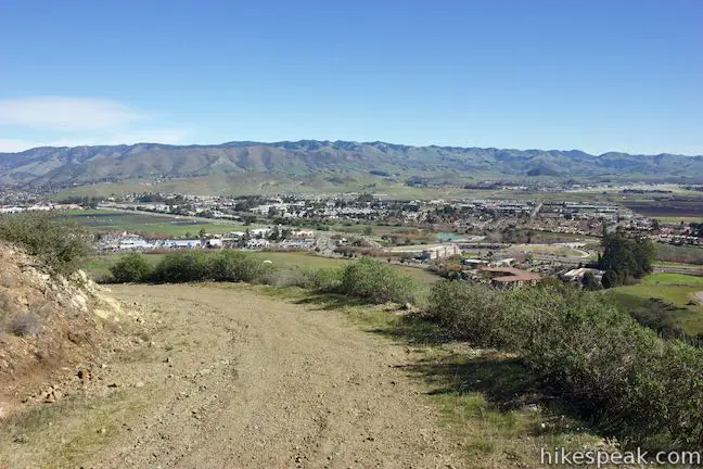
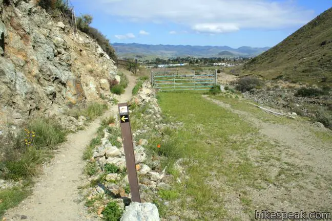
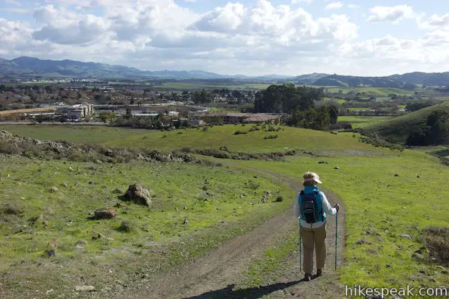
Johnson Ranch Loop Trail runs along a hillside with views across Johnson Ranch. Passing through a grove of shading oaks, you will descend to the unmarked junction with the Connector Trail, 0.45 miles from the Shortcut Trail and 1.25 miles from the start. Turn left and begin up the Connector Trail. At this point, you are leaving Johnson Ranch Open Space and entering the privately held Filipponi Ranch. Stay on the agreed upon trail to ensure that the easement is upheld and hikers and bikers can continue to enjoy the Connector Trail.

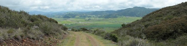
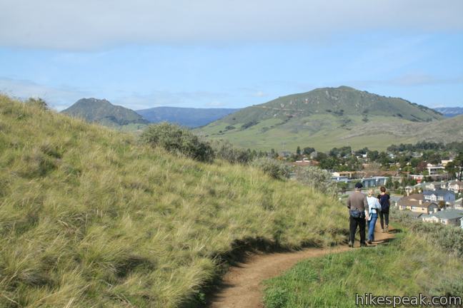
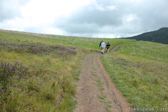
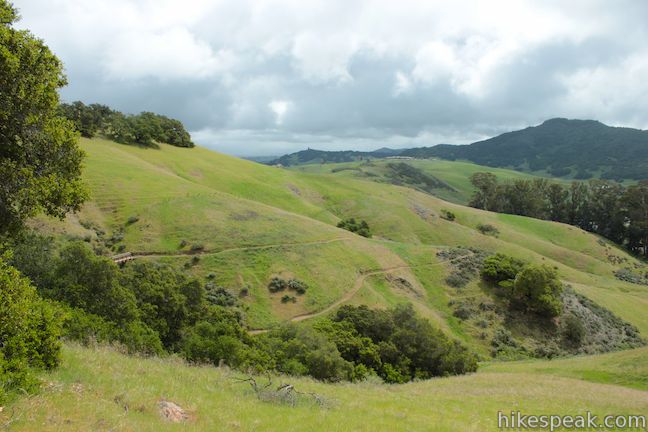
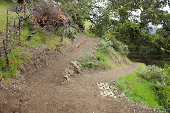
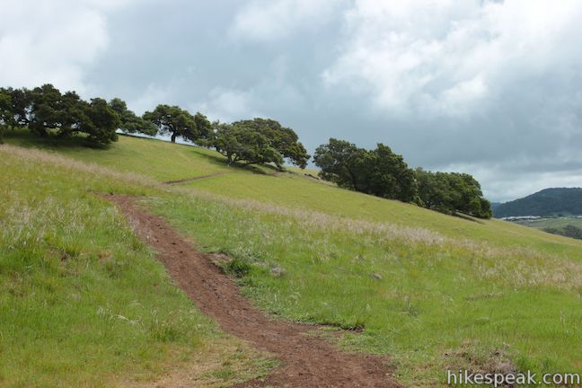
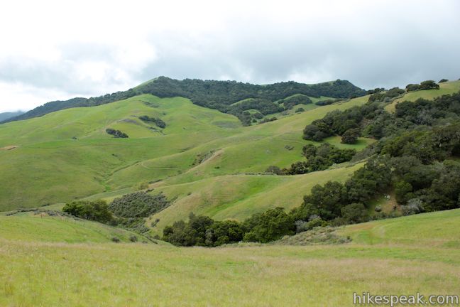
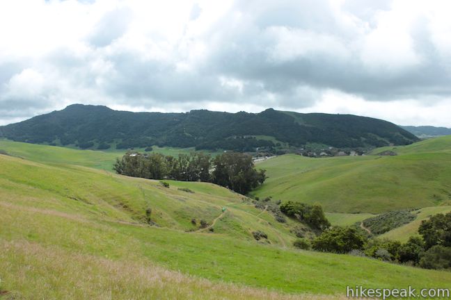
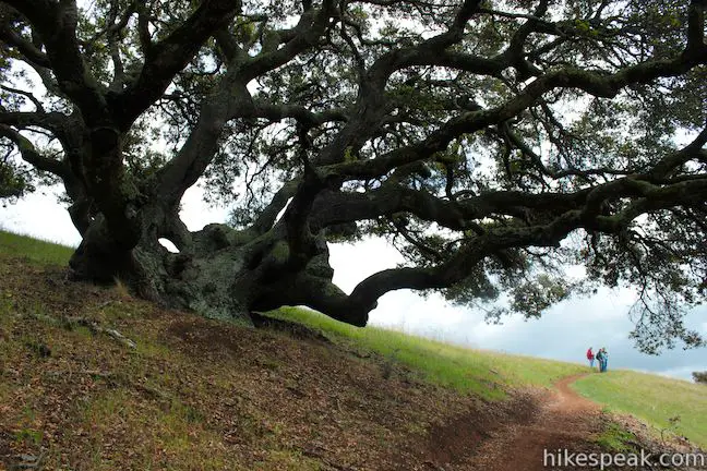
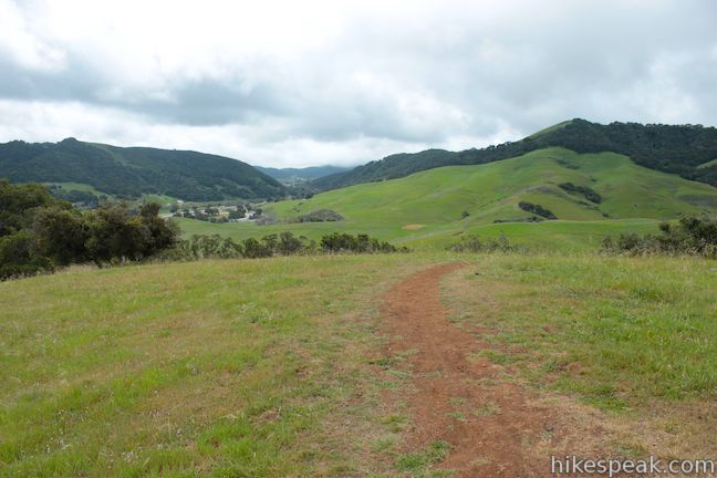
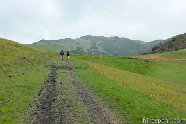
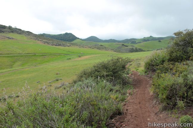
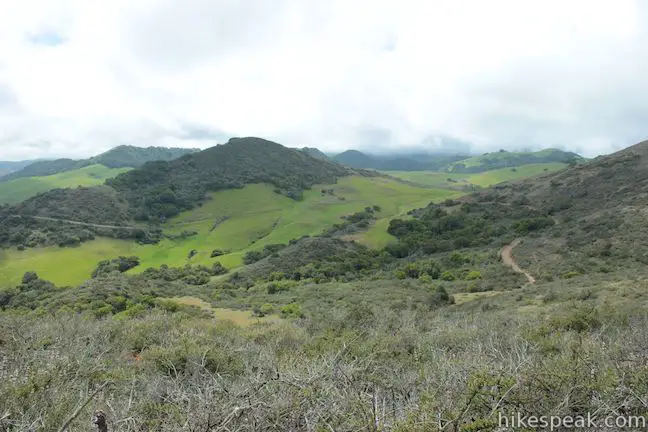
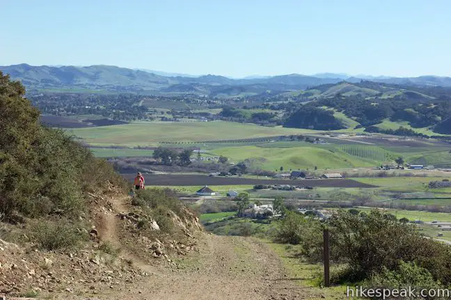
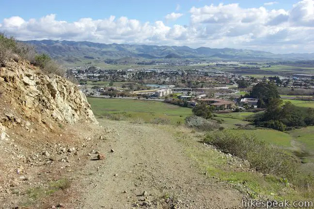
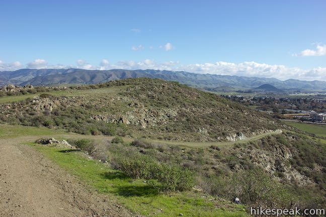
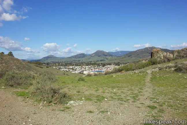
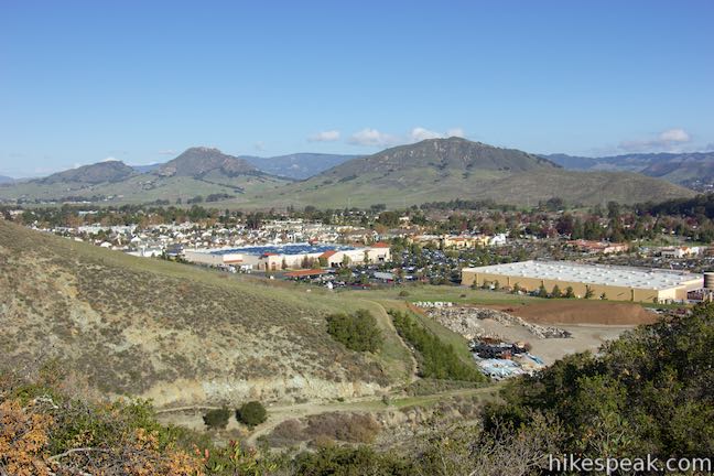
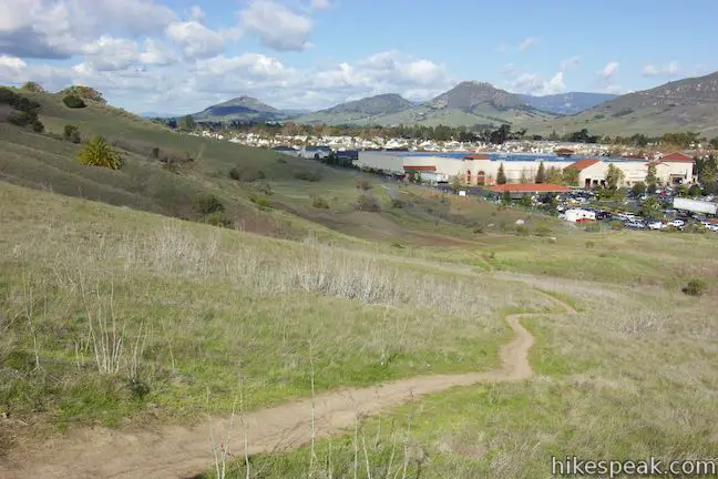
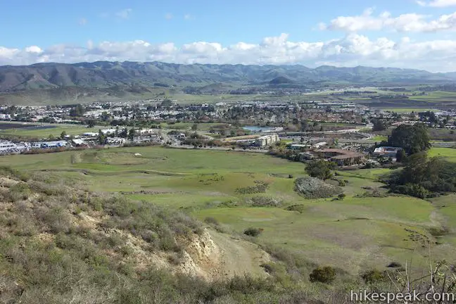
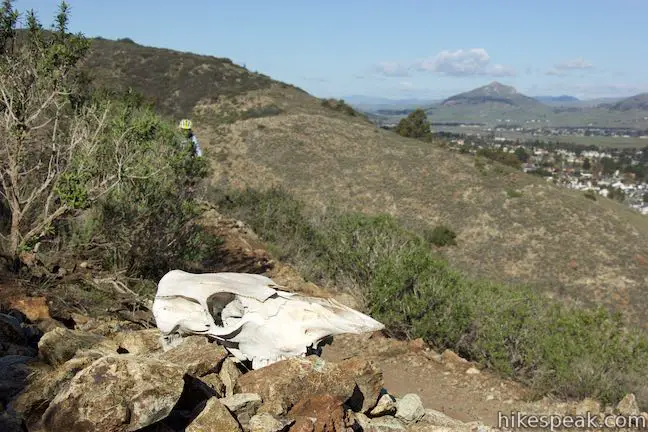
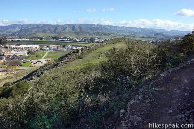
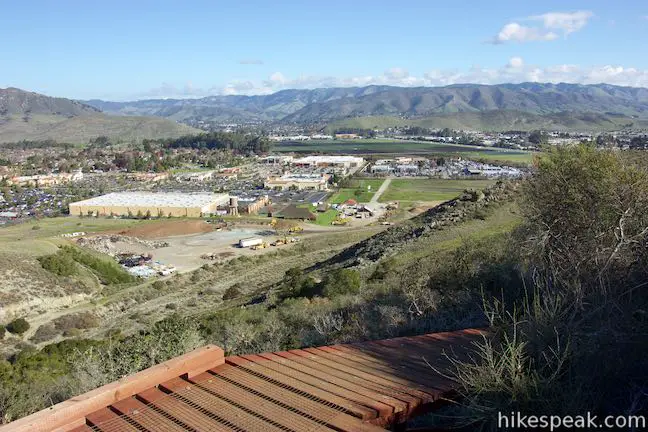
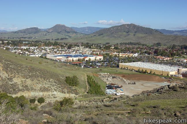
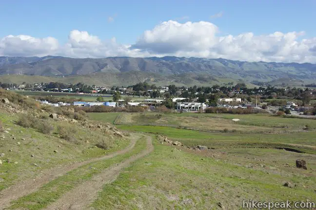
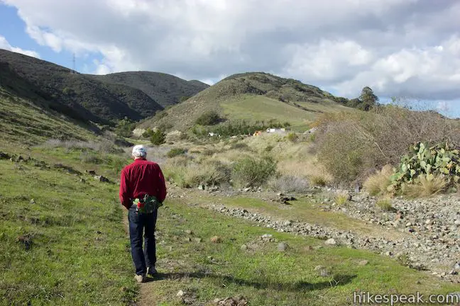
You will immediately pass through a livestock gate, following the dirt single track up a grassy ridge toward a line of oaks. As you ascend the new trail, there are sweeping views over Johnson Ranch to the south. You will be thanking the trail builders of the Johnson Ranch – Irish Hills Connector Trail because the views on this new trail beat anything that has come so far, and there seems to be fantastic scenery around every turn. For example, as you pass through the oaks you will reach the end of a grassy ridge with panoramic views looking north and east over San Luis Obispo and the Edna Valley. Cerro San Luis, the South Hills, and Islay Hill are all in sight, backed by the Santa Lucia Mountains. This viewpoint is just a quarter mile from Johnson Ranch Loop Trail, and even if you aren’t hiking the entire Connector Trail, it would be worth it to hike just this far.
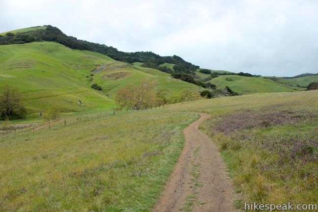
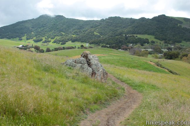
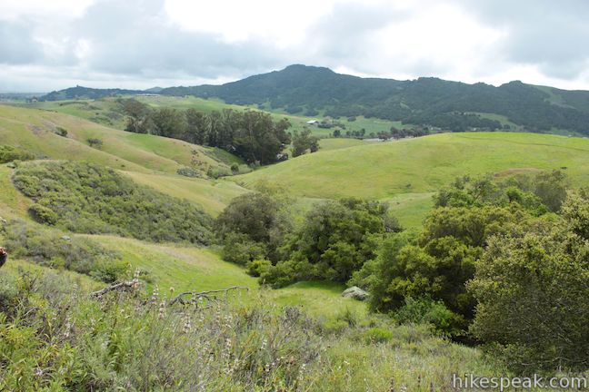
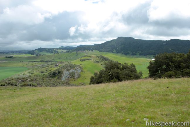
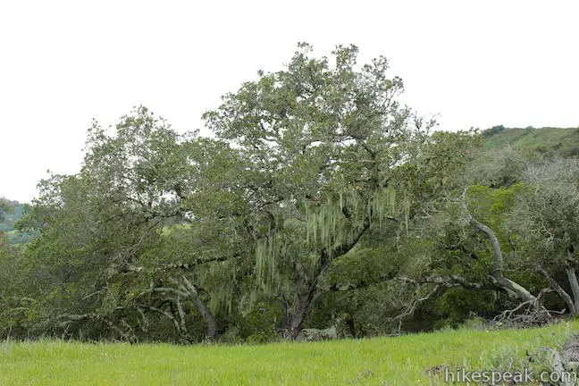
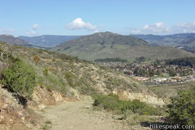
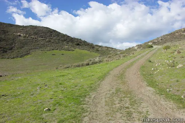
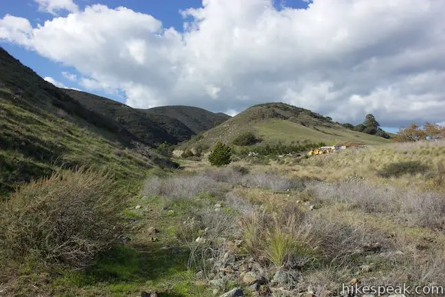
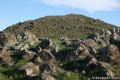
Beyond the grassy viewpoint, 1.5 miles from the start, the Connector Trail bends to the left, heading up the ridge into a grove of live oaks. Lace lichens hang from the oaks like enchanting tinsel. The Connector Trail temporarily widens into a dirt road as you pass some rugged rock formations and come to a saddle between two ridges. The trail curves to the right at the saddle, which offers new views west over the Irish Hills. Here, you will pass through a junction with a private dirt road, 2.15 miles from the start. The dirt road drops into the canyon to the east.
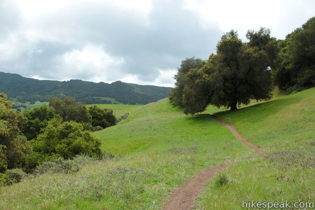
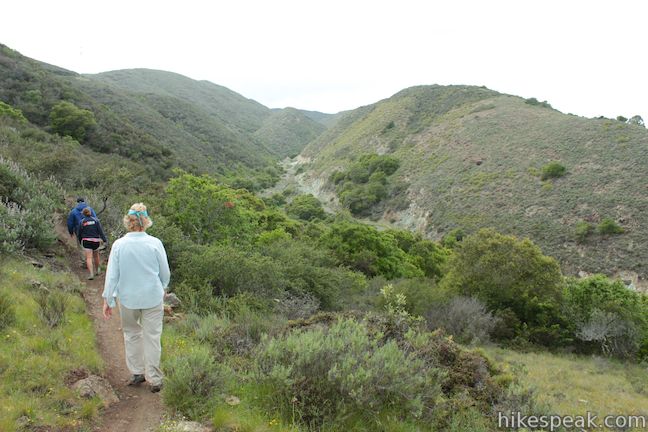
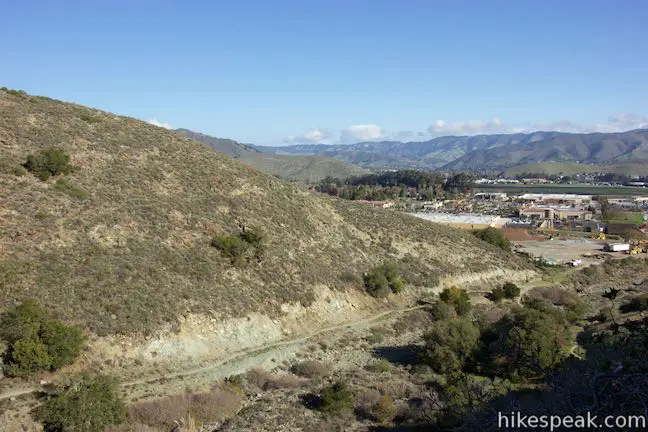
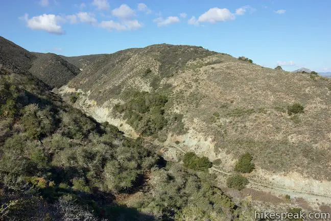
Continue hiking up the Connector Trail, which aims north across the rocky rim of the canyon. The single-track trail maintains a gradual uphill course through sage and chaparral with views east over the canyon and south over the ridge you came up. Cross a spring that flows over the trail and hike up to the ridge at the north end of the canyon, 2.85 miles from the start. This is the high point of the hike at an elevation around 660 feet.
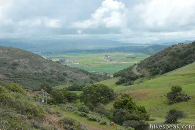
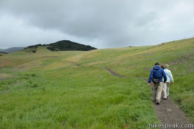
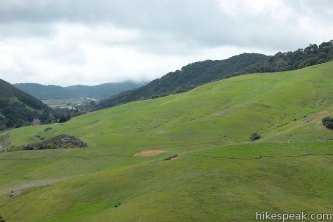
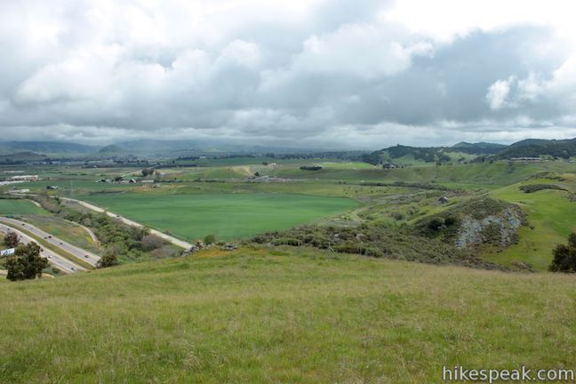
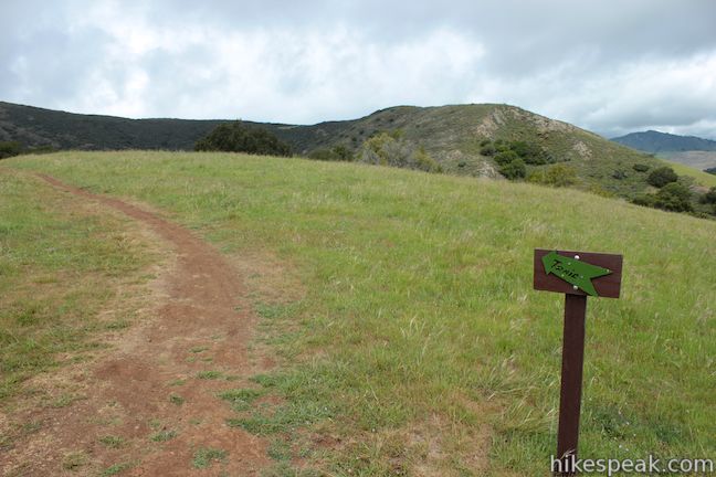
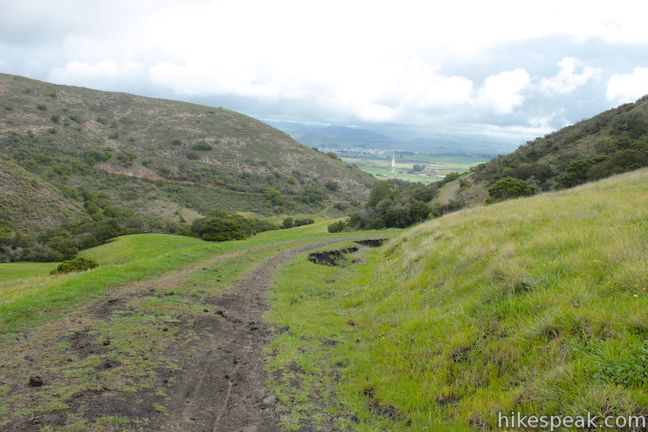
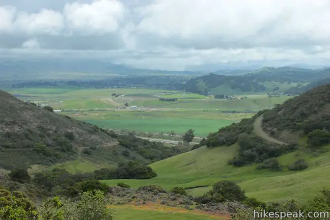
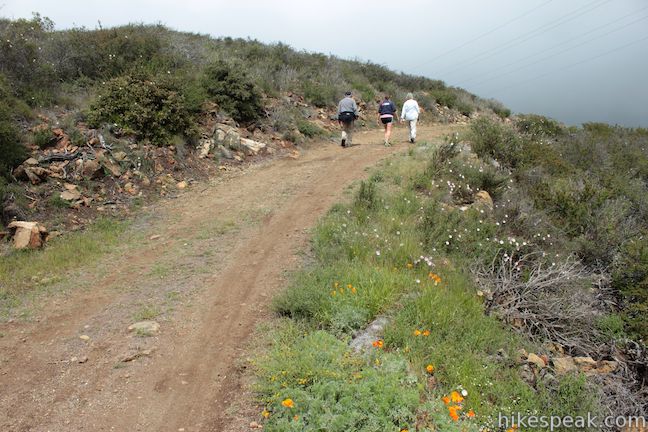
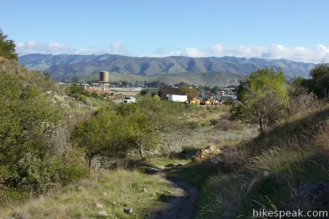
The trail bends to the left, crossing through a livestock gate to enter a grove of short oaks, similar to those you would find in the Elfin Forest near Morro Bay. Hiking downhill, you will come to a wide dirt road, just over three miles from the start. Turn left and continue into Irish Hills Natural Reserve. The wider dirt road turns uphill and passes the top of Pond Trail, a single track breaking off to the left. Stick with the road as it makes a horseshoe bend to the right, where there is another junction, and descends to the east to offer more excellent views over Edna Valley. In another tenth of a mile, or 3.35 miles from the start of the Connector Trail, a single track trail called Chutes and Ladders Trail will break off to the left. This trail can be used to replace the next 0.35 miles of the main connector trail. It is 0.75 miles long, packed with switchbacks, and popular with mountain bikers.

Sticking with the main trail, the views expand to the north toward downtown San Luis Obispo and Cerro San Luis as the road curves to the left around the mountainside. After about 2/3 of a mile on the road, and 3.7 miles from the start, pass the bottom of Chutes and Ladders Trail and come to a junction at a saddle near the end of the ridge where a trail breaks off to the left. You have the option to turn right or left here for equidistant routes to the bottom of Froom Canyon.
- If you stay hiking down the jeep road to the right, it will curve around the bottom of the ridge and become faint. From there, turn left following footpaths up to Froom Creek Trail.
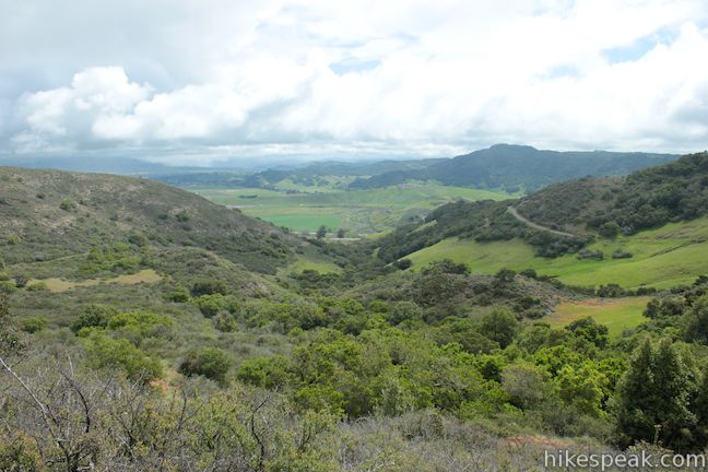
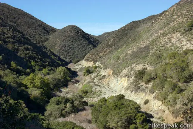
- The better bet is probably to turn left, cross the saddle, and hike down into Froom Canyon. You will get a nice view up the canyon before descending through tall oaks on the side of the canyon. After 0.3 miles, the trail bends to the right, passing a junction with Old Prospector Trail and head down the canyon along Froom Creek. Cross the creek bed after another quarter mile to reach a junction with Froom Creek Trail, 4.25 miles from the start.
For a longer hike in the Irish Hills, you could turn left and venture up the canyon on Froom Creek Trail. Otherwise, turn right down Froom Creek Trail, which curves to the left and leaves the canyon. From here it is 3/4 of a mile to the Madonna Trailhead, 5 miles from the start of the hike.
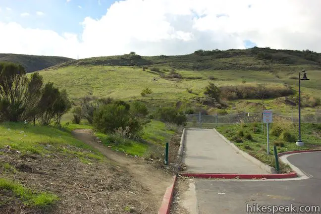
After a tenth of a mile on Froom Creek Trail, you will pass through a fence and spot a path descending to the right toward the Costco parking lot. This well-worn track reaches the parking lot after another 0.15 miles (4.5 miles from the start of the hike in Johnson Ranch) and is another place to consider ending your two-car shuttle hike.
For the full hike, continue toward the Madonna Trailhead on Froom Creek Trail, which makes its way along a grassy slope just above the houses and businesses on Los Osos Valley Road. Bear right when you reach a junction with King Trail and hike another 0.28 miles to the Madonna Trailhead. Turn right at the trail kiosk and walk down to the cul-de-sac at the end of Madonna Road.
If you parked a second vehicle here, your hike is over. Otherwise make your way back through Irish Hills Natural Reserve to Johnson Ranch Open Space. Those hiking out and back on the Connector Trail, may wish to turn around upon reaching the ridge above Froom Canyon, saving the effort of the final descent without sacrificing many views for a roughly 7.4-mile round trip hike.
Dogs and mountain bikes are welcome in both parks and on the Connector Trail. No fee or permit is required to park at the trailheads in both parks, so get out and enjoy!
Directions to the Trailhead
Johnson Ranch Trailhead:
- From San Luis Obispo, take Highway 101 south to exit 198 for Higuera Street.
- At the bottom of a horseshoe bend in the off ramp, turn left into a parking area for Johnson Ranch.
Madonna Trailhead:
- Take Highway 101 to exit 200, Los Osos Valley Road, three miles south of downtown San Luis Obispo.
- Drive northwest on Los Osos Valley Road for one mile and turn left on Madonna Road.
- Drive 1/3 of a mile to the intersection at the end of the road and park.
- The trail continues from the end of Madonna Road.
- There is a short paved walkway between houses up to a map of the park at the junction with King Trail.
Trailhead Location
Trailhead address: Johnson Ranch Trailhead, South Higuera Street, San Luis Obispo, CA 93405
Trailhead coordinates: 35.223448, -120.693313 (35° 13′ 24.41″N 120° 41′ 35.92″W)
Trailhead address: Madonna Trailhead, Madonna Road & Devaul Ranch Drive, San Luis Obispo, CA 93405
Trailhead coordinates: 35.254311, -120.69525 (35° 15′ 15.51″N 120° 41′ 42.90″W)
You may also view a regional map of surrounding Central Coast trails and campgrounds.


"Chutes and Ladders Trail" (alternate route)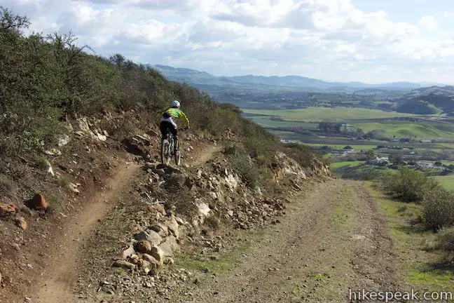


Neil Havlik Way (alternate route)

 | Johnson Ranch Loop This 2.5 to 3.7-mile loop explores a grassy open space just south of San Luis Obispo. |
 | Froom Creek Trail Loop This 3-mile loop explores a canyon on the east side of the Irish Hills, ascending 500 feet to a nice view over Laguna Lake, Cerro San Luis, and Bishop Peak. |
 | Old Prospector Trail Loop This 3.4 to 4.4-mile hike ascends a rugged ravine off Froom Canyon to the ruins of an old mine. |
 | Morro View This 3.15-mile hike in the Irish Hills Natural Reserve delivers panoramic views over Los Osos Valley and the full chain of Morros. |
 | Cerro San Luis This 4-mile hike summits one of the Nine Sisters just west of downtown San Luis Obispo, delivering panoramic views. |
 | Cerro San Luis from Laguna Lake Park This 5.7-mile hike reaches the summit from a nearby park, enjoying even more San Luis Obispo views. |
 | "M" Trail This extensions off the trail up Cerro San Luis makes its own 1.9-mile round trip hike to the large white "M" installed halfway up the east side of the mountain. |
 | Lemon Grove Trail This 2.2-mile loop visits a historical lemon grove on the eastern slopes of Cerro San Luis. |
 | Lemon Grove & "M" Trails Loop This 2.4-mile hike uses all of the "M" Trail and part of Lemon Grove Loop Trail for a scenic circuit on the east side of Cerro San Luis. |
 | South Hills Ridge Trail This 1.5-mile round trip hike ascends 425 feet to the highest point in a cluster of hills near downtown San Luis Obispo, offering fine views over the city and surroundings. |
 | Islay Hill This 1.8-mile round trip hike climbs 550 feet to the top of San Luis Obispo's easternmost Morro. |
 | Bob Jones Bike Trail This easy 5-mile round trip hike or ride follows San Luis Obispo Creek to Avila Beach. |
 | More hikes in San Luis Obispo Explore other trails around San Luis Obispo including Montaña de Oro State Park and the Morros. |
Common Questions about Johnson Ranch – Irish Hills Connector Trail in San Luis Obispo
- Is the trail open?
- Yes. You should expect to find that Johnson Ranch to Irish Hills Natural Reserve is open. There are no recent reports of trail closures. If you discover that the trail is closed, please help your fellow hikers by reporting a closure.
- Is this trail free to access?
- Yes, Johnson Ranch to Irish Hills Natural Reserve is free to access. No entrance fee, pass, or permit is required. If you discover that access rules have changed, please provide feedback on your experience.
- How much time does this hike take?
- It takes approximately 2 hours 30 minutes to hike Johnson Ranch to Irish Hills Natural Reserve. Individual hiking times vary. Add extra time for breaks and taking in the views.
- How long is this hike?
- The hike to Johnson Ranch to Irish Hills Natural Reserve is a 5 mile one-way with 575 feet of elevation change.
- Are dogs allowed on this trail?
- Yes, dogs are allowed on Johnson Ranch to Irish Hills Natural Reserve. The trail is open to hikers, dogs, bikes.
- Where is the trailhead located?
- The trailhead for Johnson Ranch to Irish Hills Natural Reserve is located in San Luis Obispo, CA.
Trailhead Address:
South Higuera Street
San Luis Obispo, CA 93405
Trailhead Coordinates:
35.223448, -120.693313 - What are the driving directions to the start of the hike?
To get to the trailhead: Johnson Ranch Trailhead: From San Luis Obispo, take Highway 101 south to exit 198 for Higuera Street. At the bottom of a horseshoe bend in the off ramp, turn left into a parking area for Johnson Ranch.
Madonna Trailhead: Take Highway 101 to exit 200, Los Osos Valley Road, three miles south of downtown San Luis Obispo. Drive northwest on Los Osos Valley Road for one mile and turn left on Madonna Road. Drive 1/3 of a mile to the intersection at the end of the road and park. The trail continues from the end of Madonna Road. There is a short paved walkway between houses up to a map of the park at the junction with King Trail.
View custom Google Maps directions from your current location.
- Are there other trails near Johnson Ranch to Irish Hills Natural Reserve?
- Yes, you can find other nearby hikes using the Hikespeak Hike Finder Map.

[…] Johnson Ranch Trail […]
[…] a 2.5 to 3.7 mile loop. If you do your research before heading out, there is also a lesser known connector trail between Johnson Ranch and Irish Hills for runners looking to add more miles before calling it a […]