Johnson Ranch Open Space
in San Luis Obispo

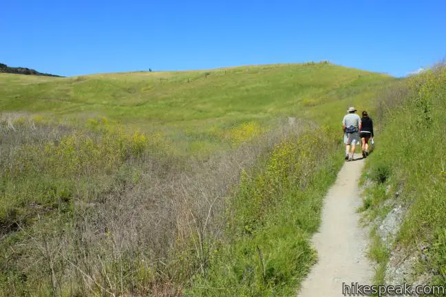
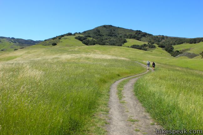
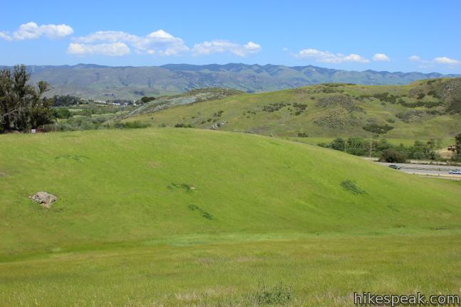
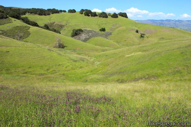
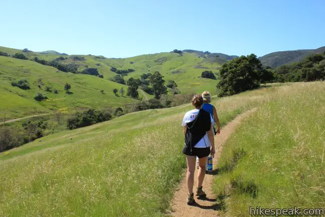
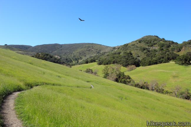
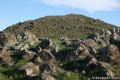
Johnson Ranch Open Space preserves 242 acres of old ranch land just south of San Luis Obispo. The 3.7-mile Johnson Ranch Loop explores the municipal open space, which is dominated by rolling grassy hills accented by serpentine rocks. A shortcut can be used to trim the hike to 2.5 miles. There is 200 feet of total elevation between the high and low points of the hike, a distance that is repeated several times over the meandering loop.
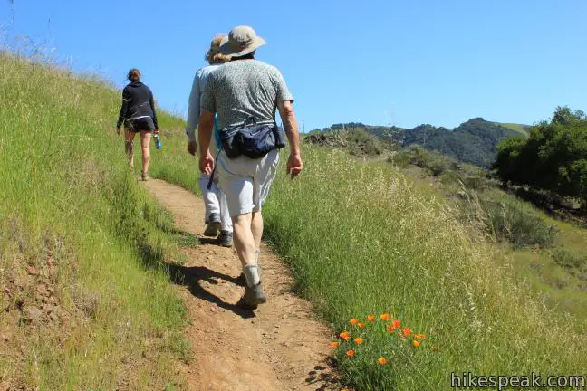
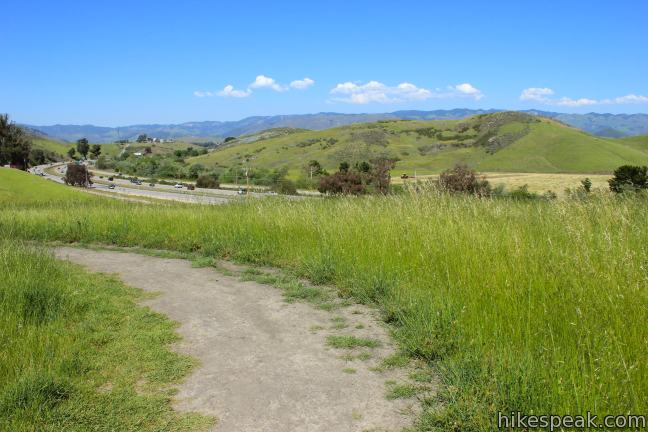
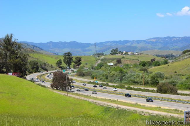
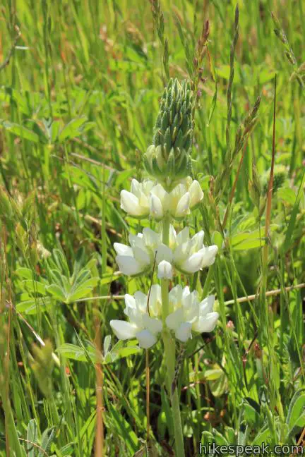
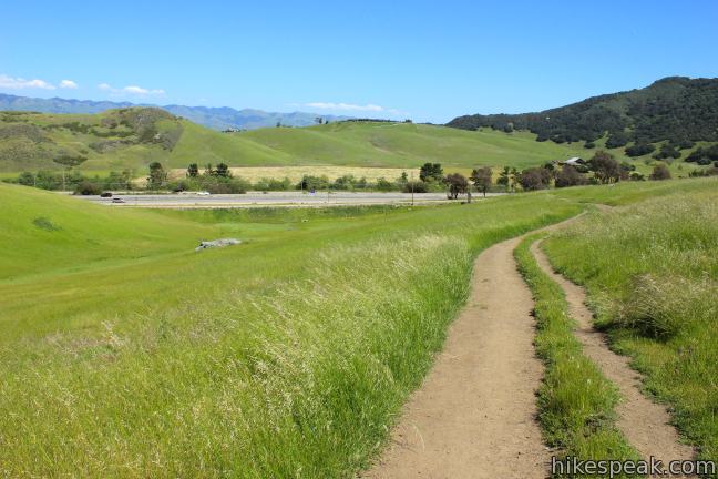
The trailhead for Johnson Ranch is conveniently located just off Highway 101 between San Luis Obispo and Pismo Beach. The proximity becomes slightly inconvenient once you start hiking as the grassy hills do little to obstruct the din of the motorists. Once you tune that out, the trail is quite peaceful, and deeper sections of the loop have no freeway noise at all. Spring is an ideal time to hike Johnson Ranch Loop. Lupines, poppies, and vetch bloom along the trail. The grass is lively and green in the wet season, but the landscape becomes dry and brown by fall.
In 2001, after a century as a working ranch, the city of San Luis Obispo purchased this property and created Johnson Ranch Open Space. They city has put up signs honoring the Johnson Family and the parcel’s history. A collaborative community effort constructed a loop trail through the park, which opened in 2009 and is in great shape.
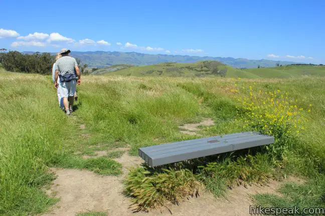
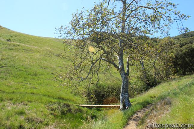
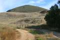
Take on the loop in a counterclockwise direction, heading north parallel to the freeway. The trail switches up a grassy slope on the right side of the canyon, passing through a cattle fence after a quarter mile. Head up the hillside and turn away from the freeway up a grassy slope, reaching a short spur, 0.6 miles from the start. Turn left and take a few steps off the loop to a bench. A sign explains how an old quarry in the canyon below filled with water and became a heron rookery.
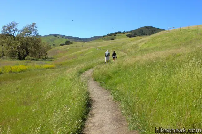
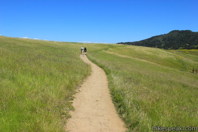
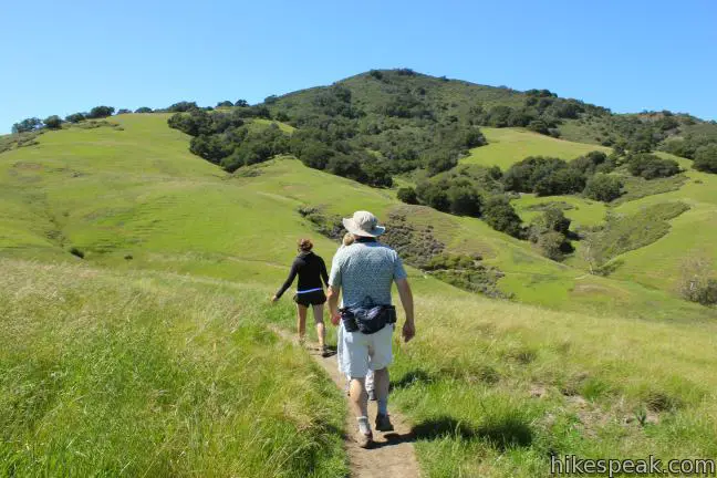
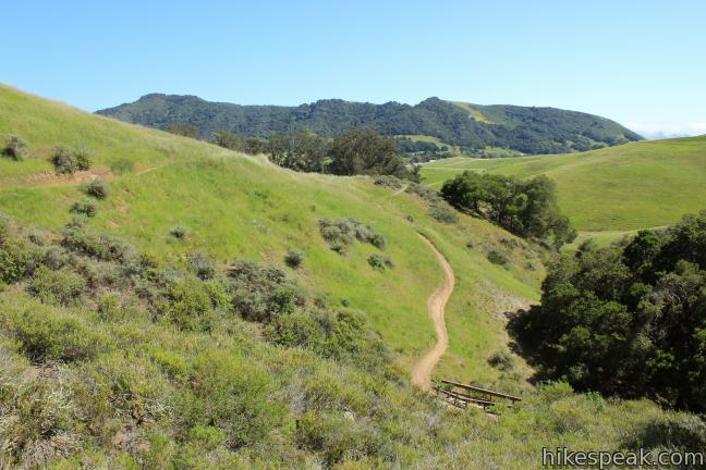
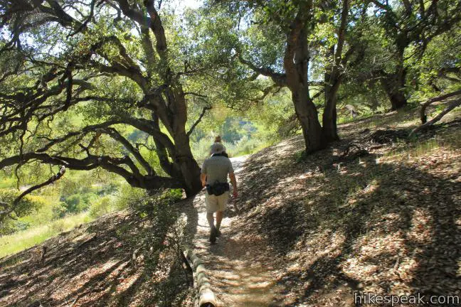
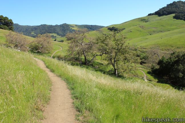
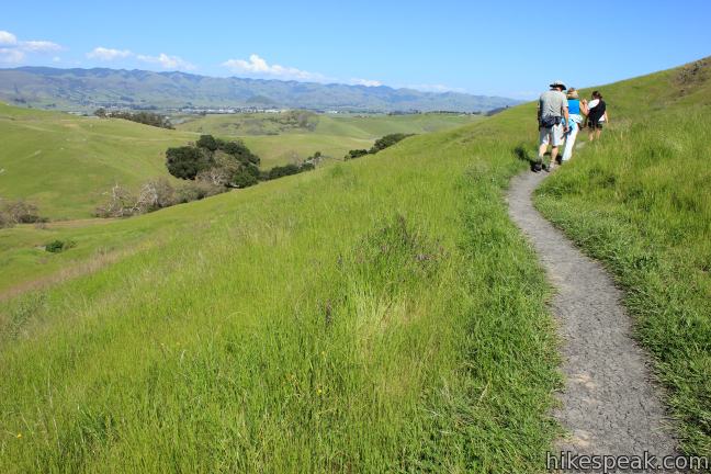
Just beyond the viewpoint, the trail comes to a split. To the left is the shortcut that reconnects with the larger loop a tenth of a mile up the field. Straight ahead, the loop meanders another 1.3 miles through more grasses on the skirt of a hill before reaching the other end of the shortcut. Watch the tall grasses bend to the whim of the wind as you hike. The trail passes through an oak grove that provides the hike’s longest stretch of shade. The loop tops out here and swings around in the other direction, delivering views over the hills to the south.
At the top of the north loop in Johnson Ranch, you will come to a junction with the Johnson Ranch – Irish Hills Connector Trail (opened in the spring of 2013), which connects Johnson Ranch with Froom Creek in the Irish Hills to the north. Even if you don’t hike the full trail, which is 5 miles from trailhead to trailhead, you may wish to hike a quarter mile up the Connector Trail to a grassy ridge with panoramic views.
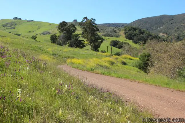
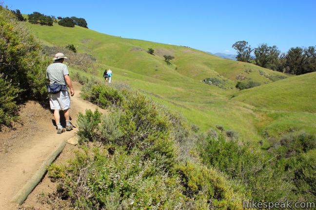
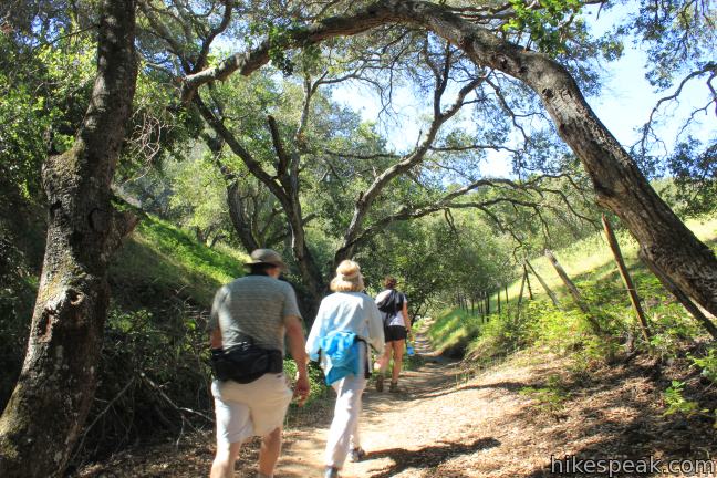
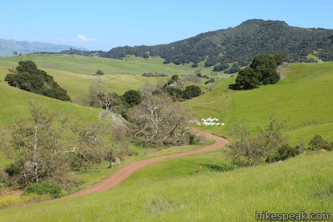
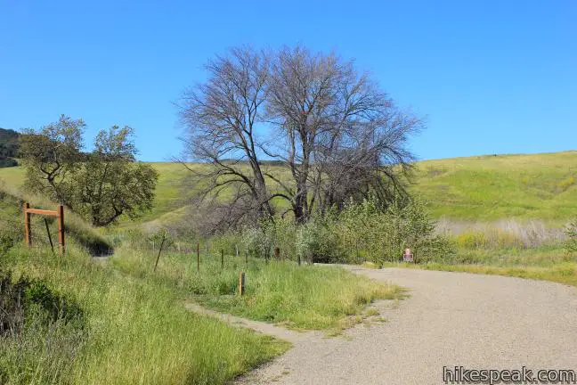
After reuniting with the shortcut, Johnson Ranch Loop Trail heads west, crossing grasslands and another grove of oaks. The trail snakes through a line of sycamores to a footbridge over Dry Creek (which is not always dry in the spring). On the other side, rise to an easement road, crossing it to continue up the single track. Foot traffic is prohibited on the dirt easement road, which runs up the bottom of the canyon.
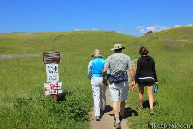
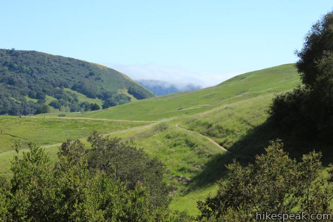
From here the trail wraps down the south side of the canyon, returning to the trailhead after another mile. The trail exits the canyon next to the easement road, opposite the start of the loop. Feel free to hike Johnson Ranch Loop in the opposite direction. Dogs are allowed on leash. No fee or permit is required, so get out and enjoy!
Directions to the Trailhead
- From San Luis Obispo, take Highway 101 south to exit 198 for Higuera Street.
- At the bottom of a horseshoe bend in the off ramp, turn left into a parking area for Johnson Ranch.
Trailhead Location
Trailhead address: South Higuera Street, San Luis Obispo, CA 93405
Trailhead coordinates: 35.223448, -120.693313 (35° 13′ 24.41″N 120° 41′ 35.92″W)
View Irish Hills in a larger map
Or view a regional map of surrounding Central Coast trails and campgrounds.


 | Johnson Ranch - Irish Hills Connector Trail This scenic 5-mile point-to-point hike connects Johnson Ranch Open Space with Irish Hills Natural Reserve. |
 | Froom Creek Trail Loop This 3-mile loop explores a canyon on the east side of the Irish Hills, ascending 500 feet to a nice view over Laguna Lake, Cerro San Luis, and Bishop Peak. |
 | Old Prospector Trail Loop This 3.4 to 4.4-mile hike ascends a rugged ravine off Froom Canyon to the ruins of an old mine. |
 | Morro View This 3.15-mile hike in the Irish Hills Natural Reserve delivers panoramic views over Los Osos Valley and the full chain of Morros. |
 | Cerro San Luis This 4-mile hike summits one of the Nine Sisters just west of downtown San Luis Obispo, delivering panoramic views. |
 | Cerro San Luis from Laguna Lake Park This 5.7-mile hike reaches the summit from a nearby park, enjoying even more San Luis Obispo views. |
 | "M" Trail This extensions off the trail up Cerro San Luis makes its own 1.9-mile round trip hike to the large white "M" installed halfway up the east side of the mountain. |
 | Lemon Grove Trail This 2.2-mile loop visits a historical lemon grove on the eastern slopes of Cerro San Luis. |
 | Lemon Grove & "M" Trails Loop This 2.4-mile hike uses all of the "M" Trail and part of Lemon Grove Loop Trail for a scenic circuit on the east side of Cerro San Luis. |
 | South Hills Ridge Trail This 1.5-mile round trip hike ascends 425 feet to the highest point in a cluster of hills near downtown San Luis Obispo, offering fine views over the city and surroundings. |
 | Islay Hill This 1.8-mile round trip hike climbs 550 feet to the top of San Luis Obispo's easternmost Morro. |
 | Bob Jones Bike Trail This easy 5-mile round trip hike or ride follows San Luis Obispo Creek to Avila Beach. |
 | More hikes in San Luis Obispo Explore other trails around San Luis Obispo including Montaña de Oro State Park and the Morros. |
Common Questions about Johnson Ranch Open Space in San Luis Obispo
- Is the trail open?
- Yes. You should expect to find that Johnson Ranch Loop is open. There are no recent reports of trail closures. If you discover that the trail is closed, please help your fellow hikers by reporting a closure.
- Is this trail free to access?
- Yes, Johnson Ranch Loop is free to access. No entrance fee, pass, or permit is required. If you discover that access rules have changed, please provide feedback on your experience.
- How much time does this hike take?
- It takes approximately 1 hour 45 minutes to hike Johnson Ranch Loop. Individual hiking times vary. Add extra time for breaks and taking in the views.
- How long is this hike?
- The hike to Johnson Ranch Loop is a 3.7 mile loop with 200 feet of elevation change.
- Are dogs allowed on this trail?
- Yes, dogs are allowed on Johnson Ranch Loop. The trail is open to hikers, dogs.
- Where is the trailhead located?
- The trailhead for Johnson Ranch Loop is located in San Luis Obispo, CA.
Trailhead Address:
South Higuera Street
San Luis Obispo, CA 93405
Trailhead Coordinates:
35.223448, -120.693313 - What are the driving directions to the start of the hike?
To get to the trailhead: From San Luis Obispo, take Highway 101 south to exit 198 for Higuera Street. At the bottom of a horseshoe bend in the off ramp, turn left into a parking area for Johnson Ranch.
View custom Google Maps directions from your current location.
- Are there other trails near Johnson Ranch Loop?
- Yes, you can find other nearby hikes using the Hikespeak Hike Finder Map.

23 Comments on Johnson Ranch Open Space in San Luis Obispo
What hikers are saying:
✨ Generated summary of user commentsHikers appreciate the scenic beauty of these connecting paths through the ranch. Marcia emphasizes the importance of packing out dog waste to keep the trails clean for everyone.
“it's a beauty!” Jump to comment ↓
I heard you can hike from Irish Hills all the way to Johnson Ranch. Is this trail officially open and, if so, do you access it from Froom Canyon?
Hi-
The trail is open and does start from Froom Canyon. It is about 5 miles to Johnson Ranch. You can access the new trail from the Madonna Road Trailhead or from the Costco parking lot near the gas pumps (which shortens the hike by about half a mile). If you are doing a one-way shuttle hike with two cars, it has been recommended that you start the hike from Johnson Ranch. Hope that helps. I am looking forward to checking out the new trail myself!
Update: I’ve hiked the Johnson Ranch – Irish Hills Connector Trail and it’s a beauty!
Are dogs allowed on trail?
Dogs are allowed. Enjoy the hike!
[…] Johnson Trail also can connect you to the Irish Hills Trail. I am hoping to come back and extend the hike which would make it about 10 miles round […]
Stopped by JR Trail on 12/5 and found sign sayin it was closed. Can I ask why? And when will it be reopened? Thanks…
The city of San Luis Obispo often closes trails when it rains. Come on back when the weather has been good.
Just wondering, Is there a guided/informational tour this Saturday April 25 at Johnson’s Ranch at 9:00 AM??
yes there sure was!
Hi Pat, Check out ECOSLO.org or SLO-DOCENTS.org for the guided hikes schedule.
Saw a rattlesnake about 1/2 mile into the Mariposa Trail today (6/1/15) crossing the pavement.
How many people visit on an average per year and day
Is the Johnson Ranch trail still closed? If so, when will it open?
[…] Johnson Ranch Open Space: Located just off the 101 between SLO and Pismo Beach, the Johnson Ranch trail is a local favorite for trail runners looking for a little bit of elevation gain and a 2.5 to 3.7 mile loop. If you do your research before heading out, there is also a lesser known connector trail between Johnson Ranch and Irish Hills for runners looking to add more miles before calling it a day. […]
Hadn’t hiked Johnson Trail for awhile. Went early a.m. last week and was appalled at the massive amounts of dog waste on and along the trail. We encountered a guy with his dog and morning cup of coffee. About 40 feet later we encountered his dog’s steaming pile in the middle of the trail. You can bring your coffee mug but not a waste bag?
Is this trail open to horses?
We hiked today June 5 and saw two people with dogs not on leash. One of the dogs chased some wild turkeys that then flew up and left the area. We saw that there was a young turkey still there in the grass. The dog owner called to the dog and it came to him and then it ran after the other turkey. I told him to put the dog on a leash, But he ignored me.
Thanks for at least trying to take some humane sense into him! If enough of us speak up, there’s a better chance of making an impact.
What is the green rock that can be found all along this trail?
[…] our quest to find an open trail, we discovered Johnson Ranch Open Space. We drove the picturesque Los Osos Valley Road, went south on the 101 to the trailhead just off the […]
Can you ride mobiles with people also hiking these trails? And do they get offended?
Who originally owned the Johnson Ranch? I believe that our family is related to them. Thanks