Bluff Trail
in Montaña de Oro State Park
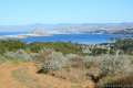
Montaña de Oro State Park preserves 8,000 acres along the picturesque coast of San Luis Obispo County. This park is like a slice of Big Sur, located between Avila Beach and Morro Bay. Montaña de Oro State Park is a popular destination for beach-goers, hikers, mountain bikers, and horseback riders. The dramatic shoreline and thousand-foot mountains provide scenic setting for a host of great trails.
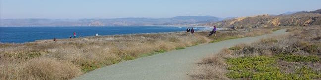
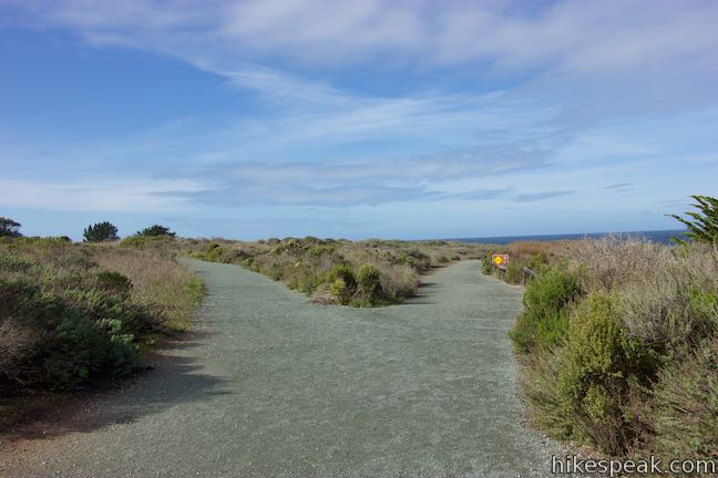
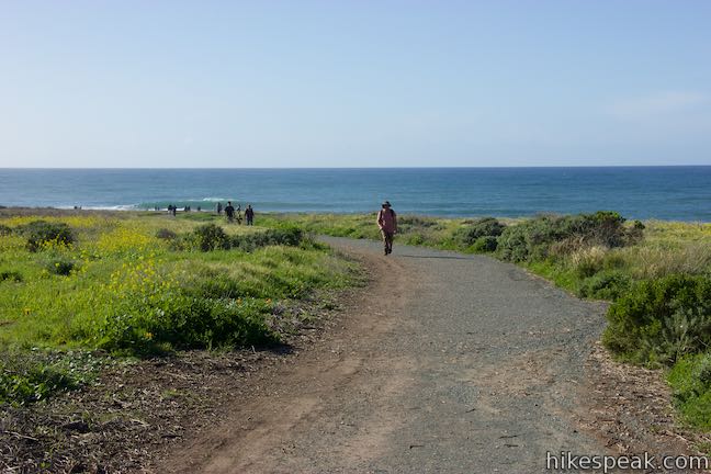
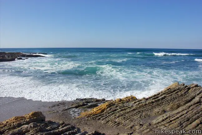
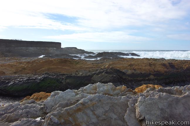
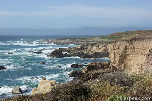
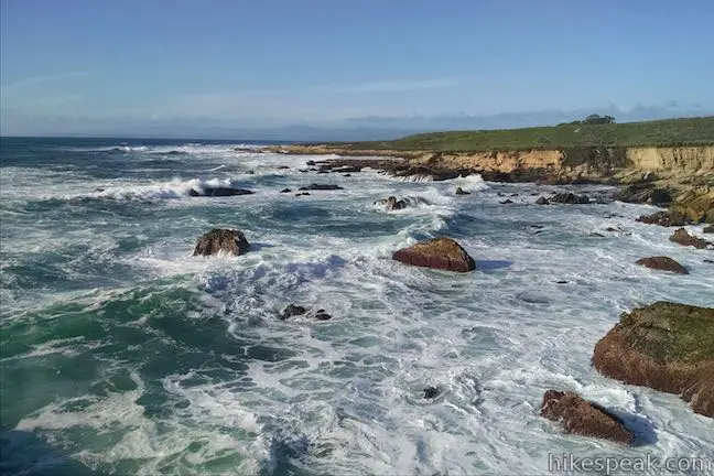
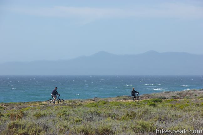
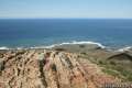
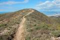
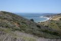
Bluff Trail is a level coastal trail suitable for hikers, bikes, and wheelchairs that is 2.1 miles long one way with a host of side trails that allow for outings between one and five miles. A hike of around three miles round trip with 90 feet of elevation change is the perfect way to see all the tide pools, beaches, rock islands, and natural bridges, along the superb coastline of Montaña De Oro State Park, hitting highlights like Corallina Cove, Quarry Cove, and Grotto Rock.
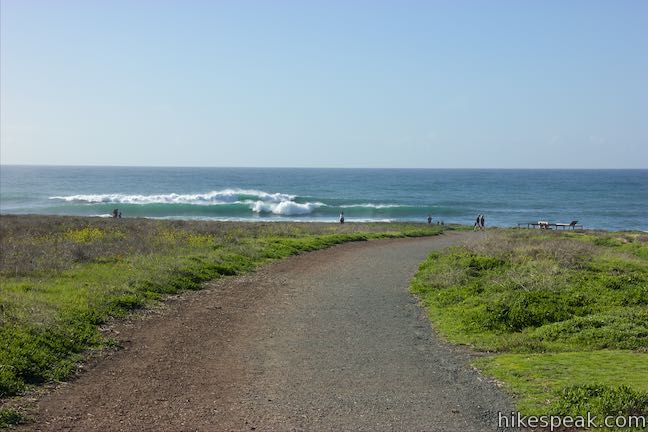
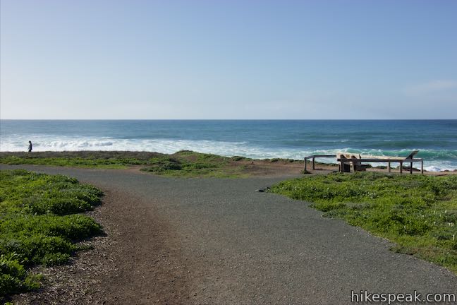
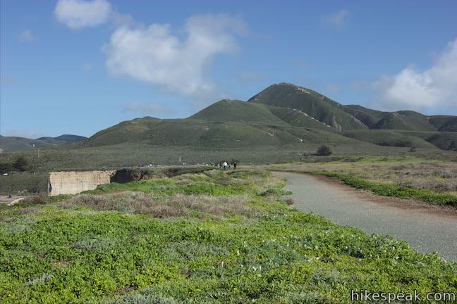
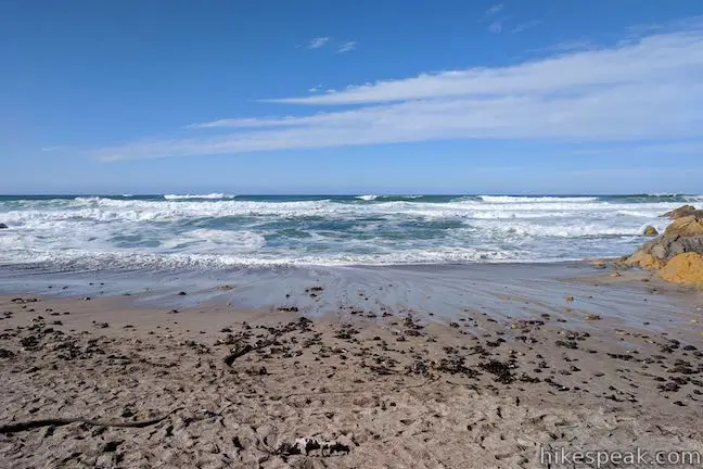
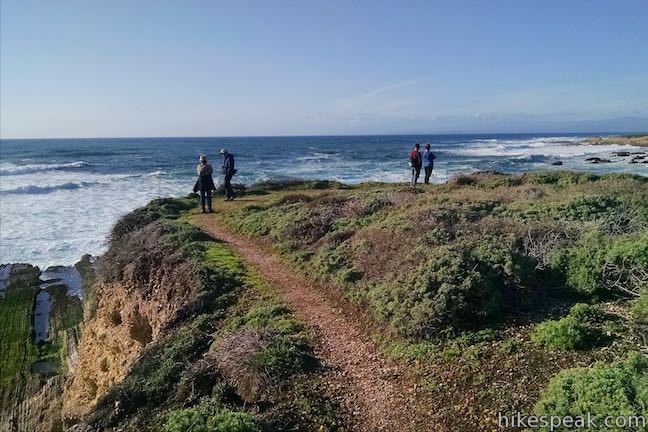
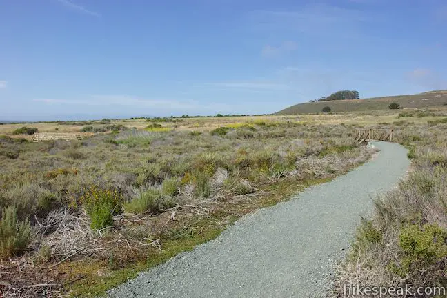
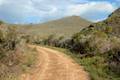
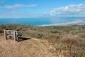
Start from the north end of the Bluff Trail at a parking area on Pecho Valley Road just past the Montaña de Oro Visitor Center and across from the trailhead for Valencia Peak. Follow the signs for Bluff Trail and begin hiking south along the coastal bluff. The wide dirt and gravel trail turns toward the sea, venturing out to Islay Point. To the north is a nice view of Spooner’s Cove, home to a popular beach located below the visitor center.
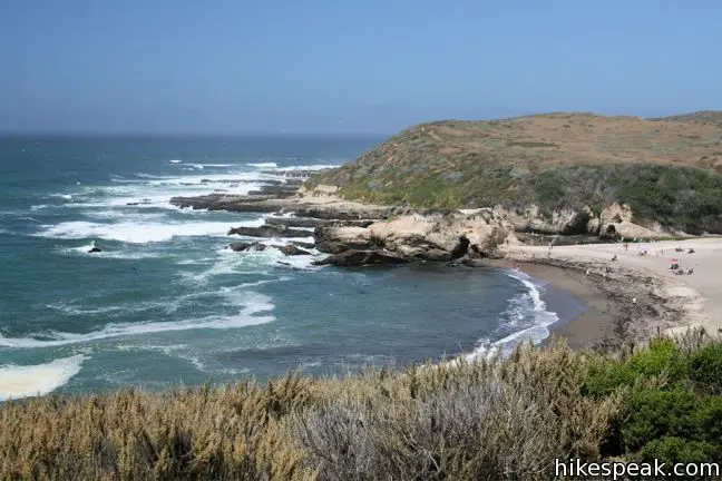
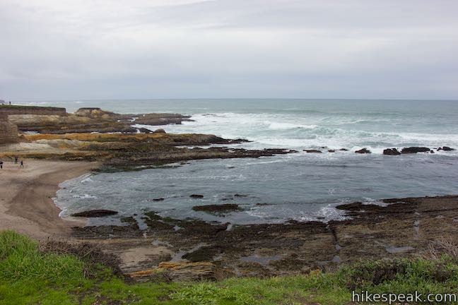
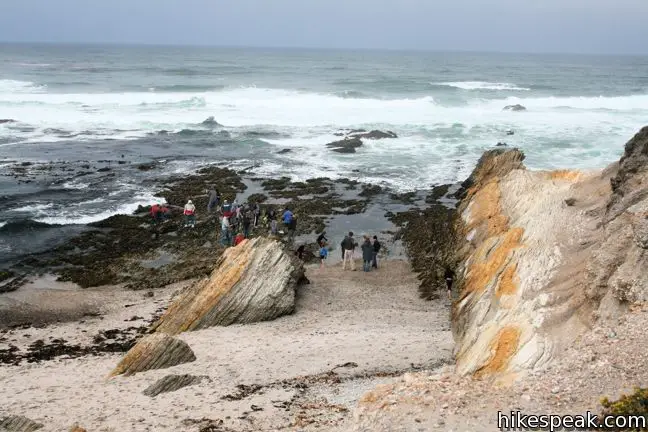
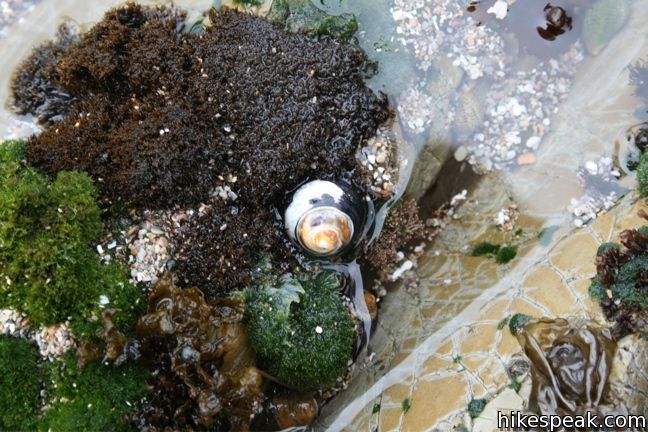
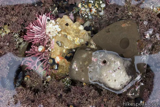
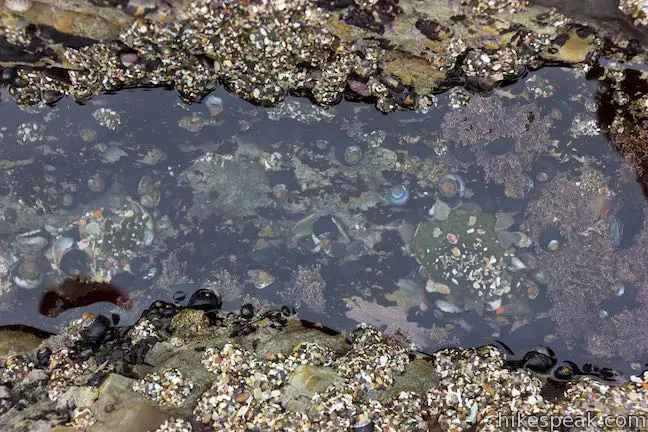
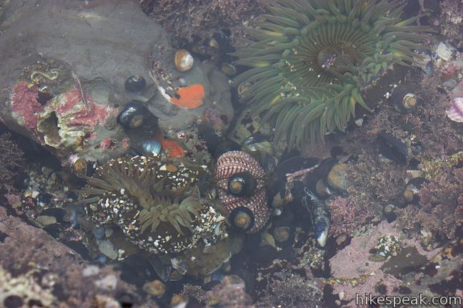
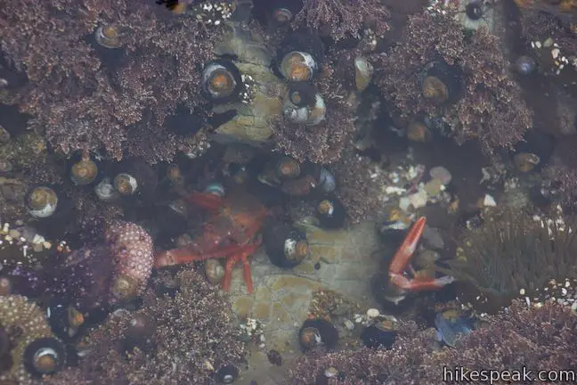
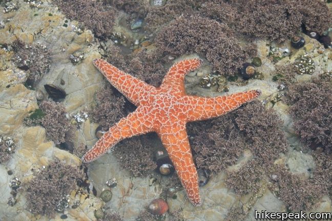
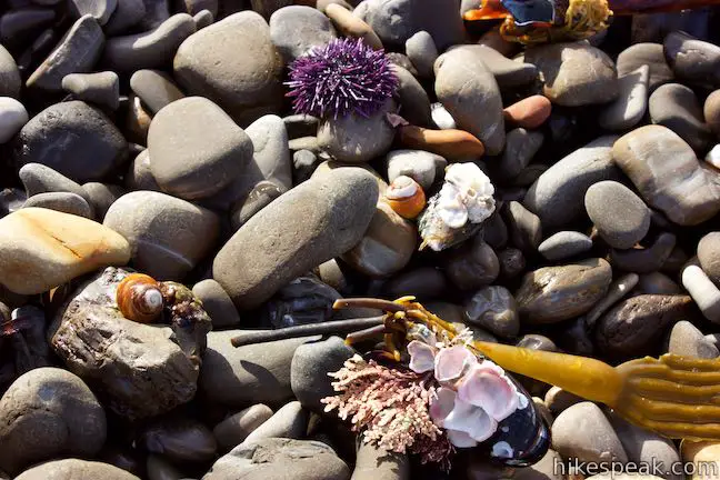
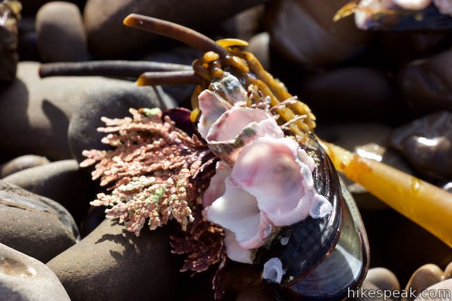
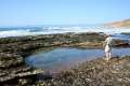
Continue south across the bluff through low brush with coastal views. Cyclists, joggers, and families pushing BOB strollers share the trail, which arrives at Corallina Cove after half a mile. A short spur descends to this small beach with tide pools full of interesting sea creatures. Children can scour the rocks, spotting sea anemone, hermit crabs, and sea stars (starfish). This popular destination can be visited on a family-friendly 1.2-mile round trip hike on the Bluff Trail, by hiking back along the coast via the same route or looping back to the start on another trail that lies ahead.
Bluff Trail explores even more rugged coastline south of Corallina Cove. From the spur down to Corallina Cove, head directly inland and come to a junction next to a ravine behind Corallina Cove. Straight ahead, a 0.4-mile long trail circles back to the start, allowing for a 1 mile loop without the spur to Corallina Cove and a 1.2-mile loop with the spur. Additionally, on the way back from a longer hike on the Bluff Trail, the loop trail can be used to trim 0.2 miles from the return distance, sacrificing ocean views for speed. To proceed along the Bluff Trail, turn right and cross the ravine.
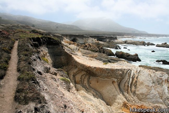
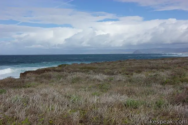
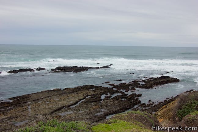
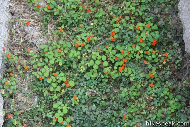
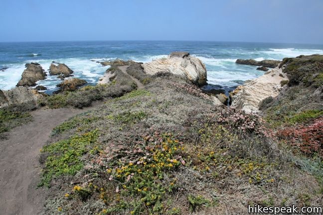
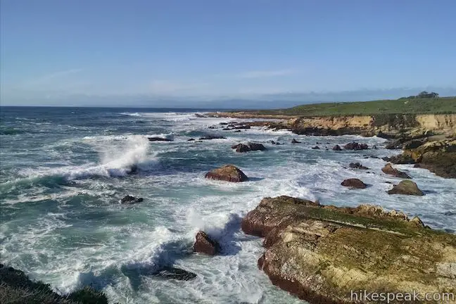
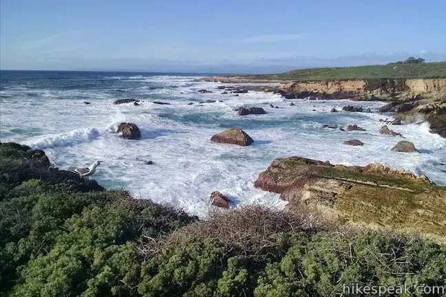
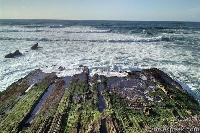
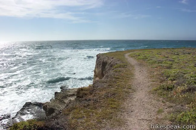
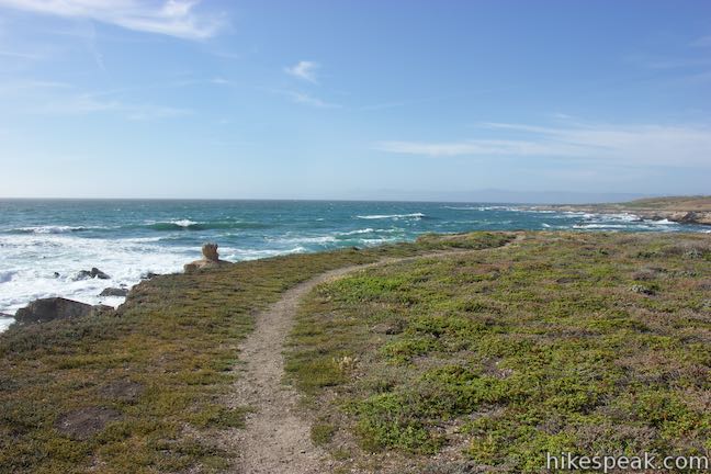
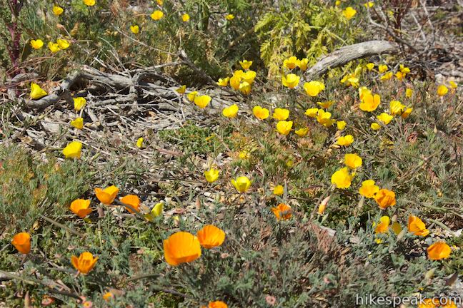
Nasturtiums may be visible at the bottom of the ravine in the spring. Bluff Trail heads south again, serving up bold ocean views. The main trail is complimented by smaller footpaths that weave across the bluff for more intimate looks at the beautiful coast. The rocky bluffs are broken off in small layers that look like intricate steps.
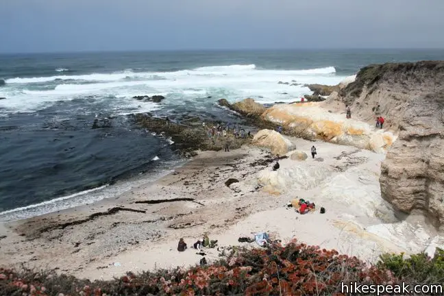
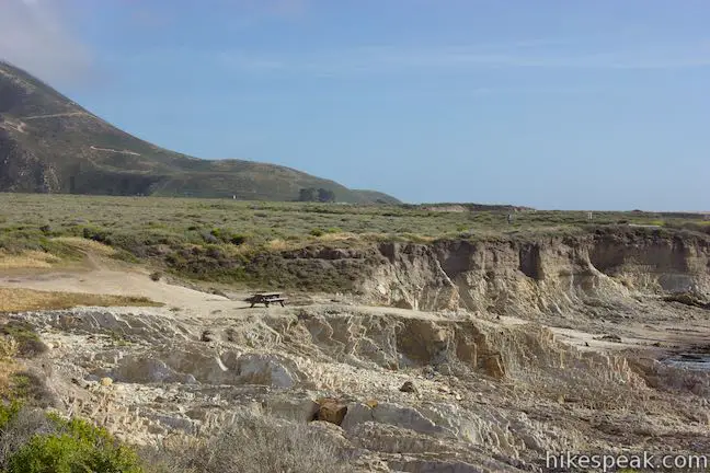
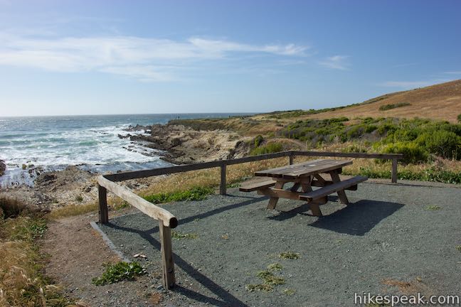
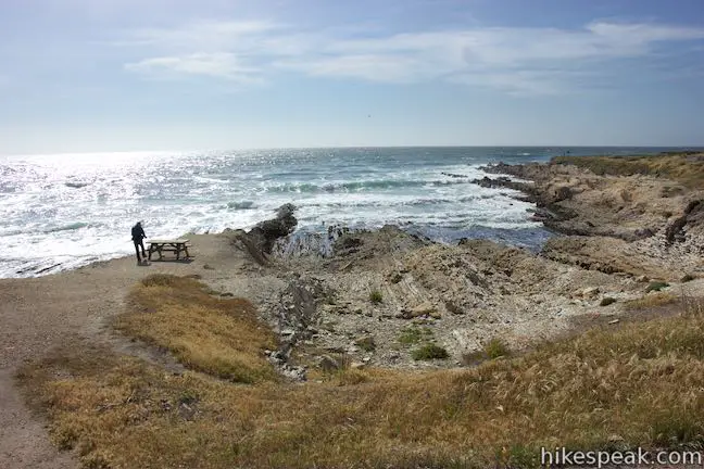
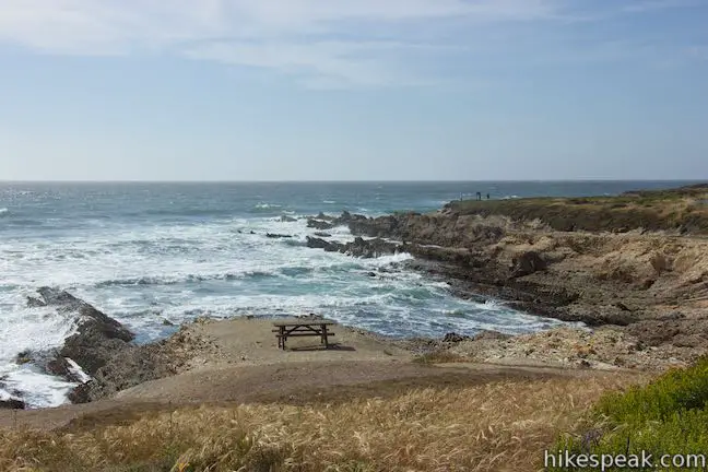
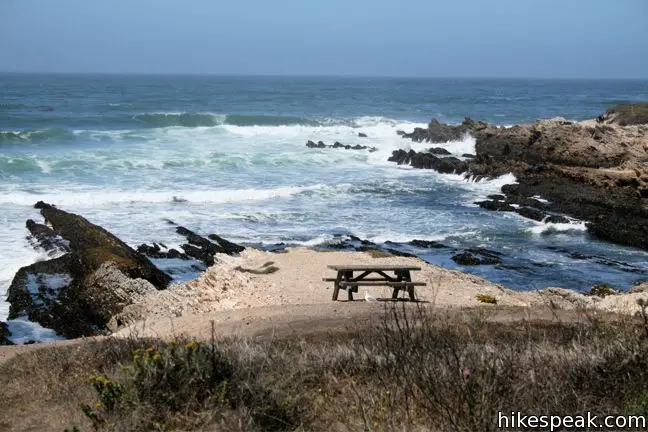
Half a mile past the spur to Corallina Cove comes another popular tide pool, Quarry Cove. A wheelchair-accessible picnic table is right along the trail and another is down a short path closer to the coast, made up of narrow rock point and tide pools.
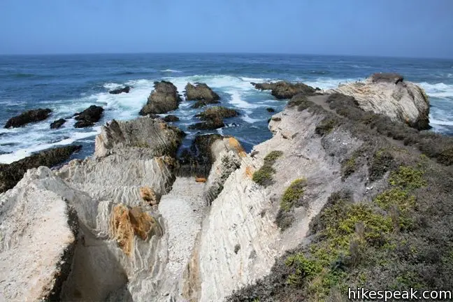
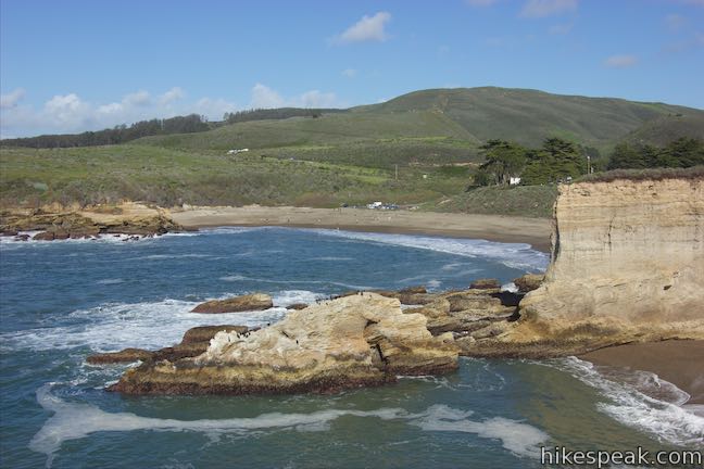
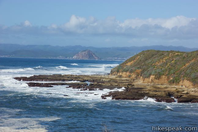
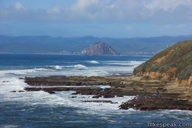
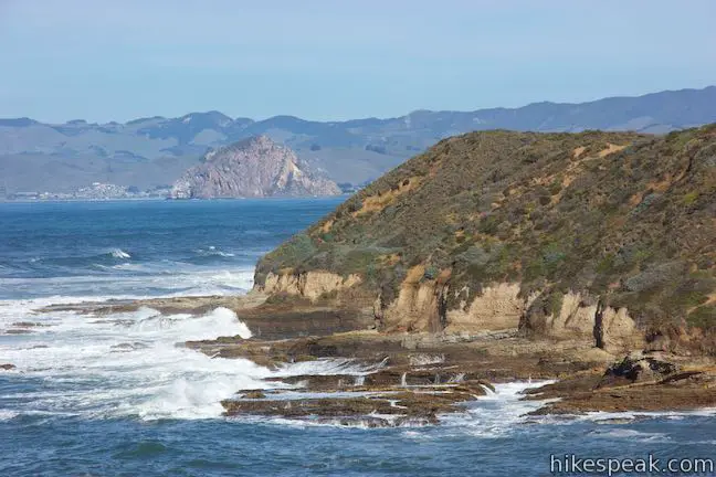
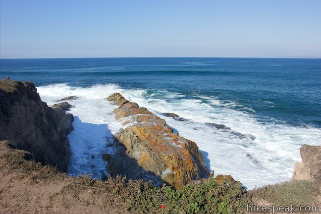
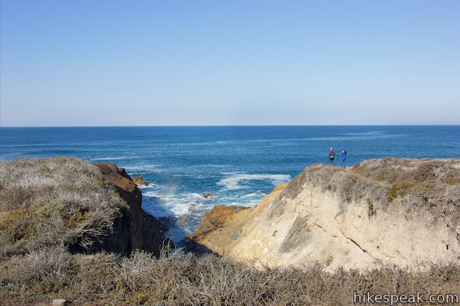
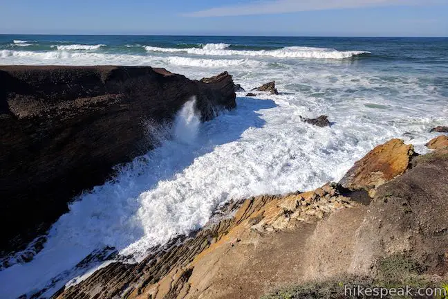
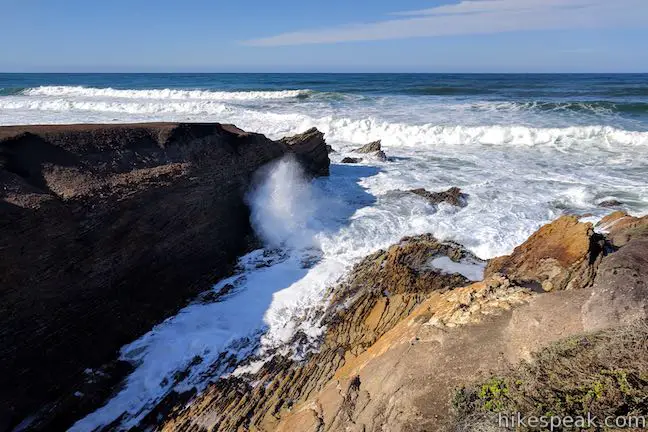
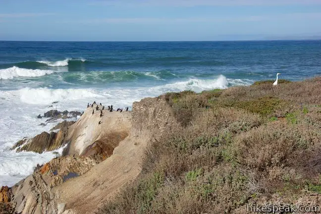
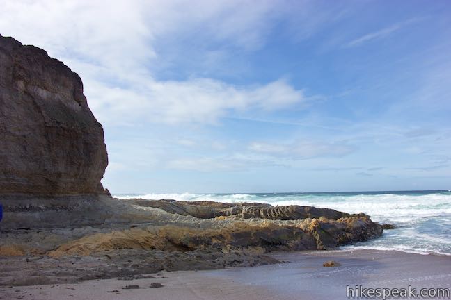
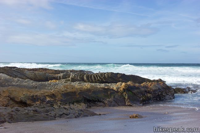
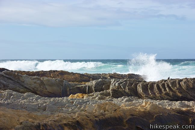
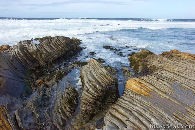
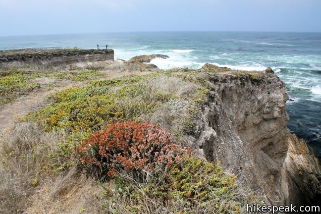
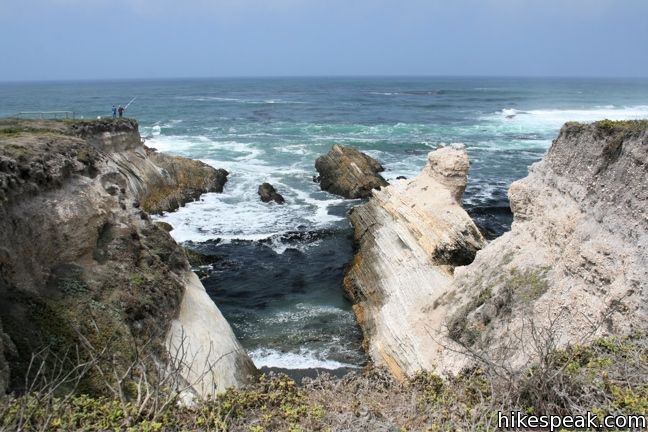
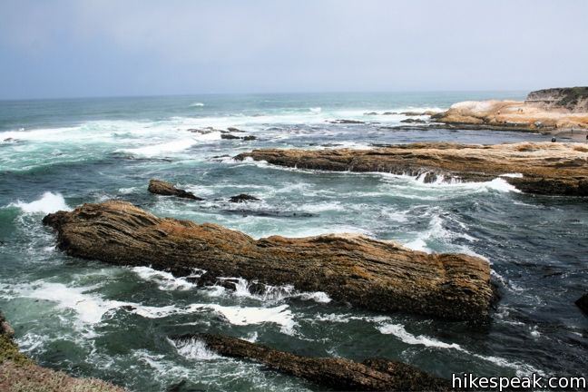
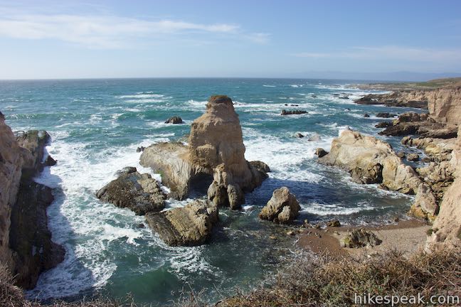
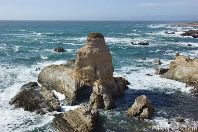
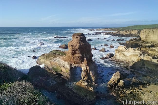
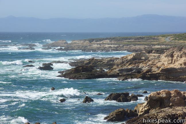
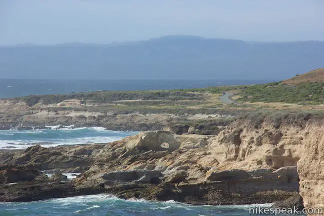
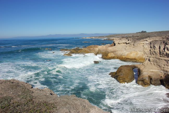
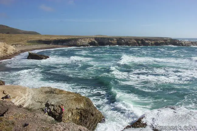
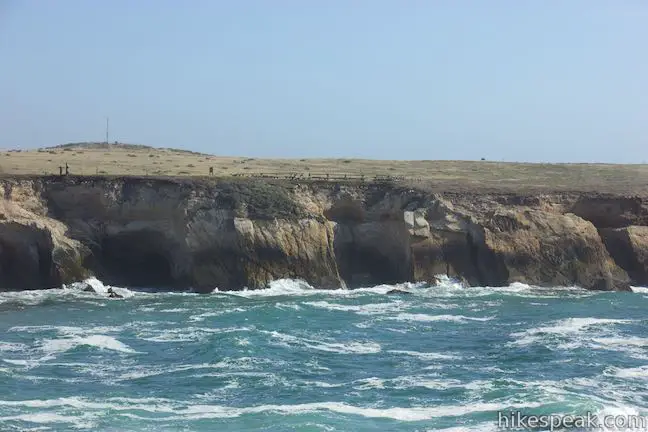
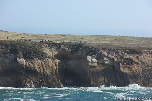
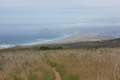
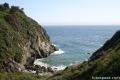
Beyond Quarry Cove, the coastline somehow continues to become more dramatic, leading up to Grotto Rock, one of the more wondrous wonders along this wonderful coast. Pass through a junction a short distance past Quarry Cove with a trail heading to the left up to Pecho Valley Road. At 0.35 miles from Quarry Cove, you will spot Grotto Rock, a tall stone island standing resolute within a rocky cove. Grotto Rock has fought valiantly against the ceaseless forces of the ocean waves and incredible cavernous waterways cut through the base of Grotto Rock allow waves to flow right through dark tunnels. Somehow Grotto Rock has avoided crumbling into the sea. It is an impressive formation, and a highlight of the hike. Take the footpath along the point south of Grotto Rock to gain the best perspective.
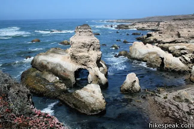
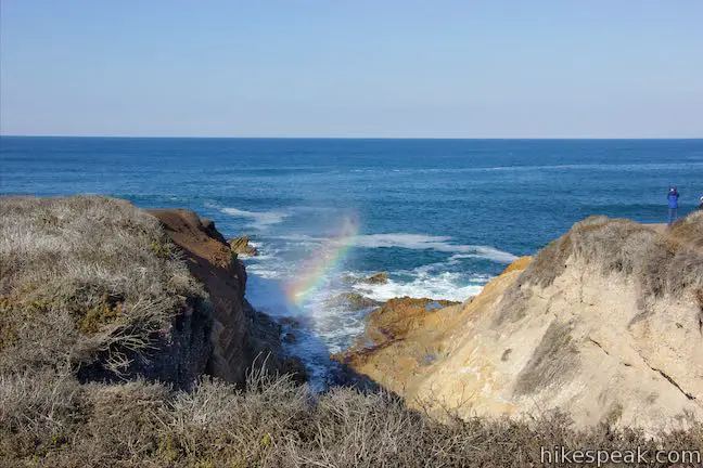
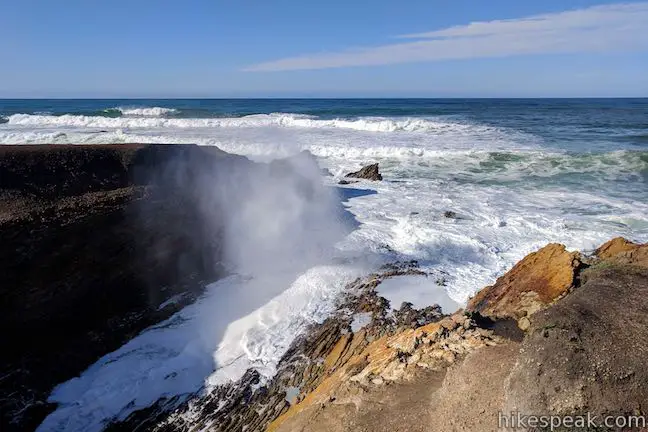
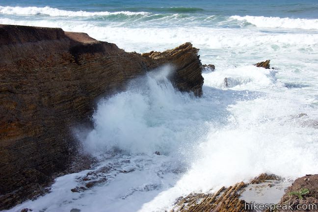
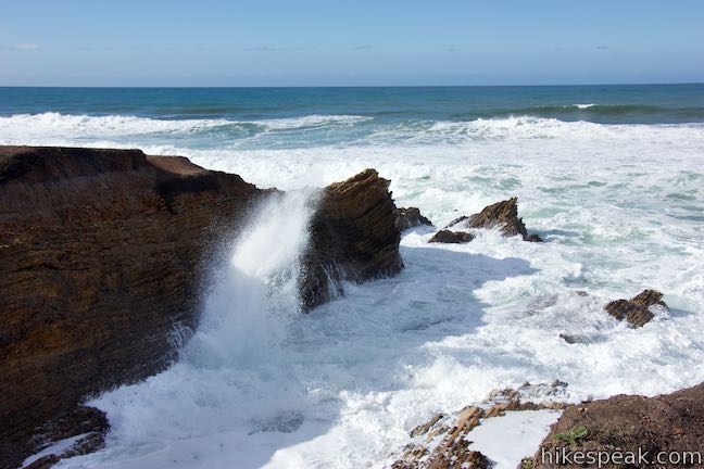
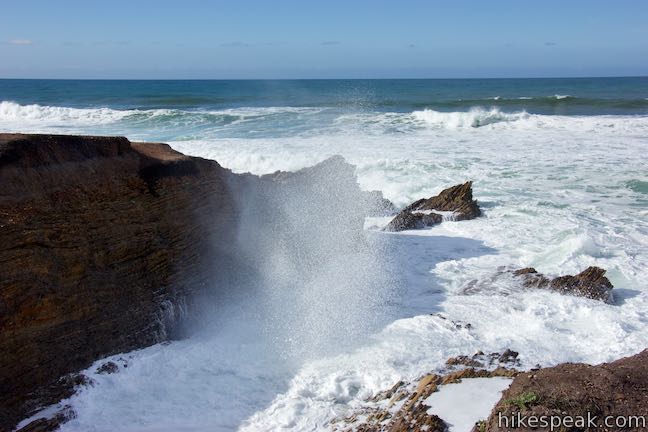
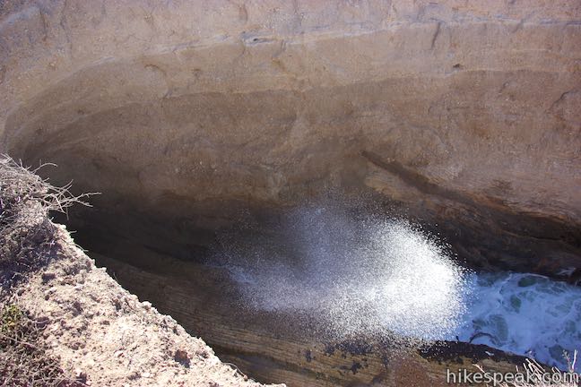
Looking at the coastline surrounding Grotto Rock, you’ll spot natural bridges carved into the coastal points. The pounding waves have cut several deep channels into the bluffs. In certain conditions, you might even spot a blowhole in the channel just south of Grotto Rock. If the tide and currents are aligned, this is yet another striking feature along the Bluff Trail.
Note: an even better blowhole can appear near the start of Bluff Trail during specific conditions (photos and video below).
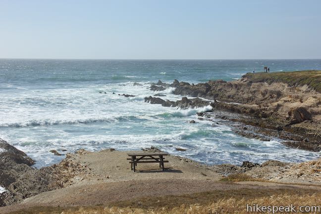
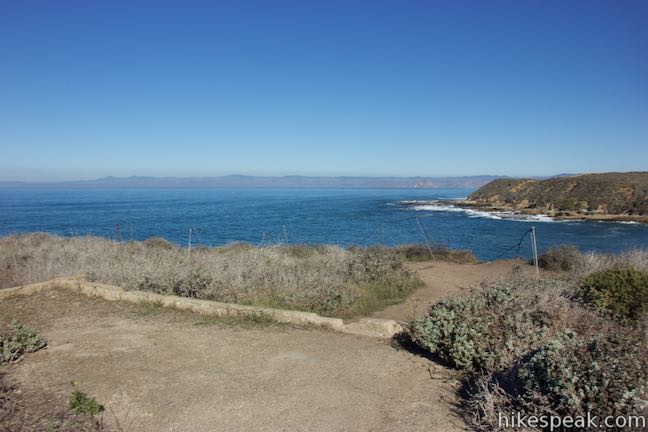
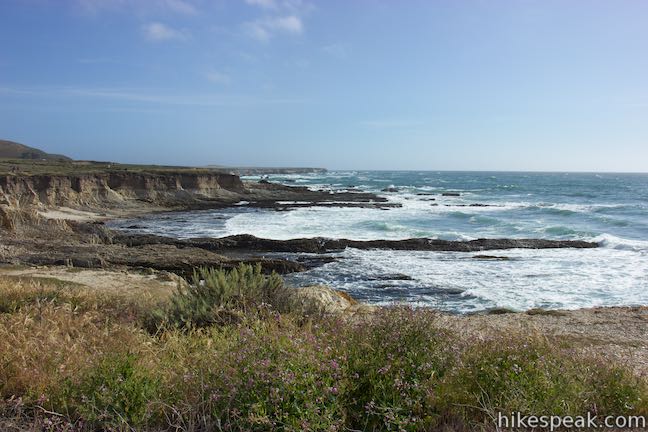
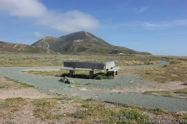
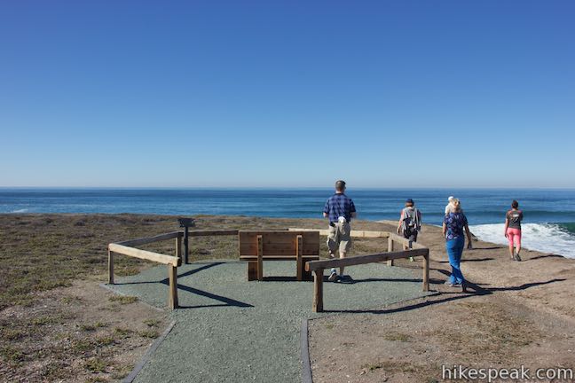
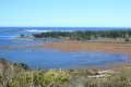
A quarter mile past Grotto Rock, and 1.5 miles or more from the start, Bluff Trail comes to one last viewpoint. At a V-shaped pair of benches, take a path off the bluff trail out to the southernmost overlook. From this promontory, you can look south across Coon Creek Beach toward a sinkhole on Point Buchon Trail that has created a large bridge in the bluffs.
The Bluff Trail continues for another 0.6 miles, but it heads away from the coast, making this a good spot to turn around. If you took the spur down to Corallina Cove, you’ll reach the southernmost overlook after hiking about 1.7 miles. Hike just under a mile back to the junction along the ravine inland of Corallina Cove and then bear right to take the inland route back to the start for a three mile round trip hike.
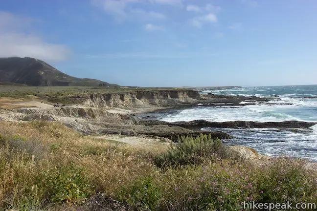
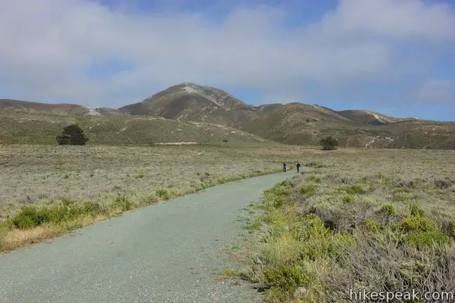
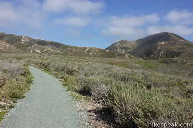
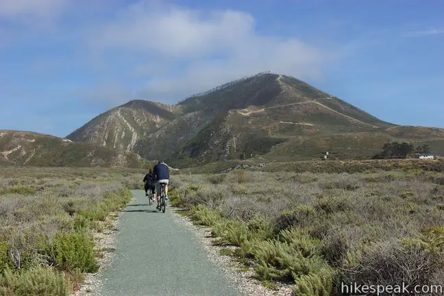
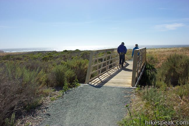
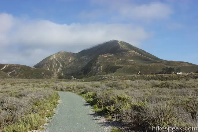
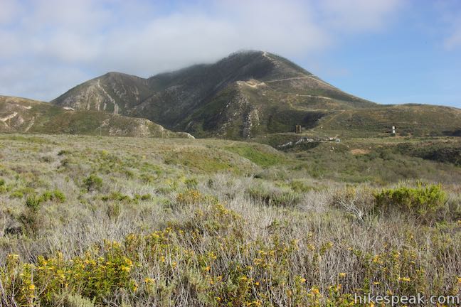
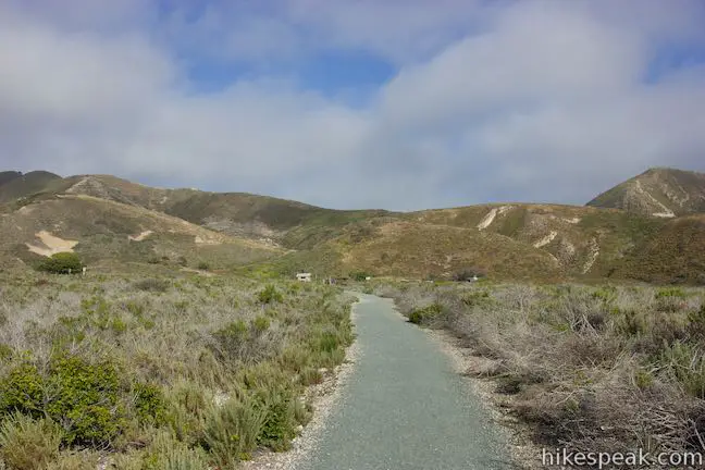
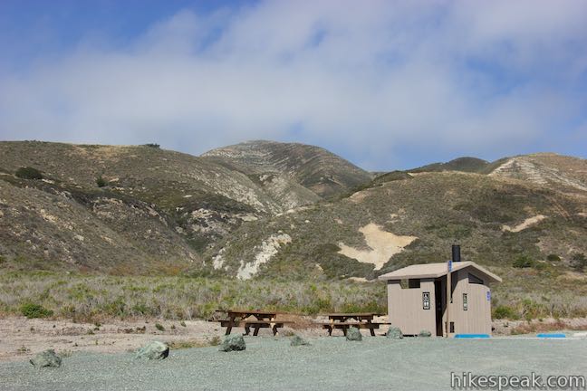
To go all the way to the end of the Bluff Trail, proceed past the V-shaped bench on the wide trail, which turns inland and crosses two bridges, rising steadily toward a trailhead on Pecho Valley Road at the southern end of the park. Over this final stretch of the trail, enjoy nice views of Valencia Peak and the tall ridge on the south side of Coon Creek Canyon. The Bluff Trail ends at Pecho Valley Road beside picnic tables, a bathroom, and additional trails. From the south end of the Bluff Trail, hikers could continue heading inland on Coon Creek Trail or venture south beyond the park boundary on Point Buchon Trail. From the end of the Bluff Trail, it is 2.1 miles back to the start (or 1.9 miles back if you opt for the shorter loop trail). The coastal views are excellent in the opposite direction.
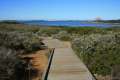
There is less than a hundred feet of elevation change over Montaña de Oro’s Bluff Trail going down to the southernmost overlook. Even if you hike to the very end of the Bluff Trail, there is only 140 feet of elevation change, making the trail suitable for hikers of all abilities. Recent improvements have made the Bluff Trail wheelchair-friendly. The great scenery makes it appealing to everyone. For those interested in spending more time in the park, Montaña de Oro has numerous other trails and a 50-site campground. For a twist on the Bluff Trail, consider Rattlesnake Flats Trail – Badger Trail – Bluff Trail Loop. No fee is charged to visit Montaña de Oro State Park, so get out and enjoy! To visit a second great San Luis Obispo County trail with the same name, hike the Bluff Trail in Fiscalini Ranch Preserve.
Directions to the Trailhead
- From San Luis Obispo, exit Highway 101 at Los Osos Valley Road and drive a total of fifteen miles northwest toward Montaña de Oro State Park.
- After 11.2 miles Los Osos Valley Road becomes Pecho Valley Road and turns sharply to the south.
- Continue the final 3.8 miles, entering Montaña de Oro State Park and passing through a eucalyptus grove before reaching the parking area for Bluff Trail, which is on the right side of the road just past the visitor center.
- The trailhead for the steeper hike to Valencia Peak is on the left side of the same parking area.
Trailhead Location
Trailhead address: Pecho Valley Road, Montaña de Oro State Park, Los Osos, CA 93402
Trailhead coordinates: 35.2728, -120.8887 (35° 16′ 22.1″N 120° 53′ 19.3″W)
You may also view a regional map of surrounding Central Coast trails and campgrounds.


 | Valencia Peak Trail This 4.5-mile hike summits a 1,347-foot peak with stunning views over Montaña de Oro. |
 | Rattlesnake Flats Trail – Badger Trail – Bluff Trail Loop This 1 2/3-mile hike offers a twist on the Bluff Trail, going along and just above the coast of Montaña de Oro State Park. |
 | Coon Creek Trail This 5-mile out and back hike ventures up a coastal canyon at the south end of Montaña de Oro State Park. |
 | Point Buchon Trail This 1 1/3 to 6.8-mile hike explores the beautiful coastline south of Montaña de Oro State Park. |
 | Oats Peak Trail This scenic 10.8-mile hike ventures into Montaña de Oro State Park to a panoramic summit. |
 | Reservoir Flats Trail This 2-mile loop delivers fine ocean and canyon views as it explores the bottom of Islay Creek Canyon in Montaña de Oro State Park. |
 | Islay Creek Trail This easy 6-mile round trip hike follows a wide trail up a coastal canyon flanked by thousand-foot peaks, passing a small waterfall to reach an abandoned barn. |
 | Hazard Peak Trail This 6-mile round trip hike ascends coastal ridges to a 1,076-foot summit with panoramic views that include a dynamic perspective of Morro Bay. |
 | Hazard Peak - Islay Creek Loop This 9.2 mile loop continues beyond Hazard Peak deeper into Montana de Oro before circling back on Islay Creek Trail. |
 | South Dune Trail – Bloody Nose Trail – Hiedra Trail – Hazard Peak Trail Loop This 2 2/3-mile loop combines four trails through dunes and eucalyptus trees to lovely coastal views. |
 | Dune Trail to Hazard Canyon Reef This one-mile hike in Montaña de Oro State Park descends an oceanfront ravine to a rocky shoreline graced with engaging tide pools. |
 | Morro Dunes Ecological Reserve This 2.6-mile loop serves up panoramic views over Morro Bay as it ascends 800 feet from Los Osos to Montaña de Oro State Park. |
 | Elfin Forest Natural Reserve This easy 1-mile loop on a boardwalk explores a pygmy forest on the edge of Morro Bay. |
 | Cerro Cabrillo This tough 2.5-mile hike summits the highest mountain in Morro Bay State Park, a 911-foot member of the Nine Sisters. |
 | Portola Point This 2-mile loop explores a short hill just east of Morro Estuary in Morro Bay State Park. |
 | More hikes in San Luis Obispo Explore other trails around San Luis Obispo including Morro Bay State Park and the Morros. |
 | Jade Cove and Plaskett Rock Point on the Big Sur coast This 1.5-mile hike is similar to Montaña de Oro's Bluff Trail, crossing scenic bluffs to a prominent point and a small cove. |
 | Partington Cove on the Big Sur coast This 1.5-mile hike visits a cove and a secluded beach. The cove is accessed through a tunnel. |
 | Corral Canyon in Malibu This 2.5-mile loop offers ocean and canyon views from a unspoiled section of the Santa Monica Mountains. |
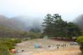 | Islay Creek Campground This 50-site campground is located at the heart of Montaña de Oro State Park in Islay Creek Canyon, and is a great base camp for treks in the park. |
- Bluff Trail in California's Coastal Parks: A Day Hiker's Guide by John McKinney (opens in a new tab)
- Bluff Trail on californiacoastaltrail.com (opens in a new tab)
- Montaña de Oro State Park on summitpost.org (opens in a new tab)
- Montaña de Oro State Park on wikipedia.org (opens in a new tab)
- The official website for Montaña de Oro State Park (opens in a new tab)
Common Questions about Bluff Trail in Montaña de Oro State Park
- Is the trail open?
- Yes. You should expect to find that Bluff Trail is open. There are no recent reports of trail closures. If you discover that the trail is closed, please help your fellow hikers by reporting a closure.
- Is this trail free to access?
- Yes, Bluff Trail is free to access. No entrance fee, pass, or permit is required. If you discover that access rules have changed, please provide feedback on your experience.
- How much time does this hike take?
- It takes approximately 1 hour 15 minutes to hike Bluff Trail. Individual hiking times vary. Add extra time for breaks and taking in the views.
- How long is this hike?
- The hike to Bluff Trail is a 3 mile out and back with 90 feet of elevation change.
- Are dogs allowed on this trail?
- No, dogs are likely not allowed on Bluff Trail. The trail is primarily open to hikers, bikes.
- Are there ocean views on this hike?
- Yes, Bluff Trail offers views of the ocean.
- Is this trail wheelchair accessible?
- Yes, Bluff Trail is designated as wheelchair-friendly.
- Where is the trailhead located?
- The trailhead for Bluff Trail is located in Los Osos, CA.
Trailhead Address:
Pecho Valley Road
Los Osos, CA 93402
Trailhead Coordinates:
35.272858, -120.888755 - What are the driving directions to the start of the hike?
To get to the trailhead: From San Luis Obispo, exit Highway 101 at Los Osos Valley Road and drive a total of fifteen miles northwest toward Montaña de Oro State Park. After 11.2 miles Los Osos Valley Road becomes Pecho Valley Road and turns sharply to the south. Continue the final 3.8 miles, entering Montaña de Oro State Park and passing through a eucalyptus grove before reaching the parking area for Bluff Trail, which is on the right side of the road just past the visitor center. The trailhead for the steeper hike to Valencia Peak is on the left side of the same parking area.
View custom Google Maps directions from your current location.
- Are there other trails near Bluff Trail?
- Yes, you can find other nearby hikes using the Hikespeak Hike Finder Map.

14 Comments on Bluff Trail in Montaña de Oro State Park
What hikers are saying:
✨ Generated summary of user commentsHikers find this flat, ADA-accessible path to be a photographer's paradise with mesmerizing views of crashing waves and turquoise tide pools. The trail is easy and charming. Kash advises staying on the designated path to avoid the poison ivy that grows throughout the area.
“The views of the waves crashing against the bluffs and rocks below are just mesmerizing.” Jump to comment ↓
[…] Carolina Cove in Montana de Oro State Park […]
[…] Obispo area. The second hike is at Montana De Oro State Park. Beach lovers, this hike is for you! Montana De Oro is located near Morro Bay, a area just a few miles north of San Luis Obispo. The area has hikes, […]
[…] to check out each week. The first trail is my favorite trail so far at Montaña de Oro. It is the Bluff Trail and is 2.1 miles right along the ocean. This trail is exceptionally breathtaking. Running along […]
You are absolutely right. This trail is amazing. Very easy and yet charming! Thanks for recommending it.
[…] the road back) and it runs along the edge of the coastal Bluffs that overlook the ocean. This Bluff Trail (as it is actually called) has breathtaking views of ocean, coves, hills, and foothills and is a […]
Please, can you update site to include the extensive Bluff Trail closures and the timing thereof. Thank you.
I have never hiked before but it is something i really want to do…i am making a trip to pismo beach 3/7 and i would like a trail that will be not be to difficult first timer but has lots to see and i do not own hiking gear..do i need anything special? and which trail would be best for a first timer…i want to see lots of trees and greenery like a forest?
I’d like to get feedback from environmentally conscious users about the renovations. I almost cried I thought they are so ugly. They appear to be ruining this trail. We need to start a petition to mitigate the changes.
The Bluff Trail is one of the best things I have seen. Just amazing views and places to play/rest and absorb the nature. Stay on the trail because there is poison ivy everywhere. Nothing to worry, if you stay on the trail.
Thank you so much hikespeak.com for putting pictures and describing how to get there.
Bluff trail is open and ADA accessible. Trail work is done and areas that were disturbed are being restored. Fabulous trail and one of the more popular trails in the park. Easy and flat with spectacular views.
Can you take dogs on the bluff trail?
Hi-
Dogs are not allowed on the Bluff Trail.
Horses are but dogs on a leash are not?? Dumb !!!
A very easy over four mile trail along the bluffs of the Pacific Ocean. There is a four foot wide gravel trail about ten feet from the bluff edge that you can use. This path is used allot by the resident trail runners, bikers, and exercise walkers. Then there is the trail that runs right up to the edge of the bluffs. The views of the waves crashing against the bluffs and rocks below are just mesmerizing. There are so many whites, blues, and turquoises. Always changing with the crash of the waves. This is just a beautiful place and a photographers paradise. I had real hard time just to keeping walking and not stopping all the time to take that better picture. About a mile into the trail you come to the only access to the beach on this trail. It leads you down to tide pools that form in the rocks at low tide. The North end entrance of the trail begins at Spooner’s Cove. A large beach area that you have to swim, sun bath, and launch your kayak. The bluff trail is located in the Montania de Oro State Park. This is a trail you can travel in an hour and a half, or spend hours looking at the beauty that had been given us. A must see.