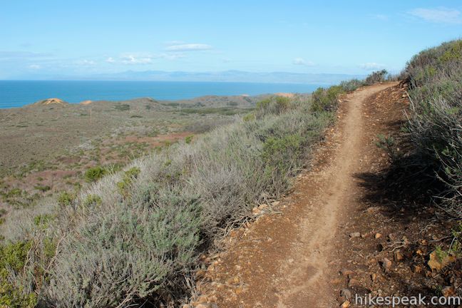
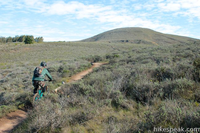
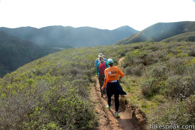
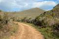
The hike up and down Hazard Peak Trail delivers a heavy dose of ocean views. While it could be argued that this 6-mile round trip hike is the finest trek to the summit of Hazard Peak, you may wish to consider elongating that hike to a 9.2-mile loop that returns to the coast via Islay Creek Trail in the adjacent Islay Creek Canyon. Sacrificing a second helping of ocean views, the loop explores the secluded interior of Montaña de Oro State Park and finishes with a cool down on a wide, gradual trail in a canyon flanked by thousand foot peaks (including the 1,076-foot Hazard Peak).
The high and low points on Hazard Peak – Islay Creek Loop are separated by 100 feet, with two major climbs of 950 feet and 270 feet. The loop starts with a 950-foot ascent over 3 miles, attaining the summit of Hazard Peak. After that, you will descend 325 feet toward a fork of Hazard Canyon. Turning uphill again, the loop climbs 270 feet over 0.85 miles to the crest of Barranca Trail, before descending 675 feet into Islay Creek Canyon over 1.05 miles. Finish with gradual rolling terrain down Islay Creek Canyon for 2.85 miles.
While this loop employs a total of five trails (and a short stretch of Pecho Valley Road), you’ll spend most of the time on just two trails, Hazard Peak Trail and Islay Creek Trail. You will turn right at each well-marked junction.
The basic directions for Hazard Peak – Islay Creek Loop are:
- Start up Hazard Peak Trail (0 miles)
- Pass through a junction with Hiedra Trail (1.07 miles)
- Turn right on a spur to the top of Hazard Peak (3 miles)
- Continue east on Hazard Peak Trail (3.05 miles)
- Turn right on Manzanita Trail (4.3 miles)
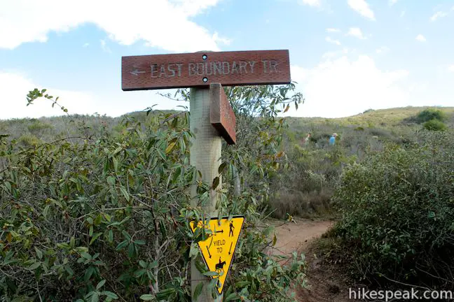
- Turn right on East Boundary Trail (4.4 miles)
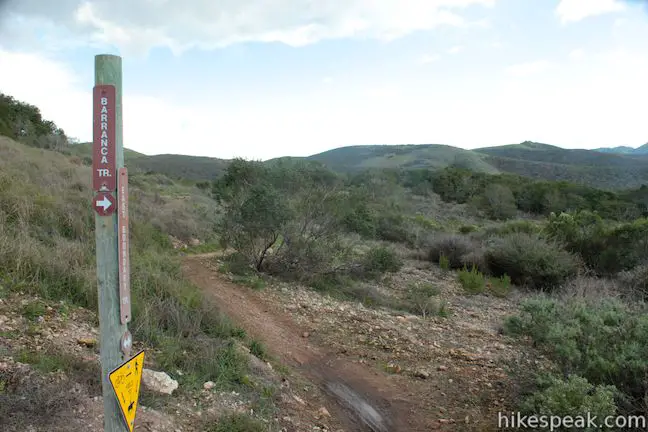
- Turn right on Barranca Trail (4.85 miles)
- Turn left up a spur to the top of the ridge on Barranca Trail (5.25 miles)
- Continue down Barranca Trail
- Turn right on Islay Creek Trail (6.3 miles)
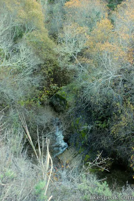
- Pass a small waterfall (7.75 miles)
- Pass through a junction with Reservoir Flats Trail (8 miles)
- Reach the bottom of Islay Creek Trail (9.1 miles)
- Turn right up Pecho Valley Road to return to the Hazard Peak Trailhead (9.2 miles)
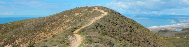
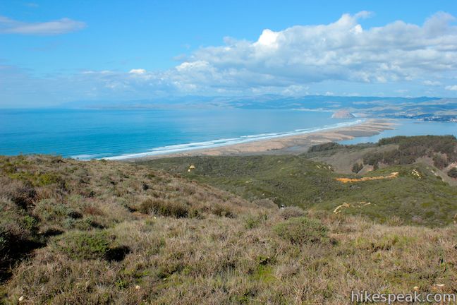
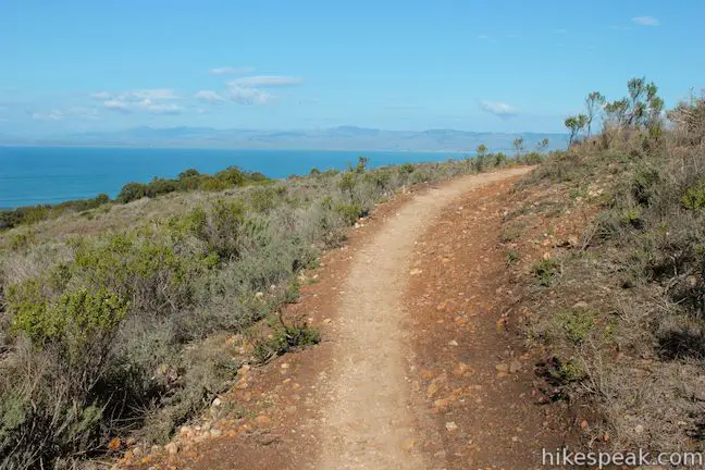
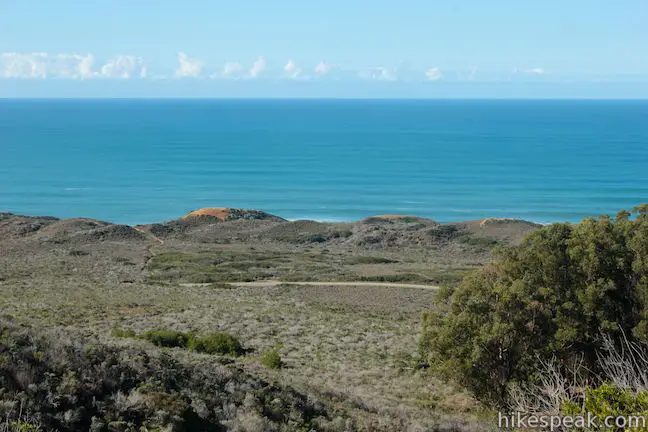
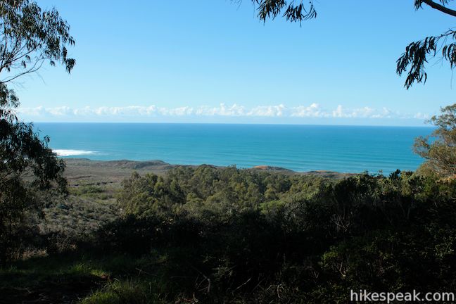
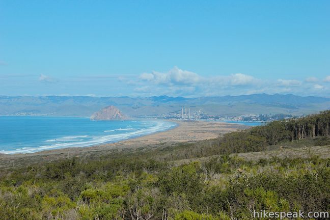
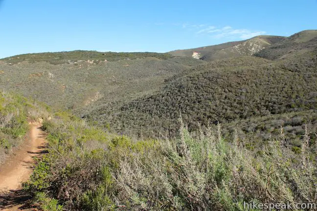
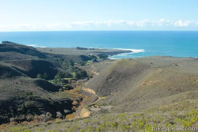
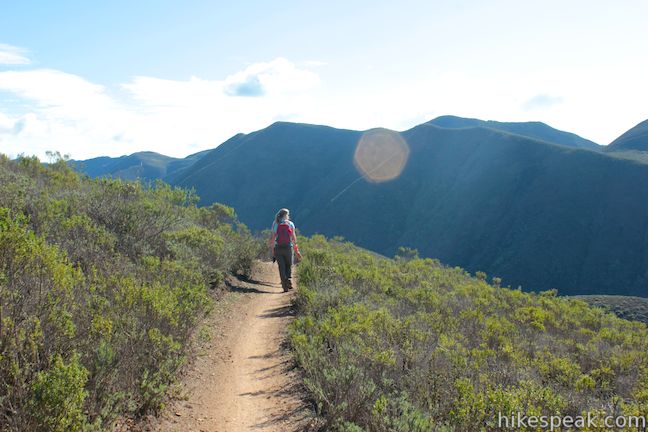
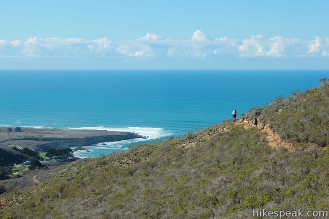
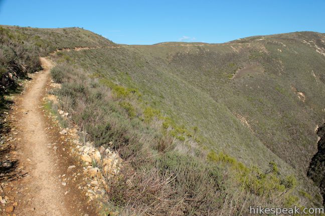
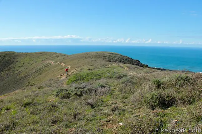
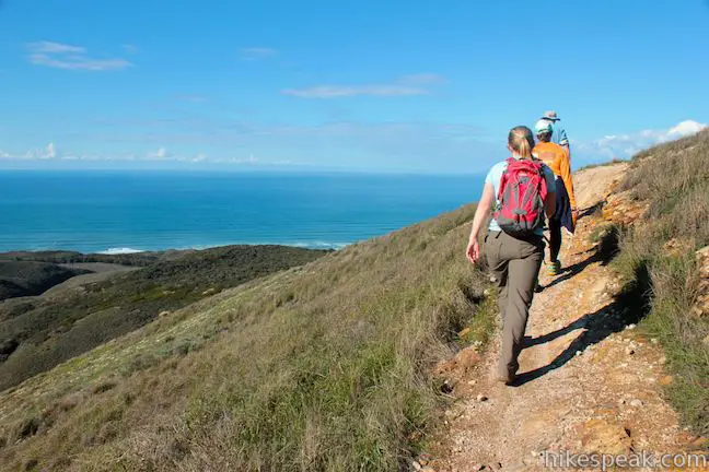
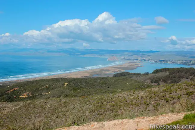
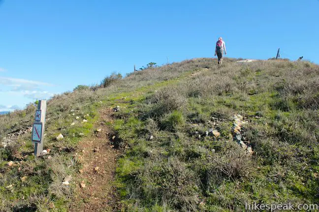
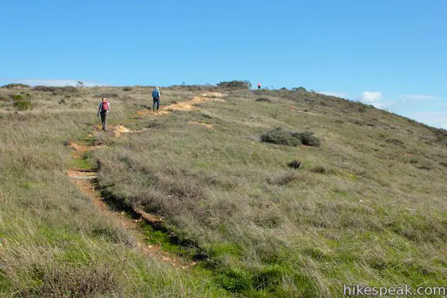
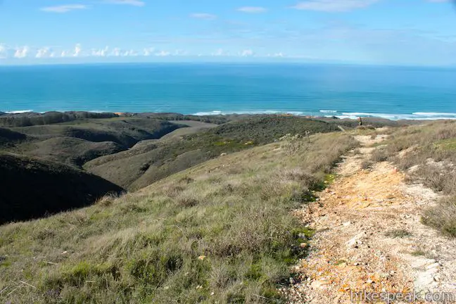
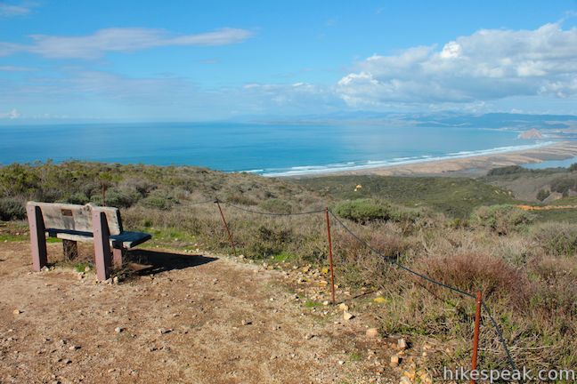
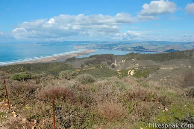
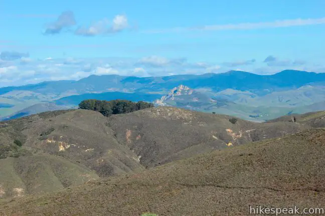
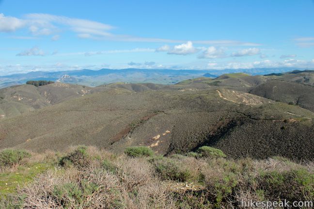
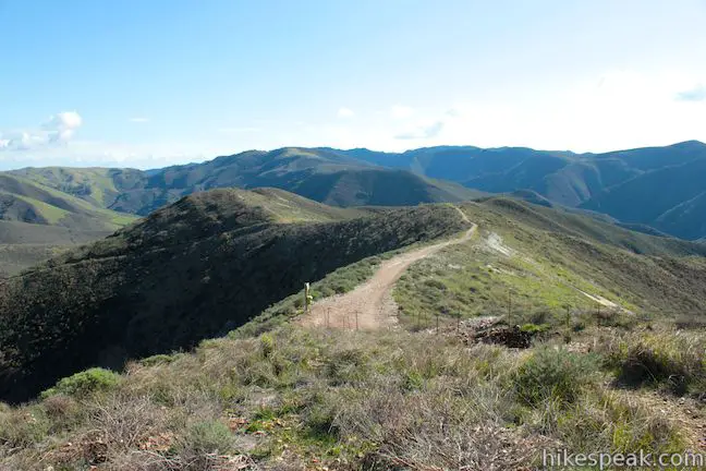
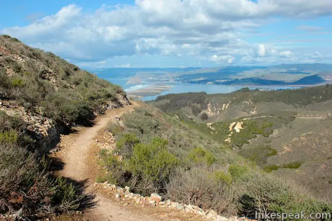
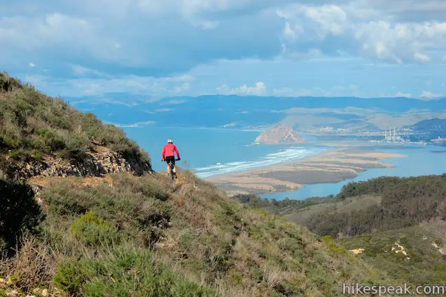
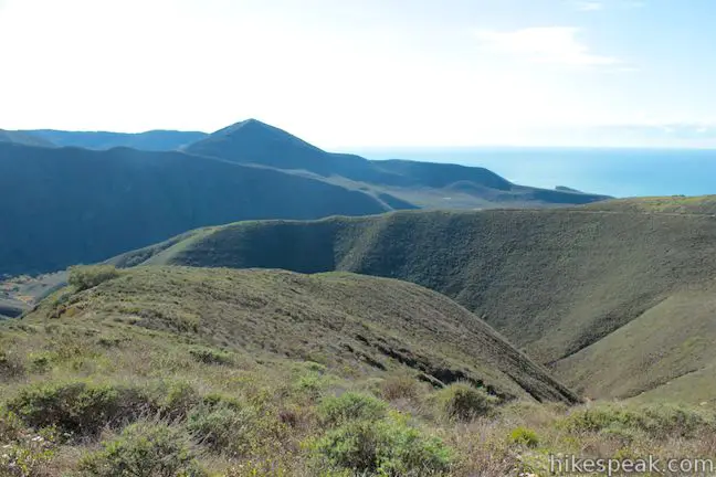
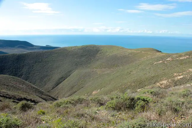
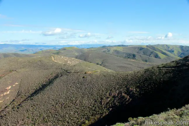
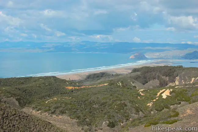
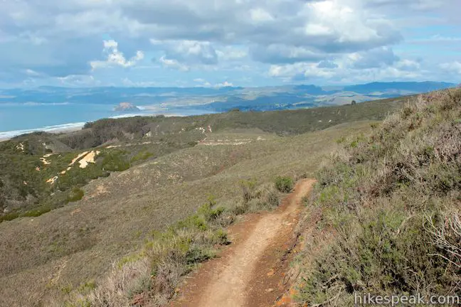
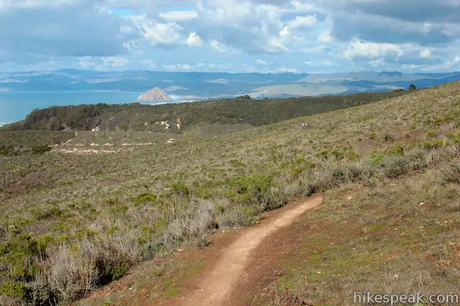
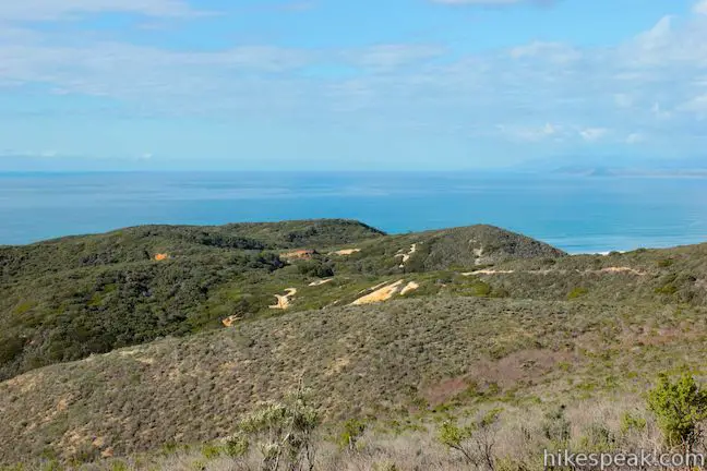
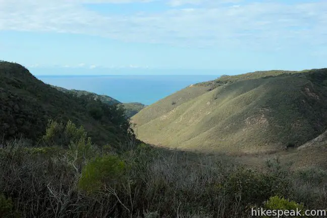
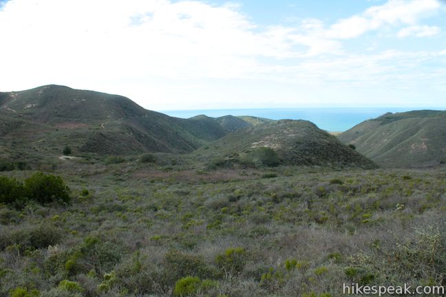
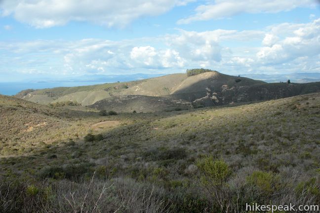
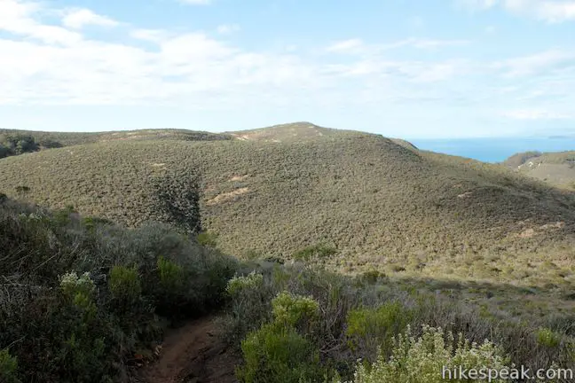
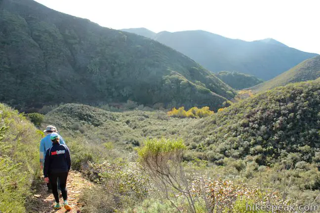
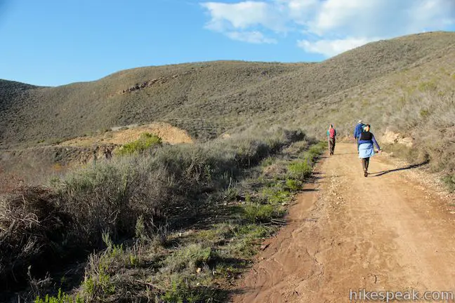
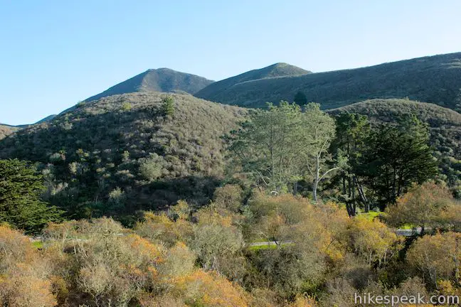
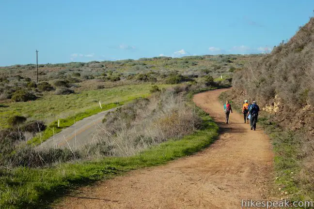
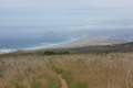
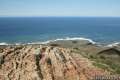
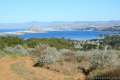
The first leg of the loop up Hazard Peak Trail delivers exceptional ocean views. The summit has 360-degree views, but your eyes will likely be drawn north toward the postcard perspective of Morro Bay. Beyond the summit, continue east on Hazard Peak Trail, heading deeper into the Irish Hills in Montaña de Oro State Park. You will see fewer hikers and mountain bikers from this point on.
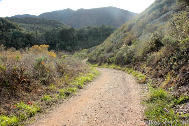
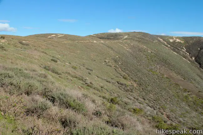
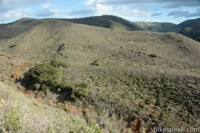
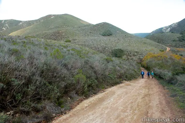
Hazard Peak Trail descends a long ridge that bends northeast toward Hazard Canyon. Gradually descending on the north side of the ridge, you will have continuous views toward Morro Bay.
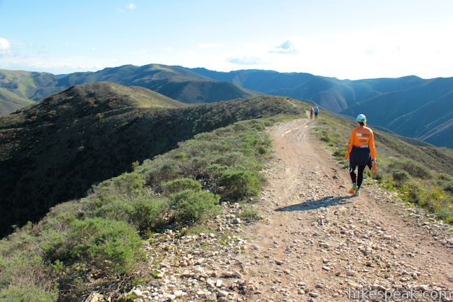
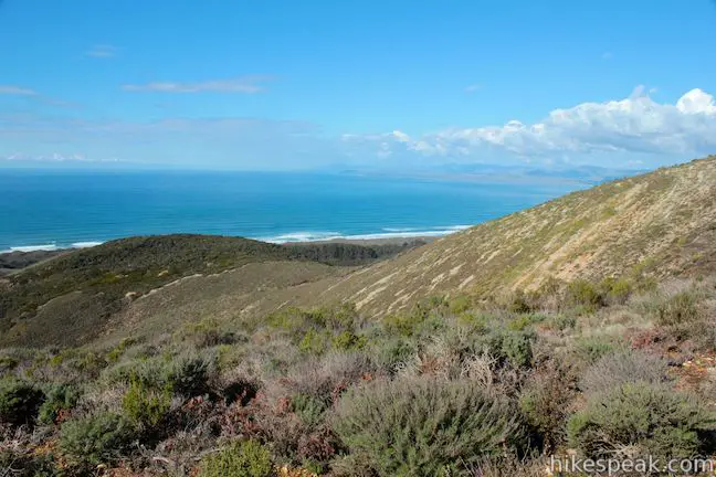
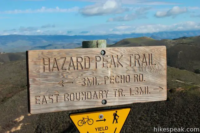
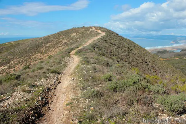
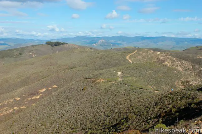
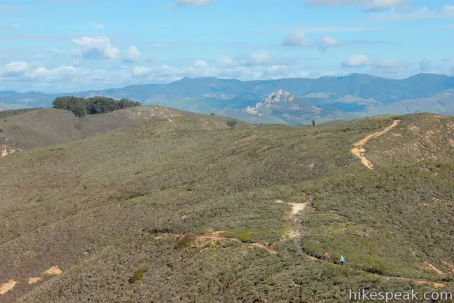
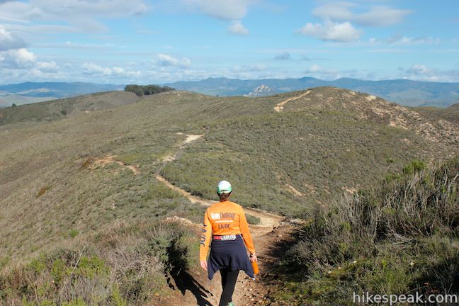
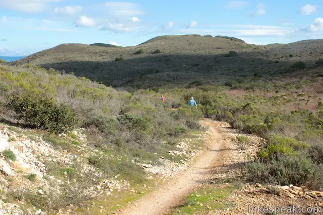
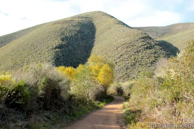
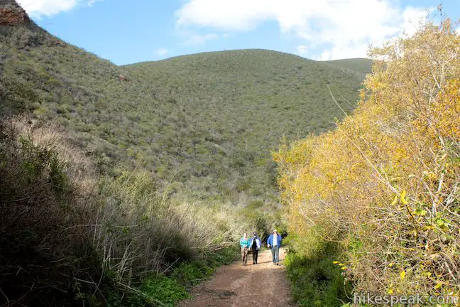
Hazard Peak Trail ends, 4.3 miles from the start, at a junction with Manzanita Trail. Turn right, following a sign for East Boundary Trail, which you will reach after 0.1 miles. Turn right again and begin up a series of incredibly gradual switchbacks. As you ascend, you will get a nice view west toward Hazard Canyon and Hazard Peak.
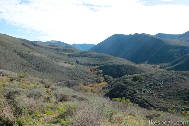
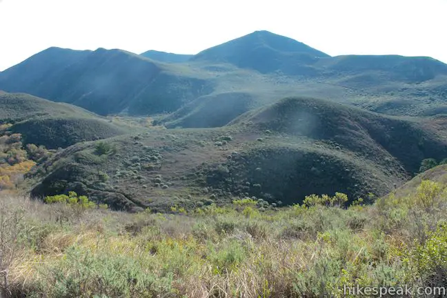
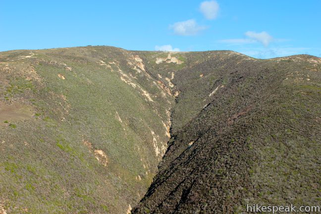
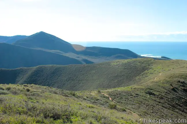
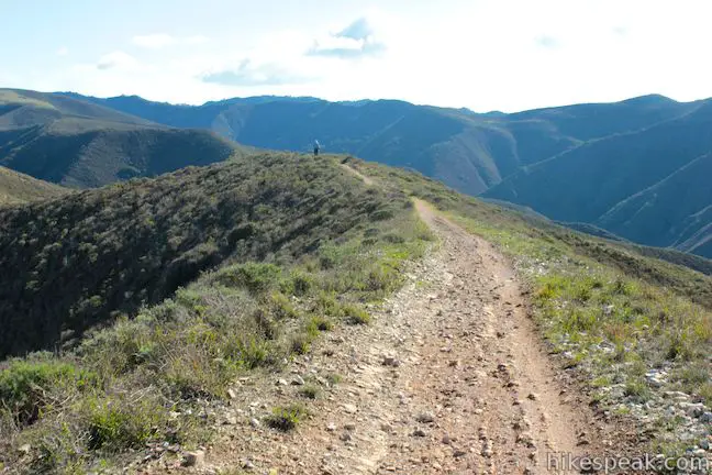
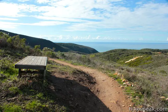
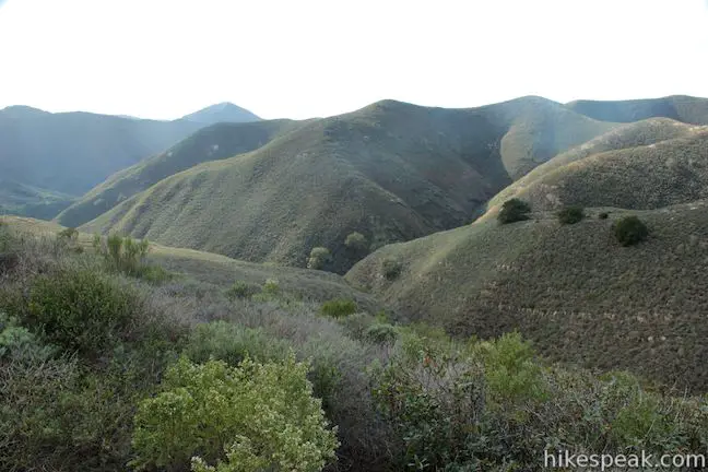
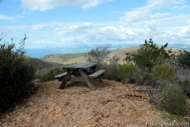
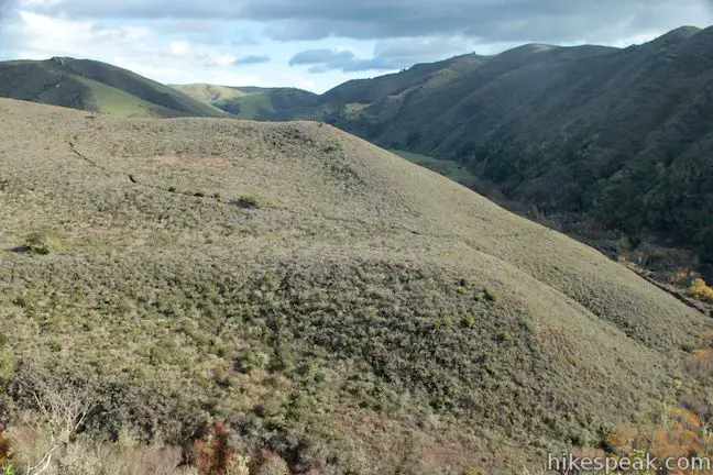
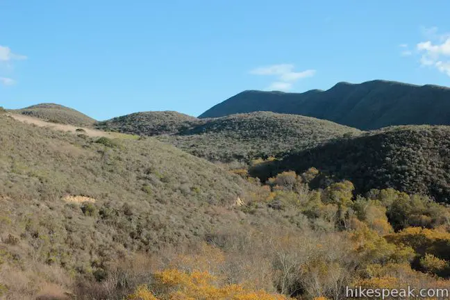
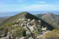
After 0.45 miles on East Boundary Trail you will come to a marked junction with Barranca Trail. Turn right and take this trail over an isolated ridge that will drop you into Islay Creek Canyon. The trail climbs for 0.35 miles to a spur trail on the left leading to the 1,022-foot high point of the ridge. There is a picnic table at the top with an inviting view to the northwest.
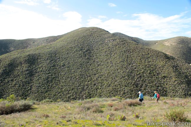
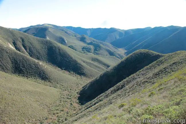
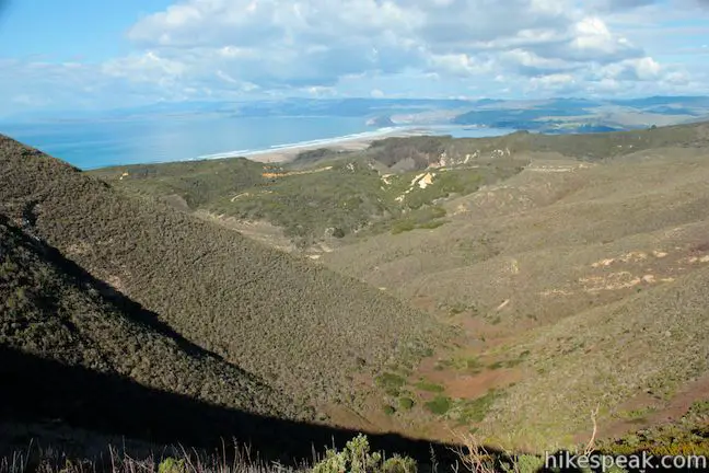
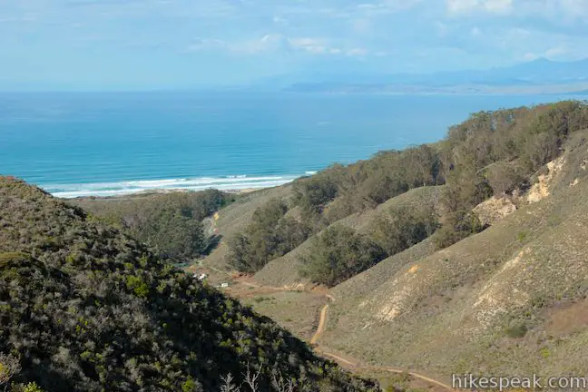
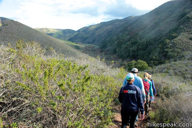
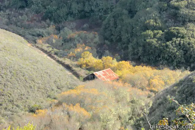
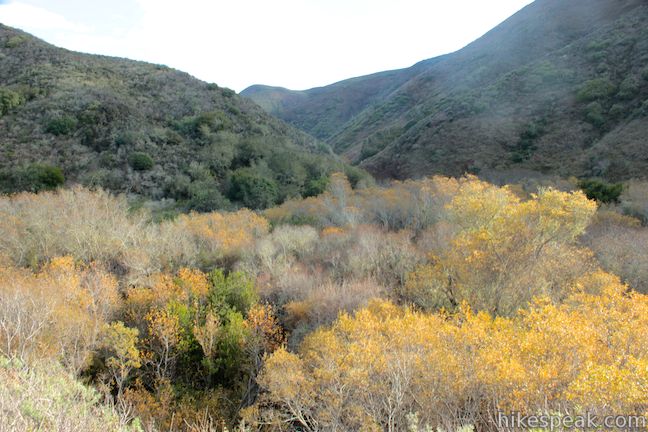
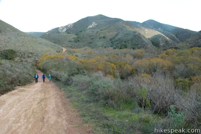
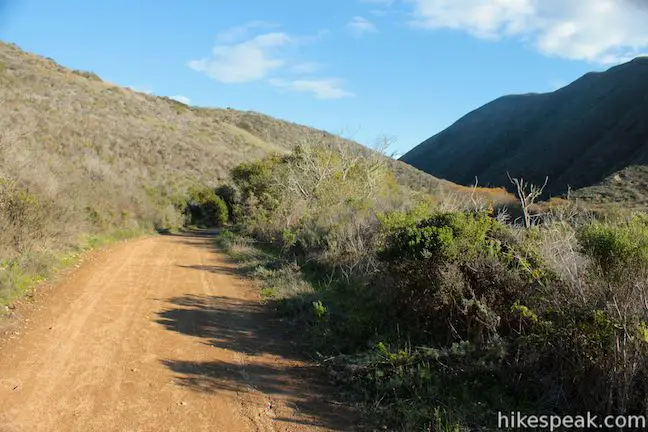
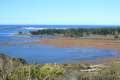
Continue down Barranca Trail, which descends 1.05 miles of rather steep switchbacks into Islay Creek Canyon. You will have big open views up and down the canyon as you hike. Just up the canyon from Barranca Trail you will spot the tin roof of an old bard surrounded by a grove of sycamores.
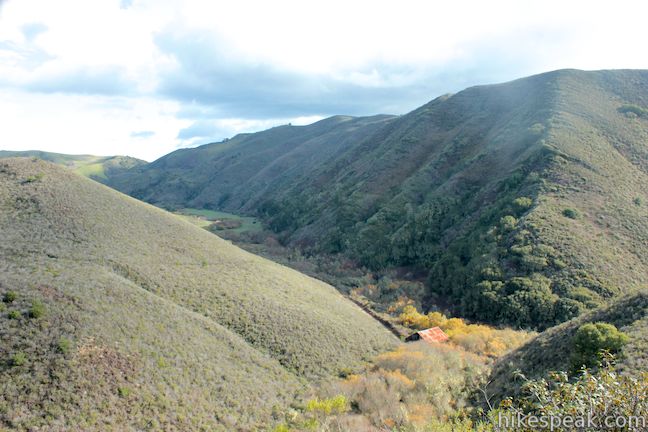
When you reach the bottom of Barranca Trail, you can turn left and hike a short distance up to the barn. Otherwise turn right and hike 2.8 miles down Islay Creek Trail. The wide dirt road provides a relaxing stroll for your tired legs. The trail parallels Islay Creek. About halfway back to the trailhead, you may hear the sound of tumbling water. Look down on Islay Creek where you will spot a small waterfall tumbling over a ledge within the sycamores.
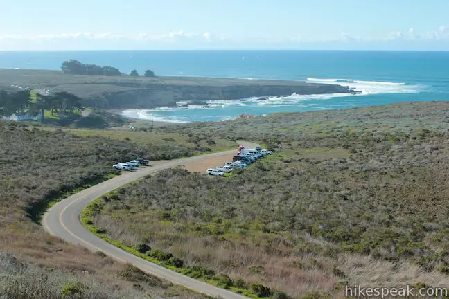
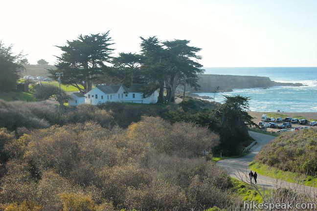
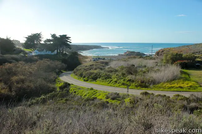
Islay Creek Trail comes to an end on Pecho Valley Road just north of Spooner’s Cove and 0.1 miles south of the Hazard Peak Trailhead. Turn right and hike up the shoulder of the road to return to your vehicle and close the loop.
Note: Several old trail guides put the distance of this loop at 8 miles, using a “Ridge Trail” to cross Hazard Peak. The path of the old Ridge Trail is still evident, but has been closed for restoration. The new Hazard Peak Trail presents a longer hike.
Directions to the Trailhead
- From San Luis Obispo, exit Highway 101 at Los Osos Valley Road and drive northwest toward Los Osos.
- After 11.2 miles, Los Osos Valley Road becomes Pecho Valley Road and turns sharply to the south.
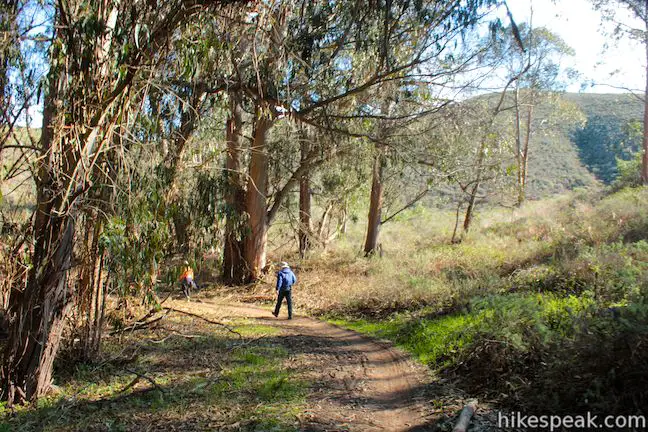
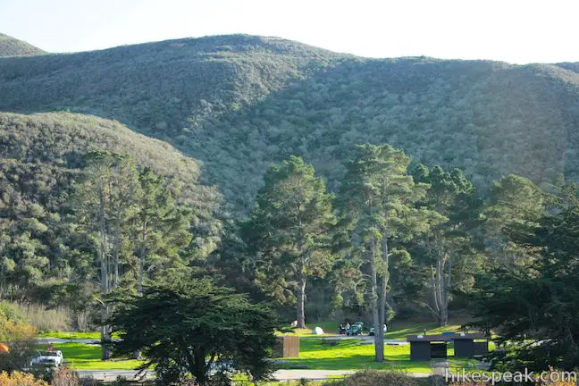
- Continue the final 3.2 miles, entering Montaña de Oro State Park and passing through a eucalyptus grove before reaching the trailhead for Hazard Peak on the left, just before Spooner's Cove and the trailhead for Islay Creek Trail.
- There is parking on both sides of the road.
Trailhead Location
Trailhead address: Pecho Valley Road, Montaña de Oro State Park, Los Osos, CA 93402
Trailhead coordinates: 35.277106, -120.884546 (35° 16′ 37.58″N 120° 53′ 04.36″W)
View Montaña de Oro State Park in a larger map
Or view a regional map of surrounding Central Coast trails and campgrounds.


 | Hazard Peak Trail This 6-mile round trip hike ascends coastal ridges to a 1,076-foot summit with panoramic views that include a dynamic perspective of Morro Bay. |
 | Islay Creek Trail This easy 6-mile round trip hike follows a wide trail up a coastal canyon flanked by thousand-foot peaks, passing a small waterfall to reach an abandoned barn. |
 | South Dune Trail – Bloody Nose Trail – Hiedra Trail – Hazard Peak Trail Loop This 2 2/3-mile loop combines four trails through dunes and eucalyptus trees to lovely coastal views. |
 | Reservoir Flats Trail This 2-mile loop delivers fine ocean and canyon views as it explores the bottom of Islay Creek Canyon in Montaña de Oro State Park. |
 | Oats Peak Trail This scenic 10.8-mile hike ventures into Montaña de Oro State Park to a panoramic summit. |
 | Valencia Peak Trail This 4.5-mile hike summits a 1,347-foot peak with stunning views over Montaña de Oro. |
 | Bluff Trail This hike of around three miles tours tide pools, beaches, and impressive cliffs along the picturesque coast of Montaña de Oro State Park. |
 | Rattlesnake Flats Trail – Badger Trail – Bluff Trail Loop This 1 2/3-mile hike offers a twist on the Bluff Trail, going along and just above the coast of Montaña de Oro State Park. |
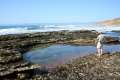 | Dune Trail to Hazard Canyon Reef This one-mile hike in Montaña de Oro State Park descends an oceanfront ravine to a rocky shoreline graced with engaging tide pools. |
 | Coon Creek Trail This 5-mile out and back hike ventures up a coastal canyon at the south end of Montaña de Oro State Park. |
 | Point Buchon Trail This 1 1/3 to 6.8-mile hike explores the beautiful coastline south of Montaña de Oro State Park. |
 | Morro Dunes Ecological Reserve This 2.6-mile loop serves up panoramic views over Morro Bay as it ascends 800 feet from Los Osos to Montaña de Oro State Park. |
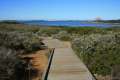 | Elfin Forest Natural Reserve This easy 1-mile loop on a boardwalk explores a pygmy forest on the edge of Morro Bay. |
 | Cerro Cabrillo This tough 2.5-mile hike summits the highest mountain in Morro Bay State Park, a 911-foot member of the Nine Sisters. |
 | Portola Point This 2-mile loop explores a short hill just east of Morro Estuary in Morro Bay State Park. |
 | More hikes in San Luis Obispo Explore other trails around San Luis Obispo including Morro Bay State Park and the Morros. |
 | Islay Creek Campground This 50-site campground is located at the heart of Montaña de Oro State Park in Islay Creek Canyon, and is a great base camp for treks in the park. |
Common Questions about Hazard Peak – Islay Creek Loop in Montaña de Oro State Park
- Is the trail open?
- Yes. You should expect to find that Hazard Peak - Islay Creek Loop is open. There are no recent reports of trail closures. If you discover that the trail is closed, please help your fellow hikers by reporting a closure.
- Is this trail free to access?
- Yes, Hazard Peak - Islay Creek Loop is free to access. No entrance fee, pass, or permit is required. If you discover that access rules have changed, please provide feedback on your experience.
- How much time does this hike take?
- It takes approximately 4 hours 30 minutes to hike Hazard Peak - Islay Creek Loop. Individual hiking times vary. Add extra time for breaks and taking in the views.
- How long is this hike?
- The hike to Hazard Peak - Islay Creek Loop is a 9.2 mile loop with 1000 feet of elevation change.
- Are dogs allowed on this trail?
- No, dogs are likely not allowed on Hazard Peak - Islay Creek Loop. The trail is primarily open to hikers, bikes.
- Is Hazard Peak - Islay Creek Loop a difficult hike?
- This hike should be considered strenuous. Hikers should be prepared for a workout covering 9.2 miles and 1000 feet of climbing.
- Are there ocean views on this hike?
- Yes, Hazard Peak - Islay Creek Loop offers views of the ocean.
- Does this trail go to a summit?
- Yes, Hazard Peak - Islay Creek Loop reaches a summit with panoramic views.
- Where is the trailhead located?
- The trailhead for Hazard Peak - Islay Creek Loop is located in Los Osos, CA.
Trailhead Address:
Pecho Valley Road
Los Osos, CA 93402
Trailhead Coordinates:
35.277106, -120.884546 - What are the driving directions to the start of the hike?
To get to the trailhead: From San Luis Obispo, exit Highway 101 at Los Osos Valley Road and drive northwest toward Los Osos. After 11.2 miles, Los Osos Valley Road becomes Pecho Valley Road and turns sharply to the south. Continue the final 3.2 miles, entering Montaña de Oro State Park and passing through a eucalyptus grove before reaching the trailhead for Hazard Peak on the left, just before Spooner's Cove and the trailhead for Islay Creek Trail. There is parking on both sides of the road.
View custom Google Maps directions from your current location.
- Are there other trails near Hazard Peak - Islay Creek Loop?
- Yes, you can find other nearby hikes using the Hikespeak Hike Finder Map.

[…] to hikespeak.com, Hazard Peak Trail is about six miles round trip and gives a heavy dose of ocean views at the […]
[…] getting back down the mountain. We had originally planned on taking Islay Creek Road based off of this post, but after their warnings, we decided to follow them down, taking a left at Manzanita, riding […]
[…] easy, so we took in the scenery along the Bluff Trail, but you could do a more challenging hike at Hazard Peak or elsewhere in the park if you felt so moved. For the Bluff Trail, we parked along the road just […]