Hazard Peak
in Montaña de Oro State Park
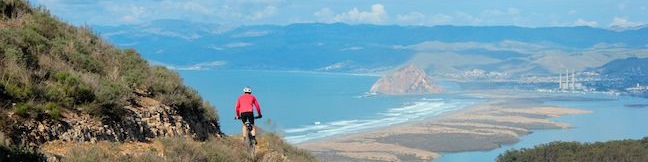
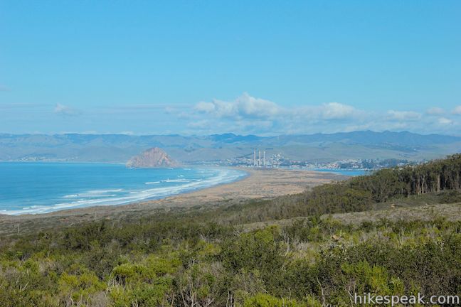
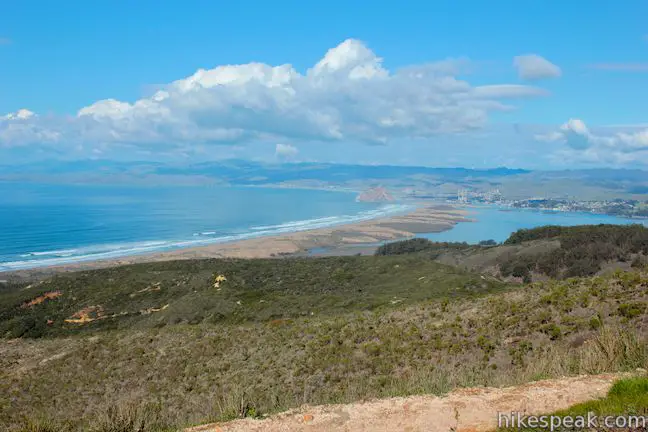
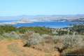
Montaña de Oro State Park is packed with so many picturesque places that it can be difficult to settle on just one day hike. However, if you are looking for broad, unobstructed view over Morro Bay, you should feel compelled to set out for the top of Hazard Peak. Looking north from this coastal 1,076-foot summit, you won’t see anything even half as tall as Hazard Peak for about 15 miles, giving you a full view of the dune-lined coast backed by the iconic Morro Rock. Hazard Peak (named after a previous landowner, Alexander Hazard, and not for some grand danger) has 360-degree views that extend west over the Pacific and east and south over the Irish Hills. The 6-mile round trip hike to the summit spreads plentiful ocean views over a 950-foot climb that is as satisfying as they come.
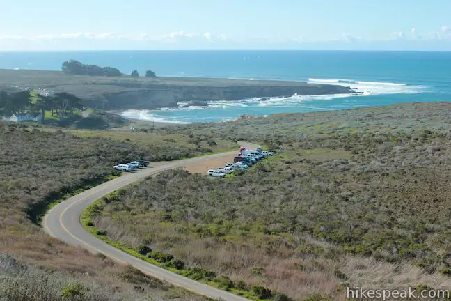
Hazard Peak Trail starts from Pecho Valley Road just north of Spooner’s Cove and Islay Creek Trail, which can actually be used to form a loop with Hazard Peak Trail called Hazard Peak – Islay Creek Loop. Hazard Peak Parking Day Use Area is on the west side of the road (beside South Dune Trail) across from Hazard Peak Trail.
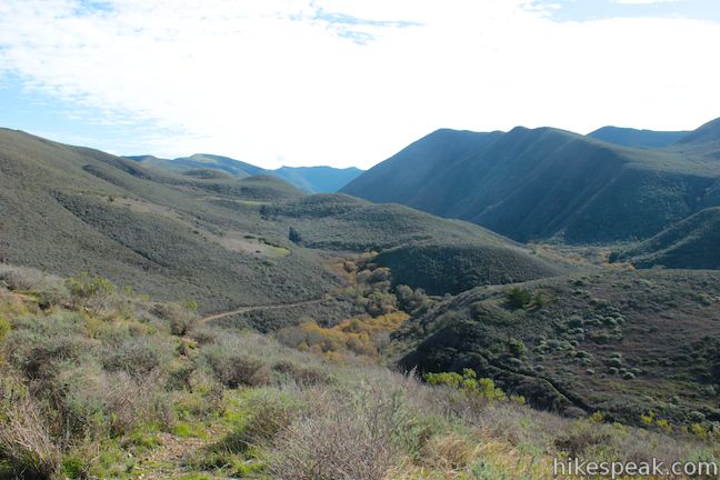
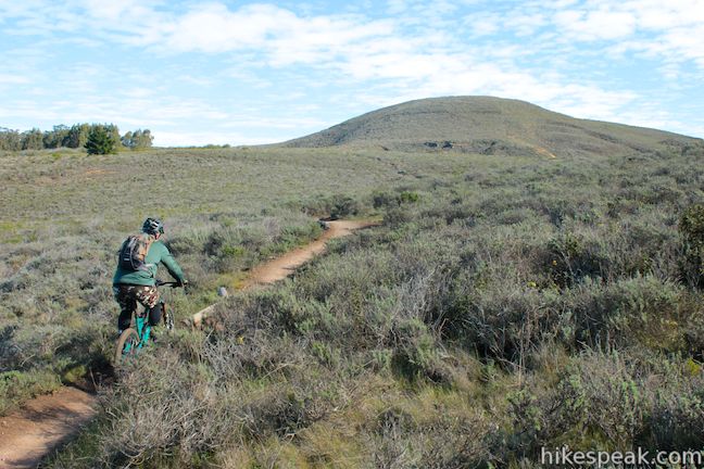
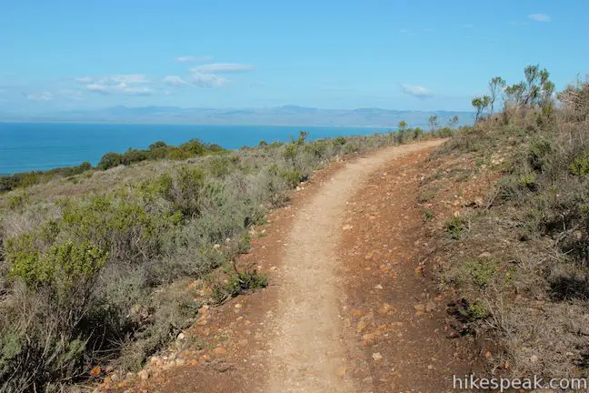
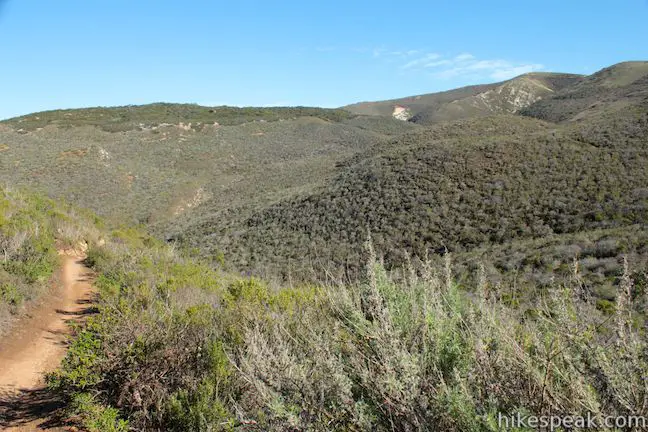
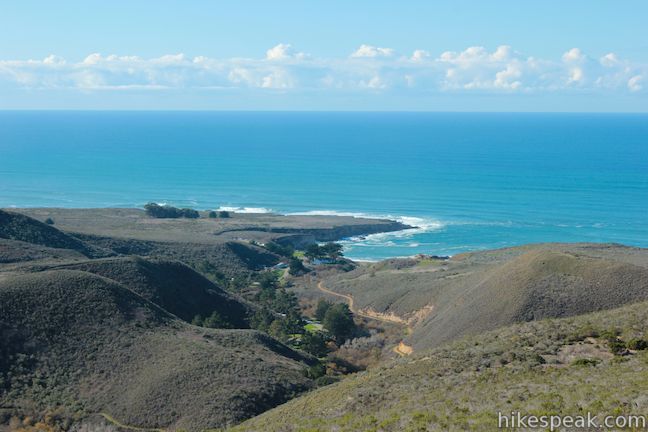
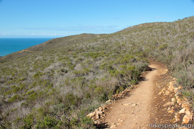
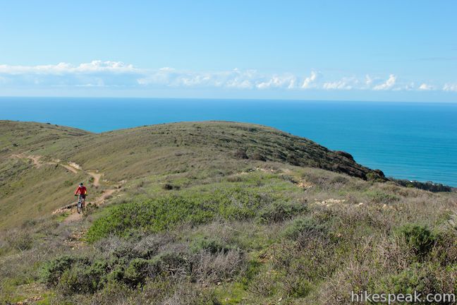
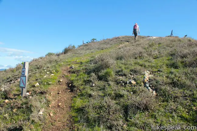
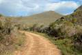
Begin hiking east up a dirt single track that never gets too steep, maintaining a steady grade that makes it popular with mountain bikers. After half a mile, the trail passes a bench that looks south over Islay Creek Canyon, which terminates at Spooner’s Cove. Across the sycamore-bottomed canyon you will see the pyramid-shaped summit of Valencia Peak.
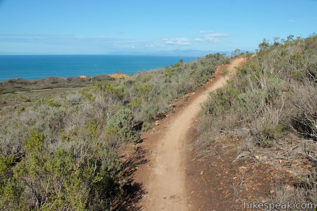
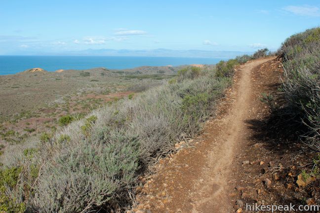
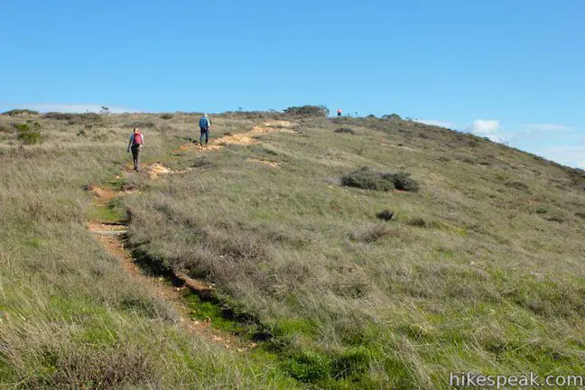
The trail bends north through sagebrush that enables open views of the ever-expanding coast. Pass through a small grove of eucalyptus trees and a junction with Hiedra Trail, 1.07 miles from the start. Stay to the right and continue up Hazard Peak Trail. There won’t be another junction until you reach the summit. (Psst… If you walk 150 feet down Hiedra Trail you’ll find a bench with a nice coastal view).
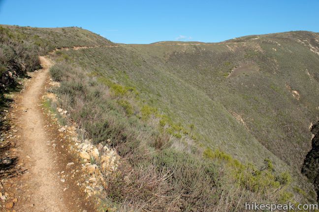
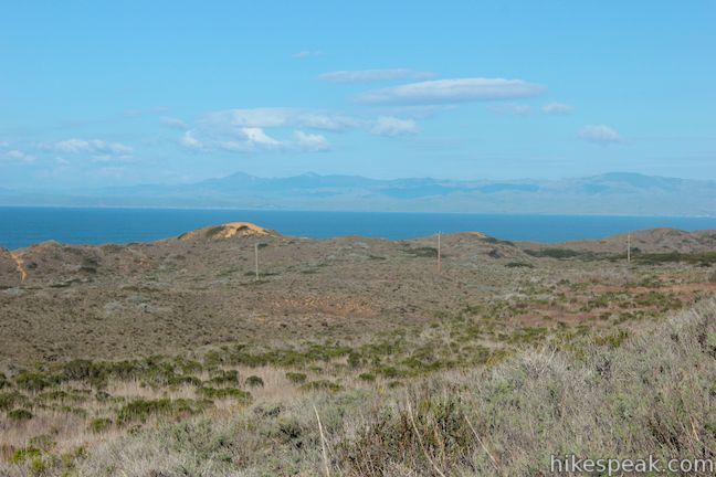
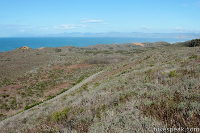
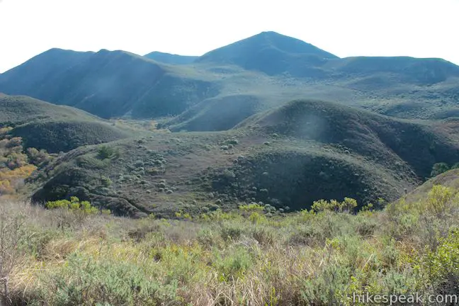
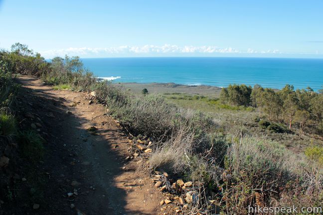
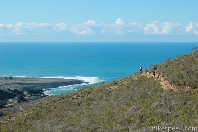
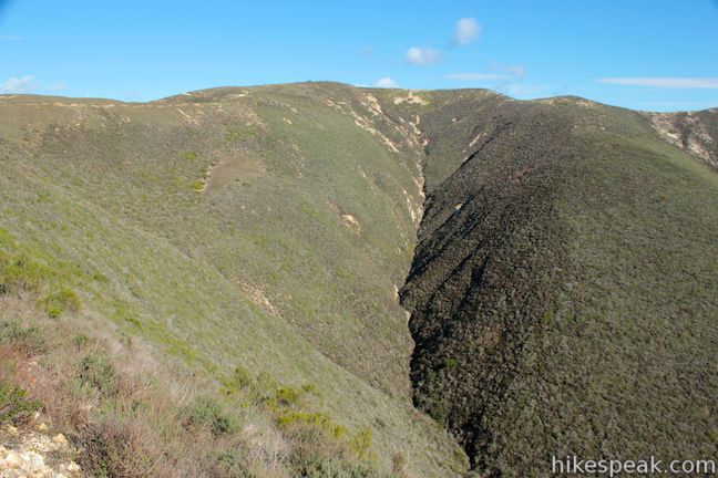
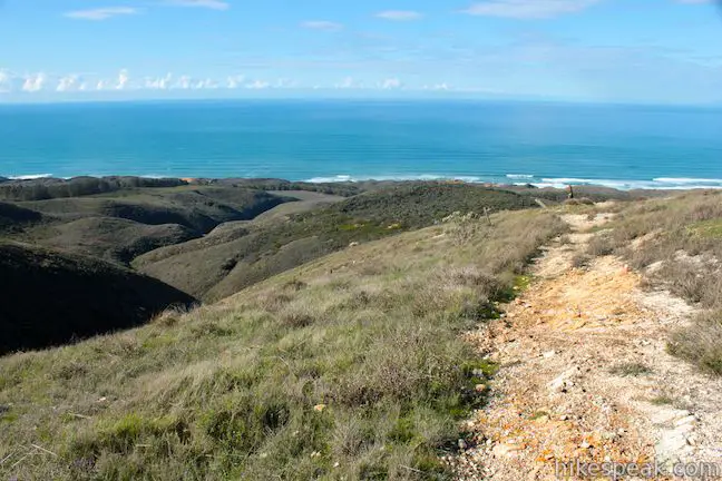
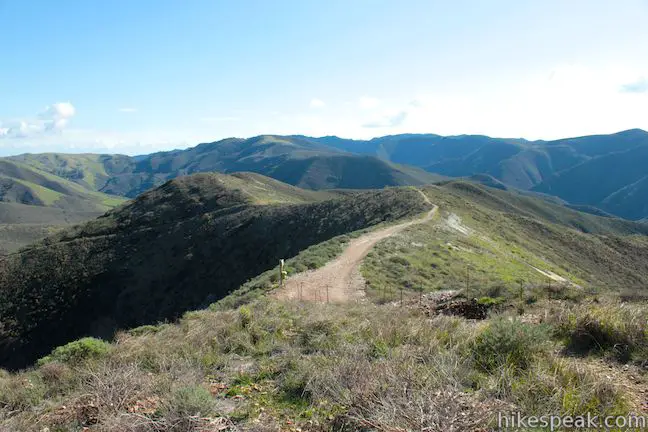
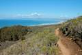
Hazard Peak Trail curls northeast, offering an early view of Morro Rock beyond the line of sand dunes at the north end of Montaña de Oro. The trail heads east toward Hazard Peak along the rim of a small canyon. Weaving back to the south, you will attain a higher view over Islay Creek Canyon, along with constantly improving ocean views.

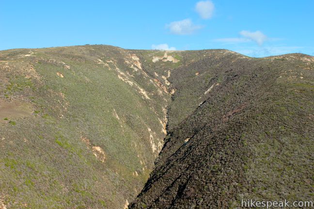
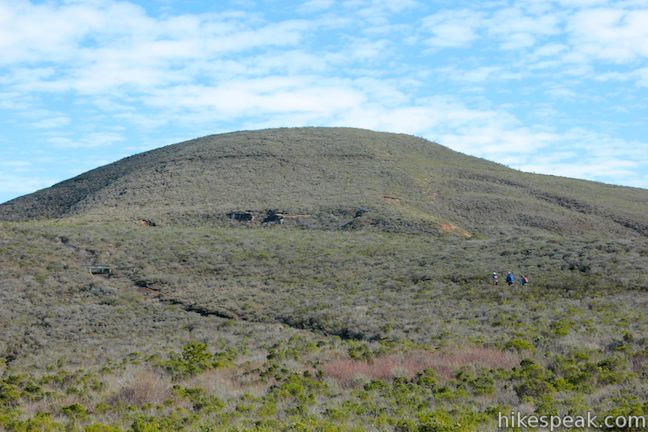
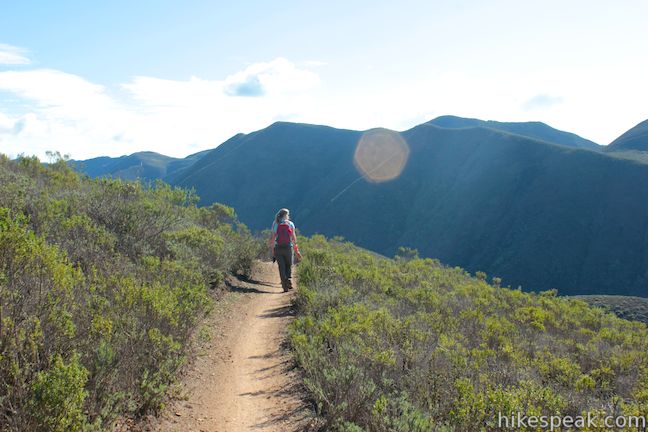
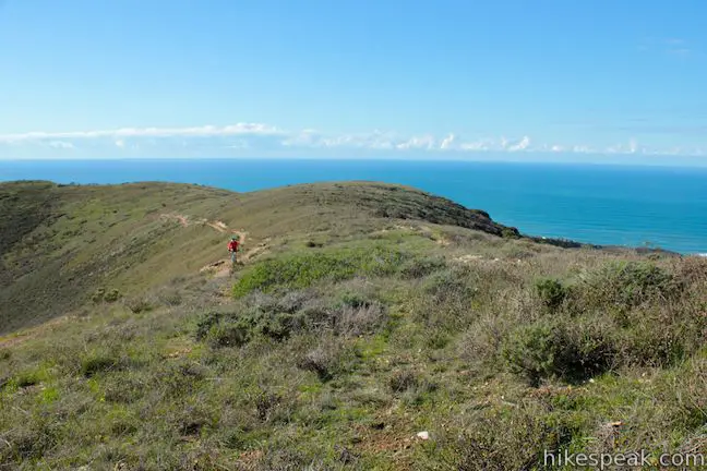
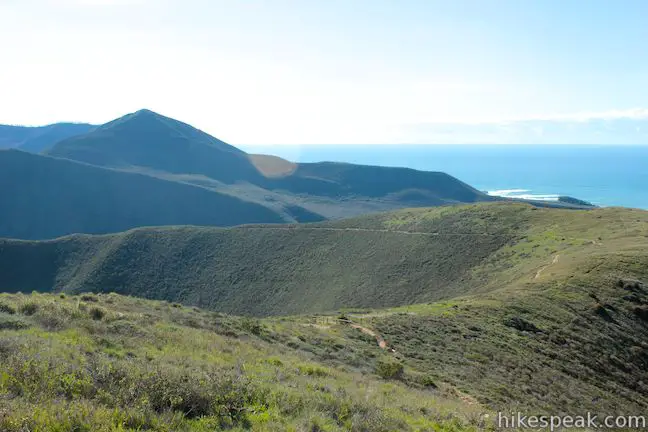
The trail curves east again along the slopes above Islay Creek Canyon, coming to a landing 2.25 miles from the start. From here, you can look across a side-canyon off Islay Creek Canyon toward Hazard Peak, and the route to the round summit is clear. The trail makes a long gradual curve across the top of steep slopes toward the summit of Hazard Peak.
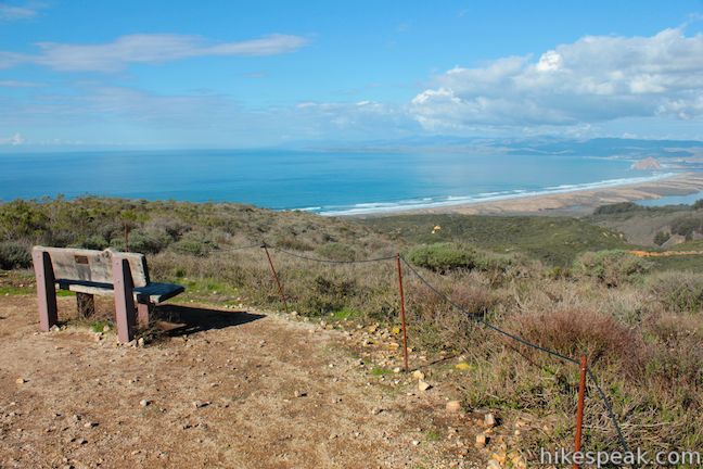
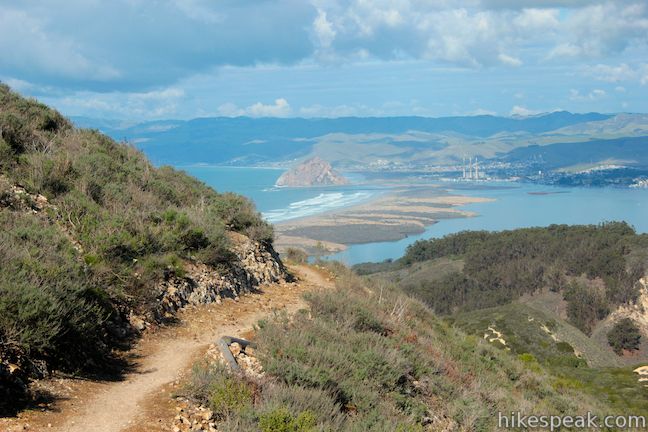
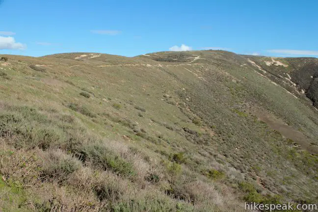
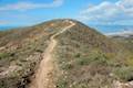
Follow the steady trail north and eventually northeast just below the top of the ridge angling toward the summit. After another half mile, you will reach a bench on the western face of Hazard Peak. Take a seat and enjoy fantastic views north over Morro Bay.
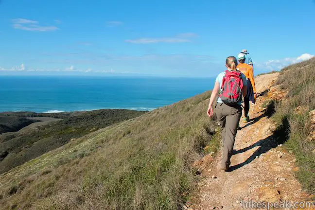
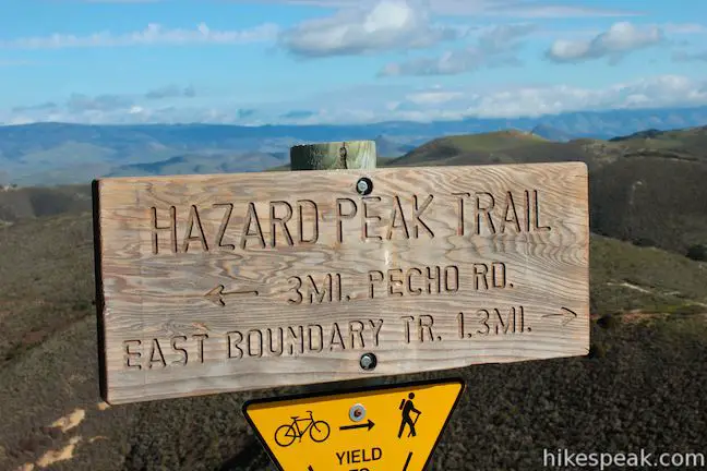
Continue up the trail, which wraps around the north side of the peak. Hazard Peak Trail wraps around the northeast side of the summit to a junction with a short spur to the top, where you will find a picnic table, benches, and sweeping views.
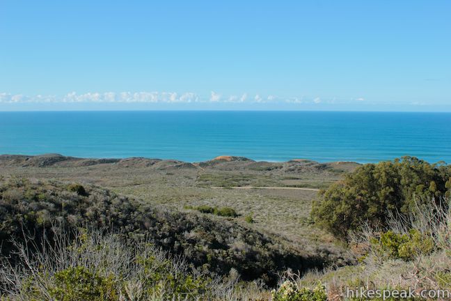
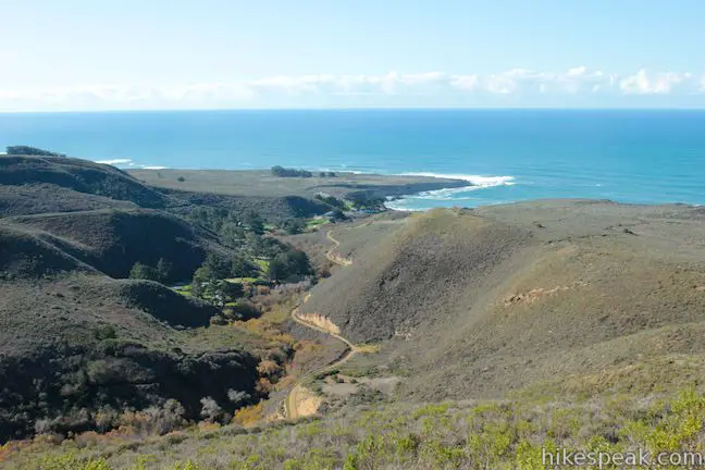
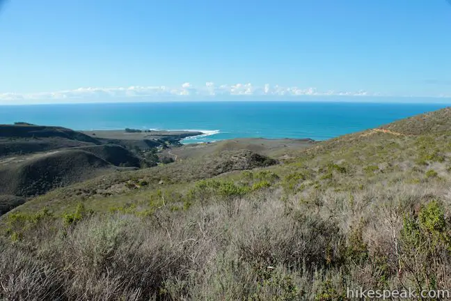
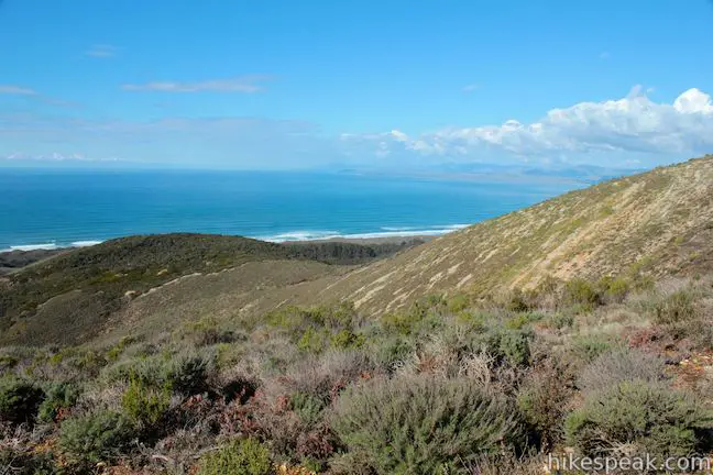
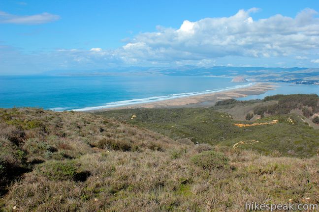
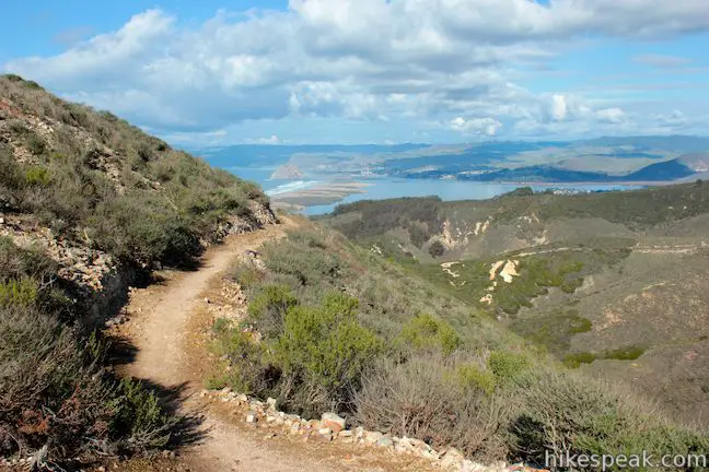
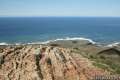
The postcard perspective north toward Morro Rock and Morro Bay is mesmerizing. The views extend inland over Los Osos Valley and the easy-to-spot chain of volcanic plugs crossing San Luis Obispo County called the Morros.
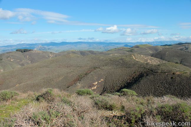
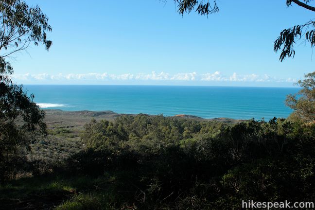
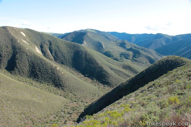
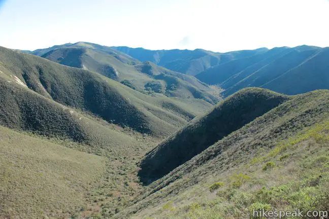
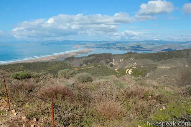
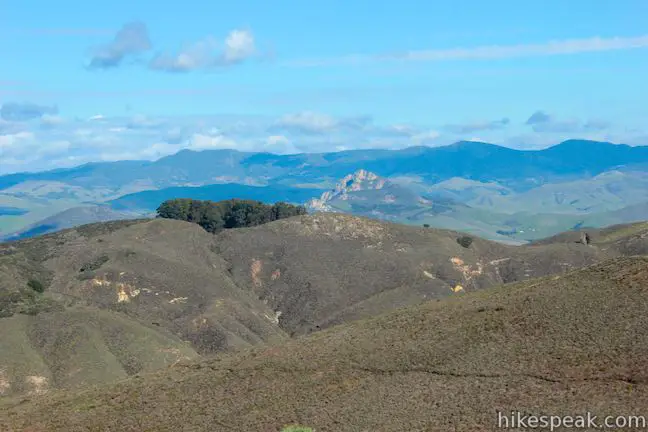
Look east over Hazard Peak Trail as it continues down a green ridge, heading deeper into Montaña de Oro State Park where there are more picturesque green peaks and valleys. The second highest point in the park, Oats Peak, along with Valencia Peak, are visible to the south beyond Islay Creek Canyon. And to the west there is a view of verdant headlands, blue bays, and rolling sand dunes.
When it is time to leave the summit, don’t fret. You will be facing the ocean for most of the 3-mile hike back down Hazard Peak Trail. If you are willing to trade in that second helping of ocean views for the chance to explore the secluded interior of Montaña de Oro, you can convert the 6-mile out and back hike into a 9.2-mile loop (Hazard Peak – Islay Creek Loop) that circling back toward the coast down Islay Creek Trail, a wide trail at the bottom of Islay Canyon Creek.
For a slightly-shorter variation on this hike, you can use the junction with Hiedra Trail to alter the approach to Hazard Peak on Bloody Nose Trail, Hiedra Trail, and Hazard Peak Trail. No fee or permit is required to hike Hazard Peak Trail in Montaña de Oro State Park. Dogs are not allowed but mountain bikes are welcome, so get out and enjoy!
Directions to the Trailhead
- From San Luis Obispo, exit Highway 101 at Los Osos Valley Road and drive northwest toward Los Osos.
- After 11.2 miles, Los Osos Valley Road becomes Pecho Valley Road and turns sharply to the south.
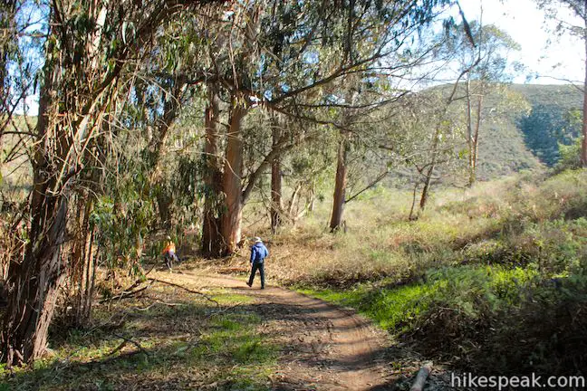
- Continue the final 3.2 miles, entering Montaña de Oro State Park and passing through a eucalyptus grove before reaching the trailhead for Hazard Peak on the left, just before Spooner's Cove.
- There is parking on both sides of the road.
Trailhead Location
Trailhead address: Pecho Valley Road, Montaña de Oro State Park, Los Osos, CA 93402
Trailhead coordinates: 35.277106, -120.884546 (35° 16′ 37.58″N 120° 53′ 04.36″W)
(Hazard Peak Trail is in red)
View Montaña de Oro State Park in a larger map
Or view a regional map of surrounding Central Coast trails and campgrounds.


 | South Dune Trail – Bloody Nose Trail – Hiedra Trail – Hazard Peak Trail Loop This 2 2/3-mile loop combines four trails through dunes and eucalyptus trees to lovely coastal views. |
 | Hazard Peak via Bloody Nose Trail, Hiedra Trail, and Hazard Peak Trail This 5.55-mile hike rises through a eucalyptus grove and views of Morro Bay to a panoramic summit in Montaña de Oro State Park. |
 | Islay Creek Trail This easy 6-mile round trip hike follows a wide trail up a coastal canyon flanked by thousand-foot peaks, passing a small waterfall to reach an abandoned barn. |
 | Hazard Peak - Islay Creek Loop This 9.2 mile loop continues beyond Hazard Peak deeper into Montana de Oro before circling back on Islay Creek Trail. |
 | Reservoir Flats Trail This 2-mile loop delivers fine ocean and canyon views as it explores the bottom of Islay Creek Canyon in Montaña de Oro State Park. |
 | Oats Peak Trail This scenic 10.8-mile hike ventures into Montaña de Oro State Park to a panoramic summit. |
 | Valencia Peak Trail This 4.5-mile hike summits a 1,347-foot peak with stunning views over Montaña de Oro. |
 | Bluff Trail This hike of around three miles tours tide pools, beaches, and impressive cliffs along the picturesque coast of Montaña de Oro State Park. |
 | Rattlesnake Flats Trail – Badger Trail – Bluff Trail Loop This 1 2/3-mile hike offers a twist on the Bluff Trail, going along and just above the coast of Montaña de Oro State Park. |
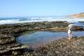 | Dune Trail to Hazard Canyon Reef This one-mile hike in Montaña de Oro State Park descends an oceanfront ravine to a rocky shoreline graced with engaging tide pools. |
 | Coon Creek Trail This 5-mile out and back hike ventures up a coastal canyon at the south end of Montaña de Oro State Park. |
 | Point Buchon Trail This 1 1/3 to 6.8-mile hike explores the beautiful coastline south of Montaña de Oro State Park. |
 | Morro Dunes Ecological Reserve This 2.6-mile loop serves up panoramic views over Morro Bay as it ascends 800 feet from Los Osos to Montaña de Oro State Park. |
 | More hikes in San Luis Obispo Explore other trails around San Luis Obispo including Morro Bay State Park and the Morros. |
 | Islay Creek Campground This 50-site campground is located at the heart of Montaña de Oro State Park in Islay Creek Canyon, and is a great base camp for treks in the park. |
- Hazard Peak on Bob Burd's Trip Reports (opens in a new tab)
- Hazard Peak on hikinglibrarian.wordpress.com (opens in a new tab)
- One of the many videos of a mountain biker descending Hazard Peak Trail on youtube.com (opens in a new tab)
- Montaña de Oro State Park on summitpost.org (opens in a new tab)
- Montaña de Oro State Park on wikipedia.org (opens in a new tab)
- The official website for Montaña de Oro State Park (opens in a new tab)
Common Questions about Hazard Peak in Montaña de Oro State Park
- Is the trail open?
- Yes. You should expect to find that Hazard Peak Trail to Hazard Peak is open. There are no recent reports of trail closures. If you discover that the trail is closed, please help your fellow hikers by reporting a closure.
- Is this trail free to access?
- Yes, Hazard Peak Trail to Hazard Peak is free to access. No entrance fee, pass, or permit is required. If you discover that access rules have changed, please provide feedback on your experience.
- How much time does this hike take?
- It takes approximately 3 hours to hike Hazard Peak Trail to Hazard Peak. Individual hiking times vary. Add extra time for breaks and taking in the views.
- How long is this hike?
- The hike to Hazard Peak Trail to Hazard Peak is a 6 mile out and back with 950 feet of elevation change.
- Are dogs allowed on this trail?
- No, dogs are likely not allowed on Hazard Peak Trail to Hazard Peak. The trail is primarily open to hikers, bikes.
- Are there ocean views on this hike?
- Yes, Hazard Peak Trail to Hazard Peak offers views of the ocean.
- Does this trail go to a summit?
- Yes, Hazard Peak Trail to Hazard Peak reaches a summit with panoramic views.
- Where is the trailhead located?
- The trailhead for Hazard Peak Trail to Hazard Peak is located in Los Osos, CA.
Trailhead Address:
Pecho Valley Road
Los Osos, CA 93402
Trailhead Coordinates:
35.277106, -120.884546 - What are the driving directions to the start of the hike?
To get to the trailhead: From San Luis Obispo, exit Highway 101 at Los Osos Valley Road and drive northwest toward Los Osos. After 11.2 miles, Los Osos Valley Road becomes Pecho Valley Road and turns sharply to the south. Continue the final 3.2 miles, entering Montaña de Oro State Park and passing through a eucalyptus grove before reaching the trailhead for Hazard Peak on the left, just before Spooner's Cove. There is parking on both sides of the road.
View custom Google Maps directions from your current location.
- Are there other trails near Hazard Peak Trail to Hazard Peak?
- Yes, you can find other nearby hikes using the Hikespeak Hike Finder Map.

6 Comments on Hazard Peak in Montaña de Oro State Park
What hikers are saying:
✨ Generated summary of user commentsThis trail enforces a strict ban on dogs to preserve the natural environment, sparking a clear divide between visitors who value pristine conditions and those who feel excluded. Travelers who prefer hiking with pets bypass this location entirely, while those who visit appreciate the absence of litter and off-leash encounters. Jack warns that dogs are not allowed on this trail to protect the environment from waste and potential damage.
When is the state going to loosen up on dogs? I have never been to Montana de Oro and probably never will as my dog goes with me everywhere. Too bad!
Given the number of dogs illegally off-leash on other trails and their entitled owners, I hope never…
Hence why you shouldn’t get stupid dogs.
Not every dog owner feels entitled and not all dogs are illegally off-leash. Responsible dog owners should have the same rights as stupid humans (Matt and Matthew). I see more hikers leaving trails littered than dogs (doo).
Your dogs mess up the environment and most of you owners don’t pick up after them, or even worse bag it up and leave the bag…State Parks has it right
[…] our tanks happily filled, we headed to the Hazard Peak trailhead to try on our mountain biking skills. This 8- mile roundtrip journey starts with a […]