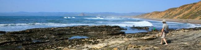
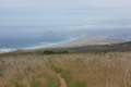
For a quick one-mile jaunt in Montaña de Oro State Park, hike down Dune Trail to Hazard Canyon Reef. At the bottom of this oceanfront ravine is a rocky shoreline graced with engaging tide pools. Explore up or down the coast to extend your stay, or settle in for a picnic on the sandy beach. The postcard views of Morro Rock are a good reason to stick around.
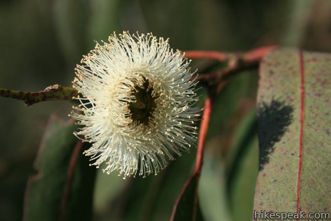
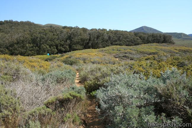
The trail begins from Hazard Canyon Parking Day Use Area, a dirt turnout along Pecho Valley Road north of the Montaña de Oro State Park Visitor Center (across from a eucalyptus grove). South Dune Trail leaves from the south side of the lot. Don’t take this trail and instead, hike out of the north end of the lot on a dirt track into Hazard Canyon.
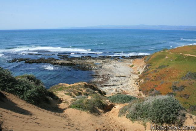
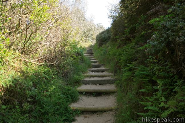
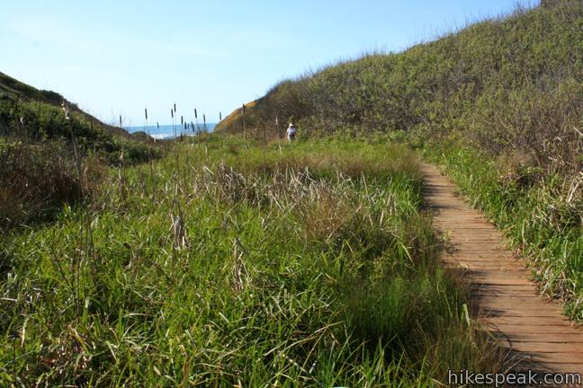
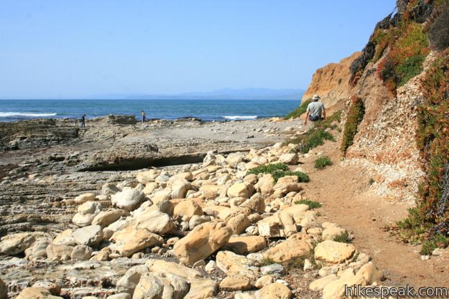
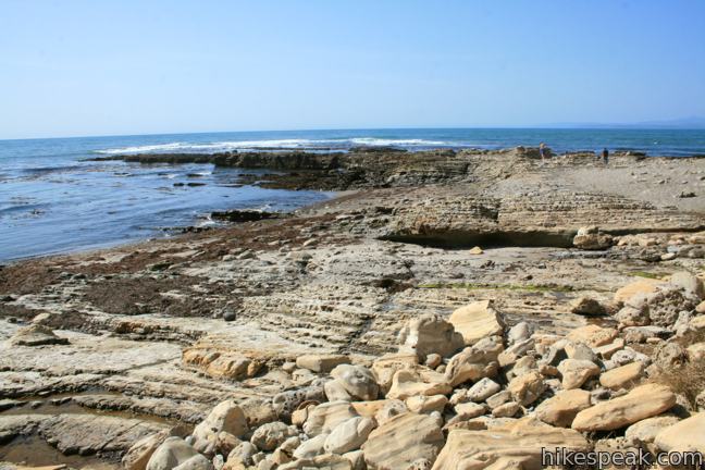
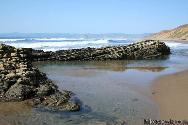
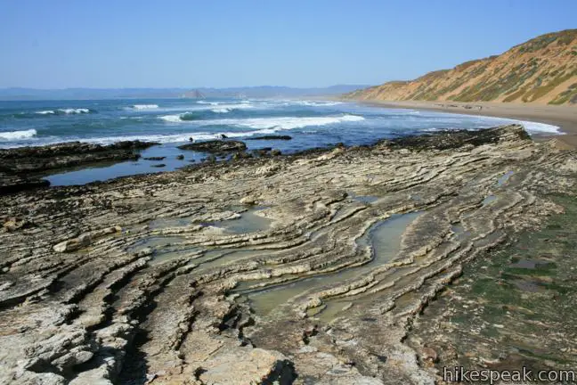
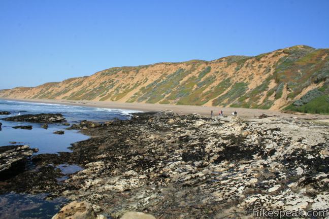
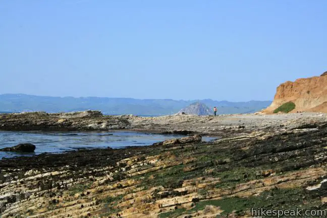
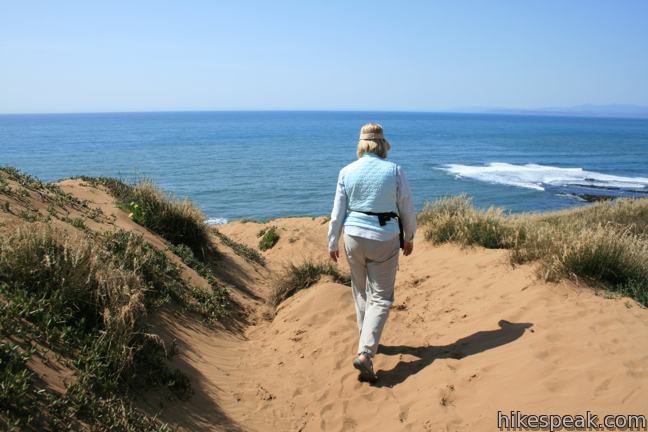
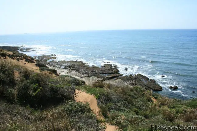
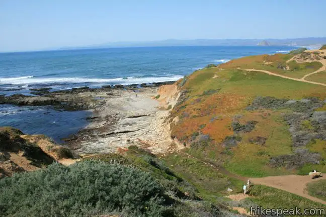
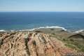
The ocean appears in no time, and you will reach the bottom of the ravine after a third of a mile. A few wooden steps assist with the 100-foot descent, and a boardwalk across the wetlands at the mouth of the canyon ensure that you don’t have to mess with any mud. To reach the ocean, pass through a gap in the dunes just beyond an unmarked 4-way junction (another section of Dune Trail continues up the coast to the right and a path comes down from the dunes to the left (more on that later)). Beyond the canyon, the trail continues a short distance to Hazard Canyon Reef, a rocky point along the shoreline.
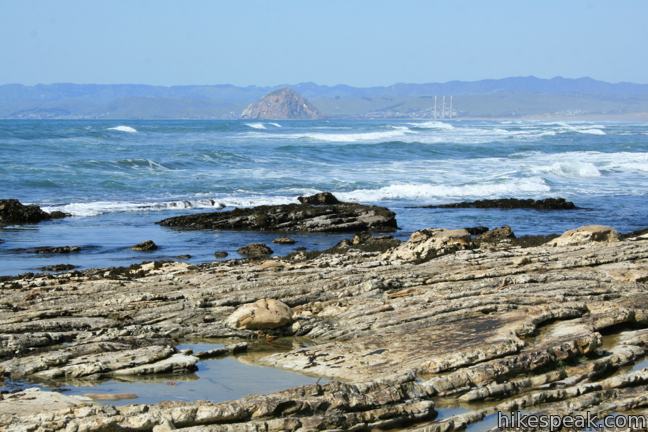
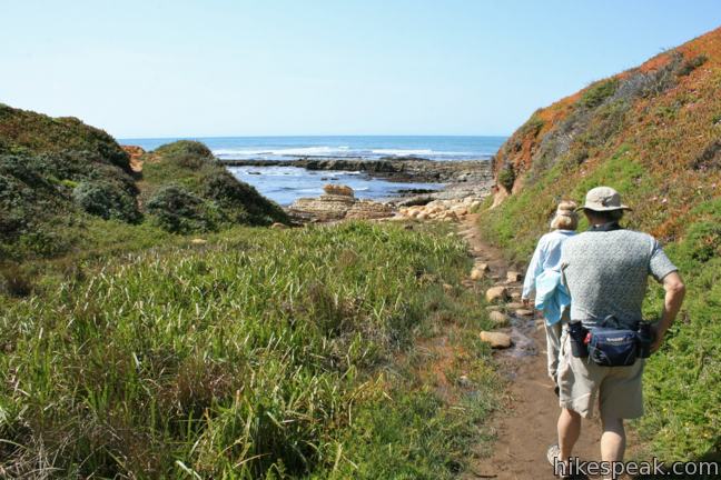
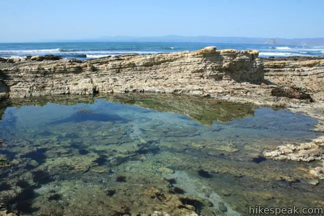
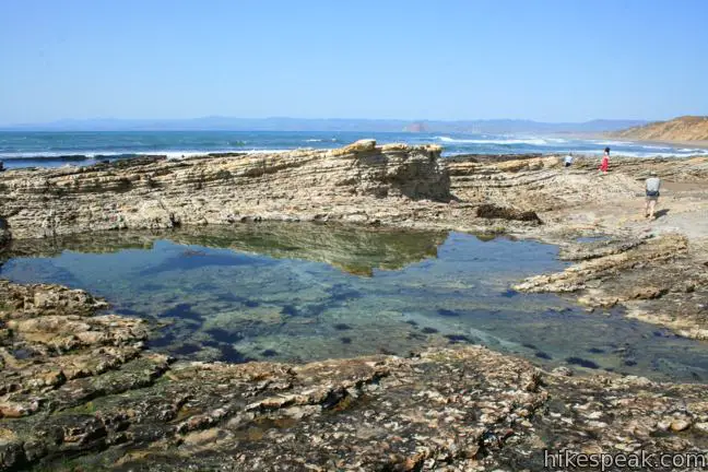
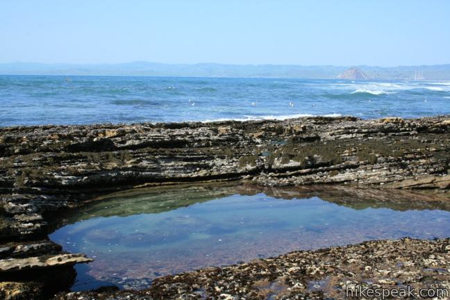
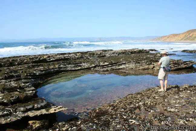
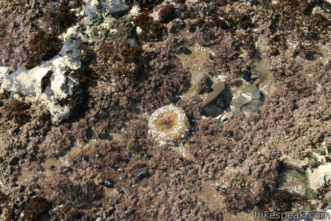
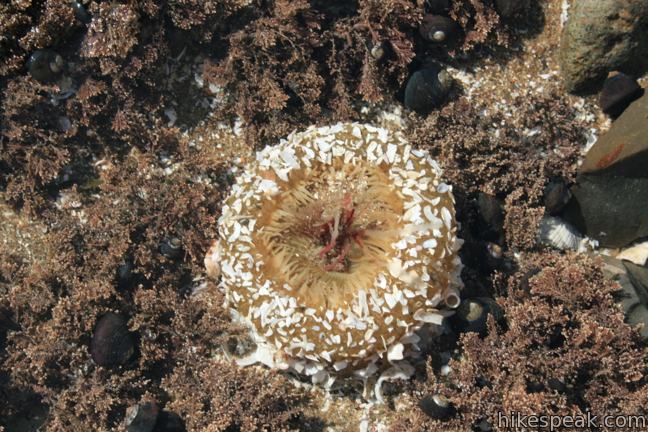
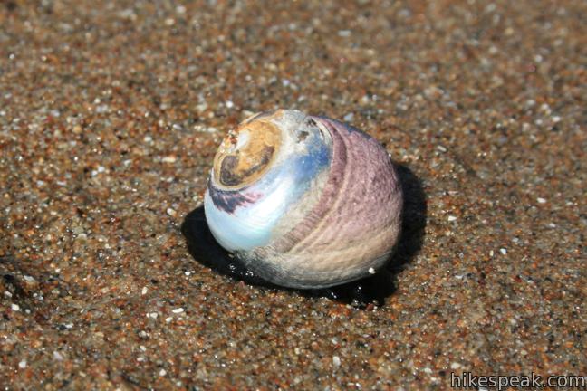
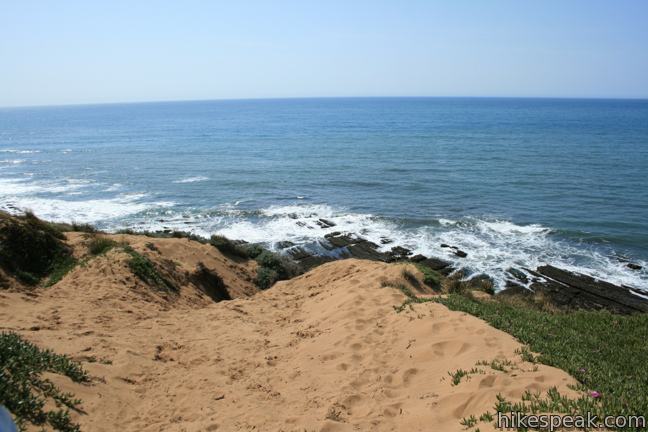
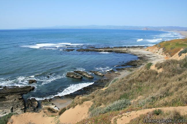
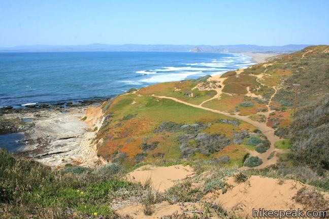
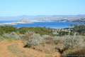
The trail fades and the exploration begins. Step out on the rocks to examine pools housing sea stars, hermit crabs, and sea anemones. Watch waves crash against the rocks, filling and draining the blue pools. North of Hazard Canyon Reef, a sandy line of dunes sheltering Moro Bay. A few miles up the sandy beach is the iconic Moro Rock, giving the tide pools at Hazard Canyon Reef a dynamic backdrop.
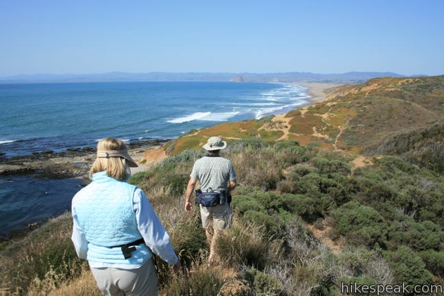
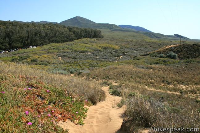
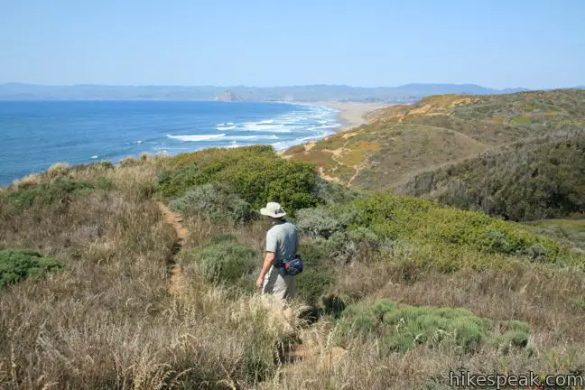
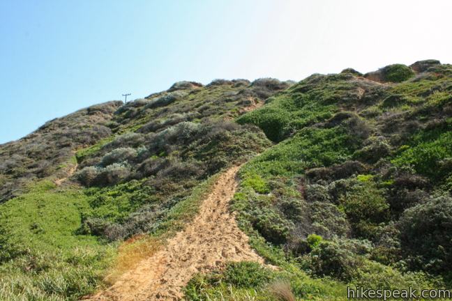
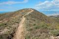
An alternate route to Hazard Canyon Reef is to head west from the north end of the lot on a path across the dunes. After reaching a scenic ocean overlook atop the steep dune wall, angle north along the bluff.
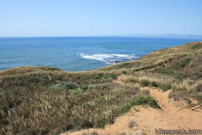
When Hazard Canyon appears below, take a precipitous sandy path down into the canyon. This stretch drops 150 feet in less than a tenth of a mile and feels like downhill skiing in the sand. You would not want to attempt this path in reverse, but it can be used to create a loop hike to Hazard Canyon Reef, adding broader views.
It is a short hike to Hazard Canyon Reef and there is a lot to see. Dogs are not allowed. No fee or permit is required to hike Dune Trail in Montaña de Oro State Park, so get out and enjoy!
Directions to the Trailhead
- From Highway 101 south of San Luis Obispo, take exit 200 onto Los Osos Valley Road.
- Drive a total of fifteen miles northwest toward Montaña de Oro State Park.
- After 11.2 miles, Los Osos Valley Road becomes Pecho Valley Road and turns sharply to the south.
- Continue 2.7 miles, entering Montaña de Oro State Park and a eucalyptus grove.
- Turn right into a large dirt turnout for Hazard Canyon (If you reach Spooner's Cove and the visitor center, you've gone too far).
- A collection of horse trailers are often positioned in the dirt lot.
- The trail begins from the north end of the lot, labeled simply beach.
Trailhead Location
Trailhead address: Pecho Valley Road, Montaña de Oro State Park, Los Osos, CA 93402
Trailhead coordinates: 35.285512, -120.881105 (35° 17′ 07.84″N 120° 52′ 51.97″W)
You may also view a regional map of surrounding Central Coast trails and campgrounds.


 | South Dune Trail – Bloody Nose Trail – Hiedra Trail – Hazard Peak Trail Loop This 2 2/3-mile loop combines four trails through dunes and eucalyptus trees to lovely coastal views. |
 | Hazard Peak Trail This 6-mile round trip hike ascends coastal ridges to a 1,076-foot summit with panoramic views that include a dynamic perspective of Morro Bay. |
 | Hazard Peak - Islay Creek Loop This 9.2 mile loop continues beyond Hazard Peak deeper into Montana de Oro before circling back on Islay Creek Trail. |
 | Islay Creek Trail This easy 6-mile round trip hike follows a wide trail up a coastal canyon flanked by thousand-foot peaks, passing a small waterfall to reach an abandoned barn. |
 | Oats Peak Trail This scenic 10.8-mile hike ventures into Montaña de Oro State Park to a panoramic summit. |
 | Reservoir Flats Trail This 2-mile loop delivers fine ocean and canyon views as it explores the bottom of Islay Creek Canyon in Montaña de Oro State Park. |
 | Valencia Peak Trail This 4.5-mile hike summits a 1,347-foot peak with stunning views over Montaña de Oro. |
 | Bluff Trail This hike of around three miles tours tide pools, beaches, and impressive cliffs along the picturesque coast of Montaña de Oro State Park. |
 | Rattlesnake Flats Trail – Badger Trail – Bluff Trail Loop This 1 2/3-mile hike offers a twist on the Bluff Trail, going along and just above the coast of Montaña de Oro State Park. |
 | Coon Creek Trail This 5-mile out and back hike ventures up a coastal canyon at the south end of Montaña de Oro State Park. |
 | Point Buchon Trail This 1 1/3 to 6.8-mile hike explores the beautiful coastline south of Montaña de Oro State Park. |
 | Morro Dunes Ecological Reserve This 2.6-mile loop serves up panoramic views over Morro Bay as it ascends 800 feet from Los Osos to Montaña de Oro State Park. |
 | More hikes in San Luis Obispo Explore other trails around San Luis Obispo including Montaña de Oro State Park and the Morros. |
 | Islay Creek Campground This 50-site campground is located at the heart of Montaña de Oro State Park in Islay Creek Canyon, and is a great base camp for treks in the park. |
Common Questions about Dune Trail to Hazard Canyon Reef in Montaña de Oro State Park
- Is the trail open?
- Yes. You should expect to find that Dune Trail to Hazard Canyon Reef is open. There are no recent reports of trail closures. If you discover that the trail is closed, please help your fellow hikers by reporting a closure.
- Is this trail free to access?
- Yes, Dune Trail to Hazard Canyon Reef is free to access. No entrance fee, pass, or permit is required. If you discover that access rules have changed, please provide feedback on your experience.
- How much time does this hike take?
- It takes approximately 30 minutes to hike Dune Trail to Hazard Canyon Reef. Individual hiking times vary. Add extra time for breaks and taking in the views.
- How long is this hike?
- The hike to Dune Trail to Hazard Canyon Reef is a 1 mile out and back with 100 feet of elevation change.
- Are dogs allowed on this trail?
- No, dogs are likely not allowed on Dune Trail to Hazard Canyon Reef. The trail is primarily open to hikers.
- Is Dune Trail to Hazard Canyon Reef good for kids?
- Yes, this hike is likely suitable for children. It is relatively short (1 miles) with manageable elevation gain.
- Are there ocean views on this hike?
- Yes, Dune Trail to Hazard Canyon Reef offers views of the ocean.
- Where is the trailhead located?
- The trailhead for Dune Trail to Hazard Canyon Reef is located in Los Osos, CA.
Trailhead Address:
Pecho Valley Road
Los Osos, CA 93402
Trailhead Coordinates:
35.285512, -120.881105 - What are the driving directions to the start of the hike?
To get to the trailhead: From Highway 101 south of San Luis Obispo, take exit 200 onto Los Osos Valley Road. Drive a total of fifteen miles northwest toward Montaña de Oro State Park. After 11.2 miles, Los Osos Valley Road becomes Pecho Valley Road and turns sharply to the south. Continue 2.7 miles, entering Montaña de Oro State Park and a eucalyptus grove. Turn right into a large dirt turnout for Hazard Canyon (If you reach Spooner's Cove and the visitor center, you've gone too far). A collection of horse trailers are often positioned in the dirt lot. The trail begins from the north end of the lot, labeled simply beach.
View custom Google Maps directions from your current location.
- Are there other trails near Dune Trail to Hazard Canyon Reef?
- Yes, you can find other nearby hikes using the Hikespeak Hike Finder Map.

Go the extra miles...
Submit a rating of this hike to go with your comment. Contribute to the average trail rating.