Islay Creek
in Montaña de Oro State Park
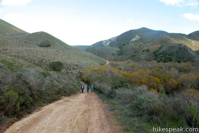
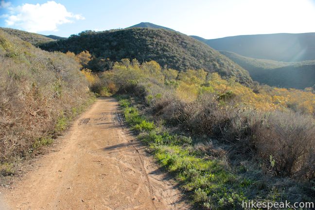
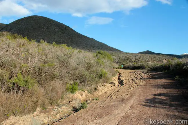
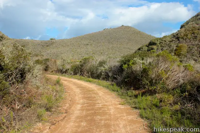
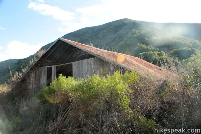
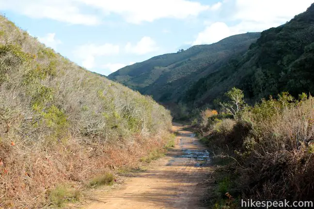
Montaña de Oro State Park has a couple lengthy level hikes. If you desire ocean views, you can’t do any better than the Bluff Trail. If you would rather hike up a canyon flanked by thousand foot peaks along a creek that even has a small waterfall, the fitting trail is Islay Creek Trail. The rolling 3-mile long dirt road has 300-feet of easy elevation change. Just before the trail ends at the eastern boundary of Montaña de Oro State Park, you will come across an abandoned barn that makes a good turn around point for a 6-mile round trip hike.
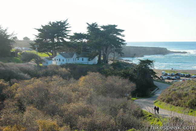
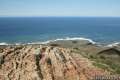
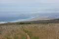
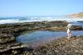
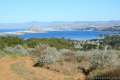
The trail start at the bottom of Islay Creek Canyon, where the stream meets the sea at Spooner’s Cove. Looking across the mouth of the canyon, you’ll spot the park visitor center inside the old Spooner’s Ranch House.
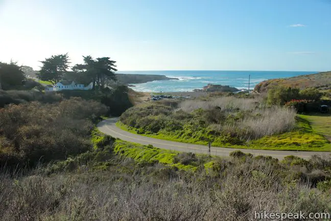
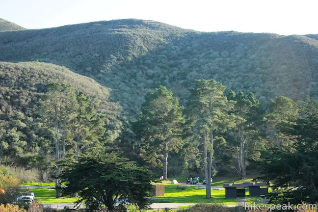
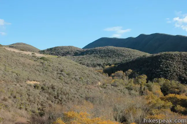
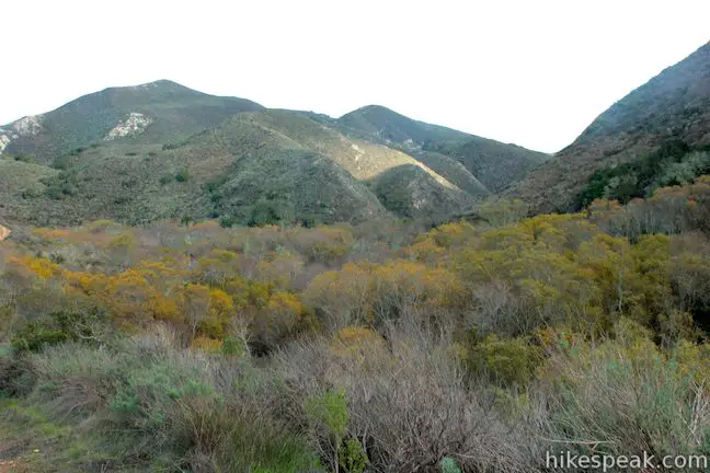
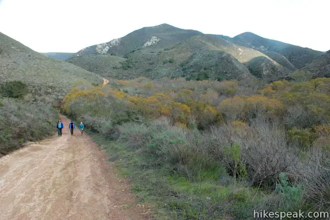
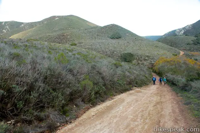
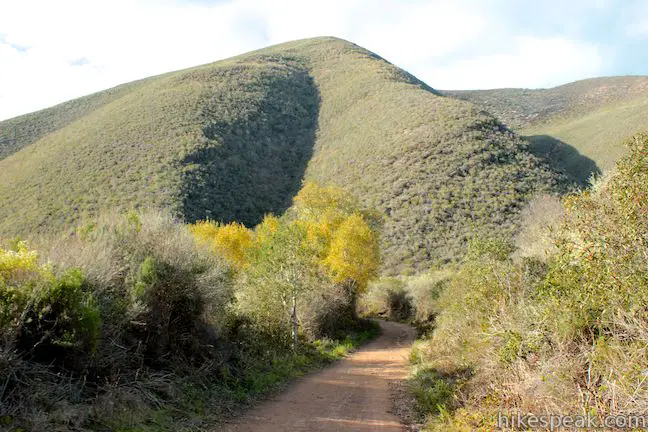
Head inland up the wide dirt trail, leaving the ocean behind. You’ll notice a long carpet of sycamores covering Islay Creek in the canyon below the road. On the opposite bank is the park’s campground, and above the south bank of the canyon is the pyramid-shaped summit of Valencia Peak. As the trail progresses inland, you’ll get a view of one of the park’s other major peaks, Hazard Peak, just north of the canyon.
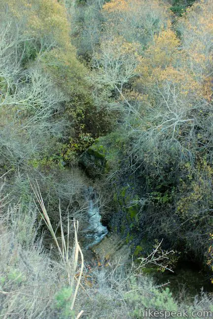
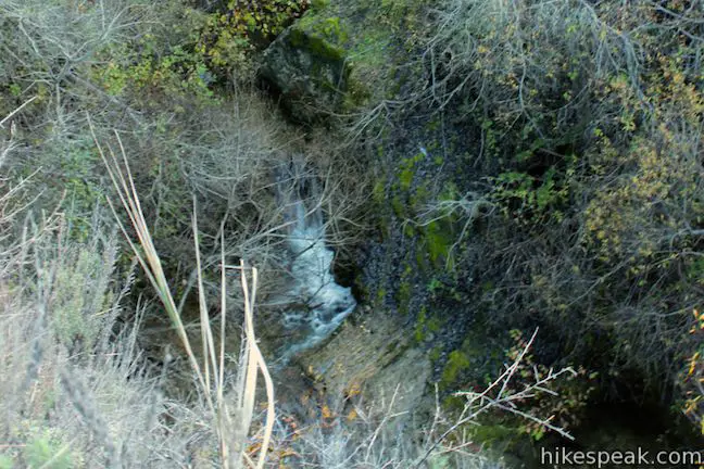
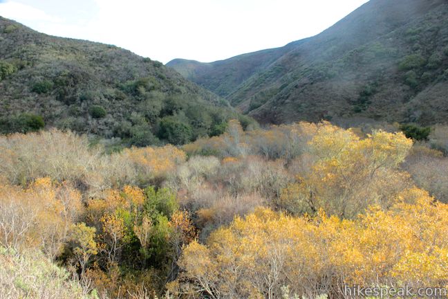
After 1.1 gradual miles curving along the north side of the canyon, you’ll pass a junction with a connector trail to Reservoir Flats Trail. Stick with the wide main road and continue up Islay Creek Canyon. After another quarter mile, you’ll spot a short waterfall in the creek below.
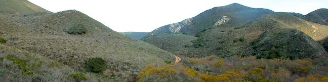
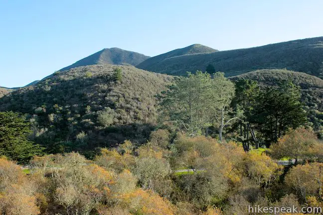
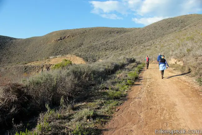
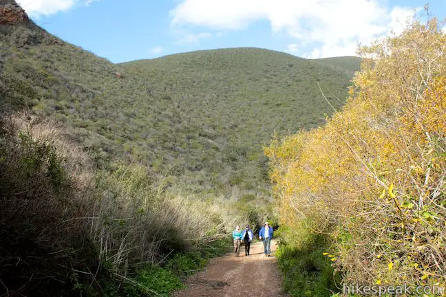
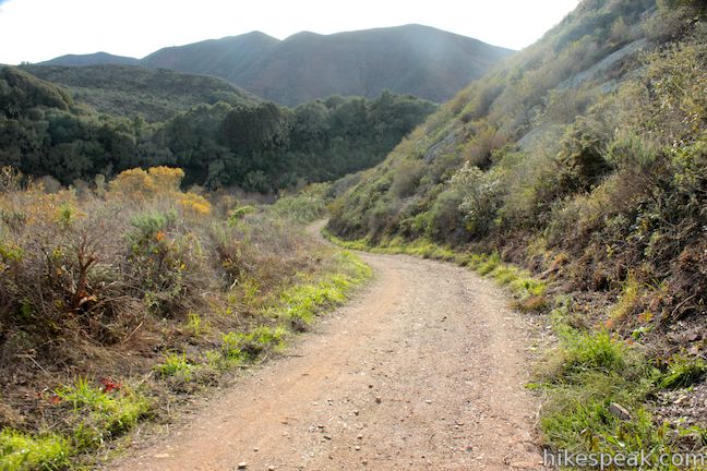
The trail continues an eastward course up the canyon just above the creek. About halfway between the coast and the barn, Islay Creek Trail turns temporarily downhill, before renewing its gradual ascent. As you climb again, Islay Creek Canyon widens to allow broader views of the surrounding mountains.
At 2.85 miles from the start, Islay Creek Trail comes to a junction with Barranca Trail. The single track breaks off to the left heading up a ridge toward a junction with East Boundary Trail. Barranca Trail can be used to form a loop (Hazard Peak – Islay Creek Loop) connecting Hazard Peak Trail and Islay Creek Trail.
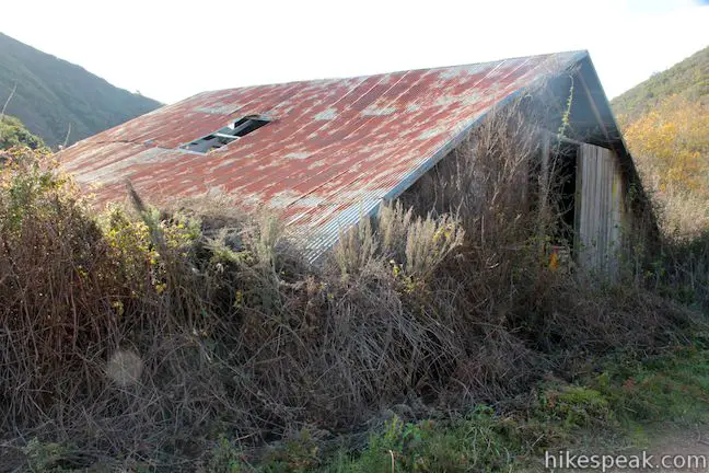
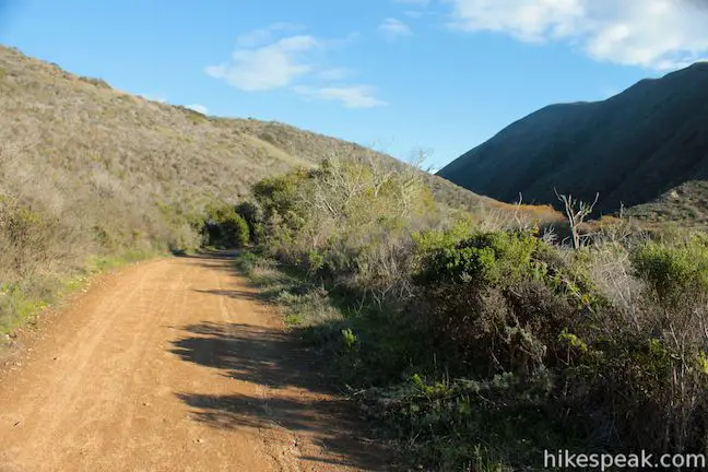
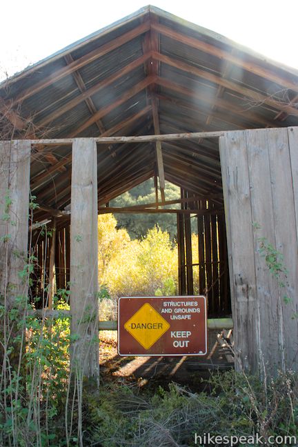
Continue through the junction with Barranca Trail and you will quickly arrive at a dilapidated barn with a tin roof. It is unsafe for hikers to enter the old barn. Nevertheless, the landmark makes a suitable turnaround point. Just ahead, the trail reaches a gate at the east boundary of Montaña de Oro State Park where you can hike no farther up Islay Creek Trail.
To the barn and back is 6 miles round trip with 300 feet of elevation gain. Dogs are not allowed on Islay Creek Trail but mountain bikes are. No fee or permit is required to hike in Montaña de Oro State Park, so get out and enjoy!
Directions to the Trailhead
- From San Luis Obispo, exit Highway 101 at Los Osos Valley Road and drive northwest toward Los Osos.
- After 11.2 miles, Los Osos Valley Road becomes Pecho Valley Road and turns sharply to the south.
- Continue the final 3.3 miles, entering Montaña de Oro State Park.
- Pass through a eucalyptus grove before reaching the trailhead for Islay Creek Trail on the left.
- The trailhead is just after a larger parking area for Hazard Peak Trail and just before Spooner's Cove.
Trailhead Location
Trailhead address: Pecho Valley Road, Montaña de Oro State Park, Los Osos, CA 93402
Trailhead coordinates: 35.276412, -120.885504 (35° 16′ 35.08″N 120° 53′ 07.81″W)
(Islay Creek Trail is in brown)
View Montaña de Oro State Park in a larger map
Or view a regional map of surrounding Central Coast trails and campgrounds.


 | Hazard Peak Trail This 6-mile round trip hike ascends coastal ridges to a 1,076-foot summit with panoramic views that include a dynamic perspective of Morro Bay. |
 | Hazard Peak - Islay Creek Loop This 9.2 mile loop continues beyond Hazard Peak deeper into Montana de Oro before circling back on Islay Creek Trail. |
 | Reservoir Flats Trail This 2-mile loop delivers fine ocean and canyon views as it explores the bottom of Islay Creek Canyon in Montaña de Oro State Park. |
 | Oats Peak Trail This scenic 10.8-mile hike ventures into Montaña de Oro State Park to a panoramic summit. |
 | Valencia Peak Trail This 4.5-mile hike summits a 1,347-foot peak with stunning views over Montaña de Oro. |
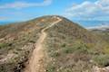
 | Bluff Trail This hike of around three miles tours tide pools, beaches, and impressive cliffs along the picturesque coast of Montaña de Oro State Park. |
 | Rattlesnake Flats Trail – Badger Trail – Bluff Trail Loop This 1 2/3-mile hike offers a twist on the Bluff Trail, going along and just above the coast of Montaña de Oro State Park. |
 | South Dune Trail – Bloody Nose Trail – Hiedra Trail – Hazard Peak Trail Loop This 2 2/3-mile loop combines four trails through dunes and eucalyptus trees to lovely coastal views. |
 | Dune Trail to Hazard Canyon Reef This one-mile hike in Montaña de Oro State Park descends an oceanfront ravine to a rocky shoreline graced with engaging tide pools. |
 | Coon Creek Trail This 5-mile out and back hike ventures up a coastal canyon at the south end of Montaña de Oro State Park. |
 | Point Buchon Trail This 1 1/3 to 6.8-mile hike explores the beautiful coastline south of Montaña de Oro State Park. |
 | Morro Dunes Ecological Reserve This 2.6-mile loop serves up panoramic views over Morro Bay as it ascends 800 feet from Los Osos to Montaña de Oro State Park. |
 | More hikes in San Luis Obispo Explore other trails around San Luis Obispo including Morro Bay State Park and the Morros. |
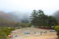 | Islay Creek Campground This 50-site campground is located at the heart of Montaña de Oro State Park in Islay Creek Canyon, and is a great base camp for treks in the park. |
Common Questions about Islay Creek in Montaña de Oro State Park
- Is the trail open?
- Yes. You should expect to find that Islay Creek Trail is open. There are no recent reports of trail closures. If you discover that the trail is closed, please help your fellow hikers by reporting a closure.
- Is this trail free to access?
- Yes, Islay Creek Trail is free to access. No entrance fee, pass, or permit is required. If you discover that access rules have changed, please provide feedback on your experience.
- How much time does this hike take?
- It takes approximately 2 hours 45 minutes to hike Islay Creek Trail. Individual hiking times vary. Add extra time for breaks and taking in the views.
- How long is this hike?
- The hike to Islay Creek Trail is a 6 mile out and back with 300 feet of elevation change.
- Are dogs allowed on this trail?
- No, dogs are likely not allowed on Islay Creek Trail. The trail is primarily open to hikers, bikes.
- Are there ocean views on this hike?
- Yes, Islay Creek Trail offers views of the ocean.
- Where is the trailhead located?
- The trailhead for Islay Creek Trail is located in Los Osos, CA.
Trailhead Address:
Pecho Valley Road
Los Osos, CA 93402
Trailhead Coordinates:
35.276412, -120.885504 - What are the driving directions to the start of the hike?
To get to the trailhead: From San Luis Obispo, exit Highway 101 at Los Osos Valley Road and drive northwest toward Los Osos. After 11.2 miles, Los Osos Valley Road becomes Pecho Valley Road and turns sharply to the south. Continue the final 3.3 miles, entering Montaña de Oro State Park. Pass through a eucalyptus grove before reaching the trailhead for Islay Creek Trail on the left. The trailhead is just after a larger parking area for Hazard Peak Trail and just before Spooner's Cove.
View custom Google Maps directions from your current location.
- Are there other trails near Islay Creek Trail?
- Yes, you can find other nearby hikes using the Hikespeak Hike Finder Map.

What is the name of the ranch that lies South of the park beyond the locked gate?
Who owns the large two story wooden house in the trees beyond the southerly locked gate and for what is it used?
Ned