Reservoir Flats Trail
in Montaña de Oro State Park
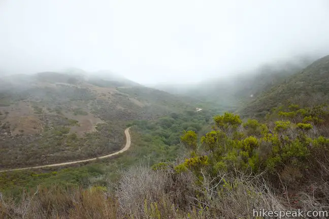
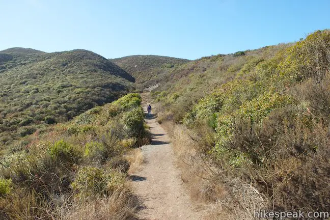
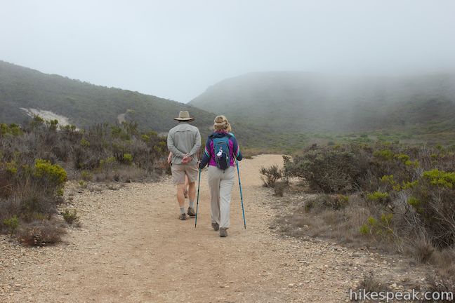
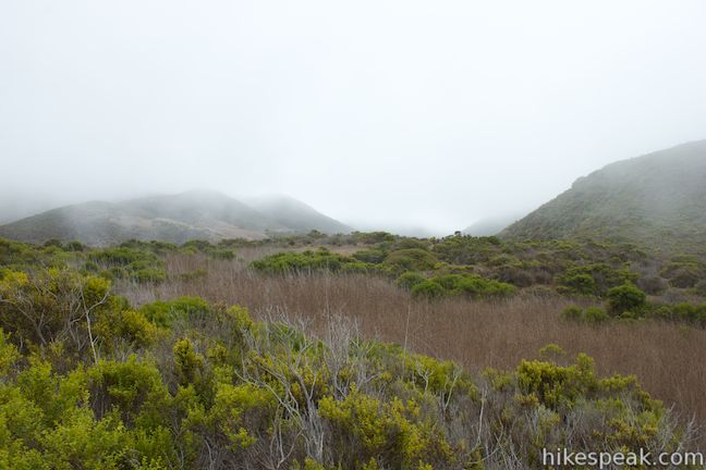
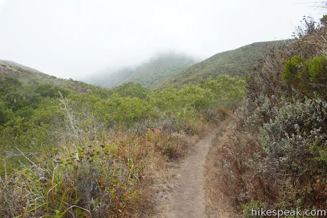
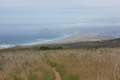
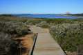
Montaña de Oro State Park has every type of hike you could want, ranging from easy oceanfront strolls to difficult summit ascents. If you’re feeling like Goldilocks and want something in the middle (just right), check out Reservoir Flats Trail, a 2-mile loop with 200 feet of elevation gain that is conveniently located just behind the park visitor center. The trail travels around the bottom of Islay Creek Canyon above Islay Creek Campground, delivering a variety of views looking down toward the nearby coast and up into the Irish Hills.
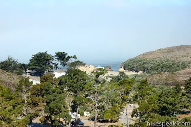
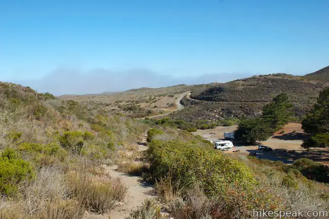
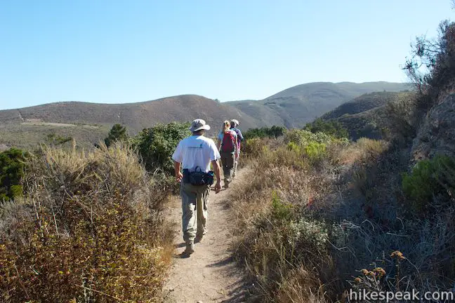
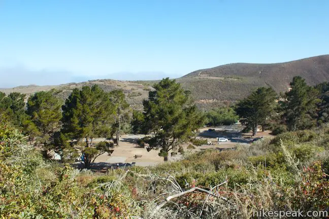
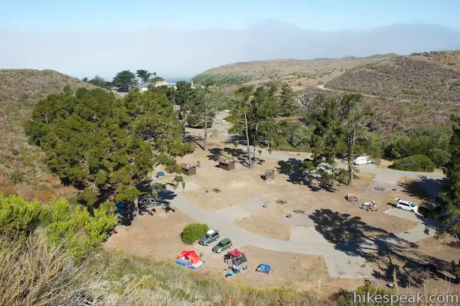
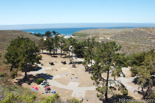
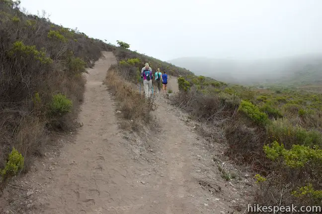
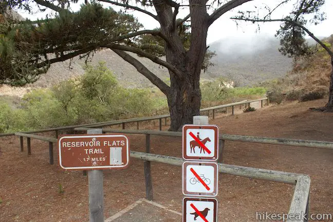
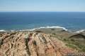
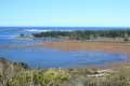
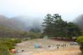
The hike begins from a trailhead between Islay Creek Campground and the park visitor center in Spooner’s Ranch House. There are signs for Reservoir Flats Trail and Oats Peak Trail at the trailhead as the two hikes cover the same ground for the first 0.3 miles. On this opening leg, you will ascend the south side of Islay Creek Canyon, gaining an overview of the 50-site Islay Creek Campground. Look back down the trail to see the bluff-framed beach called Spooner’s Cove at the bottom of Islay Creek Canyon, backed by the blue water of the Pacific Ocean.
At 0.3 miles from the start, you will reach the first trail junction, which is also the most critical. To the right, Oats Peak Trail continues to ascend toward Oats Peak. Save that longer hike for another day and turn left onto Reservoir Flats Trail.
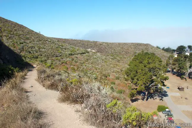
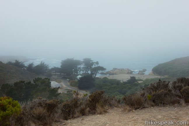
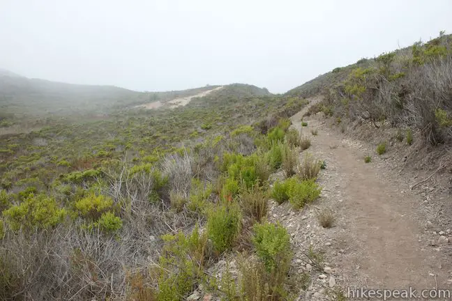
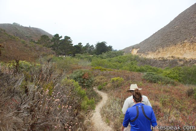
Reservoir Flats Trail makes its way out to a flat area on the canyon wall that is perched above the campground to offer a fine perspective back down toward the coast. Next, drop across a depression that held the small spring-fed reservoir that this trail is named after (a handy asset for the former residents of Spooner’s Ranch House). The trail crosses the bowl to the foot of a small hill standing in the middle of Islay Creek Canyon where you will reach a second junction, a tenth of a mile from the first one. This is a split between old and new segments of Reservoir Flats Trail.
Old Reservoir Flats Trail parts to the left, ascending a switchback to cross the top of the hill. New Reservoir Flats Trail heads to the right on a more level course across the miniature valley between the hill and the canyon wall. If you turn right and follow the new trail, you’ll hike an easy quarter mile to another junction where the trails come back together. Turn right to continue with the loop.
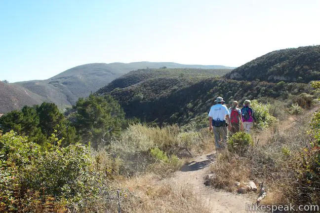
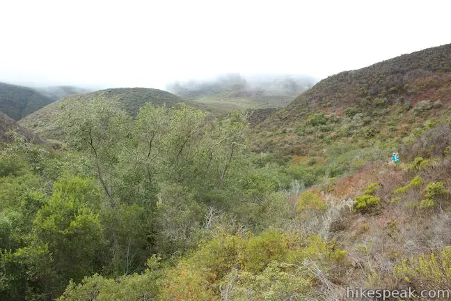
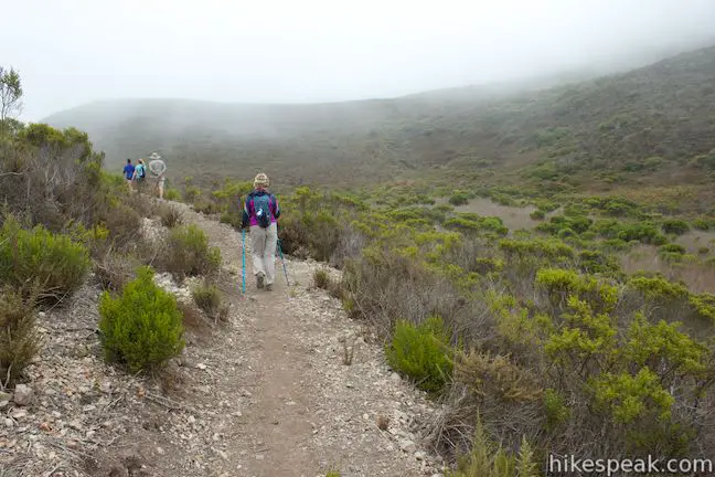
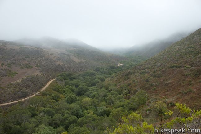
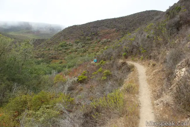
From the reunion of old and new Reservoir Flats Trail, follow the unified trail east deeper into Islay Creek Canyon. The trail turns downhill to offer views across the canyon from the canyon wall. Cottonwoods line the bottom of the canyon and you’ll spot Islay Creek Trail on the far side.
You won’t hike all the way to the bottom of the canyon, but close. After another quarter mile (0.9 miles from the start), you will reach another junction. To the right is a connector trail to Islay Creek Trail, which you could use as an alternate return route if you want to hike a little farther. Make the sharp left turn to continue on Reservoir Flats Trail toward Islay Creek Campground.
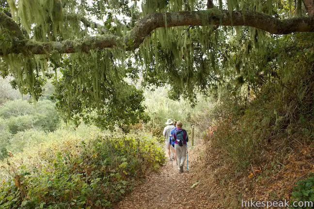
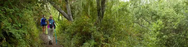
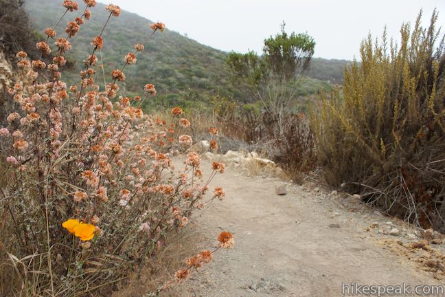
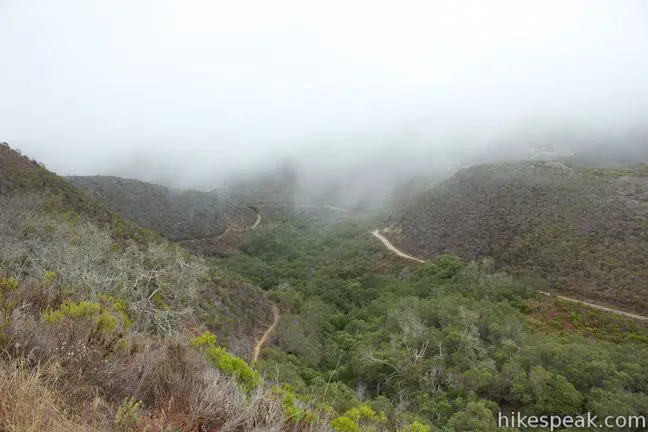
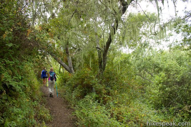
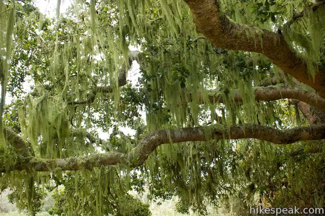
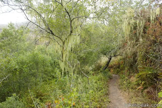
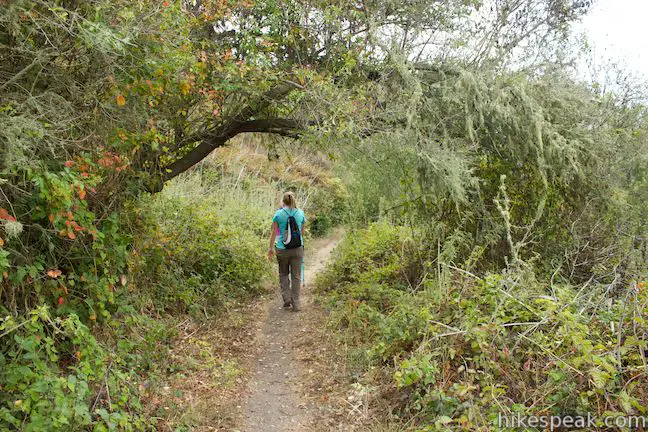
Reservoir Flats Trail makes its way along the side of the canyon, passing through tall brush and clusters of oaks decorated with lace lichens that hang from tree branches like tinsel. There are views up and down the canyon as the single track rounds a bend in the canyon above the creek.
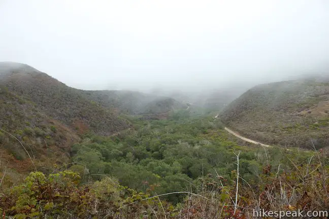
After another 2/3 of a mile (1.55 miles from the start), you will reach the edge of Islay Creek Campground. Walk straight down the road through the campground to return to the trailhead where the hike began. Just after the campground’s second loop, you will angle uphill toward the Spooner’s Ranch House and spot the trailhead on the left.
People camping at Islay Creek Campground may find it convenient to hike this loop in reverse. Campers can also use Reservoir Flats Trail to reach Islay Creek Trail to hike farther up Islay Creek Canyon.
No permit is required to hike Reservoir Flats Trail and there is no entrance fee for Montaña de Oro State Park (although there is a fee to camp at Islay Creek Campground). Dogs are not allowed, but the trail opened to horses and bikes in March of 2014. Wear long pants and watch out for poison oak along the trail.
Directions to the Trailhead
- From San Luis Obispo, exit Highway 101 at Los Osos Valley Road.
- Drive northwest toward Los Osos.
- After 11.2 miles, Los Osos Valley Road becomes Pecho Valley Road and turns sharply to the south.
- Continue the final 3.7 miles, entering Montaña de Oro State Park.
- Pass through a eucalyptus grove before reaching the road to Islay Creek Campground, on the left side of the road just past Spooner's Cove and the visitor center in Spooner's Ranch House (and before the trailheads for the Bluff Trail and Valencia Peak).
- Turn left onto the road and drive past the visitor center toward the campground.
- Park at the trailhead on the right, just before the road drops to the campground.
Trailhead Location
Trailhead address: Pecho Valley Road, Montaña de Oro State Park, Los Osos, CA 93402
Trailhead coordinates: 35.273872, -120.88553 (35° 16′ 25.93″N 120° 53′ 07.90″W)
(Reservoir Flats Trail is in teal)
View Montaña de Oro State Park in a larger map
Or view a regional map of surrounding Central Coast trails and campgrounds.


 | Oats Peak This scenic 10.8-mile hike ventures into Montaña de Oro State Park to a panoramic summit. |
 | Islay Creek Trail This easy 6-mile round trip hike follows a wide trail up a coastal canyon flanked by thousand-foot peaks, passing a small waterfall to reach an abandoned barn. |
 | Hazard Peak Trail This 6-mile round trip hike ascends coastal ridges to a 1,076-foot summit with panoramic views that include a dynamic perspective of Morro Bay. |
 | Hazard Peak - Islay Creek Loop This 9.2 mile loop continues beyond Hazard Peak deeper into Montana de Oro before circling back on Islay Creek Trail. |
 | Valencia Peak This 4.5-mile hike summits a 1,347-foot peak with stunning views over Montaña de Oro. |
 | Bluff Trail This hike of around three miles tours tide pools, beaches, and impressive cliffs along the picturesque coast of Montaña de Oro State Park. |
 | Rattlesnake Flats Trail – Badger Trail – Bluff Trail Loop This 1 2/3-mile hike offers a twist on the Bluff Trail, going along and just above the coast of Montaña de Oro State Park. |
 | South Dune Trail – Bloody Nose Trail – Hiedra Trail – Hazard Peak Trail Loop This 2 2/3-mile loop combines four trails through dunes and eucalyptus trees to lovely coastal views. |
 | Dune Trail to Hazard Canyon Reef This one-mile hike in Montaña de Oro State Park descends an oceanfront ravine to a rocky shoreline graced with engaging tide pools. |
 | Coon Creek Trail This 5-mile out and back hike ventures up a coastal canyon at the south end of Montaña de Oro State Park. |
 | Point Buchon Trail This 1 1/3 to 6.8-mile hike explores the beautiful coastline south of Montaña de Oro State Park. |
 | Morro Dunes Ecological Reserve This 2.6-mile loop serves up panoramic views over Morro Bay as it ascends 800 feet from Los Osos to Montaña de Oro State Park. |
 | Elfin Forest Natural Reserve This easy 1-mile loop on a boardwalk explores a pygmy forest on the edge of Morro Bay. |
 | Cerro Cabrillo This tough 2.5-mile hike summits the highest mountain in Morro Bay State Park, a 911-foot member of the Nine Sisters. |
 | Portola Point This 2-mile loop explores a short hill just east of Morro Estuary in Morro Bay State Park. |
 | More hikes in San Luis Obispo Explore other trails around San Luis Obispo including Morro Bay State Park and the Morros. |
 | Islay Creek Campground This 50-site campground is located at the heart of Montaña de Oro State Park in Islay Creek Canyon, and is a great base camp for treks in the park. |
Common Questions about Reservoir Flats Trail in Montaña de Oro State Park
- Is the trail open?
- Yes. You should expect to find that Reservoir Flats Trail is open. There are no recent reports of trail closures. If you discover that the trail is closed, please help your fellow hikers by reporting a closure.
- Is this trail free to access?
- Yes, Reservoir Flats Trail is free to access. No entrance fee, pass, or permit is required. If you discover that access rules have changed, please provide feedback on your experience.
- How much time does this hike take?
- It takes approximately 1 hour to hike Reservoir Flats Trail. Individual hiking times vary. Add extra time for breaks and taking in the views.
- How long is this hike?
- The hike to Reservoir Flats Trail is a 2 mile loop with 200 feet of elevation change.
- Are dogs allowed on this trail?
- No, dogs are likely not allowed on Reservoir Flats Trail. The trail is primarily open to hikers, bikes, horses.
- Is Reservoir Flats Trail good for kids?
- Yes, this hike is likely suitable for children. It is relatively short (2 miles) with manageable elevation gain.
- Are there ocean views on this hike?
- Yes, Reservoir Flats Trail offers views of the ocean.
- Where is the trailhead located?
- The trailhead for Reservoir Flats Trail is located in Los Osos, CA.
Trailhead Address:
Pecho Valley Road
Los Osos, CA 93402
Trailhead Coordinates:
35.273872, -120.88553 - What are the driving directions to the start of the hike?
To get to the trailhead: From San Luis Obispo, exit Highway 101 at Los Osos Valley Road. Drive northwest toward Los Osos. After 11.2 miles, Los Osos Valley Road becomes Pecho Valley Road and turns sharply to the south. Continue the final 3.7 miles, entering Montaña de Oro State Park. Pass through a eucalyptus grove before reaching the road to Islay Creek Campground, on the left side of the road just past Spooner's Cove and the visitor center in Spooner's Ranch House (and before the trailheads for the Bluff Trail and Valencia Peak). Turn left onto the road and drive past the visitor center toward the campground. Park at the trailhead on the right, just before the road drops to the campground.
View custom Google Maps directions from your current location.
- Are there other trails near Reservoir Flats Trail?
- Yes, you can find other nearby hikes using the Hikespeak Hike Finder Map.

Go the extra miles...
Submit a rating of this hike to go with your comment. Contribute to the average trail rating.