Coon Creek Trail
in Montaña de Oro State Park

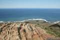
Coon Creek Trail explores a coastal canyon at the south end of Montaña de Oro State Park. The trail heads inland for 2.5 miles to a pleasant grove of Monterey cypress at the site of an old homestead that has since disappeared. Take a break in the shade of the cypress trees before turning around for a 5-mile round trip hike with 250 feet of elevation gain. Junctions with Rattesnake Flats Trail and Oats Peak Trail allow hikers to explore even more of Montaña de Oro State Park.
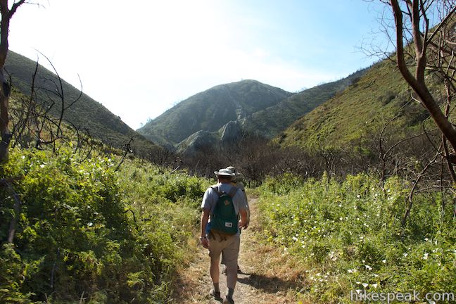
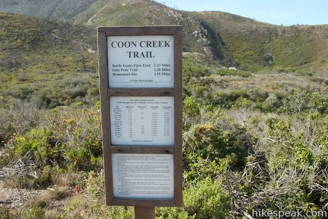
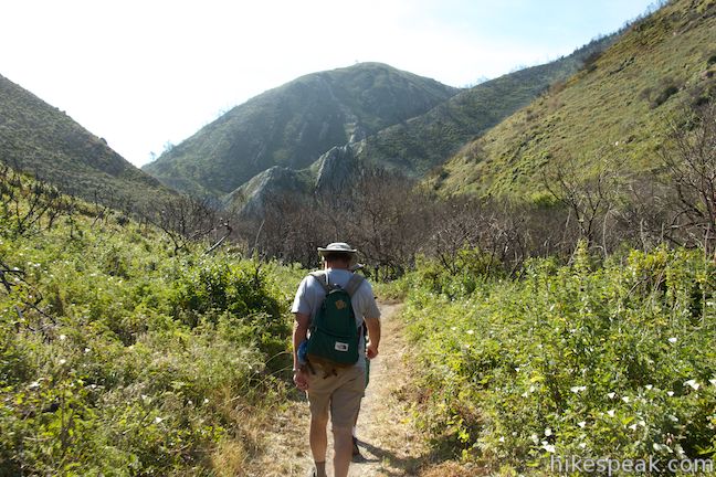
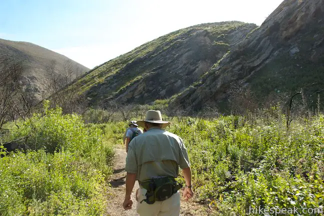
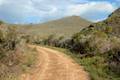
Coon Creek Trail starts from a parking area at the end of Pecho Valley Road, where you would also park to hike Point Buchon Trail in the PG&E land south of Montaña de Oro State Park. Find a sign with detailed mileage information about Coon Creek Trail and head inland up the dirt single track. Almost immediately you will come to a junction. Stay to the right to continue on Coon Creek Trail. The path to the left connects to Rattlesnake Flats Trail after 0.15 miles and can be used to create a loop off Coon Creek Trail (more on that later).
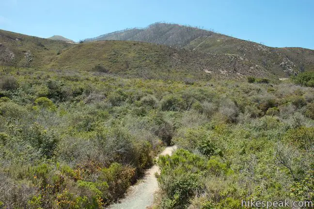
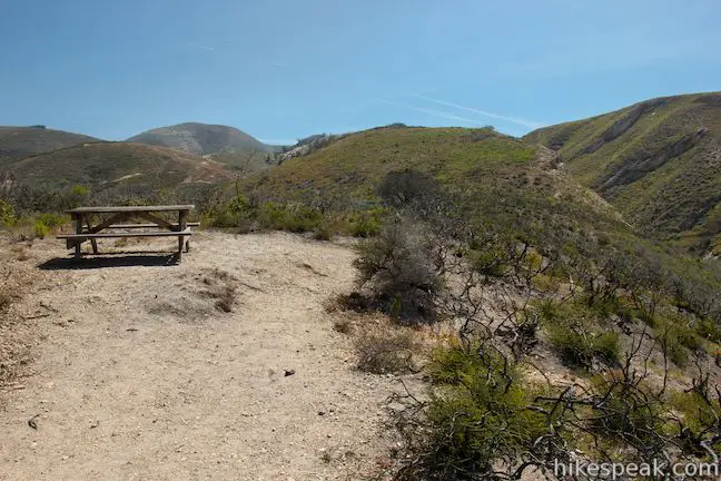
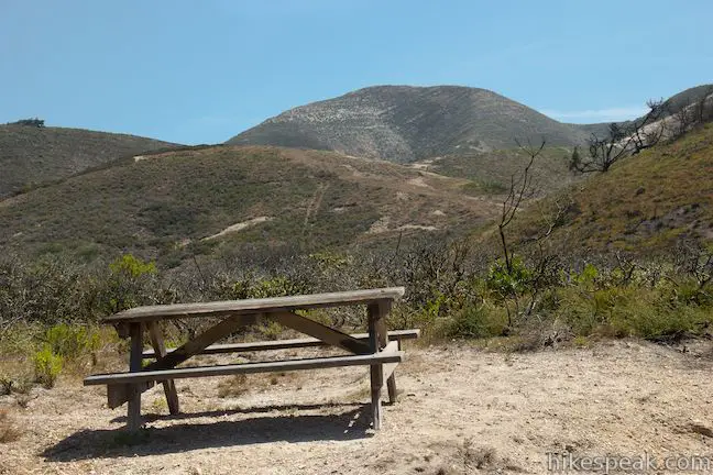
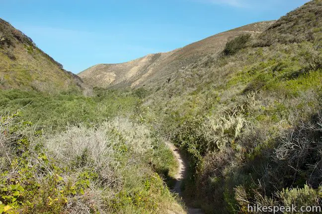
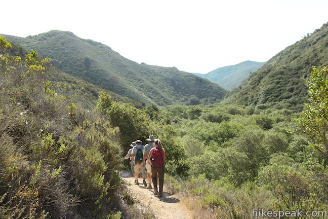
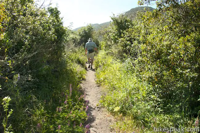
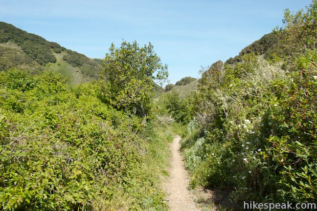
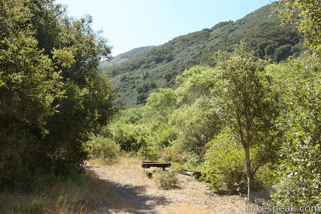
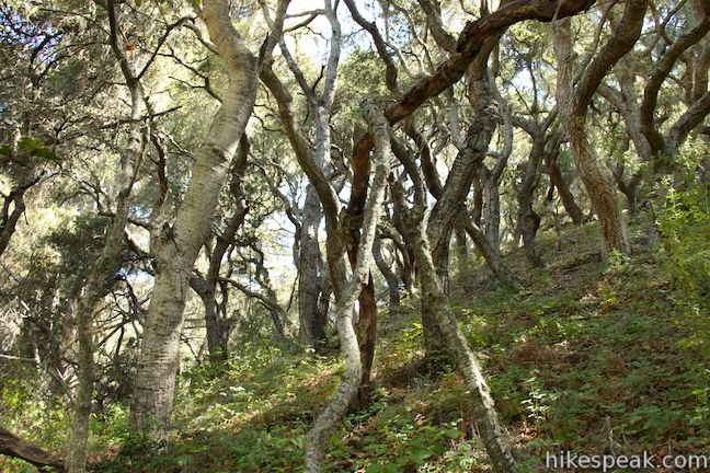
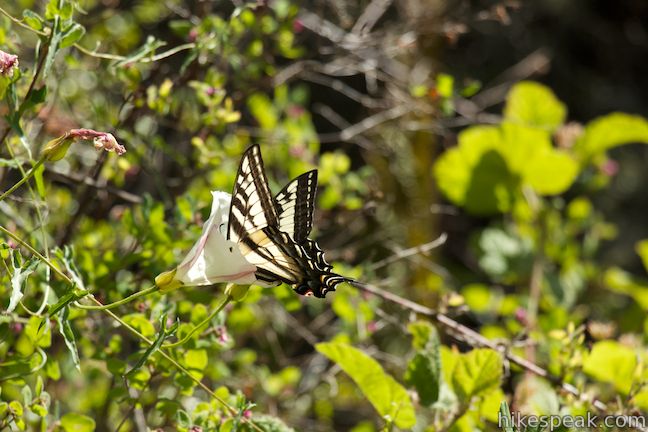
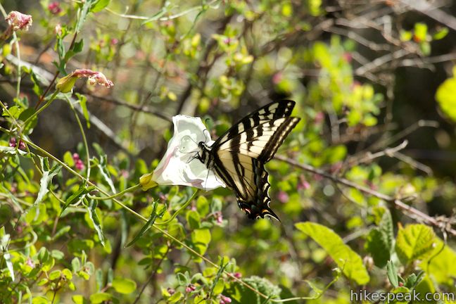
Coon Creek Trail drops into the canyon to the south, passing a picnic table with views up two canyons. Coon Creek Trail bottoms out and swings up the canyon floor through a dense riparian zone of arroyo willows and brush that bursts with wildflowers each spring, attracting lots of butterflies. The trail is narrow and hugged by tall vegetation, so wear long pants and watch out for ticks (several hopped onto hikers on a trip up Coon Creek Trail in May of 2014).
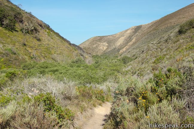
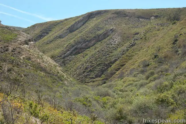
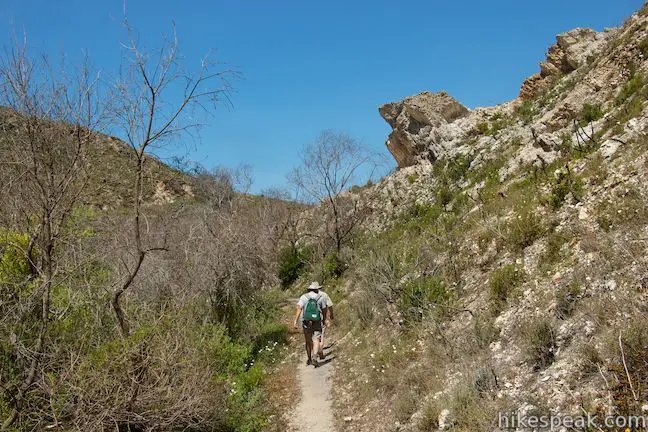
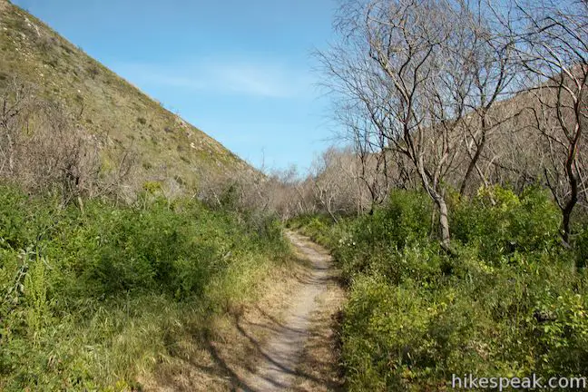
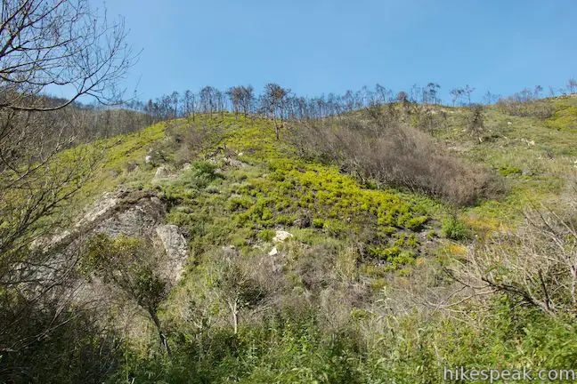
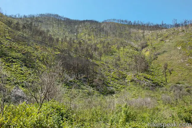
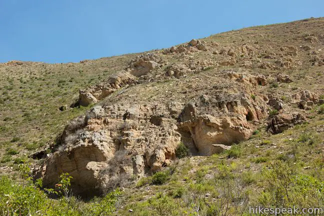
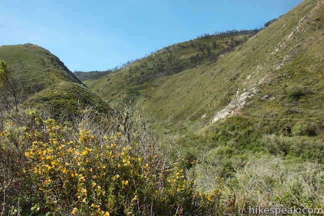
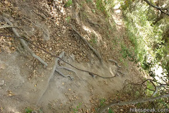
The opposing ridges grow closer together as you head inland up the canyon, passing interesting rock formations along the sides of the canyon. In 2012, a prescribed fire in Coon Creek Canyon grew out of control and burned much of the area along the first half of this trail. As a result, more of the bedrock has been exposed and there are numerous charred trees surrounded by young growth.
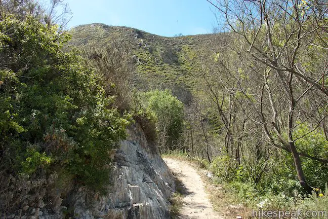
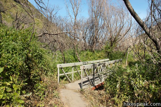
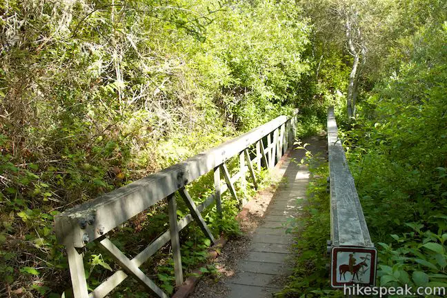
At around 0.45 miles from the start, the trail crosses its first wooden footbridge, and there is a second bridge after another 0.3 miles. In total, you will cross six bridges along Coon Creek Trail.
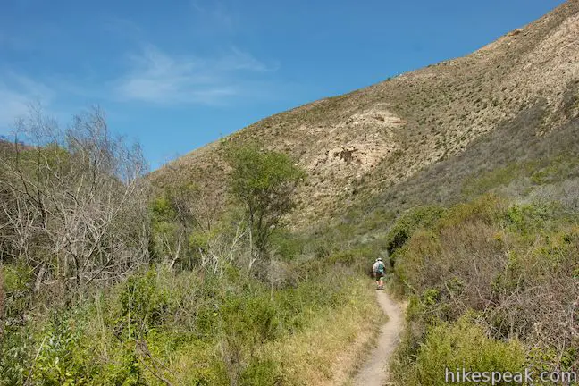
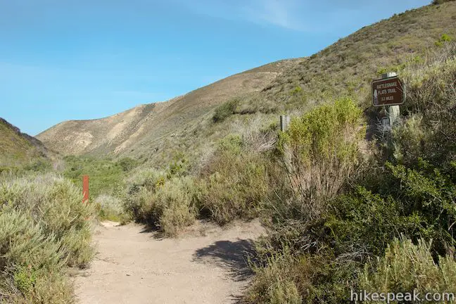
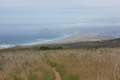
At the halfway point (1.25 miles in), Coon Creek Trail comes up onto a rise above the canyon floor and reaches a junction with Rattlesnake Flats Trail. This slightly raised vantage offers broad views up and down the canyon, allowing you to really take in your surroundings.
Rattlesnake Flats Trail parts to the left and can be used to create a loop hike with Coon Creek Trail. It is 2 miles back to the start via Rattlesnake Flats Trail, for a 3.25-mile loop with 450 feet of elevation gain. For this alternative to the out and back hike on Coon Creek Trail, hike up Rattlesnake Flats Trail, along a ridge above the canyon, and down toward the coast. Just before Rattlesnake Flats Trail reaches Pecho Valley Road, turn left down the connector trail back to the parking area (the one you passed at the start of Coon Creek Trail).
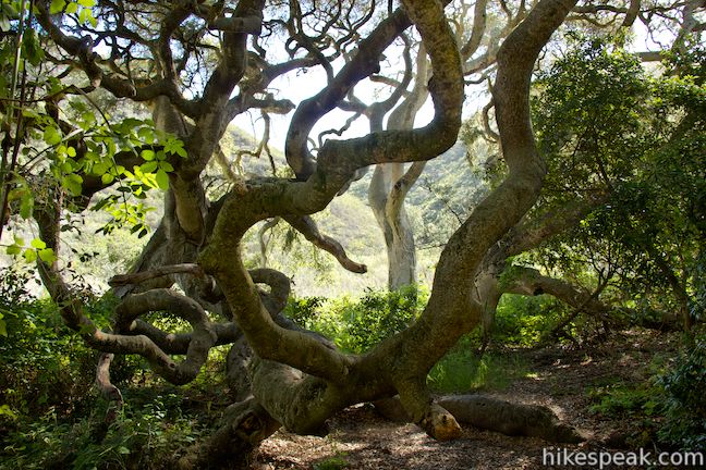
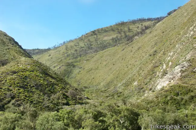
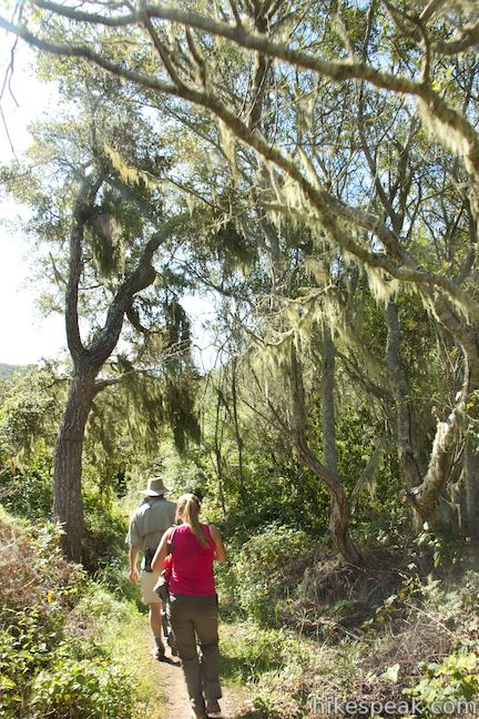
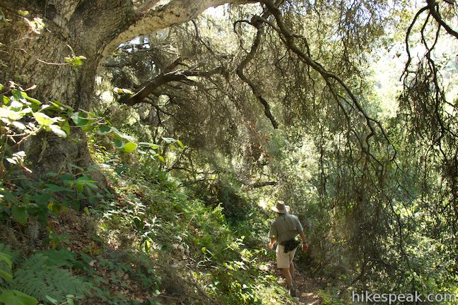
For those continuing up Cook Creek Trail, it is another 1.25 miles to the Homestead Site at the end of the trail. Having left the burnt area behind, the canyon becomes filled with more brush that will be bright green and loaded with wildflowers in the spring. The trail gets narrow in areas where dense vegetation encroaches on the path. After another quarter mile, you will reach a large oak tree with massive limbs that spread out like tentacles. The tree is named the Mother Oak and on a hot day, you will certainly appreciate the mother’s love it provides in the form of shade.
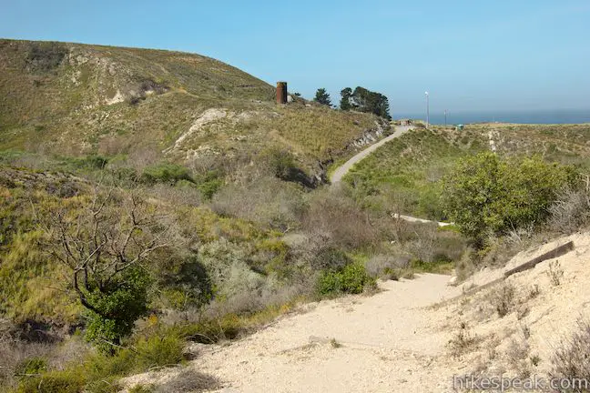
After a series of four more footbridges, the trail comes to a junction with Oats Peak Trail, 2.3 miles from the start. Oats Peak Trail starts from the road into Islay Creek Campground near the Spooner’s Ranch House and ascends 1,325 feet over 5.4 miles to the top of Oats Peak. Beyond the summit, Oats Peak Trail drops to Coon Creek Trail. For those looking for a challenging workout, it would be an over 1,000-foot ascent to the summit from Coon Creek Trail.
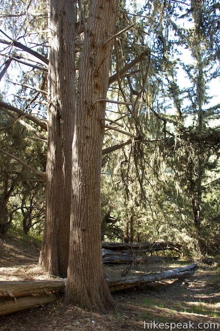
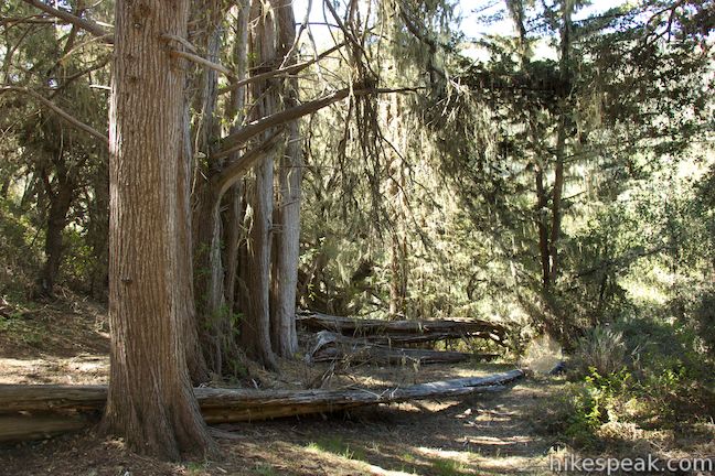
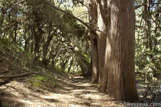
Coon Creek Trail continues another 0.2 miles beyond the Oats Peak Trail junction to the Homestead Site. The sign at the trailhead explains that:
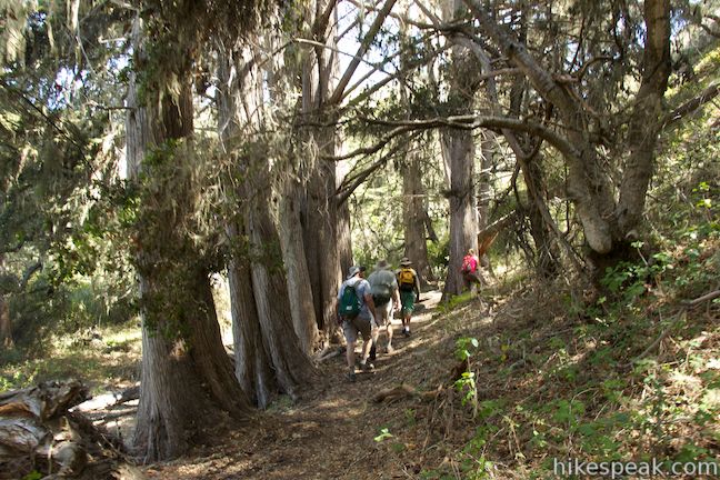
Coon Creek Trail ends at a grove of Monterey cypress, at the site of a homestead that predates the Spooner Ranch. In 1965 there was still a shed there, by 2002 only a few of the floor boards remained.
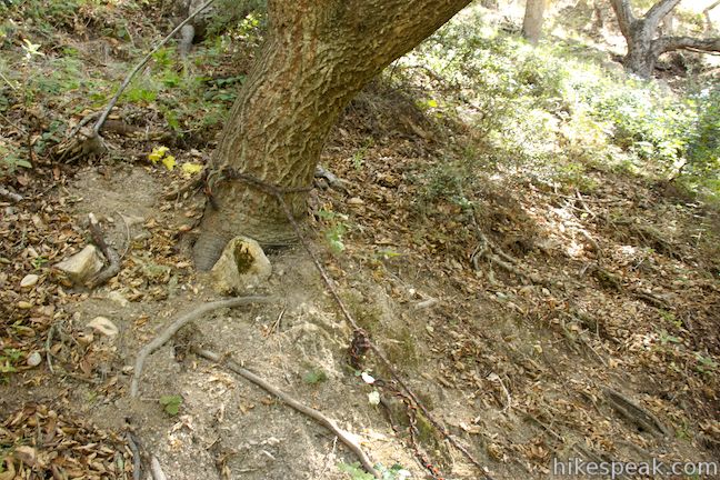
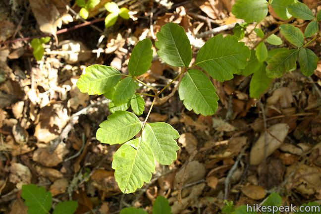
While evidence of the former residence is gone, the large cypress trees provide a shaded destination for a turnaround point. A use path continues up the canyon through lots of poison oak, employing a rope tied to a tree trunk to cross a steep bank along the creek.
Unless you’re feeling particularly adventurous, the cypress grove should be as far as you venture on the canyon on this 5-mile round trip hike (that can be extended to 5.75 miles if you take Rattlesnake Flats Trail on the way back.
Be advised that the trail is quite narrow in places, so wear long clothing and check yourself for ticks when you complete the hike. Dogs and bikes are not allowed. No fee or permit is required to hike Coon Creek Trail, so get out and enjoy!
Directions to the Trailhead
- From San Luis Obispo, exit Highway 101 at Los Osos Valley Road and drive a total of fifteen miles northwest toward Montaña de Oro State Park.
- After 11.2 miles Los Osos Valley Road becomes Pecho Valley Road and turns sharply to the south.
- Continue 4.8 miles across Montaña de Oro State Park to the large parking area on the left for Coon Creek Trail, just in front of a large metal gate that blocks vehicle traffic.
Trailhead Location
Trailhead address: Pecho Valley Road, Montaña de Oro State Park, Los Osos, CA 93402
Trailhead coordinates: 35.257927, -120.886988 (35° 15′ 28.53″N 120° 53′ 13.15″W)
View Montaña de Oro State Park in a larger map
Or view a regional map of surrounding Central Coast trails and campgrounds.


 | Point Buchon Trail This 1 1/3 to 6.8-mile hike explores the beautiful coastline south of Montaña de Oro State Park. |
 | Bluff Trail This out and back hike of around three miles tours tide pools, beaches, and impressive cliffs along the picturesque coastline in Montaña de Oro State Park. |
 | Valencia Peak Trail This 4.5-mile hike summits a 1,347-foot peak with stunning views over Montaña de Oro. |
 | Rattlesnake Flats Trail – Badger Trail – Bluff Trail Loop This 1 2/3-mile hike offers a twist on the Bluff Trail, going along and just above the coast of Montaña de Oro State Park. |
 | Reservoir Flats Trail This 2-mile loop delivers fine ocean and canyon views as it explores the bottom of Islay Creek Canyon in Montaña de Oro State Park. |
 | Islay Creek Trail This easy 6-mile round trip hike follows a wide trail up a coastal canyon flanked by thousand-foot peaks, passing a small waterfall to reach an abandoned barn. |
 | Oats Peak Trail This scenic 10.8-mile hike ventures into Montaña de Oro State Park to a panoramic summit. |
 | Hazard Peak Trail This 6-mile round trip hike ascends coastal ridges to a 1,076-foot summit with panoramic views that include a dynamic perspective of Morro Bay. |
 | Hazard Peak - Islay Creek Loop This 9.2 mile loop continues beyond Hazard Peak deeper into Montana de Oro before circling back on Islay Creek Trail. |
 | South Dune Trail – Bloody Nose Trail – Hiedra Trail – Hazard Peak Trail Loop This 2 2/3-mile loop combines four trails through dunes and eucalyptus trees to lovely coastal views. |
 | Dune Trail to Hazard Canyon Reef This one-mile hike in Montaña de Oro State Park descends an oceanfront ravine to a rocky shoreline graced with engaging tide pools. |
 | Morro Dunes Ecological Reserve This 2.6-mile loop serves up panoramic views over Morro Bay as it ascends 800 feet from Los Osos to Montaña de Oro State Park. |
 | More hikes in San Luis Obispo Explore other trails around San Luis Obispo including Morro Bay State Park and the Morros. |
 | Islay Creek Campground This 50-site campground is located at the heart of Montaña de Oro State Park in Islay Creek Canyon, and is a great base camp for treks in the park. |
- Coon Creek Trail on alltrails.com (opens in a new tab)
- Coon Creek Trail on mapmyhike.com (opens in a new tab)
- Coon Creek Trail on localwiki.org (opens in a new tab)
- Coon Creek - Oats Peak loop on stevenmarx.net (opens in a new tab)
- Montaña de Oro State Park on summitpost.org (opens in a new tab)
- Montaña de Oro State Park on wikipedia.org (opens in a new tab)
- The official website for Montaña de Oro State Park (opens in a new tab)
Common Questions about Coon Creek Trail in Montaña de Oro State Park
- Is the trail open?
- Yes. You should expect to find that Coon Creek Trail is open. There are no recent reports of trail closures. If you discover that the trail is closed, please help your fellow hikers by reporting a closure.
- Is this trail free to access?
- Yes, Coon Creek Trail is free to access. No entrance fee, pass, or permit is required. If you discover that access rules have changed, please provide feedback on your experience.
- How much time does this hike take?
- It takes approximately 2 hours 15 minutes to hike Coon Creek Trail. Individual hiking times vary. Add extra time for breaks and taking in the views.
- How long is this hike?
- The hike to Coon Creek Trail is a 5 mile out and back with 250 feet of elevation change.
- Are dogs allowed on this trail?
- No, dogs are likely not allowed on Coon Creek Trail. The trail is primarily open to hikers.
- Where is the trailhead located?
- The trailhead for Coon Creek Trail is located in Los Osos, CA.
Trailhead Address:
Pecho Valley Road
Los Osos, CA 93402
Trailhead Coordinates:
35.257927, -120.886988 - What are the driving directions to the start of the hike?
To get to the trailhead: From San Luis Obispo, exit Highway 101 at Los Osos Valley Road and drive a total of fifteen miles northwest toward Montaña de Oro State Park. After 11.2 miles Los Osos Valley Road becomes Pecho Valley Road and turns sharply to the south. Continue 4.8 miles across Montaña de Oro State Park to the large parking area on the left for Coon Creek Trail, just in front of a large metal gate that blocks vehicle traffic.
View custom Google Maps directions from your current location.
- Are there other trails near Coon Creek Trail?
- Yes, you can find other nearby hikes using the Hikespeak Hike Finder Map.

Go the extra miles...
Submit a rating of this hike to go with your comment. Contribute to the average trail rating.