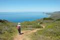
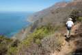
A great way to explore the dramatic waterfront on the Big Sur coast is to take a hike down the action-packed Partington Cove Trail. Partington Cove is part of Julia Pfeiffer Burns State Park begins from Highway One, just north of McWay Falls.
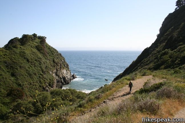
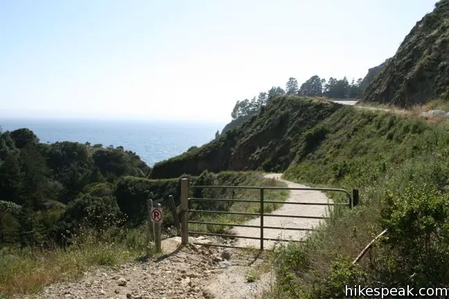
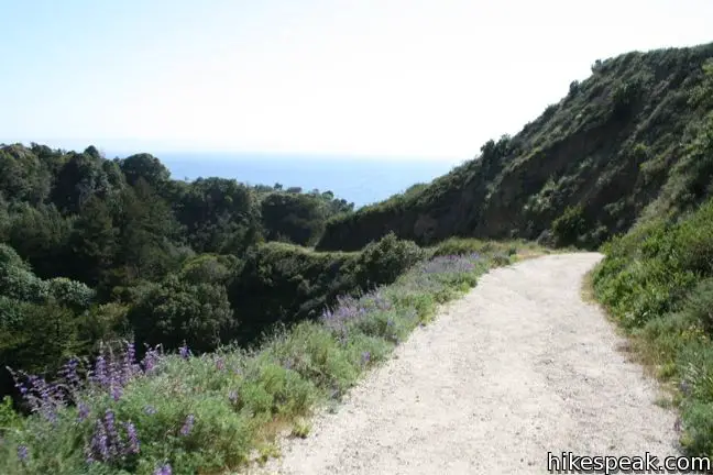
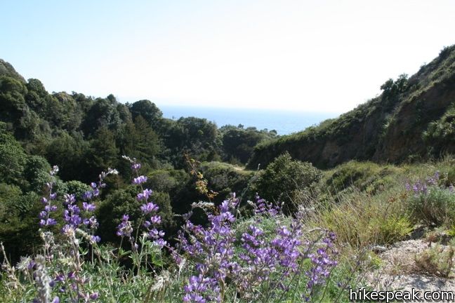
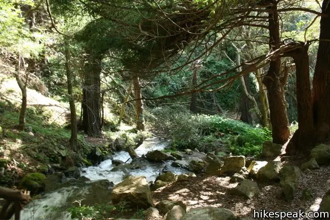
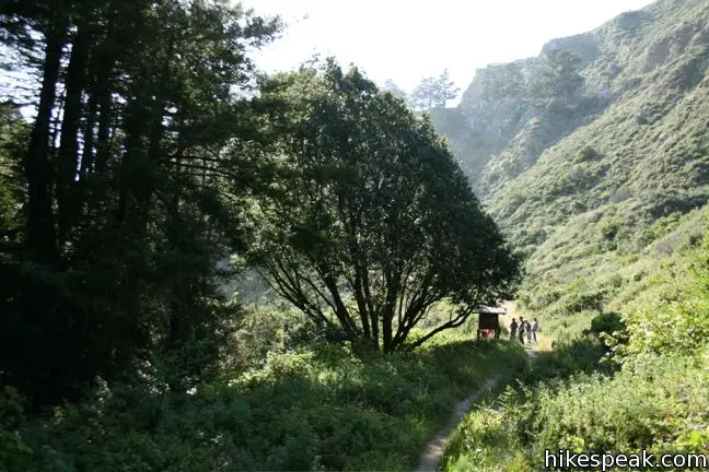
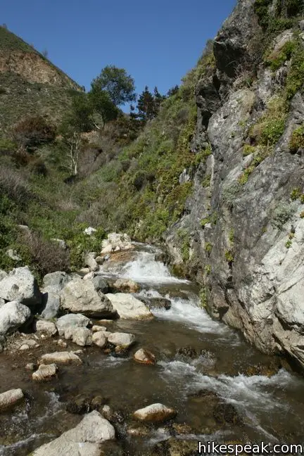
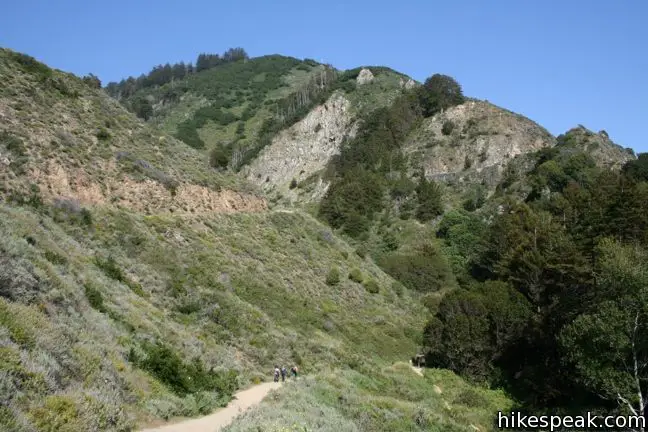
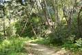
The 1.5-mile hike to Partington Cove begins at the top of a gated fire road on the west side of Highway One and descends toward the coast to a junction at an information kiosk 0.3 miles and 200 feet below. To the left, a short 0.1-mile spur goes to a shady area along Partington Creek. To the right of the kiosk, a single-track continues for a couple hundred feet to another junction.
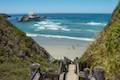
The main trail turns left across a bridge to Partington Cove, while a footpath heads straight to an isolated beach. Definitely visit both destinations.
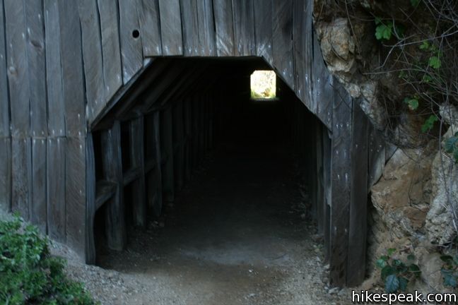
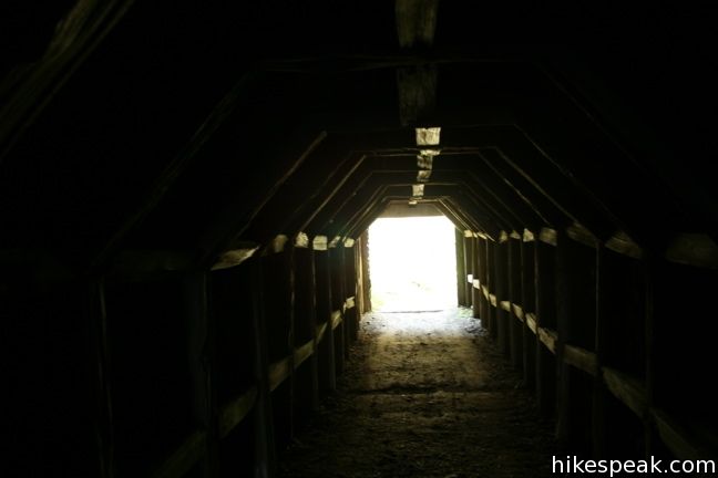
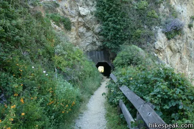
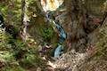
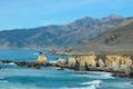
The trail to the cove crosses the creek, turns right, and reaches a tunnel carved through a wall of rock. Walk through this 60-foot tunnel to the long cove on the other side. The tunnel was constructed in the 1880s for John Partington, who transported oak from the Tanbark forests in the mountains above to ships moored in the eponymous cove.
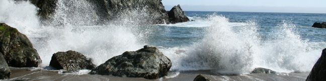
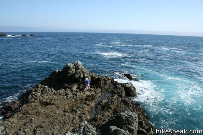
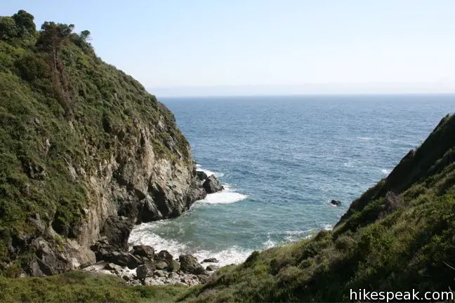
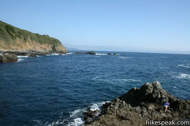
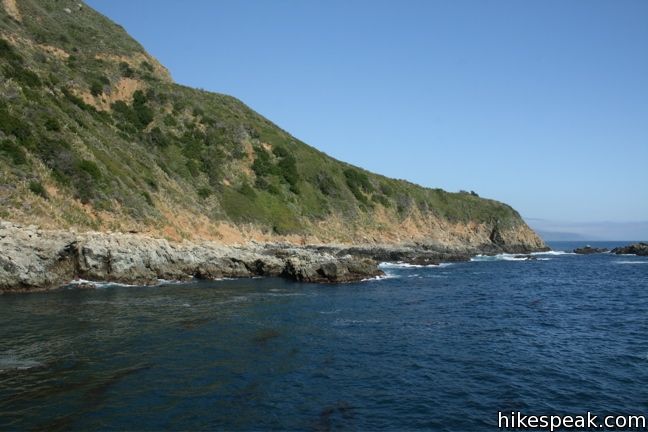
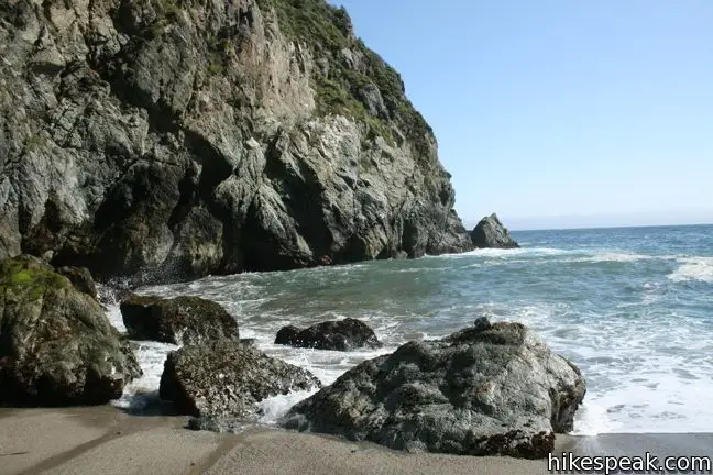
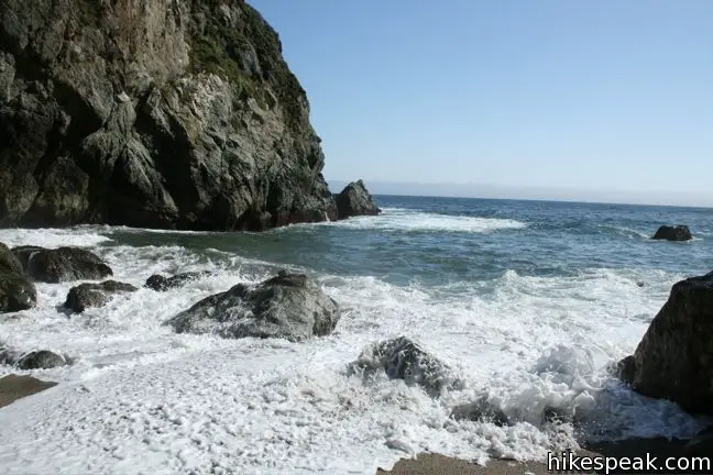
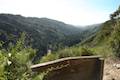
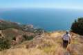
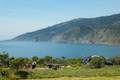
Beyond the tunnel, follow the trail along the right side of the cove to Partington Point. Enjoy the view up and down the coast before hiking back 0.2 miles to the junction.
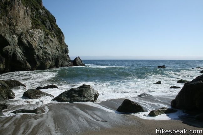
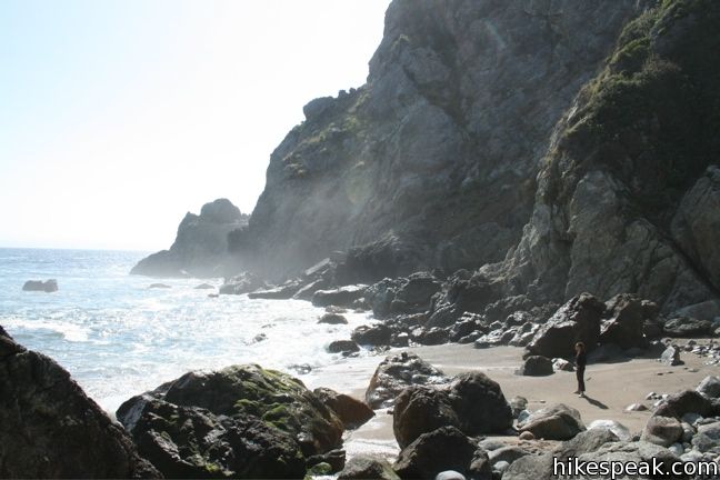
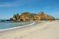
The path to the beach is a quick 0.15 miles through high brush and blackberry bushes. The path ends at a beach of boulders and sand in a small cove where the waters of Partington Creek spill out over the rocks and join the sea. There are no sweeping coastal views, but this is a nice spot to relax and look out at the big blue.
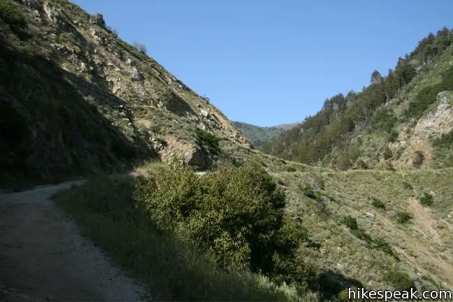
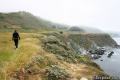
All that is left to do is hike back up to Highway One, after a very enjoyable multi-faceted coastal excursion. Just across the road is the less visited Tanbark Trail, which accesses mountain forests upstream. A bridge a quarter mile from the highway forms the top of a quick loop, or you may venture farther up the trail in to the Santa Lucia Mountains. No fee or permit is required to visit Partington Cove, so get out and enjoy.
Trail status: As of 2018, Partington Cove Trail is open, even as other areas of Julia Pfeiffer Burns State Park recover from storm damage.
Directions to the Trailhead
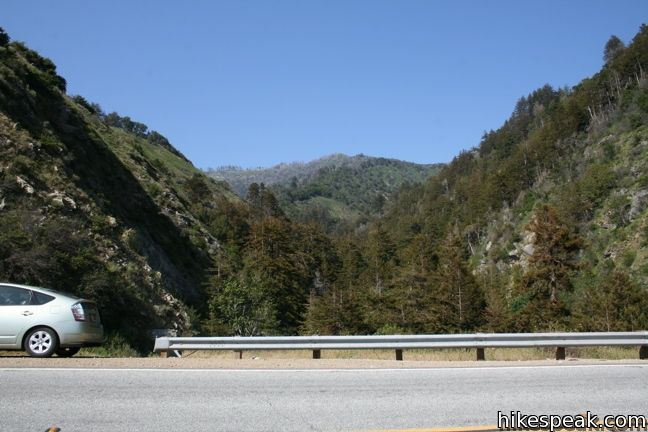
- The top of the trail is located on the inside of a bend in Highway One, 6 miles south of Nepenthe Restaurant in Big Sur, and 2 miles north of the entrance to Julia Pfeiffer Burns State Park (across from McWay Falls).
- From Ragged Point, drive 39.3 miles north and park along the highway at the trailhead (62.1 miles north of Cambria).
Trailhead Location
Trailhead address: Highway 1, Julia Pfeiffer Burns State Park, Big Sur, CA 93920
Trailhead coordinates: 36.1770, -121.6937 (36° 10′ 37.2″N 121° 41′ 37.3″W)
View Julia Pfeiffer Burns State Park in a larger map
Or view a regional map of surrounding Central Coast trails and campgrounds.


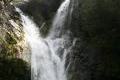
 | McWay Falls This 0.6-mile hike looks out on a stunning Big Sur waterfall that pours 80 feet right on to the beach. |
 | Canyon Falls This 0.9-mile hike heads inland up McWay Creek past a picnic area in a redwood grove to a lovely little waterfall. |
 | Pfeiffer Beach This short walk reaches an absolutely stunning beach that's a classic feature of the Big Sur landscape. |
 | Big Sur River Gorge This half-mile off-trail hike ventures up the Big Sur River on a water-wading boulder-hopping adventure to a crystal clear pool that's a gorgeous Big Sur swimming hole. |
 | Pfeiffer Falls and Valley View This 2.4-mile hike is like two hikes in one, reaching a waterfall in a canyon of redwoods and a vista point overlooking the Big Sur River Valley. |
 | Nature Trail - River Path Loop This easy 0.55-mile loop explores woodlands along the Big Sur River and a redwood grove that includes the unique and impressive Proboscis Tree. The loop can be combined with the trail to Pfeiffer Falls and Valley View for a 3-mile trek. |
 | Ridge Trail - Panorama Trail - Bluff Trail Loop This 8.7-mile loop in Andrew Molera State Park crosses a coastal ridge, bluff, and beach that are packed with amazing Big Sur views. |
 | Hare Creek Trail, Limekiln Trail, and Falls Trail This 2.65-mile hike in Limekiln State Park explores a trio of trails along lovely streams in redwood-lined canyons, reaching Limekiln Falls and historic lime kilns. |
 | Pacific Valley Bluff Trail This short out and back hike extends from Highway One to an ocean bluff with fantastic views of the Big Sur Coast. |
 | Sand Dollar Beach This short hike to Big Sur's longest beach passes two scenic overlooks on the way to the sand for a hike of 0.5 miles (or more) round trip. |
 | Jade Cove and Plaskett Rock Point This 1.5-mile hike along an ocean bluff visits a prominent peninsula and a small cove. |
 | Salmon Creek Falls This short hike visits a fine 120-foot waterfall near the start of Salmon Creek Trail. |
 | Buckeye Trail This hike of 6.5 miles or more reaches incredibly ocean vistas and trail camps in the Silver Peak Wilderness. Connect Cruickshank Trail and Buckeye Trail for an excellent shuttle hike of 8.25 miles or more. |
 | Cruickshank Trail This hike into Silver Peak Wilderness starts with bold ocean views and crosses redwood groves to reach Upper Cruickshank Camp at a junction with Buckeye Trail, 5 miles round trip from Highway One. |
 | More Central Coast Hikes Explore other destinations along the California coast between Ventura and Monterey, including trails in Los Padres National Forest. |
 | Bluff Trail in Montaña de Oro State Park This hike of around three miles tours tide pools, beaches, and impressive cliffs along a picturesque coastline. |
 | Point Buchon Trail This 1 1/3 to 6.8-mile hike explores the beautiful coastline south of Montaña de Oro State Park. |
 | Pfieffer Big Sur State Park Campground This large campground in the heart of Big Sur is spread out through oak and redwood groves along the Big Sur River. |
 | Andrew Molera State Park Trail Camp This trail camp is easy to reach (just a short walk in) with campsites in a meadow along the Big Sur River near Molera Beach. |
 | Limekiln State Park Campground This small Big Sur campground at the bottom of Limekiln Canyon has sites along a creek through a redwood grove and near the ocean, with access to trails up Limekiln Canyon. |
 | Kirk Creek Campground This outstanding 33-site campground in Los Padres National Forest has enormous ocean views from a bluff along the Big Sur coast. |
 | Plaskett Creek Campground This 45-site campground in Los Padres National Forest is positioned across Highway One from Sand Dollar Beach and Plaskett Rock Point on the coast of Big Sur. |
Common Questions about Partington Cove in Julia Pfeiffer Burns State Park
- Is the trail open?
- Yes. You should expect to find that Partington Cove Trail is open. There are no recent reports of trail closures. If you discover that the trail is closed, please help your fellow hikers by reporting a closure.
- Is this trail free to access?
- Yes, Partington Cove Trail is free to access. No entrance fee, pass, or permit is required. If you discover that access rules have changed, please provide feedback on your experience.
- How much time does this hike take?
- It takes approximately 45 minutes to hike Partington Cove Trail. Individual hiking times vary. Add extra time for breaks and taking in the views.
- How long is this hike?
- The hike to Partington Cove Trail is a 1.5 mile out and back with 270 feet of elevation change.
- Are dogs allowed on this trail?
- No, dogs are likely not allowed on Partington Cove Trail. The trail is primarily open to hikers.
- Is Partington Cove Trail good for kids?
- Yes, this hike is likely suitable for children. It is relatively short (1.5 miles) with manageable elevation gain.
- Are there ocean views on this hike?
- Yes, Partington Cove Trail offers views of the ocean.
- Where is the trailhead located?
- The trailhead for Partington Cove Trail is located in Big Sur, CA.
Trailhead Address:
Highway 1
Big Sur, CA 93920
Trailhead Coordinates:
36.1770, -121.6937 - What are the driving directions to the start of the hike?
To get to the trailhead: The top of the trail is located on the inside of a bend in Highway One, 6 miles south of Nepenthe Restaurant in Big Sur, and 2 miles north of the entrance to Julia Pfeiffer Burns State Park (across from McWay Falls). From Ragged Point, drive 39.3 miles north and park along the highway at the trailhead (62.1 miles north of Cambria).
View custom Google Maps directions from your current location.
- Are there other trails near Partington Cove Trail?
- Yes, you can find other nearby hikes using the Hikespeak Hike Finder Map.

11 Comments on Partington Cove in Julia Pfeiffer Burns State Park
What hikers are saying:
✨ Generated summary of user commentsHikers describe this coastal destination as a beautiful spot that leaves a lasting impression. Mike discovered the path by accident and found the scenery to be a wonderful surprise.
“Beautiful spot in the world.” Jump to comment ↓
“absolutely loved it!” Jump to comment ↓
So, so beautiful. Thank you, Julia. My brother’s name is John and my daughther’s name is Julia too, Maybe one day we’ll come and visit “our” cove.
Are there campgrounds near here, or where can I find back country camping?
Plaskett Creek Campground is nearby, and you can camp in the backcountry of the surrounding national forest like along the Buckeye Trail.
Are dogs allowed in this trail?
Hi – Dogs aren’t allowed on trails in Julia Pfeiffer Burns State Park
Hi – Where do you park for this trail? Thanks!
There is parking on the side of Highway One. It’s at a big bend in the highway a couple miles north of the park’s main entrance. Just follow the directions above and enjoy the hike!
The last time I visited this trail, I specifically took my family to show them what I discovered but to our disappointment the tunnel was closed. Is this open now?
Are there any trails in Big Sur that allow dogs?
I literally found this hike by accident while looking at my phone at a gas station and absolutely loved it!
1968 I was invited to the point by a hippie named Happy. There was no trail other than the one Happy n friends created. Pines and brush covered what now is a government gate. Going through the tunnel was climbing over rocks that had fallen from the ceiling. They had a rope set up to climb down to the beach. Everyone were in their birthday suits. Happy led me around to the point where we climbed over rock cliff as we went north about 50 yards we climbed up towards a opening to a big cave where they all lived together in. Great experience will never forget it since I have taken many friends and showed them what I experienced. Beautiful spot in the world.