For backpackers and day hikers, Cruickshank Trail offers an extraordinary opportunity to explore the wilderness off Highway One on the beautiful Big Sur Coast. The single track starts by climbing to lofty ocean views, and then heads inland along a canyon wall with relaxing pockets of oaks and redwoods toward a handful of trail camps. The excellent trail to Upper Cruickshank Camp crosses diverse scenery for a 5-mile round trip hike with 1,150 feet of elevation gain, and there are several possible extensions.
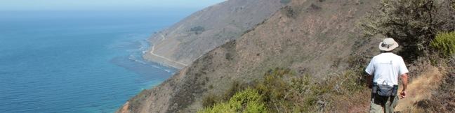
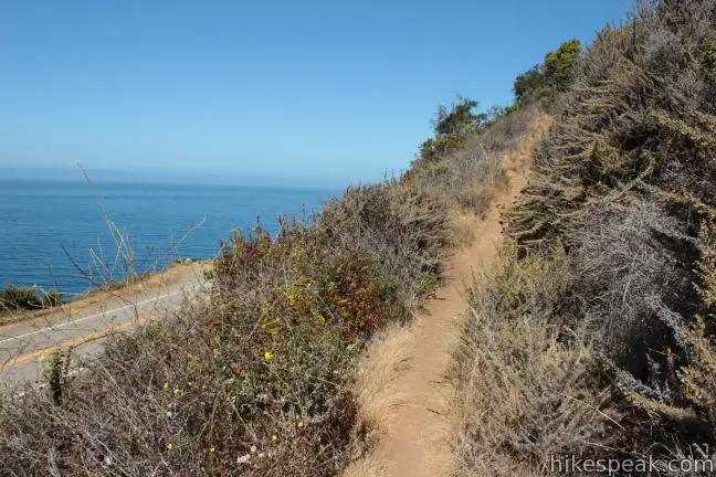
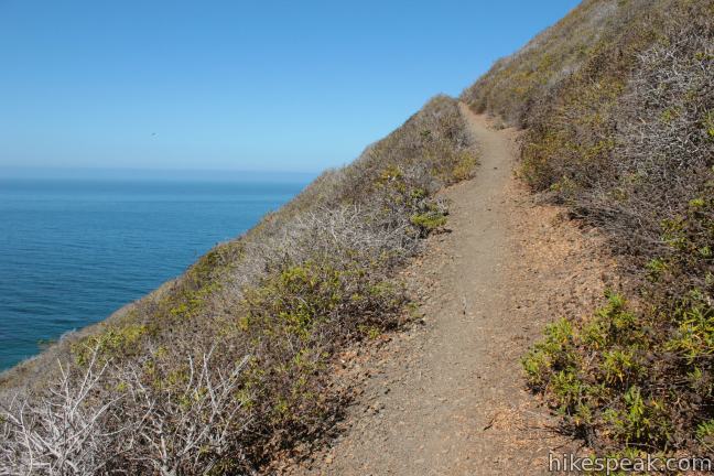
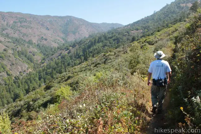
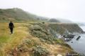
Beginning from a turnout along Highway One, Cruickshank Trail immediately gets down to the business of climbing an oceanfront ridge. If you weren’t rewarded by motivational views up and down the coast, you might think about turning back. Long pants are preferable as you get underway, battling through tall brush that encroaches on the narrow trail. Luckily, this is only an issue at the very start. The brush thins out as you begin up a string of switchbacks.
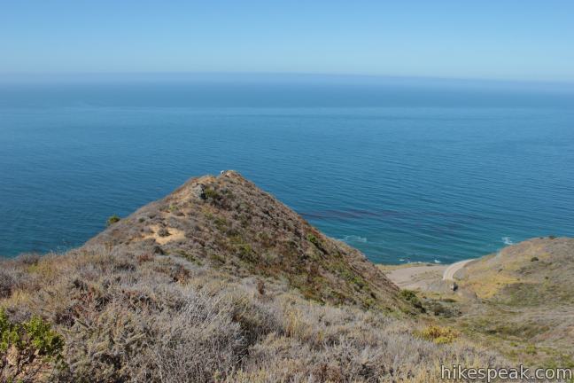
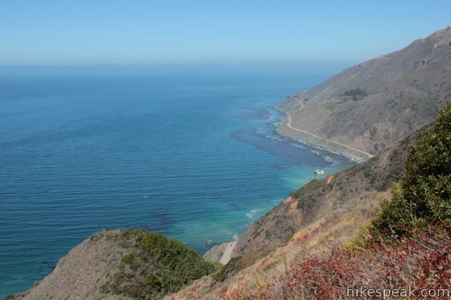
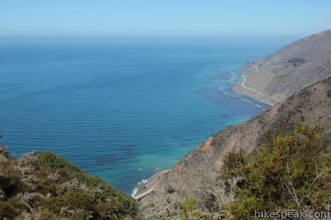
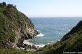
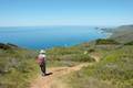
While the trail never gets too steep, you will be ready to catch your breath by the time you reach a picturesque landing atop the ridge, 2/3 of a mile from the start. There is a knockout view north up the winding coast. For those eager for closer ocean views, there is a use trail extending to the left down to a point on the ridge, while Cruickshank Trail turns right up another switchback on the mountainside.
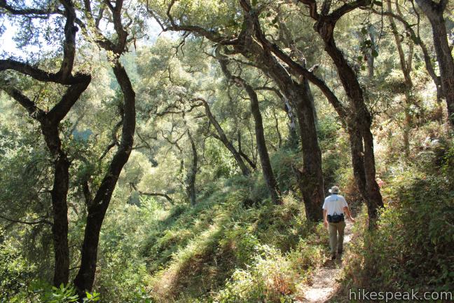
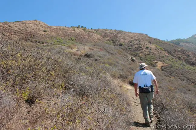
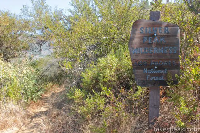
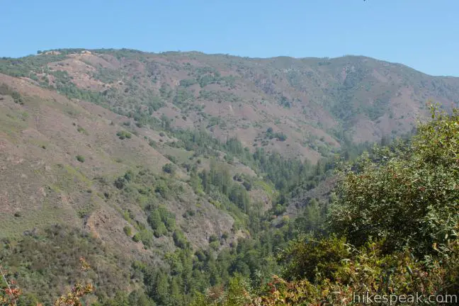
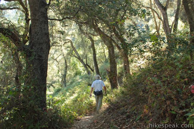
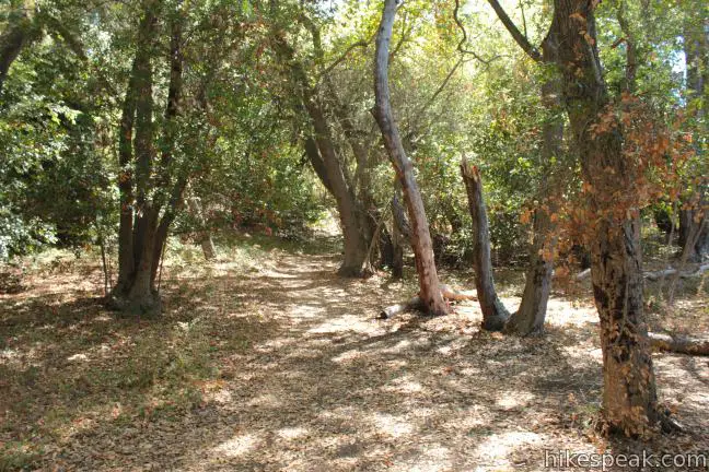
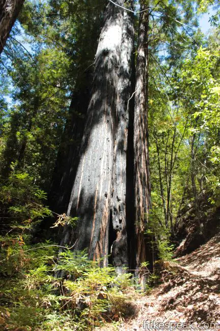
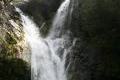
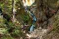
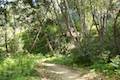
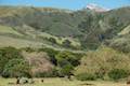
The trail works its way to the north side of the ridge and enters Silver Peak Wilderness. After a 700-foot climb over the first 0.8 miles, Cruickshank Trail becomes more gradual, heading inland along the south wall of a wide and deep V-shaped canyon carved by Villa Creek. The coastal sagebrush disappears, and after half a mile the trail enters a lush oak woodland. Sporadic stands of redwoods appear as you cross two seasonal streams.
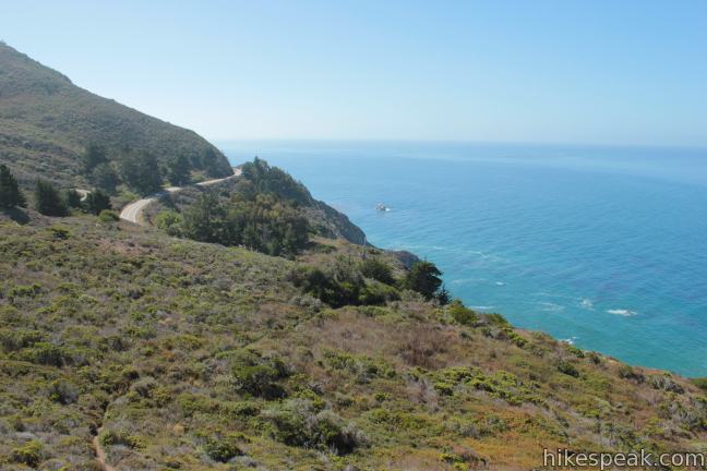
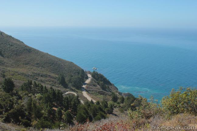
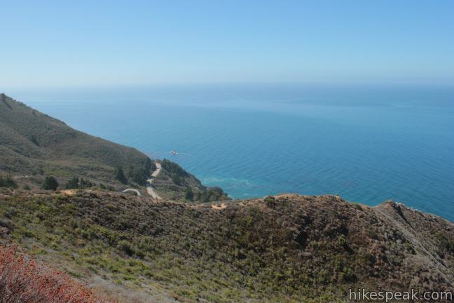
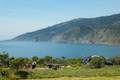
Leaving the forest for a moment, the trail crosses a west-facing kink in the canyon wall (about 2 miles from the start) that delivers one final dynamic ocean view, looking down the canyon toward the calm blue waters of the Pacific.
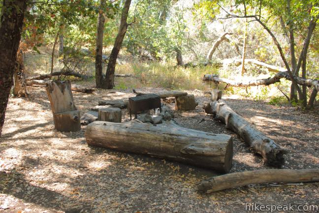
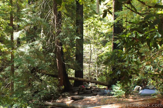
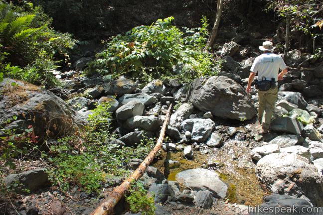
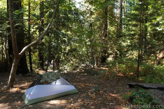
Shortly after crossing a third stream, the trail arrives at Lower Cruickshank Camp. There is a picnic table, a small fire ring, and room for a small tent. Backpackers can filter water from the nearby stream.
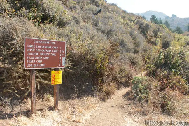
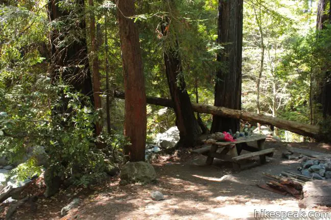
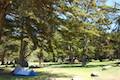
It is another quarter mile to Upper Cruickshank Camp, which has a group-friendly seating area around a larger fire ring along with room for a few tents. Buckeye Trail crosses Cruickshank Trail at Upper Cruickshank Camp, and backpackers can find water to filter by turning left on Buckeye Trail and walking a hundred feet to a spring that flows over the trail. It is 2.5 miles up Cruickshank Trail to Upper Cruickshank Camp, and there are a few noteworthy extensions for those looking for more.
For a short addition, head north (left) on Buckeye Trail and hike half a mile to Villa Creek Camp. You will rapidly descend 200 feet to Villa Creek, where a channel of clear, cold water flows over grey boulders. The creek is flanked by redwoods that create a shady canyon bottom. After crossing the creek, the trail turns downstream for another 0.2 miles to Villa Creek Camp, situated on a landing along the creek beneath tall redwoods. Ferns line the forest floor, creating a taste of the redwood forests on the North Coast of California. Beyond Villa Creek Camp, the trail continues another 3.5 miles to Alder Creek Camp.
Returning to Upper Cruickshank Camp, Buckeye Trail can be taken in the other direction toward a number of destinations. From Upper Cruickshank Camp, it is 2.5 miles down Buckeye Trail to Buckeye Camp, another large trail camp, and 5.75 miles to Highway One at Soda Springs Creek. If you have a second vehicle, the two trails make an excellent through hike.
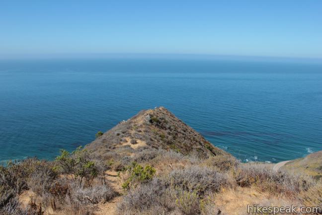
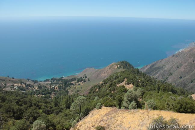
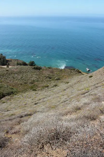
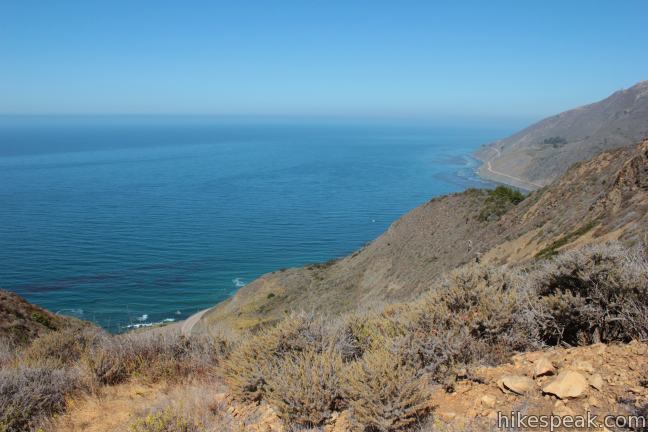
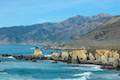
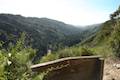
It would be a shame to hike all the way to Upper Cruickshank Camp and not see the absolutely amazing views waiting 1 1/3 miles up Buckeye Trail. There is an additional 900 feet of elevation gain along this stretch of trail, which means you’ll have to work for it, but the soaring 2,325-foot view over the Big Sur coast will leave you speechless.
To reach the vista point, take Buckeye Trail south from Upper Cruickshank Camp (away from Villa Creek Camp). The trail immediately enters a meadow and comes to an unmarked split. Take the worn path to the left/straight, which quickly leads to a marked junction. Silver Camp and Lions Den Camp are farther up Cruickshank Trail to the left. Turn right to stay on Buckeye Trail and hike another mile up the mountainside to a saddle that looks south down the coast. Buckeye Trail continues to the left toward Buckeye Camp, but turn right and hike a short distance to an unbelievable overlook at the end of the ridge. From the divine vantage, you can look down over the initial switchbacks on Cruickshank Trail leaving Highway One. The views along the coast and across the ocean are extraordinary.
No matter how far you hike on Cruickshank Trail, you are in for a fantastic experience. Lower Cruickshank Camp, Upper Cruickshank Camp, and Villa Creek Camp are all great backpacker base camps for adventures deeper into the 28,000 acres of Silver Peak Wilderness in the Los Padres National Forest. It is free to hike Cruickshank Trail and no permit is required to stay overnight at one of the trail camps. An easy-to-obtain campfire permit is required if you would like to use a stove or make a fire (under safe conditions). Dogs are welcome, and there is no red tape for day hikers, so get out and enjoy!
Bad News: As of July 2018, Highway 1 has reopened to provide access to the trailhead from the north and south. For more information, you may call the US Forest Service Monterey District Office in King City at (831)385-5434.
Directions to the Trailhead
- the trail is located on Highway One, 4.2 miles north of Salmon Creek Falls and 8 miles north of Ragged Point Inn (or 30 miles north of Cambria).
- From the other direction, the trailhead is 0.6 miles south of the Villa Creek Bridge, or 29.4 miles south of Julia Pfeiffer Burns State Park (home of McWay Falls) and 37.6 miles south of the Nepenthe Restaurant turnoff in Big Sur.
- Look for a large trail mileage sign at the trailhead.
- There is parking on the side of the road.
Trailhead Location
Trailhead address: Cabrillo Highway (Highway One), Los Padres National Forest, Big Sur, CA 93920
Trailhead coordinates: 35.843073, -121.403025 (35° 50′ 35.06″N 121° 24′ 10.88″W)
View Cruickshank Trail in a larger map
Or view a regional map of surrounding Central Coast trails and campgrounds.


 | Buckeye Trail This hike of 6.5 miles or more reaches incredible ocean vistas and trail camps in the Silver Peak Wilderness. |
 | Salmon Creek Falls This short hike visits a fine 120-foot waterfall near the start of Salmon Creek Trail. |
 | Jade Cove and Plaskett Rock Point This 1.5-mile hike along an ocean bluff visits a prominent peninsula and a small cove. |
 | Sand Dollar Beach This short hike to Big Sur's longest beach passes two scenic overlooks on the way to the sand for a hike of 0.5 miles (or more) round trip. |
 | Pacific Valley Bluff Trail This short out and back hike extends from Highway One to an ocean bluff with fantastic views of the Big Sur Coast. |
 | Hare Creek Trail, Limekiln Trail, and Falls Trail This 2.65-mile hike in Limekiln State Park explores a trio of trails along lovely streams in redwood-lined canyons, reaching Limekiln Falls and historic lime kilns. |
 | McWay Falls This 0.6-mile hike looks out on a stunning Big Sur waterfall that pours 80 feet right on to the beach. |
 | Canyon Falls This 0.9-mile hike heads inland up McWay Creek past a picnic area in a redwood grove to a lovely little waterfall. |
 | Partington Cove This 1.5-mile hike visits a cove and a secluded beach along the scenic Big Sur coast. The cove is accessed through a tunnel. |
 | Pfeiffer Beach This short walk reaches an absolutely stunning beach that's a classic feature of the Big Sur landscape. |
 | Big Sur River Gorge This half-mile off-trail hike ventures up the Big Sur River on a water-wading boulder-hopping adventure to a crystal clear pool that's a gorgeous Big Sur swimming hole. |
 | Pfeiffer Falls and Valley View This 2.4-mile hike is like two hikes in one, reaching a waterfall in a canyon of redwoods and a vista point overlooking the Big Sur River Valley. |
 | Nature Trail - River Path Loop This easy 0.55-mile loop explores woodlands along the Big Sur River and a redwood grove that includes the unique and impressive Proboscis Tree. The loop can be combined with the trail to Pfeiffer Falls and Valley View for a 3-mile trek. |
 | Ridge Trail - Panorama Trail - Bluff Trail Loop This 8.7-mile loop in Andrew Molera State Park crosses a coastal ridge, bluff, and beach that are packed with amazing Big Sur views. |
 | More Central Coast Hikes Explore other destinations along the California coast between Ventura and Monterey, including trails in Los Padres National Forest. |
 | Kirk Creek Campground This outstanding 33-site campground in Los Padres National Forest has enormous ocean views from a bluff along the Big Sur coast. |
 | Plaskett Creek Campground This 45-site campground in Los Padres National Forest is positioned across Highway One from Sand Dollar Beach and Plaskett Rock Point on the coast of Big Sur. |
 | Limekiln State Park Campground This small Big Sur campground at the bottom of Limekiln Canyon has sites along a creek through a redwood grove and near the ocean, with access to trails up Limekiln Canyon. |
 | Pfieffer Big Sur State Park Campground This large campground in the heart of Big Sur is spread out through oak and redwood groves along the Big Sur River. |
 | Andrew Molera State Park Trail Camp This trail camp is easy to reach (just a short walk in) with campsites in a meadow along the Big Sur River near Molera Beach. |
- Cruickshank Trail on jrabold.net (opens in a new tab)
- Cruickshank Trail on hikinginbigsur.com (opens in a new tab)
- Cruickshank-Salmon-Buckeye Loop Trail on ouachitamaps.com (opens in a new tab)
- Silver Peak Wilderness on wilkipedia.org (opens in a new tab)
- The official website for Los Padres National Forest (opens in a new tab)
Common Questions about Cruickshank Trail in the Silver Peak Wilderness
- Is the trail open?
- Yes. You should expect to find that Cruickshank Trail to Upper Cruichshank Camp is open. There are no recent reports of trail closures. If you discover that the trail is closed, please help your fellow hikers by reporting a closure.
- Is this trail free to access?
- Yes, Cruickshank Trail to Upper Cruichshank Camp is free to access. No entrance fee, pass, or permit is required. If you discover that access rules have changed, please provide feedback on your experience.
- How much time does this hike take?
- It takes approximately 2 hours 45 minutes to hike Cruickshank Trail to Upper Cruichshank Camp. Individual hiking times vary. Add extra time for breaks and taking in the views.
- How long is this hike?
- The hike to Cruickshank Trail to Upper Cruichshank Camp is a 5 mile out and back with 1150 feet of elevation change.
- Are dogs allowed on this trail?
- Yes, dogs are allowed on Cruickshank Trail to Upper Cruichshank Camp. The trail is open to hikers, dogs.
- Are there ocean views on this hike?
- Yes, Cruickshank Trail to Upper Cruichshank Camp offers views of the ocean.
- Where is the trailhead located?
- The trailhead for Cruickshank Trail to Upper Cruichshank Camp is located in Big Sur, CA.
Trailhead Address:
Highway One
Big Sur, CA 93920
Trailhead Coordinates:
35.843073, -121.403025 - What are the driving directions to the start of the hike?
To get to the trailhead: the trail is located on Highway One, 4.2 miles north of Salmon Creek Falls and 8 miles north of Ragged Point Inn (or 30 miles north of Cambria). From the other direction, the trailhead is 0.6 miles south of the Villa Creek Bridge, or 29.4 miles south of Julia Pfeiffer Burns State Park (home of McWay Falls) and 37.6 miles south of the Nepenthe Restaurant turnoff in Big Sur. Look for a large trail mileage sign at the trailhead. There is parking on the side of the road.
View custom Google Maps directions from your current location.
- Are there other trails near Cruickshank Trail to Upper Cruichshank Camp?
- Yes, you can find other nearby hikes using the Hikespeak Hike Finder Map.

7 Comments on Cruickshank Trail in the Silver Peak Wilderness
What hikers are saying:
✨ Generated summary of user commentsHikers find the initial ascent of this trail to be a tedious climb, though the path becomes more manageable once past the first section. Bob advises not to let the description fool you regarding the difficulty of the start. Recent reports indicate that poison oak has been cleared from the area, making for a more pleasant journey to the falls.
I saw that this was update July 22nd, 2015. Did you last go here then? Is there still water flowing? I want to go backpacking here but want to make sure there is going to be water to filter. Thanks so much!
No. Sorry. Not sure of the water status.
I went to Salmon Falls last week, there was water–not much in the Falls. Good news is that according to signage they have removed the poison oak on July 20.
[…] Hikespeak.com has a great trail description available here: […]
Don’t let the description fool you…the first bit of the trail is a pain to get up. Its not that its extremely difficult…just annoying. After that point the trail is ok though.
Hi there! Thinking of doing this hike to the Buckeye Outlook. Does anyone know the mileage?
Just want to plan accordingly!
Any info would be appreciated!
Hi,
Starting on Cruickshank Trail, it is just over 3.5 miles up to the scenic overlook off Buckeye Trail.