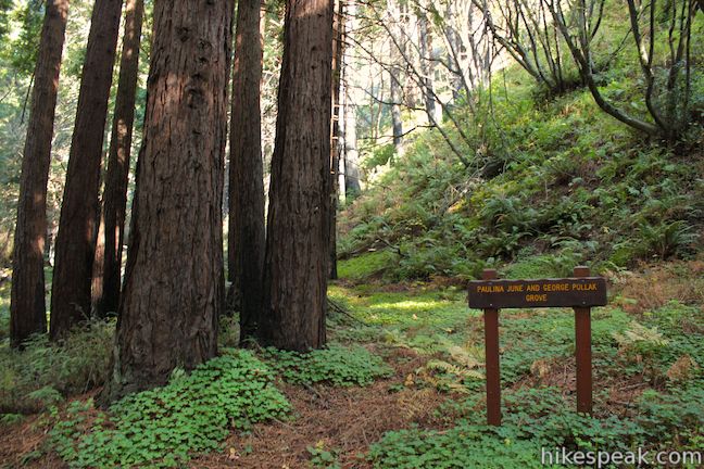
For pleasant hiking along creeks in canyons shaded by coast redwoods, you can’t do much better than Limekiln State Park in Big Sur. A trio of short trails in the park provide variety and great scenery on a 2.65-mile round trip hike with 250 feet of elevation gain. Hare Creek Trail is a supremely peaceful creekside stroll, as is Limekiln Trail, which heads to historic lime kilns that the park has preserved, and Falls Trail ascends another fork of Limekiln Creek to a hundred-foot tall waterfall. The trails all branch out from the same trailhead, making them easy to combine for a beautiful hike to multiple star attractions in Limekiln State Park.
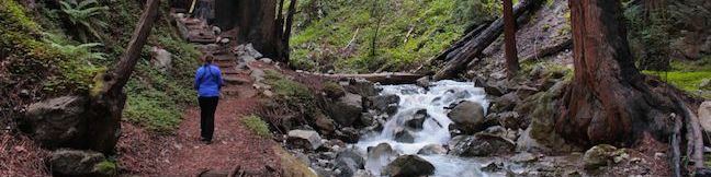
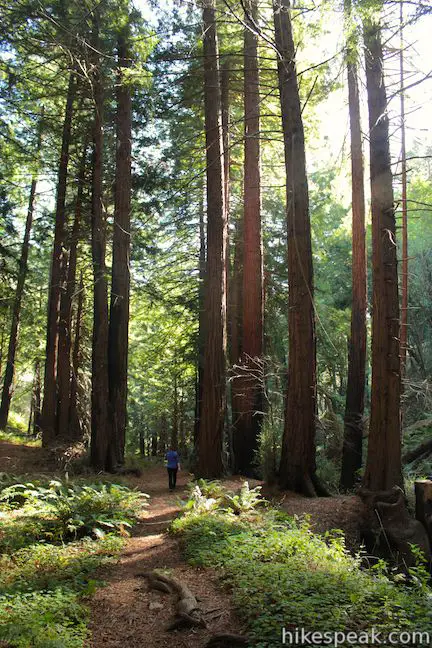
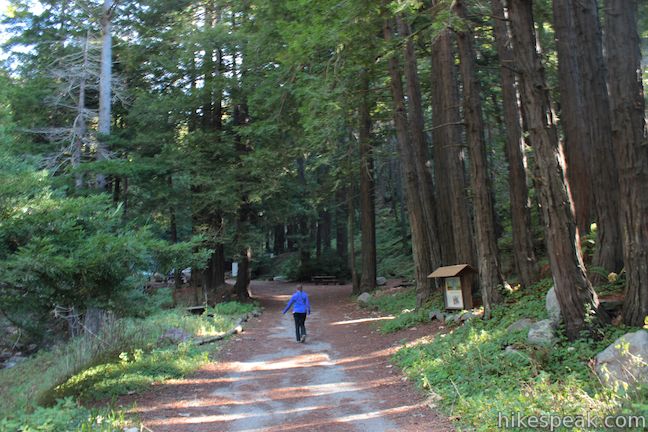
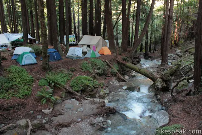
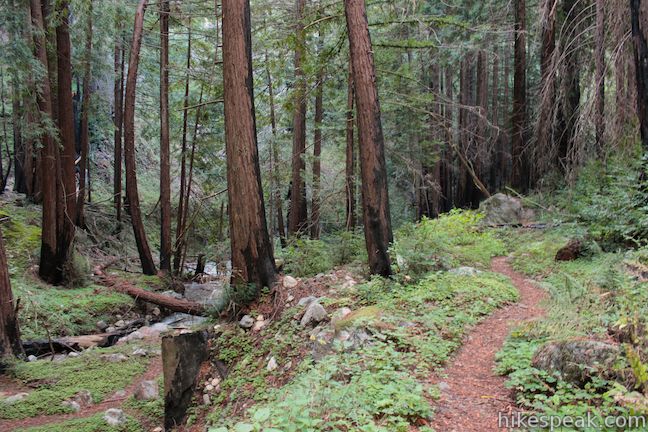
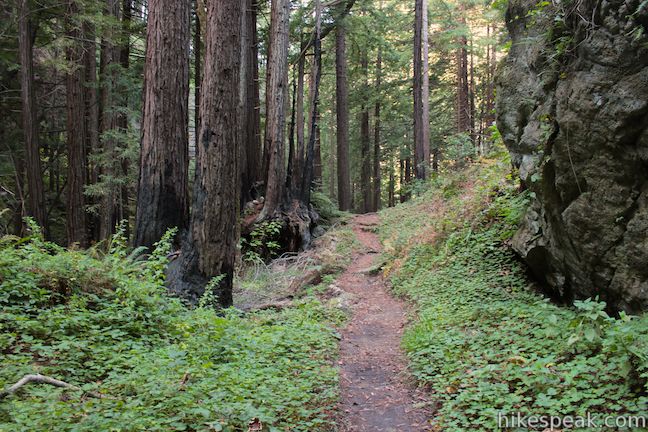
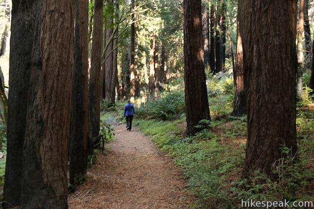
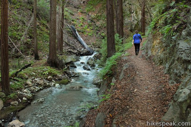
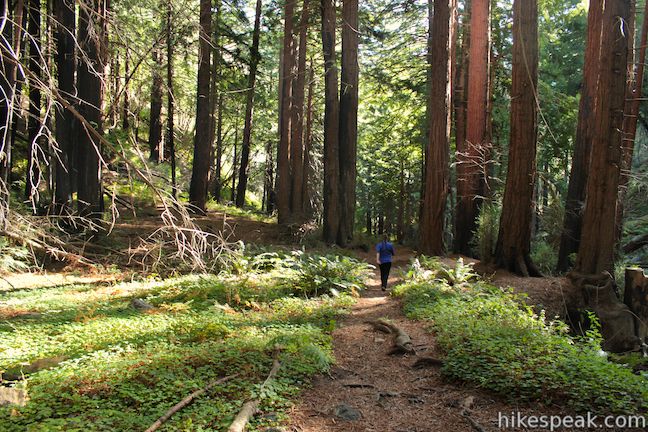
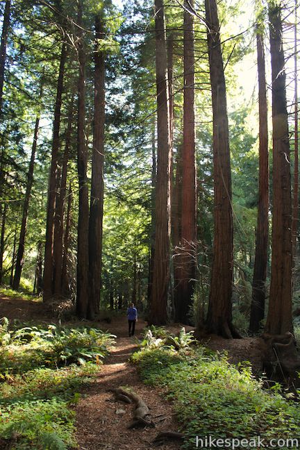
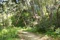
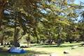
Start from a trailhead just inside Limekiln State Park along Highway One. Hike inland up the bottom of Limekiln Canyon on a wide trail that quickly enters a shaded grove of tall redwoods. You may see people camping along the trail as you pass through the Redwood Campsites section of Limekiln State Park Campground (Additional “Ocean Campsites” are in an area closer to Highway One).
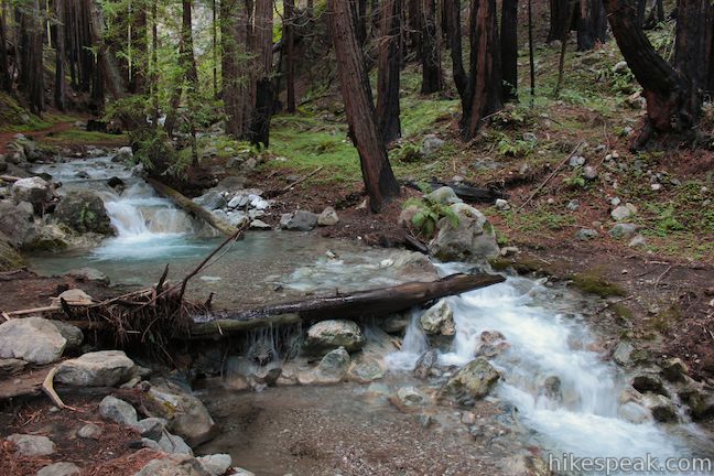
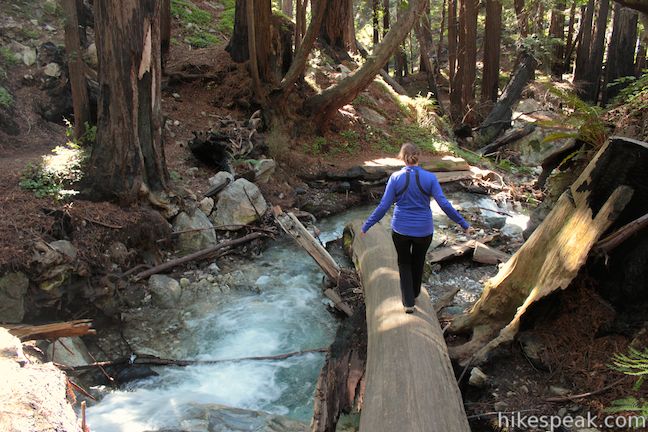
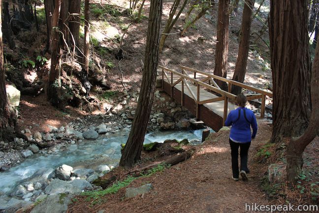
Leave the campground on a wooden bridge across the creek to your left. The bridge is just upstream from the confluence where Hare Creek joins Limekiln Creek. Just over the bridge, and 0.2 miles from the start, you will come to the hike’s first junction. Hare Creek Trail breaks off to the right as Limekiln Trail heads to the left toward the historic kilns and another spur to Limekiln Falls.
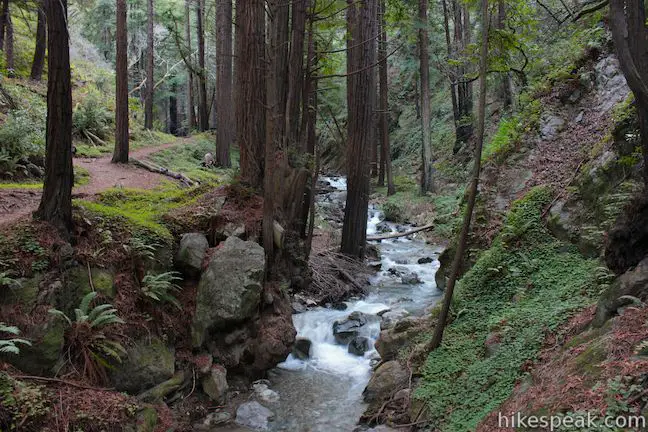
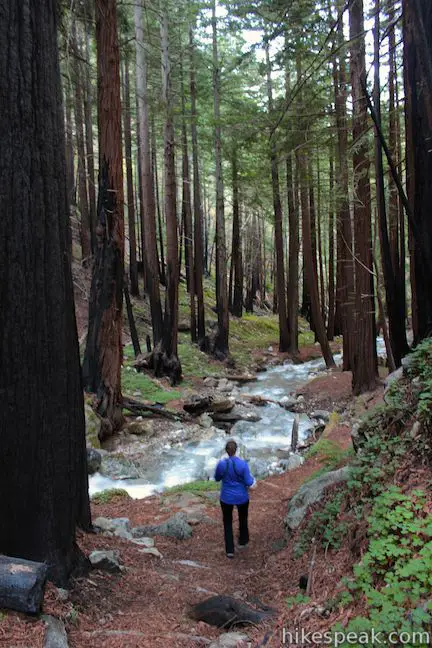
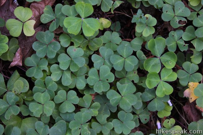
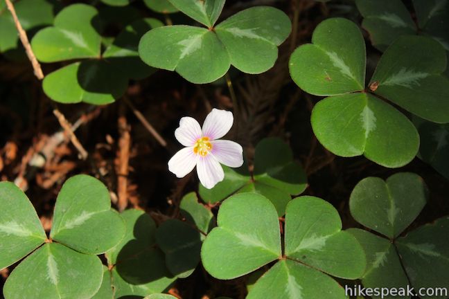
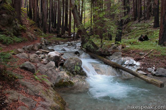
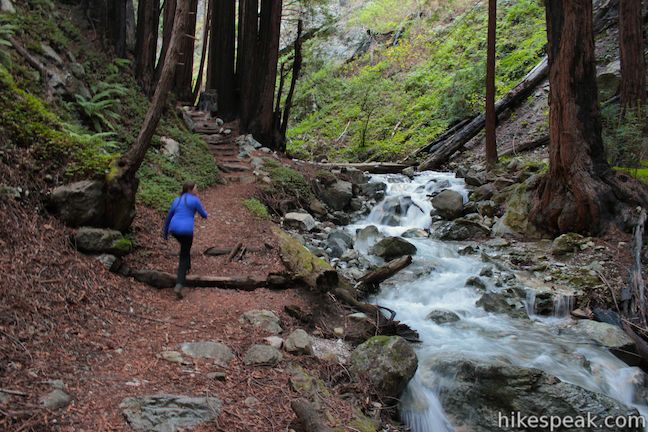
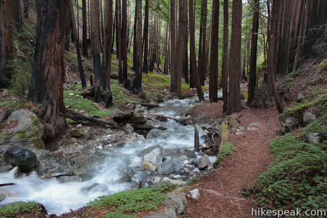
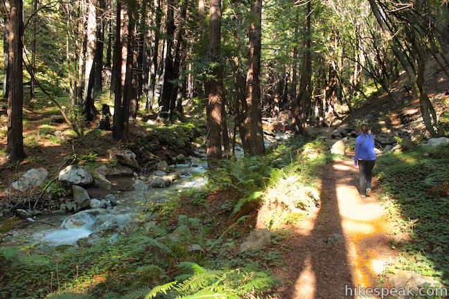
While Hare Creek Trail doesn’t have a big attraction at the end, it’s plenty attractive throughout. The trail crosses a carpet of pine needles below tall redwood trees and hugs the bank of Hare Creek, which tumbles melodiously over a series of small cascades. Redwood sorrel, ferns, and moss add patches of green to the forest floor, contributing to an enchanting redwood scene. Walk up Hare Creek Trail for 0.35 miles until you see a sign marking the end of the trail. You may notice charred trunks on some of the redwood trees, evidence of past wildfires.
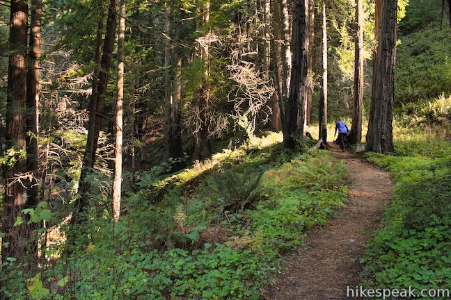
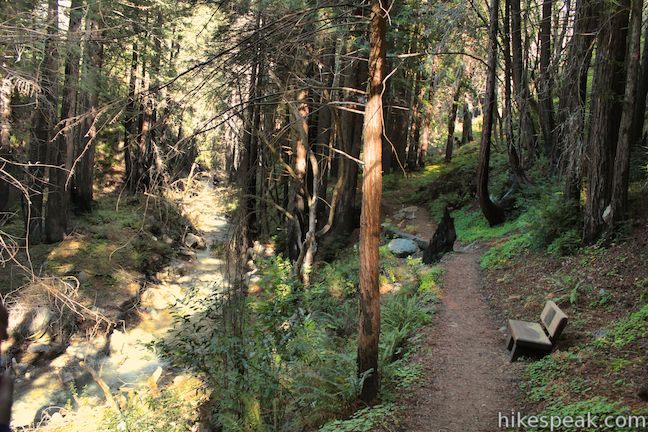
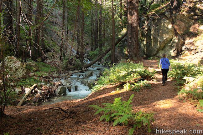
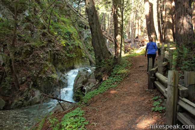
The walk up and down Hare Creek Trail is 0.7 miles round trip, so you’ll have hiked a total of 0.9 miles when you return to the junction and continue up the canyon on Limekiln Trail. The larger Limekiln Creek will be to your left as your proceed up the canyon. If you’re in no mood to hurry, have a seat and linger on the bench on the right side of the trail. Listen to robins chirping and watch beams of sunlight drop in through the redwood canopy.
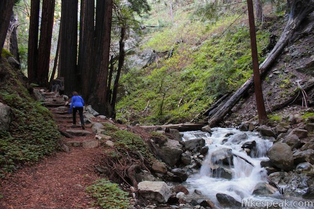
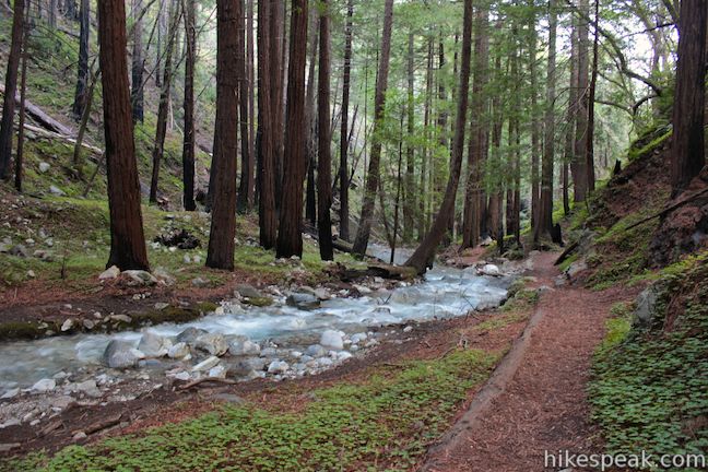
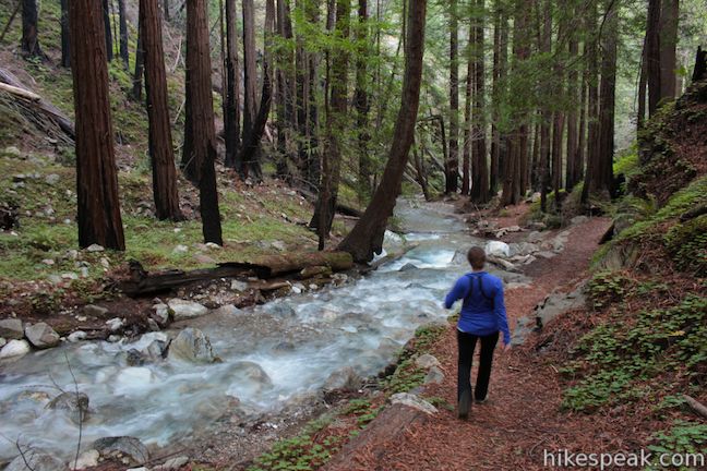
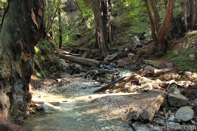
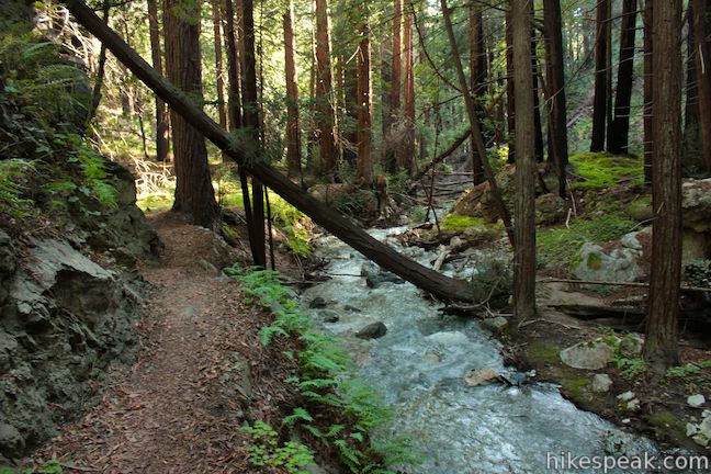
At about 0.15 miles from the Hare Creek Trail junction, another wooden footbridge takes you to the other side of Limekiln Creek. Just above the bridge, the East Fork of Limekiln Creek breaks off to the right. This is the water coming down from Limekiln Falls. The west fork holds its course on the bottom of the canyon alongside Limekiln Trail. Keep an eye out for the junction with Falls Trail, which comes on your right in another 250 feet.
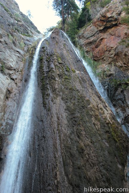
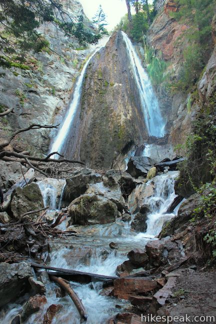
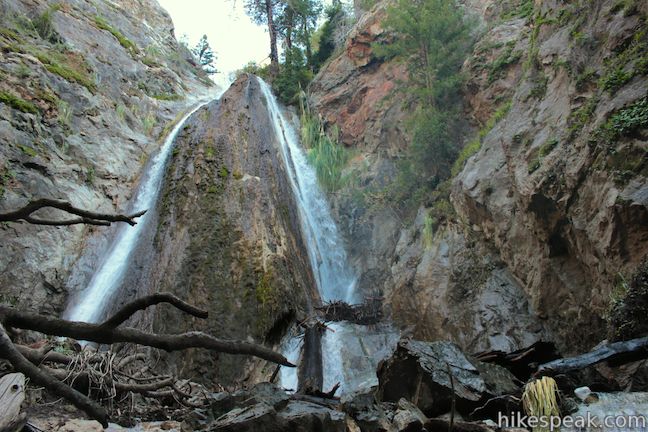
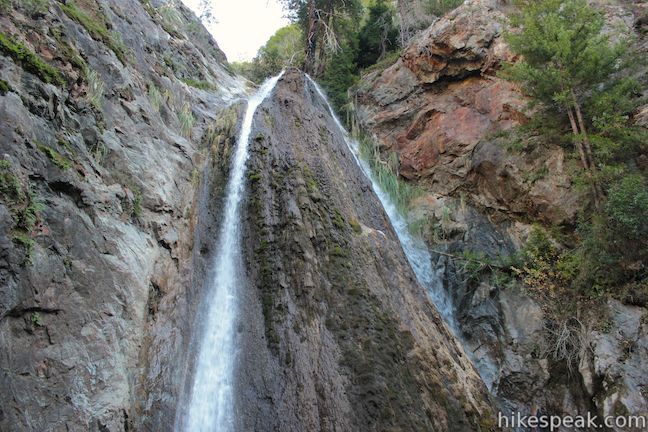
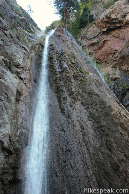
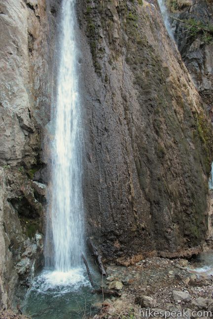
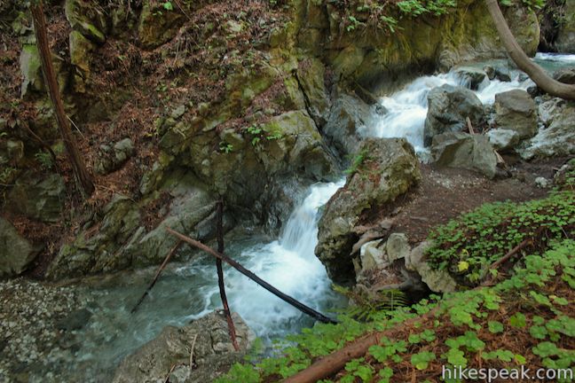
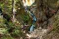
Take Falls Trail to hike a quarter mile up to the base of Limekiln Falls. The trail jumps across the West Fork of Limekiln Creek, runs alongside East Fork of Limekiln Creek, crossing it in order to approach the falls. This trail is more rugged than the other two and may require you to climb over boulders and fallen redwoods to reach the base of the waterfall. Falls Trail is the steepest part of the hike and demands the most agility.
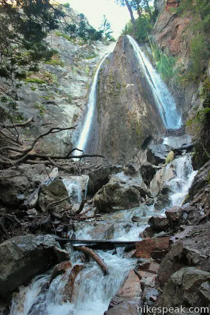
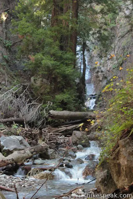
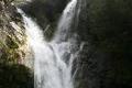
Scramble up along a cascade in the stream beneath the falls, maneuver back to the left side of the creek, and climb through redwood roots to reach a small opening below the waterfall. From here, there’s nothing to obscure your view as you gaze up at the water coursing down a cliff at the back of the side canyon. Near the top of this 100-foot tall waterfall, the water splits into two white ribbons that grow farther apart as they fall. If the waterfall is flowing at its max, there will be several other cords of water coming down the falls to create a unified sheet of white water. Winter and early spring will be the best chance to see this waterfall in full force.
Lovely isn’t it? When you’ve appreciated the waterfall, hike back down to Limekiln Trail. The Falls Trail spur is half a mile round trip, so you’ll have hiked a total of 1.6 miles when you return to Limekiln Trail and bear right to reach the kilns.
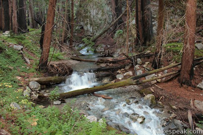
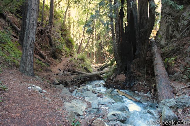
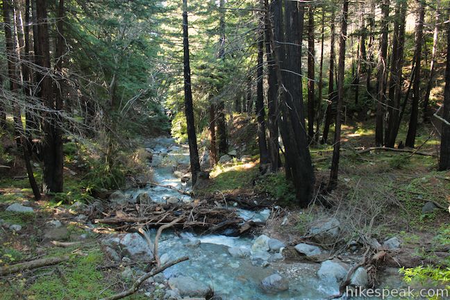
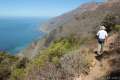
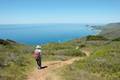
In another tenth of a mile, you will pass a junction with Pitkins Curve – California Coastal Trail on the left and cross a final bridge over to the north side of the West Fork of Limekiln Creek. The canyon walls come closer together as the trail squirts across narrow ledges above the creek. This area has nice walking along the creek, but then again, it’s hard to find any areas along these trails that aren’t pleasant.
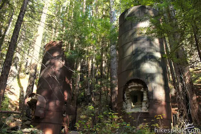
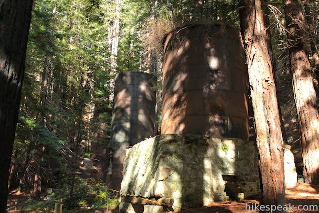
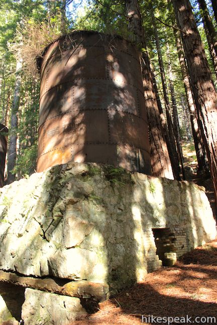
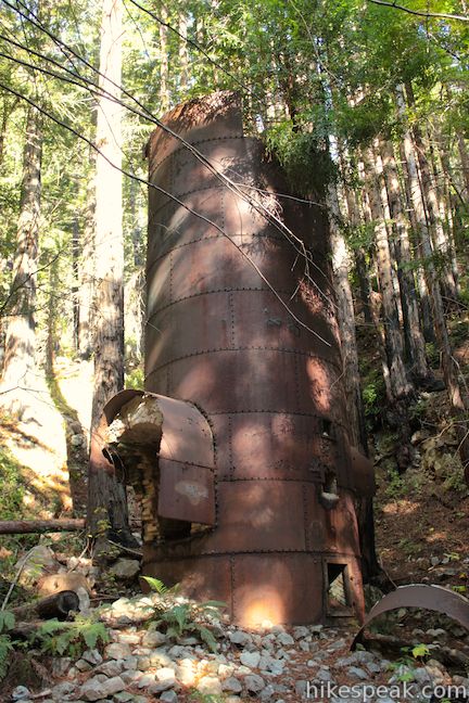
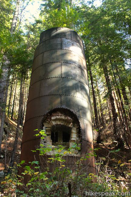
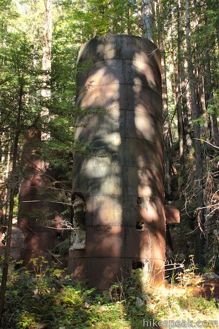
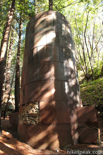
After hiking for 0.3 miles from the Falls Trail Junction, you will reach the end of Limekiln Trail at the site of the historic lime kilns. Walk around these four stone kilns, which are lingering proof of the lime extraction operation that took place in Limekiln Canyon at the end of the 19th century. The park brochure explains:
Beginning in 1887, the Rockland Lime and Lumber Company extracted, processed, and exported thousands of barrels of lime from Limekiln Canyon. Four stone and iron furnaces were built at the base of a large talus slope eroding from a limestone deposit. Limestone rocks were loaded into the kilns, where very hot wood fires burned for long periods to purify the lime. The lime was packed into barrels, hauled by wagon to Rockland Landing on the coast, and loaded onto ships that carried it to northern ports for use in concrete. After only three years, the limestone deposit was all but depleted, as was the redwood forest that had been nearly clear-cut to use for lumber and fuel. Today the four kilns, some stone walls and bridge abutments are the only remains of the thriving lime industry that existed here.
The iron has oxidized to a nice earthy color, but otherwise the kilns are in good shape considering they’ve been standing in this canyon for the past 125 years.
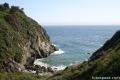
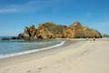
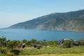
Once you’ve walked around the kilns, it is time to hike back down Limekiln Trail. It is 0.7 miles back to the trailhead, completing this roughly 2.65 miles round trip hike. When you’re done with that, why not walk down to the beach area at the bottom of Limekiln Canyon. Take the road through the Ocean Campsites and pass below the long bridge on Highway One that spans the canyon. There are a few picnic tables by the rough sand beach. This doesn’t look like a safe place to swim through. Waves smashing on the rocks to the right can put on impressive displays of force.
Limekiln State Park is a 716-acre park with one entrance along Highway One. No permit is required to hike Hare Creek Trail, Falls Trail, and Limekiln Trail, but there is a $10 entrance fee for Limekiln State Park. As with other California State Parks, you should also be able to enter Limekiln State Park for no additional charge if you paid an entrance fee or a campground fee at another state park on the same day. Employees of Parks Management Company, which operates the entrance station and campground through a concession, may tell you that they don’t allow entry based on fees paid at other state park (in an attempt to maximize their own profits), but they should be expected to behave as part of the state park system. Just a few parking spaces are available at the trailhead, so try to arrive early in the day or on a weekday if you can (or camp at Limekiln State Park Campground and get your own reserved parking space). Dogs and bikes are prohibited on this hike.
Directions to the Trailhead
- From the south, drive up Highway One to the Limekiln State Park entrance, located on the east side of the road, 22.5 miles north of Ragged Point Inn (or 45 miles north of Cambria).
- Just south of the bridge over Limekiln Canyon, turn right down the park entrance road on the inland side of Highway One.
- Past the park entrance station and park at the trailhead just ahead on the right outside the Redwood Campsites.
- From the north, drive 15 miles south from Julia Pfeiffer Burns State Park (home of McWay Falls).
- Cross the bridge over Limekiln Canyon and turn left down the park entrance road on the inland side of Highway One.
- Past the park entrance station and park at the trailhead just ahead on the right outside the Redwood Campsites.
Trailhead Location
Trailhead address: Highway 1, Big Sur, CA 93920
Trailhead coordinates: 36.010436, -121.518588 (36° 00′ 37.56″N 121° 31′ 06.91″W)
View Limekiln State Park in a larger map
Or view a regional map of surrounding Central Coast trails and campgrounds.


 | Pacific Valley Bluff Trail This short out and back hike extends from Highway One to an ocean bluff with fantastic views of the Big Sur Coast. |
 | Sand Dollar Beach This stunning hike of half a mile or more reaches two scenic overlooks as it descends to a long beach on the Big Sur coast. |
 | Jade Cove and Plaskett Rock Point This 1.5-mile hike along an ocean bluff visits a prominent peninsula and a small cove. |
 | McWay Falls This 0.6-mile hike looks out on a stunning Big Sur waterfall that pours 80 feet right on to the beach. |
 | Canyon Falls This 0.9-mile hike heads inland up McWay Creek past a picnic area in a redwood grove to a lovely little waterfall. |
 | Partington Cove This 1.5 mile hike visits a cove and a secluded beach along the scenic Big Sur coast. The cove is accessed through a tunnel. |
 | Salmon Creek Falls This short hike visits a fine 120-foot waterfall near the start of Salmon Creek Trail. |
 | Buckeye Trail This hike of 6.5 miles or more reaches incredibly ocean vistas and trail camps in the Silver Peak Wilderness. Connect Cruickshank Trail and Buckeye Trail for an excellent shuttle hike of 8.25 miles or more. |
 | Cruickshank Trail This hike into Silver Peak Wilderness starts with bold ocean views and crosses redwood groves to reach Upper Cruickshank Camp at a junction with Buckeye Trail, 5 miles round trip from Highway One. |
 | Pfeiffer Beach This short walk reaches an absolutely stunning beach that's a classic feature of the Big Sur landscape. |
 | Big Sur River Gorge This half-mile off-trail hike ventures up the Big Sur River on a water-wading boulder-hopping adventure to a crystal clear pool that's a gorgeous Big Sur swimming hole. |
 | Pfeiffer Falls and Valley View This 2.4-mile hike is like two hikes in one, reaching a waterfall in a canyon of redwoods and a vista point overlooking the Big Sur River Valley. |
 | Nature Trail - River Path Loop This easy 0.55-mile loop explores woodlands along the Big Sur River and a redwood grove that includes the unique and impressive Proboscis Tree. The loop can be combined with the trail to Pfeiffer Falls and Valley View for a 3-mile trek. |
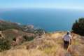
 | Ridge Trail - Panorama Trail - Bluff Trail Loop This 8.7-mile loop in Andrew Molera State Park crosses a coastal ridge, bluff, and beach that are packed with amazing Big Sur views. |
 | More Central Coast Hikes Explore other destinations along the California coast between Ventura and Monterey, including trails in Los Padres National Forest. |
 | Limekiln State Park Campground This 29-site Big Sur campground at the bottom of Limekiln Canyon has sites along a creek through a redwood grove and near the ocean, with access to trails up Limekiln Canyon. |
 | Kirk Creek Campground This outstanding 33-site campground in Los Padres National Forest has enormous ocean views from a bluff along the Big Sur coast. |
 | Plaskett Creek Campground This 45-site campground in Los Padres National Forest is positioned across Highway One from Sand Dollar Beach and Plaskett Rock Point on the coast of Big Sur. |
 | Pfieffer Big Sur State Park Campground This large campground in the heart of Big Sur is spread out through oak and redwood groves along the Big Sur River. |
 | Andrew Molera State Park Trail Camp This trail camp is easy to reach (just a short walk in) with campsites in a meadow along the Big Sur River near Molera Beach. |
- Limekiln, Limekiln Falls, and Hare Creek Trails on redwoodhikes.com (opens in a new tab)
- Limekiln, Limekiln Falls, and Hare Creek Trails on modernhiker.com (opens in a new tab)
- Limekiln Falls on world-of-waterfalls.com (opens in a new tab)
- Limekiln State Park on wikipedia.org (opens in a new tab)
- The brochure for Limekiln State Park (opens in a new tab)
- The official website for Limekiln State Park (opens in a new tab)
Common Questions about Hare Creek Trail, Limekiln Trail, and Falls Trail in Limekiln State Park
- Is the trail open?
- Yes. You should expect to find that Limekiln Trail, Hare Creek Trail, and Falls Trail is open. There are no recent reports of trail closures. If you discover that the trail is closed, please help your fellow hikers by reporting a closure.
- Do I need a permit for this hike?
- Yes. State Park Entrance Fee.
- How much time does this hike take?
- It takes approximately 1 hour 15 minutes to hike Limekiln Trail, Hare Creek Trail, and Falls Trail. Individual hiking times vary. Add extra time for breaks and taking in the views.
- How long is this hike?
- The hike to Limekiln Trail, Hare Creek Trail, and Falls Trail is a 2.65 mile out and back with 250 feet of elevation change.
- Are dogs allowed on this trail?
- No, dogs are likely not allowed on Limekiln Trail, Hare Creek Trail, and Falls Trail. The trail is primarily open to hikers.
- Will I see a waterfall on this hike?
- Yes, Limekiln Trail, Hare Creek Trail, and Falls Trail features a waterfall.
- Are there redwood trees on this hike?
- Yes, Limekiln Trail, Hare Creek Trail, and Falls Trail passes through a grove of redwood trees.
- Where is the trailhead located?
- The trailhead for Limekiln Trail, Hare Creek Trail, and Falls Trail is located in Big Sur, CA.
Trailhead Address:
Highway 1
Big Sur, CA 93920
Trailhead Coordinates:
36.010436, -121.518588 - What are the driving directions to the start of the hike?
To get to the trailhead: From the south, drive up Highway One to the Limekiln State Park entrance, located on the east side of the road, 22.5 miles north of Ragged Point Inn (or 45 miles north of Cambria). Just south of the bridge over Limekiln Canyon, turn right down the park entrance road on the inland side of Highway One. Past the park entrance station and park at the trailhead just ahead on the right outside the Redwood Campsites.
From the north, drive 15 miles south from Julia Pfeiffer Burns State Park (home of McWay Falls). Cross the bridge over Limekiln Canyon and turn left down the park entrance road on the inland side of Highway One. Past the park entrance station and park at the trailhead just ahead on the right outside the Redwood Campsites.
View custom Google Maps directions from your current location.
- Are there other trails near Limekiln Trail, Hare Creek Trail, and Falls Trail?
- Yes, you can find other nearby hikes using the Hikespeak Hike Finder Map.

why only 2.5 stars, looks awesome to me.
I really want to go to this place… but my kids want to this place and also to San Diego zoo!! is it close?? both places??
They are 7.5 hours apart according to google maps.