Andrew Molera State Park’s big loop trek centered over Ridge Trail, Panorama Trail, and Bluff Trail has about everything you could want in a Big Sur hike, including a redwood grove, an unspoiled beach, and lots of ocean views over a wild coastline. This is a hike for those who want to lose themselves in the majestic beautify of Big Sur. Ok, don’t get lost, bring along these directions and immerse yourself in the area’s natural beauty, enjoying spectacular seaside views and solitude in Andrew Molera State Park.
Ridge Trail ascends a long ridge between the Pacific Ocean and the Big Sur River Valley, reaching a junction with Panorama Trail at the high point of the loop where a bench is perfectly placed for both epic views and soothing shade. The loop issues more amazing coastal gazing as you descend Panorama Trail to Bluff Trail toward Molera Beach at the mouth of the Big Sur River. This beautiful loop is around 8.7-miles round trip (depending on the exact route you take) with 1,100 feet of elevation gain.
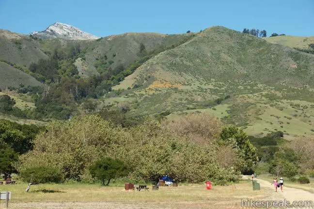
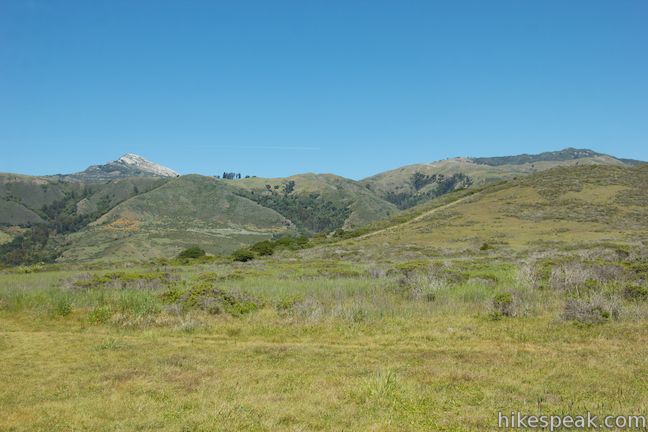
Andrew Molera State Park covers nearly 5,000 acres at the north end of Big Sur, with some twenty-five miles of hiking trails. You can see much of the park’s west side on this loop that combines several trails to take in the scenes.
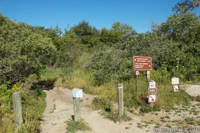
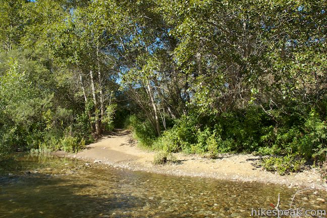
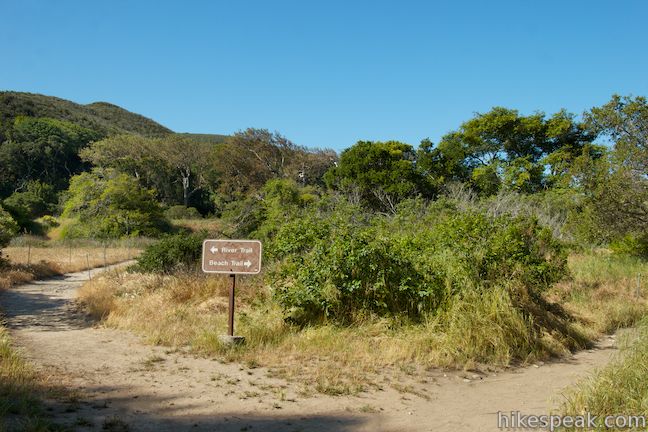
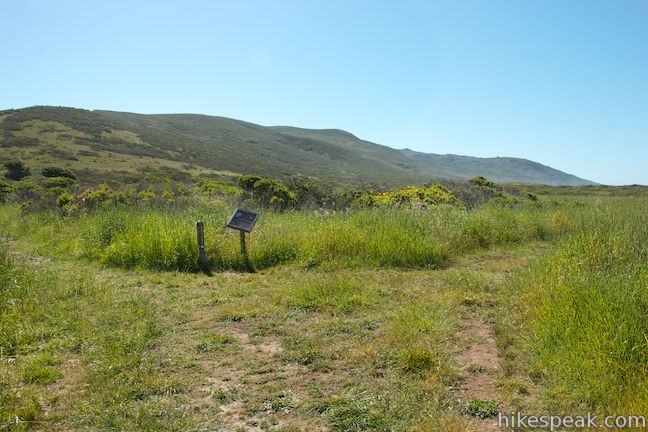
Start from a large parking area just off Highway One, but don’t take the trail from the north end of the lot, which heads toward the trail camp (a potential return route). Instead, take the trail heading west from the middle of the parking lot next to a sign marked, “Creamery Meadow Trail to beach.” This trail immediately reaches the Big Sur River and unless you’re hiking from around June to October, there will be no bridge to the other side. The park removes the bridge to preserve the fragile habitat of the steelhead fish that spawn in the Big Sur River. Visitors are asked not to build rock dams that can hinder the steelhead. Without the bridge, you will need to wade across the relatively shallow river. You can do it barefoot and then put your boots on when you reach the other bank.
On the other side of the river, head up the trail to a junction, a tenth of a mile from the start. Beach Trail heads to the right toward Molera Beach (another potential return route for the end of the hike). For now, turn left on River Trail and head south along the edge of the riparian zone that borders the Big Sur River. You’ll soon reach another junction, this time with Creamery Meadow Trail, a quarter mile from the start. Turn right to take Creamery Meadow Trail to the start of Ridge Trail (alternatively, you could turn left and make the next right up Hidden Trail for a shorter, steeper route up to Ridge Trail that eliminates about 2/3 of a mile from this hike along with all the early ocean views).
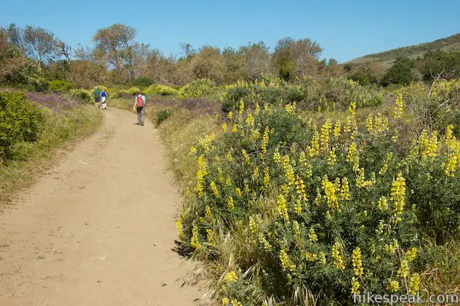
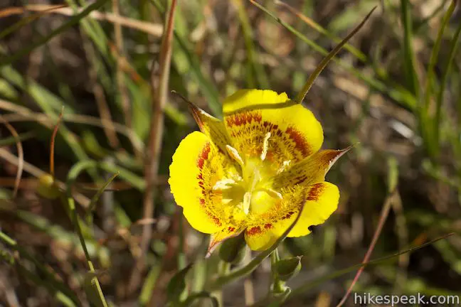
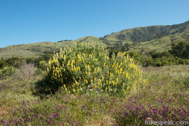
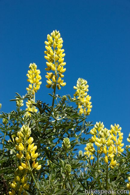
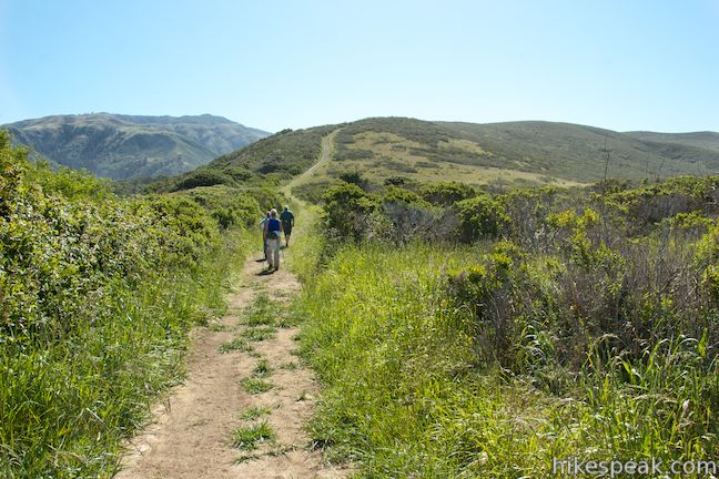
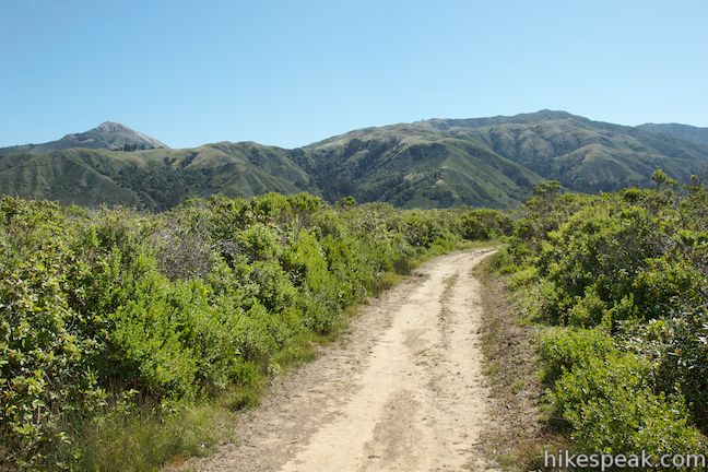
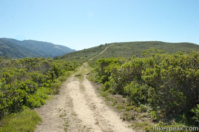
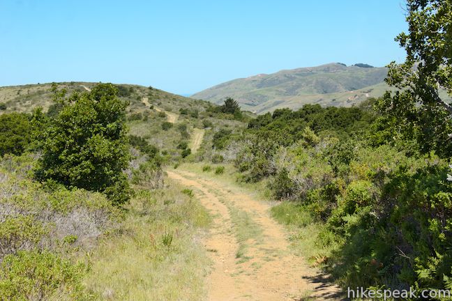
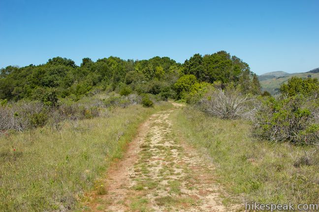
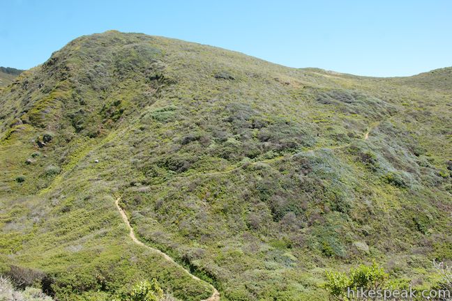
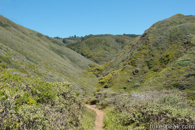
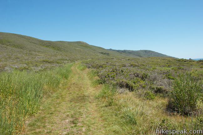
In the springtime, Creamery Meadow Trail is a very colorful place to hike. The wide, level double-track trail is lined by lots of flowers, most notably golden lupines that have vibrant yellow flower clusters that are sure to brighten your day. After 0.7 miles on Creamery Meadow Trail, and almost a mile of flat hiking, the warm-up is over and the ascent begins. Make a left turn up Ridge Trail, a wide trail that veers south up the end of a rounded ridge that rises between the Pacific Ocean and the Big Sur River Valley, the conduit used by the Big Sir River and Highway One.
Before Ridge Trail really gets underway, pass through a junction with a connector trail that branches off to the right toward Bluff Trail. You will explore Bluff Trail later in this loop. For now stay to the left and keep climbing up Ridge Trail.
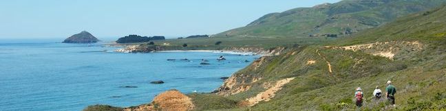
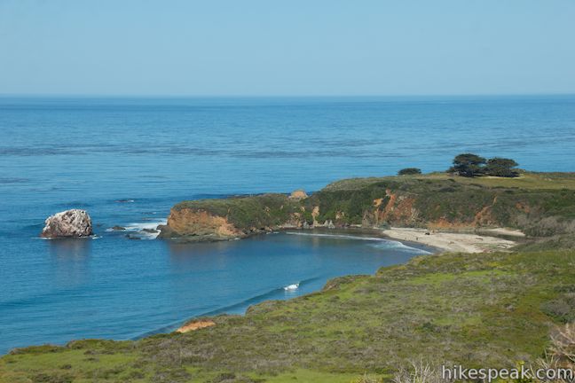
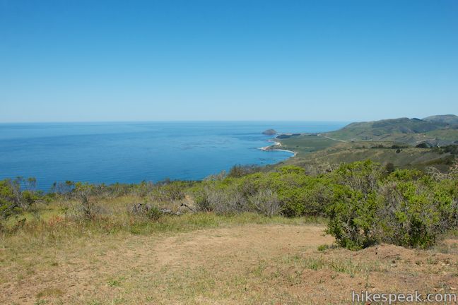
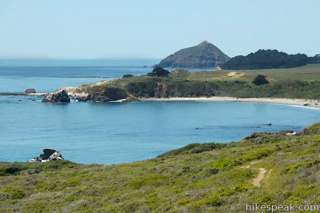
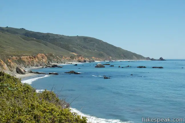
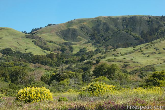
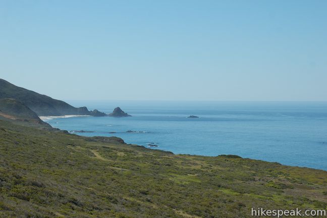
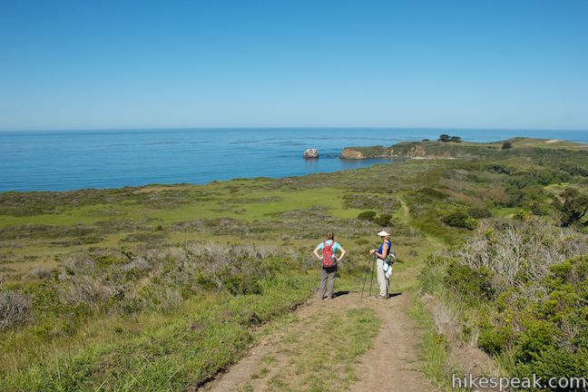
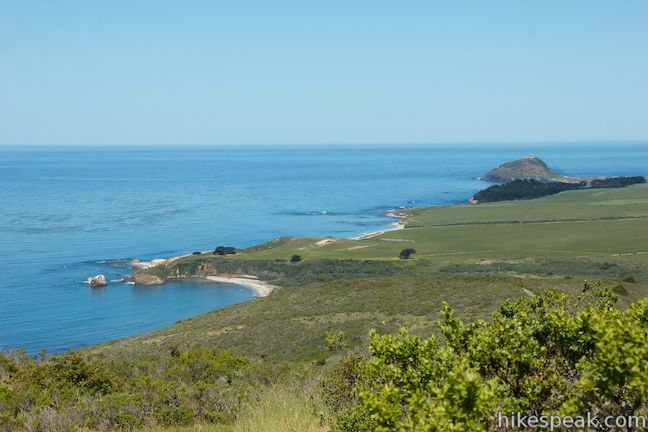
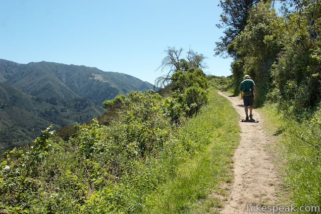
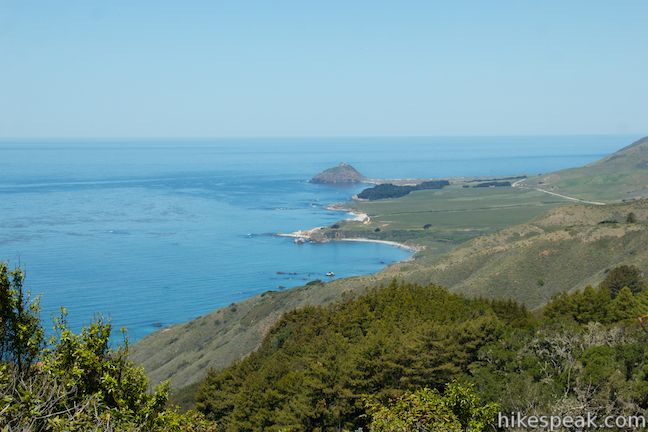
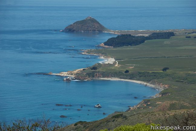
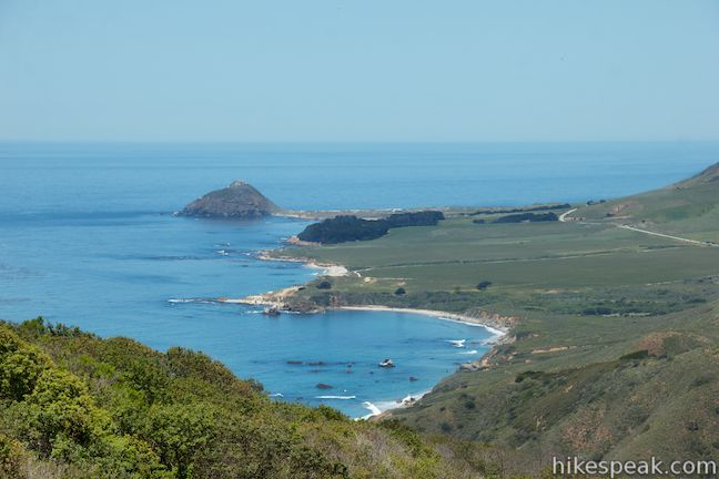
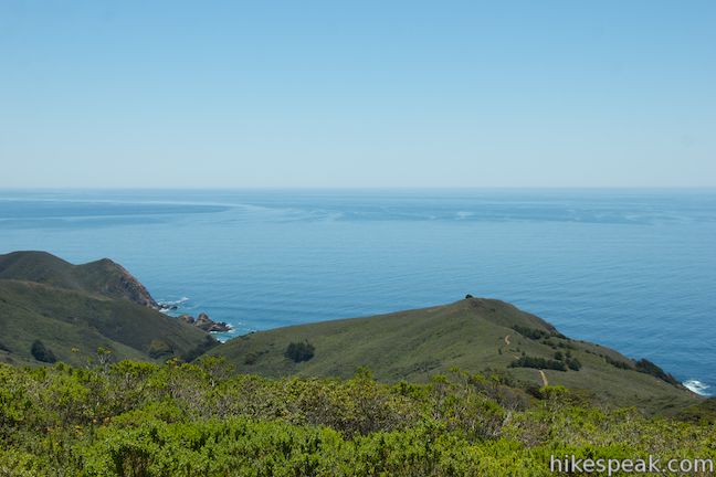
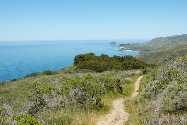
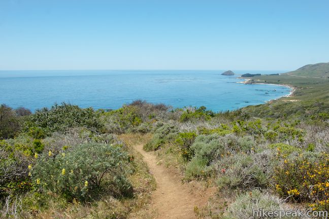
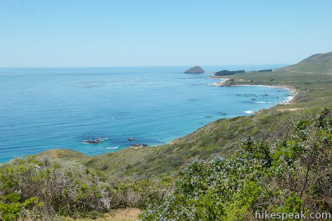
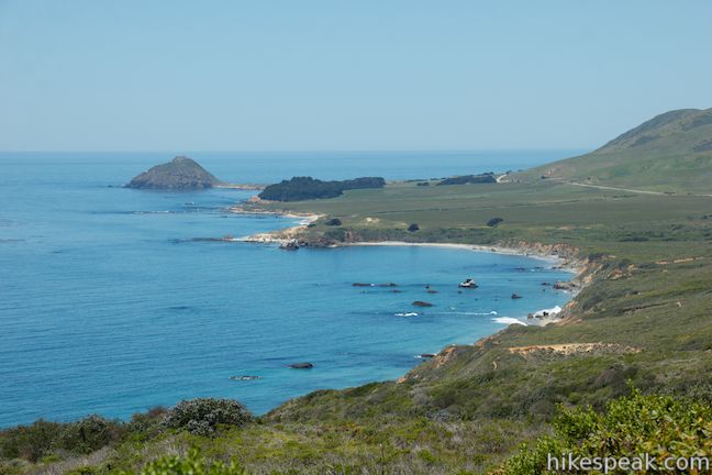
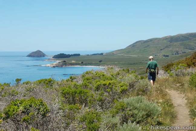
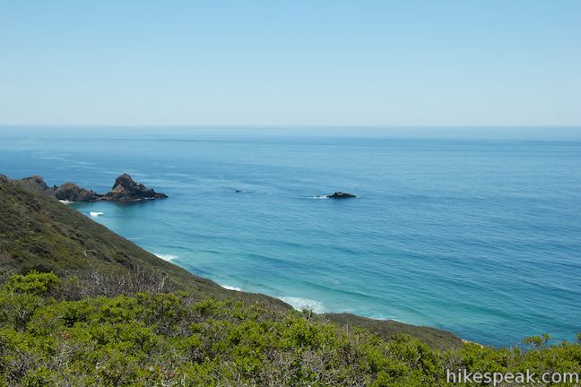
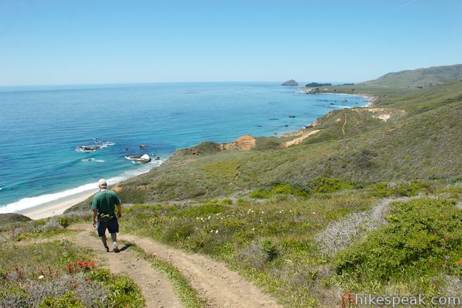
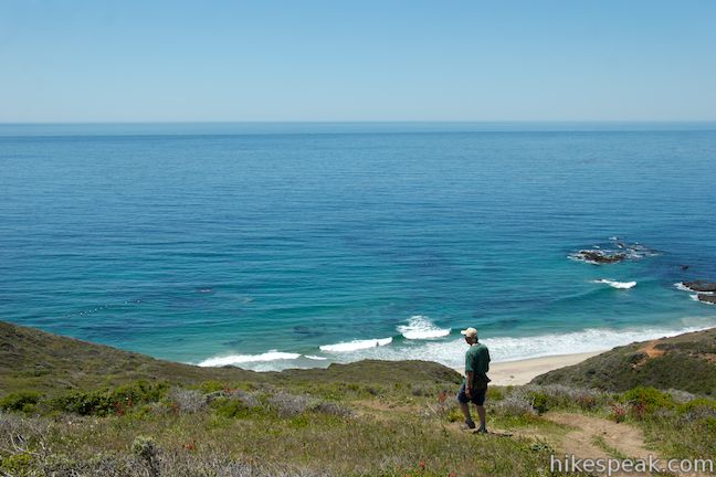
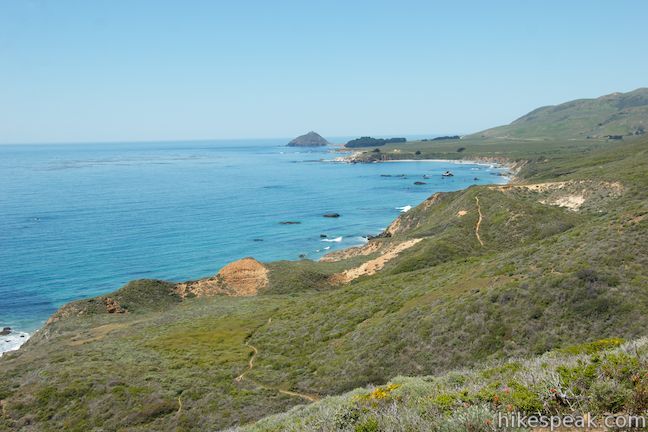
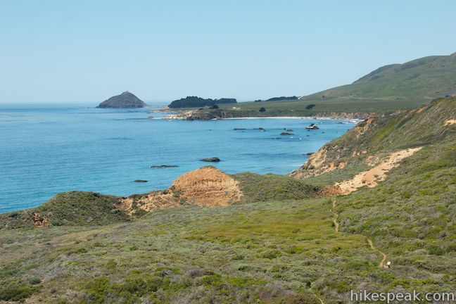
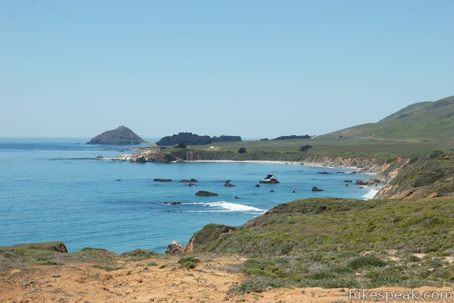
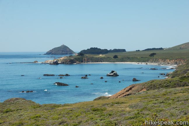
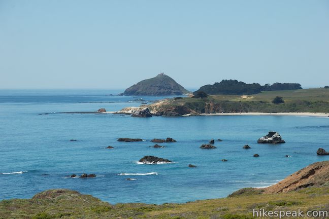
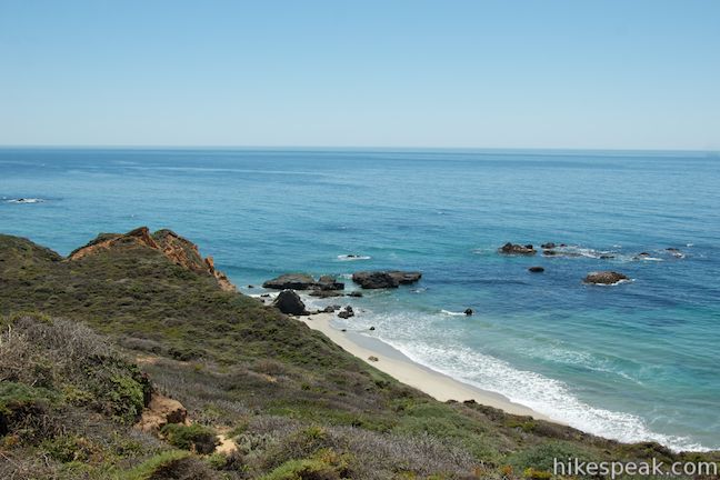
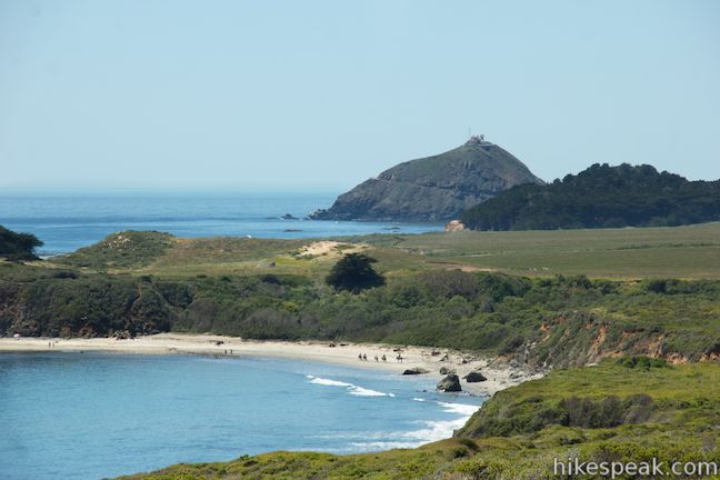
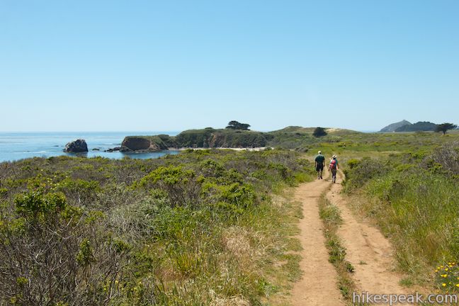
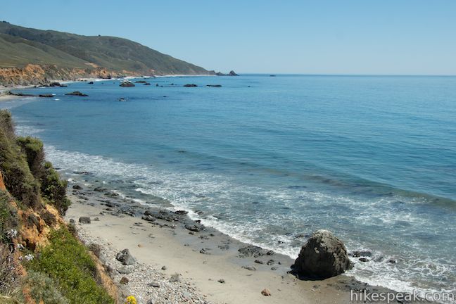
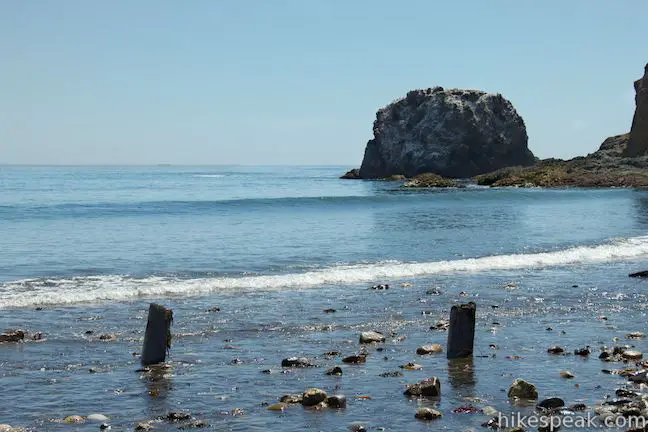
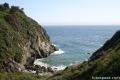
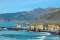
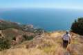
You’ll expend some energy now as you follow the wide trail up the ridge. Any time you stop to look over your shoulder, you will discover growing views west over the Pacific Ocean and north up the coast. Look down the ridge for good view over the sandy cove at the north end of Molera Beach, which is backed by a short rocky headland called Molera Point. Beyond that, a bit farther up the coast it Point Sur, a massive dome-shaped rock jutting into the ocean that is connected to the mainland by a sandy tie bar. A landmark lighthouse built atop Point Sur can easy be seen from Ridge Trail.
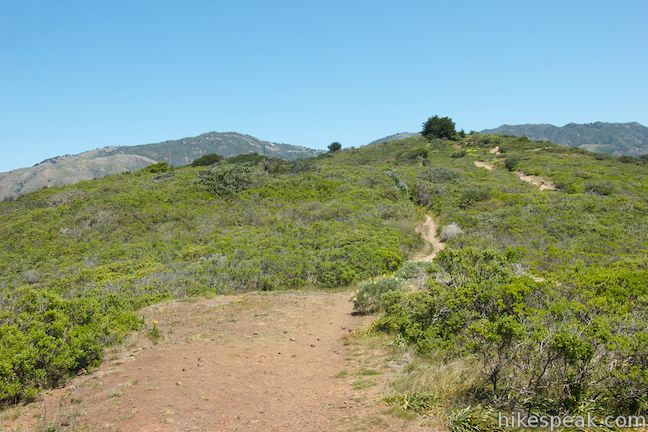
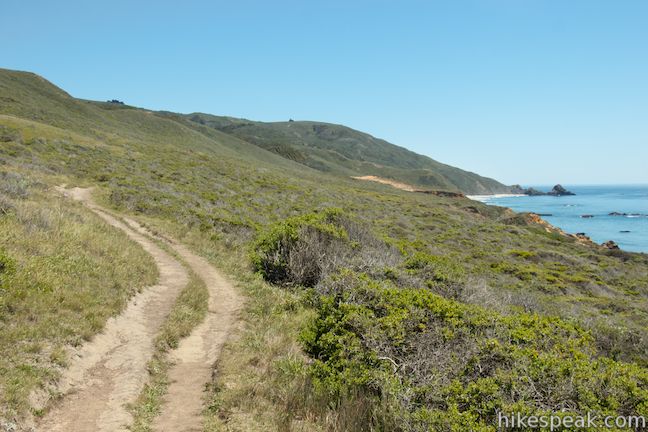
Ridge Trail climbs, tapers out, and climbs again, until it crests after one mile and descends temporarily to a junction with Hidden Trail, 2.1 miles from the commencement of the hike. Stay to the right to continue along the ridge. While Ridge Trail gained close to 700 feet in the opening mile, the ascent becomes less aggressive from this point on. Past the Hidden Trail junction, there is only 450 feet more to gain over the next 2.65 miles to reach the end of Ridge Trail.
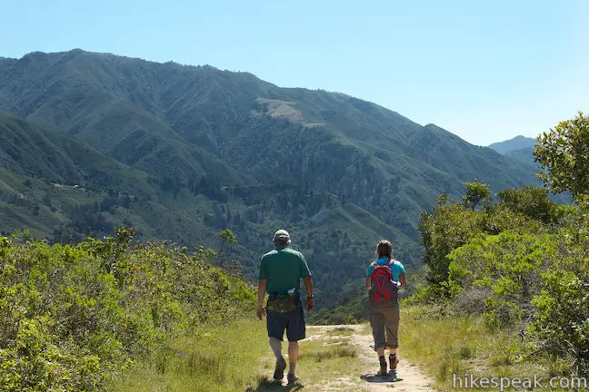
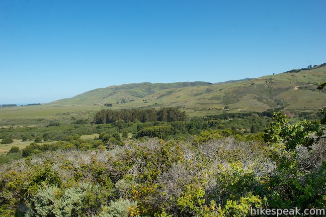
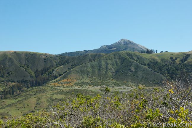
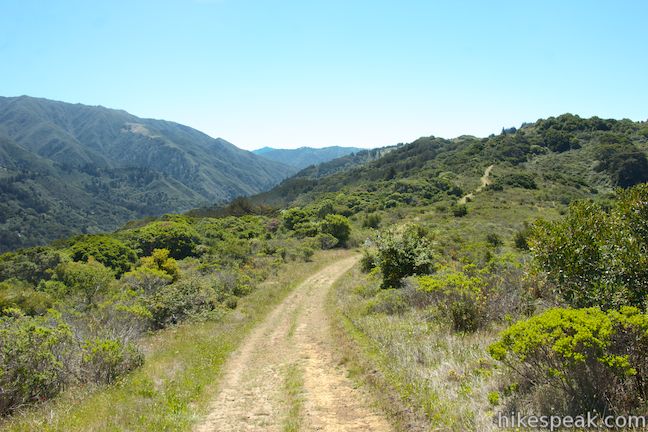
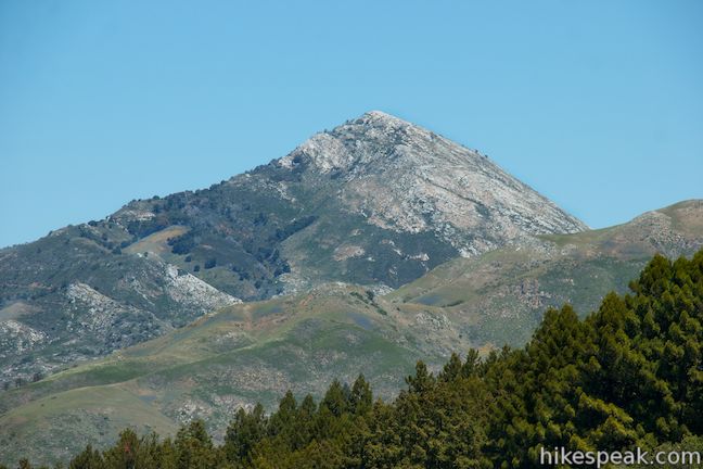
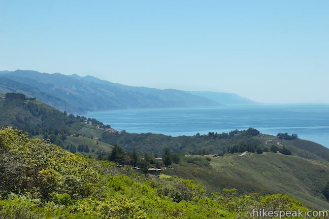
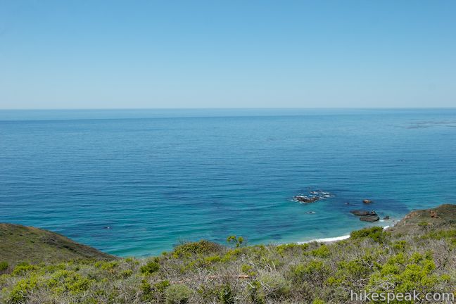
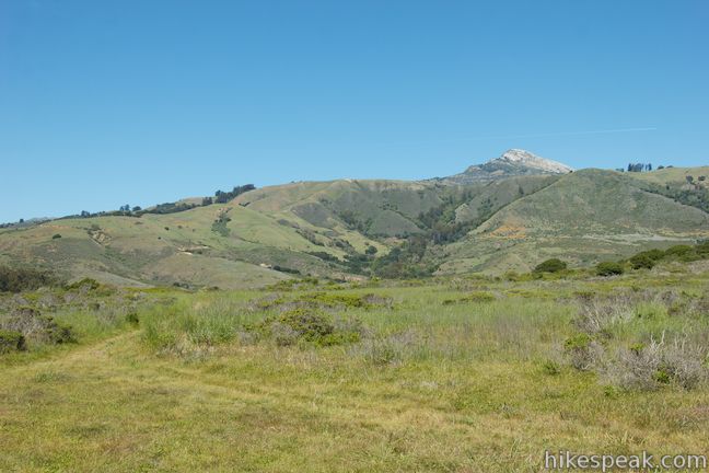
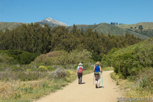
The ocean views become more sporadic as the trail runs along the east side of the crown of the ridge. As you get higher up, the views improve looking east toward the tall green ridge on the opposite side of Highway One, which is backed by the limestone pyramid-shaped summit of Pico Blanco. Somewhere on the slopes of these mountains to the southeast is the Valley View Overlook in Pfeiffer Big Sur State Park, which looks the opposite direction toward Andrew Molera State Park.
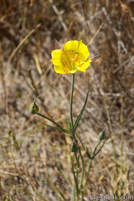
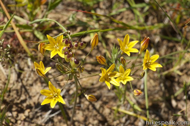
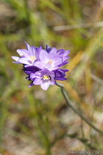
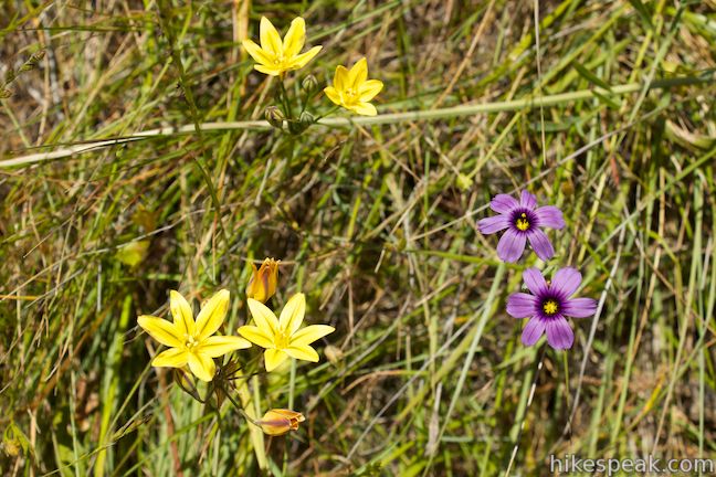
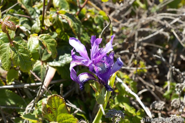
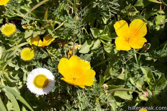
In the open grasses and brush that cover most of this ridge, notice several varieties of spring wildflowers including mariposa lilies and golden stars. Most of this hike is exposed to the sun, but some welcome, though fleeting shade, can be found about half a mile past the junction with Hidden Trail.
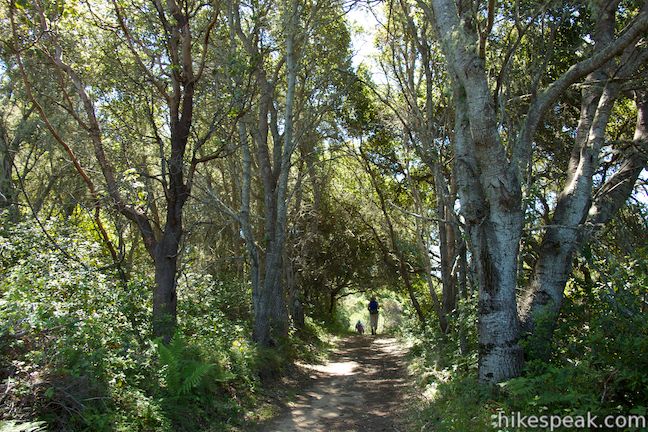
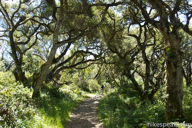
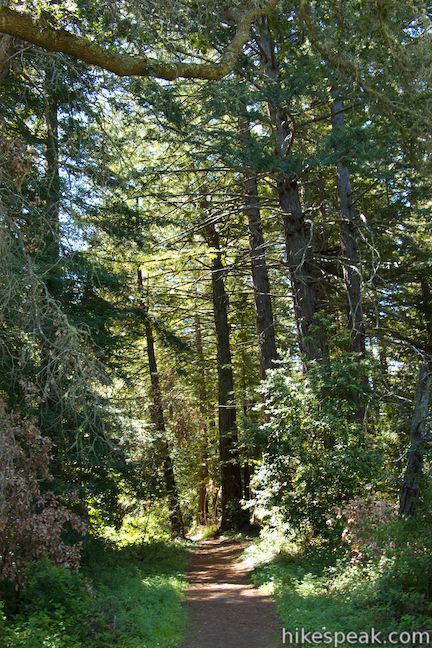
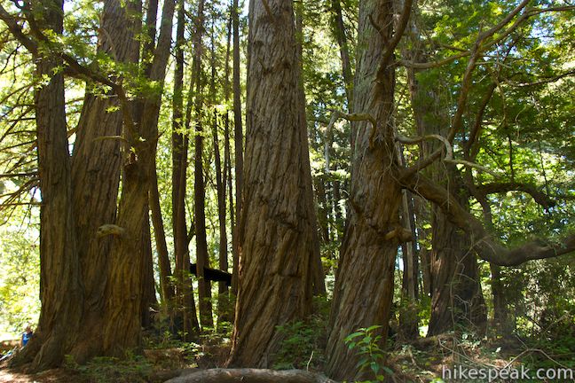
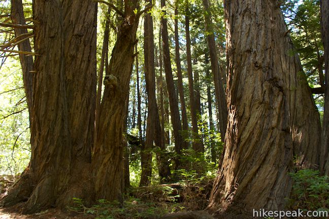
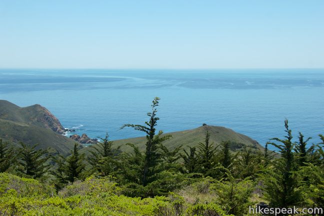
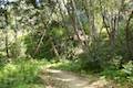
Another junction comes after two miles on Ridge Trail. Stay to the right past the top of South Boundary Trail to continue up the ridge. Shortly thereafter, reach some earnest shade by entering a grove of large oak trees followed by a small forest of redwoods. Enjoy the solitude of this small but remote redwood grove as you stroll past coast redwoods on Ridge Trail. Many of the trees appear to be young, but some are quite tall with large imposing trunks.
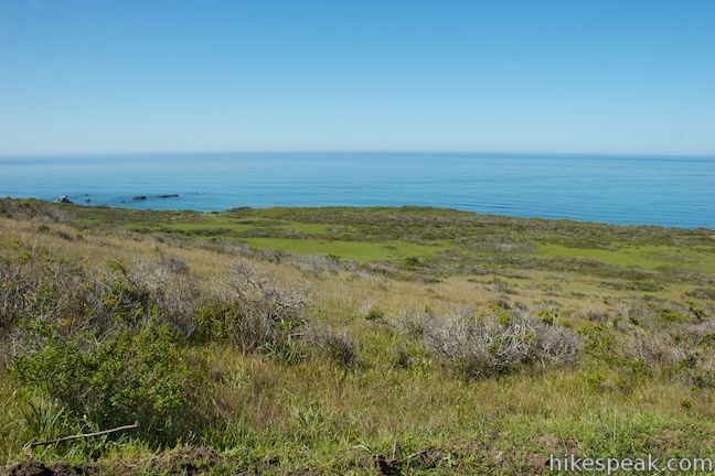
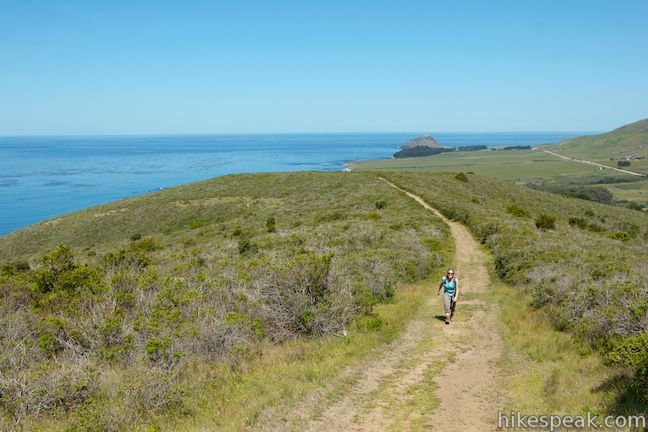
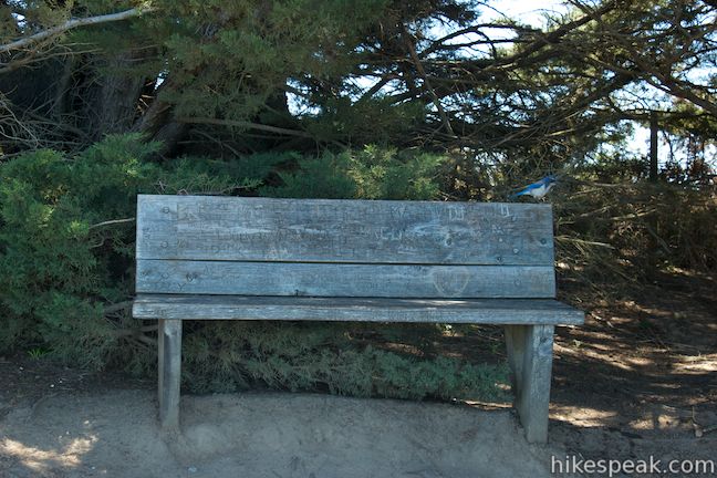
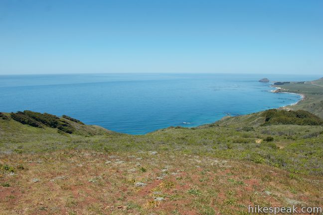
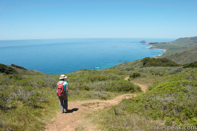
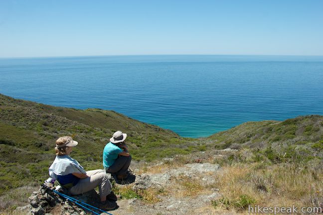
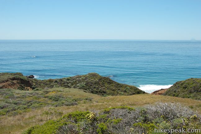
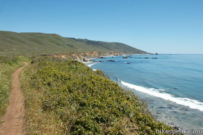
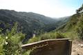
As you exit the forest, Ridge Trail presents more views off the slopes to the west toward the Pacific Ocean, which is now far below. After 2.8 miles on Ridge Trail and 3.75 miles of hiking, approach the southern edge of Andrew Molera State Park. Ridge Trail ends here at a bench below a row of Monterey pines, 1,100 feet above sea level. Before continuing onto Panorama Trail, which descends to the right, have a seat and take in the major view that the bench provides. You can look all the way down the ridge and up the coast beyond Point Sur. Look inland toward the high summit of Pico Blanco and the surrounding ridges in the Santa Lucia Mountains protected by Los Padres National Forest. To the west, of course, are miles and miles of Pacific blue.
What a great place for a bench! If you packed a lunch, this is the place to eat it. If not, feast on the ocean views from this worthy high point before moving on.
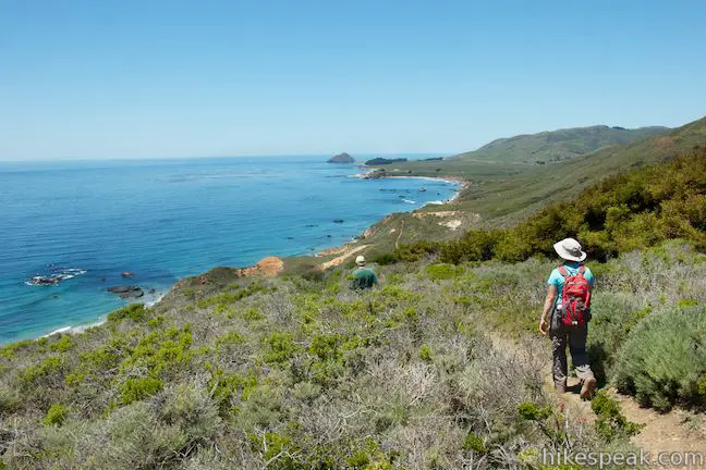
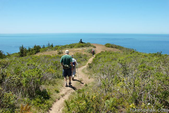
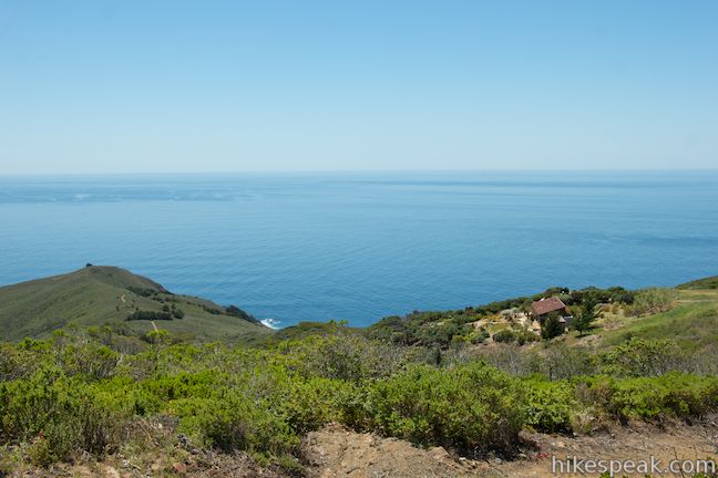
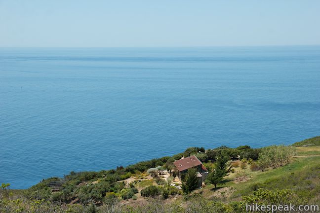
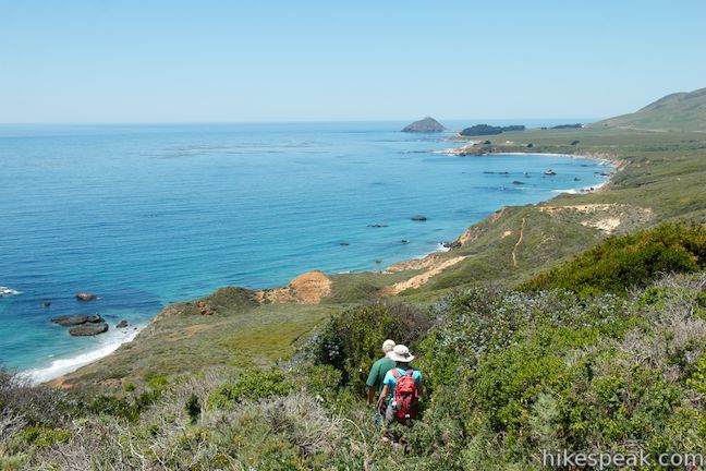
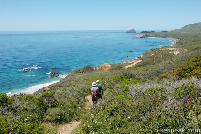
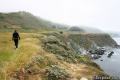
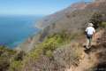
While Ridge Trail is a wide double-track trail, Panorama Trail is a more rugged single-track, with high brush and slipperier soil. You’ll feel more at one with the surrounding vegitation on this trail, which is certainly a better route to hike down than hike up (less views if you hike the loop in reverse too). Hike down Panorama Trail, which initially parallels a private road located just outside the park. You’ll see a few homes spread across the ridges to the south, each appearing to have a fantastic view.
A quarter mile down the trail, a short spur goes up onto a little rise on the left side of the trail. From here there are impressive views looking south over the steep mountains and rugged waterfront on the Big Sur coast. If you’ve been to Pfeiffer Beach, you might just recognize the rock formation that juts out from the beach, although it takes on a different shape from this high vantage. Enjoy the sweeping 180-degree ocean views and then continue down Panorama Trail.
Take this single-track down off the ridge and north toward the ocean bluffs. In the springtime, wildflowers blooming abundantly along these slopes, like sweet peas, poppies, lupines, blue-eyed grass, sticky monkeyflower, and Indian paintbrush.
At 1.4 miles down Panorama Trail, a short innocuous-looking path on the right appears to disappear into the brush. Take a few steps up this trail through the brush and into a shaded grove of densely packed trees. These are young redwoods and unlike redwood forests you’re familiar with, this grove is full of thin-trunked trees that stand close together. The branches overhead are intertwined to form a thick canopy that lets very little sunlight through to the forest floor.
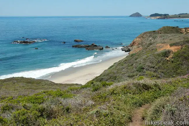
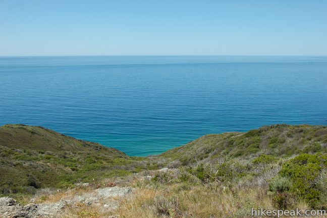
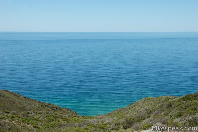
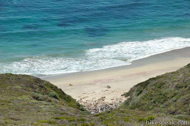
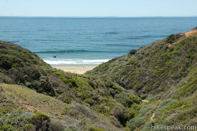
Back on Panorama Trail, the descent continues. Notice areas of the beach below the bluffs. Panorama Trail drops into a ravine that cuts into the side of the ridge and runs down to the ocean. As you dip across the bottom of the canyon, find a trickling stream and a thicket of oaks for just a bit of shade. Ascend the other side and enjoy a look down the gap in the bluffs toward the beach below. Spring Trail is visible making its way down the ravine toward the sand.
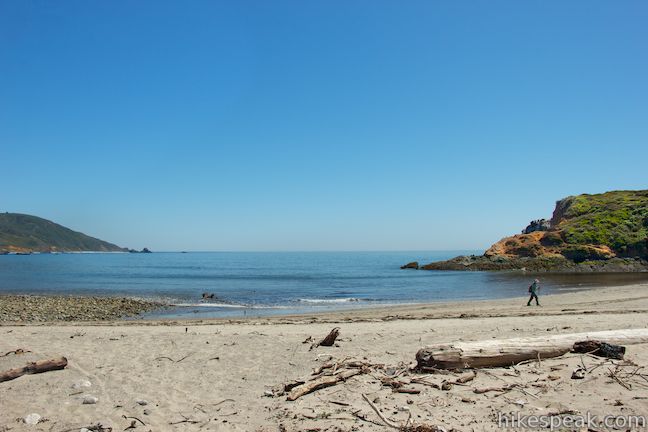
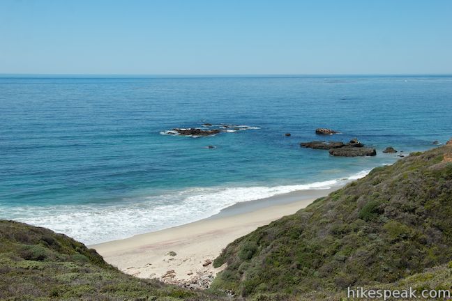
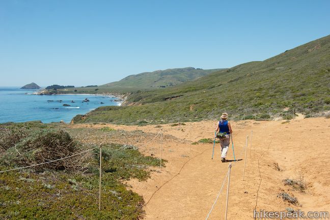
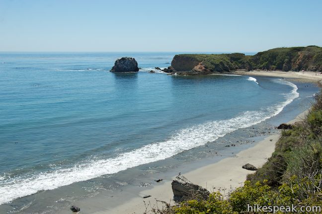
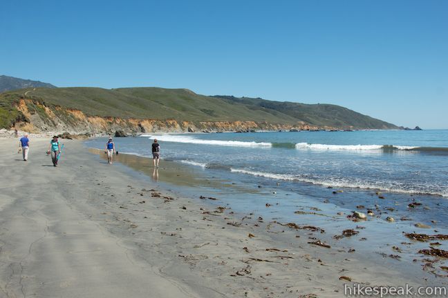
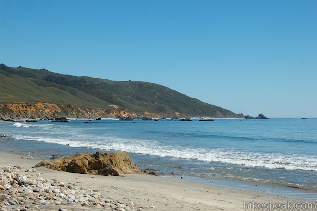
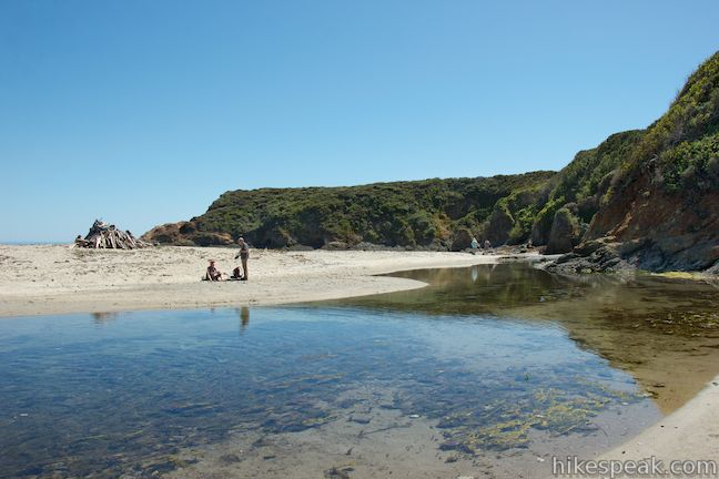
Climb up the other side of the ravine to a junction with Spring Trail. The 3-way junction comes 5.55 miles from the start and marks the end of Panorama Trail. To continue with the loop, turn right onto Bluff Trail. Alternatively, you could descend Spring Trail to the beach and, if the tide is out, walk north up the sand instead of taking Bluff Trail. Molera Beach is a 2.5-mile long tidal beach, stretching from Molera Point to the north down to Cooper Point at the park’s southern boundary. Time any beach walk carefully and do not attempt to take the beach route anywhere near high tide when strong waves come right up to the rocks at the base of the bluffs. Sleeper waves make this area quite dangerous to cross if the tide is not out.
There aren’t any tide considerations for Bluff Trail, which takes the high road across the coastal bluffs. This isn’t Panorama Trail, but the coastal views are still impressive. Bluff Trail passes through an area of loose sand before the ground becomes firm and the trail widens. Hike along this dirt double-track trail through grassland to reach the other end of the connector trail between Bluff Trail and Ridge Trail.
At this point, after 1.55 miles on Bluff Trail and having hiked 7.1 miles, choose from a few ways to finish up the loop. The first option comes at the junction with the connector trail to Ridge Trail. If you want to head back before reaching the beach, you could turn right here, make a left on Ridge Trail, and a right on Creamery Meadow Trail to retrace your steps back to the parking lot. This will be just slightly shorter than the next potential return route, which is probably the most sensible.
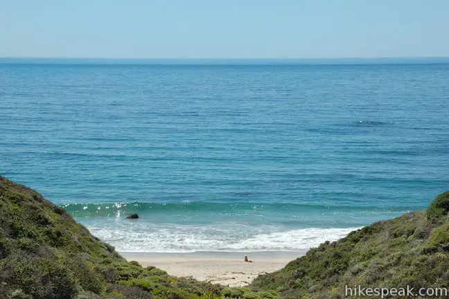
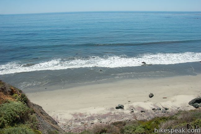
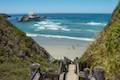
Continue straight on Bluff Trail for another quarter mile where it ends at a T-junction with Beach Trail. As you descend toward the beach, you’ll be able to look over the edge of the bluff toward the sand below. If you think the sand looks purple, there’s nothing wrong with your vision. This beautiful color comes from almandine garnets dissolving in the bluffs above the beach.
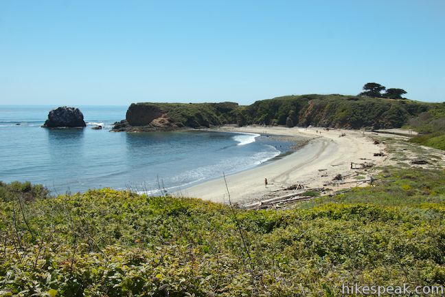
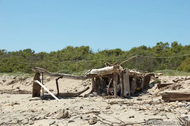
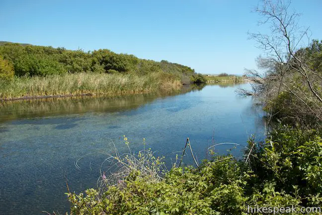
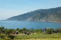
When you reach Beach Trail, you can turn right and hike roughly one mile back to the parking lot. Before you do so, turn left and walk out onto Molera Beach. Take a seat in the sand and look south down the impressive coastline you just explored. Previous visitors have assembled driftwood shelters along the beach that offer a bit of shade. Meander north up the beach to the mouth of the Big Sur River, which runs along Molera Point and flows into the Pacific.
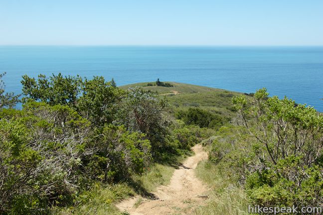
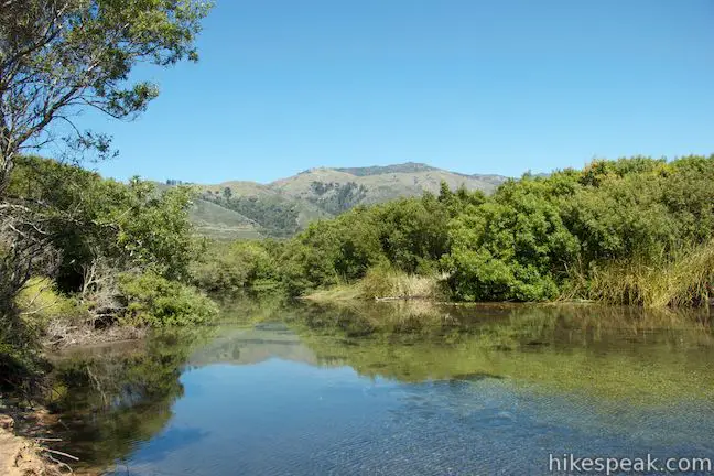
Instead of returning via Beach Trail, you can caulk the wagon and ford the Big Sur River Oregon Trail-style. Wade to the other side and find the end of Trail Camp Beach Trail, which returns to the parking lot by passing a walk-in campground and Cooper Cabin, the oldest building in Big Sur. The water in the river could be knee to thigh deep, but you may welcome this little dip after the long hike you’ve put it. Once you get across, it’s a level hike back to the start. Walk up the wide trail, which immediately comes to a junction with Headlands Trail. Take this side trail to the left to venture out to the end of Molera Point or stay to the right to continue the loop back.
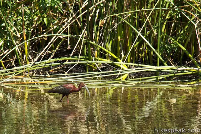
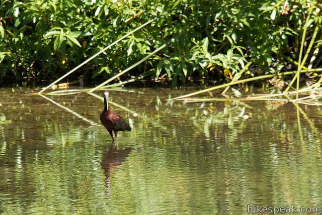
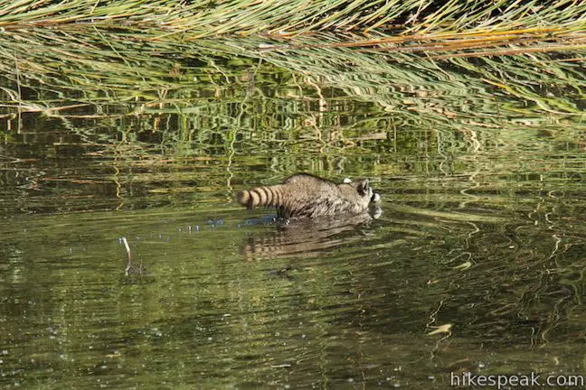
The trail briefly passes alongside the Big Sur River. If you have time to stop, pause here and see if you can spot any wildlife (check out the photos below to see a glossy ibis and a raccoon that revealed themselves in the couple minutes it took to put hiking boots back on).
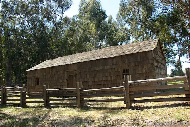
Just before you reach the trail camp, and about 0.6 miles from the beach, come to a short spur trail on the left up to a wooden cabin. Tired as your legs may be, take the short side trail to see a piece of Big Sur history. Built around the time of the Civil War, Cooper Cabin was used as housing for ranch hands and later as a barn. A panel by the cabin explains that:
Andrew Molera State Park was once part of a Mexican land grant known as the Rancho El Sur. Though granted in 1834 to Juan Bautista Alvarado, later governor of the province, it was soon acquired by his uncle, J.B.R. Cooper. Cooper was a Monterey sea captain and merchant who came to California in 1823. Beginning in 1834, the industrious Cooper had a number of buildings constructed on the ranch. The cabin you see before you was built in the spring of 1861, and is the oldest surviving ranch structure, as well as the oldest building on the Big Sur Coast.
The cabin stands firm, constructed with broad-axed and adzed redwood timbers and a roof that was covered with redwood shingles that were split by hand.
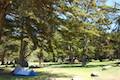
History lesson complete, return to Trail Camp Beach Trail, which then enters a field occupied by the Andrew Molera State Park Trail Camp. The wide trail heads straight through this 24-site walk-in campground and comes to one final junction, which is marked with a sign with arrows to Highway One and to the parking lot. Bear right toward the parking lot. Hike the final quarter mile, which crosses a bit of undulating terrain on the bank of the Big Sur River to return to the north end of the parking lot.
The Ridge Trail – Panorama Trail – Bluff Trail Loop in Andrew Molera State Park has to be one of the most epic coastal hikes in Big Sur. Dogs are not permitted on these trails. Bikes seem to be allowed on wider trails like Creamery Meadow Trail and Ridge Trail, but not on the park’s single-track trails. Wear long pants and check yourself for ticks when you finish this hike. Poison oak is common along the trail, so walk carefully. In the late spring, wild strawberries are also pretty common along the trail and amazingly delicious. A $10 day use fee is charged to enter Andrew Molera State Park and leave a vehicle at the trailhead (as of 2017). No permit is required to hike the loop, so get out and enjoy!
The basic directions for the Ridge Trail – Panorama Trail – Bluff Trail Loop are:
- Cross the Big Sur River and turn left onto River Trail at a junction with Beach Trail (0.1 miles)
- Turn right on Creamery Meadow Trail (0.25 miles)
- Turn left up Ridge Trail (0.95 miles)
- Bear left past the connector trail to Bluff Trail (1.05 miles)
- Stay right past the top of Hidden Trail (2.1 miles)
- Stay right through the junction with South Boundary Trail (2.95 miles)
- Turn right down Panorama Trail at the end of Ridge Trail (3.75 miles)
- Turn right at the junction with Spring Trail onto Bluff Trail (5.55 miles)
- Stay left past the connector trail to Ridge Trail (7.1 miles)
- Turn left toward the beach at the end of Bluff Trail or turn right to finish the loop on Beach Trail (7.35 miles)
- Cross the Big Sur River at the north end of the beach (7.5 miles)
- Stay right at the junction with Headlands Trail (7.55 miles)
- Pass Cooper Cabin (8.1 miles)
- Bear right at the junction on the far side of the trail camp (8.45 miles)
- Return to the parking lot (8.7 miles)
Directions to the Trailhead
- From the south, drive up Highway One to the Andrew Molera State Park entrance, located on the west side of the road, 4.4 miles north of Pfeiffer Big Sur State Park and 15.4 miles north of Julia Pfeiffer Burns State Park.
- The short road into Andrew Molera State Park curves to the right to reach the entrance booth at the edge of a large dirt parking area.
- The trailhead is just ahead on the right.
- From the north, drive 22 miles south of Carmel and 8.3 miles past the Bixby Bridge.
- Turn right on the well marked road into the park.
- The short road curves to the right to reach the entrance booth at the edge of a large dirt parking area.
- The trailhead is just ahead on the right.
Trailhead Location
Trailhead address: Highway One, Big Sur, CA 93920
Trailhead coordinates: 36.287409, -121.8441 (36° 17′ 14.67″N 121° 50′ 38.75″W)
View Andrew Molera State Park in a larger map
Or view a regional map of surrounding Central Coast trails and campgrounds.


 | Pfeiffer Beach This short walk reaches an absolutely stunning beach that's a classic feature of the Big Sur landscape. |
 | Big Sur River Gorge This half-mile off-trail hike ventures up the Big Sur River on a water-wading boulder-hopping adventure to a crystal clear pool that's a gorgeous Big Sur swimming hole. |
 | Pfeiffer Falls and Valley View This 2.4-mile hike is like two hikes in one, reaching a waterfall in a canyon of redwoods and a vista point overlooking the Big Sur River Valley. |
 | Nature Trail - River Path Loop This easy 0.55-mile loop explores woodlands along the Big Sur River and a redwood grove that includes the unique and impressive Proboscis Tree. The loop can be combined with the trail to Pfeiffer Falls and Valley View for a 3-mile trek. |
 | McWay Falls This 0.6-mile hike looks out on a stunning Big Sur waterfall that pours 80 feet right on to the beach. |
 | Canyon Falls This 0.9-mile hike heads inland up McWay Creek past a picnic area in a redwood grove to a lovely little waterfall. |
 | Partington Cove This 1.5 mile hike visits a cove and a secluded beach along the scenic Big Sur coast. The cove is accessed through a tunnel. |
 | Hare Creek Trail, Limekiln Trail, and Falls Trail This 2.65-mile hike in Limekiln State Park explores a trio of trails along lovely streams in redwood-lined canyons, reaching Limekiln Falls and historic lime kilns. |
 | Sand Dollar Beach This stunning hike of half a mile or more reaches two scenic overlooks as it descends to a long beach on the Big Sur coast. |
 | Jade Cove and Plaskett Rock Point This 1.5-mile hike along an ocean bluff visits a prominent peninsula and a small cove. |
 | Pacific Valley Bluff Trail This short out and back hike extends from Highway One to an ocean bluff with fantastic views of the Big Sur Coast. |
 | Salmon Creek Falls This short hike visits a fine 120-foot waterfall near the start of Salmon Creek Trail. |
 | Buckeye Trail This hike of 6.5 miles or more reaches incredibly ocean vistas and trail camps in the Silver Peak Wilderness. Connect Cruickshank Trail and Buckeye Trail for an excellent shuttle hike of 8.25 miles or more. |
 | Cruickshank Trail This hike into Silver Peak Wilderness starts with bold ocean views and crosses redwood groves to reach Upper Cruickshank Camp at a junction with Buckeye Trail, 5 miles round trip from Highway One. |
 | More Central Coast Hikes Explore other destinations along the California coast between Ventura and Monterey, including trails in Los Padres National Forest. |
 | Andrew Molera State Park Trail Camp This trail camp is easy to reach (just a short walk in) with campsites in a meadow along the Big Sur River near Molera Beach. |
 | Pfieffer Big Sur State Park Campground This large campground in the heart of Big Sur is spread out through oak and redwood groves along the Big Sur River. |
 | Limekiln State Park Campground This small Big Sur campground at the bottom of Limekiln Canyon has sites along a creek through a redwood grove and near the ocean, with access to trails up Limekiln Canyon. |
 | Kirk Creek Campground This outstanding 33-site campground in Los Padres National Forest has enormous ocean views from a bluff along the Big Sur coast. |
 | Plaskett Creek Campground This 45-site campground in Los Padres National Forest is positioned across Highway One from Sand Dollar Beach and Plaskett Rock Point on the coast of Big Sur. |
- Ridge, Panorama, and Bluff Trails Loop on redwoodhikes.com (opens in a new tab)
- Ridge, Panorama, and Bluff Trails Loop on hikinginbigsur.com (opens in a new tab)
- Ridge, Panorama, and Bluff Trails Loop on mapmyhike.com (opens in a new tab)
- Andrew Molera State Park on wikipedia.org (opens in a new tab)
- The official website for Andrew Molera State Park (opens in a new tab)
Common Questions about Ridge Trail – Panorama Trail – Bluff Trail Loop in Andrew Molera State Park
- Is the trail open?
- Yes. You should expect to find that Ridge Trail - Panorama Trail - Bluff Trail Loop is open. There are no recent reports of trail closures. If you discover that the trail is closed, please help your fellow hikers by reporting a closure.
- Do I need a permit for this hike?
- Yes. State Park Entrance Fee.
- How much time does this hike take?
- It takes approximately 4 hours 15 minutes to hike Ridge Trail - Panorama Trail - Bluff Trail Loop. Individual hiking times vary. Add extra time for breaks and taking in the views.
- How long is this hike?
- The hike to Ridge Trail - Panorama Trail - Bluff Trail Loop is a 8.7 mile loop with 1100 feet of elevation change.
- Are dogs allowed on this trail?
- No, dogs are likely not allowed on Ridge Trail - Panorama Trail - Bluff Trail Loop. The trail is primarily open to hikers.
- Is Ridge Trail - Panorama Trail - Bluff Trail Loop a difficult hike?
- This hike should be considered strenuous. Hikers should be prepared for a workout covering 8.7 miles and 1100 feet of climbing.
- Are there ocean views on this hike?
- Yes, Ridge Trail - Panorama Trail - Bluff Trail Loop offers views of the ocean.
- Are there redwood trees on this hike?
- Yes, Ridge Trail - Panorama Trail - Bluff Trail Loop passes through a grove of redwood trees.
- Is this a good hike for wildflowers?
- Yes, Ridge Trail - Panorama Trail - Bluff Trail Loop is known for its seasonal wildflower displays.
- Where is the trailhead located?
- The trailhead for Ridge Trail - Panorama Trail - Bluff Trail Loop is located in Big Sur, CA.
Trailhead Address:
Highway One
Big Sur, CA 93920
Trailhead Coordinates:
36.287409, -121.8441 - What are the driving directions to the start of the hike?
To get to the trailhead: From the south, drive up Highway One to the Andrew Molera State Park entrance, located on the west side of the road, 4.4 miles north of Pfeiffer Big Sur State Park and 15.4 miles north of Julia Pfeiffer Burns State Park. The short road into Andrew Molera State Park curves to the right to reach the entrance booth at the edge of a large dirt parking area. The trailhead is just ahead on the right.
From the north, drive 22 miles south of Carmel and 8.3 miles past the Bixby Bridge. Turn right on the well marked road into the park. The short road curves to the right to reach the entrance booth at the edge of a large dirt parking area. The trailhead is just ahead on the right.
View custom Google Maps directions from your current location.
- Are there other trails near Ridge Trail - Panorama Trail - Bluff Trail Loop?
- Yes, you can find other nearby hikes using the Hikespeak Hike Finder Map.

I have no question to ask, but I want to thank the Hikespeak’s team for good proposal in this beautiful area that my wife and I know well for our journey in California from S.Francisco to S.Diego along the fantastic Camino Real. All the best,
Mary and Enzo Bonacina.
This is the best trail I’ve taken. Magical. My girlfriend and I live in Monterey and discovered this trail. Eat some amazing breakfast (eggs Bennedict) at Deetjens’s in Big sur before (we don’t work there. It’s a locals favorite). Enjoy fellow humans.
The 8.7mi loop was wonderful. I’d avoid the beach though, excessive decomposing seaweed and flies, not appealing..at..all.