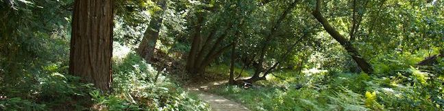
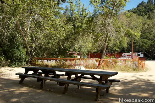
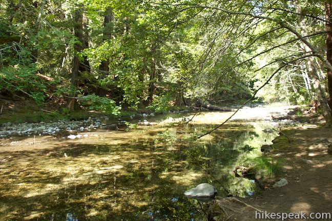
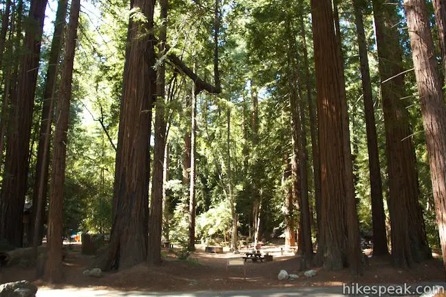
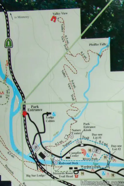
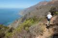
You don’t have to travel far beyond the entrance booth at Pfeiffer Big Sur State Park to get an introduction to the area’s plants and animals. That’s because the easy-walk providing Nature Trail starts from a day use lot just inside the park. Two additional trails along the Big Sur River in this area can be combined with the Nature Trail to form short easy loops. The highlight of the hike is a grove of over five hundred-year-old redwood trees that include an atypical redwood called the Proboscis. Combine Nature Trail with the River Path for a 0.55-mile loop. Alternatively (or additionally), cross the bridges at either end of the River Path and walk along the south side of the river on Warden’s Path for a slightly longer 0.65-mile loop.
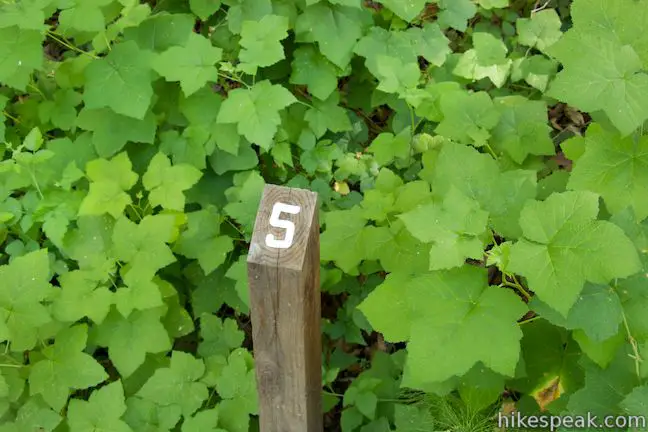
The Nature Trail begins across from Day Use Lot Two where there is a panel depicting some of the plants along the trail and animals you might see, including common creatures like woodpeckers and squirrels and less-likely treats like banana slugs. You can pick up a pamphlet for the self-guided nature trail, which has twelve entries to read that coincide with numbered markers along the trail.
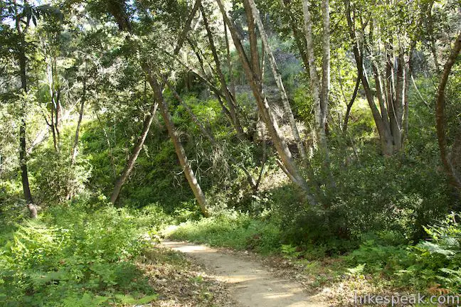
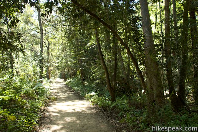
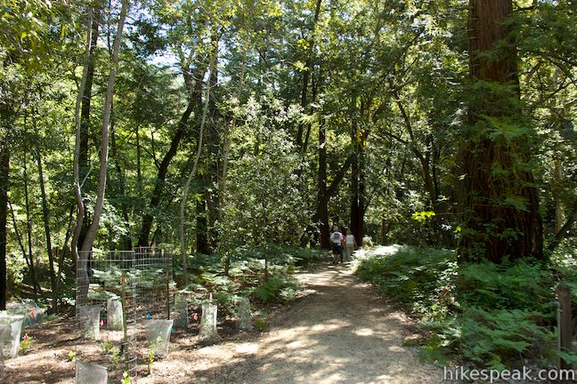
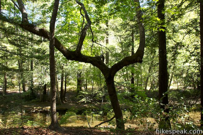
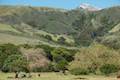
Begin up the Nature Trail, a 5-foot wide wheelchair-friendly path that passes through a riparian woodland on the north side of the park road. As you head west, the pamphlet will point out the sycamores, cottonwoods, and lovely-scented bays along the trail, as well as coast live oaks on the hillside above.
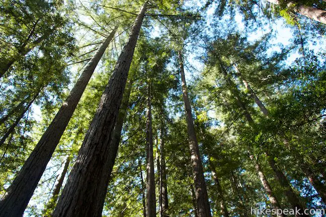
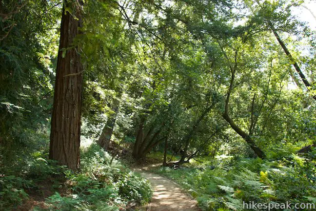
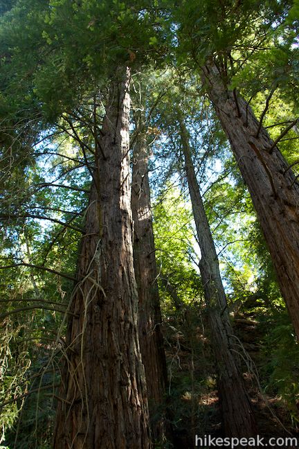
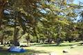
After a thousand feet, you will pass a path on the left going through the trees to the entrance station along the park road. Proceed up the trail into a grove of redwoods. At this point, you’ll be reading entry number ten in the pamphlet, which offers this:
You have stepped into a redwood grove. How does it differ from the area you have just walked through? The redwood trees grow densely and allow little sunshine to come through, inhibiting plant growth. A lack of undergrowth makes the forest much more open. Enjoy these ancient redwoods, which offer inspiration to the thousands of visitors who walk among them.
The pamphlet goes on to explain that:
Redwood trees have very broad, shallow root systems. These evergreen trees shed twigs and cones year-round, creating a thick layer of duff to protect the fragile roots from being damaged. Redwoods do not often reproduce from the seeds contained in their cones. Usually, new tree sprout from old stumps or from the base of mature trees.
It is truly impressive how these massive trees are able to dominate a forest, and how gratifying it is to walk in their presence.
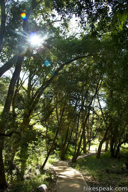
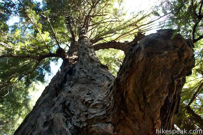
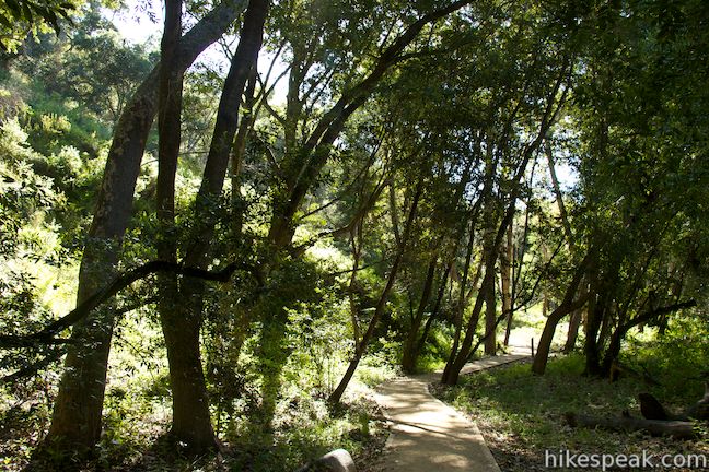
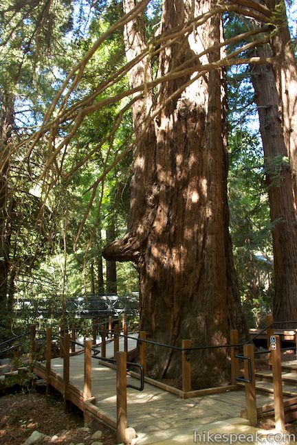
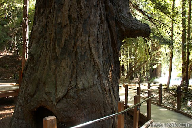
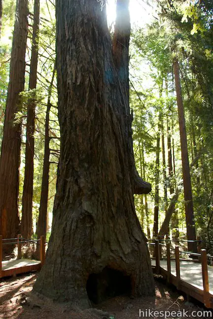
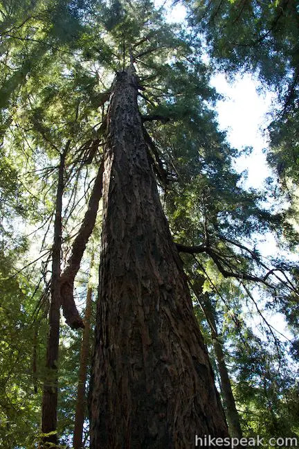
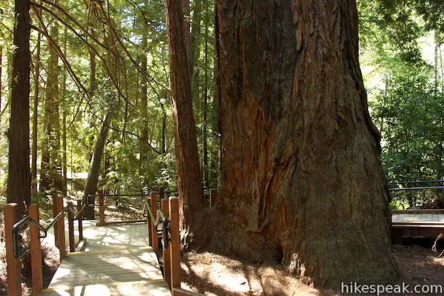
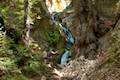
Your stroll through the tall, impressive redwood trees stops abruptly when the trail ends at the park road after 0.28 miles. Cross it to reach a junction with the River Path. You could turn left to walk back toward the day use parking lots, but first turn right and walk into an impressive cluster of redwoods centered around the Proboscis. If you are concerned you might not be able to pick the Proboscis out from all the other redwoods, don’t worry it sticks right out!
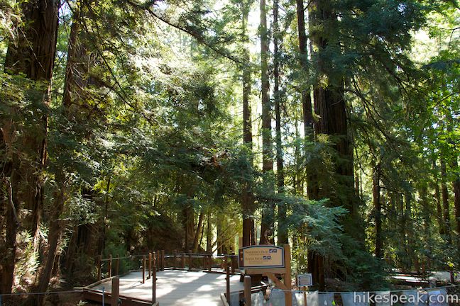
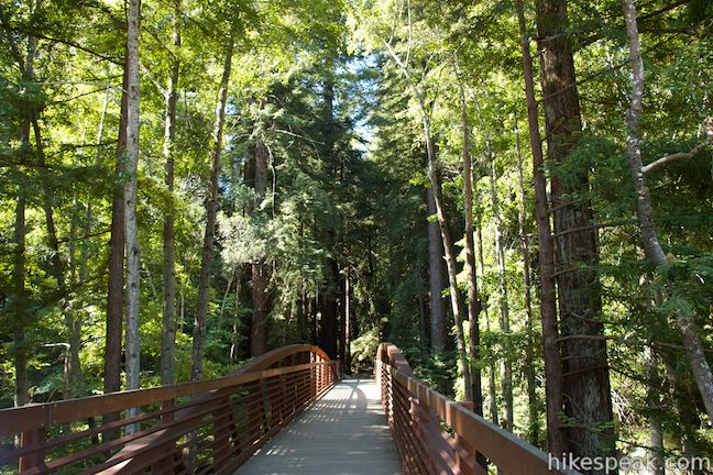
The trees in the Proboscis Grove are estimated to be between 500 and 800 years old. Take a short boardwalk through the grove, which circles around the Proboscis Tree. This unique redwood appears to have a nose growing out of its trunk and is one of the biggest trees in the park.
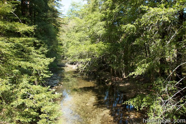
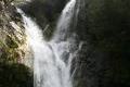
At the far side of the Proboscis Grove, you’ll find the start of the trail to Pfeiffer Falls and Valley View, located across the road from the general store and restaurant for the Big Sur Lodge. From here it is a 2.4-mile round trip hike to Pfeiffer Falls and the Valley View Overlook. Between the Proboscis Tree and the Big Sur Lodge there is a metal bridge crossing the Big Sur River. Take this if you’d like to walk back along the south side of the river, following a camp road to Warden’s Path, which leads to a pedestrian bridge back to Day Use Lot 2. The more direct option is to walk back past the Proboscis Tree and return along the River Trail. This trail goes through more riparian woodland above the riverbank and passes the park amphitheater to return to the start. Neither the River Path or the Warden’s Path go right along the river’s edge, but both are short, easy, soothing trails.
These short, easy trails can be used to connect the park’s large campground with the Big Sur Lodge and the trail to Pfeiffer Falls and Valley View. The Nature Trail – River Path Loop is pleasant as it’s own short walk or it can be combined with the hike to Pfeiffer Falls and Valley View for a trek that’s about three miles round trip. If you took a pamphlet for the nature trail, return it to the trailhead before leaving. Bikes are not allowed on these trails. Dogs are allowed on the River Path and Warden’s Path but are not allowed on the Nature Trail or other trails in the park. There is a $10 day use fee to enter the park or a $35 to $50 per night fee to camp in Pfieffer Big Sur State Park (all prices as of 2016). For a more energetic hike in Pfeiffer Big Sur State Park, check out the Big Sur River Gorge. No permit is required for this short loop or other hikes in Pfeiffer Big Sir State Park, so get out and enjoy!
Directions to the Trailhead
- From the south, drive up Highway One to the Pfeiffer Big Sur State Park entrance, located on the right (east) side of the road, 11 miles north of Julia Pfeiffer Burns State Park and 2.9 miles north of Nepenth Restaurant.
- There are signs for the lodge and the state park at the intersection with Pfeiffer Big Sur Road.
- Drive up the road through an intersection for the lodge and cabin sites to reach the park's entrance booth.
- Enter and park in the second day use lot on the right, across from the start of the Nature Trail.
- From the north, drive 4.4 miles south of Andrew Molera State Park and 0.7 miles past Fernwood Resort.
- Turn left into the park entrance.
- There are signs for the lodge and the state park at the intersection with Pfeiffer Big Sur Road.
- Drive up the road through an intersection for the lodge and cabin sites to reach the park's entrance booth.
- Enter and park in the second day use lot on the right, across from the start of the Nature Trail.
Trailhead Location
Trailhead address: 47225 Highway 1, Big Sur, CA 93920
Trailhead coordinates: 36.250472, -121.781215 (36° 15′ 01.69″N 121° 46′ 52.37″W)
View Pfeiffer Big Sur State Park in a larger map
Or view a regional map of surrounding Central Coast trails and campgrounds.


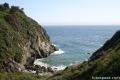
 | Pfeiffer Falls and Valley View This 2.4-mile hike is like two hikes in one, reaching a waterfall in a canyon of redwoods and a vista point overlooking the Big Sur River Valley. |
 | Big Sur River Gorge This half-mile off-trail hike ventures up the Big Sur River on a water-wading boulder-hopping adventure to a crystal clear pool that's a gorgeous Big Sur swimming hole. |
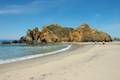 | Pfeiffer Beach This short walk reaches an absolutely stunning beach that's a classic feature of the Big Sur landscape. |
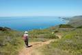 | Ridge Trail - Panorama Trail - Bluff Trail Loop This 8.7-mile loop in Andrew Molera State Park crosses a coastal ridge, bluff, and beach that are packed with amazing Big Sur views. |
 | McWay Falls This 0.6-mile hike looks out on a stunning Big Sur waterfall that pours 80 feet right on to the beach. |
 | Canyon Falls This 0.9-mile hike heads inland up McWay Creek past a picnic area in a redwood grove to a lovely little waterfall. |
 | Partington Cove This 1.5 mile hike visits a cove and a secluded beach along the scenic Big Sur coast. The cove is accessed through a tunnel. |
 | Hare Creek Trail, Limekiln Trail, and Falls Trail This 2.65-mile hike in Limekiln State Park explores a trio of trails along lovely streams in redwood-lined canyons, reaching Limekiln Falls and historic lime kilns. |
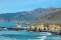
 | Sand Dollar Beach This stunning hike of half a mile or more reaches two scenic overlooks as it descends to a long beach on the Big Sur coast. |
 | Jade Cove and Plaskett Rock Point This 1.5-mile hike along an ocean bluff visits a prominent peninsula and a small cove. |
 | Pacific Valley Bluff Trail This short out and back hike extends from Highway One to an ocean bluff with fantastic views of the Big Sur Coast. |
 | Salmon Creek Falls This short hike visits a fine 120-foot waterfall near the start of Salmon Creek Trail. |
 | Buckeye Trail This hike of 6.5 miles or more reaches incredibly ocean vistas and trail camps in the Silver Peak Wilderness. Connect Cruickshank Trail and Buckeye Trail for an excellent shuttle hike of 8.25 miles or more. |
 | Cruickshank Trail This hike into Silver Peak Wilderness starts with bold ocean views and crosses redwood groves to reach Upper Cruickshank Camp at a junction with Buckeye Trail, 5 miles round trip from Highway One. |
 | More Central Coast Hikes Explore other destinations along the California coast between Ventura and Monterey, including trails in Los Padres National Forest. |
 | Pfieffer Big Sur State Park Campground This large campground in the heart of Big Sur is spread out through oak and redwood groves along the Big Sur River. |
 | Andrew Molera State Park Trail Camp This trail camp is easy to reach (just a short walk in) with campsites in a meadow along the Big Sur River near Molera Beach. |
 | Limekiln State Park Campground This small Big Sur campground at the bottom of Limekiln Canyon has sites along a creek through a redwood grove and near the ocean, with access to trails up Limekiln Canyon. |
 | Kirk Creek Campground This outstanding 33-site campground in Los Padres National Forest has enormous ocean views from a bluff along the Big Sur coast. |
 | Plaskett Creek Campground This 45-site campground in Los Padres National Forest is positioned across Highway One from Sand Dollar Beach and Plaskett Rock Point on the coast of Big Sur. |
- Nature Trail, Warden's Path, Pfeiffer Falls Trail, and Valley View Trail on modernhiker.com (opens in a new tab)
- Pfeiffer Big Sur State Park on Wikipedia.org (opens in a new tab)
- The official brochure for Pfeiffer Big Sur State Park (opens in a new tab)
- The official website for Pfeiffer Big Sur State Park (opens in a new tab)
Common Questions about Nature Trail – River Path Loop in Pfeiffer Big Sur State Park
- Is the trail open?
- Yes. You should expect to find that Nature Trail - River Path - Warden's Trail Loop is open. There are no recent reports of trail closures. If you discover that the trail is closed, please help your fellow hikers by reporting a closure.
- Do I need a permit for this hike?
- Yes. State Park Entrance Fee.
- How much time does this hike take?
- It takes approximately 15 minutes to hike Nature Trail - River Path - Warden's Trail Loop. Individual hiking times vary. Add extra time for breaks and taking in the views.
- How long is this hike?
- The hike to Nature Trail - River Path - Warden's Trail Loop is a 0.55 mile loop with 15 feet of elevation change.
- Are dogs allowed on this trail?
- No, dogs are likely not allowed on Nature Trail - River Path - Warden's Trail Loop. The trail is primarily open to hikers.
- Is Nature Trail - River Path - Warden's Trail Loop good for kids?
- Yes, this hike is likely suitable for children. It is relatively short (0.55 miles) with manageable elevation gain.
- Is this trail wheelchair accessible?
- Yes, Nature Trail - River Path - Warden's Trail Loop is designated as wheelchair-friendly.
- Are there redwood trees on this hike?
- Yes, Nature Trail - River Path - Warden's Trail Loop passes through a grove of redwood trees.
- Where is the trailhead located?
- The trailhead for Nature Trail - River Path - Warden's Trail Loop is located in Big Sur, CA.
Trailhead Address:
47225 Highway 1
Big Sur, CA 93920
Trailhead Coordinates:
36.250472, -121.781215 - What are the driving directions to the start of the hike?
To get to the trailhead: From the south, drive up Highway One to the Pfeiffer Big Sur State Park entrance, located on the right (east) side of the road, 11 miles north of Julia Pfeiffer Burns State Park and 2.9 miles north of Nepenth Restaurant. There are signs for the lodge and the state park at the intersection with Pfeiffer Big Sur Road. Drive up the road through an intersection for the lodge and cabin sites to reach the park's entrance booth. Enter and park in the second day use lot on the right, across from the start of the Nature Trail.
From the north, drive 4.4 miles south of Andrew Molera State Park and 0.7 miles past Fernwood Resort. Turn left into the park entrance. There are signs for the lodge and the state park at the intersection with Pfeiffer Big Sur Road. Drive up the road through an intersection for the lodge and cabin sites to reach the park's entrance booth. Enter and park in the second day use lot on the right, across from the start of the Nature Trail.
View custom Google Maps directions from your current location.
- Are there other trails near Nature Trail - River Path - Warden's Trail Loop?
- Yes, you can find other nearby hikes using the Hikespeak Hike Finder Map.

Go the extra miles...
Submit a rating of this hike to go with your comment. Contribute to the average trail rating.