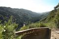
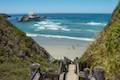
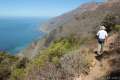
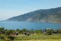
Julia Pfeiffer Burns State Park in Big Sur has a word famous waterfall named McWay Falls, which tumbles off a coastal bluff straight into the Pacific Ocean in a display of unique natural beauty. The park has a second waterfall too, just inland from McWay Falls, with the more generic name of Canyon Falls. This lovely little waterfall can’t rival McWay for postcard beauty, but the 0.9-mile round trip hike to the waterfall is quite pleasant, passing through an enchanting grove of ancient redwoods.
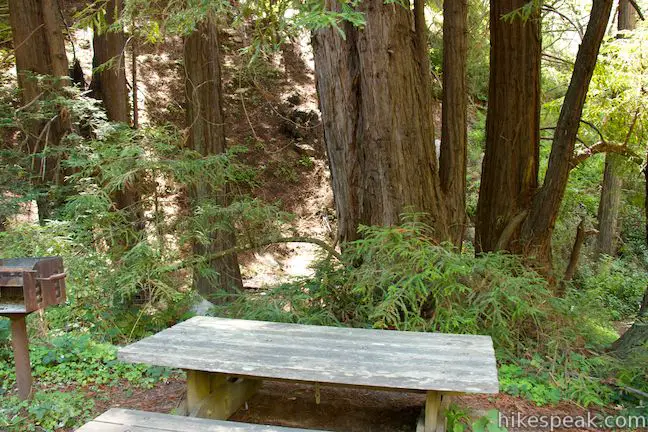
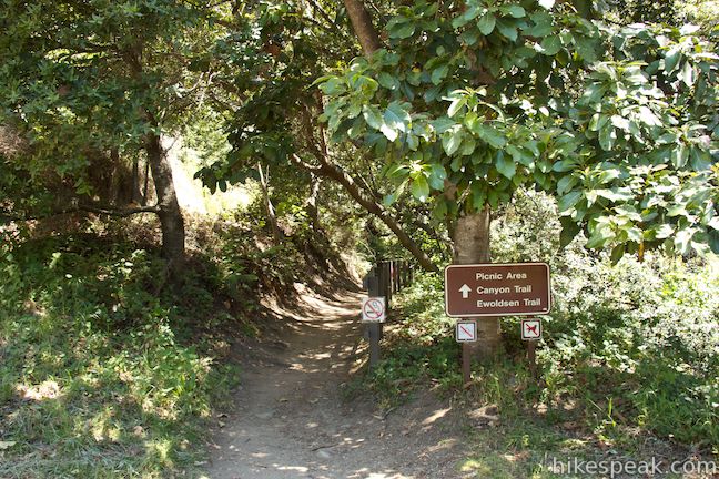
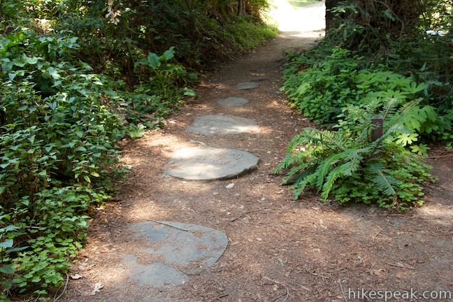
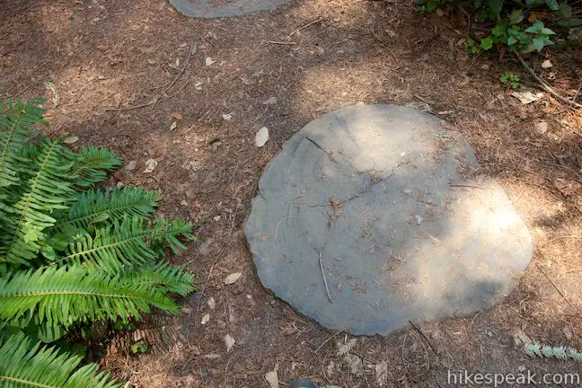
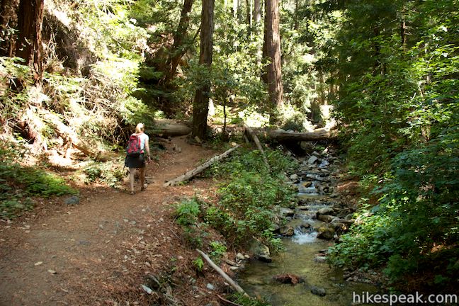
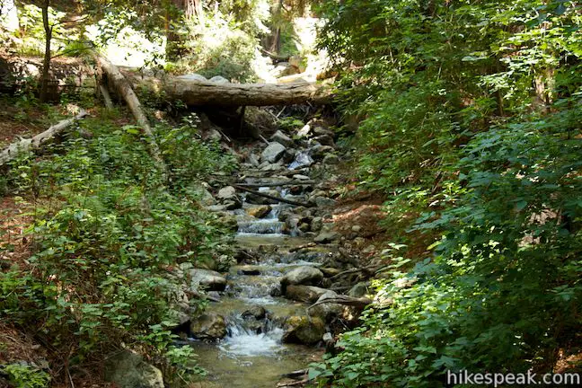
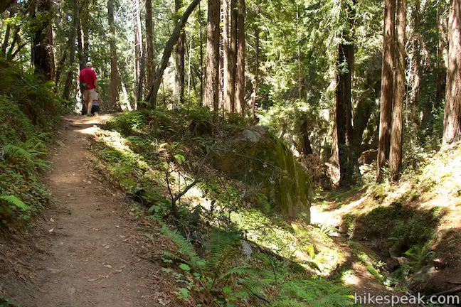
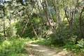
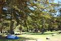
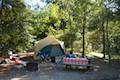
Start from the top of the first parking area inside Julia Pfieffer Burns State Park where Canyon Trail descends immediately into a grove of redwoods. Keep an eye on the trail below you, where slices of redwood trunks are embedded into the trail like oversized stepping stones. If you have time to count the rings, you’ll see that the redwoods had quite a long life before they ended up underfoot. After just less than a tenth of a mile, Canyon Trail passes through a picnic area where a few picnic tables and grills are spread out along McWay Creek. This is a lovely place to stop for a meal before or after you hike.
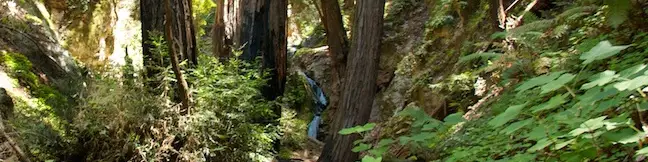
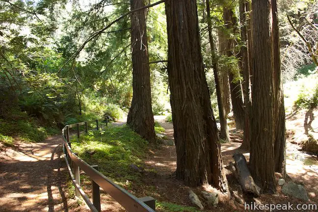
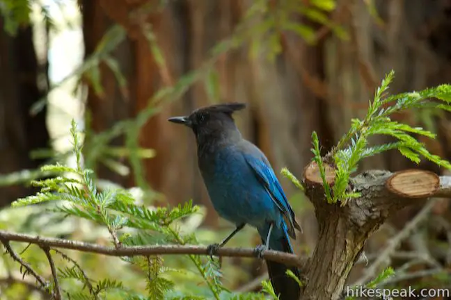
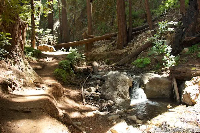
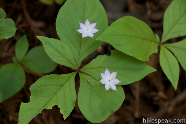
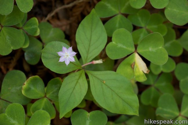
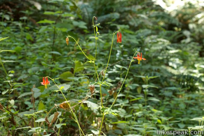
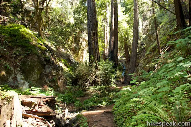
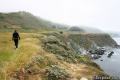
Continue up the trail, which runs along the north side of McWay Creek. If you look to your left, you’ll spot the ruins of an old cabin. Tall ancient redwoods line the canyon bottom, casting grand shadows across the trail. The patches of sunlight that reach the forest floor illuminate a verdant collection of ferns, redwood sorrel, and pacific starflower.
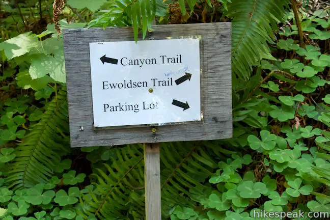
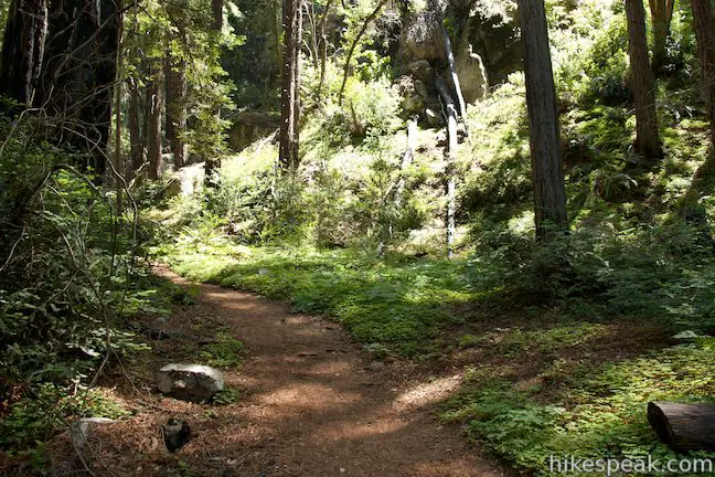
At 0.15 miles from the start, take the footbridge to the right to the other side of the stream. In another tenth of a mile, you will come to a trail junction, the only junction on this hike. Ewoldsen Trail breaks off to the right, venturing farther up the canyon. Stay to the left to continue toward Canyon Falls.
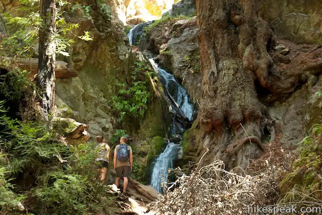
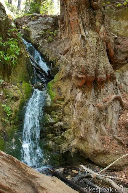
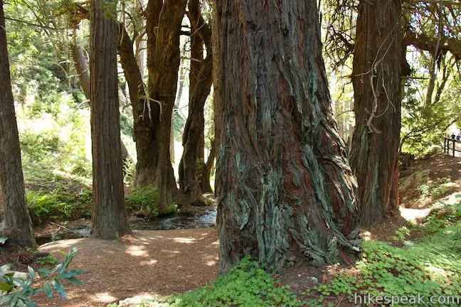
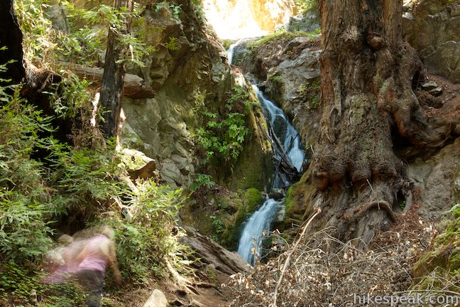
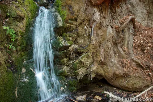
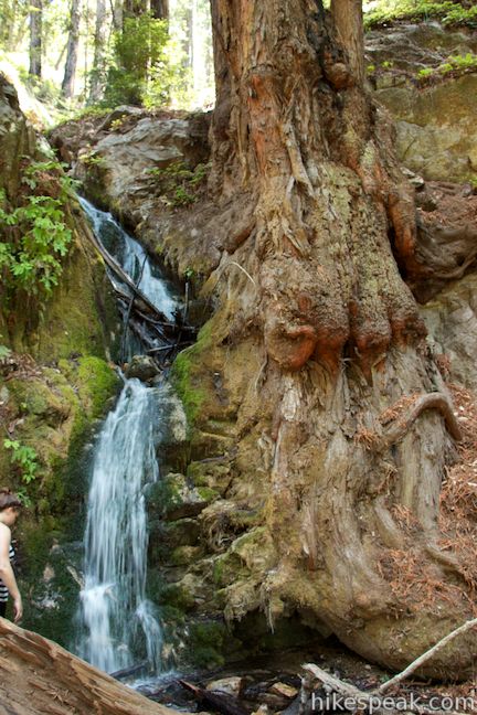
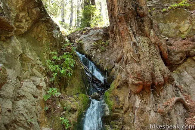
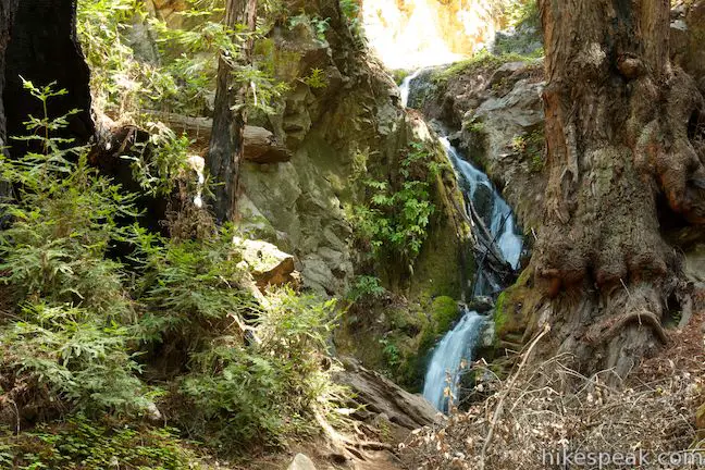
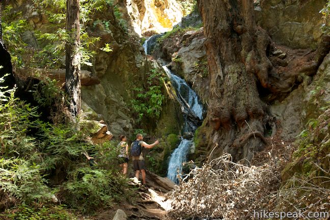
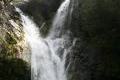
Canyon Trail rises just above the south side of the stream and ventures up the canyon through more redwoods. As the waterfall comes into view, hop back to the north side of McWay Creek and proceed up to the base of Canyon Falls where a white band pours through a chute in a granite wall. The Julia Pfeiffer Burns State Park website measures Canyon Falls at sixty feet tall, but the three-tier website doesn’t look to be more than thirty feet from top to bottom. A tall redwood tree stands to the right of the waterfall and the roots cling to the rock wall like wooden toes. Green moss coats the rock behind the waterfall and there are maidenhair ferns running down the rock wall just a few feet from the waterfall. It’s a charming little waterfall.
An unofficial footpath seems to continue above the waterfall, but it is probably best to turn around here. It is 0.45 miles back to the trailhead, descending 225 feet. Dogs and bikes are not allowed on this trail. There is a $10 vehicle fee to enter Julia Pfieffer Burns State Park. Alternatively, you may park for free along Highway One and walk a short distance into the park. No permit is required to hike Canyon Trail to Canyon Falls, so get out and enjoy!
Directions to the Trailhead
- From Ragged Point, drive 37.2 miles north on Highway One to the well marked Julia Pfeiffer Burns State Park (60 miles north of Cambria).
- The park is 8.1 miles south of Nepenthe Restaurant in Big Sur.
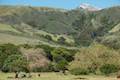
- Park beneath the sycamores alongside Highway One or pull into the park to reach the proper trailhead.
- Drive down the park road.
- Make the first left into the parking area.
- (The turn is before the road curves to the right over a bridge across McWay Creek.)
- Canyon Trail starts from the top of the parking area.
Trailhead Location
Trailhead address: Highway 1, Julia Pfeiffer Burns State Park, Big Sur, CA 93920
Trailhead coordinates: 36.16014, -121.668523 (36° 09′ 36.50″N 121° 40′ 06.68″W)
You may also view a regional map of surrounding Central Coast trails and campgrounds.


 | McWay Falls This 0.6-mile hike looks out on a stunning Big Sur waterfall that pours 80 feet right on to the beach. |
 | Partington Cove This 1.5 mile hike visits a cove and a secluded beach along the scenic Big Sur coast. The cove is accessed through a tunnel. |
 | Pfeiffer Beach This short walk reaches an absolutely stunning beach that's a classic feature of the Big Sur landscape. |
 | Big Sur River Gorge This half-mile off-trail hike ventures up the Big Sur River on a water-wading boulder-hopping adventure to a crystal clear pool that's a gorgeous Big Sur swimming hole. |
 | Pfeiffer Falls and Valley View This 2.4-mile hike is like two hikes in one, reaching a waterfall in a canyon of redwoods and a vista point overlooking the Big Sur River Valley. |
 | Nature Trail - River Path Loop This easy 0.55-mile loop explores woodlands along the Big Sur River and a redwood grove that includes the unique and impressive Proboscis Tree. The loop can be combined with the trail to Pfeiffer Falls and Valley View for a 3-mile trek. |
 | Ridge Trail - Panorama Trail - Bluff Trail Loop This 8.7-mile loop in Andrew Molera State Park crosses a coastal ridge, bluff, and beach that are packed with amazing Big Sur views. |
 | Hare Creek Trail, Limekiln Trail, and Falls Trail This 2.65-mile hike in Limekiln State Park explores a trio of trails along lovely streams in redwood-lined canyons, reaching Limekiln Falls and historic lime kilns. |
 | Pacific Valley Bluff Trail This short out and back hike extends from Highway One to an ocean bluff with fantastic views of the Big Sur Coast. |
 | Sand Dollar Beach This short hike to Big Sur's longest beach passes two scenic overlooks on the way to the sand for a hike of 0.5 miles (or more) round trip. |
 | Jade Cove and Plaskett Rock Point This 1.5-mile hike along an ocean bluff visits a prominent peninsula and a small cove. |
 | Salmon Creek Falls This short hike visits a fine 120-foot waterfall near the start of Salmon Creek Trail. |
 | Buckeye Trail This hike of 6.5 miles or more reaches incredibly ocean vistas and trail camps in the Silver Peak Wilderness. Connect Cruickshank Trail and Buckeye Trail for an excellent shuttle hike of 8.25 miles or more. |
 | Cruickshank Trail This hike into Silver Peak Wilderness starts with bold ocean views and crosses redwood groves to reach Upper Cruickshank Camp at a junction with Buckeye Trail, 5 miles round trip from Highway One. |
 | More Central Coast Hikes Explore other destinations along the California coast between Ventura and Monterey, including trails in Los Padres National Forest. |
 | Limekiln State Park Campground This 29-site Big Sur campground at the bottom of Limekiln Canyon has sites along a creek through a redwood grove and near the ocean, with access to trails up Limekiln Canyon. |
 | Kirk Creek Campground This outstanding 33-site campground in Los Padres National Forest has enormous ocean views from a bluff along the Big Sur coast. |
 | Plaskett Creek Campground This 45-site campground in Los Padres National Forest is positioned across Highway One from Sand Dollar Beach and Plaskett Rock Point on the coast of Big Sur. |
 | Pfieffer Big Sur State Park Campground This large campground in the heart of Big Sur is spread out through oak and redwood groves along the Big Sur River. |
 | Andrew Molera State Park Trail Camp This trail camp is easy to reach (just a short walk in) with campsites in a meadow along the Big Sur River near Molera Beach. |
- Canyon Falls on world-of-waterfalls.com (opens in a new tab)
- Ewoldsen Trail and Canyon Trail on hikinginbigsur.com (opens in a new tab)
- A brochure on camping in Julia Pfeiffer Burns State Park (with a great map) (opens in a new tab)
- Camping in Julia Pfeiffer Burns State Park on hipcamp.com (opens in a new tab)
- The official website for Julia Pfeiffer Burns State Park (opens in a new tab)
Common Questions about Canyon Falls in Julia Pfeiffer Burns State Park
- Is the trail open?
- Yes. You should expect to find that Canyon Trail to Canyon Falls is open. There are no recent reports of trail closures. If you discover that the trail is closed, please help your fellow hikers by reporting a closure.
- Do I need a permit for this hike?
- Yes. Free parking on Highway One / Entrance Fee for Julia Pfeiffer Burns State Park.
- How much time does this hike take?
- It takes approximately 30 minutes to hike Canyon Trail to Canyon Falls. Individual hiking times vary. Add extra time for breaks and taking in the views.
- How long is this hike?
- The hike to Canyon Trail to Canyon Falls is a 0.9 mile out and back with 225 feet of elevation change.
- Are dogs allowed on this trail?
- No, dogs are likely not allowed on Canyon Trail to Canyon Falls. The trail is primarily open to hikers.
- Is Canyon Trail to Canyon Falls good for kids?
- Yes, this hike is likely suitable for children. It is relatively short (0.9 miles) with manageable elevation gain.
- Will I see a waterfall on this hike?
- Yes, Canyon Trail to Canyon Falls features a waterfall.
- Are there redwood trees on this hike?
- Yes, Canyon Trail to Canyon Falls passes through a grove of redwood trees.
- Where is the trailhead located?
- The trailhead for Canyon Trail to Canyon Falls is located in Big Sur, CA.
Trailhead Address:
Highway 1
Big Sur, CA 93920
Trailhead Coordinates:
36.16014, -121.668523 - What are the driving directions to the start of the hike?
To get to the trailhead: From Ragged Point, drive 37.2 miles north on Highway One to the well marked Julia Pfeiffer Burns State Park (60 miles north of Cambria). The park is 8.1 miles south of Nepenthe Restaurant in Big Sur. Park beneath the sycamores alongside Highway One or pull into the park to reach the proper trailhead. Drive down the park road. Make the first left into the parking area. (The turn is before the road curves to the right over a bridge across McWay Creek.) Canyon Trail starts from the top of the parking area.
View custom Google Maps directions from your current location.
- Are there other trails near Canyon Trail to Canyon Falls?
- Yes, you can find other nearby hikes using the Hikespeak Hike Finder Map.

Is this particular Trail open and do I need to make a reservation?