Gaviota Peak – Trespass Trail in Gaviota State Park and Los Padres National Forest
Gaviota Peak sits at the lofty west end of the Santa Ynez Mountains behind Santa Barbara. The 2,458-foot peak is just two miles from the Pacific Ocean, putting it in prime position to offer eye-popping views. There are two routes to the summit from the trailhead in Gaviota State Park. The traditional Gaviota Peak Trail is 3.15 miles one-way, while the immensely scenic Trespass Trail is 3.35 miles one-way, creating a superb 6.5-mile loop with 2,150 feet of elevation gain.
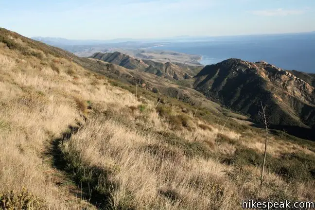
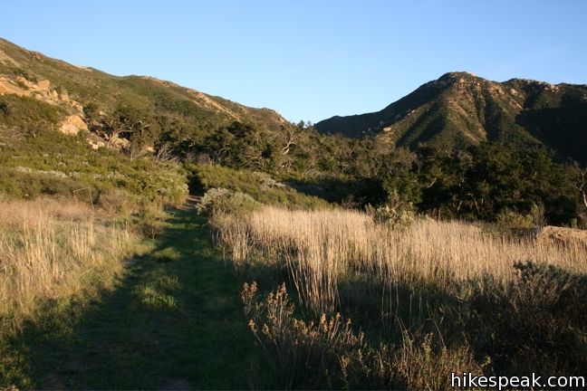
From the trailhead cul-de-sac just off Highway 101 in Gaviota State Park, begin hiking up the wide fire road toward Gaviota Peak. The road climbs 150 feet over the first quarter mile to a junction with Trespass Trail. From here you may head left or right to reach the peak. Trespass Trail is a narrow singe-track with stunning ocean views, while Gaviota Peak Trail offers underwhelming (though not un-enjoyable) inland views from a broad fire road. If you could only hike one trail, Trespass Trail would be the way to go. Since you can visit Gaviota Peak as a loop, hike up on the fire road and then come down on Trespass Trail, enjoying the views looking out from the mountain.
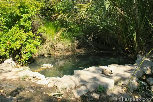
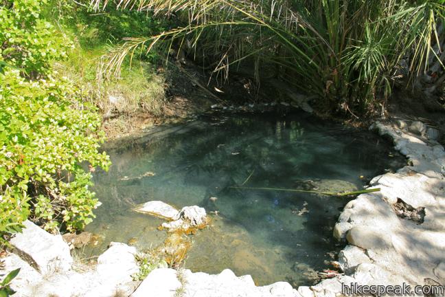
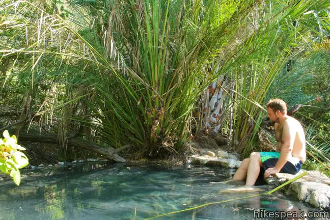
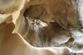
Turn left up the fire road toward Gaviota Peak and Gaviota Hot Springs. After a short distance, the road crosses a creek and comes to a junction with a single-track on the right that heads up to the hot springs, reaching it after 0.1 miles. The milky blue pool attracts bathers who relish a dip in the naturally warm sulfur spring waters.
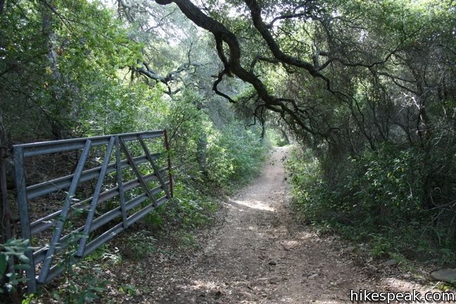
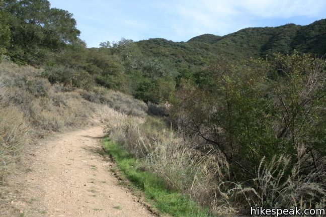
Gaviota Peak Trail continues past the junction, actually losing elevation for perhaps the only time on the trail, swinging out across a grass field before aiming up the mountain again. The road finds shade and passes through a metal gate, 0.9 miles from the start. Continue up Gaviota Peak Trail, which passes in and out of shade as it unrelentingly picks up elevation.
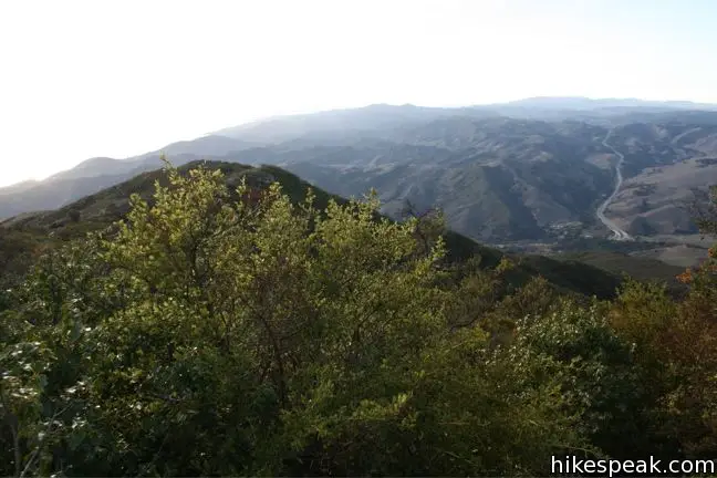
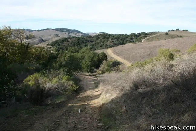
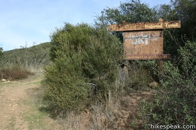
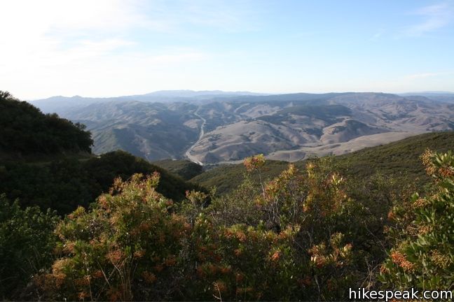
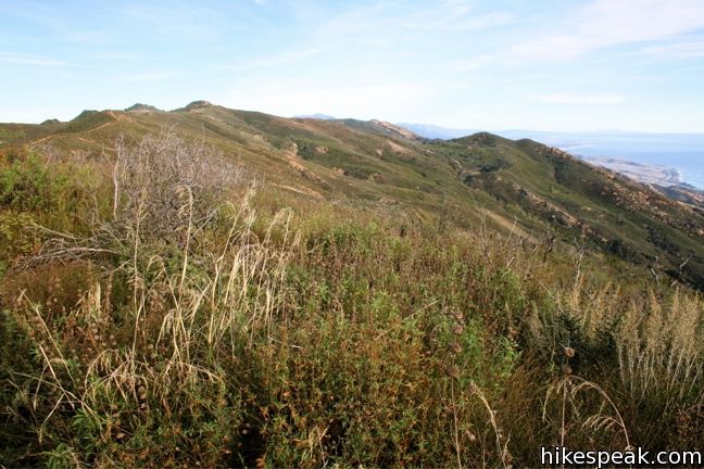
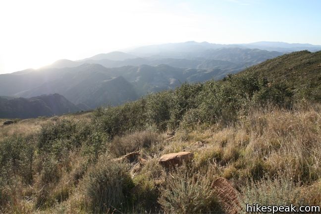
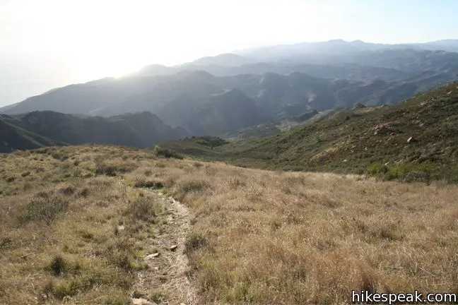
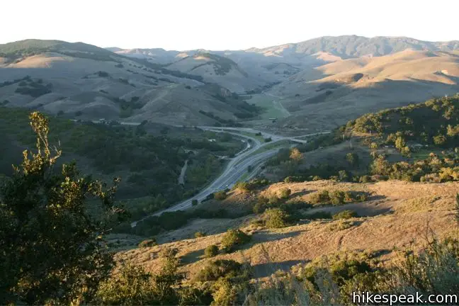
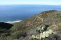
After ascending a thousand feet over the first 1.6 miles, the trail enters Los Padres National Forest. A sliver of the Pacific Ocean comes into view to the west beyond the hills of Lompoc as the road continues to climb, putting on another thousand feet over the next 1.4 miles. Come to a T-junction in the saddle northeast of Gaviota Peak. The junction greets hikers with a grand view down the other side of the ridge over a stunning stretch of coastline spanning east toward Santa Barbara. This should propel you on to the panoramic views at the summit. Turn right and finish the ascent, tackling the final 0.17 miles to the top of Gaviota Peak.
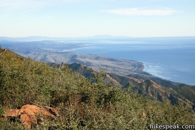
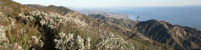
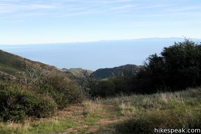
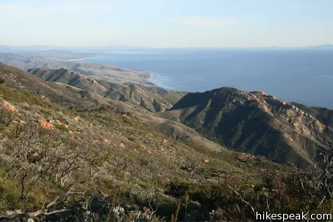
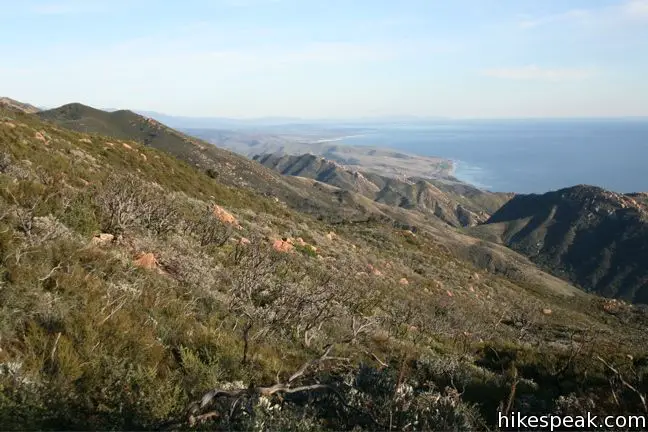
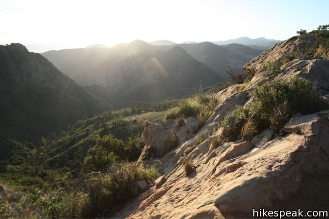
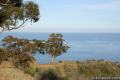
Gaviota Peak offers breathtaking views up and down the coast. You can look east clear across Santa Barbara, and west across Lompoc toward Point Conception. In between is vast sea adorned by Channel Islands that hover on the horizon. To the north, gentle rolling hills frame the fertile Santa Ynez Valley. And the view to the east, across the Santa Ynez Mountains, that’s pretty good too… Indeed, the 2,458-foot Gaviota Peak rises mightily over a beautiful region of California.
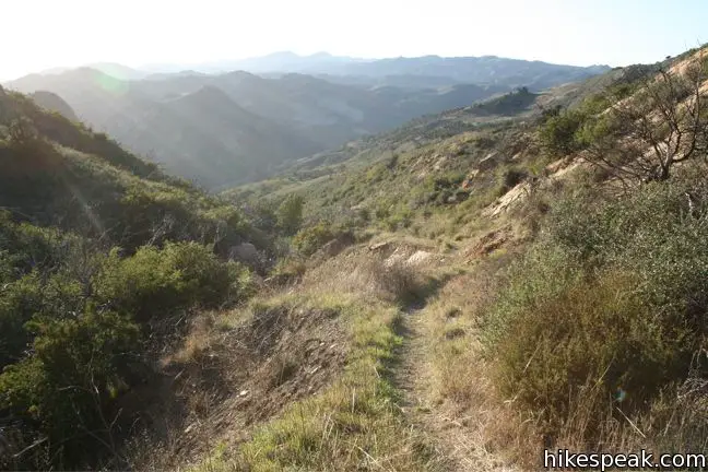
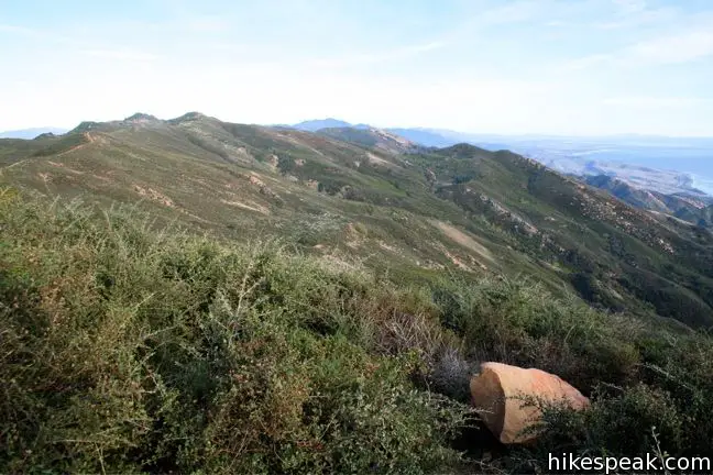
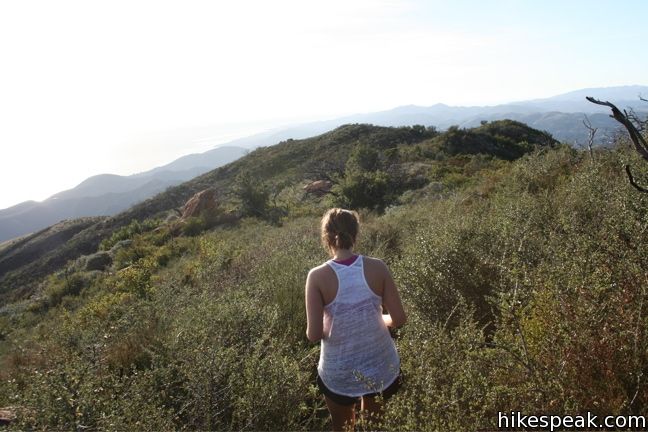
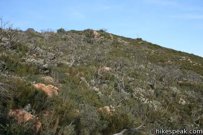
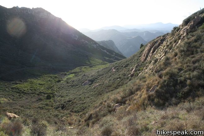
Those descending on Trespass Trail will find it completely different from the ascent. Trespass Trail is narrow, overgrown, and unmaintained. Definitely wear long pants if you trek this way or your legs will get scraped! Pick up the single-track heading southwest off the summit and prepare for sensational views. The landscape surrounding this trail is so pristine and wild, it is hard to believe you are just a couple miles from a major freeway.
Wildfire-scorched trees on the upper slopes are surrounded by thriving underbrush. Orange boulders dot the mountainside that rises high above the blue waters of the Pacific. The trail might not be easy going, but the views are worth it. After 1/3 of a mile, the trail reaches a grassy slope. The scenery remain tremendous as the narrow track descends another 2/3 of a mile to the bottom of a ravine, at an elevation of 1,400 feet. The trail turns to the right, heading west for 0.7 miles to a gate across the trail.
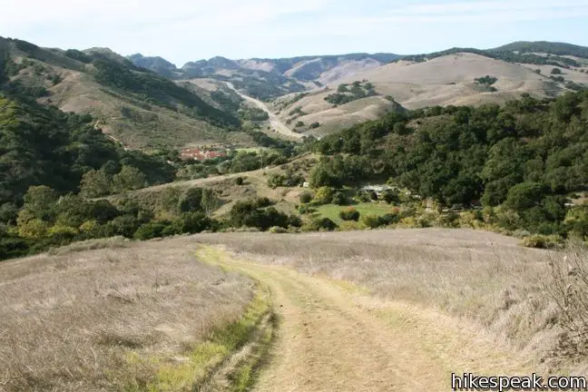
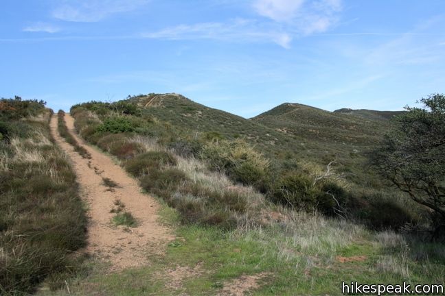
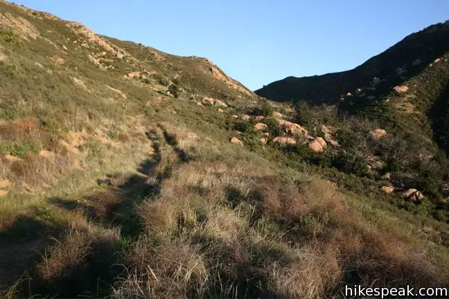
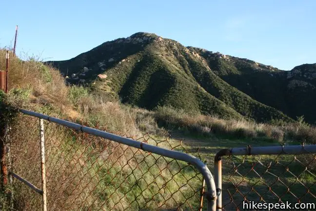
Why the gate? The land on this side of the fence is owned by ranchers who purchased the property with a built-in agreement that the public be granted continued access to the trail, hence the name Trespass Trail because you are a welcome trespasser. Pass through the gate, re-latching it as you go, and return to Gaviota State Park. The rough dirt path dissects a few more patches of high brush over the next half mile before coming clear and widening to a jeep trail that allows brisker hiking across a grassy slope. Shortly after Trespass Trail widens, you will pass the top of Tunnel View Trail on the left, an alternate route back that offers a view of the Gaviota Tunnel.
Look down on Highway 101, literally of course, as you hike the final mile of Trespass Trail, wrapping around the base of Gaviota Peak back to the junction near the start of the hike. If your body needs a soak, turn right to hike up to the hot springs. Otherwise, turn left and descend a quarter mile to the trailhead, completing this 6.5-mile loop with 2,150 feet of elevation change.
Great exercise and unbelievable views make this a must-do hike on California’s central coast. Be sure to wear long pants, at least for Trespass Trail, or the incredible track will be less of a joy. Dogs are not allowed. There is a $2 fee to park at the trailhead. Bring exact change, because this is a self-fee area. If that price is too steep for you, of if you are just looking for a nearby trails that is less steep, check out Nojoqui Falls and the Gaviota Wind Caves.
Directions to the Trailhead
- From Santa Barbara, drive 30 miles west on Highway 101.
- When the freeway turns inland, pass the Gaviota Rest Area and drive 1.5 miles to the next exit (132) labeled California One (Lompoc / Vandenberg AFB).
- At the top of the ramp, turn right.
- Make another immediate right on the unnamed Gaviota Park Boundary Road.
- Continue 1/3 of a mile to the cul-de-sac at road's end.
- From Buellton to the north, take the 101 South for 8 miles to the exit for California One.
- Turn left across the freeway.
- Make a right on the frontage road to the trailhead.
Trailhead Location
Trailhead address: Gaviota Park Boundary Road, Goleta, CA 93117
Trailhead coordinates: 34.5046, -120.2259 (34° 30′ 16.6″N 120° 13′ 33.23″W)
View Gaviota State Park in a larger map
Or view a regional map of surrounding Central Coast trails and campgrounds.


 | Gaviota Hot Springs This short hike visits a warm hot springs along the trail to Gaviota Peak in Gaviota State Park. |
 | Tunnel View and Trespass Trails Loop This 2.6-mile loop steals a view over Highway 101 and the Gaviota Tunnel. |
 | Gaviota Pass Overlook Loop This 6.5-mile loop tours scenic ridges in Gaviota State Park to arrive at a soaring overlook above the Gaviota Tunnel. |
 | Gaviota Wind Caves This 2.5-mile hike just off Highway 101 visits wind-carved caves in Gaviota State Park with great ocean views. |
 | Nojoqui Falls This short 0.65-mile hike visits an 80-foot tall fern-lined waterfall. |
 | More Central Coast Hikes Explore other destinations along the California coast between Ventura and Monterey, including trails in Los Padres National Forest. |
 | La Jolla Canyon Loop This 11.75-mile hike explores Point Mugu State Park on the west end of the Santa Monica Mountains, offering extraordinary ocean views. |
 | Hermit Gulch Trail Trans-Catalina Trail Loop This 11.75-mile hike over the ridges above Avalon offers amazing ocean views, in two directions at times, as well as a look at the pristine interior of the island. |
 | Sandstone Peak This 6.25-mile loop summits the tallest peak in the Santa Monica Mountains. |
 | Cerro San Luis from Laguna Lake Park This 5.7-mile hike summits one of the Nine Sisters just west of downtown San Luis Obispo. |
 | Gaviota State Park Campground With 39 sites situated right next to the beach and proximity to many hiking trails, this coastal campground has a lot of appeal. |
 | Refugio State Beach Campground This 67-site campground is a great oceanfront camping destination along the coast west of Santa Barbara, just three miles from El Capitán State Beach. |
 | El Capitán State Beach Campground This 132-site campground offers oceanfront camping along the coast west of Santa Barbara, just three miles from Refugio State Beach. |
- Gaviota Peak on summitpost.org (opens in a new tab)
- Gaviota Peak on santabarbarahikes.com (opens in a new tab)
- Photos of a sierra club hike to Gaviota Hot Springs and Trespass Trail (opens in a new tab)
- The official trail map for Gaviota State Park (opens in a new tab)
- The official website for Gaviota State Park (opens in a new tab)
- The official website for Los Padres National Forest (opens in a new tab)
Common Questions about Gaviota Peak – Trespass Trail in Gaviota State Park and Los Padres National Forest
- Is the trail open?
- Yes. You should expect to find that Gaviota Peak Trail - Trespass Trail Loop is open. There are no recent reports of trail closures. If you discover that the trail is closed, please help your fellow hikers by reporting a closure.
- Do I need a permit for this hike?
- Yes. State Park Fee.
- How much time does this hike take?
- It takes approximately 4 hours to hike Gaviota Peak Trail - Trespass Trail Loop. Individual hiking times vary. Add extra time for breaks and taking in the views.
- How long is this hike?
- The hike to Gaviota Peak Trail - Trespass Trail Loop is a 6.5 mile loop with 2150 feet of elevation change.
- Are dogs allowed on this trail?
- No, dogs are likely not allowed on Gaviota Peak Trail - Trespass Trail Loop. The trail is primarily open to hikers.
- Is Gaviota Peak Trail - Trespass Trail Loop a difficult hike?
- This hike should be considered strenuous. Hikers should be prepared for a workout covering 6.5 miles and 2150 feet of climbing.
- Are there ocean views on this hike?
- Yes, Gaviota Peak Trail - Trespass Trail Loop offers views of the ocean.
- Does this trail go to a summit?
- Yes, Gaviota Peak Trail - Trespass Trail Loop reaches a summit with panoramic views.
- Are there hot springs on this hike?
- Yes, there are hot springs located along Gaviota Peak Trail - Trespass Trail Loop.
- What mountain range is this trail in?
- Gaviota Peak Trail - Trespass Trail Loop is located in the Santa Ynez Mountains.
- Where is the trailhead located?
- The trailhead for Gaviota Peak Trail - Trespass Trail Loop is located in Goleta, CA.
Trailhead Address:
Gaviota Park Boundary Road
Goleta, CA 93117
Trailhead Coordinates:
34.5046, -120.2259 - What are the driving directions to the start of the hike?
To get to the trailhead: From Santa Barbara, drive 30 miles west on Highway 101. When the freeway turns inland, pass the Gaviota Rest Area and drive 1.5 miles to the next exit (132) labeled California One (Lompoc / Vandenberg AFB). At the top of the ramp, turn right. Make another immediate right on the unnamed Gaviota Park Boundary Road. Continue 1/3 of a mile to the cul-de-sac at road's end.
From Buellton to the north, take the 101 South for 8 miles to the exit for California One. Turn left across the freeway. Make a right on the frontage road to the trailhead.
View custom Google Maps directions from your current location.
- Are there other trails near Gaviota Peak Trail - Trespass Trail Loop?
- Yes, you can find other nearby hikes using the Hikespeak Hike Finder Map.

11 Comments on Gaviota Peak – Trespass Trail in Gaviota State Park and Los Padres National Forest
What hikers are saying:
✨ Generated summary of user commentsHikers find this trail to be a rewarding workout that leads to spectacular views of the surrounding scenery. It is important to prepare for a significant temperature drop at the summit and bring plenty of water and sunscreen for the exposed sections. Navigation requires attention because the remote atmosphere makes it easy to lose the way.
I’ll be up that way in a few months. I’m going to be hiking 1000 trails in 1000 days.
https://www.calihike.blogspot.com/
Love your page (I can see what I missed), was just there on 3/5/11 but I didn’t make it to the peak as it was getting dark, so I turned back at the Hot Spring. Flowers were in bloom and the hills were bright green, the part of Gaviota Peak Fireroad I did hike was wooded and beautiful. Must hike to the peak sometime!
Beautiful photos and an enjoyable blog. Gaviota peak is a good trail to experience if you are new to the area and wanting to see first hand the beautiful scenery that surrounds Santa Barbara. I have been coming to Santa Barbara for years for hiking and just soaking in all the nature I can. My only recommendation is to bring lots and lots of sunscreen and water! You feel like you’re out in the middle of no where at points and it is easy to get lost if you don’t know where you are going so pay attention. I’ve been hiking for years and sometimes it’s easy to get lost.
We just made this trip today. We did the loop up the fire road and down trespass trail. Most people say it’s a three hour trip but we could have made it in two except we kept stopping to take pictures. It is a heck of a workout but worth it for the views from the top. I plan on doing this hike again soon.
[…] 1/17/15 I went on a hike with Cal Poly’s very own “Poly Escapes” program to Gaviota Peak in Santa Barbara county. The trip was 6.5 mile loop with an elevation gain of 2,150 feet,and it was a decent workout. We […]
IT TOOK US 14 PEOPLE 2 HOURS TO CLIMB TO THE TOP .WE SIGN ON THE BOOK AND WE HAVE LOTS OF FUN .
[…] Saturday 1/17/15 I went on a hike with Cal Poly’s “Poly Escapes” program to Gaviota Peak in Santa Barbara county. We left campus around 10am and it took about an hour to get from Cal Poly’s campus to the […]
Did it today. 2 hours to reach the top b/c we were a bit concerned with daylight on the way down due to our late start and daylight savings. Exceptional views. Thanks for sharing your knowledge!
Dogs not allowed.
Excellent workout. Three hours round trip. Nice wide trail 95% of the time. spectacular view from the top. 30 degree drop in temp at the top.
Glad you enjoyed it. This hike does have great views!