Gaviota Wind Caves
in Gaviota State Park
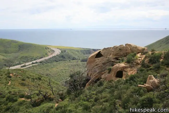
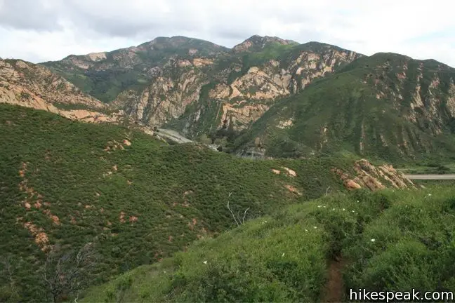
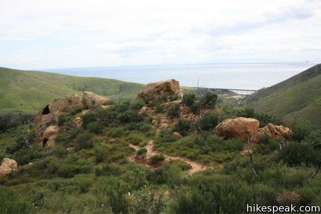
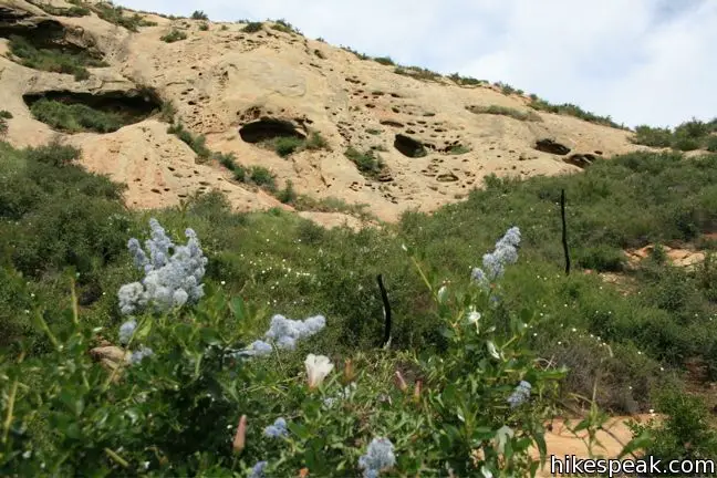
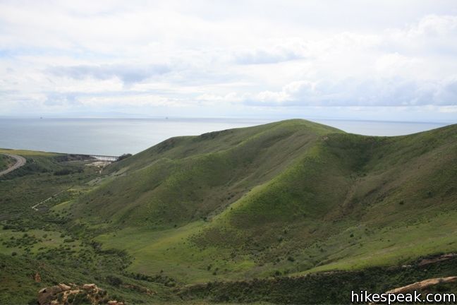
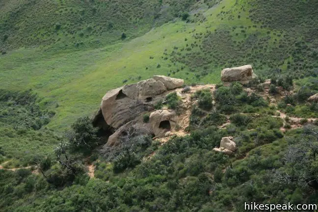
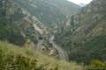
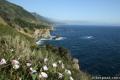
The Gaviota Wind Caves are a sandstone formation located a mile from the Pacific Ocean in the Santa Ynez Mountains west of Santa Barbara. The hike to the wind-swept caves is 2.5 miles round trip with 600 feet of elevation gain.
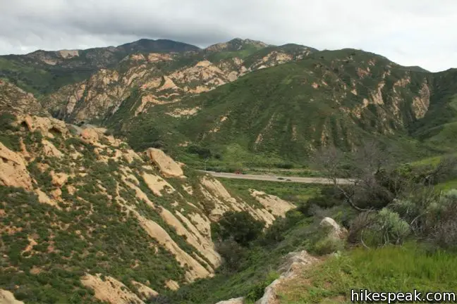
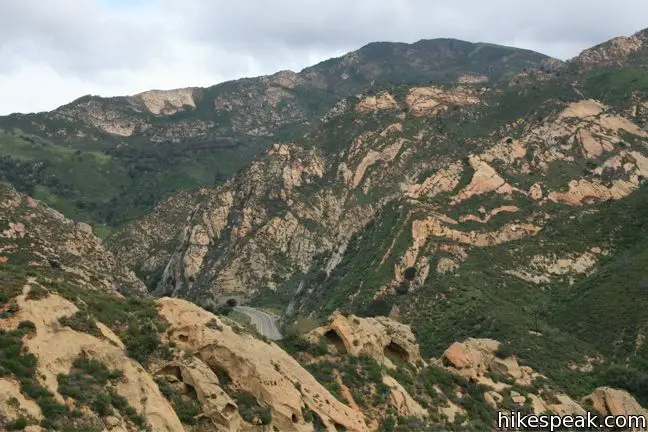
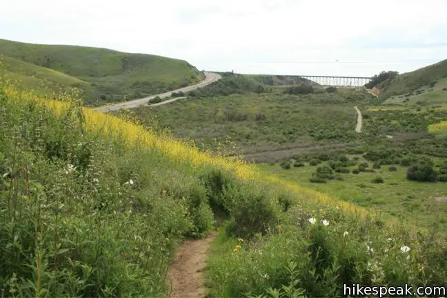
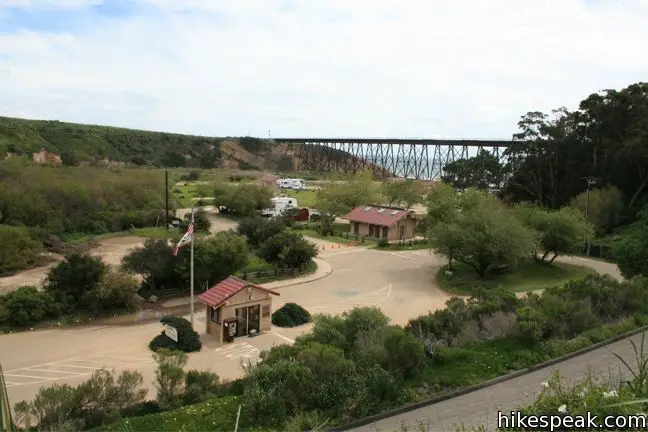
One good thing about the Gaviota Wild Caves is that they are easy to get to from the 101. In fact, the wind caves can be seen from the freeway.
The bad thing is that the freeway can be also seen from the wind caves, and the sound of passing traffic follows hikers for the entire trail. The other unfortunate thing is that the first half of the trail is paved, which is not the preferred surface for hiking. Past the pavement, the trail becomes a single track that climbs rapidly to a ridge running down from the caves. This part of the hike is much more pleasant and the Gaviota Wind Caves are a great place to explore, boasting fine views of the mountains and sea.
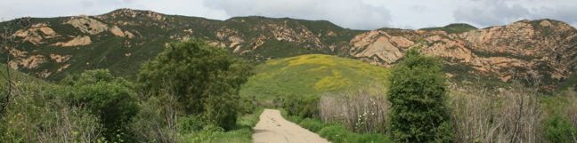
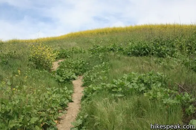
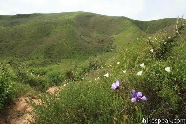
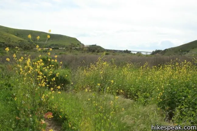
From the trailhead, start north on the paved trail running parallel to the 101 and Gaviota Beach Road. Just after the road bends to the right, make a left turn on to a narrow dirt path breaking off through high grasses, about an 1/8 of a mile before the end of the pavement. Look up and you can trace the trail over the ridge to the west toward the visible wind caves.
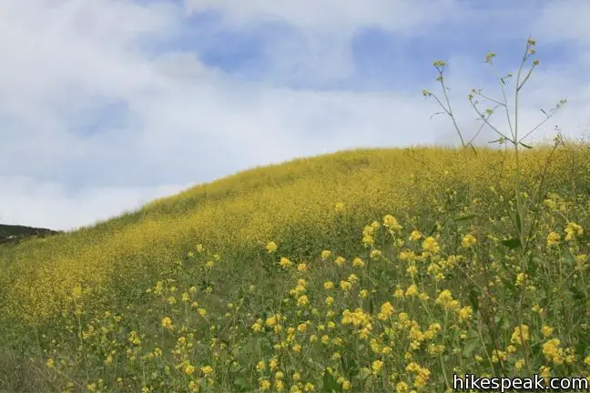
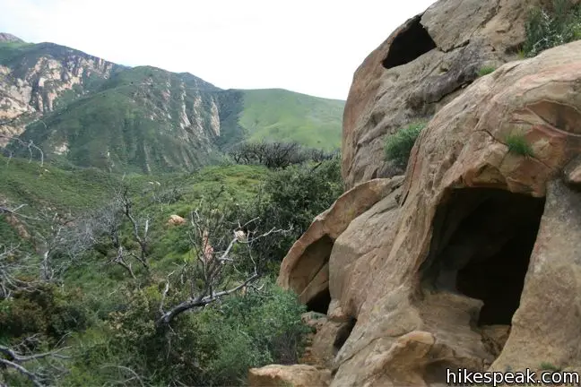
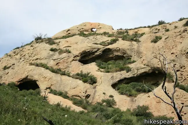
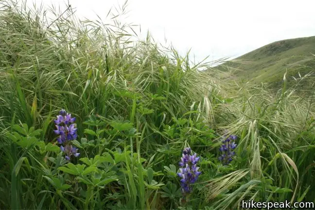
In the spring, the chest-high Black Mustard is gilded by bright yellow flowers. It is recommended that you wear long pants or be prepare to get a little scratched and covered in pollen on this hike. After gaining the ridge, turn left toward the exposed pocked sandstone. There are a few other paths in this area, so follow the most worn trail straight up to the wind caves.
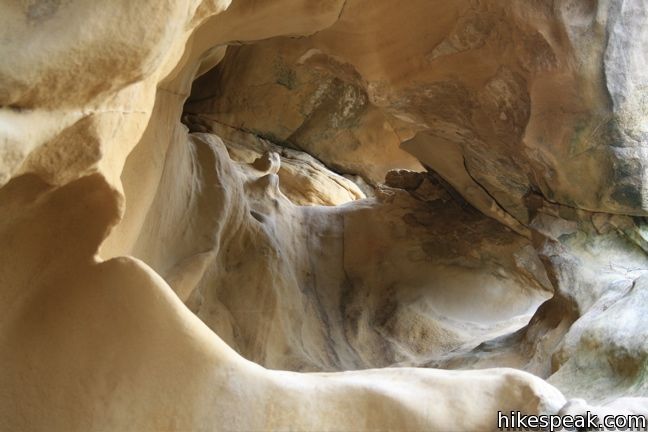
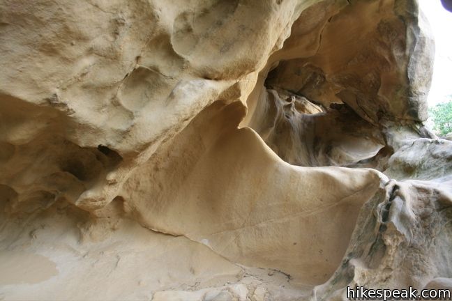
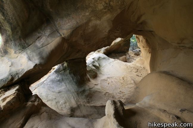
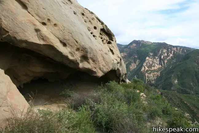
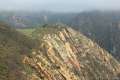
Step inside the opening in the lower set of caves before continuing on to the larger formation. A path around the west side of the rock leads to the top of the wind caves, where there is an eyelet piercing the rock that can be seen from below. Inside the opening on the far side of this window, you will find the trail registry canister. Have a seat here and enjoy the fine view.
Climb around the wind-carved caves, before returning the way your came. For a stunning nearby trail, check out Gaviota Peak. For camping, visit the adjacent Gaviota State Park Campground. Dogs are not allowed on this hike. No fee or permit is required to hike to the Gaviota Wind Caves in Gaviota State Park, so get out and enjoy!
Directions to the Trailhead
- From Santa Barbara, travel west for 30 miles on Highway 101.
- Take the Gaviota Beach Road Exit (sign reads Gaviota State Beach), which is just before the rest area and the Gaviota Tunnel en route to Los Olivos.
- Drive down Gaviota Beach Road and bear right past the park entrance onto Hollister Ranch Road, which goes up the hill to the right.
- Almost immediately, the road turns to the right and there are gravel turnouts on both sides of the road.
- Park here.
- The trailhead is on the right next to a mountain lion warning sign.
Trailhead Location
Trailhead address: Hollister Ranch Road, Gaviota State Park, Goleta, CA 93117
Trailhead coordinates: 34.47172, -120.2297 (34° 28′ 18.2″N 120° 13′ 46.9″W)
View Gaviota State Park in a larger map
Or view a regional map of surrounding Central Coast trails and campgrounds.


 | Gaviota Pass Overlook Loop This 6.5-mile loop tours scenic ridges in Gaviota State Park to arrive at a soaring overlook above the Gaviota Tunnel. |
 | Gaviota Peak This 6.5-mile loop mounts a 2,458-foot summit two miles from the Pacific and then descends Trespass Trail to explore the wilds of the Santa Ynez Mountains. |
 | Gaviota Hot Springs This short hike visits a warm hot springs along the trail to Gaviota Peak in Gaviota State Park. |
 | Tunnel View and Trespass Trails Loop This 2.6-mile loop steals a view over Highway 101 and the Gaviota Tunnel. |
 | Nojoqui Falls This short 0.65-mile hike visits an 80-foot tall fern-lined waterfall. |
 | More Central Coast Hikes Explore other destinations along the California coast between Ventura and Monterey, including trails in Los Padres National Forest. |
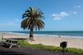
 | Gaviota State Park Campground With 39 sites situated right next to the beach and proximity to many hiking trails, this coastal campground has a lot of appeal. |
 | Refugio State Beach Campground This 67-site campground is a great oceanfront camping destination along the coast west of Santa Barbara, just three miles from El Capitán State Beach. |
 | El Capitán State Beach Campground This 132-site campground offers oceanfront camping along the coast west of Santa Barbara, just three miles from Refugio State Beach. |
Common Questions about Gaviota Wind Caves in Gaviota State Park
- Is the trail open?
- Yes. You should expect to find that Trail to Gaviota Wind Caves is open. There are no recent reports of trail closures. If you discover that the trail is closed, please help your fellow hikers by reporting a closure.
- Is this trail free to access?
- Yes, Trail to Gaviota Wind Caves is free to access. No entrance fee, pass, or permit is required. If you discover that access rules have changed, please provide feedback on your experience.
- How much time does this hike take?
- It takes approximately 1 hour 30 minutes to hike Trail to Gaviota Wind Caves. Individual hiking times vary. Add extra time for breaks and taking in the views.
- How long is this hike?
- The hike to Trail to Gaviota Wind Caves is a 2.5 mile out and back with 600 feet of elevation change.
- Are dogs allowed on this trail?
- No, dogs are likely not allowed on Trail to Gaviota Wind Caves. The trail is primarily open to hikers.
- Are there ocean views on this hike?
- Yes, Trail to Gaviota Wind Caves offers views of the ocean.
- Are there caves on this hike?
- Yes, Trail to Gaviota Wind Caves features caves to explore.
- What mountain range is this trail in?
- Trail to Gaviota Wind Caves is located in the Santa Ynez Mountains.
- Where is the trailhead located?
- The trailhead for Trail to Gaviota Wind Caves is located in Goleta, CA.
Trailhead Address:
Hollister Ranch Road
Goleta, CA 93117
Trailhead Coordinates:
34.47172, -120.2297 - What are the driving directions to the start of the hike?
To get to the trailhead: From Santa Barbara, travel west for 30 miles on Highway 101. Take the Gaviota Beach Road Exit (sign reads Gaviota State Beach), which is just before the rest area and the Gaviota Tunnel en route to Los Olivos. Drive down Gaviota Beach Road and bear right past the park entrance onto Hollister Ranch Road, which goes up the hill to the right. Almost immediately, the road turns to the right and there are gravel turnouts on both sides of the road. Park here. The trailhead is on the right next to a mountain lion warning sign.
View custom Google Maps directions from your current location.
- Are there other trails near Trail to Gaviota Wind Caves?
- Yes, you can find other nearby hikes using the Hikespeak Hike Finder Map.

19 Comments on Gaviota Wind Caves in Gaviota State Park
What hikers are saying:
✨ Generated summary of user commentsHikers find the rewarding ocean views and bouldering opportunities at the caves to be a highlight of this trek. While the path offers beautiful wildflowers in the spring, Gordon warns that a hard-to-see trail to the left at the ridge is the correct route to reach the destination. Visitors should remain vigilant for ticks throughout the journey. The terrain involves loose gravel and steep sections that demand careful attention to footing.
“Some fun bouldering opportunities on the caves at the top.” Jump to comment ↓
I have always wanted to do this hike. I hear it is beautiful from countless friends and by the looks of your photos it really is! This is just more motivation for me to get back in shape and back in SB to do some more of what I love, hiking! I was such an avid hiker a few years ago and I really miss it. Along with Santa Barbara! Vacation full of hiking, I cannot wait.
Have you started hiking yet? The best way to get in shape for hiking, is hiking. Get out there! Now!
These are some great pictures you took of the wind caves. I myself always seem to misplace my camera when I most need it, aka whenever I’m out hiking in cool places like this! The next time I go I will for sure double check so I can post awesome pictures like you did!
Was that used by the indiginous people?
I don’t know if these were. Are you thinking of the Painted (not windy) Cave? https://www.hikespeak.com/trails/chumash-painted-cave-santa-barbara/
We did this hike because the pictures looked interesting. We saw a group of hikers make a wrong turn and not make it to the caves. To avoid this yourself: When you reach the ridge, there is a false trail to the right (east). There is a hard-to-see trail to the left (west) that climbs up the ridge to the caves. Once you are heading up the ridge, there are many trail deviations, but they all lead to the same place.
Q: I saw a photo of a sign that said “No dogs on trail except seeing-eye dogs.” Is this actually enforced? Do folks brings dogs up there?
Unfortunately, dogs aren’t allowed on trails in Gaviota State Park
We just hiked this yesterday and saw about 6 dogs so I don’t know how enforced the no dogs rule is… Also, beware of ticks. When I got to the car to take my shoes off, I noticed a very small one against the white paint of my car which I believe fell from my pants or shoes….
So, mountain lions. Is that something to worry about? I’m thinking of visiting Santa Barbara in June and would like to do some hiking.
Mountain lions are never something to worry about. Sure, they’ve killed humans, but deer and vending machines kill more people each year than mountain lions.
We hiked this as a group of 6 in late February – an absolutely gorgeous time in Santa Barbara, where the wildflowers are already blooming. There are a couple tougher inclines, but generally it’s a nice, easy hike out and back. Some fun bouldering opportunities on the caves at the top. It’s definitely worth going all the way up! We didn’t see any dogs, but passed a few families with kids, who seemed to be doing fine. Gorgeous views of the surrounding hillsides and the ocean. Would definitely do this one again!
[…] a little more than 20 miles north of Santa Barbara, along the Gaviota coast. Here is how you get here, if you’re around and need a leg stretcher one of these days. I can highly recommend […]
Is it a good trail to take toddlers on ?
This hike was pretty easy. Loved the caves and the view from the top. I saw two couples with dogs. There are signs posted that say NO DOGS but apparently people don’t care and take their dogs anyhow. I would definitely do this hike again.
Dogs not allowed.
How were the ocean views along the hike?
[…] You get a really nice view of the ocean once you get up to the top of the wind caves. The Gaviota Wind Caves hike is definitely a beginner’s hike and is 2.5 miles round trip with 600 feet of elevation gain. […]
Saying this trail is easy would be misleading, unless you are a very young fit person. The trail begins as a paved walking surface that slopes downward at first but then is mostly flat all the way to the sign at the start of the dirt path that leads up to the caves. The dirt path is relatively flat for perhaps only a hundred yards before you encounter a very steep slope, approximately 12% incline.
Although this first incline is relatively short in length (maybe 30 yd), once you get past it, you will continue climbing at an incline between 7% and 10% most of the way to the first cave.
The winding dirt trail varies between narrow and narrower with rocks and loose gravel and you need to be looking at your footing each step of the way less you slip. Sometimes the trail branches off in different directions and it isn’t always clear which way you are supposed to go, because there are absolutely no markings on the trail to tell you where to go.
Although the trail provides switchbacks to help ease the incline, it is still an uphill hike most of the way to the first cave and beyond.
The first cave is definitely the easiest of the bunch to reach but, again, saying this is an easy hike would be misleading.
Moderate would be a better description.
It took us approximately 60 minutes to hike from the Trailhead up to the first cave.