Point Buchon Trail
near Montaña de Oro State Park
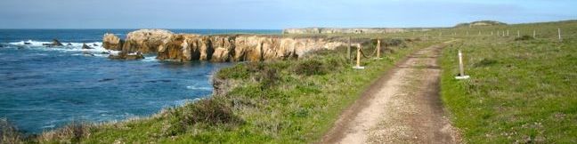
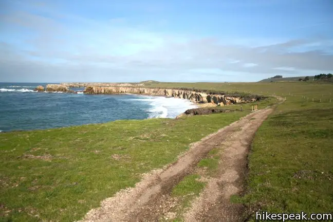
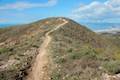
South of Los Osos and Montaña de Oro State Park is a stunning stretch of coastline that includes the historic headland Point Buchon. The area was closed to the public until 2007 when the landowner, Pacific Gas and Electric Company, opened Point Buchon Trail and began allowing hikers to access the picturesque waterfront. Similar to the Bluff Trail in Montaña de Oro State Park, Point Buchon Trail travels across grassy bluffs overlooking a rugged shoreline with mesmerizing cliff formations. The trail is 3.4 miles from end to end with a 1 1/3-mile loop at that start that offers a shorter option. The loop can also be used to trim the out-and-back hike to 6.25 miles. Minimal elevation change and excellent views make Point Buchon Trail suitable and enjoyable for all.
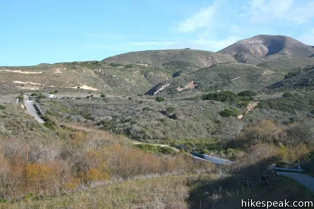
From the trailhead parking lot at the south end of Montaña de Oro State Park, walk a quarter mile on the paved Pecho Valley Road across Coon Creek and ascend to the Point Buchon Trail sign-in station.
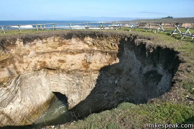
The trail owner and operator, Pacific Gas & Electric, grants trail access Thursday through Monday from 8AM to 4PM or later depending on the season. Hikers are required to sign a liability waiver before starting the hike, promising not to hold PG&E responsible for injuries and to stay a safe distance from cliffs and sinkholes. (That’s right, the trail has sink holes!)
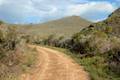
After signing on the dotted line, begin hiking west above the bank of Coon Creek. Stay to the right through a junction with a path heading east. This is the shortcut to Point Buchon that forms the back of the 1 1/3-mile loop (or 1.8 miles of you include the distance between the parking area and the sign-in station).
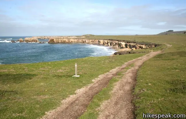
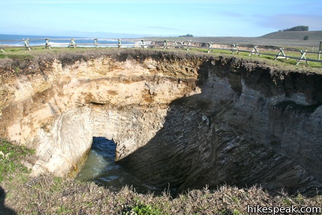
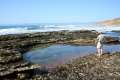
The main trail descends toward the ocean, passing a path breaking off to the right, 0.4 miles from the start, which drops down to the beach at the bottom of Coon Creek. Just ahead, the trail arrives at loud and interesting geological feature – the sinkhole. A gaping depression in the surface gives way to ocean water flowing in via a short tunnel. Stay behind the safety ropes, and enjoy this natural anomaly. The acoustics of the sinkhole, which is actually a collapsed sea cave, amplifies the volume of the waves, creating a great sound.
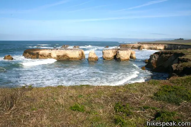
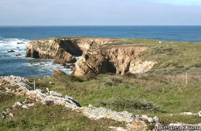
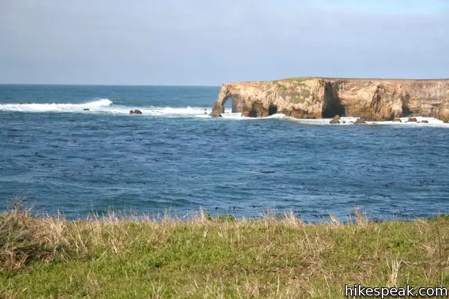
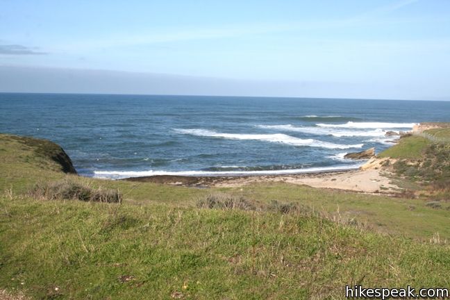
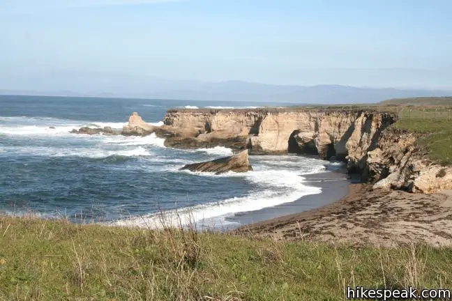
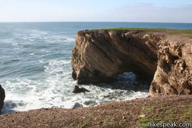
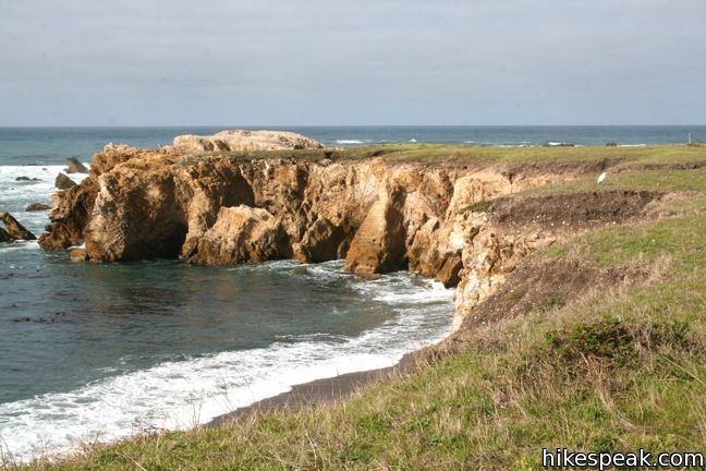
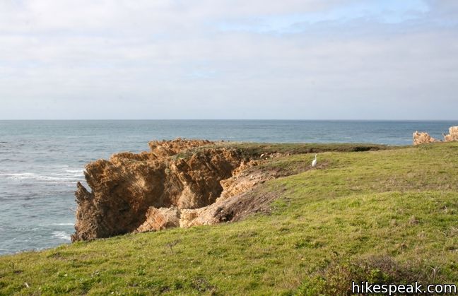
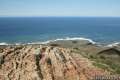
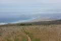
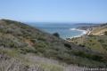
The dirt trail turns south across the edge of the bluff overlooking remarkable rugged coastline. One spectacular feature is a rock island just offshore that is buttressed by multiple natural rock bridges.
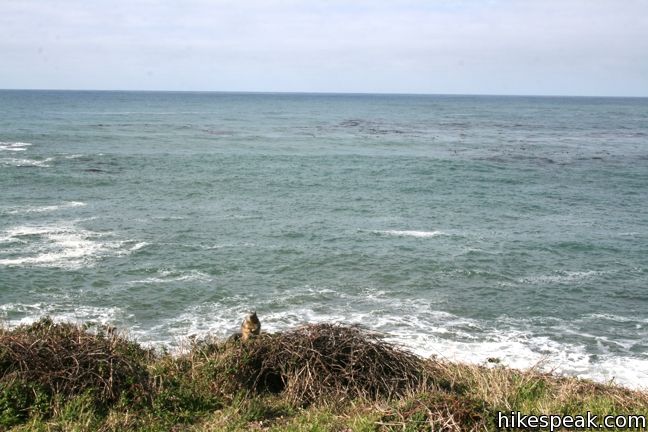
Next the trail reaches Point Buchon and turns briefly inland. Take the path splitting off to the right up to a bench at Point Buchon Lookout. Have a seat and enjoy the excellent views. In winter months, whales can be spotted off the coast on their journey to and from the warmer breeding waters to the south.
Point Buchon takes its name for the Spanish word for goiter. The Chumash chief who commanded this region at the time of the Spanish arrival had an enormous goiter on his neck, and was nicknamed El Buchon. The headland named in his honor is the westernmost point on the Central Coast of California below Morro Bay, and was an important landmark for Spanish navigators.
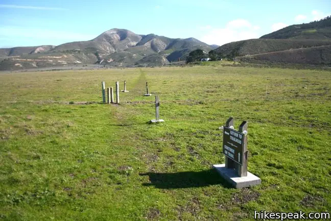
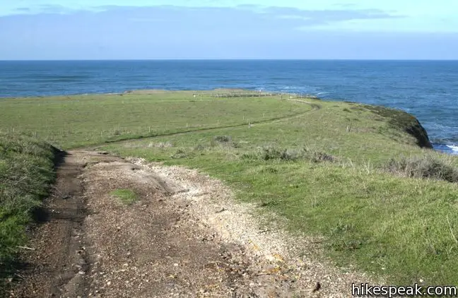
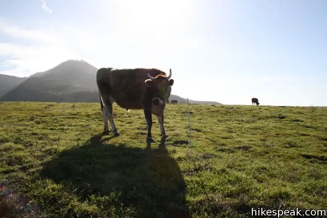
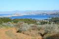
A few hundred feet past the vista point comes a junction with the trail returning to the sign-in station. To complete the shorter 1 1/3-mile loop, turn left here and hike 0.4 miles back to the start. The path passes through two electric fences and a grassy pasture grazed by livestock. PG&E uses this land as a buffer zone for the Diablo Canyon Nuclear Power Plant, four miles to the south, but also leases space to ranchers, so you may see cattle or sheep along the trail. The low and high points of the short loop are separated by just 60 vertical feet, making for a very accessible hike (though the trail does undulate over the rolling grasslands).
Enjoy excellent views of Point Buchon as the main trail travels south for 0.55 miles crossing a bow in the landscape to the next vista point on the hike. Disney Point, so named because a Disney picture, Pete’s Dragon was filmed here in the 1970s, provides another nice viewpoint. The beautiful shoreline played the role of Northern Maine on screen, but this landscape clearly belongs in California. A temporary lighthouse built along the coast for the movie has been removed.
Point Buchon Trail continues south for another 1.9 miles, exploring more amazing coastline. At 2.6 miles from the start, the trail arrives at Windy Point. From here, the final 0.8 miles head downhill with views to the south toward Diablo Canyon Power Plant and more epic waterfront.
If you hike to the end and then return via the connection trail near Point Buchon, the total distance is 6.25 miles (not including the quarter mile to and from the sign-in station). The Bluff Trail in Montaña de Oro State Park ends at the parking lot for Point Buchon Trail, so those who really want to max out their coastal hiking could join the Bluff Trail and Point Buchon Trail together as one incredible 11-mile trek. Coon Creek Trail also departs from this parking lot, heading inland.
Take your time and appreciate the spectacularly carved coastline along Point Buchon Trail. Numerous markers and guide ropes along the trail make it easy to stay on track. In the spring, the wildflower bloom makes the landscape even more amazing. Dogs and bicycles are not allowed on Point Buchon Trail. While access is restricted, the trail is free, so get out and enjoy.
Directions to the Trailhead
- From San Luis Obispo, exit Highway 101 at Los Osos Valley Road and drive a total of fifteen miles northwest toward Montaña de Oro State Park.
- After 11.2 miles Los Osos Valley Road becomes Pecho Valley Road and turns sharply to the south.
- Continue 4.8 miles across Montaña de Oro State Park to a large parking area in front of a large metal gate that blocks vehicle traffic.
Trailhead Location
Trailhead address: Pecho Valley Road, Montaña de Oro State Park, Los Osos, CA 93402
Trailhead coordinates: 35.257964, -120.887483 (35° 15′ 28.67″N 120° 53′ 14.93″W)
View Montaña de Oro State Park in a larger map
Or view a regional map of surrounding Central Coast trails and campgrounds.


 | Coon Creek Trail This 5-mile out and back hike ventures up a coastal canyon at the south end of Montaña de Oro State Park. |
 | Valencia Peak Trail This 4.5-mile hike summits a 1,347-foot peak with stunning views over Montaña de Oro. |
 | Bluff Trail This hike of around three miles tours tide pools, beaches, and impressive cliffs along the picturesque coast of Montaña de Oro State Park. |
 | Rattlesnake Flats Trail – Badger Trail – Bluff Trail Loop This 1 2/3-mile hike offers a twist on the Bluff Trail, going along and just above the coast of Montaña de Oro State Park. |
 | Reservoir Flats Trail This 2-mile loop delivers fine ocean and canyon views as it explores the bottom of Islay Creek Canyon in Montaña de Oro State Park. |
 | Oats Peak Trail This scenic 10.8-mile hike ventures into Montaña de Oro State Park to a panoramic summit. |
 | Islay Creek Trail This easy 6-mile round trip hike follows a wide trail up a coastal canyon flanked by thousand-foot peaks, passing a small waterfall to reach an abandoned barn. |
 | Hazard Peak Trail This 6-mile round trip hike ascends coastal ridges to a 1,076-foot summit with panoramic views that include a dynamic perspective of Morro Bay. |
 | Hazard Peak - Islay Creek Loop This 9.2 mile loop continues beyond Hazard Peak deeper into Montana de Oro before circling back on Islay Creek Trail. |
 | South Dune Trail – Bloody Nose Trail – Hiedra Trail – Hazard Peak Trail Loop This 2 2/3-mile loop combines four trails through dunes and eucalyptus trees to lovely coastal views. |
 | Dune Trail to Hazard Canyon Reef This one-mile hike in Montaña de Oro State Park descends an oceanfront ravine to a rocky shoreline graced with engaging tide pools. |
 | Morro Dunes Ecological Reserve This 2.6-mile loop serves up panoramic views over Morro Bay as it ascends 800 feet from Los Osos to Montaña de Oro State Park. |
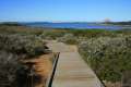 | Elfin Forest Natural Reserve This easy 1-mile loop on a boardwalk explores a pygmy forest on the edge of Morro Bay. |
 | More hikes in San Luis Obispo Explore other trails around San Luis Obispo including Morro Bay State Park and the Morros. |
 | Jade Cove and Plaskett Rock Point on the Big Sur coast This 1.5-mile hike is similar to Montaña de Oro's Bluff Trail, crossing scenic bluffs to a prominent point and a small cove. |
 | Partington Cove on the Big Sur coast This 1.5-mile hike visits a cove and a secluded beach. The cove is accessed through a tunnel. |
 | Corral Canyon in Malibu This 2.5-mile loop offers ocean and canyon views from a unspoiled section of the Santa Monica Mountains. |
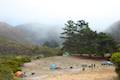 | Islay Creek Campground This 50-site campground is located at the heart of Montaña de Oro State Park in Islay Creek Canyon, and is a great base camp for treks in the park. |
Common Questions about Point Buchon Trail near Montaña de Oro State Park
- Is the trail open?
- Yes. You should expect to find that Point Buchon Trail is open. There are no recent reports of trail closures. If you discover that the trail is closed, please help your fellow hikers by reporting a closure.
- Is this trail free to access?
- Yes, Point Buchon Trail is free to access. No entrance fee, pass, or permit is required. If you discover that access rules have changed, please provide feedback on your experience.
- How much time does this hike take?
- It takes approximately 3 hours to hike Point Buchon Trail. Individual hiking times vary. Add extra time for breaks and taking in the views.
- How long is this hike?
- The hike to Point Buchon Trail is a 6.8 mile out and back with 75 feet of elevation change.
- Are dogs allowed on this trail?
- No, dogs are likely not allowed on Point Buchon Trail. The trail is primarily open to hikers.
- Are there ocean views on this hike?
- Yes, Point Buchon Trail offers views of the ocean.
- Where is the trailhead located?
- The trailhead for Point Buchon Trail is located in Los Osos, CA.
Trailhead Address:
Pecho Valley Road
Los Osos, CA 93402
Trailhead Coordinates:
35.257964, -120.887483 - What are the driving directions to the start of the hike?
To get to the trailhead: From San Luis Obispo, exit Highway 101 at Los Osos Valley Road and drive a total of fifteen miles northwest toward Montaña de Oro State Park. After 11.2 miles Los Osos Valley Road becomes Pecho Valley Road and turns sharply to the south. Continue 4.8 miles across Montaña de Oro State Park to a large parking area in front of a large metal gate that blocks vehicle traffic.
View custom Google Maps directions from your current location.
- Are there other trails near Point Buchon Trail?
- Yes, you can find other nearby hikes using the Hikespeak Hike Finder Map.

11 Comments on Point Buchon Trail near Montaña de Oro State Park
What hikers are saying:
✨ Generated summary of user commentsThis trail offers a pleasant coastal walk. Michael suggests starting a trek around 9 a.m. to enjoy a leisurely pace before the midday sun.
“Very nice walk.” Jump to comment ↓
Hi, Are mountain bikes allowed on the Point Buchon trail? I can’t walk this far (hip/back), but would really enjoy responsibly riding the trail on a mountain bike.
Thank you.
Hi- Bikes and dogs are not allowed on this trail. Here are all of the rules for the trail.
Very nice walk. We started at 9 AM, went to end and back with a few brief rests, and were back at check-in station at noon. Hardest part is the climb from check-in station back up to the parking lot!
Are strollers allowed on the trail?
I believe so. The Bluff Trail to the north may be more suitable for strollers though.
[…] Here’s a super helpful step-by-step hiking guide to the entire loop from Hike Speak […]
Greetings, I am wheelchair bound and fortunate enough to have a couple of very durable 2 wheel drive electric wheelchairs. I took note the hike is stroller friendly. Would that be the same for an electric wheelchair?
I wouldn’t feel confident recommending this trail for wheelchairs. However, the Bluff Trail just north of Point Buchon Trail is tailor-made for wheelchairs, bikes, and strollers. Enjoy the coast!
I was wondering if this trail is back open. We have went several times but this trail has been closed because of covid. We are going back on the 15th of August and have been wanting to hike this trail. Do you know if it’s back open
[…] next day we decided to hike the Point Buchon trail. The trail is on PG&E property at the far end of Montaña de Oro State Park. It’s a very […]
How do we sign up online for the hike, or is trail open to all just by signing in at the gate?