Hikes in Santa Barbara County
If you come to Santa Barbara for the scenic coastline, fine wineries, and quaint lodging, you should stay for the excellent hiking.
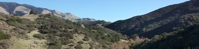
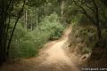
The Santa Ynez Mountains rise just behind the coastal cities of Santa Barbara County. This east-west range is part of Los Padres National Forest and forms a beautiful green backdrop for Santa Barbara. Many great trails run through these mountains, visiting quiet canyons, gushing waterfalls, and overlooks with stunning ocean views. Another attractive thing about hiking in Santa Barbara is that most of the trails are free! Start exploring Santa Barbara.
Highlights of Santa Barbara County


Santa Barbara Hiking
This collection of trails around Santa Barbara, California lists the hikes from west to east. The table may also be sorted alphabetically or by distance to help you pick your next hike. Each trail links to its own report complete with directions, photos, GPS maps, elevation profiles, and all the other information needed to locate and enjoy these hikes. You can also view hikes around Santa Barbara County on the Hike Finder Map.
Trail | Description | Distance | Location |
|---|---|---|---|
 540 540 | Nojoqui Falls This short out and back hike visits an 80-foot tall fern-lined waterfall. | 0.65 miles 175 feet | 34.528556, -120.172473 |
 550 550 | Gaviota Pass Overlook Loop This loop tours scenic ridges in Gaviota State Park to arrive at a soaring overlook above the Gaviota Tunnel. | 6.5 miles 650 feet | 34.507693, -120.227949 |
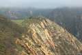
 560 560 | Gaviota Peak This loop mounts a 2,458-foot summit two miles from the Pacific and then descends Trespass Trail to explore the wilds of the Santa Ynez Mountains. | 6.5 miles 2,150 feet | 34.5046, -120.2259 |
 570 570 | Gaviota Hot Springs This short hike visits a warm hot springs along the trail to Gaviota Peak. | 1 mile 400 feet | 34.5046, -120.2259 |
 580 580 | Tunnel View and Trespass Trails Loop This loop steals views over the 101 Freeway and the Gaviota Tunnel from Gaviota State Park. | 2.6 miles 600 feet | 34.5046, -120.2259 |
 590 590 | Gaviota Wind Caves This out and back hike just off the 101 Freeway in Gaviota State Park visits wind-carved caves with great ocean views. | 2.5 miles 650 feet | 34.47172, -120.2297 |
 595 595 | Nature Trail in El Capitán State Beach This loop explores a lush sycamore grove bordering El Capitán Creek to approach the rocky shore at the end of El Capitán Point. | 0.35 miles 18 feet | 34.460105, -120.023608 |
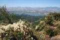 600 600 | Tequepis Trail This out and back hike delivers views of Lake Cachuma as it climbs the Santa Ynez mountains to a saddle overlooking the Pacific. | 8.4 miles 2,300 feet | 34.5525, -119.9565 |
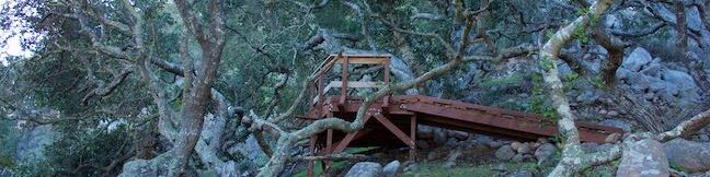
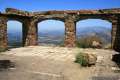 610 610 | Knapp's Castle This easy hike visits the scenic ruins of an estate home built atop the mountains behind Santa Barbara. | 0.8 miles 50 feet | 34.518155, -119.793234 |
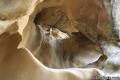
 620 620 | Chumash Painted Cave This very short trail looks in on Native American rock art in the Santa Ynez Mountains. | 0.1 miles 20 feet | 34.50448, -119.78773 |
 630 630 | Lizard’s Mouth This short out and back hike visits a unique rock formation with amazing views over Santa Barbara and the Pacific. | 0.5 miles 25 feet | 34.503055, -119.86569 |
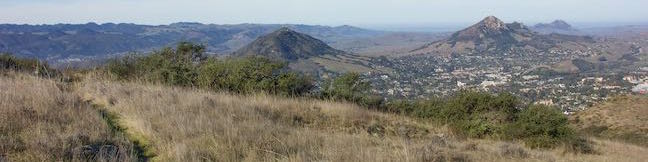
 640 640 | Inspiration Point from San Roque Road This out and back hike up the western side of Jesusita Trail reaches a panoramic perch in the Santa Ynez Mountains overlooking Santa Barbara. | 7.55 miles 1,400 feet | 34.45432, -119.72875 |
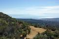 642 642 | Inspiration Point from Tunnel Road This out and back hike combines Tunnel Trail and Jesusita Trail to ascend Mission Canyon to a sweeping viewpoint that looks down over Santa Barbara and up into the Santa Ynez Mountains. | 3.75 miles 825 feet | 34.46492, -119.71272 |
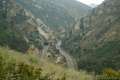
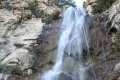 650 650 | Tangerine Falls This out and back hike crosses a lush canyon to a beautiful waterfall on the edge of Los Padres National Forest near Santa Barbara. | 875 feet | 34.45605, -119.6533 |
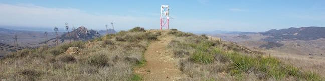
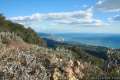 660 660 | Montecito Peak This partial loop climbs to a panoramic summit in Los Padres National Forest overlooking Montecito and Santa Barbara. | 7.1 miles 2,450 feet | 34.456058, -119.6533 |
 670 670 | McMenemy Overlook This hike uses four trails to form a loop to a vista point in the Santa Ynez Mountains behind Montecito. | 3.7 miles 1,000 feet | 34.446008, -119.622303 |
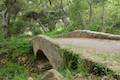 673 673 | Ennisbrook Trail This easy lollipop loop crosses charming stone bridges over San Ysidro Creek to explore a lush oak forest that is flooded by nasturtiums in the spring. | 1.85 miles 150 feet | 34.425482, -119.622238 |
 680 680 | Carpinteria Salt Marsh Nature Park This level out and back hike explores El Estuaro, a vital ecosystem for shorebirds. | 1.2 miles 10 feet | 34.395872, -119.528247 |
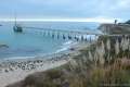 690 690 | Carpinteria Bluffs Trail to Carpinteria Seal Sanctuary Overlook This short hike goes from Carpinteria Bluffs Nature Preserve to a viewing area above a harbor seal rookery, offering beach access and beautiful oceanfront hiking. | 1 - 2 miles 25 - 100 feet | 34.386929, -119.498625 |
Or explore hikes around Santa Barbara County on the Hike Finder Map