Carpinteria Bluffs Trail to Carpinteria Seal Sanctuary Overlook in Carpinteria Bluffs Nature Preserve
You could call a hike easy if it was less a mile long and almost completely level. You could call a hike easy to reach if the trailhead was right at the end of a freeway offramp. You could call a hike easy to enjoy if it offered lovely coastal views and almost guaranteed wildlife viewing. Introducing the easy-to-reach, easy-to-enjoy, and all around easy hike from Carpinteria Bluffs Nature Preserve to Carpinteria Seal Sanctuary Overlook!
Straight to the Seal Sanctuary Overlook and back is one mile round trip with 25 feet of elevation change. Venture down to a beach next to the Seal Sanctuary Overlook and add a loop to another overlook in and adjacent park to easily expanded the hike to 2 miles round trip with 100 feet of elevation change. At any length, the hike presents a quick quality excursion on the beautiful coast west of Santa Barbara.
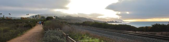
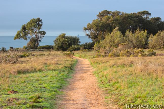
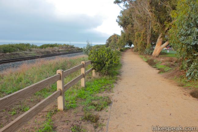
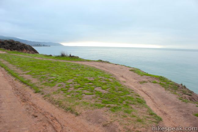
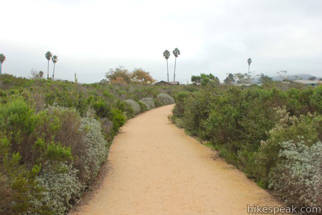
Get underway from a large dirt parking area in Carpinteria Bluffs Nature Preserve located at the south end of Bailard Avenue in Carpinteria (right next to the 101 Freeway). The small preserve has several side trails, but the shortest route to the Seal Sanctuary Overlook starts from the center of the parking area and heads south toward the ocean. Look for a sign at the trailhead describing the preserve. The trail angles southwest crossing a meadow of sage and brush.
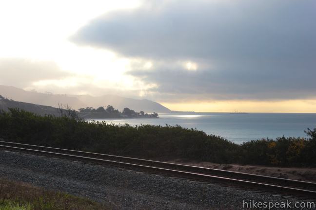
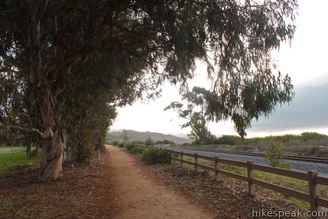
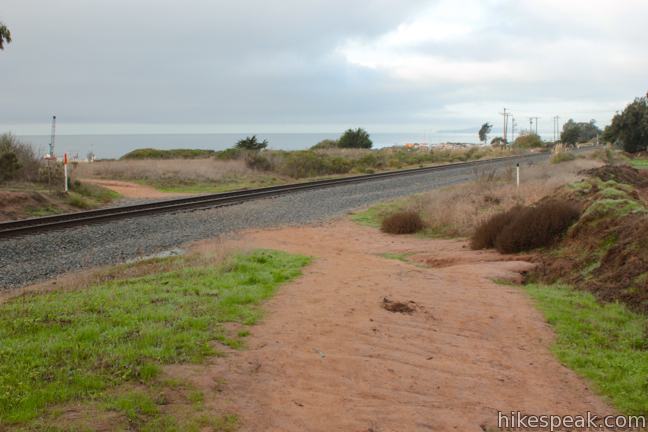
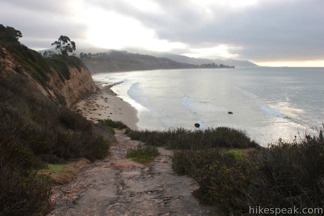
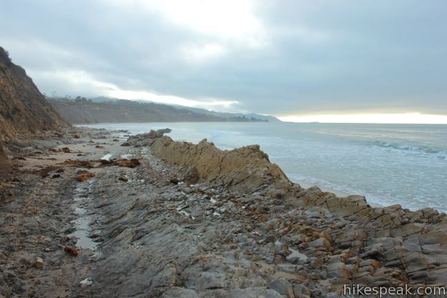
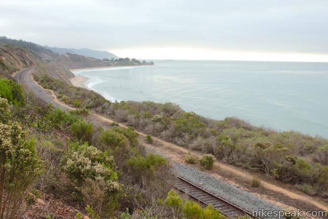
After 0.15 miles, you will come to a T-junction with Carpinteria Bluffs Trail. Turn right on this wide pebble path, which runs parallel to railroad tracks on the ocean bluff. Enjoy views up and down the coast as you follow Carpinteria Bluffs Trail along a line of large eucalyptus trees. After 0.2 miles, the trail bends left and crosses the railroad tracks. On the ocean side of the tracks, you will quickly reach a beach access trail breaking off to the left down to a sandy beach.
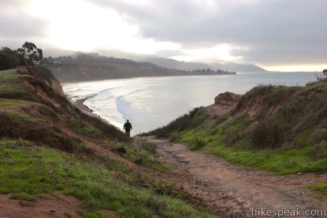
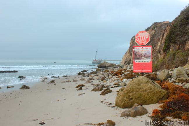
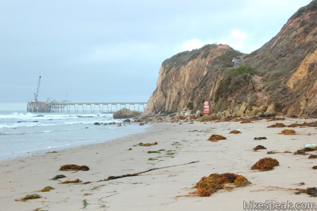
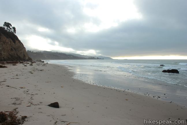
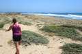
To lengthen your hike with a stroll on the sand, take this trail down to the ocean. The access trail ends at the beach in less than a tenth of a mile. The waterfront to the right of the access trail (west) is closed for much of the year to ensure that the harbor seals have an undisturbed birthing area. The beach is closed to the public in the winter and spring when harbor seals have their pups, but that is a great time of year to visit to the overlook.
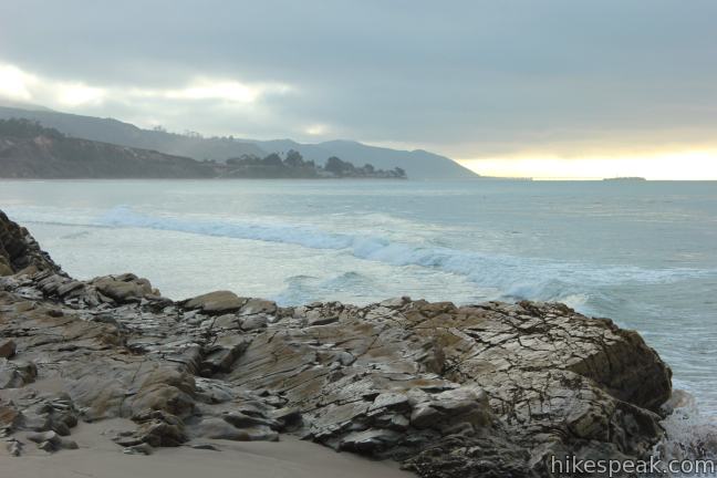
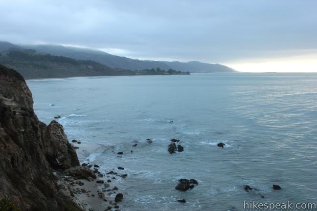
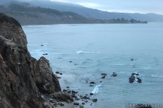
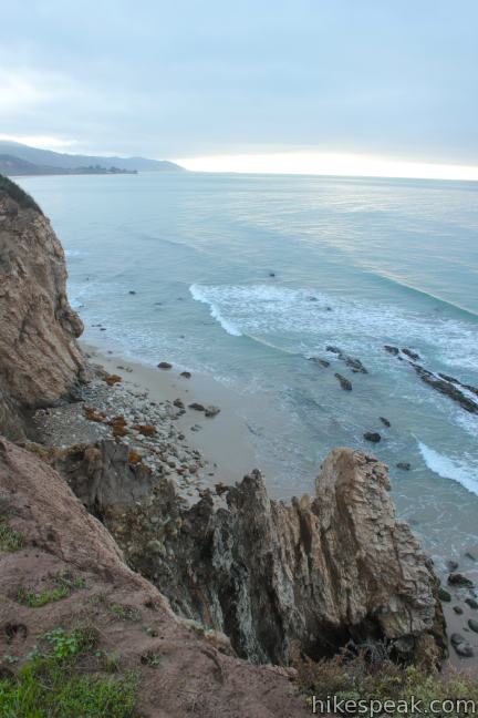
Looking east down the beach, fine sand stretches toward a rocky point where you can discover tide pools, a tenth of a mile from the beach access trail. Extended exploration along the beach is also possible.
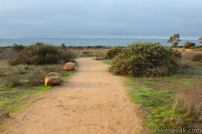
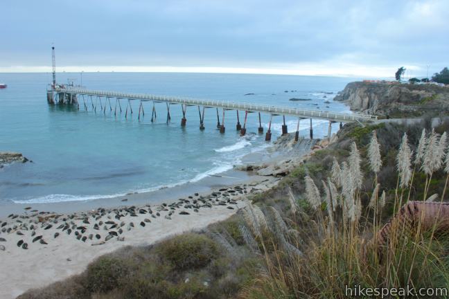
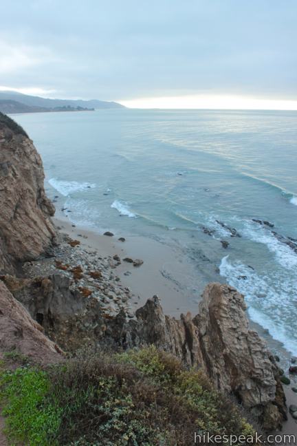
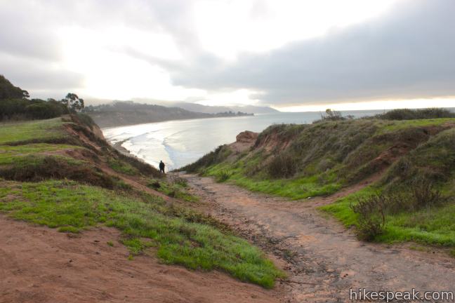
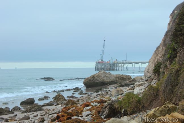
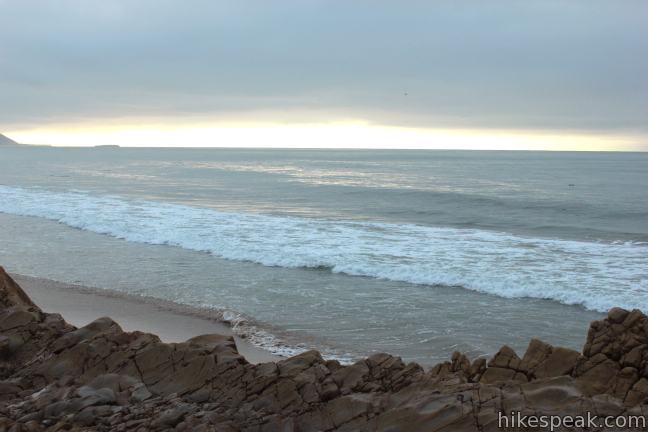
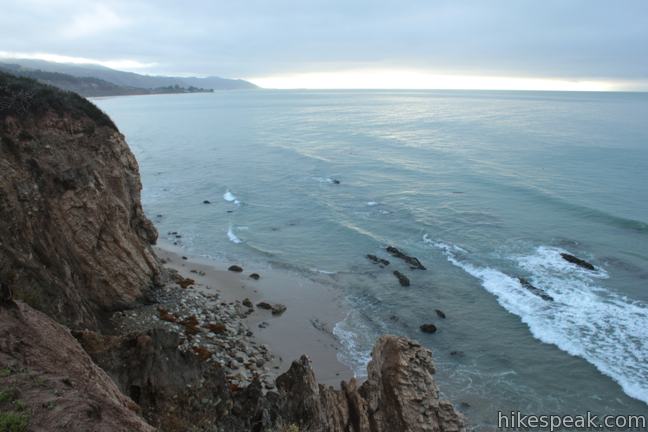
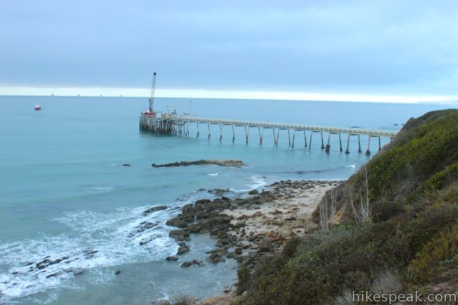
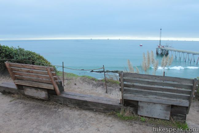
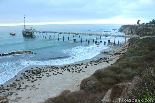
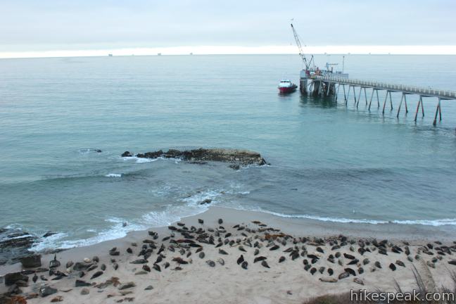
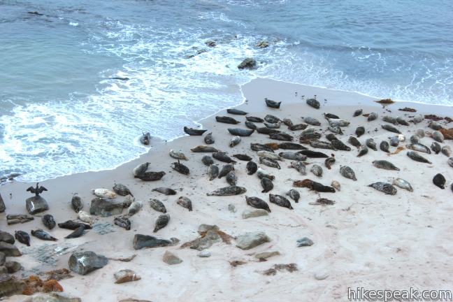
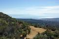
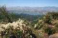
Returning to Carpinteria Bluffs Trail, the wide dirt trail continues along the coast for just over a tenth of a mile to the Carpinteria Seal Sanctuary Overlook. Turn left toward a wooden bench where you can look down from the bluff onto the beach, 75 feet below, where harbor seals can usually be seen lying in the sand. The rookery is home to about 100 harbor seals, and pups may appear between December and May. Just west of the overlook is a Chevron Pier. The jutting pier and the surrounding rocky bluffs create a beautiful ocean vista (with or without the seals).

See what there is to see from Seal Sanctuary Overlook (binoculars recommended) and return the way you came to Carpinteria Bluffs Nature Preserve. Cross the railroad tracks and pass the eucalyptus grove to reach the junction where you first joined Carpinteria Bluffs Trail (on the initial trail crossing the meadow from the parking area). You could turn left for a simple out and back hike (1.2 miles or more with the beach, one mile without), or continue straight along Carpinteria Bluffs Trail to add a loop to the end of the hike that takes in one more ocean overlook.
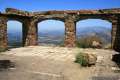
For this loop extension, continue east for 0.3 miles to the end of Carpinteria Bluffs Trail at Viola Fields. This is an alternate trailhead for the hike with bathrooms here for those who need them. To the right, find a short path out to Lois Sidenberg Coastal Overlook, which looks out over the railroad tracks and across the blue water of the Pacific Ocean toward the Channel Islands.
Leave the overlook and walk along a parking lot to the north side of a pair of baseball fields. Turn left, following a dirt trail along the fields back to the parking area for Carpinteria Bluffs Nature Preserve, reaching it in 0.2 miles. This extra loop is 2/3 of a mile long, flat, and not as scenic as the main trail, but it makes an easy addition for those looking for a little extra exercise.
Carpinteria Bluffs Nature Preserve, Viola Fields, and the Carpinteria Seal Sanctuary (also called the Carpinteria Harbor Seal Preserve and Rookery) combine to protect 53 acres of oceanfront green space on the coast east of Santa Barbara. Dogs are allowed on the Bluff Trail in Carpinteria Bluffs Nature Preserve and Viola Park, but are not allowed at the Carpinteria Seal Sanctuary Overlook because dogs can disturb the harbor seals. Bikes are also allowed on the Carpinteria Bluffs Trail, but are discouraged at the overlook itself. No fee or permit is required to hike from Carpinteria Bluffs Nature Preserve to Carpinteria Seal Sanctuary Overlook, so get out and enjoy!
Directions to the Trailhead
- Take the 101 Freeway to exit 85 for Bailard Avenue (12 miles east of Santa Barbara).
- At the end of the offramp turn south toward the coast on Bailard Avenue.
- Drive straight across an intersection with Carpinteria Avenue into a dirt parking area in Carpinteria Bluffs Nature Preserve.
Trailhead Location
Trailhead address: Bailard Avenue & Carpinteria Avenue, Carpinteria Bluffs Nature Preserve, Carpinteria, CA 93013
Trailhead coordinates: 34.386929, -119.498625 (34° 23′ 12.94″N 119° 29′ 55.05″W)
View Carpinteria Bluffs Trail in a larger map
Or view a regional map of surrounding Central Coast trails and campgrounds.


![]()


 | Carpinteria Salt Marsh Nature Park This level 1.2-mile round trip hike explores El Estuaro, a vital ecosystem for shorebirds. |
 | Ocean's Edge and River's Edge Trails Loop This level and easy 1.5-mile loop in Emma Wood State Beach borders the Pacific Ocean, the Ventura River, and an estuary flocked by seabirds. |
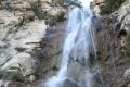 | Tangerine Falls This 2.5-mile hike visits a beautiful waterfall on the edge of Los Padres National Forest near Santa Barbara. |
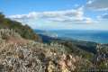 | Montecito Peak This 7.1-mile partial loop climbs to a panoramic summit in Los Padres National Forest overlooking Montecito and Santa Barbara. |
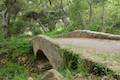 | Ennisbrook Trail This easy 1.85-mile lollipop loop crosses charming stone bridges over San Ysidro Creek to explore a lush oak forest that is flooded by nasturtiums in the spring. |
 | McMenemy Overlook This 3.7-mile hike uses four trails to form a loop through the mountains behind Montecito, California. |
 | Inspiration Point from Tunnel Road This 3.75-mile round trip combines Tunnel Trail and Jesusita Trail to ascend Mission Canyon to a sweeping viewpoint that looks down over Santa Barbara and up into the Santa Ynez Mountains. |
 | Inspiration Point from San Roque Road This 7.55 to 7.95-mile round trip hike ascends 1,400 feet up the western side of Jesusita Trail to a panoramic perch in the Santa Ynez Mountains with great views over Santa Barbara. |
 | Chumash Painted Cave This very short trail looks in on Native American rock art in the Santa Ynez Mountains. |
 | Knapp's Castle This easy 0.8-mile hike visits the scenic ruins of an estate home built atop the mountains behind Santa Barbara. |
 | Lizard's Mouth This half-mile hike visits a unique rock formation with amazing views over Santa Barbara and the Pacific. |
 | Tequepis Trail This invigorating 8.4-mile round trip hike offers views of Lake Cachuma as it climbs the Santa Ynez mountains to views of Santa Barbara and the Pacific. |
 | More Central Coast Hikes Explore other destinations along the California coast between Ventura and Monterey, including trails in Los Padres National Forest. |
 | Piedras Blancas This 3.2-mile out-and-back hike ventures up the coast from the Piedras Blancas Elephant Seal Rookery to Piedras Blancas Light Station. Additional boardwalks at the rookery can be used to add another mile of hiking. |
- The Harbor Seal Sanctuary on carpinteriaca.gov (opens in a new tab)
- A Santa Barbara Independent article on Carpinteria Bluffs (opens in a new tab)
- Carpinteria Harbor Seal Rookery on calihike.blogspot.com (opens in a new tab)
- Carpinteria Bluffs and Harbor Seals Loop to Rincon Beach on calihike.blogspot.com (opens in a new tab)
- The Carpinteria Seal Rookery and Clifftop Walk on lotsafunmaps.com (opens in a new tab)
- Carpinteria Bluffs Nature Preserve on songsofthewilderness.wordpress.com (opens in a new tab)
Common Questions about Carpinteria Bluffs Trail to Carpinteria Seal Sanctuary Overlook in Carpinteria Bluffs Nature Preserve
- Is the trail open?
- Yes. You should expect to find that Carpinteria Bluffs Trail to Carpinteria Seal Preserve Overlook is open. There are no recent reports of trail closures. If you discover that the trail is closed, please help your fellow hikers by reporting a closure.
- Is this trail free to access?
- Yes, Carpinteria Bluffs Trail to Carpinteria Seal Preserve Overlook is free to access. No entrance fee, pass, or permit is required. If you discover that access rules have changed, please provide feedback on your experience.
- How much time does this hike take?
- It takes approximately 45 minutes to hike Carpinteria Bluffs Trail to Carpinteria Seal Preserve Overlook. Individual hiking times vary. Add extra time for breaks and taking in the views.
- How long is this hike?
- The hike to Carpinteria Bluffs Trail to Carpinteria Seal Preserve Overlook is a 2 mile out and back with 100 feet of elevation change.
- Are dogs allowed on this trail?
- Yes, dogs are allowed on Carpinteria Bluffs Trail to Carpinteria Seal Preserve Overlook. The trail is open to hikers, dogs, bikes.
- Is Carpinteria Bluffs Trail to Carpinteria Seal Preserve Overlook good for kids?
- Yes, this hike is likely suitable for children. It is relatively short (2 miles) with manageable elevation gain.
- Are there ocean views on this hike?
- Yes, Carpinteria Bluffs Trail to Carpinteria Seal Preserve Overlook offers views of the ocean.
- Where is the trailhead located?
- The trailhead for Carpinteria Bluffs Trail to Carpinteria Seal Preserve Overlook is located in Carpinteria, CA.
Trailhead Address:
Bailard Avenue
Carpinteria, CA 93013
Trailhead Coordinates:
34.386929, -119.498625 - What are the driving directions to the start of the hike?
To get to the trailhead: Take the 101 Freeway to exit 85 for Bailard Avenue (12 miles east of Santa Barbara). At the end of the offramp turn south toward the coast on Bailard Avenue. Drive straight across an intersection with Carpinteria Avenue into a dirt parking area in Carpinteria Bluffs Nature Preserve.
View custom Google Maps directions from your current location.
- Are there other trails near Carpinteria Bluffs Trail to Carpinteria Seal Preserve Overlook?
- Yes, you can find other nearby hikes using the Hikespeak Hike Finder Map.

9 Comments on Carpinteria Bluffs Trail to Carpinteria Seal Sanctuary Overlook in Carpinteria Bluffs Nature Preserve
What hikers are saying:
✨ Generated summary of user commentsLynda describes the experience as an easy beautiful walk that pairs well with a lunch stop in town before the return trip. While dogs are welcome on the Bluff Trail and in Viola Park, they are strictly prohibited at the Carpinteria Seal Sanctuary Overlook because dogs can disturb the harbor seals.
“It is an easy beautiful walk” Jump to comment ↓
can I take my dog on a leash with me on that trail ?
Dogs are allowed on the Bluff Trail in Carpinteria Bluffs Nature Preserve and Viola Park, but are not allowed at the Carpinteria Seal Sanctuary Overlook because dogs can disturb the harbor seals.
Is there a place on the trail or nearby with picnic tables?
How can I find out if I can hike a trail that I grew up 40 years ago hiking- there is now a sign that says “no trail access” but I think the new homeowner just stuck it there. Who do I contact to get the true story on trail access? Thank you!
In this area, you could start by contacting the California Coastal Commission. Good luck.
Margie, I was recently reading about how if a trail was open for years and years and many people hiked it, then if it closes because of new landowners, it can be reopened for hiking. I’m sorry but I do not have the link to where I found this. I know this is a vague post.
you might talk to local hikers in your area and do some research to find out if in fact the trail is closed or did someone just put a sign up! then organize and do more research to see what you can find out.
I know a few trails in Ojai and Carpinteria were reopened in the last 15 yrs through community efforts.
[…] Trail info […]
[…] you are a novice hiker or a more experienced one, you’ll love the 1.7 mile hike through the Carpinteria Bluffs Trail. Try the hiking trail directly above the coastline, or the biking trail that cuts a more direct […]
What is the distance from the parking lot down the trail past the Seal Preserve and into downtown Carpinteria? It is an easy beautiful walk, stopped for lunch and then did the return trip.