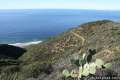
Emma Wood State Beach borders both the Pacific Ocean and the Ventura River. There is an estuary where the two meet, where you can sprawl out on soft sand and watch the gathering marine birds. See the beach, the river, and the estuary on a level and easy 1.5-mile loop through Emma Wood State Beach and the adjacent Seaside Wilderness Park in Ventura.
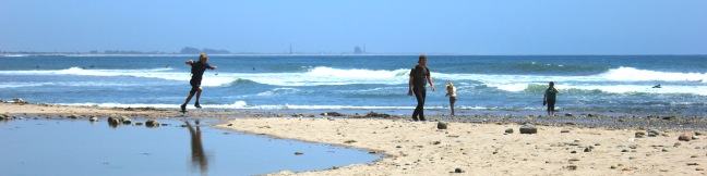
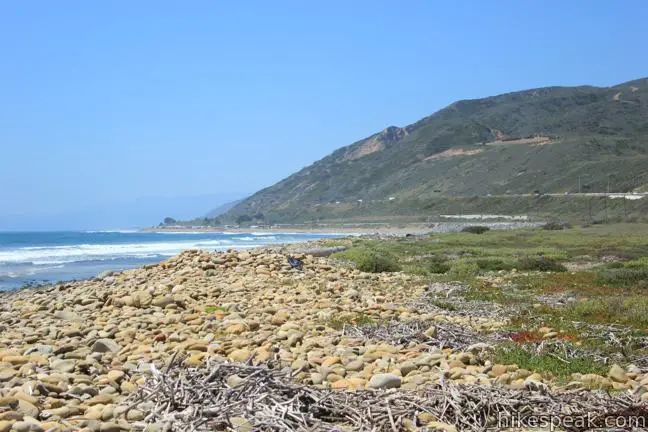
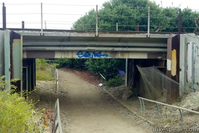
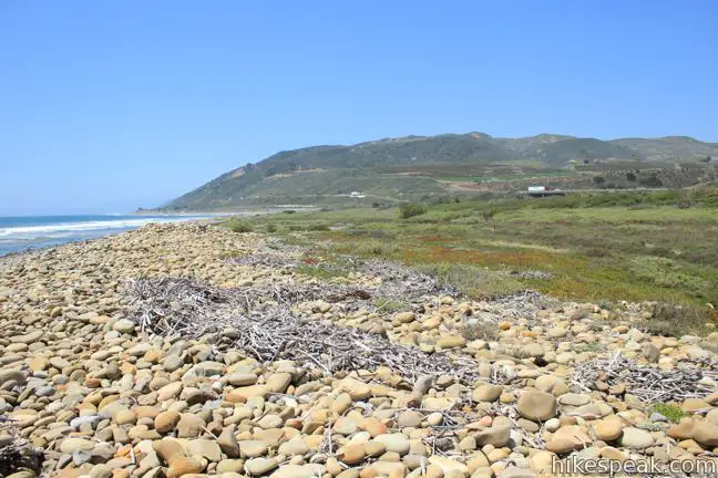
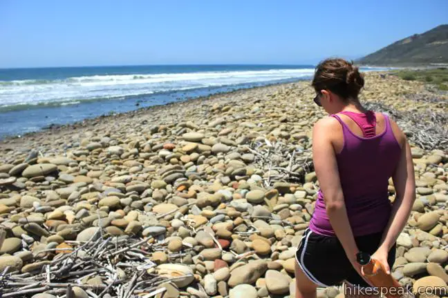
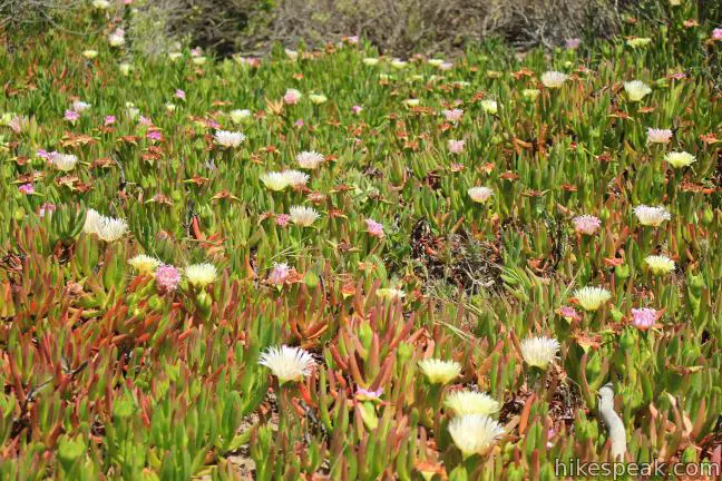
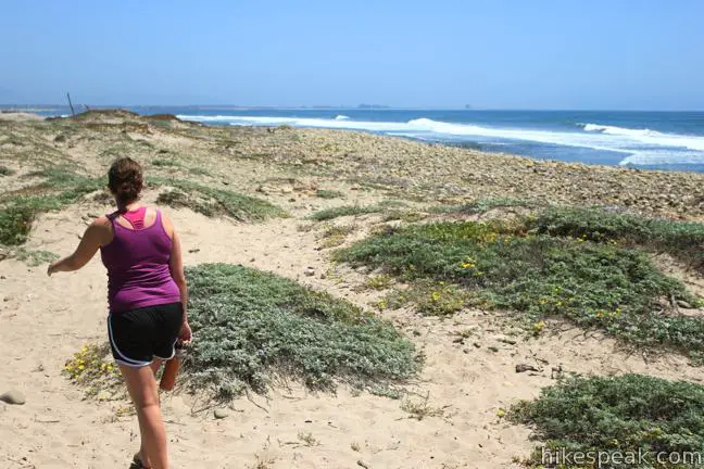
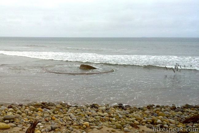
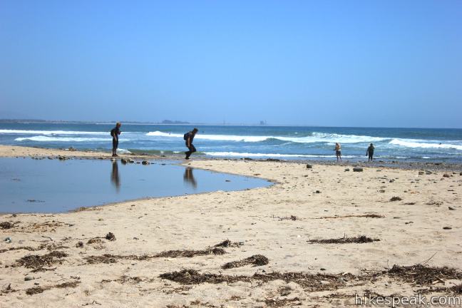
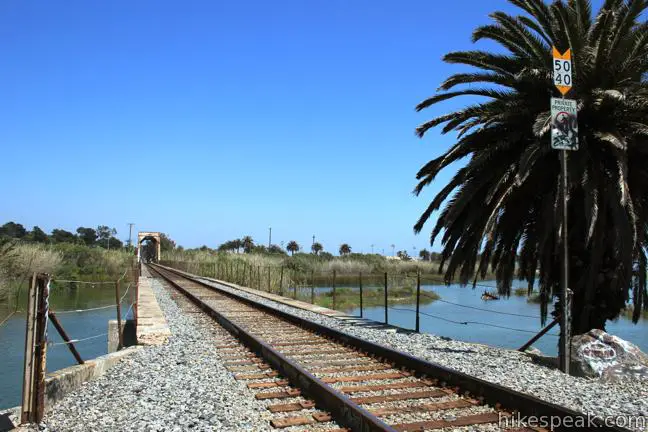
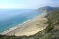
Starting within the 115-acre state beach wedged between the Pacific Ocean and the 101 Freeway, and split down the middle by the Union Pacific Railroad, you will hike southeast leaving the large parking area next to the group campground and picnic area. After a few hundred feet, make a right and slip beneath a railroad bridge on Ocean’s Edge Trail. On the seaward side of the tracks, turn left heading southeast along a cobblestone beach on a trail through dunes peppered with sand verbena and ice plant. Stick to the sandy path, or saunter along the rocky waterfront, where you’ll get a nice view up the shore toward Santa Barbara.
The inviting sounds of the sea breeze and the pounding surf cancel out the hum of the freeway. Keep an eye out for the ruins of a World War II artillery site, which is located on the beach near the river, and now seems to only be doing battle with the waves (see the photos below).
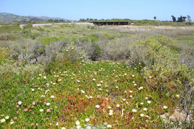
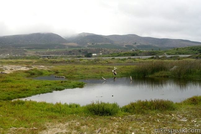
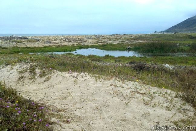
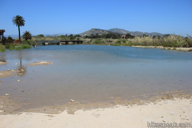
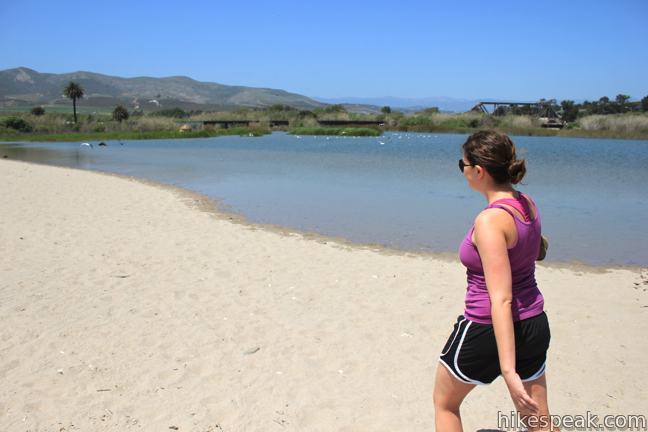
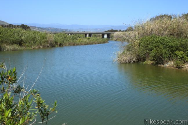
After 2/3 of a mile with hardly any elevation gain, you’ll meet a wide shallow estuary at the bottom of the Ventura River. If the tide is out and the water flow is low, you can hop to the other side of the river and stroll farther down the coast on Shoreline Drive or head inland on the Ventura River Bike Trail. To stay dry and continue the loop, there’s no need to cross the river.
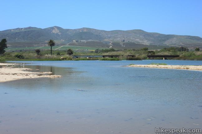
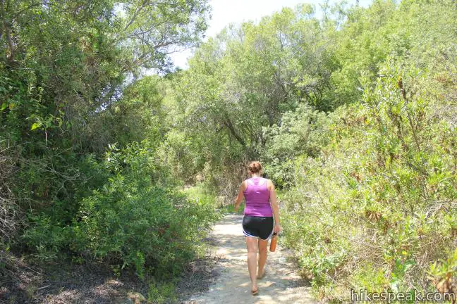
Plop down in the sand and watch the ducks, egrets, seagulls, pelicans, and other water foul birding around in the brackish water. When you are ready to leave, head inland along the west side of the estuary, walking across the railroad tracks to River’s Edge Trail. The dirt single track borders the river briefly before coming to a split. Stay to the left for the shortest and the most worn route heading westward back to the trailhead. A marginally longer route breaks off to the right through more tall brush along the river. Both options lead back to the picnic area and group camp at the start of the loop.
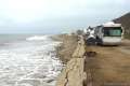
If you are traveling up the 101 Freeway and looking for a quick and easy activity between Oxnard and Santa Barbara, take a break at Emma Wood State Beach. Camping is also an option for longer stays, and the 90-site beach campground is typically full during summer months. An entrance fee of $10 is charged to access the state beach (price as of 2017). Dogs are not allowed on Ocean’s Edge and River’s Edge Trails Loop, but most humans will have no trouble completing the 1.5-mile hike with 25 feet of elevation change. It is a “no sweat” stroll exploring both ocean and river. Edge your way to the trail!
Directions to the Trailhead
- From the northbound 101 Freeway, take exit 70A to California Street.
- At the bottom of the ramp, turn right.
- Drive half a block up California Street to Thompson Boulevard and turn left.
- After half a mile, the road curves to the right and becomes Garden Street.
- Go to the end of the street and turn left on Main Street.
- Drive 3/4 of a mile and turn left on Park Access Road, just before the freeway on ramp.
- There are signs for Seaside Wilderness Park and Emma Wood State Beach Group Camp.
- From the southbound 101 Freeway, take exit 71 for Main Street.
- At the bottom of the ramp, turn right on Main Street.
- Make an immediate right on Park Access Road to reach the state beach.
Trailhead Location
Trailhead address: Park Access Road, Emma Wood State Beach, Ventura, CA 93001
Trailhead coordinates: 34.28057, -119.315346 (34° 16′ 50.05″N 119° 18′ 55.24″W)
You may also view a regional map of surrounding Central Coast trails and campgrounds.


 | Carpinteria Bluffs Trail to Carpinteria Seal Sanctuary Overlook This 1 to 2-mile hike goes from Carpinteria Bluffs Nature Preserve to a viewing area above a harbor seal rookery, offering beach access and beautiful oceanfront hiking. |
 | La Jolla Canyon Loop This 11.75-mile hike explores Point Mugu State Park on the west end of the Santa Monica Mountains, offering extraordinary ocean views (while still visiting La Jolla Canyon Falls). |
 | Scenic and Overlook Trails Loop This 2.7 to 3.5-mile hike takes in tremendous ocean views above Big Sycamore Canyon in Point Mugu State Park. |
 | Angel Vista via Rosewood Trail This 4-mile round trip hike is the most direct route to a panoramic viewpoint overlooking the Conejo Valley. |
 | McMenemy Overlook This 3.7-mile hike uses four trails to form a loop through the mountains behind Montecito, California. |
 | More Central Coast Hikes Explore other destinations along the California coast between Ventura and Monterey. |
 | Emma Wood State Beach Campground This 90-site campground in Ventura is only for RVs, offers ocean views but few amenities, and does not allow tents. |
Common Questions about Ocean’s Edge and River’s Edge Trails Loop in Emma Wood State Beach
- Is the trail open?
- Yes. You should expect to find that River's Edge and Ocean's Edge Trails Loop is open. There are no recent reports of trail closures. If you discover that the trail is closed, please help your fellow hikers by reporting a closure.
- Do I need a permit for this hike?
- Yes. State Beach Entrance Fee.
- How much time does this hike take?
- It takes approximately 30 minutes to hike River's Edge and Ocean's Edge Trails Loop. Individual hiking times vary. Add extra time for breaks and taking in the views.
- How long is this hike?
- The hike to River's Edge and Ocean's Edge Trails Loop is a 1.5 mile loop with 25 feet of elevation change.
- Are dogs allowed on this trail?
- No, dogs are likely not allowed on River's Edge and Ocean's Edge Trails Loop. The trail is primarily open to hikers.
- Is River's Edge and Ocean's Edge Trails Loop good for kids?
- Yes, this hike is likely suitable for children. It is relatively short (1.5 miles) with manageable elevation gain.
- Are there ocean views on this hike?
- Yes, River's Edge and Ocean's Edge Trails Loop offers views of the ocean.
- Where is the trailhead located?
- The trailhead for River's Edge and Ocean's Edge Trails Loop is located in Ventura, CA.
Trailhead Address:
Park Access Road
Ventura, CA 93001
Trailhead Coordinates:
34.28057, -119.315346 - What are the driving directions to the start of the hike?
To get to the trailhead: From the northbound 101 Freeway, take exit 70A to California Street. At the bottom of the ramp, turn right. Drive half a block up California Street to Thompson Boulevard and turn left. After half a mile, the road curves to the right and becomes Garden Street. Go to the end of the street and turn left on Main Street. Drive 3/4 of a mile and turn left on Park Access Road, just before the freeway on ramp. There are signs for Seaside Wilderness Park and Emma Wood State Beach Group Camp.
From the southbound 101 Freeway, take exit 71 for Main Street. At the bottom of the ramp, turn right on Main Street. Make an immediate right on Park Access Road to reach the state beach.
View custom Google Maps directions from your current location.
- Are there other trails near River's Edge and Ocean's Edge Trails Loop?
- Yes, you can find other nearby hikes using the Hikespeak Hike Finder Map.

Beautiful location, but do not venture into the shrubs along the river. There are several people who live in tents, and it is not safe to walk in the woods.
[…] of the group and a small handful of us drove down to Emma Wood State Beach and had a stroll down Ocean’s Edge Trail, stopping for snacks and tidepool exploring along the way. At 12:30 p.m., we said our final […]