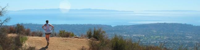
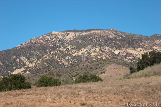
Located in the Santa Ynez Mountains, 1,800-feet above Santa Barbara, Inspiration Point provides panoramic views over The American Riviera. It is a moderate 7.55 to 7.95-mile round trip trek from San Roque Road up Jesusita Trail to Inspiration Point, gradually checking off 1,400 feet of elevation gain. Those who prefer a shorter alternative, can hike from Tunnel Road and take a 3.75-mile round trip hike up Tunnel Trail and Jesusita Trail to Inspiration Point. If you’ve got a hankering for ocean views from an overlook high above Santa Barbara, don’t hesitate to hike Jesusita Trail!
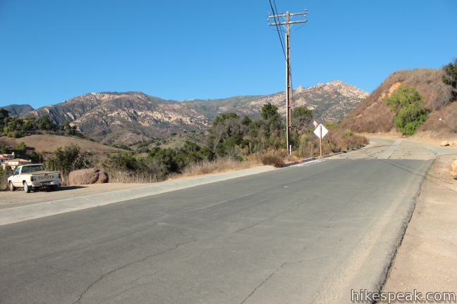
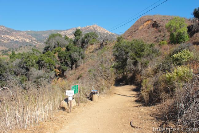
Jesusita Trail starts from San Roque Road just above Foothill Boulevard west of downtown Santa Barbara. Find the trailhead next to the William B. Cater Filtration Plant and begin hiking down into the San Roque Canyon.
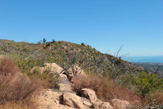
Jesusita Trail takes many forms on its way to Inspiration Point. It starts as a dirt single-track, briefly overlaps a paved road, transitions to a wide dirt road, back to a narrow single track and back to a dirt road again. Despite these changes in character, Jesusita Trail is well marked until the final spur to the overlook at Inspiration Point, when the fantastic views will draw you to the finish.
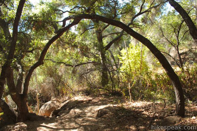
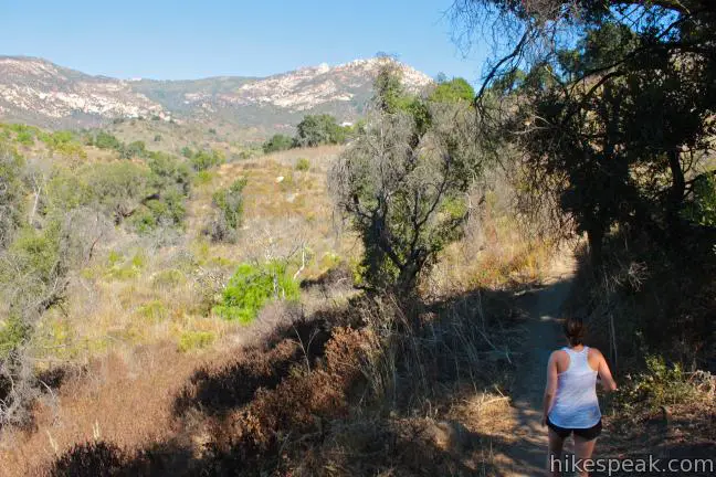
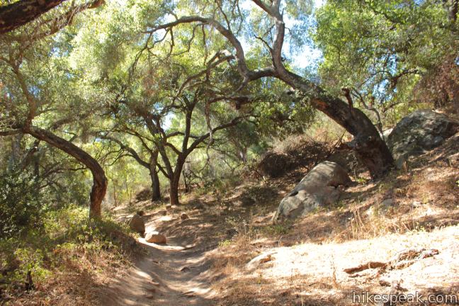
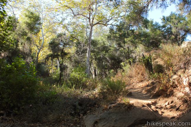
Enjoy intermittent shade over the first 2.5 miles of Jesusita Trail as it follows the riparian banks of San Roque Creek. After 3/4 of a mile, turn right at a marked junction with Arroyo Borro Trail. Leave the oak woodland and cross a field with broad views of the mountain range ahead, including the rocky face of Cathedral Peak. The trail appears to split when you reach the field. Stick with the worn path on the left to stay on course.
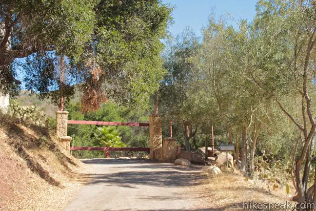
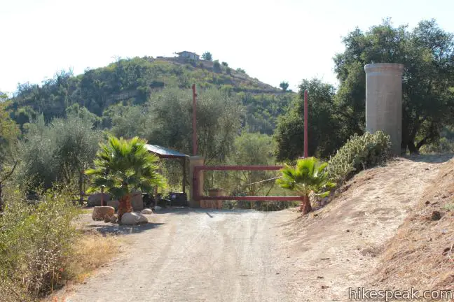
Jesusita Trail returns to the creek and runs parallel with a paved private drive. After three creek crossings, the trail merges with the paved road. Walk 0.05 miles up the road to a bend and turn right up a bit more pavement to a gate at the entrance of Moreno Ranch, which grants access to hikers on Jesusita Trail.
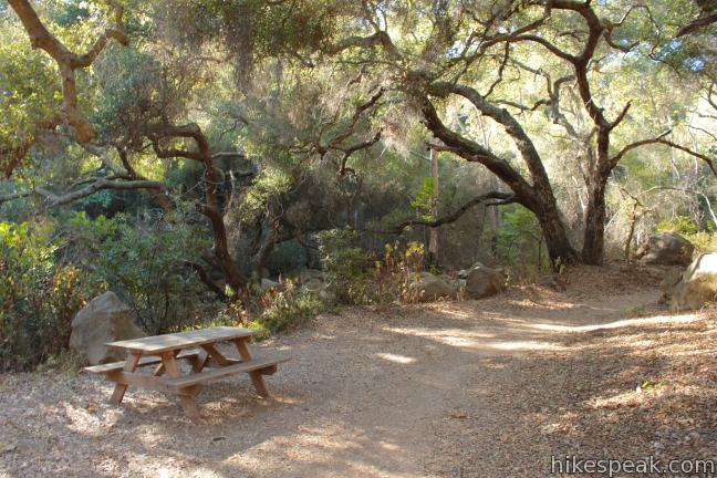
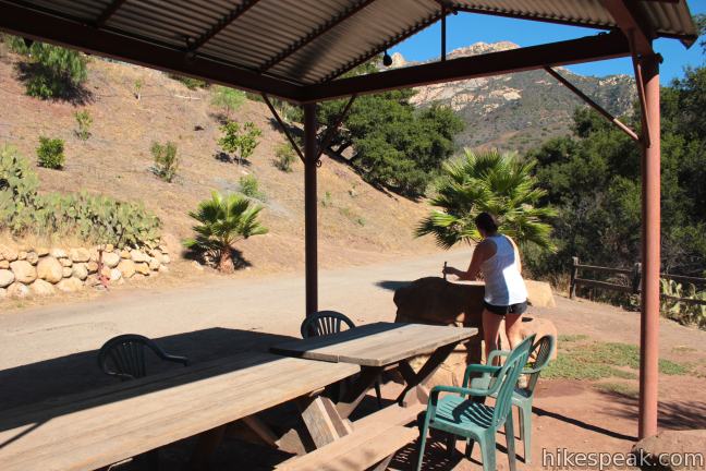
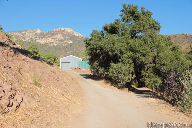
The trail passes through the ranch gate by a canopied picnic table and a drinking fountain. Walk toward a green barn to reach a split in the dirt road. Turn right and descend back toward the creek. On the far bank of the creek, follow the sign and turn left up Jesusita Trail. The trail leaves the ranch road and resumes its original nature as a single track bordering a fork of San Roque Creek.
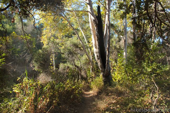
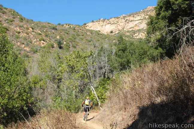
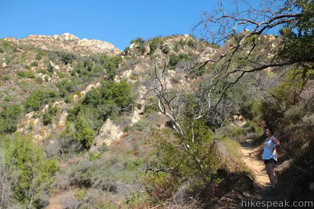
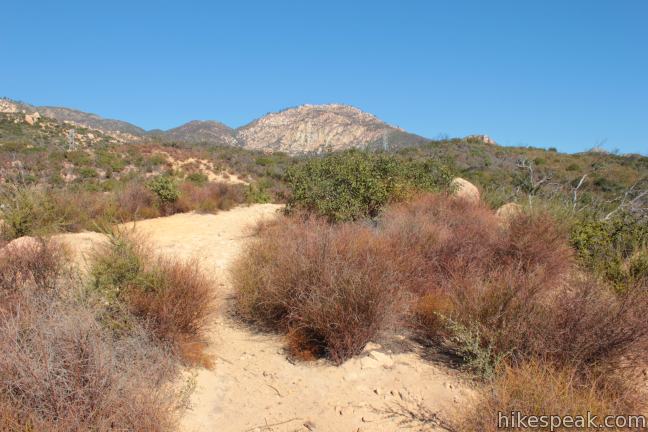
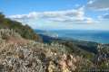
Hike along the creek for another 0.9 miles to the back of the canyon. The trail climbs out of the oaks and sycamores and begins up a sunny mountainside covered in manzanitas, chamise, and other chaparral. The ocean views begin, 2.5 miles from the start. Another 500 feet of elevation are gained over the next 1.25 miles of lovely trail leading up to Inspiration Point.
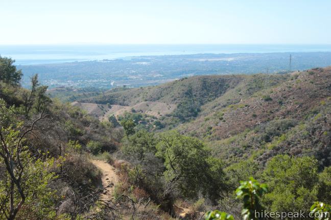
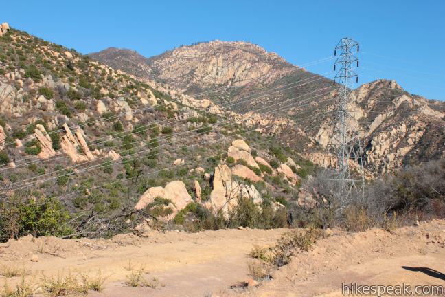
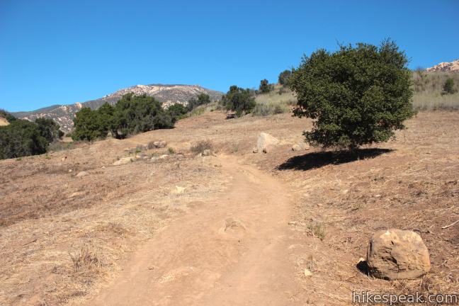
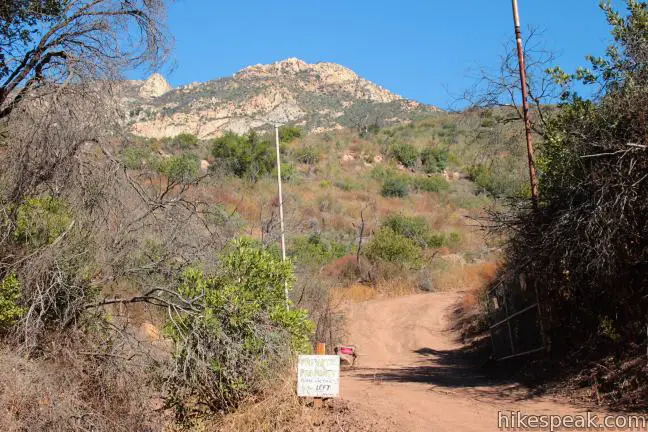
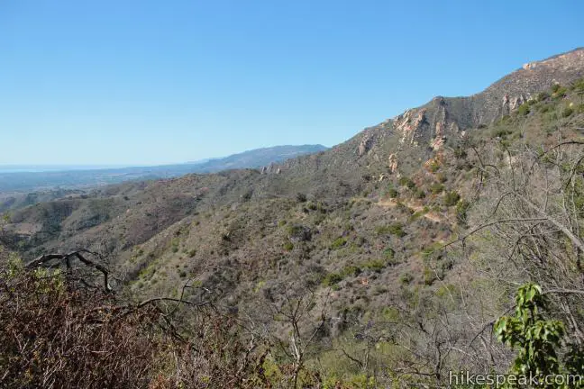
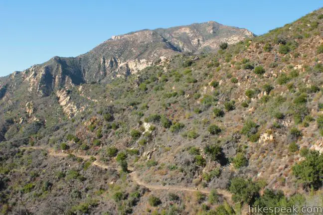
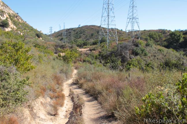
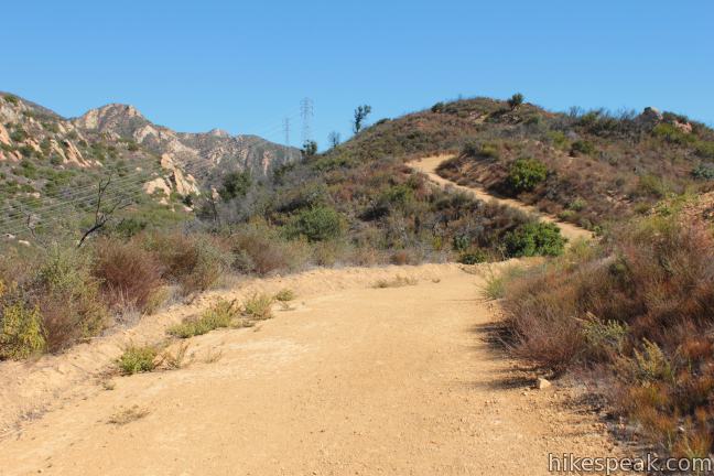
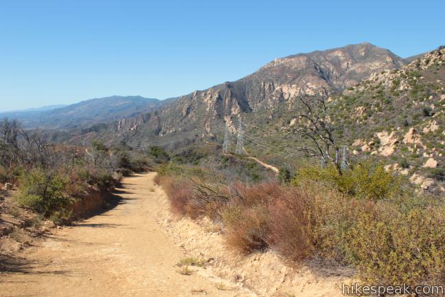
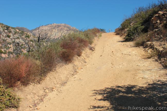
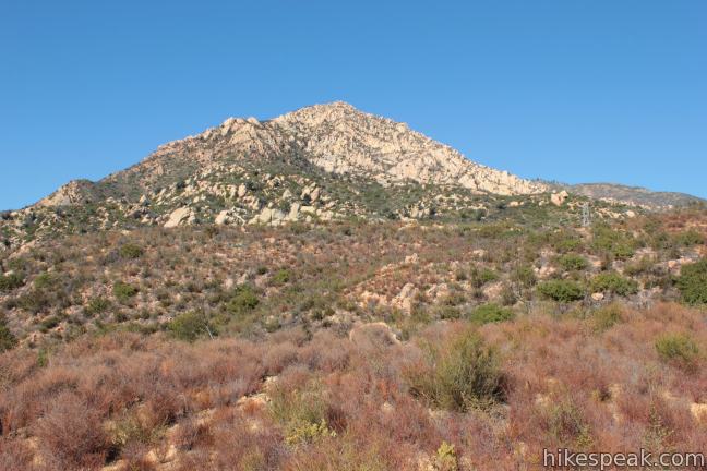
The crescent-shaped trail bends east, climbing higher into the Santa Ynez Mountains to deliver expanding views of the Pacific. When the single track meets a dirt service road, 3.25 miles from the start, turn left and continue east up the road beneath a row of power lines. Sharp sandstone peaks rise above the trail, adding a new sense of rugged grandeur. The road climbs a rise on the mountainside through two long curves shaped like a backward S.
Just as the road starts to level and turn downhill, after 3.75 miles of hiking, come to an important unmarked junction. The trail to the right leads to Inspiration Point. The trail to the left is the other end of Jesusita Trail, which descends into Mission Canyon and can be used for the shorter hike to Inspiration Point. Straight ahead, the wide dirt road heads down into the canyon and dead ends by electrical towers. A path off this road can be used to reach Historic Inspiration Point (described below). To reach Inspiration Point, turn right at the junction and walk a hundred feet out to a worn dirt landing where the memorable vista awaits.
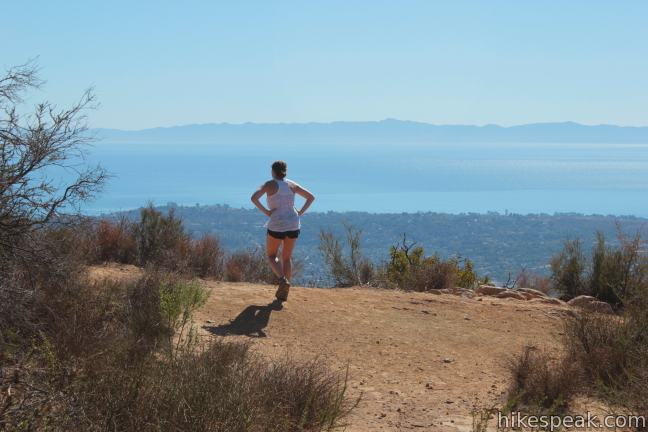
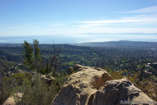
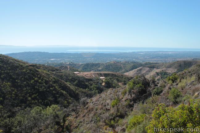
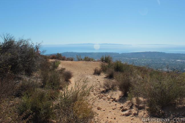
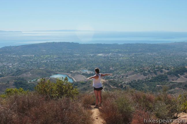
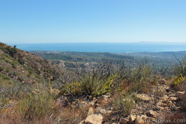
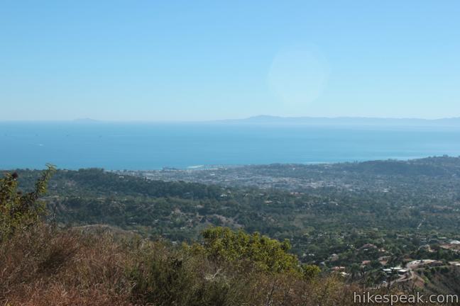
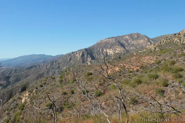
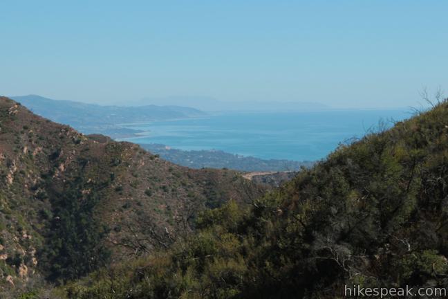
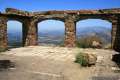
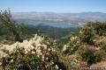
Inspiration Point provides a clear view over the coast of Santa Barbara and across the Pacific Ocean toward the Channel Islands. Inspiration Point also looks west down miles and miles of the Santa Ynez Mountains, the dramatic backdrop behind Santa Barbara. Inspiration Point is only about halfway up the mountain range in terms of elevation, so tall sandstone summits like Arlington Peak, Cathedral Peak, and the Mission Crags jut skyward high above Inspiration Point to the north.
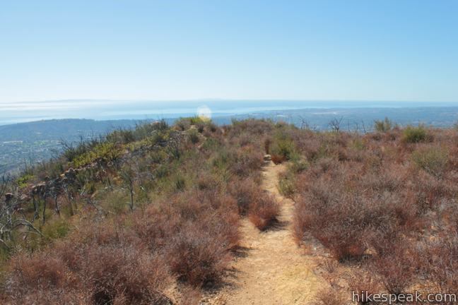
For additional views, trek down a footpath to a bluff a tenth of a mile (and 75 feet) below Inspiration Point. This worn path goes past several charred trees in an area recovering from the 2009 Jesusita Fire.
If you need extra inspiration, you can take a path to Historic Inspiration Point, which offers expanded views to the southeast along with privacy that can be fleeting at Inspiration Point. To get to Historic Inspiration Point, head back to the junction at the top of Jesusuta Trail and go east along the road for just 150 feet. At the bottom of a shallow dip, a hard-to-spot path breaks off to the right and heads out to the crown at the end of the ridge. Take this path out to a clusters of sandstone boulders that you can sit down on or stand up on and enjoy sweeping views over Santa Barbara. Look up the coast to the west or down the coast to the east toward Ventura. There are also views to the northeast up Mission Canyon toward the tops of the Santa Ynez Mountains and a jumbled cluster of sandstone called the Rock Garden. This extension to Historic Inspiration Point adds about 0.4 miles round trip to the hike to Inspiration Point.
When you have had all the inspiration you can handle, simply return the way you came. The hike is 7.75 miles round trip to Inspiration Point and back, or 7.95 miles if you add a visit to Historic Inspiration Point. No fee or permit is required to hike Jesusita Trail to Inspiration Point. Dogs and mountain bikes are welcome, so get out and enjoy!
Directions to the Trailhead
- From Highway 101 in Santa Barbara, take exit 100 and turn north up Las Positas Road (Route 225).
- After 0.8 miles, cross State Street where Las Positas Road becomes San Roque Road.
- Continue another 1.3 miles to the trailhead, which will be on the left just past the William B. Cater Filtration Plant.
- Additional parking is on the right side of the road.
Trailhead Location
Trailhead address: 1150 San Roque Road, Santa Barbara, CA 93105
Trailhead coordinates: 34.45432, -119.72875 (34° 27′ 15.55″N 119° 43′ 43.50″W)
View Inspiration Point in a larger map
Or view a regional map of surrounding Central Coast trails and campgrounds.


 | Inspiration Point via Tunnel Trail and Jesusita Trail from Tunnel Road This 3.75-mile round trip hike uses a pair of trails to ascend Mission Canyon to a sweeping viewpoint that looks down over Santa Barbara and up into the Santa Ynez Mountains. |
 | Chumash Painted Cave This very short trail looks in on Native American rock art in the Santa Ynez Mountains. |
 | Knapp's Castle This easy 0.8-mile hike visits the scenic ruins of an estate home built atop the mountains behind Santa Barbara. |
 | Lizard's Mouth This half-mile hike visits a unique rock formation with amazing views over Santa Barbara and the Pacific. |
 | Tequepis Trail This invigorating 8.4-mile round trip hike offers views of Lake Cachuma as it climbs the Santa Ynez mountains to views of Santa Barbara and the Pacific. |
 | Montecito Peak This 7.1-mile partial loop climbs to a panoramic summit in Los Padres National Forest overlooking Montecito and Santa Barbara. |
 | Tangerine Falls This 2.5-mile hike visits a beautiful waterfall on the edge of Los Padres National Forest near Santa Barbara. |
 | McMenemy Overlook This 3.7-mile hike uses four trails to form a loop through the mountains behind Montecito, California. |
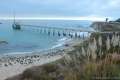 | Carpinteria Bluffs Trail to Carpinteria Seal Sanctuary Overlook This 1 to 2-mile hike goes from Carpinteria Bluffs Nature Preserve to a viewing area above a harbor seal rookery, offering beach access and beautiful oceanfront hiking. |
 | More Central Coast Hikes Explore other destinations along the California coast between Ventura and Monterey. |
Common Questions about Inspiration Point via Jesusita Trail from San Roque Road in Santa Barbara
- Is the trail open?
- Yes. You should expect to find that Jesusita Trail to Inspiration Point from San Roque Road is open. There are no recent reports of trail closures. If you discover that the trail is closed, please help your fellow hikers by reporting a closure.
- Is this trail free to access?
- Yes, Jesusita Trail to Inspiration Point from San Roque Road is free to access. No entrance fee, pass, or permit is required. If you discover that access rules have changed, please provide feedback on your experience.
- How much time does this hike take?
- It takes approximately 4 hours 15 minutes to hike Jesusita Trail to Inspiration Point from San Roque Road. Individual hiking times vary. Add extra time for breaks and taking in the views.
- How long is this hike?
- The hike to Jesusita Trail to Inspiration Point from San Roque Road is a 7.55 mile out and back with 1800 feet of elevation change.
- Are dogs allowed on this trail?
- Yes, dogs are allowed on Jesusita Trail to Inspiration Point from San Roque Road. The trail is open to hikers, dogs, bikes.
- Are there ocean views on this hike?
- Yes, Jesusita Trail to Inspiration Point from San Roque Road offers views of the ocean.
- What mountain range is this trail in?
- Jesusita Trail to Inspiration Point from San Roque Road is located in the Santa Ynez Mountains.
- Where is the trailhead located?
- The trailhead for Jesusita Trail to Inspiration Point from San Roque Road is located in Santa Barbara, CA.
Trailhead Address:
1150 San Roque Road
Santa Barbara, CA 93105
Trailhead Coordinates:
34.45432, -119.72875 - What are the driving directions to the start of the hike?
To get to the trailhead: From Highway 101 in Santa Barbara, take exit 100 and turn north up Las Positas Road (Route 225). After 0.8 miles, cross State Street where Las Positas Road becomes San Roque Road. Continue another 1.3 miles to the trailhead, which will be on the left just past the William B. Cater Filtration Plant. Additional parking is on the right side of the road.
View custom Google Maps directions from your current location.
- Are there other trails near Jesusita Trail to Inspiration Point from San Roque Road?
- Yes, you can find other nearby hikes using the Hikespeak Hike Finder Map.

Looking for a moderate one-way hike down from the west side of the El Camino Cielo ridge road. Can you recommend a trail?
Thank you
This was a great trail, I really enjoyed it. The directions were spot on and I was happy to have them. Too bad everything is so dry! Crossing my fingers for some California rain! Nice hike, really pretty view. Go early in the summer or it’s quite warm.
The majority of this trail runs through private property and is travelled by more than 250,000 people a year. Please be respectful, stay on the trail, and don’t get caught after dark. Due to the January, 2023 rain storms, the trail is closed until the County of SB reopens it. Signs are posted, but are frequently torn down.