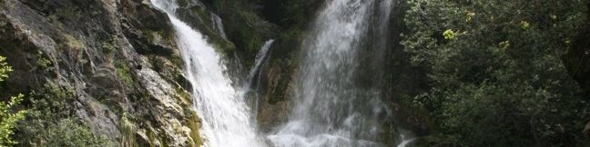
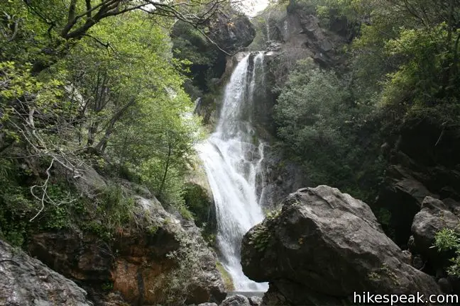
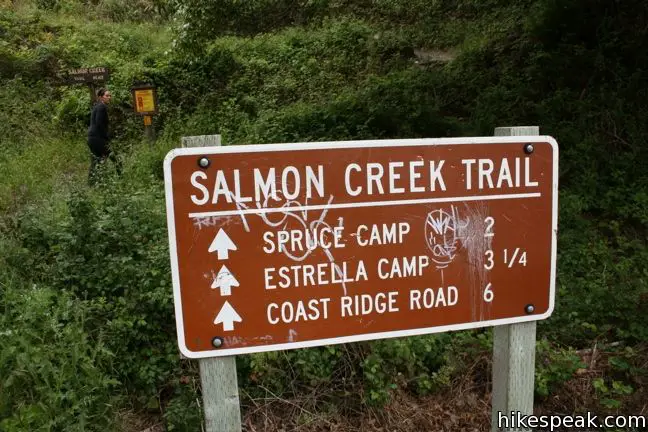
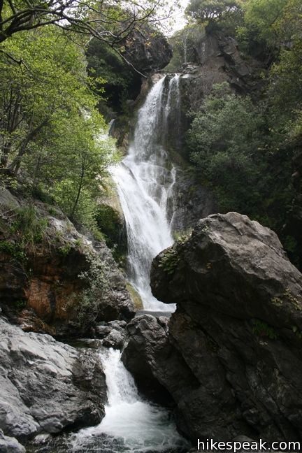
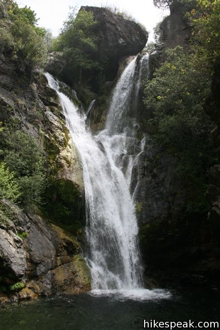
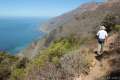
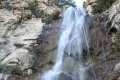
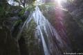
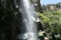
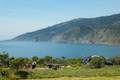
Salmon Creek Trail is a popular track with backpackers venturing deep into the Silver Peak Wilderness in the Monterey District of Los Padres National Forest, but you only need to hike a quarter mile round trip from Highway One to see a beautiful 120-foot waterfall. Unlike the trail overlooking beautiful McWay Falls farther up the Big Sur Coast, this hike brings you up close and person with a powerful cascade pouring down the Santa Lucia Mountains.
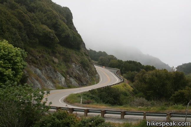
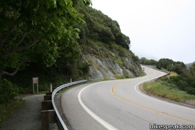
Park at the trailhead on a big horseshoe bend in Highway One, just south of the non-operational Salmon Creek Ranger Station and Buckeye Trail. Look for the mileage sign on the east side of the highway, and start hiking up the trail south of the creek.
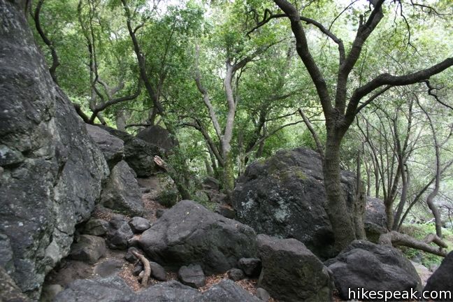
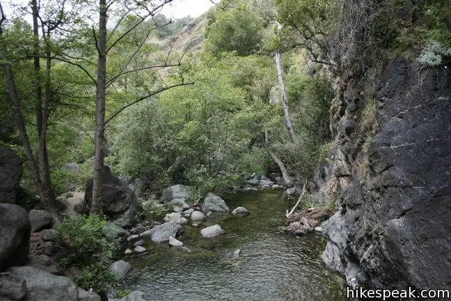
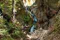
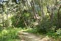
You can basically follow you ears the entire way to the falls. After 300 feet, break from the trail through a garden of boulders toward the creek. The surrounding Bays add a soothing fragrance to this shaded glen.
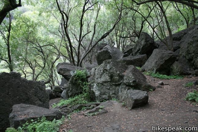
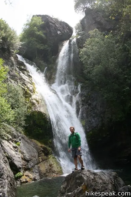
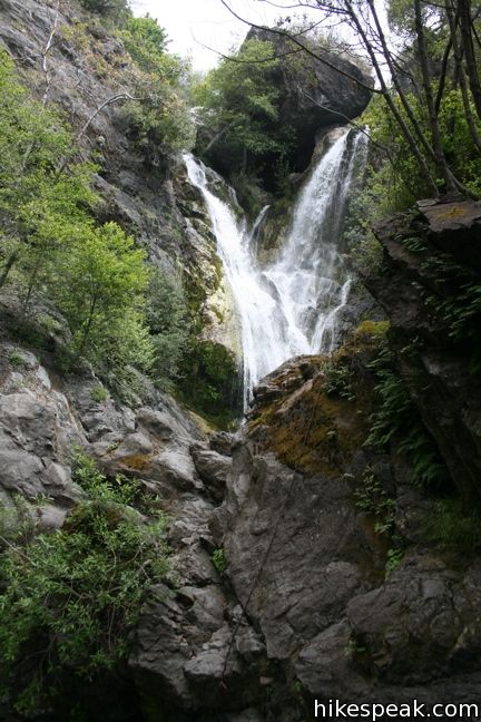
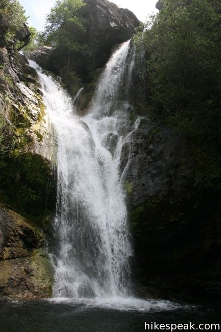
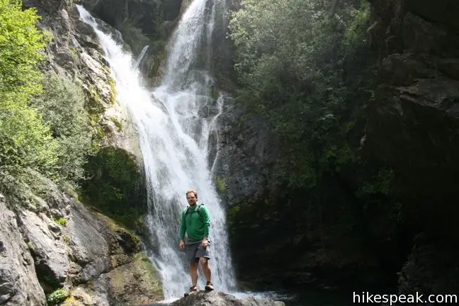
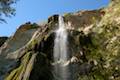
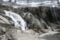
Cross a couple of small grottos and approach the waterfall. Two branches of water unite as they drop 120 feet and crash into the pool below, giving rise to a spray of mist. There is a boulder blocking easy access to the base of the falls. To obtain the unobstructed view on the other side, employ the assistance of a rope that hangs down the rock. Hoist yourself a couple feet and cross the rock.
Even if you aren’t up for this quick bit of climbing, the waterfall is quite impressive from the rocks just downstream. When you have taken it all in, make your way back through the boulders and down the trail to Highway One (assuming you aren’t hiking farther up Salmon Creek Trail). No fee or permit is required, so get out and enjoy.
Trail status: As of July 2018, Highway 1 has reopened to provide access to Salmon Falls from the north and south. For more information, you may call the US Forest Service Monterey District Office in King City at (831)385-5434.
Directions to the Trailhead
- Salmon Creek Trail is located on a large horseshoe bend in Highway One, 3.7 miles north of Ragged Point Inn (or 26 miles north of Cambria).
- From the north, drive 33.6 miles south from Julia Pfeiffer Burns State Park (home of McWay Falls) or 41.6 miles from the Nepenthe Restaurant turnoff in Big Sur.
- The trail to Salmon Creek Falls is located right on the bend in the road, south of the out-of-service Salmon Creek Ranger Station and Buckeye Trail.
Trailhead Location
Trailhead address: Cabrillo Highway (Highway One), Los Padres National Forest, Big Sur, CA 93920
Trailhead coordinates: 35.81573, -121.35879 (35° 48′ 56.62″N 121° 21′ 31.64″W)
You may also view a regional map of surrounding Central Coast trails and campgrounds.


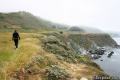
 | Buckeye Trail This hike of 6.5 miles or more reaches incredibly ocean vistas and trail camps in the Silver Peak Wilderness. Connect Cruickshank Trail and Buckeye Trail for an excellent shuttle hike of 8.25 miles or more. |
 | Cruickshank Trail This hike into Silver Peak Wilderness starts with bold ocean views and crosses redwood groves to reach Upper Cruickshank Camp at a junction with Buckeye Trail, 5 miles round trip from Highway One. |
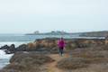
 | Jade Cove and Plaskett Rock Point This 1.5-mile hike along an ocean bluff visits a prominent peninsula and a small cove. |
 | Sand Dollar Beach This stunning hike of half a mile or more reaches two scenic overlooks as it descends to a long beach on the Big Sur coast. |
 | Pacific Valley Bluff Trail This short out and back hike extends from Highway One to an ocean bluff with fantastic views of the Big Sur Coast. |
 | Hare Creek Trail, Limekiln Trail, and Falls Trail This 2.65-mile hike in Limekiln State Park explores a trio of trails along lovely streams in redwood-lined canyons, reaching Limekiln Falls and historic lime kilns. |
 | McWay Falls This 0.6-mile hike looks out on a stunning Big Sur waterfall that pours 80 feet right on to the beach. |
 | Canyon Falls This 0.9-mile hike heads inland up McWay Creek past a picnic area in a redwood grove to a lovely little waterfall. |
 | Partington Cove This 1.5-mile hike visits a cove and a secluded beach along the scenic Big Sur coast. The cove is accessed through a tunnel. |
 | Pfeiffer Beach This short walk reaches an absolutely stunning beach that's a classic feature of the Big Sur landscape. |
 | Big Sur River Gorge This half-mile off-trail hike ventures up the Big Sur River on a water-wading boulder-hopping adventure to a crystal clear pool that's a gorgeous Big Sur swimming hole. |
 | Pfeiffer Falls and Valley View This 2.4-mile hike is like two hikes in one, reaching a waterfall in a canyon of redwoods and a vista point overlooking the Big Sur River Valley. |
 | Nature Trail - River Path Loop This easy 0.55-mile loop explores woodlands along the Big Sur River and a redwood grove that includes the unique and impressive Proboscis Tree. The loop can be combined with the trail to Pfeiffer Falls and Valley View for a 3-mile trek. |
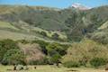
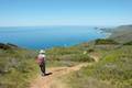 | Ridge Trail - Panorama Trail - Bluff Trail Loop This 8.7-mile loop in Andrew Molera State Park crosses a coastal ridge, bluff, and beach that are packed with amazing Big Sur views. |
 | Piedras Blancas This 3.2-mile out-and-back hike ventures up the coast from the Piedras Blancas Elephant Seal Rookery to Piedras Blancas Light Station. Additional boardwalks at the rookery can be used to add another mile of hiking. |
 | More Central Coast Hikes Explore other destinations along the California coast between Ventura and Monterey, including trails in Los Padres National Forest. |
 | Tangerine Falls in Los Padres National Forest This 2.5-mile hike visits a beautiful waterfall on the edge of Los Padres National Forest near Santa Barbara. |
 | Nojoqui Falls This short 0.65-mile hike visits an 80-foot tall fern-lined waterfall. |
 | Rose Valley Falls in Los Padres National Forest This 1-mile round trip trail leads to the lower tier of a lovely two-tier 300-foot waterfall. |
 | Sturtevant Falls in the San Gabriel Mountains This 3.3-mile hike visits a 60-foot waterfall and a lush cottage-lined canyon. |
 | Fish Canyon Falls in the San Gabriel Mountains This 4.8-mile round trip hike leaves from an active rock quarry and progresses up a beautiful canyon to a mesmerizing multi-tiered waterfall. |
 | Escondido Falls in the Santa Monica Mountains This 3.8-mile out and back hike visits a 200-foot waterfall that is split into two tiers. The upper tier is 150 feet tall and stunning after a rainstorm. |
 | Tokopah Falls in Sequoia National Park This 4.2-mile hike reaches the base of the tallest waterfall in Sequoia National Park. |
 | Lower Yosemite Fall in Yosemite National Park This 1.2-mile hike delivers visitors to the base of the tallest waterfall in North America. The experience is not to be missed. |
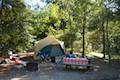
 | Kirk Creek Campground This outstanding 33-site campground in Los Padres National Forest has enormous ocean views from a bluff along the Big Sur coast. |
 | Plaskett Creek Campground This 45-site campground in Los Padres National Forest is positioned across Highway One from Sand Dollar Beach and Plaskett Rock Point on the coast of Big Sur. |
 | Limekiln State Park Campground This small Big Sur campground at the bottom of Limekiln Canyon has sites along a creek through a redwood grove and near the ocean, with access to trails up Limekiln Canyon. |
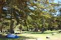
 | Pfieffer Big Sur State Park Campground This large campground in the heart of Big Sur is spread out through oak and redwood groves along the Big Sur River. |
 | Andrew Molera State Park Trail Camp This trail camp is easy to reach (just a short walk in) with campsites in a meadow along the Big Sur River near Molera Beach. |
- Salmon Creek Falls on wilkipedia.org (opens in a new tab)
- Salmon Creek in Top Trails: California Central Coast by Brian Milne (opens in a new tab)
- Salmon Creek Trail on hikinginbigsur.com (opens in a new tab)
- Silver Peak Wilderness on wilkipedia.org (opens in a new tab)
- The official website for Los Padres National Forest (opens in a new tab)
Common Questions about Salmon Creek Falls in Los Padres National Forest
- Is the trail open?
- Yes. You should expect to find that Salmon Creek Falls is open. There are no recent reports of trail closures. If you discover that the trail is closed, please help your fellow hikers by reporting a closure.
- Is this trail free to access?
- Yes, Salmon Creek Falls is free to access. No entrance fee, pass, or permit is required. If you discover that access rules have changed, please provide feedback on your experience.
- How much time does this hike take?
- It takes approximately 15 minutes to hike Salmon Creek Falls. Individual hiking times vary. Add extra time for breaks and taking in the views.
- How long is this hike?
- The hike to Salmon Creek Falls is a 0.25 mile out and back with 60 feet of elevation change.
- Are dogs allowed on this trail?
- Yes, dogs are allowed on Salmon Creek Falls. The trail is open to hikers, dogs.
- Is Salmon Creek Falls good for kids?
- Yes, this hike is likely suitable for children. It is relatively short (0.25 miles) with manageable elevation gain.
- Will I see a waterfall on this hike?
- Yes, Salmon Creek Falls features a waterfall.
- Where is the trailhead located?
- The trailhead for Salmon Creek Falls is located in Big Sur, CA.
Trailhead Address:
Cabrillo Highway
Big Sur, CA 93920
Trailhead Coordinates:
35.81573, -121.35879 - What are the driving directions to the start of the hike?
To get to the trailhead: Salmon Creek Trail is located on a large horseshoe bend in Highway One, 3.7 miles north of Ragged Point Inn (or 26 miles north of Cambria).
From the north, drive 33.6 miles south from Julia Pfeiffer Burns State Park (home of McWay Falls) or 41.6 miles from the Nepenthe Restaurant turnoff in Big Sur. The trail to Salmon Creek Falls is located right on the bend in the road, south of the out-of-service Salmon Creek Ranger Station and Buckeye Trail.
View custom Google Maps directions from your current location.
- Are there other trails near Salmon Creek Falls?
- Yes, you can find other nearby hikes using the Hikespeak Hike Finder Map.

41 Comments on Salmon Creek Falls in Los Padres National Forest
What hikers are saying:
✨ Generated summary of user commentsHikers enjoy the scenic access to the falls but must navigate significant patches of poison oak that can cause lasting irritation. Reaching the water requires scrambling over boulders, which makes swimming a risky endeavor for some. Justin warns that staying on the path is essential to avoid the thick brush. Overnight parking is unavailable in the immediate vicinity, and camping is prohibited near the waterfall itself.
Wow! These falls are really flowing. This will definitely be high on my to-do list for hikes in Central California. Thanks for the detailed write-up.
Can you take your dog?
You sure can, but little dogs might have trouble getting over the rocks at the end.
how accessible is the trail to the first good viewing point? thank u
Hi-
The trail is by no means wheelchair accessible and you have to be agile to cross the rocks to resch the base of the falls. The trail itself is short and will not challenge most hikers.
Is it good to visit with a four year old ?
Young ones should not have trouble reaching the lower falls, but don’t attempt the upper.
Has anyone been to the Upper Falls? I tried to find them the other day and failed. I was just passing through, so I guess I will try again on the next trip.
Does an overnight at the Salmon Creek Trail require an Adventure Pass?
You should not need a pass to park on Highway One. Enjoy your hike!
where do you park to go to the falls?
There is roadside parking along Highway One.
can you overnight at any of the camps along this trail without reservations or a permit?
The Salmon Creek Trail enters the Silver Peak Wilderness where no permit is required to stay overnight at any of the trail camps. An easy-to-obtain campfire permit is required if you would like to use a stove or make a fire, but that’s the only red tape. Enjoy your trek!
How to you get the camfire permit??
Due to extremely dry vegetation, they aren’t currently offering backcountry campfire permits. Check with the National Forest (click here) for more information.
Are there campsites nearby?
Can you camp on the trail with no reservations for free? Or is there an entry fee?
There is no entry fee. I believe the same rules apply as for the nearby Buckeye Trail. You do not need any reservation to camp at the free trail camps further up the trail. A campfire permit is required if you would like to use a stove or make a fire (under safe conditions). Have a great trek!
How bad is the poison oak around this trail and Big Sur in general this year. We are heeding up there next week (big Sur lodge) and I seem to remember a lot of poison oak. Thanks.
Poison oak can be really bad, especially since I can’t seem to identify it. I got some on my arm from this hike and it took awhile to heal (it was pretty bad). I guess it was bad karma for going a bit off the trail.
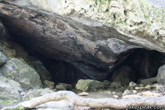
We once camped in a cave near the falls. I wonder if that might still be possible.
Do the falls have water at this time of year? I did this hike a few years back and loved it. I’m wondering if there will be any water right now.
How strainious is this hike? My hubby has bad knees, will he be able to hike to the falls? On a scale of 1-10.
We are seniors, can we do the walk to the falls if we go slow?
WE ARE GOING TO ragged Point the first of June. Do you think there will be water around that time?
[…] were coming from Pasadena and Santa Barbara respectively) so we stopped for a quick jaunt to Salmon Creek Falls. Very nice waterfall, and some fun rock scrambling around […]
Is there a pool to swim in at the bottom of the falls?
Yes, there is a pool at the base of the waterfall. Climbing over boulders is required to reach the pool, so it may not be the best/safest place to swim.
Wanting to backpack Big Sur this weekend August 4-7. With the road closures and some trail heads closed due to weather damage, does anyone know if we can? We will be traveling from San Diego North to Big Sur. Parts of the 1 are closed. Need more information, anything helps. Thanks.
Just went this weekend, trail is accessible from highway 1 to the south!
Are bikes allowed on this trail? We’re biking from Cambria and want to find a spot to camp with our bikes. Thanks in advance!
This trail is not suitable for bikes. Enjoy your trip!
We will be in this area October 11. Can we access the falls on PCH 1 from Ragged Point? Thanks.
Is there overnight parking or is there anyway to get there without a car for camping?
There is not any overnight parking nearby, nor is there any camping immediately near the falls allowed
How easy is it to park heading south down Hwy 1? I noticed the parking is in the opposite side of the road so maybe there is a good turn around point?
Is it safe to take my infant in a baby carrier on this hike? Is there climbing necessary to get to the falls?
Can you fly fish for the trout in the water ?
[…] visiting the Silver Peak Wilderness, Salmon Creek Falls is one spot you don’t want to miss. Even in dry seasons, this large waterfall tends to have at […]
[…] When the highway is open, those spots are often all full. Not now. And it’s only about 0.3 of a mile to the base of the 120-foot falls, where there’s plenty of shade for the weary and boulder-scrambling for those who are bold. In the hour I spent scrambling and resting, I encountered just two couples and one family, all enjoying the uncrowded scene […]